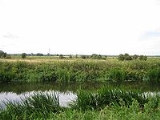
Wet Moor
Encyclopedia
Wet Moor is a 491.0 hectare
(1214.0 acre) biological Site of Special Scientific Interest east of Muchelney
in Somerset
, notified in 1985.
Wet Moor is part of the extensive grazing marsh grassland
s and ditch systems of the Somerset Levels
and Moors.
Wet Moor is low lying low relief land typical in character of the Somerset Moors and Levels. The landscape is dominated by two major arterial watercourses, the Rivers Parrett
and Yeo. These are large embanked channels which act as upland water carriers conveying water from the upstream catchments through the low moor lands. In storm conditions the rivers can surcharge their banks and overspill into the adjacent low lying moorland. here, flood waters are retained until river levels recede below bankfull conditions. The rivers running through the moor make home for many wildlife, including wintering Whooper Swan
s.
Hectare
The hectare is a metric unit of area defined as 10,000 square metres , and primarily used in the measurement of land. In 1795, when the metric system was introduced, the are was defined as being 100 square metres and the hectare was thus 100 ares or 1/100 km2...
(1214.0 acre) biological Site of Special Scientific Interest east of Muchelney
Muchelney
Muchelney is a village and civil parish in Somerset, England, on the River Parrett, south of Huish Episcopi and miles south west of Somerton in the South Somerset district...
in Somerset
Somerset
The ceremonial and non-metropolitan county of Somerset in South West England borders Bristol and Gloucestershire to the north, Wiltshire to the east, Dorset to the south-east, and Devon to the south-west. It is partly bounded to the north and west by the Bristol Channel and the estuary of the...
, notified in 1985.
Wet Moor is part of the extensive grazing marsh grassland
Grassland
Grasslands are areas where the vegetation is dominated by grasses and other herbaceous plants . However, sedge and rush families can also be found. Grasslands occur naturally on all continents except Antarctica...
s and ditch systems of the Somerset Levels
Somerset Levels
The Somerset Levels, or the Somerset Levels and Moors as they are less commonly but more correctly known, is a sparsely populated coastal plain and wetland area of central Somerset, South West England, between the Quantock and Mendip Hills...
and Moors.
Wet Moor is low lying low relief land typical in character of the Somerset Moors and Levels. The landscape is dominated by two major arterial watercourses, the Rivers Parrett
River Parrett
The River Parrett flows through the counties of Dorset and Somerset in South West England, from its source in the Thorney Mills springs in the hills around Chedington in Dorset...
and Yeo. These are large embanked channels which act as upland water carriers conveying water from the upstream catchments through the low moor lands. In storm conditions the rivers can surcharge their banks and overspill into the adjacent low lying moorland. here, flood waters are retained until river levels recede below bankfull conditions. The rivers running through the moor make home for many wildlife, including wintering Whooper Swan
Whooper Swan
The Whooper Swan , Cygnus cygnus, is a large Northern Hemisphere swan. It is the Eurasian counterpart of the North American Trumpeter Swan. An old name for the Whooper Swan is Elk; it is so called in Francis Willughby and John Ray's Ornithology of 1676.-Description:The Whooper Swan is similar in...
s.

