Whitchurch Lock
Encyclopedia
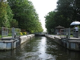
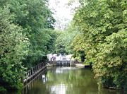
Whitchurch Lock is a lock
and weir
situated on the River Thames
in England
. It is a pound lock, built by the Thames Navigation Commissioners in 1787. It is on an island near the Oxfordshire
village of Whitchurch-on-Thames
and is inaccessible except by boat.
The weir crosses the river to the Berkshire
village of Pangbourne
.
 There was a flash lock
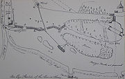
recorded at Whitchurch in the 16th century. The pound lock, built of oak, was installed at the island in the summer of 1787. Two alternative sites were originally considered. One would have expanded the mill stream on the Whitchurch side, and another would have involved a cut across land occupied by the Swan public house at Pangbourne. A lock house was built on the island in the 1830s. In the later 19th century local people used to cross over the weir to avoid paying tolls on the bridge. The lock was rebuilt in 1876 and access across the weir was closed. The right of way from Whitchurch to the lock was closed in 1888.


 The reach passes along the Chiltern Hills
, culminating in Goring Gap
. Halfway along the reach is the Gatehampton Railway Bridge
.
The hills on the Oxfordshire side are populated by houses at Whitchurch and are then covered by the Hartslock beech woods. This name derives from a lock among the islands below the hills. This had become disused by the time the pound locks were built, but the obstructions remaining from it were not removed until 1910. The river turns west away from the hills leaving flat meadows up to Goring
.
On the Berkshire side the river passes the river side at Pangbourne where there are seven distinctive Edwardian-style houses overlooking the river. These were built by D. H. Evans the shop owner and were nicknamed the "Seven Deadly Sins" as it was alleged that he kept a mistress in each of them. Beyond this point is Beale Park
and set back from the river is Basildon Park
. The river turns north again at the Goring Gap
where the hills on the Streatley
side overshadow the river. Just before the Goring Lock is Goring and Streatley Bridge
.
Pangbourne College
is based on this stretch of the river and the Pangbourne Junior Sculls take place on the reach in November.
The Thames Path
, having crossed Whitchurch Bridge, continues away from the river through the streets of Whitchurch and then through the woods. This is a section with steep inclines and long flights of steps. Once back to the river side at Hartslock, it continues on the Oxfordshire bank to Goring.
Lock (water transport)
A lock is a device for raising and lowering boats between stretches of water of different levels on river and canal waterways. The distinguishing feature of a lock is a fixed chamber in which the water level can be varied; whereas in a caisson lock, a boat lift, or on a canal inclined plane, it is...
and weir
Weir
A weir is a small overflow dam used to alter the flow characteristics of a river or stream. In most cases weirs take the form of a barrier across the river that causes water to pool behind the structure , but allows water to flow over the top...
situated on the River Thames
River Thames
The River Thames flows through southern England. It is the longest river entirely in England and the second longest in the United Kingdom. While it is best known because its lower reaches flow through central London, the river flows alongside several other towns and cities, including Oxford,...
in England
England
England is a country that is part of the United Kingdom. It shares land borders with Scotland to the north and Wales to the west; the Irish Sea is to the north west, the Celtic Sea to the south west, with the North Sea to the east and the English Channel to the south separating it from continental...
. It is a pound lock, built by the Thames Navigation Commissioners in 1787. It is on an island near the Oxfordshire
Oxfordshire
Oxfordshire is a county in the South East region of England, bordering on Warwickshire and Northamptonshire , Buckinghamshire , Berkshire , Wiltshire and Gloucestershire ....
village of Whitchurch-on-Thames
Whitchurch-on-Thames
Whitchurch-on-Thames is a village and civil parish on the Oxfordshire bank of the River Thames, about northwest of Reading, Berkshire. Opposite Whitchurch on the Berkshire bank is the village of Pangbourne.-History:...
and is inaccessible except by boat.
The weir crosses the river to the Berkshire
Berkshire
Berkshire is a historic county in the South of England. It is also often referred to as the Royal County of Berkshire because of the presence of the royal residence of Windsor Castle in the county; this usage, which dates to the 19th century at least, was recognised by the Queen in 1957, and...
village of Pangbourne
Pangbourne
Pangbourne is a large village and civil parish on the River Thames in the English county of Berkshire. Pangbourne is the home of the independent school, Pangbourne College.-Location:...
.
History

Flash lock
Early locks were designed with a single gate, known as a flash lock or staunch lock. The earliest European references to what were clearly flash locks were in Roman times....
recorded at Whitchurch in the 16th century. The pound lock, built of oak, was installed at the island in the summer of 1787. Two alternative sites were originally considered. One would have expanded the mill stream on the Whitchurch side, and another would have involved a cut across land occupied by the Swan public house at Pangbourne. A lock house was built on the island in the 1830s. In the later 19th century local people used to cross over the weir to avoid paying tolls on the bridge. The lock was rebuilt in 1876 and access across the weir was closed. The right of way from Whitchurch to the lock was closed in 1888.
Access to the lock
Whitchurch Lock is the only lock on the River Thames which has no public access other than by boat.Reach above the lock


Chiltern Hills
The Chiltern Hills form a chalk escarpment in South East England. They are known locally as "the Chilterns". A large portion of the hills was designated officially as an Area of Outstanding Natural Beauty in 1965.-Location:...
, culminating in Goring Gap
Goring Gap
The Goring Gap is a British geological feature located on the River Thames approximately 8 miles upstream from Reading.Half a million years ago the River Thames flowed on its existing course through Oxfordshire, but then turned northeast to flow through Hertfordshire before eventually reaching the...
. Halfway along the reach is the Gatehampton Railway Bridge
Gatehampton Railway Bridge
Gatehampton Railway Bridge is a railway bridge carrying the Great Western Main Line over the River Thames in Lower Basildon, Berkshire, England...
.
The hills on the Oxfordshire side are populated by houses at Whitchurch and are then covered by the Hartslock beech woods. This name derives from a lock among the islands below the hills. This had become disused by the time the pound locks were built, but the obstructions remaining from it were not removed until 1910. The river turns west away from the hills leaving flat meadows up to Goring
Goring-On-Thames
Goring-on-Thames is a large village and civil parish on the River Thames in South Oxfordshire, about south of Wallingford.-Geography:...
.
On the Berkshire side the river passes the river side at Pangbourne where there are seven distinctive Edwardian-style houses overlooking the river. These were built by D. H. Evans the shop owner and were nicknamed the "Seven Deadly Sins" as it was alleged that he kept a mistress in each of them. Beyond this point is Beale Park
Beale Park
Beale Wildlife Park and Gardens is situated by the River Thames, between the villages of Pangbourne and Lower Basildon in Berkshire, England. It has three main areas of attraction: collections of small exotic animals, farm animals and birds; landscaped gardens and woodlands; and children's play...
and set back from the river is Basildon Park
Basildon Park
Basildon Park is a country house situated 3 kilometres south of Goring-on-Thames and Streatley in Berkshire, between the villages of Upper Basildon and Lower Basildon. It is owned by the National Trust and is a Grade I listed building...
. The river turns north again at the Goring Gap
Goring Gap
The Goring Gap is a British geological feature located on the River Thames approximately 8 miles upstream from Reading.Half a million years ago the River Thames flowed on its existing course through Oxfordshire, but then turned northeast to flow through Hertfordshire before eventually reaching the...
where the hills on the Streatley
Streatley, Berkshire
Streatley is a village and civil parish on the River Thames in Berkshire, England.-Location:Streatley is about from Reading and from Oxford. It is in the Goring Gap on the River Thames and is directly across the river from the Oxfordshire village of Goring-on-Thames...
side overshadow the river. Just before the Goring Lock is Goring and Streatley Bridge
Goring and Streatley Bridge
Goring and Streatley Bridge is a road bridge across the River Thames in England. The bridge links the twin villages of Goring-On-Thames, Oxfordshire, and Streatley, Berkshire, and is adjacent to Goring Lock....
.
Pangbourne College
Pangbourne College
Pangbourne College is a coeducational independent school located in the civil parish of Pangbourne, just South West of the village, in the English County of Berkshire....
is based on this stretch of the river and the Pangbourne Junior Sculls take place on the reach in November.
The Thames Path
Thames Path
The Thames Path is a National Trail, opened in 1996, following the length of the River Thames from its source near Kemble in Gloucestershire to the Thames Barrier at Charlton. It is about long....
, having crossed Whitchurch Bridge, continues away from the river through the streets of Whitchurch and then through the woods. This is a section with steep inclines and long flights of steps. Once back to the river side at Hartslock, it continues on the Oxfordshire bank to Goring.

