Whitley, Cheshire
Encyclopedia
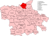
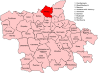
Whitley is a civil parish in the unitary authority of Cheshire West and Chester
and the ceremonial county of Cheshire
, England
. It is surrounded by the parishes of Antrobus, Comberbach
, Little Leigh
and Dutton
. It also borders Daresbury
in Halton borough
as well as Hatton
and Stretton
in Warrington
borough.
 The civil parish was created in 1936 based on Whitley Inferior and Whitley Superior, now known as Lower Whitley and Higher Whitley.
Whitley lies mostly in the northern part of a triangle of land bounded by the A49 (Warrington to Tarporley) to the west, the A559 (Warrington to Northwich) to the east and the A533
(Runcorn to Northwich) to the south.
All public roads in the village are maintained by Cheshire County Council. The A49 Tarporley Road is a single carriageway primary road (formerly a trunk road). Between the world wars the Lower Whitley By-Pass was constructed, the old route being called Street Lane.
The A559 Northwich Road has always been a county road and is generally a narrower road.
Just half a mile to the north of the parish is the M56 North Cheshire Motorway giving access to nations motorway network.
Buses
Buses run through the village from Warrington to Northwich and vice versa. These are operated by Warrington Borough Transport, although Cheshire West and Chester Council
do subsidise the service. In 2006 the services running through Weaverham and Little Leigh were scrapped. This means no bus services now run along the A49 through Whitley, though they still run on the A559.
Trains
While no railways run through Whitley stations are available close by including:
Warrington Bank Quay
Warrington Central
Runcorn East
Acton Bridge
Northwich
In the last few years a third pub The Millstone on Grimsditch Lane was bought and closed down. The pub is currently boarded up.
All three pubs were owned by Greenall Whitley & Co until it moved away from pubs in the 1990s.
Several pubs lie very close to Whitley including The Ring O'Bells, Stretton Fox, The Hollow Tree and the Antrobus Arms.
Secondary education is currently provided by Weaverham High School. Previously it was in the catchment area of The County High School Leftwich (formerly Leftwich High School).
Previously to this children went to Broomfields High School, now part of Bridgewater High School.
Further education is available at St John Deans College or Mid-Cheshire College in Northwich, or in Warrington at Priestly College or Warrington Collegiate.
Cheshire West and Chester
Cheshire West and Chester is a unitary authority area with borough status, in the ceremonial county of Cheshire. It was established in April 2009 as part of the 2009 structural changes to local government in England, by virtue of an order under the Local Government and Public Involvement in Health...
and the ceremonial county of Cheshire
Cheshire
Cheshire is a ceremonial county in North West England. Cheshire's county town is the city of Chester, although its largest town is Warrington. Other major towns include Widnes, Congleton, Crewe, Ellesmere Port, Runcorn, Macclesfield, Winsford, Northwich, and Wilmslow...
, England
England
England is a country that is part of the United Kingdom. It shares land borders with Scotland to the north and Wales to the west; the Irish Sea is to the north west, the Celtic Sea to the south west, with the North Sea to the east and the English Channel to the south separating it from continental...
. It is surrounded by the parishes of Antrobus, Comberbach
Comberbach
Comberbach is a civil parish and small village in the unitary authority of Cheshire West and Chester and the ceremonial county of Cheshire, England, located between Northwich and Warrington. The village sports a new Memorial Hall , a Bowling Club, two pubs - the Spinner and Burgamot, and the Drum...
, Little Leigh
Little Leigh
thumb|right|200px|Map of civil parish of Little Leigh within the former borough of Vale RoyalLittle Leigh is a civil parish and village within the unitary authority of Cheshire West and Chester and the ceremonial county of Cheshire, England. It is located approximately 2 miles north of Weaverham...
and Dutton
Dutton, Cheshire
thumb|right|200px|Map of civil parish of Dutton within the former borough of Vale RoyalDutton is a civil parish and village within the unitary authority of Cheshire West and Chester in the ceremonial county of Cheshire, England. It is located approximately east of Runcorn.-External links:...
. It also borders Daresbury
Daresbury
Daresbury is a small rural village, civil parish and ward in the unitary authority of Halton and part of the ceremonial county of Cheshire, England. It is covered by the Weaver Vale constituency...
in Halton borough
Halton (borough)
Halton is a local government district in North West England, with borough status and administered by a unitary authority. It was created in 1974 as a district of Cheshire, and became a unitary authority area on 1 April 1998. It consists of the towns of Widnes and Runcorn and the civil parishes of...
as well as Hatton
Hatton, Warrington
Hatton is a small village some 6 km south of Warrington, Cheshire .It lies on the B5356 road between the villages of Daresbury and Stretton. It has one public house, The Hatton Arms. This is a Grade II listed building which formerly incorporated a post office and a village store.-External...
and Stretton
Stretton, Cheshire
Stretton is a village and civil parish in Cheshire, England not far from Warrington. The parish includes the village of Lower Stretton. It is at the very southern tip of Warrington, about seven miles south of the town centre. It has a large hotel and is the site of Warrington's private hospital,...
in Warrington
Warrington
Warrington is a town, borough and unitary authority area of Cheshire, England. It stands on the banks of the River Mersey, which is tidal to the west of the weir at Howley. It lies 16 miles east of Liverpool, 19 miles west of Manchester and 8 miles south of St Helens...
borough.

Whitley lies mostly in the northern part of a triangle of land bounded by the A49 (Warrington to Tarporley) to the west, the A559 (Warrington to Northwich) to the east and the A533
(Runcorn to Northwich) to the south.
Transport
RoadsAll public roads in the village are maintained by Cheshire County Council. The A49 Tarporley Road is a single carriageway primary road (formerly a trunk road). Between the world wars the Lower Whitley By-Pass was constructed, the old route being called Street Lane.
The A559 Northwich Road has always been a county road and is generally a narrower road.
Just half a mile to the north of the parish is the M56 North Cheshire Motorway giving access to nations motorway network.
Buses
Buses run through the village from Warrington to Northwich and vice versa. These are operated by Warrington Borough Transport, although Cheshire West and Chester Council
Cheshire West and Chester
Cheshire West and Chester is a unitary authority area with borough status, in the ceremonial county of Cheshire. It was established in April 2009 as part of the 2009 structural changes to local government in England, by virtue of an order under the Local Government and Public Involvement in Health...
do subsidise the service. In 2006 the services running through Weaverham and Little Leigh were scrapped. This means no bus services now run along the A49 through Whitley, though they still run on the A559.
Trains
While no railways run through Whitley stations are available close by including:
Warrington Bank Quay
Warrington Central
Warrington Central railway station
Warrington Central railway station is one of two main railway stations serving the town of Warrington in the north-west of England. It is located on the southern route of the Liverpool to Manchester Line , and is situated around halfway between the two cities...
Runcorn East
Runcorn East railway station
Runcorn East railway station serves the eastern suburbs of Runcorn in Cheshire, England and offers trains to Warrington and Manchester and to Chester and North Wales....
Acton Bridge
Acton Bridge railway station
Acton Bridge railway station is near the village of Acton Bridge, Cheshire, in the northwest of England.The station, and all the trains that stop here, are operated by London Midland; however, very few services call at this station on the service between Liverpool and Birmingham...
Northwich
Northwich railway station
Northwich railway station serves the town of Northwich in Cheshire, England. The station has two platforms and is located on the Mid-Cheshire Line.-Services:...
Public Houses
Whitley is home to two public houses. The Chetwode Arms is located on Street Lane (the old A49) with the Birch and Bottle on Northwich Road.In the last few years a third pub The Millstone on Grimsditch Lane was bought and closed down. The pub is currently boarded up.
All three pubs were owned by Greenall Whitley & Co until it moved away from pubs in the 1990s.
Several pubs lie very close to Whitley including The Ring O'Bells, Stretton Fox, The Hollow Tree and the Antrobus Arms.
Education
Whitley Village School is a primary school providing infant and junior education for the children of Whitley and Dutton.Secondary education is currently provided by Weaverham High School. Previously it was in the catchment area of The County High School Leftwich (formerly Leftwich High School).
Previously to this children went to Broomfields High School, now part of Bridgewater High School.
Further education is available at St John Deans College or Mid-Cheshire College in Northwich, or in Warrington at Priestly College or Warrington Collegiate.

