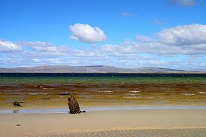
Wickham Heights
Encyclopedia

East Falkland
East Falkland the largest of the Falkland Islands in the South Atlantic, has an area of and a coastline long. Most of the population of the Falklands live in East Falkland, almost all of them living in the northern half of the island...
in the Falkland Islands
Falkland Islands
The Falkland Islands are an archipelago in the South Atlantic Ocean, located about from the coast of mainland South America. The archipelago consists of East Falkland, West Falkland and 776 lesser islands. The capital, Stanley, is on East Falkland...
. They include the island group's highest peak, Mount Usborne
Mount Usborne
Mount Usborne is a mountain on East Falkland. At above sea level, it is the highest point in the Falkland Islands.The mountain is referenced by Charles Darwin in Chapter 9 of the Zoology of the Voyage of the Beagle and is named after , Master's Assistant on HMS Beagle, the ship that took Darwin...
, Mount Wickham
Mount Wickham
Mount Wickham is a mountain on East Falkland, Falkland Islands. It is the chief summit of the Wickham Heights....
and are partly contiguous with No Man's Land
No Man's Land, Falkland Islands
No Man's Land is an area on East Falkland island, in the Falkland Islands.It probably derives its name from the fact that it is extremely rough ground, and is partly co-extensive with the Wickham Heights. It is to the north west of RAF Mount Pleasant, on the northern half of East Falkland....
. The slopes of Wickham Heights feature numerous stone run
Stone run
A stone run is a conspicuous rock landform, result of the erosion of particular rock varieties caused by myriad freezing-thawing cycles taking place in periglacial conditions during the last Ice Age.The actual formation of stone runs involved no less than five processes: weathering, solifluction,...
s, some of them extending up to 5 km.
The Wickham Heights are in the northern portion of East Falkland, running east and west, and rising in some places to a height of nearly 2000 ft. They form the "spine" of the East Falkland, north of Lafonia
Lafonia
Lafonia is a peninsula forming the southern part of East Falkland, the largest of the Falkland Islands.-Geography and geology:Shaped like the letter "E", it is joined to the northern part of the island by a 1.5-mile narrow isthmus; were this isthmus to be severed, Lafonia would be the third...
.
Rivers and streams such as the Malo River
Malo River
The Malo River , is a river in East Falkland, Falkland Islands. Its name is derived from the Breton port of St Malo , due to the French settlement established at Port Louis in 1764.It is situated in the north of East Falkland, and flows into Salvador Water off the Wickham Heights in No...
and San Carlos River spring in the Wickham Heights.

