Wilsford, Lincolnshire
Encyclopedia
Wilsford is a hamlet and civil parish
within the North Kesteven
district of Lincolnshire
, England
.
, and nine miles (14.5 km) northeast of Grantham
, and has a total resident population of 392.
Located off Ermine Street
, the parish of Ancaster
lies to the northwest and Rauceby to the northeast. The parish covers about 2900 acres (11.7 km²) and includes the eastern edge of the village of Ancaster. The ancient hamlet of Hanbeck is part of the parish, now only a farm.
The Grantham to Skegness Line passes close to the north of the village, running alongside the A153 and crosses the road at a level crossing close to the east. The A153 used to go through the village along Main Street.
to the west of the village towards Ancaster.
Civil parish
In England, a civil parish is a territorial designation and, where they are found, the lowest tier of local government below districts and counties...
within the North Kesteven
North Kesteven
North Kesteven is a local government district in the East Midlands. Just over north of London, it is east of Nottingham and south of Lincoln. North Kesteven is one of seven districts in Lincolnshire, England and is in the centre of the County...
district of Lincolnshire
Lincolnshire
Lincolnshire is a county in the east of England. It borders Norfolk to the south east, Cambridgeshire to the south, Rutland to the south west, Leicestershire and Nottinghamshire to the west, South Yorkshire to the north west, and the East Riding of Yorkshire to the north. It also borders...
, England
England
England is a country that is part of the United Kingdom. It shares land borders with Scotland to the north and Wales to the west; the Irish Sea is to the north west, the Celtic Sea to the south west, with the North Sea to the east and the English Channel to the south separating it from continental...
.
Geography
It is five miles (8 km) west-southwest of SleafordSleaford
Sleaford is a town in the North Kesteven district of Lincolnshire, England. It is located thirteen miles northeast of Grantham, seventeen miles west of Boston, and nineteen miles south of Lincoln, and had a total resident population of around 14,500 in 6,167 households at the time...
, and nine miles (14.5 km) northeast of Grantham
Grantham
Grantham is a market town within the South Kesteven district of Lincolnshire, England. It bestrides the East Coast Main Line railway , the historic A1 main north-south road, and the River Witham. Grantham is located approximately south of the city of Lincoln, and approximately east of Nottingham...
, and has a total resident population of 392.
Located off Ermine Street
Ermine Street
Ermine Street is the name of a major Roman road in England that ran from London to Lincoln and York . The Old English name was 'Earninga Straete' , named after a tribe called the Earningas, who inhabited a district later known as Armingford Hundred, around Arrington, Cambridgeshire and Royston,...
, the parish of Ancaster
Ancaster, Lincolnshire
Ancaster is a village in the South Kesteven district of Lincolnshire, England, on the site of the Roman town of "Causennae"Ancaster Hall at The University of Nottingham is named after the parish and the, now extinct, title of the Earl of Ancaster....
lies to the northwest and Rauceby to the northeast. The parish covers about 2900 acres (11.7 km²) and includes the eastern edge of the village of Ancaster. The ancient hamlet of Hanbeck is part of the parish, now only a farm.
The Grantham to Skegness Line passes close to the north of the village, running alongside the A153 and crosses the road at a level crossing close to the east. The A153 used to go through the village along Main Street.
History
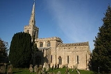
The parish church is dedicated to St Mary. The village pub is the Plough Inn on Main Street. There is a deserted medieval villageDeserted medieval village
In the United Kingdom, a deserted medieval village is a former settlement which was abandoned during the Middle Ages, typically leaving no trace apart from earthworks or cropmarks. If there are fewer than three inhabited houses the convention is to regard the site as deserted; if there are more...
to the west of the village towards Ancaster.
External links
- Wilsford, GENUKI article.

