

Windsor Mill Road
Encyclopedia
Woodlawn, Maryland
Woodlawn is the name of some places in the U.S. state of Maryland:*Woodlawn, Baltimore County, Maryland*Woodlawn, Prince George's County, Maryland...
. The road starts as a one way street named Edgewood Street, then makes a slight left corner and becomes Windsor Mill Road. The road, which is approximately 7½ miles in length, runs parallel to nearby Liberty Road
Maryland Route 26
Maryland Route 26 is an east–west state highway in the U.S. state of Maryland. Outside of the Baltimore city limits, it is known as Liberty Road; inside the city limits it is known as Liberty Heights Avenue....
and Security Boulevard
Maryland Route 122
Maryland Route 122 , better known locally as Security Boulevard, is a six-lane highway that runs near the Social Security Administration complex located in Woodlawn in western Baltimore County, Maryland...
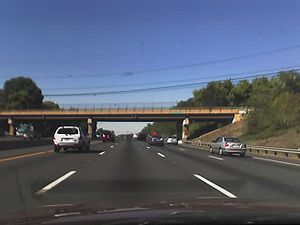
, and is often used as an alternative to these routes. Though Windsor Mill Road has no interchange with the Baltimore Beltway, it crosses over the highway, and this point is frequently mentioned in traffic reports.
Windsor Mill Road once continued east to near the intersection of Pennsylvania and Fremont Avenues; a short piece survives as School Street. The road is an old one, existing prior to the founding of Baltimore in 1729.
Currently, Windsor Mill Road begins near Walbrook Junction in West Baltimore as a one-way street for several blocks, but becomes a larger two-way road at Gwynns Falls Parkway. It then proceeds as a winding road, passing two city parks: Gwynns Falls Park and Leakin Park.
After passing the two parks, Windsor Mill Road runs mostly straight with few curves. The road is lined mostly with single-family houses, apartments, and small shops and shopping centers throughout its duration.
Then passing Forest Park Avenue, it becomes the Baltimore County line between Kernan and Forest Park Avenues in the Woodlawn area, run by motorists in the area.
The main part of Windsor Mill Road ends at Old Court Road
Old Court Road
Old Court Road is a major cross-county road in the central region of the U.S. state of Maryland, running east–west for approximately through Baltimore County, Maryland from just inside Howard County, Maryland at Woodstock on the Patapsco River to Maryland Route 25 near Towson...
. There is no traffic light at this intersection. However, Windsor Mill Road continues for two more blocks beyond Old Court as a side street that is Inwood Road.
Major intersections
- Edgewood Street - A road starts at Clifton Avenue with a one-way street to Gwynn Falls Parkway. (Walbrook Junction)
- Forest Park Avenue and Ingleside Avenue
- Woodlawn Drive/Gwynn Oak Avenue
- Essex Road/St Lukes Lane/Windsor Boulevard/Lugine Avenue
- Rolling RoadRolling RoadRolling Road is a major cross county road that runs through Baltimore County, Maryland. The road, once a continuous route, is divided into two by Interstate 95...
- Old Court RoadOld Court RoadOld Court Road is a major cross-county road in the central region of the U.S. state of Maryland, running east–west for approximately through Baltimore County, Maryland from just inside Howard County, Maryland at Woodstock on the Patapsco River to Maryland Route 25 near Towson...
(after Old Court Road, Windsor Mill Road as a side street, to the name Inwood Road)
Parks
Two well-known parks, Gwynns Falls and Leakin Park, are located along Windsor Mill Road in Baltimore City. The parks have more than 1000 acres (4 km²) of land combined. Leakin Park is home to the Gwynns Falls Trail, that runs through Leakin Park, and the annual Baltimore Herb Festival.Gwynns Falls Parkway
When traveling westbound on Windsor Mill Road, after passing the parks, Windsor Mill Road crosses Baltimore County after Forest Park Avenue. The road continues around Windsor Mill, Maryland and travels away to Randallstown, Maryland after passing Rolling Road with many land and new houses with a new school called Windsor Mill Middle School.When traveling eastbound on Windsor Mill Road, after passing the parks, Windsor Mill Road becomes one way facing in the other direction. At this point, a right turn would bring the motorist onto Lyndhurst Avenue, which continues to an intersection at Clifton Avenue. A left turn, which is more common, and is permitted without stopping, will bring the motorist onto Gwynns Falls Parkway, a major road that continues west-east for about two miles (3 km) up until the entrance to Druid Hill Park
Druid Hill Park
Druid Hill Park is a urban park in northwest Baltimore, Maryland. Its boundaries are marked by Druid Park Drive , Swann Drive and Reisterstown Road , and the Jones Falls Expressway...
and the Maryland Zoo in Baltimore after City home communities. Gwynns Falls Parkway is a multi-lane divided road that is mostly lined with residential development. Major landmarks on Gwynns Falls Parkway include:
- Mondawmin MallMondawmin MallMondawmin Mall is a three-level shopping mall in Northwest Baltimore, Maryland, United States. The mall was a development of James Rouse and opened in October 1956....
- Coppin State UniversityCoppin State UniversityCoppin State University is a historically black college located in Baltimore, Maryland, United States. It is part of the University System of Maryland...
- Frederick Douglass High School
- Gwynns Falls Elementary School