Wootton, Bedfordshire
Encyclopedia
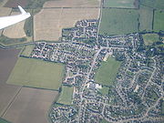
Wootton is a large village and civil parish located to the south-west of Bedford, in the north of Bedfordshire
, England
. The parish also includes the hamlets of Hall End, Keeley Green
and Wootton Green.
Wootton has had a long association with brickmaking, but is now mainly a dormitory community for Bedford and Milton Keynes
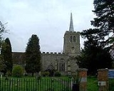
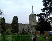
. In the 18th century church bells were made here for several churches in Bedfordshire and adjoining counties. There has been a great deal of residential development over the last 30 years but some attractive old timber-framed houses still survive. The church is mainly 14th century but contains two fine monuments in the chancel to members of the Monoux family who died in 1685 and 1707. To the west of the church is Wootton House, an impressive late 17th century house with a contemporary, red brick stable block.
of 1086, listed Wootton as having 26 residents (20 villagers and six slaves) across ten hides
. By 1901
, the population had risen to 1,252. The population remained fairly steady throughout the first half of the 20th century. But by 1971
, the population had climbed to 2,386, a 35.61% (1010 residents) increase within ten years.
According to the 2001 Census, the area covered by Wootton civil parish had 4,230 residents who lived in 1,643 households. The median
age of the population is 39. Of these residents, 74% describe their health as good and 1.78% of economically active people aged 16–74 were unemployed.
Visit the village website
and as far afield as Milton Keynes. A voluntary group of people living in the Wootton area who strongly oppose these plans have created a group known as the Wootton Against Village Expansion (aka WAVE). They are against any plans of the proposed mass development of new housing within the village.
Housing plans include:

Bedfordshire
Bedfordshire is a ceremonial county of historic origin in England that forms part of the East of England region.It borders Cambridgeshire to the north-east, Northamptonshire to the north, Buckinghamshire to the west and Hertfordshire to the south-east....
, England
England
England is a country that is part of the United Kingdom. It shares land borders with Scotland to the north and Wales to the west; the Irish Sea is to the north west, the Celtic Sea to the south west, with the North Sea to the east and the English Channel to the south separating it from continental...
. The parish also includes the hamlets of Hall End, Keeley Green
Keeley Green
Keeley Green is a hamlet located in the Bedford Borough of Bedfordshire, England.The settlement is situated directly to the north of the larger village of Wootton. Keeley Green is also close to the Wood End area of Kempston Rural, as well as the larger town of Kempston....
and Wootton Green.
Wootton has had a long association with brickmaking, but is now mainly a dormitory community for Bedford and Milton Keynes
Milton Keynes
Milton Keynes , sometimes abbreviated MK, is a large town in Buckinghamshire, in the south east of England, about north-west of London. It is the administrative centre of the Borough of Milton Keynes...
. In the 18th century church bells were made here for several churches in Bedfordshire and adjoining counties. There has been a great deal of residential development over the last 30 years but some attractive old timber-framed houses still survive.

Demography
The Domesday BookDomesday Book
Domesday Book , now held at The National Archives, Kew, Richmond upon Thames in South West London, is the record of the great survey of much of England and parts of Wales completed in 1086...
of 1086, listed Wootton as having 26 residents (20 villagers and six slaves) across ten hides
Hide (unit)
The hide was originally an amount of land sufficient to support a household, but later in Anglo-Saxon England became a unit used in assessing land for liability to "geld", or land tax. The geld would be collected at a stated rate per hide...
. By 1901
1901 in the United Kingdom
Events from the year 1901 in the United Kingdom. This year marks the transition from the Victorian to the Edwardian era.-Incumbents:*Monarch — Queen Victoria , King Edward VII...
, the population had risen to 1,252. The population remained fairly steady throughout the first half of the 20th century. But by 1971
1971 in the United Kingdom
Events from the year 1971 in the United Kingdom.-Incumbents:* Monarch - Elizabeth II* Prime Minister - Edward Heath, Conservative Party-January - March:...
, the population had climbed to 2,386, a 35.61% (1010 residents) increase within ten years.
According to the 2001 Census, the area covered by Wootton civil parish had 4,230 residents who lived in 1,643 households. The median
Median
In probability theory and statistics, a median is described as the numerical value separating the higher half of a sample, a population, or a probability distribution, from the lower half. The median of a finite list of numbers can be found by arranging all the observations from lowest value to...
age of the population is 39. Of these residents, 74% describe their health as good and 1.78% of economically active people aged 16–74 were unemployed.
Visit the village website
Village expansion
Wootton is currently undergoing many plans to expand the village, with the eventual hope of joining it with CranfieldCranfield
Cranfield is a village and civil parish in north west Bedfordshire, England, between Bedford and Milton Keynes. It has a population of 4,909, and is in Central Bedfordshire District....
and as far afield as Milton Keynes. A voluntary group of people living in the Wootton area who strongly oppose these plans have created a group known as the Wootton Against Village Expansion (aka WAVE). They are against any plans of the proposed mass development of new housing within the village.
Housing plans include:
- More than 1000 new houses on fields situated next to the A421 roadA421 roadThe A421 is an important road for east/west journeys across England. Together with the A428, the A43 and A34, it forms the route from Cambridge through Milton Keynes to Oxford...
. - Possible plans to build another 1000 houses on fields located on the road between the village and KempstonKempstonKempston is a town and civil parish located in Bedfordshire, England. Once known as the largest village in England, Kempston is now a town with its own town council. It has a population of about 20,000, and together with Bedford, it forms an urban area with around 100,000 inhabitants, which is the...
. - A middle school, and a second lower school
- Dentist
Public houses in Wootton
- The Rose and Crown
- Cock Inn
- The Fox and Duck
- The Black Horse
- The Chequers Inn
- The Cross Keys (Tre Fratelli)
Shops in Wootton
- CostcutterCostcutterCostcutter is based in the United Kingdom, Ireland and Poland under which there are supermarkets and local and urban convenience stores. The banner also has its own brand of goods and products which are sold alongside Nisa Today own-brand products and branded products.As of December 2006,...
(Post Office) - One Stop
- Pats Pizza
- Pharmacy
- Wootton Garage
- Medical health centre
See also
- Wootton Village Website
- Wootton Blue Cross F.C.Wootton Blue Cross F.C.Wootton Blue Cross F.C. is a football club based in Wootton, near Bedford, Bedfordshire, England. In the 2002-03 season, they reached the 4th round of the FA Vase. For the 2011-12 season, they are members of the United Counties League Division One...
- Wootton Upper SchoolWootton Upper SchoolWootton Upper School and Performing Arts College is located on Hall End Road, in Wootton. It teaches years 9-11 in compulsory education and years 12-13 in post-16 education. Approximately 75% of students previously in compulsory education stay on to the sixth form. Wootton Upper School is the fifth...
External links

- 2001 Census - Parish Profile for Wootton
- Wootton Upper School

