
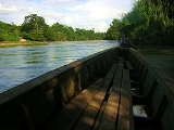
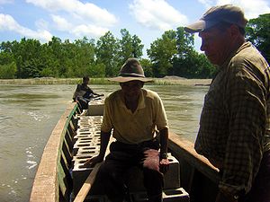
Xalbal River
Encyclopedia
River
A river is a natural watercourse, usually freshwater, flowing towards an ocean, a lake, a sea, or another river. In a few cases, a river simply flows into the ground or dries up completely before reaching another body of water. Small rivers may also be called by several other names, including...
of Guatemala
Guatemala
Guatemala is a country in Central America bordered by Mexico to the north and west, the Pacific Ocean to the southwest, Belize to the northeast, the Caribbean to the east, and Honduras and El Salvador to the southeast...
.
Its sources are located in the Sierra de los Cuchumatanes
Sierra de los Cuchumatanes
The Sierra de los Cuchumatanes is the highest non-volcanic mountain range in Central America. Its elevations range from 500 m to over 3,800 m, and it covers a total area of ±16,350 km². With an area of 1,500 km² situated above 3,000 m, it is also the most extensive highland region in Central...
(at 15.497769°N 91.132793°W) in the department of El Quiché, where the river is called Río Xaclbal or Río Chajul. The Xaclbal river flows northwards down the tropical lowlands of Ixcan
Ixcán
Ixcán is a municipality in the Guatemalan department of El Quiché. Its administrative centre can be found in Playa Grande. The municipality consists of 176 communities, called aldeas. It has an area of 1575 km2...
where it is called Río Xalbal (at 15.954727°N 90.925255°W), and crosses the border with Mexico
Mexico
The United Mexican States , commonly known as Mexico , is a federal constitutional republic in North America. It is bordered on the north by the United States; on the south and west by the Pacific Ocean; on the southeast by Guatemala, Belize, and the Caribbean Sea; and on the east by the Gulf of...
, where it joins the Lacantún River
Lacantún River
-References:*Atlas of Mexico, 1975 .*The Prentice Hall American World Atlas, 1984.*Rand McNally, The New International Atlas, 1993....
, a tributary of the Usumacinta river
Usumacinta River
The Usumacinta River is a river in southeastern Mexico and northwestern Guatemala. It is formed by the junction of the Pasión River, which arises in the Sierra de Santa Cruz and the Salinas River, also known as the Chixoy, or the Negro, which descends from the Sierra Madre de Guatemala...
. The Guatemalan part of Xaclbal river basin covers an area of 1,366 km2.
The village of Xalbal, named after the river, suffered a massacre in 1982. The village was abandoned in March 1982 .