Yokine, Western Australia
Encyclopedia
Yokine is a suburb
of Perth
, Western Australia
. Its Local Government Area
is the City of Stirling.
word meaning native dog. The name was chosen because the area is close to Dog Swamp. Its post code is 6060.
Yokine was part of the grant originally allocated to TRC Walters in 1840. Western Australian Golf Limited owned Yokine from at least 1927 and subdivided a small portion of land near the golf course. Before World War II the only house in Yokine was at the eastern end of Royal Street. Yokine experienced a housing boom after the war and much of the area near the golf course was developed by the early 1950s. The southern area grew rapidly in the 1960s and by the late 1970s Yokine was almost completely developed.
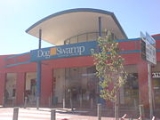
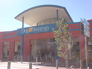
 Dog Swamp Shopping Centre is a major shopping centre
, located in Yokine.
The shopping centre was first opened in 1967. Prior to being taken over by the Westpac Diversified Property Trust, the centre was owned by the Foodland Associated Limited Property Trust. As of September 2007, the shopping centre has a 100% occupancy rate.
Major retailers within the centre include: Woolworths, Flight Centre
, Civic Video
, Subway
and TAB
.
bus routes operated by Path Transit
. The 354 and 870 (Mirrabooka-Perth) covers the end of Flinders Street and Wanneroo road south to perth, the 346 (Wanneroo-Perth), 347 (Warwick-Perth) and the 363, 373 and 374 (Marangaroo-Perth) covers Wanneroo Road south to Perth.
Suburb
The word suburb mostly refers to a residential area, either existing as part of a city or as a separate residential community within commuting distance of a city . Some suburbs have a degree of administrative autonomy, and most have lower population density than inner city neighborhoods...
of Perth
Perth, Western Australia
Perth is the capital and largest city of the Australian state of Western Australia and the fourth most populous city in Australia. The Perth metropolitan area has an estimated population of almost 1,700,000....
, Western Australia
Western Australia
Western Australia is a state of Australia, occupying the entire western third of the Australian continent. It is bounded by the Indian Ocean to the north and west, the Great Australian Bight and Indian Ocean to the south, the Northern Territory to the north-east and South Australia to the south-east...
. Its Local Government Area
Local Government Areas of Western Australia
The Australian state of Western Australia is divided into 141 local government areas...
is the City of Stirling.
History
The name Yokine was derived from the AboriginalIndigenous Australians
Indigenous Australians are the original inhabitants of the Australian continent and nearby islands. The Aboriginal Indigenous Australians migrated from the Indian continent around 75,000 to 100,000 years ago....
word meaning native dog. The name was chosen because the area is close to Dog Swamp. Its post code is 6060.
Yokine was part of the grant originally allocated to TRC Walters in 1840. Western Australian Golf Limited owned Yokine from at least 1927 and subdivided a small portion of land near the golf course. Before World War II the only house in Yokine was at the eastern end of Royal Street. Yokine experienced a housing boom after the war and much of the area near the golf course was developed by the early 1950s. The southern area grew rapidly in the 1960s and by the late 1970s Yokine was almost completely developed.
Yokine Primary School
Y.P.S. is a Primary School in Yokine on Blythe Ave. The school is small (about 300-350 students) but has a great community. The current principal is Neil Mc Callum.Dog Swamp Shopping Centre

Shopping mall
A shopping mall, shopping centre, shopping arcade, shopping precinct or simply mall is one or more buildings forming a complex of shops representing merchandisers, with interconnecting walkways enabling visitors to easily walk from unit to unit, along with a parking area — a modern, indoor version...
, located in Yokine.
The shopping centre was first opened in 1967. Prior to being taken over by the Westpac Diversified Property Trust, the centre was owned by the Foodland Associated Limited Property Trust. As of September 2007, the shopping centre has a 100% occupancy rate.
Major retailers within the centre include: Woolworths, Flight Centre
Flight Centre
Flight Centre Limited is Australia's largest travel agent. It is listed on the Australian Stock Exchange with a market capitalisation of $1.145 billion as at March 2006. It has over 1500 stores in nine different countries with over 8000 staff.-History:...
, Civic Video
Civic Video
Civic Video is a DVD and video rental store chain which operates over 330 franchise and corporate-owned video stores across Australia, New Zealand and Thailand.-Australia:Civic Video was formed in Australia in 1985...
, Subway
Subway (restaurant)
Subway is an American restaurant franchise that primarily sells submarine sandwiches and salads. It is owned and operated by Doctor's Associates, Inc. . Subway is one of the fastest growing franchises in the world with 35,519 restaurants in 98 countries and territories as of October 25th, 2011...
and TAB
Totalizator Agency Board
Totalisator Agency Board in Australia and New Zealand, universally shortened to TAB, is the name given to monopoly totalisator organisations. All were originally government owned...
.
Transport
The suburb is served by a number of TransperthTransperth
Transperth is the brand name of the public transport system in Perth, Western Australia. It is operated by the Public Transport Authority.-History:...
bus routes operated by Path Transit
Path Transit
Path Transit is a transport company operating 320 buses in Perth, Australia since 1996.It has depots in :* Bayswater* MalagaPath Transit also provides rental of vehicles for private functions.-Vehicles:...
. The 354 and 870 (Mirrabooka-Perth) covers the end of Flinders Street and Wanneroo road south to perth, the 346 (Wanneroo-Perth), 347 (Warwick-Perth) and the 363, 373 and 374 (Marangaroo-Perth) covers Wanneroo Road south to Perth.

