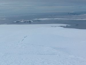
Zverino Island
Encyclopedia

Meade Islands
Meade Islands is a group of two islands, the larger west one being Zverino Island and the smaller east one Cave Island, and rocks lying in the north entrance to McFarlane Strait in the South Shetland Islands, Antarctica. Their surface areas are and . respectively...
lying in the north entrance to McFarlane Strait
McFarlane Strait
McFarlane Strait is the 24.5 km long and 3.35 km wide strait lying between Greenwich and Livingston Island, in the South Shetland Islands...
in the South Shetland Islands
South Shetland Islands
The South Shetland Islands are a group of Antarctic islands, lying about north of the Antarctic Peninsula, with a total area of . By the Antarctic Treaty of 1959, the Islands' sovereignty is neither recognized nor disputed by the signatories and they are free for use by any signatory for...
, Antarctica. It is extending 1.2 km by 700 m, with surface area of 48 hectares (118.6 acre), and is snow-free in summer.
The island is named after the settlement of Zverino in Western Bulgaria.
Location
Zverino Island is located at 62°27′09"S 60°04′25"W, which is 2.4 km east of Williams PointWilliams Point
Williams Point is the point forming both the north extremity of Varna Peninsula and the northeast tip of Livingston Island in the South Shetland Islands, Antarctica...
and 2.1 km northeast of Ficheto Point
Ficheto Point
Ficheto Point is an ice-free point on the northeast coast of Varna Peninsula, Livingston Island, Antarctica forming the southeast side of the entrance to Dragon Cove. Channel Rock is lying in the adjacent northwestern part of McFarlane Strait, northeast of Ficheto Point and south-southwest of...
on Livingston Island, 1.9 km west of Duff Point
Duff Point
Duff Point is a point forming the west extremity of Greenwich Island, in the South Shetland Islands, Antarctica. The name Duffs Straits was applied to McFarlane Strait by James Weddell in 1820-23, after Captain Norwich Duff under whom Weddell served in HMS Espoir in 1814...
on Greenwich Island, and 170 m southwest of Cave Island
Cave Island
Cave Island is an island marked by a large cavern in its south side, which is the second largest of the Meade Islands lying in the north entrance to McFarlane Strait, in the South Shetland Islands. The name Cave Rock appears to have been applied by DI personnel on the Discovery II who charted the...
. British mapping in 1935 and 1968, Chilean in 1971, Argentine in 1980, Spanish in 1991, and Bulgarian in 2005 and 2009.
Maps
- L.L. Ivanov et al. Antarctica: Livingston Island and Greenwich Island, South Shetland Islands. Scale 1:100000 topographic map. Sofia: Antarctic Place-names Commission of Bulgaria, 2005.

