

2008 Irish flash floods
Encyclopedia

Flash flood
A flash flood is a rapid flooding of geomorphic low-lying areas—washes, rivers, dry lakes and basins. It may be caused by heavy rain associated with a storm, hurricane, or tropical storm or meltwater from ice or snow flowing over ice sheets or snowfields...
s that occurred across the island
Ireland
Ireland is an island to the northwest of continental Europe. It is the third-largest island in Europe and the twentieth-largest island on Earth...
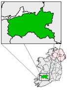
in August 2008. The floods and related weather conditions primarily affected the following counties; Limerick
County Limerick
It is thought that humans had established themselves in the Lough Gur area of the county as early as 3000 BC, while megalithic remains found at Duntryleague date back further to 3500 BC...
, Cork
County Cork
County Cork is a county in Ireland. It is located in the South-West Region and is also part of the province of Munster. It is named after the city of Cork . Cork County Council is the local authority for the county...
, Dublin
County Dublin
County Dublin is a county in Ireland. It is part of the Dublin Region and is also located in the province of Leinster. It is named after the city of Dublin which is the capital of Ireland. County Dublin was one of the first of the parts of Ireland to be shired by King John of England following the...
, Antrim
County Antrim
County Antrim is one of six counties that form Northern Ireland, situated in the north-east of the island of Ireland. Adjoined to the north-east shore of Lough Neagh, the county covers an area of 2,844 km², with a population of approximately 616,000...
, Carlow
County Carlow
County Carlow is a county in Ireland. It is part of the South-East Region and is also located in the province of Leinster. It is named after the town of Carlow, which lies on the River Barrow. Carlow County Council is the local authority for the county...
, Galway
County Galway
County Galway is a county in Ireland. It is located in the West Region and is also part of the province of Connacht. It is named after the city of Galway. Galway County Council is the local authority for the county. There are several strongly Irish-speaking areas in the west of the county...
, Laois
County Laois
County Laois is a county in Ireland. It is part of the Midlands Region and is also located in the province of Leinster. It was formerly known as Queen's County until the establishment of the Irish Free State in 1922. The county's name was formerly spelt as Laoighis and Leix. Laois County Council...
, Louth
County Louth
County Louth is a county of Ireland. It is part of the Border Region and is also located in the province of Leinster. It is named after the town of Louth. Louth County Council is the local authority for the county...
, Meath
County Meath
County Meath is a county in Ireland. It is part of the Mid-East Region and is also located in the province of Leinster. It is named after the ancient Kingdom of Mide . Meath County Council is the local authority for the county...
, Kildare
County Kildare
County Kildare is a county in Ireland. It is part of the Mid-East Region and is also located in the province of Leinster. It is named after the town of Kildare. Kildare County Council is the local authority for the county...
, Kilkenny
County Kilkenny
County Kilkenny is a county in Ireland. It is part of the South-East Region and is also located in the province of Leinster. It is named after the city of Kilkenny. The territory of the county was the core part of the ancient Irish Kingdom of Osraige which in turn was the core of the Diocese of...
, Tipperary
County Tipperary
County Tipperary is a county of Ireland. It is located in the province of Munster and is named after the town of Tipperary. The area of the county does not have a single local authority; local government is split between two authorities. In North Tipperary, part of the Mid-West Region, local...
, Offaly
County Offaly
County Offaly is a county in Ireland. It is part of the Midlands Region and is also located in the province of Leinster. It is named after the ancient Kingdom of Uí Failghe and was formerly known as King's County until the establishment of the Irish Free State in 1922. Offaly County Council is...
, Sligo and Donegal
County Donegal
County Donegal is a county in Ireland. It is part of the Border Region and is also located in the province of Ulster. It is named after the town of Donegal. Donegal County Council is the local authority for the county...
. Parts of Ireland's large urban centres, including Dublin and Belfast
Belfast
Belfast is the capital of and largest city in Northern Ireland. By population, it is the 14th biggest city in the United Kingdom and second biggest on the island of Ireland . It is the seat of the devolved government and legislative Northern Ireland Assembly...
, were submerged, whilst Carlow town
Carlow
Carlow is the county town of County Carlow in Ireland. It is situated in the south-east of Ireland, 84 km from Dublin. County Carlow is the second smallest county in Ireland by area, however Carlow Town is the 14th largest urban area in Ireland by population according to the 2006 census. The...
has experienced some of the worst flooding in the country. One person died; 31-year-old Polish
Poland
Poland , officially the Republic of Poland , is a country in Central Europe bordered by Germany to the west; the Czech Republic and Slovakia to the south; Ukraine, Belarus and Lithuania to the east; and the Baltic Sea and Kaliningrad Oblast, a Russian exclave, to the north...
dad-of-one Przemyslaw Jablonski. He went missing in the River Fergus
River Fergus
The River Fergus is a river in County Clare, Ireland. It rises in Loughnagowan which lies a few kilometers west of Corofin and flows into the Shannon Estuary. It is noted for its trout and salmon fishing. Trummer is an island in the river...
, in Ennis
Ennis
Ennis is the county town of Clare in Ireland. Situated on the River Fergus, it lies north of Limerick and south of Galway. Its name is a shortening of the original ....
, and was found 6 days later (on 18 August) in the same river. He was pronounced dead at the scene.
Conditions before the floods
Rainfall in Cork for the month of July 2008 was the heaviest recorded since 1975. The combined total for June and July was more than twice the normal level of rainfall expected for that period. Around the country the weather was wetter than normal for July with exceptional rainfall in County Limerick in the last 24 hours of July giving rise to this figure. Met ÉireannMet Éireann
Met Éireann is the national meteorological service in Ireland, part of the Department of the Environment, Heritage and Local Government.-History:...
described July as "a dull month generally". The highest average temperature recorded in July was 15.7 degrees (Shannon Airport); the same location also enjoyed the warmest day of the month at 25.2 degrees on July 24th. The lowest air temperature since the early 1970s was recorded at Mullingar
Mullingar
Mullingar is the county town of County Westmeath in Ireland. The Counties of Meath and Westmeath Act of 1542, proclaimed Westmeath a county, separating it from Meath. Mullingar became the administrative centre for County Westmeath...
during July - a figure of 3.6 degrees was recorded on the 5th. The greatest level of sunshine was in the east of the country - Dublin Airport
Dublin Airport
Dublin Airport, , is operated by the Dublin Airport Authority. Located in Collinstown, in the Fingal part of County Dublin, 18.4 million passengers passed through the airport in 2010, making it the busiest airport in the Republic of Ireland, followed by Cork and Shannon...
recorded 156 hours of sunshine - whilst the lowest level of rainfall was recorded at Belmullet
Belmullet
Belmullet is a coastal Gaeltacht town with a population of around 2,000 on the Mullet Peninsula in the barony of Erris, County Mayo, Ireland. Its name means the "mouth of the mullet"...
- 54 millimetres fell during July.
Timeline of events
August 1
County LimerickCounty Limerick
It is thought that humans had established themselves in the Lough Gur area of the county as early as 3000 BC, while megalithic remains found at Duntryleague date back further to 3500 BC...
and County Cork
County Cork
County Cork is a county in Ireland. It is located in the South-West Region and is also part of the province of Munster. It is named after the city of Cork . Cork County Council is the local authority for the county...
were the first areas to be affected. On the night of July 31/August 1, the River Blackwater
Munster Blackwater
The Blackwater or Munster Blackwater is a river which flows through counties Kerry, Cork, and Waterford in Ireland. It rises in the Mullaghareirk Mountains in County Kerry and then flows in an easterly direction through County Cork, through Mallow and Fermoy...
in Cork
Cork (city)
Cork is the second largest city in the Republic of Ireland and the island of Ireland's third most populous city. It is the principal city and administrative centre of County Cork and the largest city in the province of Munster. Cork has a population of 119,418, while the addition of the suburban...
burst its banks, causing severe flooding between Banteer
Banteer
Banteer is a village in north County Cork, Province of Munster, Ireland. It is near the town of Mallow, County Cork. Located in the district of northern Cork known as Duhallow.-History:...
and Mallow
Mallow, County Cork
Mallow is the "Crossroads of Munster" and the administrative capital of north County Cork, in Ireland. The Northern Divisional Offices of Cork County Council are located in the town....
. Cork County Council issued a flood warning for Mallow on the morning of the 1st whilst council staff distributed sandbags. Bridge Street in Mallow was closed for a time but later reopened for motorist use. The Town Park Road in Mallow was closed for a longer period. Flood relief works had been ongoing in Mallow for six months but were not expected to finish for another 18 months. Further downstream, floodwaters reached Fermoy
Fermoy
Fermoy is a town in County Cork, Ireland. It is situated on the River Blackwater in the south of Ireland. Its population is some 5,800 inhabitants, environs included ....
at around 10 pm.
In Limerick, it took several hours before electricity was restored to 3,000 homes in Newcastle West
Newcastle West
Newcastle West is a town in west County Limerick, Ireland. The town is the largest town in the county, excluding Limerick city, and is sited on the River Arra which flows into the River Deel...
, where a major clear-up operation was underway after the River Arra burst its banks earlier in the morning. Up to 20 homes were badly affected by "freak" flash flooding overnight, with residents having to be rescued from their houses. There were few injuries; although an elderly woman was airlifted from her home and immediately diagnosed with hypothermia
Hypothermia
Hypothermia is a condition in which core temperature drops below the required temperature for normal metabolism and body functions which is defined as . Body temperature is usually maintained near a constant level of through biologic homeostasis or thermoregulation...
. Met Éireann
Met Éireann
Met Éireann is the national meteorological service in Ireland, part of the Department of the Environment, Heritage and Local Government.-History:...
said that the average rainfall for the last week of July was about 26mm - three times that amount dropped between 7 pm and midnighton July 31 in Newcastle West. At one rainfall station in the area, a measurement of 90.1mm was recorded in that time. Around 100mm of rain would be expected in one month. The rainfall was said to be "tropical-like in intensity". Limerick County Council issued a public drinking water notice residents of Newcastle West to boil their water before use. The areas affected by the boil notice included Newcastle West, Coolcappagh and Rathcahill and the Ballyine, Dually, Reens Kilscannell, Old Mill Road, Killoughteen and Killeline Group Water Supply Schemes.
August 2
The River DeelRiver Deel
The River Deel is in County Limerick, Ireland.The river rises near Dromina in North County Cork and flows north into County Limerick for over 60 km to enter the Shannon Estuary at Askeaton....
threatened to flood in Askeaton
Askeaton
Askeaton is a town in County Limerick, Ireland. Located on the N69, the town is built on the banks of the River Deel some 3 km upstream from the estuary of the River Shannon. There is also a secondary school in Askeaton...
, County Limerick
County Limerick
It is thought that humans had established themselves in the Lough Gur area of the county as early as 3000 BC, while megalithic remains found at Duntryleague date back further to 3500 BC...
. Localised flooding occurred earlier in the day in the town. The Newcastle West Business Association called on the government to help those worst affected by the flash floods of the previous day. Spokesman Pat O'Donovan stated that many businesses were uninsured or under-insured and needed financial assistance. A huge clean up operation continued in parts of Limerick and Cork. It was estimated that millions of euro worth of damage was caused. Met Éireann
Met Éireann
Met Éireann is the national meteorological service in Ireland, part of the Department of the Environment, Heritage and Local Government.-History:...
claimed that the area around Newcastle West experienced the equivalent of four weeks rain in five hours.
August 9
The record for a single 24-hour period of rain in August was almost broken in Dublin. 56mm of rain fell on Dublin AirportDublin Airport
Dublin Airport, , is operated by the Dublin Airport Authority. Located in Collinstown, in the Fingal part of County Dublin, 18.4 million passengers passed through the airport in 2010, making it the busiest airport in the Republic of Ireland, followed by Cork and Shannon...
in 24 hours. The record (60mm) was set in August 1986, in the aftermath of Hurricane Charley. Celbridge
Celbridge
Celbridge is a town and townland on the River Liffey in County Kildare, Ireland. It is west of Dublin. As a town within the Dublin Metropolitan Area and the Greater Dublin Area, it is located at the intersection of the R403 and R405 regional roads....
was flooded and nearby roads were impassable. Flooding was reported between Naas
Naas
Naas is the county town of County Kildare in Ireland. With a population of just over twenty thousand, it is also the largest town in the county. Naas is a major commuter suburb, with many people residing there and working in Dublin...
and Blessington
Blessington
Blessington, historically known as Ballycomeen , is a town in County Wicklow, Ireland. It is located on the N81 road, which connects Dublin to Tullow.- History :...
. A river burst its banks along the Ballyroan
Ballyroan
Ballyroan is a small village in County Laois, Ireland, on the R425 regional road. It is part of the parish of Abbeyleix. It has two churches , two schools , three pubs, Whelan's, Delaney's & Scully's. Also two shops.-History:There was a Druids Altar in Cashel. St...
to Portlaoise road at Cashel Cross in County Laois
County Laois
County Laois is a county in Ireland. It is part of the Midlands Region and is also located in the province of Leinster. It was formerly known as Queen's County until the establishment of the Irish Free State in 1922. The county's name was formerly spelt as Laoighis and Leix. Laois County Council...
. Only one lane of the road was open to traffic at the time. The road between Portlaoise and Timahoe
Timahoe
Timahoe is a village in County Laois, Ireland, 12 km south of Portlaoise on the R426 regional road.-Features:The village of Timahoe is situated in a broad and fertile valley. The houses are built around a large central green, known as the Goosegreen...
was badly flooded whilst the Stradbally Village to Athy
Athy
The town developed from a 12th century Anglo-Norman settlement to an important British military outpost on the border of the Pale.The first town charter dates from the 16th century and the town hall was constructed in the early 18th century...
road was impassable. Other roads closed included the N3 (inbound and outbound at Blanchardstown Shopping Centre), the M1 (inbound and outbound after the Port Tunnel
Dublin Port Tunnel
The Dublin Port Tunnel is a road traffic tunnel in Dublin, Ireland, that forms part of the M50 motorway....
), the M50 (blocked at Ballymun northbound) with diversions in place. Dart
Dublin Area Rapid Transit
The Dublin Area Rapid Transit is part of the suburban railway network in Ireland, running mainly along the coastline of Dublin Bay on the Trans-Dublin route, from Greystones in County Wicklow, through Dublin to Howth and Malahide in County Dublin.Trains are powered via a 1500V DC overhead catenary...
services were suspended between the Malahide
Malahide
Malahide is a coastal suburban town, near Dublin city, located in the administrative county of Fingal, within the traditional County Dublin, Ireland. It has a village-like centre and extensive residential areas to the south, west and northwest.-Name:...
and Howth
Howth
Howth is an area in Fingal County near Dublin city in Ireland. Originally just a small fishing village, Howth with its surrounding rural district is now a busy suburb of Dublin, with a mix of dense residential development and wild hillside, all on the peninsula of Howth Head. The only...
junctions whilst there was also disruption to Northern Commuter and Belfast rail services. Garda diversions were put in place and long delays were to be had. Dublin Airport authorities asked passengers to give plenty of time to reach the airport and, if possible, to check their route before they leave. A football match between Shamrock Rovers
Shamrock Rovers F.C.
Shamrock Rovers Football Club are a professional football club from Dublin, Ireland. They compete in the Premier Division of the League of Ireland and are the most successful club in Irish football history. The club have won the League of Ireland title a record 17 times and the FAI Cup a record 24...
and Sunderland
Sunderland A.F.C.
Sunderland Association Football Club is an English association football club based in Sunderland, Tyne and Wear who currently play in the Premier League...
, due to be played at Tolka Park
Tolka Park
Tolka Park is an Irish football ground located in the north Dublin suburb of Drumcondra, on the northern banks of the River Tolka. It is currently the home ground of League of Ireland club Shelbourne...
at 7.30pm that evening, was cancelled due to the flooding.
In Dublin, it was reported that one vehicle was swept down a road in a torrent of flood water. "The combination of monsoon-like rain and a high-tide" prompted a spokesperson for Dublin Fire Brigade to report that crews spent most of the night rescuing people from houses and cars. He claimed that, between 4 pm and midnight, 800 calls were taken with 600 of these flood-related, going on to say: “We’ve never had anything like that. We wouldn’t generally get that many calls on Halloween
Halloween
Hallowe'en , also known as Halloween or All Hallows' Eve, is a yearly holiday observed around the world on October 31, the night before All Saints' Day...
.” Hundreds of Armagh
Armagh GAA
The Armagh County Board of the Gaelic Athletic Association or Armagh GAA is one of the 32 county boards of the GAA in Ireland, and is responsible for Gaelic games in County Armagh...
Gaelic football
Gaelic football
Gaelic football , commonly referred to as "football" or "Gaelic", or "Gah" is a form of football played mainly in Ireland...
fans, attending the All-Ireland quarter-final at Croke Park
Croke Park
Croke Park in Dublin is the principal stadium and headquarters of the Gaelic Athletic Association , Ireland's biggest sporting organisation...
, were stranded by torrential rain when they left the stadium to discover their cars surrounded by water. The rain prompted GAA
Gaelic Athletic Association
The Gaelic Athletic Association is an amateur Irish and international cultural and sporting organisation focused primarily on promoting Gaelic games, which include the traditional Irish sports of hurling, camogie, Gaelic football, handball and rounders...
officials in Croke Park
Croke Park
Croke Park in Dublin is the principal stadium and headquarters of the Gaelic Athletic Association , Ireland's biggest sporting organisation...
to turn on the floodlights for the second half of the All-Ireland quarter final between Kerry and Galway in what was to be the first ever floodlight championship game in Croke park, the game was described by many as the greatest game of pure vintage football played in Croke Park in the noughties decade despite the worst rain in Irish history.
August 10
A clean-up operation was underway in Dublin and Kildare following the previous day's flash flooding. Gardaí said flood water had subsided in most parts except for some areas in north county Dublin. The N3 near BlanchardstownBlanchardstown
Blanchardstown is a large suburb of Dublin in the district of Fingal, Ireland. It is within the historical barony of Castleknock. It is located 10 km north-west of the city centre. The suburb is in the Dublin 15 postal area, the Dublin West electoral constituency, and Fingal County...
was re-opened. On the M50 there was still severe flooding on both the northbound and southbound lanes. The M1 at Whitehall
Whitehall, Dublin
Whitehall is a Northside suburb of Dublin City, Ireland.Whitehall is on the northern outskirts of Dublin's inner city, located on the N1 road leading to Dublin Airport, Swords and Belfast, between Santry and Drumcondra. North of Whitehall, the N1 becomes a motorway, the M1...
was re-opened on both sides following flood-related closures. According to Met Éireann
Met Éireann
Met Éireann is the national meteorological service in Ireland, part of the Department of the Environment, Heritage and Local Government.-History:...
, in the 24-hour period from midnight on August 8 until midnight on August 9, 76.2mm of rain was recorded at Dublin Airport
Dublin Airport
Dublin Airport, , is operated by the Dublin Airport Authority. Located in Collinstown, in the Fingal part of County Dublin, 18.4 million passengers passed through the airport in 2010, making it the busiest airport in the Republic of Ireland, followed by Cork and Shannon...
, a new record for the month of August. The previous record, 73mm, was recorded in August 1986.
Kildare County Council reported bad flooding in Celbridge
Celbridge
Celbridge is a town and townland on the River Liffey in County Kildare, Ireland. It is west of Dublin. As a town within the Dublin Metropolitan Area and the Greater Dublin Area, it is located at the intersection of the R403 and R405 regional roads....
. Eight houses in the Vanessa Close Estate were flooded with water of approximately 60 cm after the Toni River, a tributary of the River Liffey
River Liffey
The Liffey is a river in Ireland, which flows through the centre of Dublin. Its major tributaries include the River Dodder, the River Poddle and the River Camac. The river supplies much of Dublin's water, and a range of recreational opportunities.-Name:The river was previously named An Ruirthech,...
, overflowed. The Clane
Clane
Clane is a town on the River Liffey and in the barony of Clane in County Kildare, Ireland, from Dublin.Its population of 4,968 makes it the eighth largest town in Kildare and the 78th largest in the Republic of Ireland....
to Celbridge
Celbridge
Celbridge is a town and townland on the River Liffey in County Kildare, Ireland. It is west of Dublin. As a town within the Dublin Metropolitan Area and the Greater Dublin Area, it is located at the intersection of the R403 and R405 regional roads....
Road and Ardrass Road from Straffan
Straffan
Sruthán was mistakenly cited by Thomas O'Connor in the Ordnance Survey Letters in 1837, and adopted as the Irish form of Straffan. Seosamh Laoide used it in his list of Irish names of post-offices published in Post-Sheanchas . An Sruthán gained currency among those involved in the Irish revival...
to Celbridge were closed due to flooding. Flooded pumps caused sewage to flow into the streets of Celbridge, damaging some premises on the Main Street. 4,000 scouts in Punchestown had to spend the night indoors after being removed by the Civil Defence to the major events centre on the site. Leixlip
Leixlip
-Politics:Since 1988 Leixlip has had a nine member Town Council , headed by a Cathaoirleach , which has control over many local matters, although it is limited in that it is not also a planning authority...
and Maynooth
Maynooth
Maynooth is a town in north County Kildare, Ireland. It is home to a branch of the National University of Ireland, a Papal University and Ireland's main Roman Catholic seminary, St. Patrick's College...
experienced flooding although no damage to property was reported.
In County Laois
County Laois
County Laois is a county in Ireland. It is part of the Midlands Region and is also located in the province of Leinster. It was formerly known as Queen's County until the establishment of the Irish Free State in 1922. The county's name was formerly spelt as Laoighis and Leix. Laois County Council...
the Ballyroan
Ballyroan
Ballyroan is a small village in County Laois, Ireland, on the R425 regional road. It is part of the parish of Abbeyleix. It has two churches , two schools , three pubs, Whelan's, Delaney's & Scully's. Also two shops.-History:There was a Druids Altar in Cashel. St...
to Portlaoise Road was flooded at Cashel Cross after a river burst its banks. In County Offaly
County Offaly
County Offaly is a county in Ireland. It is part of the Midlands Region and is also located in the province of Leinster. It is named after the ancient Kingdom of Uí Failghe and was formerly known as King's County until the establishment of the Irish Free State in 1922. Offaly County Council is...
, the Tullamore Show, due to take place that day, was cancelled for the second consecutive year due to the weather. Dublin Fire Brigade said all areas of the capital had been affected by overnight flooding, particularly in Swords and Drumcondra
Drumcondra, Dublin
Drumcondra is a residential area and inner suburb on the Northside of Dublin, Ireland. It is administered by Dublin City Council.The River Tolka and the Royal Canal flow through the area.-History:...
. Houses in the Knocklyon and Firhouse areas of south Dublin were flooded. The Civil Defence was also called in to help pump water. On the M50 a bus full of people journeying to Dublin Airport
Dublin Airport
Dublin Airport, , is operated by the Dublin Airport Authority. Located in Collinstown, in the Fingal part of County Dublin, 18.4 million passengers passed through the airport in 2010, making it the busiest airport in the Republic of Ireland, followed by Cork and Shannon...
was marooned in the floods and had to be pulled free with the aid of a tractor. Racing at the Curragh
Curragh Racecourse
The Curragh Racecourse, usually abbreviated to The Curragh, is Ireland's most important Thoroughbred race track. It is situated on the Curragh plain near Newbridge, County Kildare, Ireland.- History :...
was cancelled because of a waterlogged track.
August 12
Heavy rainfall in Dublin led to flooding and collisions on commuter routes. Dublin City Council described the situation as "serious". In MulhuddartMulhuddart
Mulhuddart is a suburb situated to the north-west of Dublin city, in the barony of Castleknock, Ireland. The River Tolka passes near the village.-Location and access:The N3 dual carriageway now by-passes the village...
the Church Road was reported as closed at the cemetery through to the Hollystown Golf Club. Two open manholes were reported; one at the Drumcondra/Home Farm Rd junction, another outbound on the Ballymun Road outside the library, resulting in a flooded bus lane. The N3 at Blanchardstown
Blanchardstown
Blanchardstown is a large suburb of Dublin in the district of Fingal, Ireland. It is within the historical barony of Castleknock. It is located 10 km north-west of the city centre. The suburb is in the Dublin 15 postal area, the Dublin West electoral constituency, and Fingal County...
was closed between the two exit slips which access the Blanchardstown Town Centre. Traffic was diverted around the flooded area via the Snugborough and Mulhuddart interchanges. The left lane of the M50 Southbound at J5 Finglas
Finglas
-See also:* List of towns and villages in Ireland* List of abbeys and priories in Ireland...
was closed due to flooding. There were reports of "a lot of surface water" on the M50 at J4 Ballymun
Ballymun
Ballymun is an area on Dublin's Northside close to Dublin Airport, Ireland. It is infamous for the Ballymun flats, which became a symbol of poverty, drugs, alienation from the state and social problems in Ireland from the 1970s...
in both directions. Flooding was seen at the Strawberry beds approaching Lucan and on Tandys Lane in Lucan village, from the Old Swords Road to Coolock Lane, and at the Griffith Ave Ballymun Road junction. The flooding on River Road in Finglas was described as "heavy". Surface water and debris on the Killinarden side of the Killtipper Road at "a very bad bend" caused delays to motorists. On the Naas Road outbound there was surface water after Newlands Cross and at the Kylemore Road junction and Eglinton Road in Donnybrook
Donnybrook, Dublin
Donnybrook is a district of Dublin, Ireland. It is situated on the southside of the city, in the Dublin 4 postal district, and is home to the Irish state broadcaster RTÉ. It was once part of the Pembroke Township...
was flooded. In Dublin city centre there was flooding at Westland Row, Lincoln Place. In County Louth
County Louth
County Louth is a county of Ireland. It is part of the Border Region and is also located in the province of Leinster. It is named after the town of Louth. Louth County Council is the local authority for the county...
, the R173 Carlingford to Newry Road was described as "flooded and impassable".
August 13
Several hours of heavy rainfall led to flash floods in Dublin, with the Phoenix ParkPhoenix Park
Phoenix Park is an urban park in Dublin, Ireland, lying 2–4 km west of the city centre, north of the River Liffey. Its 16 km perimeter wall encloses , one of the largest walled city parks in Europe. It includes large areas of grassland and tree-lined avenues, and since the seventeenth...
's Castleknock gate closed off and the road rendered impassable by the heavy floods. Some DART services were suspended for a time in the evening. Rail services between Drogheda
Drogheda
Drogheda is an industrial and port town in County Louth on the east coast of Ireland, 56 km north of Dublin. It is the last bridging point on the River Boyne before it enters the Irish Sea....
and Dundalk
Dundalk
Dundalk is the county town of County Louth in Ireland. It is situated where the Castletown River flows into Dundalk Bay. The town is close to the border with Northern Ireland and equi-distant from Dublin and Belfast. The town's name, which was historically written as Dundalgan, has associations...
were not operating overnight due to the flooding. In County Leitrim
County Leitrim
County Leitrim is a county in Ireland. It is located in the West Region and is also part of the province of Connacht. It is named after the village of Leitrim. Leitrim County Council is the local authority for the county...
the Dowra to Drumkeeran Road was impassable when part of the road and a small bridge was swept away in heavy flooding. There were widespread road closures elsewhere including County Meath
County Meath
County Meath is a county in Ireland. It is part of the Mid-East Region and is also located in the province of Leinster. It is named after the ancient Kingdom of Mide . Meath County Council is the local authority for the county...
, County Louth
County Louth
County Louth is a county of Ireland. It is part of the Border Region and is also located in the province of Leinster. It is named after the town of Louth. Louth County Council is the local authority for the county...
, County Mayo
County Mayo
County Mayo is a county in Ireland. It is located in the West Region and is also part of the province of Connacht. It is named after the village of Mayo, which is now generally known as Mayo Abbey. Mayo County Council is the local authority for the county. The population of the county is 130,552...
, County Sligo and County Donegal
County Donegal
County Donegal is a county in Ireland. It is part of the Border Region and is also located in the province of Ulster. It is named after the town of Donegal. Donegal County Council is the local authority for the county...
. Homes in Dublin affected by flooding included those in Finglas
Finglas
-See also:* List of towns and villages in Ireland* List of abbeys and priories in Ireland...
(a number of elderly women were rescued from a complex), Glasnevin
Glasnevin
Glasnevin is a largely residential neighbourhood of Dublin, Ireland.-Geography:A mainly residential neighbourhood, it is located on the Northside of the city of Dublin . It was originally established on the northern bank of the River Tolka...
, Clontarf
Clontarf, Dublin
Clontarf is a coastal suburb on the northside of Dublin, in Ireland. It is most famous for giving the name to the Battle of Clontarf in 1014, in which Brian Boru, High King of Ireland, defeated the Vikings of Dublin and their allies, the Irish of Leinster. This battle, which extended to districts...
and Blanchardstown
Blanchardstown
Blanchardstown is a large suburb of Dublin in the district of Fingal, Ireland. It is within the historical barony of Castleknock. It is located 10 km north-west of the city centre. The suburb is in the Dublin 15 postal area, the Dublin West electoral constituency, and Fingal County...
- including an area around Connolly Hospital in Blanchardstown. The N3 at Blanchardstown was closed for a time and there was flooding on the M50. Some lanes on the Naas Road and Carlingford to Newry Road in County Louth were also closed. In County Kerry
County Kerry
Kerry means the "people of Ciar" which was the name of the pre-Gaelic tribe who lived in part of the present county. The legendary founder of the tribe was Ciar, son of Fergus mac Róich. In Old Irish "Ciar" meant black or dark brown, and the word continues in use in modern Irish as an adjective...
, the main Castleisland
Castleisland
Castleisland is a town and commercial centre in County Kerry in south west Ireland. The town is renowned for the width of its main street. Castleisland has a population of 2,170....
to Killarney
Killarney
Killarney is a town in County Kerry, southwestern Ireland. The town is located north of the MacGillicuddy Reeks, on the northeastern shore of the Lough Lein/Leane which are part of Killarney National Park. The town and its surrounding region are home to St...
road was impassable in the morning due to flooding, with some cars being stranded. The Gneeveguilla Killarney road was also impassable after a river broke its banks. Ballinorig in Tralee town reported flooding whilst there was a tree down on the road to Ardfert
Ardfert
Ardfert is a village in County Kerry, Ireland. Historically a religious centre, the economy of the locality is driven by agriculture and its position as a dormitory town, being only 8 km from Tralee.-Origin:...
quarries. A tree was also down on the road between Tarbert
Tarbert, County Kerry
Tarbert is a town in the north of County Kerry, with woodland to the south and the Shannon estuary to the north. It lies on the N69 coast road that runs along the estuary from Limerick before turning inland at Tarbert towards Listowel, and has two schools Tarbert Primary and Tarbert...
village and the ferry.

Northern Ireland
Northern Ireland is one of the four countries of the United Kingdom. Situated in the north-east of the island of Ireland, it shares a border with the Republic of Ireland to the south and west...
, three teenagers from County Down
County Down
-Cities:*Belfast *Newry -Large towns:*Dundonald*Newtownards*Bangor-Medium towns:...
were rescued from the Mourne Mountains in the middle of torrential rainfall. The three girls, aged between 15 and 17, awoke at 05:00 to discover their campsite had been washed away, with a swollen river determining the need for mountain rescue. The chairman of the Mourne Rescue Service, Ed Kilgore had this to say:
"If they had decided to try to get across the river it could have been nasty"and said the girls were "wet, miserable and relieved" upon rescue. The girls were met by relatives at the foot of the mountain, with dry clothes given out by the rescue team. Elsewhere in the county, a man in his early 40s was killed as a result of a two-vehicle collision near Crossgar
Crossgar
Crossgar is a village and townland in County Down, Northern Ireland. It is about 15 miles south of Belfast – between Saintfield and Downpatrick. Crossgar had a population of 1,539 people in the 2001 Census.- History :...
, with heavy rain blamed for the treacherous driving conditions. Five other motorists had to be pulled from their vehicles near Moira
Moira, County Down
Moira is a village in County Down, Northern Ireland. It is in the northwest of the county, near the borders with counties Antrim and Armagh. The M1 motorway and Dublin–Belfast railway line are nearby. The settlement has existed since time immemorial...
when flood waters entrapped them.
August 14
The Irish Insurance Federation said the cost of compensating the victims of the floods could reach tens of millions of euro. Victims of a 2002 flooding in RingsendRingsend
Ringsend is a southside inner suburb of Dublin, the capital of Ireland. It is located on the south bank of the River Liffey, about two kilometres east of the city centre, and is the southern terminus of the East Link Toll Bridge....
called on the Irish Government
Government of the 30th Dáil
The 30th Dáil was elected at the 2007 general election on 24 May 2007 and first met on 14 June when President Mary McAleese appointed Bertie Ahern as Taoiseach, on the nomination of Dáil Éireann...
to provide humanitarian assistance to those whose homes were devastated by the 2008 series of floods. In County Sligo, the Arigna
Arigna
Arigna is a village in County Roscommon, Ireland. It is near Lough Allen , on a designated "scenic route" between Keadue and Sliabh an Iarainn .-Arigna coal mine:...
to Geevagh
Geevagh
Geevagh is a village in the south-east corner of County Sligo, Ireland, on the R284 regional road. The name, meaning "the windy ", accurately describes the characteristic climatic feature of the village and its surrounding countryside...
Road was reported to still be blocked due to a landslide around Gleann. In County Leitrim
County Leitrim
County Leitrim is a county in Ireland. It is located in the West Region and is also part of the province of Connacht. It is named after the village of Leitrim. Leitrim County Council is the local authority for the county...
, the Dowra
Dowra
Dowra is a small village in northwest County Cavan, Ireland. It is the first village on, and marks the most uppermost navigable point of, the River Shannon. On one side of its bridge is County Cavan; on the other is County Leitrim...
to Drumkeeran
Drumkeeran
Drumkeeran is a village in County Leitrim, Ireland located at the junction of the R280 and R200 regional roads. It lies at the foot of Corry Mountain just north of Lough Allen. Drumkeerin is situated in drumlin hills northwest of Lough Allen, a lake on the Shannon.The Drumkeerin Development...
road was deemed passable as were the Drumkeeran to Manorhamilton and Kiltyclogher
Kiltyclogher
Kiltyclogher is a small village in County Leitrim, Ireland. It is on the border with Fermanagh, however two of the connecting roads were blocked by the British authorities during the Troubles of the late 20th century - these have since been re-opened, however the town was isolated during the...
to Glenfarne
Glenfarne
Glenfarne is a small village located in the north of County Leitrim, Ireland. It is the site of the original "Ballroom of Romance", which inspired a short story by William Trevor and was subsequently turned into a movie by the BBC...
roads. In County Meath
County Meath
County Meath is a county in Ireland. It is part of the Mid-East Region and is also located in the province of Leinster. It is named after the ancient Kingdom of Mide . Meath County Council is the local authority for the county...
, the flooding receded on the N2 at Balrath near Kentstown
Kentstown
Kentstown is a village in County Meath in Ireland at the junction of the R153 and R150 regional roads. The ruins of the medieval church can be found in Danestown, Kentstown, while in the present St. Mary's Parish Church an effigy in the shape of a medieval Norman knight is carved on a slab. The...
making the road passable.
August 16
Severe weather conditions were witnessed across the country. The M4 between the MaynoothMaynooth
Maynooth is a town in north County Kildare, Ireland. It is home to a branch of the National University of Ireland, a Papal University and Ireland's main Roman Catholic seminary, St. Patrick's College...
and Kilcock
Kilcock
Kilcock or Killcock is a town and townland in the north of County Kildare, Ireland, on the border with County Meath. Kilcock is a dormitory town for many of those who work in Dublin...
exits was closed as a result of "serious" flooding. The Clane
Clane
Clane is a town on the River Liffey and in the barony of Clane in County Kildare, Ireland, from Dublin.Its population of 4,968 makes it the eighth largest town in Kildare and the 78th largest in the Republic of Ireland....
to Kilcock Road was blocked and the Kilcock to Summerhill
Summerhill, County Meath
Summerhill is a village in County Meath, Ireland. It is located at the intersection of the R156 and R158 regional roads. The Irish version of the town's name means "Lynch's Hill", and it was the ancestral home of the Norman-Irish Lynch family, whence came the Galway merchant family of the same...
road was reduced to one lane due to the floods. Motorists were asked to use the M7 due to the Newbridge
Newbridge, County Kildare
The earliest known mention of Newbridge was by traveller and bookseller John Dunton in 1698, though he does not refer to any settlement other than at Ballymany....
to Naas
Naas
Naas is the county town of County Kildare in Ireland. With a population of just over twenty thousand, it is also the largest town in the county. Naas is a major commuter suburb, with many people residing there and working in Dublin...
road being partially closed from Tuckers roundabout. The road from Rathangan
Rathangan, County Kildare
Rathangan is a town in the west of County Kildare, Ireland, with a population of 1,718. It is located from the centre of Dublin, and from Kildare, at the intersection of the R401, R414, and R419 regional roads. The Slate River and the Grand Canal run through the town.Rathangan is situated beside...
to Kildare town
Kildare
-External links:*******...
was described as "impassable". The Clifden
Clifden
Clifden is a town on the coast of County Galway, Ireland and being Connemara's largest town, it is often referred to as "the Capital of Connemara". It is located on the Owenglen River where it flows into Clifden Bay...
to Westport
Westport, County Mayo
Westport is a town in County Mayo, Ireland. It is situated on the west coast at the south-east corner of Clew Bay, an inlet of the Atlantic Ocean....
road near Letterfrack
Letterfrack
Letterfrack or Letterfrac is a small village in the Connemara area of County Galway, Ireland. It was founded by the Quakers in the mid-19th century. The village is 15 km north-east of Clifden on Barnaderg Bay and lies at the head of Ballinakill harbour...
was blocked. In County Wicklow
County Wicklow
County Wicklow is a county in Ireland. It is part of the Mid-East Region and is also located in the province of Leinster. It is named after the town of Wicklow, which derives from the Old Norse name Víkingalág or Wykynlo. Wicklow County Council is the local authority for the county...
, Rathnew
Rathnew
Rathnew is a village of County Wicklow, Ireland. Located south of the capital Dublin along the N11 between Dublin and Wexford, it is the exit point for those wishing to visit the county town of Wicklow, situated to the East.-Education:...
experienced what was described as "severe flooding" and the Wicklow to Rathnew
Rathnew
Rathnew is a village of County Wicklow, Ireland. Located south of the capital Dublin along the N11 between Dublin and Wexford, it is the exit point for those wishing to visit the county town of Wicklow, situated to the East.-Education:...
and Trim
Trim, County Meath
Trim is the traditional county town of County Meath in Ireland, although the county town is now Navan. The town was recorded in the 2006 census to have a population of 6,870....
to Dublin roads were impassable The Skreen
Skryne
Skryne, officially Skreen , is a village with apopulation of 1403 , situated on and around a hill between the N2 and N3 national primary roads in County Meath, Ireland. It is situated on the far side of the Gabhra valley from the Hill of Tara. This valley is sometimes referred to as the Tara-Skryne...
to Walterstown road was closed, although the Navan
Navan
-People:Navan was the childhood home of Pierce Brosnan, who appeared in the television series Remington Steele and was the fifth film actor to play James Bond. TV personality Hector Ó hEochagáin, and comedians Dylan Moran and Tommy Tiernan also hail from Navan....
/Slane
Slane
Slane is a village in County Meath, in Ireland. The village stands on a steep hillside on the left bank of the River Boyne at the intersection of the N2 and the N51 . In 2006 Slane's population was 1,099, having grown from 823 in 2002. The population of the village and the surrounding rural area...
road was later deemed passable. In County Tipperary
County Tipperary
County Tipperary is a county of Ireland. It is located in the province of Munster and is named after the town of Tipperary. The area of the county does not have a single local authority; local government is split between two authorities. In North Tipperary, part of the Mid-West Region, local...
, a bridge at Ballynunty collapsed following heavy rain. The Park Road in Ravensdale, County Louth
Ravensdale, County Louth
Ravensdale is an area of Ireland located at the foothills of the Cooley Mountains on the Cooley Peninsula. It is positioned approximately 8 km to the north of Dundalk, County Louth. The M1 motorway between Dublin and Belfast runs past it. The district is heavily wooded and the housing is...
was impassable. Severe flooding in County Monaghan
County Monaghan
County Monaghan is a county in Ireland. It is part of the Border Region and is also located in the province of Ulster. It is named after the town of Monaghan. Monaghan County Council is the local authority for the county...
blocked the Castleblayney
Castleblayney
Castleblayney or Castleblaney is a town in County Monaghan, Ireland. The town has a population of about 3,000.Castleblayney lies near the border with County Armagh and is on the N2 road from Dublin to Derry...
to Lough Egish
Lough Egish
Lough Egish is a rural area in County Monaghan, Ireland which takes its name from the local lake, Lough Egish. It is situated approximately midway between Ballybay, Castleblayney and Carrickmacross....
road at the bypass bridge whilst flooding was reported along the N54 Monaghan to Clones
Clones
Clones is a small town in western County Monaghan, in the 'border area' of the Republic of Ireland. The area is part of the Border Region, earmarked for economic development by the Irish Government due to its currently below-average economic situation...
road and on the Carrickmacross
Carrickmacross
Carrickmacross or Carrickmacros is a town in County Monaghan, Ireland. The town and environs had a population of 4,387 according to the 2006 census, making it the second largest town in the county. The town won the prestigious European Entente Florale Silver Medal Award. It is a market town which...
to Ballybay
Ballybay
Ballybay, County Monaghan is a town in County Monaghan in Ireland, centered on the crossroads of the R183 and R162 regional roads. The name in English means "The Mouth of the Ford of the Birches".- Town layout :...
road. The Tramore road in County Waterford
County Waterford
*Abbeyside, Affane, Aglish, Annestown, An Rinn, Ardmore*Ballinacourty, Ballinameela, Ballinamult, Ballinroad, Ballybeg, Ballybricken, Ballyduff Lower, Ballyduff Upper, Ballydurn, Ballygunner, Ballylaneen, Ballymacarbry, Ballymacart, Ballynaneashagh, Ballysaggart, Ballytruckle, Bilberry, Bunmahon,...
was impassable from the Ballindud roundabout to Tramore. There were also reports of localised flooding in parts of Dublin.
August 17
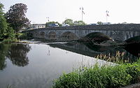
Carlow townCarlow
Carlow is the county town of County Carlow in Ireland. It is situated in the south-east of Ireland, 84 km from Dublin. County Carlow is the second smallest county in Ireland by area, however Carlow Town is the 14th largest urban area in Ireland by population according to the 2006 census. The...
was the centre of the flood alerts on August 17. Rising waters from the River Barrow
River Barrow
The Barrow is a river in Ireland. It is one of The Three Sisters; the other two being the River Suir and the River Nore. The Barrow is the longest and most prominent of the three rivers...
led to over 100 people being evacuated from a four-storey apartment block on Centaur Street. Kennedy Street was closed off. The Civil Defence was monitoring two other apartment blocks ready to evacuate them if waters rose further. Elsewhere in the county, the road between Tullow
Tullow
Tullow is a town in County Carlow, Ireland. It is located on the River Slaney where the N81 road intersects with the R762.-History:There is a statue of Father John Murphy, one of the leaders of the 1798 Rebellion, who was captured near Tullow and executed in the Market Square on 2 July...
and Rathtoe was blocked after a two-car collision in which six people were injured. The wounded were brought to St. Luke's General Hospital
St. Luke's General Hospital
St. Luke's General Hospital, Kilkenny is a public hospital located in Kilkenny, Ireland...
in Kilkenny
Kilkenny
Kilkenny is a city and is the county town of the eponymous County Kilkenny in Ireland. It is situated on both banks of the River Nore in the province of Leinster, in the south-east of Ireland...
. Gardaí reported that there was still flooding in Daingean
Daingean
Daingean , formerly Philipstown, is a small town in east County Offaly, Ireland. It is situated midway between the towns of Tullamore and Edenderry on the R402 regional road. The town or townland of Daingean has a population of 777 while the District Electoral Division has a total population of...
and Edenderry
Edenderry, County Offaly
Edenderry is a town in the north of County Offaly, Ireland. It is near the borders with Counties Kildare, Meath and Westmeath. The Grand Canal passes immediately south of the town through the Bog of Allen and there is a short spur to the town centre....
in County Offaly
County Offaly
County Offaly is a county in Ireland. It is part of the Midlands Region and is also located in the province of Leinster. It is named after the ancient Kingdom of Uí Failghe and was formerly known as King's County until the establishment of the Irish Free State in 1922. Offaly County Council is...
where the canal had burst its banks. There were reports of flooding around Clonygowan
Clonygowan
Clonygowan is a village in County Offaly, Ireland, on the R420 regional road between Tullamore to Portarlington road.-Places of interest:*Clonygowan House no longer exists, but a dovecote, designed in the manner of a folly, survives as a reminder of the former estate and house. It was built about...
. In County Laois
County Laois
County Laois is a county in Ireland. It is part of the Midlands Region and is also located in the province of Leinster. It was formerly known as Queen's County until the establishment of the Irish Free State in 1922. The county's name was formerly spelt as Laoighis and Leix. Laois County Council...
, Mountmellick
Mountmellick
Other than that its a 15th-century settlement on the narrow Owenass river with an encampment on its banks at Irishtown. Overlooking this valley with its trees and wildlife was a small church called Kilmongan which was closed by the Penal Laws in 1640...
's main street was flooded, whilst the Mountmellick to Ballyfinn (R423) and Mountmellick to Derryclooney roads were both impassable due to flooding. Diversions were in place on the N77 Kilkenny to Durrow
Durrow, County Laois
Durrow is a small town located in south County Laois, Ireland. Bypassed by the M8 motorway on 28 May 2010, the town is located on the R639 road at its junction with the N77. The river Erkina flows through Durrow and joins the River Nore about 1.5 km east of the town...
road because of flooding at Ballyragget
Ballyragget
Ballyragget is a small town in County Kilkenny in Ireland. It is situated along the river Nore in the north of the county. It is located in the province of Leinster in the south-east of the island of Ireland. Ballyragget situated on the N77 north of Kilkenny and has a population of 1,451...
. In County Galway
County Galway
County Galway is a county in Ireland. It is located in the West Region and is also part of the province of Connacht. It is named after the city of Galway. Galway County Council is the local authority for the county. There are several strongly Irish-speaking areas in the west of the county...
the N59 on the Oughterard
Oughterard
Oughterard is a small town on the banks of the Owenriff River close to the western shore of Lough Corrib in County Galway, Ireland. The population of the town in 2006 was 1,305...
side of Moycullen
Moycullen
Moycullen Moycullen Moycullen (official name: Maigh Cuilinn, Plain of Holly, or Plain of Cullen (a local giant) is a suburban village in County Galway, Ireland, about 10 km (7 mi) north west of Galway city. It is located near Lough Corrib, on the N59 road to Oughterard and Clifden in...
was partially blocked after a truck overturned. In Northern Ireland
Northern Ireland
Northern Ireland is one of the four countries of the United Kingdom. Situated in the north-east of the island of Ireland, it shares a border with the Republic of Ireland to the south and west...
, the M1 reopened inbound from Black's Road to Stockman's Lane and outbound from Saintfield Road. The M2 fully re-opened. Stena Line
Stena Line
Stena Line is one of the world's largest ferry operators, with ferry services serving Scotland, Sweden, Northern Ireland, Denmark, Norway, England, Wales, Ireland, Germany, the Netherlands and Poland. Stena Line is a major unit of Stena AB, itself a part of the Stena Sphere, a grouping of Stena AB,...
's fastferry sailings between Rosslare
Rosslare Europort
Rosslare Europort is a modern seaport located at Rosslare Harbour in County Wexford, Ireland, near the southeastern-most point of Ireland's coastline, handling passenger and freight ferries to and from Wales and France....
and Fishguard
Fishguard
Fishguard is a coastal town in Pembrokeshire, south-west Wales, with a population of 3,300 . The community of Fishguard and Goodwick had a population of 5043 at the 2001 census....
on the 18th were cancelled due to severe weather forecast for the south Irish Sea
Irish Sea
The Irish Sea separates the islands of Ireland and Great Britain. It is connected to the Celtic Sea in the south by St George's Channel, and to the Atlantic Ocean in the north by the North Channel. Anglesey is the largest island within the Irish Sea, followed by the Isle of Man...
, causing severe passenger disruption.
August 18

Carlow
Carlow is the county town of County Carlow in Ireland. It is situated in the south-east of Ireland, 84 km from Dublin. County Carlow is the second smallest county in Ireland by area, however Carlow Town is the 14th largest urban area in Ireland by population according to the 2006 census. The...
remained the worst affected area by the flash floods. Roads were flooded in County Offaly
County Offaly
County Offaly is a county in Ireland. It is part of the Midlands Region and is also located in the province of Leinster. It is named after the ancient Kingdom of Uí Failghe and was formerly known as King's County until the establishment of the Irish Free State in 1922. Offaly County Council is...
, County Tipperary
County Tipperary
County Tipperary is a county of Ireland. It is located in the province of Munster and is named after the town of Tipperary. The area of the county does not have a single local authority; local government is split between two authorities. In North Tipperary, part of the Mid-West Region, local...
, County Kilkenny
County Kilkenny
County Kilkenny is a county in Ireland. It is part of the South-East Region and is also located in the province of Leinster. It is named after the city of Kilkenny. The territory of the county was the core part of the ancient Irish Kingdom of Osraige which in turn was the core of the Diocese of...
, County Laois
County Laois
County Laois is a county in Ireland. It is part of the Midlands Region and is also located in the province of Leinster. It was formerly known as Queen's County until the establishment of the Irish Free State in 1922. The county's name was formerly spelt as Laoighis and Leix. Laois County Council...
and County Galway
County Galway
County Galway is a county in Ireland. It is located in the West Region and is also part of the province of Connacht. It is named after the city of Galway. Galway County Council is the local authority for the county. There are several strongly Irish-speaking areas in the west of the county...
. Parts of Carlow town were under almost two metres of flood water after the River Barrow
River Barrow
The Barrow is a river in Ireland. It is one of The Three Sisters; the other two being the River Suir and the River Nore. The Barrow is the longest and most prominent of the three rivers...
burst its banks following heavy rainfall. Approximately 100 people spent the night in a hotel when they had to evacuate their apartment block on Centaur Street. Others were ferried to and from work in the morning by the Civil Defence. Minister for the Environment John Gormley
John Gormley
John Gormley is an Irish politician. He was the leader of the Irish Green Party from 2007 to 2011, and was a Teachta Dála for the Dublin South East constituency from 1997 to 2011. He served as Minister for the Environment, Heritage and Local Government from 2007–11...
, visited Carlow to view the crisis, and said that the contract for flood defences would proceed "as quickly as possible". Staff at Winnie Dalgarno's flooded pet store in Greycullen had to take animals home when electricity was switched off. Winnie said: "We have lost a few reptile
Reptile
Reptiles are members of a class of air-breathing, ectothermic vertebrates which are characterized by laying shelled eggs , and having skin covered in scales and/or scutes. They are tetrapods, either having four limbs or being descended from four-limbed ancestors...
s, our birds have been badly affected, we had 20 hamster
Hamster
Hamsters are rodents belonging to the subfamily Cricetinae. The subfamily contains about 25 species, classified in six or seven genera....
s floating, I have had to put rabbits in bird cages."
In County Offaly
County Offaly
County Offaly is a county in Ireland. It is part of the Midlands Region and is also located in the province of Leinster. It is named after the ancient Kingdom of Uí Failghe and was formerly known as King's County until the establishment of the Irish Free State in 1922. Offaly County Council is...
, the Fire Service and the Civil Defence assisted residents of the Whitehall Estate in Tullamore
Tullamore
Tullamore is a town in County Offaly, in the midlands of Ireland. It is Offaly's county town and the centre of the district.Tullamore is an important commercial and industrial centre in the region. Major international employers in the town include 'Tyco Healthcare' and 'Boston Scientific'. In...
after the nearby river burst its banks. A number of homes were flooded, but the estate was not evacuated. The organisers of Fleadh Cheoil na hÉireann, which was taking place that week in Tullamore, said they were "coping with the bad weather". Some campsites had to be moved to temporary locations in the wake of the floods.
In Ennis
Ennis
Ennis is the county town of Clare in Ireland. Situated on the River Fergus, it lies north of Limerick and south of Galway. Its name is a shortening of the original ....
, the body of 31-year-old cook and father-of-one, Przemyslaw Jablonski was recovered from the River Fergus
River Fergus
The River Fergus is a river in County Clare, Ireland. It rises in Loughnagowan which lies a few kilometers west of Corofin and flows into the Shannon Estuary. It is noted for its trout and salmon fishing. Trummer is an island in the river...
. He was pronounced dead at the scene. Meath County Council advised people in Athboy
Athboy
Athboy , is a small agricultural town in County Meath in Ireland. It is located on the junction of the N51 and R154 roads. The town is located on the Yellow Ford River, in wooded country near the County Westmeath border.-History:...
to boil all water they used from the mains supply. Supply was shut down as a precautionary measure after a local river burst its banks, threatening to contaminate the drinking water supply.
Eircom
Eircom
Eircom Group LTD is a telecommunications company in the Republic of Ireland, and a former state-owned incumbent. It is currently the largest telecommunications operator in the Republic of Ireland and operates primarily on the island of Ireland, with a point of presence in Great Britain.As Bord...
reported nearly 4,300 faults over the previous weekend, with 6,500 reported faults that day. The worst affected areas included Clontarf
Clontarf, Dublin
Clontarf is a coastal suburb on the northside of Dublin, in Ireland. It is most famous for giving the name to the Battle of Clontarf in 1014, in which Brian Boru, High King of Ireland, defeated the Vikings of Dublin and their allies, the Irish of Leinster. This battle, which extended to districts...
, Blanchardstown
Blanchardstown
Blanchardstown is a large suburb of Dublin in the district of Fingal, Ireland. It is within the historical barony of Castleknock. It is located 10 km north-west of the city centre. The suburb is in the Dublin 15 postal area, the Dublin West electoral constituency, and Fingal County...
, Phibsboro
Phibsboro
Phibsborough , often formerly shortened to Phibsboro and later Phibsboro , is a district of Dublin in Ireland.-Location:Phibsboro' is located in the Dublin 7 postal district on the Northside of the city. The area is very close to the city centre, about two kilometres from the River Liffey which...
, Portmarnock
Portmarnock
Portmarnock is a small suburban village to the north of Dublin, Ireland. It is in the administrative county of Fingal.-Location:Portmarnock lies on the coast and, owing to its proximity to Dublin city, is a form of dormitory village north-northeast of the city centre...
, Leixlip
Leixlip
-Politics:Since 1988 Leixlip has had a nine member Town Council , headed by a Cathaoirleach , which has control over many local matters, although it is limited in that it is not also a planning authority...
and Clane
Clane
Clane is a town on the River Liffey and in the barony of Clane in County Kildare, Ireland, from Dublin.Its population of 4,968 makes it the eighth largest town in Kildare and the 78th largest in the Republic of Ireland....
.
Flooding at Portadown
Portadown
Portadown is a town in County Armagh, Northern Ireland. The town sits on the River Bann in the north of the county, about 23 miles south-west of Belfast...
caused delays of up to 90 minutes on the Dublin to Belfast
Belfast
Belfast is the capital of and largest city in Northern Ireland. By population, it is the 14th biggest city in the United Kingdom and second biggest on the island of Ireland . It is the seat of the devolved government and legislative Northern Ireland Assembly...
train service. One of the busiest roads in Northern Ireland
Northern Ireland
Northern Ireland is one of the four countries of the United Kingdom. Situated in the north-east of the island of Ireland, it shares a border with the Republic of Ireland to the south and west...
- the Broadway Underpass
Westlink Belfast
The Westlink road in Belfast, Northern Ireland is a dual carriageway throughpass, designated the A12, connecting the M1 to the M2 and M3 motorways which run south, north and east of the city, respectively...
in Belfast - was closed after flooding put it under six metres of water. There was uproar when it emerged that five cars were allowed to enter the underpass when it was under two metres of water. Northern Ireland's Minister for Regional Development
Department for Regional Development
The Department for Regional Development is a devolved Northern Ireland government department in the Northern Ireland Executive...
, Conor Murphy
Conor Murphy
Conor Terence Murphy is an Irish republican Sinn Féin politician.According to An Phoblacht, Murphy first became involved with the Irish Republican Army during the 1981 hunger strikes...
, ordered an investigation into why the recently constructed £104 million (€132 million) underpass was flooded. It was the first time the underpass had to cope with heavy rain. Northern Ireland's Environment Minister
Department of the Environment (Northern Ireland)
The Department of the Environment is a devolved Northern Ireland government department in the Northern Ireland Executive. The minister with overall responsibility for the department is the Minister for the Environment.-Aim:...
Sammy Wilson
Sammy Wilson
Samuel Wilson is a politician from Northern Ireland who is a Member of Parliament and a Member of the Legislative Assembly for East Antrim. He served as Lord Mayor of Belfast in 1986 – 1987; and again from June 2000 to June 2001. He was the first person from the Democratic Unionist Party ...
announced a compensation package for those whose homes were affected by the flooding.
August 19
Drinking water was delivered to hundreds of households in County Sligo where flood water caused problems with the fresh water supply. Sligo County Council issued notice for people to boil water before use. Boil notices were also in place in parts of County MeathCounty Meath
County Meath is a county in Ireland. It is part of the Mid-East Region and is also located in the province of Leinster. It is named after the ancient Kingdom of Mide . Meath County Council is the local authority for the county...
- Athboy
Athboy
Athboy , is a small agricultural town in County Meath in Ireland. It is located on the junction of the N51 and R154 roads. The town is located on the Yellow Ford River, in wooded country near the County Westmeath border.-History:...
, Kildalkey
Kildalkey
Kildalkey or Kildalky is a village and a parish in the Barony of Lune, county and diocese of Meath, Ireland.-Population:The population of the village was 137 at the time of the 1996 Census. By the 2002 Census the village had a massive 278% growth to 518.-History:The patron saint is Saint Dymphna,...
and Ráth Cairn
Ráth Cairn
Ráth Cairn is a small Gaeltacht in County Meath, Ireland. It is about 55 km northwest of Dublin....
- following the bursting of a river's banks. Speaking on RTÉ Radio
RTÉ Radio
RTÉ Radio is a department of Irish national broadcaster Raidió Teilifís Éireann. RTÉ Radio broadcasts four analogue channels and five digital channels....
's News at One
RTÉ News at One
RTÉ News at One is a news and current affairs programme broadcast on RTÉ Radio 1. It airs Monday to Friday for 45 minutes at 13:00.The programme is presented by Sean O'Rourke. Dr Gavin Jennings presents on an intermittent basis....
, Environment Minister John Gormley
John Gormley
John Gormley is an Irish politician. He was the leader of the Irish Green Party from 2007 to 2011, and was a Teachta Dála for the Dublin South East constituency from 1997 to 2011. He served as Minister for the Environment, Heritage and Local Government from 2007–11...
said despite the economic downturn, money would be made available to provide flood defences for Carlow
Carlow
Carlow is the county town of County Carlow in Ireland. It is situated in the south-east of Ireland, 84 km from Dublin. County Carlow is the second smallest county in Ireland by area, however Carlow Town is the 14th largest urban area in Ireland by population according to the 2006 census. The...
whose flood waters were subsiding (although a number of streets remained closed with dozens of residents who were forced to leave their apartments still being housed in temporary accommodation). The Office of Public Works
Office of Public Works
The Office of Public Works is a State Agency of the Department of Finance in the Republic of Ireland...
said that contracts for flood defence systems would soon be finalised for towns such as Mallow
Mallow, County Cork
Mallow is the "Crossroads of Munster" and the administrative capital of north County Cork, in Ireland. The Northern Divisional Offices of Cork County Council are located in the town....
, Ennis
Ennis
Ennis is the county town of Clare in Ireland. Situated on the River Fergus, it lies north of Limerick and south of Galway. Its name is a shortening of the original ....
and Clonmel
Clonmel
Clonmel is the county town of South Tipperary in Ireland. It is the largest town in the county. While the borough had a population of 15,482 in 2006, another 17,008 people were in the rural hinterland. The town is noted in Irish history for its resistance to the Cromwellian army which sacked both...
. Speaking on Morning Ireland
Morning Ireland
Morning Ireland is the breakfast news programme broadcast by RTÉ Radio 1 in Ireland and is noted as that country's most listened to radio programme. It is broadcast each weekday morning between 07.00 and 09.00 and is presented by Aine Lawlor, Cathal Mac Coille, Rachael English and Aoife Kavanagh...
, Tom Sherlock, principal officer of engineering services at the OPW, expressed confidence that new flood defence schemes already in place in some towns would hold for many years.
External links
- National Flood Hazard Mapping at the Office of Public WorksOffice of Public WorksThe Office of Public Works is a State Agency of the Department of Finance in the Republic of Ireland...
(OPW)