Albula Range
Encyclopedia
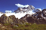
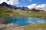
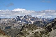
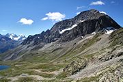
The Albula Alps is a mountain range
in the Alps
of eastern Switzerland
. It is considered to be part of the Central Eastern Alps
. It is named after the River Albula. The Albula range is separated from the Oberhalbstein Range
in the west by the Septimer Pass
and the Julia valley; from the Plessur Range
in the north-west by the Landwasser valley; from the Silvretta
group in the north-east by the Flüela Pass
; from the Bernina Alps in the south-east by the Maloja Pass
and the Inn valley (upper Engadin
).
The Albula Alps are drained by the Albula, Julia, Landwasser and Inn rivers.


 The main peaks of the Albula Range are:
es of the Albula Range are:
Mountain range
A mountain range is a single, large mass consisting of a succession of mountains or narrowly spaced mountain ridges, with or without peaks, closely related in position, direction, formation, and age; a component part of a mountain system or of a mountain chain...
in the Alps
Alps
The Alps is one of the great mountain range systems of Europe, stretching from Austria and Slovenia in the east through Italy, Switzerland, Liechtenstein and Germany to France in the west....
of eastern Switzerland
Switzerland
Switzerland name of one of the Swiss cantons. ; ; ; or ), in its full name the Swiss Confederation , is a federal republic consisting of 26 cantons, with Bern as the seat of the federal authorities. The country is situated in Western Europe,Or Central Europe depending on the definition....
. It is considered to be part of the Central Eastern Alps
Central Eastern Alps
The Central Eastern Alps comprise the main chain of the Eastern Alps with its highest peaks, located between the Northern Limestone Alps and the Southern Limestone Alps, from which they differ in geological composition....
. It is named after the River Albula. The Albula range is separated from the Oberhalbstein Range
Oberhalbstein Range
The Oberhalbstein Range is a mountain range in the Alps of eastern Switzerland and northern Italy. It is considered to be part of the Central Eastern Alps...
in the west by the Septimer Pass
Septimer Pass
Septimer Pass is a high mountain pass in the canton of Graubünden in the Swiss Alps between the valleys of Bregaglia and Oberhalbstein ....
and the Julia valley; from the Plessur Range
Plessur Range
The Plessur Range is a mountain range in the Alps of eastern Switzerland. It is considered to be part of the Central Eastern Alps. It is named after the river Plessur, which originates from the center of the ranges...
in the north-west by the Landwasser valley; from the Silvretta
Silvretta
The Silvretta Alps are a mountain range of the Central Eastern Alps shared by Tirol, Vorarlberg and Graubünden . The Austrian states of Tirol and Vorarlberg are connected by a pass road . The majority of the peaks are elevated above three thousand metres and are surrounded by glaciers...
group in the north-east by the Flüela Pass
Flüela Pass
Flüela Pass is a high mountain pass in the Swiss Alps in the canton of Graubünden. The pass road connects Davos and Susch in the lower Engadin valley.Since the Vereina Tunnel opened in 1999, the road is no longer open all year.-See also:...
; from the Bernina Alps in the south-east by the Maloja Pass
Maloja Pass
Maloja Pass is a high mountain pass in the Swiss Alps in the canton of Graubünden, linking the Engadin with the Val Bregaglia and Chiavenna in Italy...
and the Inn valley (upper Engadin
Engadin
The Engadin or Engadine is a long valley in the Swiss Alps located in the canton of Graubünden in southeast Switzerland. It follows the route of the Inn River from its headwaters at Maloja Pass running northeast until the Inn flows into Austria one hundred kilometers downstream...
).
The Albula Alps are drained by the Albula, Julia, Landwasser and Inn rivers.
Peaks


| Peak | |Elevation (m/ft) | |
|---|---|---|
| Piz Kesch Piz Kesch Piz Kesch or Piz d'Es-cha is a peak in the Albula Range of the Rhaetian Alps. At 3,418 m, it is the highest peak in the Albula Range and the municipality of Bergün, Grisons.... |
3422 | 11,288 |
| Piz Calderas Piz Calderas Piz Calderas is a mountain in the Albula Range, located in Graubünden, Switzerland. It is the highest summit of the group located between the Julier and Albula Pass.-External links:*... |
3393 | 11,132 |
| Piz Julier Piz Julier Piz Julier or Piz Güglia is a mountain in the Albula Range in Switzerland.-External links:*... |
3385 | 11,106 |
| Piz d'Err Piz d'Err Piz d'Err is a mountain in the Albula Range in Switzerland.-External links:*... |
3381 | 11,093 |
| Piz Ela | 3340 | 10,959 |
| Piz Uertsch | 3273 | 10,739 |
| Piz Ot Piz Ot -External links:*... |
3251 | 10,667 |
| Piz Jenatsch Piz Jenatsch Piz Jenatsch is a mountain in the Albula Range, located in Graubünden, Switzerland.-External links:*... |
3250 | 10,663 |
| Piz Vadret Piz Vadret Piz Vadret is a mountain in the Albula Range in Switzerland.-External links:*... |
3226 | 10,584 |
| Piz Sarsura Piz Sarsura Piz Sarsura is a mountain in the Albula Range, located in Graubünden, Switzerland.-External links:*... |
3178 | 10,427 |
| Corn da Tinizong Corn da Tinizong The Corn da Tinizong is a mountain in the Albula Range, located in Graubünden, Switzerland.-External links:*... |
3173 | 10,412 |
| Piz Lagrev Piz Lagrev Piz Lagrev is a mountain in the Albula Range, located in Graubünden, Switzerland.-External links:*... |
3165 | 10,384 |
| Piz Mitgel Piz Mitgel Piz Mitgel is a mountain in the Albula Range, located in Graubünden, Switzerland.-External links:*... |
3163 | 10,378 |
| Flüela Schwarzhorn Flüela Schwarzhorn The Flüela Schwarzhorn is a mountain in the Albula Range.... |
3156 | 10,355 |
| Hoch Ducan Hoch Ducan The Hoch Ducan is a mountain in the Albula Range, located in Graubünden, Switzerland.-External links:*... |
3066 | 10,060 |
| Piz Forun Piz Forun The Piz Forun is a mountain in the Albula Range, located in Graubünden, Switzerland.-External links:*... |
3052 | 10,013 |
| Piz Arpschella Piz Arpschella Piz Arpschella is a mountain in the Albula Range, located in Graubünden, Switzerland.-External links:*... |
3032 | 9,948 |
| Piz Grevasalvas Piz Grevasalvas Piz Grevasalvas is a mountain in the Albula Range, located in Graubünden, Switzerland.-External links:*... |
2932 | 9,619 |
| Piz Lunghin Piz Lunghin Piz Lunghin is a mountain in the Swiss canton of Graubünden, located in the Albula range, overlooking the Maloja Pass. It can be considered as the "roof of Europe" as the water running off the mountain can head towards the Atlantic, Mediterranean or Black Sea.-Geography and hydrography:Piz Lunghin... |
2780 | 9,121 |
Passes
The Albula Range is crossed by one railway tunnel, under the Albula Pass. The main mountain passMountain pass
A mountain pass is a route through a mountain range or over a ridge. If following the lowest possible route, a pass is locally the highest point on that route...
es of the Albula Range are:
| Mountain pass | location | type | elevation (m/ft) | |
|---|---|---|---|---|
| Fuorcla Calderas | Mulegns Mulegns Mulegns is a municipality in the district of Albula in the canton of Graubünden in Switzerland.-History:Around 600-500 BC, a copper mine and smelter were built in the Val Faller near modern Mulegns. The village was founded by a Walser group during the 15th Century. It was first mentioned in... to Bever Bever, Switzerland Bever is a municipality in the district of Maloja in the Swiss canton of Graubünden.-Geography:Bever has an area, , of . Of this area, 14.5% is used for agricultural purposes, while 14.9% is forested... | snow | 3130 | 10,270 |
| Fuorcla d'Eschia | Madulain Madulain Madulain is a municipality in the district of Maloja in the Swiss canton of Graubünden.-Geography:Madulain has an area, , of . Of this area, 33.9% is used for agricultural purposes, while 14.6% is forested... to Bergün Bergün Bergün/Bravuogn , is a municipality in the district of Albula in the canton of Graubünden in Switzerland. The double name has been the official name since 1943.-Geography:... | snow | 3008 | 9869 |
| Sertig Pass | Davos Davos Davos is a municipality in the district of Prättigau/Davos in the canton of Graubünden, Switzerland. It has a permanent population of 11,248 . Davos is located on the Landwasser River, in the Swiss Alps, between the Plessur and Albula Range... to S-chanf S-chanf S-chanf is a municipality in the district of Maloja in the Swiss canton of Graubünden.Localities in S-chanf municipality include Susauna, Chapella and Cinuos-chel.-Name:... | foot path | 2762 | 9062 |
| Tinzentor | Bergün to Savognin Savognin Savognin is a municipality in the district of Albula in the canton of Graubünden in Switzerland.... | foot path | 2718 | 8918 |
| Ducan Pass | Davos to Bergün | foot path | 2671 | 8763 |
| Forcella di Lunghino | Maloja Maloja Maloja may refer to:* Maloja , an administrative district in the Swiss canton of Graubünden.* Maloja Pass, an alpine pass in the Swiss canton of Graubünden.... to the Septimer Pass Septimer Pass Septimer Pass is a high mountain pass in the canton of Graubünden in the Swiss Alps between the valleys of Bregaglia and Oberhalbstein .... | foot path | 2635 | 8645 |
| Scaletta Pass | Davos to S-chanf | bridle path | 2619 | 8593 |
| Suvretta Pass | St. Moritz St. Moritz St. Moritz is a resort town in the Engadine valley in Switzerland. It is a municipality in the district of Maloja in the Swiss canton of Graubünden... to Val Bever | bridle path | 2618 | 8590 |
| Fuorcla d'Alp Fontauna | Bergün to S-chanf | foot path | 2615 | 8580 |
| Grialetsch Pass | Davos to Susch Susch Susch is a municipality in the district of Inn in the Swiss canton of Graubünden.The Flüela Pass connects Susch with Davos.-Demographics:Susch has a population of .... | foot path | 2546 | 8353 |
| Flüela Pass Flüela Pass Flüela Pass is a high mountain pass in the Swiss Alps in the canton of Graubünden. The pass road connects Davos and Susch in the lower Engadin valley.Since the Vereina Tunnel opened in 1999, the road is no longer open all year.-See also:... | Davos to Susch | road | 2389 | 7838 |
| Albula Pass Albula Pass Albula Pass is a Swiss mountain pass in the canton of Graubünden. It lies in the Albula Range of the Alps... | Bergün to La Punt-Chamues-ch La Punt-Chamues-ch La Punt - Chamues-ch is a municipality in the district of Maloja in the Swiss canton of Graubünden.-History:La Punt-Chamues-ch is first mentioned around 1137-39 as Campolovasto. In 1244 it was mentioned as Ponte.-Geography:... | road | 2315 | 7595 |
| Septimer Pass Septimer Pass Septimer Pass is a high mountain pass in the canton of Graubünden in the Swiss Alps between the valleys of Bregaglia and Oberhalbstein .... | Bivio Bivio Bivio is a municipality in the district of Albula of the Swiss canton of Graubünden.-History:Bivio is first mentioned about 840 as de stabulo Bivio. At one time it was known, in German, as Stallen and until 1895/1903 by its Italian name Stalla.-Geography:Bivio has an area, , of... to Val Bregaglia Bregaglia Bregaglia is a municipality in the district of Maloggia in the canton of Graubünden in Switzerland. It is a merger of the municipalities of Bondo, Castasegna, Soglio, Stampa and Vicosoprano, all located in the Val Bregaglia.-External links:... | bridle path | 2311 | 7582 |
| Julier Pass Julier Pass The Julier Pass is a mountain pass in Switzerland, in the Albula Range of the Alps. It connects the Engadin valley with the rest of Graubünden... | Thusis Thusis Thusis is a municipality in the district of Hinterrhein in the Swiss canton of Graubünden.-Geography:Thusis has an area, , of . Of this area, 18% is used for agricultural purposes, while 58.2% is forested... to Silvaplana Silvaplana Silvaplana is a municipality in the district of Maloja in the Swiss canton of Graubünden and the name of a lake in the municipality.-History:... | road | 2287 | 7504 |
| Maloja Pass Maloja Pass Maloja Pass is a high mountain pass in the Swiss Alps in the canton of Graubünden, linking the Engadin with the Val Bregaglia and Chiavenna in Italy... | St. Moritz to Chiavenna | road | 1815 | 5955 |

