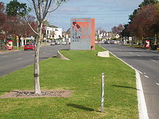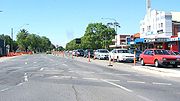
Anzac Highway, Adelaide
Encyclopedia

Adelaide
Adelaide is the capital city of South Australia and the fifth-largest city in Australia. Adelaide has an estimated population of more than 1.2 million...
, the capital of South Australia
South Australia
South Australia is a state of Australia in the southern central part of the country. It covers some of the most arid parts of the continent; with a total land area of , it is the fourth largest of Australia's six states and two territories.South Australia shares borders with all of the mainland...
, to the beachside suburb of Glenelg
Glenelg, South Australia
Glenelg is a popular beach-side suburb of the South Australian capital of Adelaide. Located on the shore of Holdfast Bay in Gulf St Vincent, it has become a popular tourist destination due to its beach and many attractions, home to several hotels and dozens of restaurants.Established in 1836, it is...
.
Previously the Bay Road, it gained its current name in honour of the contribution of the Anzacs
Anzacs
Anzacs was a 1985 5-part Australian mini series set in World War I. The series follows the lives of a group of young Australian men who enlist in the 8th Battalion of the First Australian Imperial Force in 1914, fighting first at Gallipoli in 1915, and then on the Western Front for the remainder...
(Australian and New Zealand Army Corp) in World War I
World War I
World War I , which was predominantly called the World War or the Great War from its occurrence until 1939, and the First World War or World War I thereafter, was a major war centred in Europe that began on 28 July 1914 and lasted until 11 November 1918...
. The road was first named Adelaide Road as it was the road from the first governor's landing site to the proposed location of Adelaide.
The highway is serviced by a 15 minute Go Zone, serviced by the 262, 263 and 265 buses.
South Road

 intersection with Anzac Highway is currently seeing major construction works as part of a South Australian Government initiative to transform South Road into a non-stop north-south route.
Under the works, both routes will be grade-separated, with South Road proceeding through an underpass with bi-directional controlled exits onto Anzac Highway. The underpass model is a single-point urban interchange
Single-point urban interchange
A single-point urban interchange , also called a single-point interchange or single-point diamond interchange , is a type of highway interchange...
. Construction began in October 2007, and the underpass was opened in 2009.
The underpass was named the Gallipoli Underpass, in keeping with the Anzac theme.
Major intersections
- Begin
 at junction with West TerraceCity Ring Route, AdelaideThe City Ring Route is a South Australian state route that loops around the Adelaide city centre and North Adelaide.The route is a collection of major arterial roads...
 & Goodwood RoadGoodwood Road, AdelaideGoodwood Road is a major north-south arterial road, approximately 10 kilometres long, in Adelaide, South Australia. It runs between the Adelaide city centre and the suburbs of Pasadena and Panorama, and has a speed limit of ....
 : AdelaideAdelaideAdelaide is the capital city of South Australia and the fifth-largest city in Australia. Adelaide has an estimated population of more than 1.2 million...
- Richmond Road / Greenhill Road: Keswick
 Keswick, South AustraliaKeswick is an inner south-western suburb of Adelaide, adjacent to the park lands, and located in the City of West Torrens.-Keswick Barracks:Keswick is home to the Keswick Barracks, which is an Australian Army Barracks. It is home to the 9th Brigade , 10th/27th Bn. R. SA Rgt. , the 48th Field...
 - South Road

 : Everard ParkEverard Park, South AustraliaEverard Park is a suburb of Adelaide in the City of Unley, part of the once extensive land holdings of the prominent colonist Dr. Charles Everard, and the location of "Marshfield", the home of part of his family....
- Southbound to
- Marion Road

 : PlymptonPlympton, South AustraliaPlympton is a suburb of the city of Adelaide, South Australia. The name is believed to have been given by Henry Mooringe Boswarva to a private subdivision in the area, naming after his home town in Devon, England...
- Southbound to
- Cross Road
 Cross Road, AdelaideCross Road is a major arterial road that travels east-west through the inner southern suburbs of the Australian city of Adelaide. Its western terminus is at Anzac Highway, travelling east and ending at Glen Osmond and the Adelaide Hills, joining the junction of Glen Osmond Road, Portrush Road, and...
 : Camden ParkCamden Park, South AustraliaCamden Park is a suburb of the city of Adelaide, South Australia.Camden Park is in the City of West Torrens local government area. It is split between the South Australian House of Assembly electoral districts of Ashford and West Torrens. At the federal level, Camden Park is in the Division of...
 - Morphett Road: Glengowrie
 Glengowrie, South AustraliaGlengowrie is a suburb of the Australian city of Adelaide, approximately 12 kilometres south west of the city centre. The name Glengowrie means "Glen of Gowrie", so called in honour of Lord Gowrie , Governor-General of Australia from 1936-1944.-Location:Located in the City of Marion, Glengowrie is...
 - Tapleys Hill Road / Brighton Road

 : GlenelgGlenelg, South AustraliaGlenelg is a popular beach-side suburb of the South Australian capital of Adelaide. Located on the shore of Holdfast Bay in Gulf St Vincent, it has become a popular tourist destination due to its beach and many attractions, home to several hotels and dozens of restaurants.Established in 1836, it is...
 - Terminates at intersection with Colley Terrace / Chapel Drive: Glenelg
.svg.png) Glenelg, South AustraliaGlenelg is a popular beach-side suburb of the South Australian capital of Adelaide. Located on the shore of Holdfast Bay in Gulf St Vincent, it has become a popular tourist destination due to its beach and many attractions, home to several hotels and dozens of restaurants.Established in 1836, it is...
Glenelg, South AustraliaGlenelg is a popular beach-side suburb of the South Australian capital of Adelaide. Located on the shore of Holdfast Bay in Gulf St Vincent, it has become a popular tourist destination due to its beach and many attractions, home to several hotels and dozens of restaurants.Established in 1836, it is...
-
- End


