
Augusta Raurica
Encyclopedia
Roman Empire
The Roman Empire was the post-Republican period of the ancient Roman civilization, characterised by an autocratic form of government and large territorial holdings in Europe and around the Mediterranean....
archaeological site
Archaeological site
An archaeological site is a place in which evidence of past activity is preserved , and which has been, or may be, investigated using the discipline of archaeology and represents a part of the archaeological record.Beyond this, the definition and geographical extent of a 'site' can vary widely,...
and an open-air museum in Switzerland
Switzerland
Switzerland name of one of the Swiss cantons. ; ; ; or ), in its full name the Swiss Confederation , is a federal republic consisting of 26 cantons, with Bern as the seat of the federal authorities. The country is situated in Western Europe,Or Central Europe depending on the definition....
. Located on the south bank of the Rhine river about 20 km east of Basel
Basel
Basel or Basle In the national languages of Switzerland the city is also known as Bâle , Basilea and Basilea is Switzerland's third most populous city with about 166,000 inhabitants. Located where the Swiss, French and German borders meet, Basel also has suburbs in France and Germany...
near the villages of Augst
Augst
Augst is a municipality in the district of Liestal in the canton of Basel-Country in Switzerland.It was known as Augusta Raurica in roman times-History:...
and Kaiseraugst
Kaiseraugst
Kaiseraugst is a municipality in the district of Rheinfelden in the canton of Aargau in Switzerland. It is named for the Ancient Roman city of Augusta Raurica whose ruins are situated nearby...
, it is the oldest known Roman colony on the Rhine.
Founding
Augusta Raurica, or Colonia Augusta Rauracorum, was founded by Lucius Munatius PlancusLucius Munatius Plancus
Lucius Munatius Plancus was a Roman senator, consul in 42 BC, and censor in 22 BC with Aemilius Lepidus Paullus...
around 44 BC
44 BC
Year 44 BC was either a common year starting on Sunday or Monday or a leap year starting on Friday or Saturday of the Julian calendar and a common year starting on Sunday of the Proleptic Julian calendar...
in the area of a local Gallic
Gallia
Gallia may refer to:*Gaul , the region of Western Europe occupied by present-day France, Belgium and other neighbouring countries...
tribe, the Rauraci, relatives of the Helvetii
Helvetii
The Helvetii were a Celtic tribe or tribal confederation occupying most of the Swiss plateau at the time of their contact with the Roman Republic in the 1st century BC...
. No archaeological evidence from this period has yet been found, leading to the conclusion that either the settlement of the colony was disturbed by the civil war following the death of Julius Caesar
Julius Caesar
Gaius Julius Caesar was a Roman general and statesman and a distinguished writer of Latin prose. He played a critical role in the gradual transformation of the Roman Republic into the Roman Empire....
, or that Plancus' colony was actually in the area of modern Basel, not Augst.
Successful colonization of the site had to wait for Augustus's conquest of the central Alps around 15 BC. The oldest find to date at Augusta Raurica has been dated to 6 BC by dendrochronology
Dendrochronology
Dendrochronology or tree-ring dating is the scientific method of dating based on the analysis of patterns of tree-rings. Dendrochronology can date the time at which tree rings were formed, in many types of wood, to the exact calendar year...
.
Name
The grave inscription of Munatius Plancus merely states the name of the colony as Colonia Raurica. A fragmentary inscription from the Augustinian period speaks of the Colonia P[aterna] (?) M[unatia] (?) [Felix] (?) [Apolli]naris [Augusta E]merita [Raur]ica (Letters in brackets are reconstructions).Apart from this fragmentary reference, the first certain witness to the use of the name Augustus comes from the geographer
Geographer
A geographer is a scholar whose area of study is geography, the study of Earth's natural environment and human society.Although geographers are historically known as people who make maps, map making is actually the field of study of cartography, a subset of geography...
Ptolemy
Ptolemy
Claudius Ptolemy , was a Roman citizen of Egypt who wrote in Greek. He was a mathematician, astronomer, geographer, astrologer, and poet of a single epigram in the Greek Anthology. He lived in Egypt under Roman rule, and is believed to have been born in the town of Ptolemais Hermiou in the...
in the ancient Greek
Ancient Greek
Ancient Greek is the stage of the Greek language in the periods spanning the times c. 9th–6th centuries BC, , c. 5th–4th centuries BC , and the c. 3rd century BC – 6th century AD of ancient Greece and the ancient world; being predated in the 2nd millennium BC by Mycenaean Greek...
form Augústa Rauríkon (=lat.: Augusta Rauricorum).
Augusta Raurica played an important role in Augustus's plans of conquest with two other colonies that bear his name; Augusta Praetoria, modern Aosta
Aosta
Aosta is the principal city of the bilingual Aosta Valley in the Italian Alps, north-northwest of Turin. It is situated near the Italian entrance of the Mont Blanc Tunnel, at the confluence of the Buthier and the Dora Baltea, and at the junction of the Great and Little St. Bernard routes...
at the southern end of the Great Saint Bernard Pass, and Augusta Vindelicum, modern Augsburg
Augsburg
Augsburg is a city in the south-west of Bavaria, Germany. It is a university town and home of the Regierungsbezirk Schwaben and the Bezirk Schwaben. Augsburg is an urban district and home to the institutions of the Landkreis Augsburg. It is, as of 2008, the third-largest city in Bavaria with a...
, an outpost on the Danube
Danube
The Danube is a river in the Central Europe and the Europe's second longest river after the Volga. It is classified as an international waterway....
. These three Augustae form the corners of a triangle that reaches across the Alpine conquests of Augustus, and whose long base from the Rheinknie
Rhine knee
The Rhine knee is the name of a few bends in the Rhine river.-Rhine knee at Basel:In Basel the Rhine changes its westerly direction of flow to a northerly direction, along the borders of France and Germany, to flow to the North Sea. From a political viewpoint the Rhine knee is near the tripoint of...
to the Danube formed the frontier against unconquered Germania
Germania
Germania was the Greek and Roman geographical term for the geographical regions inhabited by mainly by peoples considered to be Germani. It was most often used to refer especially to the east of the Rhine and north of the Danube...
.
Layout of the settlement
During excavations it was determined that the city was founded on a high plateauPlateau
In geology and earth science, a plateau , also called a high plain or tableland, is an area of highland, usually consisting of relatively flat terrain. A highly eroded plateau is called a dissected plateau...
just south of the Rhine river. Two small rivers, the Ergolz
Ergolz
left|thumb|Source of the Ergolz in [[Oltingen]]The Ergolz is the main river in the canton of Basel-Landschaft. It rises on Mount Geisflue in the Faltenjura mountains in the upper region of Basel-Landschaft, on the border with Aargau and Solothurn, and joins the Rhine at Augst...
and Violen, have carved a triangle in the plateau, the base of which is about 1 kilometer wide along the base of the Jura
Jura mountains
The Jura Mountains are a small mountain range located north of the Alps, separating the Rhine and Rhone rivers and forming part of the watershed of each...
, and the apex points northward toward the Rhine, about 1 kilometer from the base. This point is the site of the Roman castrum, or military fortification. The city is therefore well defended by steep slopes to the north, east, and west.
The next step in planning the city was the surveying
Surveying
See Also: Public Land Survey SystemSurveying or land surveying is the technique, profession, and science of accurately determining the terrestrial or three-dimensional position of points and the distances and angles between them...
of the area according to the architect
Architect
An architect is a person trained in the planning, design and oversight of the construction of buildings. To practice architecture means to offer or render services in connection with the design and construction of a building, or group of buildings and the space within the site surrounding the...
's plans for the city. Every important public building had its specific place, starting with the temple
Roman temple
Ancient Roman temples are among the most visible archaeological remains of Roman culture, and are a significant source for Roman architecture. Their construction and maintenance was a major part of ancient Roman religion. The main room housed the cult image of the deity to whom the temple was...
of Jupiter
Jupiter (mythology)
In ancient Roman religion and myth, Jupiter or Jove is the king of the gods, and the god of the sky and thunder. He is the equivalent of Zeus in the Greek pantheon....
as the sacred high point from which the street network would spread. The architect, who was responsible for executing the plans for the city, next laid a longitudinal
Longitude
Longitude is a geographic coordinate that specifies the east-west position of a point on the Earth's surface. It is an angular measurement, usually expressed in degrees, minutes and seconds, and denoted by the Greek letter lambda ....
axis across the triangle 36˚ west of north to form the main street
Cardo
The cardo was a north-south oriented street in Roman cities, military camps, and coloniae. The cardo, an integral component of city planning, was lined with shops and vendors, and served as a hub of economic life. The main cardo was called cardo maximus.Most Roman cities also had a Decumanus...
of the settlement. Other longitudinal streets were laid out parallel to the main street at intervals of 55 meters. The main street was then divided into sections of 66 meters (255 Roman feet), which formed the corners of 10 crossing streets. This created a series of rectangular blocks
City block
A city block, urban block or simply block is a central element of urban planning and urban design. A city block is the smallest area that is surrounded by streets. City blocks are the space for buildings within the street pattern of a city, they form the basic unit of a city's urban fabric...
of around 50 by 60 meters. The streets were laid on a solid bed of gravel
Gravel
Gravel is composed of unconsolidated rock fragments that have a general particle size range and include size classes from granule- to boulder-sized fragments. Gravel can be sub-categorized into granule and cobble...
and flanked by gutters
Street gutter
A street gutter is a depression running parallel to a road designed to collect rainwater flowing along the street and divert it into a storm drain. Where a curbstone is present, a gutter may simply be formed by the convergence of the road surface and the vertical face of the sidewalk; otherwise, a...
on both sides. The more important roads featured covered sidewalks behind rows of columns.
Borders
The limits of Colonia Raurica can no longer be determined with absolute accuracy, however the approximate boundaries can be determined by examining the extent of Augst in the early middle agesMiddle Ages
The Middle Ages is a periodization of European history from the 5th century to the 15th century. The Middle Ages follows the fall of the Western Roman Empire in 476 and precedes the Early Modern Era. It is the middle period of a three-period division of Western history: Classic, Medieval and Modern...
. This would seem to indicate the colony extending from Basel toward the mouth of the Aare, then up the Aare to the mouth of the Sigger below Solothurn
Solothurn
The city of Solothurn is the capital of the Canton of Solothurn in Switzerland. The city also comprises the only municipality of the district of the same name.-Pre-roman settlement:...
, across to the Lüssel, and then back down the Birs
Birs
The Birs is a 73-km long river in Switzerland that flows through the Jura region and ends as a tributary to the Rhine between Basel and Birsfelden.- Picture gallery :...
to Basel, though this is still conjecture at the moment. New research, based on tiles stamped with the mark of the Vindonissa Legion
Vindonissa
Vindonissa was a Roman legion camp at modern Windisch, Switzerland. It was probably established in 15 AD. In an expansion around 30, thermal baths were added....
, indicates some administrative dependence on Vindonissa. This would indicate that the colony reached over the Bözberg
Bözberg
Bözberg is a former municipality in the district of Brugg in the canton of Aargau, Switzerland.It ceased to exist in 1873, when it was split into the two new municipalities Oberbözberg and Unterbözberg....
toward Frick
Frick, Switzerland
Frick is a municipality in the district of Laufenburg in the canton of Aargau in Switzerland. A dinosaur graveyard containing more than 100 Plateosaurus was found there in August 2007.-History:...
, with the Thiersteinberg below Frick forming the eastern boundary. The western boundary, as mentioned above, was near the mouth of the Birs, possibly marked by a border station. Early Roman cremation
Cremation
Cremation is the process of reducing bodies to basic chemical compounds such as gasses and bone fragments. This is accomplished through high-temperature burning, vaporization and oxidation....
remains found in 1937 by the church in Neuallschwil show that such a post did exist on the main road north (toward Blotzheim
Blotzheim
Blotzheim is a commune in the Haut-Rhin department in Alsace in north-eastern France.-References:*...
) into Alsace
Alsace
Alsace is the fifth-smallest of the 27 regions of France in land area , and the smallest in metropolitan France. It is also the seventh-most densely populated region in France and third most densely populated region in metropolitan France, with ca. 220 inhabitants per km²...
. The Colonia Raurica on the whole contained the modern Canton of Basel, the Frick valley, and the eastern Jura
Jura mountains
The Jura Mountains are a small mountain range located north of the Alps, separating the Rhine and Rhone rivers and forming part of the watershed of each...
of the Canton of Solothurn
Canton of Solothurn
Solothurn is a canton of Switzerland. It is located in the northwest of Switzerland. The capital is Solothurn.-History:The territory of the canton comprises land acquired by the capital...
. The total area of the colony was around 700 km².
Subsequent history
By the second century AD it was a prosperous commercial trading centre and in its glory days the capital of a local Roman province. It is estimated that the population reached approximately twenty thousand people. Augusta Raurica prospered between the first and third centuries, and exported smoked pork and bacon to other parts of the Roman Empire. In the city were the typical amenities of a Roman city, an amphitheatreAmphitheatre
An amphitheatre is an open-air venue used for entertainment and performances.There are two similar, but distinct, types of structure for which the word "amphitheatre" is used: Ancient Roman amphitheatres were large central performance spaces surrounded by ascending seating, and were commonly used...
, a main forum
Forum (Roman)
A forum was a public square in a Roman municipium, or any civitas, reserved primarily for the vending of goods; i.e., a marketplace, along with the buildings used for shops and the stoas used for open stalls...
, several smaller forums, an aqueduct
Aqueduct
An aqueduct is a water supply or navigable channel constructed to convey water. In modern engineering, the term is used for any system of pipes, ditches, canals, tunnels, and other structures used for this purpose....
, a variety of temples
Roman temple
Ancient Roman temples are among the most visible archaeological remains of Roman culture, and are a significant source for Roman architecture. Their construction and maintenance was a major part of ancient Roman religion. The main room housed the cult image of the deity to whom the temple was...
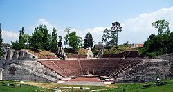
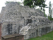
, and several public baths and the largest Roman theater north of the Alps with 8,000 to 10,000 seats. Many of these sites are open to visitors year round.
In 250 AD a powerful earthquake damaged a large part of the city. Shortly after, around 260 AD Alemanni tribes and/or marauding
Marauder
A marauder is a bandit, outlaw, raider or such like who moves about in roving fashion looking for plunder.Other uses of marauder, usually derived from the above include:in " Football"...
Roman troops destroyed the city. The Romans attempted to maintain their military position by building a fortress on the Rhine, Castrum Rauracense; the walls of which are still partly intact. Augusta Raurica was resettled on a much smaller scale on the site of the castrum. These two settlements form the centers of the modern communities of Augst
Augst
Augst is a municipality in the district of Liestal in the canton of Basel-Country in Switzerland.It was known as Augusta Raurica in roman times-History:...
and Kaiseraugst
Kaiseraugst
Kaiseraugst is a municipality in the district of Rheinfelden in the canton of Aargau in Switzerland. It is named for the Ancient Roman city of Augusta Raurica whose ruins are situated nearby...
.
In 1442 these communities were divided along the Ergolz
Ergolz
left|thumb|Source of the Ergolz in [[Oltingen]]The Ergolz is the main river in the canton of Basel-Landschaft. It rises on Mount Geisflue in the Faltenjura mountains in the upper region of Basel-Landschaft, on the border with Aargau and Solothurn, and joins the Rhine at Augst...
and Violenbach rivers. The western portion was given to Basel, which became a canton
Cantons of Switzerland
The 26 cantons of Switzerland are the member states of the federal state of Switzerland. Each canton was a fully sovereign state with its own borders, army and currency from the Treaty of Westphalia until the establishment of the Swiss federal state in 1848...
of Switzerland
Switzerland
Switzerland name of one of the Swiss cantons. ; ; ; or ), in its full name the Swiss Confederation , is a federal republic consisting of 26 cantons, with Bern as the seat of the federal authorities. The country is situated in Western Europe,Or Central Europe depending on the definition....
in 1501. In 1833 Augst became part of the canton of Basel-Land. The eastern part became part of Habsburg
Habsburg
The House of Habsburg , also found as Hapsburg, and also known as House of Austria is one of the most important royal houses of Europe and is best known for being an origin of all of the formally elected Holy Roman Emperors between 1438 and 1740, as well as rulers of the Austrian Empire and...
territories, and to differentiate between the two towns was renamed Kaiseraugst. Kaiseraugst became part of Switzerland in 1803 after the defeat of the Habsburgs during the Napoleonic Wars
Napoleonic Wars
The Napoleonic Wars were a series of wars declared against Napoleon's French Empire by opposing coalitions that ran from 1803 to 1815. As a continuation of the wars sparked by the French Revolution of 1789, they revolutionised European armies and played out on an unprecedented scale, mainly due to...
.
Augusta Raurica today
The excavation site and the late Roman castle, the Castrum Rauracense, are listed as heritage sites of national significanceSwiss Inventory of Cultural Property of National and Regional Significance
The Swiss Inventory of Cultural Property of National and Regional Significance is a register of some 8,300 items of cultural property in Switzerland...
, as are the early Christian baptisterium
Baptisterium
In classical antiquity, a baptisterium was a large basin installed in private or public baths into which bathers could plunge, or even swim about. It is more commonly called natatorium or piscina....
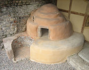
and the brick kiln
Kiln
A kiln is a thermally insulated chamber, or oven, in which a controlled temperature regime is produced. Uses include the hardening, burning or drying of materials...
at Liebrüti.
Excavations
Many of the Roman buildings have been discovered and conserved through excavations, and most are open to the public:- the theater, which with the
- temple across the street form an architectural unit.
- the main forum with the temple of JupiterJupiterJupiter is the fifth planet from the Sun and the largest planet within the Solar System. It is a gas giant with mass one-thousandth that of the Sun but is two and a half times the mass of all the other planets in our Solar System combined. Jupiter is classified as a gas giant along with Saturn,...
, basilicaBasilicaThe Latin word basilica , was originally used to describe a Roman public building, usually located in the forum of a Roman town. Public basilicas began to appear in Hellenistic cities in the 2nd century BC.The term was also applied to buildings used for religious purposes...
, and the assembly chamber of the town council. - the amphitheater, of which only modest remains exist.
- the aqueduct which supplied Augusta Raurica with drinking water from the LiestalLiestalLiestal is the capital of the canton of Basel-Country in Switzerland, south of Basel.It is an industrial town with a cobbled-street Old Town.-History:...
. (Parts are visible and accessible in Heidenloch in Liestal as well as northeast of the treatment plantSewage treatmentSewage treatment, or domestic wastewater treatment, is the process of removing contaminants from wastewater and household sewage, both runoff and domestic. It includes physical, chemical, and biological processes to remove physical, chemical and biological contaminants...
in FüllinsdorfFüllinsdorfFüllinsdorf is a municipality in the district of Liestal in the canton of Basel-Country in Switzerland.-History:Füllinsdorf is first mentioned in 825 as Firinisvilla. In 1225-26 it was mentioned as Vilistorf.-Geography:...
).
Several private commercial buildings have also been found (a taberna
Taberna
A taberna was a single room shop covered by a barrel vault within great indoor markets of ancient Rome. Each taberna had a window above it to let light into a wooden attic for storage and had a wide doorway....
, a bakery
Bakery
A bakery is an establishment which produces and sells flour-based food baked in an oven such as bread, cakes, pastries and pies. Some retail bakeries are also cafés, serving coffee and tea to customers who wish to consume the baked goods on the premises.-See also:*Baker*Cake...
, a potter
Pottery
Pottery is the material from which the potteryware is made, of which major types include earthenware, stoneware and porcelain. The place where such wares are made is also called a pottery . Pottery also refers to the art or craft of the potter or the manufacture of pottery...
, and a tile
Tile
A tile is a manufactured piece of hard-wearing material such as ceramic, stone, metal, or even glass. Tiles are generally used for covering roofs, floors, walls, showers, or other objects such as tabletops...
kiln
Kiln
A kiln is a thermally insulated chamber, or oven, in which a controlled temperature regime is produced. Uses include the hardening, burning or drying of materials...
) as well as portions of a sewer. Around 80% of the built-up area has not yet been excavated. Augusta Raurica is the best preserved Roman city north of the Alps
Alps
The Alps is one of the great mountain range systems of Europe, stretching from Austria and Slovenia in the east through Italy, Switzerland, Liechtenstein and Germany to France in the west....
that has not been built over in medieval or modern times.
Museum and Roman house
Silver
Silver is a metallic chemical element with the chemical symbol Ag and atomic number 47. A soft, white, lustrous transition metal, it has the highest electrical conductivity of any element and the highest thermal conductivity of any metal...
treasure
Treasure
Treasure is a concentration of riches, often one which is considered lost or forgotten until being rediscovered...
of Kaiseraugst
Kaiseraugst
Kaiseraugst is a municipality in the district of Rheinfelden in the canton of Aargau in Switzerland. It is named for the Ancient Roman city of Augusta Raurica whose ruins are situated nearby...
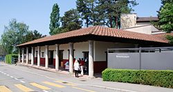
. This treasure hoard was found in the fortress in 1961/62 and it is presumed to have once been the property of a commander. The museum also has a reconstruction of a Roman house with artifacts and reconstructions showing daily domestic and commercial life from the Roman period.
Further reading
- Jahresberichte aus Augst und Kaiseraugst. Amt für Museen u. Archäologie d. Kantons Basel-Landschaft, Liestal. Römermuseum Römerstadt Augusta Raurica, Augst 1.1980(1972–1975) - 4.1984(1978–1983); 5.1985ff.
- Jahresbericht Römerhaus und Museum Augst. Römermuseum, Augst 1962-1972.
- Forschungen in Augst. Schriftenreihe. bish. 36 Bd. Stiftung Pro Augusta Raurica. Römer-Museum, Augst-Basel 1.1977, 2.1975ff. (Index of publications)
- Ausgrabungen in Augst. 4 Bd. Stiftung Pro Augusta Raurica, Basel 1948ff.
- Augster Museumshefte. bish. 32 Bd. Römermuseum, Augst 1.1976ff. (Index of publications)
- Teodora Tomasevic Buck: Augusta Raurica. Probleme, Anregungen und Neufunde. Bregenz 2003. ISBN 3-901802-13-4
- Marion Benz: Augusta Raurica. Eine Entdeckungsreise durch die Zeit. In: Archäologie der Schweiz. (as.) Mitteilungsblatt. SGUF, Basel 26.2003, S. 2-84.

