Bellevue, Western Australia
Encyclopedia
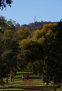
Bellevue is an eastern suburb of Perth
, Western Australia
. Its Local Government Area
s are the City of Swan and the Shire of Mundaring
, and it is located at the foot of the slopes of Greenmount
, a landmark on the Darling Scarp
that is noted in the earliest of travel journals of the early Swan River Colony
.
, railway, and substantial changes in the eastern parts of Midland. The Bellevue Primary School was closed and amalgamated with the Koongamia Primary School to form the new Clayton View Primary School slightly up the hill towards Greenmount.
However it is a significant community despite the depredations of the transport routes and changes. It was the location of the original offices of what became the Mundaring Shire Council.
It was also the location of the Catholic Church that preceded the St Anthony's church in Greenmount.
to the south, Great Eastern Highway
to the north and Military Road and Cowie Close to the west. The suburb is an even mix of residential, industrial and parkland (mainly along the Helena River).
 Originally known as the 24 miles (38.6 km) siding in 1896. On 24 May 1897 it became known as Bellevue. It was the railway station at the foot of the hills through which the Eastern Railway climbed. First for the line that proceeded east to Greenmount, then Boya
, Darlington
and on to Mundaring. Then for the line through Blackboy Hill, Swan View
, the Swan View Tunnel
and on to Chidlow
. The third and final route of the railway that goes through the Avon Valley passes over the site where the railway station
was located.
During the First World War the branch line to the Helena Vale Race course
was used for transporting troops between Blackboy Hill and Fremantle.
Although the old Mundaring Loop
was closed for passenger traffic in 1954, trains were still utilising the line to Boya, where the Mountain Quarries siding was still in use. This operation closed in 1962.
Up until the 1960s it was the terminus of the passenger services from Perth
. For a brief couple of years (1960–1962) a new railway station was made at Koongamia which was half-way to the old Greenmount Railway station. The suburban service now terminates at Midland
.
Perth, Western Australia
Perth is the capital and largest city of the Australian state of Western Australia and the fourth most populous city in Australia. The Perth metropolitan area has an estimated population of almost 1,700,000....
, Western Australia
Western Australia
Western Australia is a state of Australia, occupying the entire western third of the Australian continent. It is bounded by the Indian Ocean to the north and west, the Great Australian Bight and Indian Ocean to the south, the Northern Territory to the north-east and South Australia to the south-east...
. Its Local Government Area
Local Government Areas of Western Australia
The Australian state of Western Australia is divided into 141 local government areas...
s are the City of Swan and the Shire of Mundaring
Shire of Mundaring
The Shire of Mundaring is a Local Government Area on the eastern fringe of metropolitan Perth, the capital of Western Australia. The Shire covers an area of and has a population of 35,097 .-History:...
, and it is located at the foot of the slopes of Greenmount
Greenmount, Western Australia
Greenmount is a locality and a geographical feature in the Shire of Mundaring, Western Australia, on the edge of the Darling Scarp. It is a vital point in the transport routes from the Swan Coastal Plain into the hinterland of Western Australia....
, a landmark on the Darling Scarp
Darling Scarp
The Darling Scarp, also referred to as the Darling Range or Darling Ranges, is a low escarpment running north-south to the east of the Swan Coastal Plain and Perth, Western Australia...
that is noted in the earliest of travel journals of the early Swan River Colony
Swan River Colony
The Swan River Colony was a British settlement established in 1829 on the Swan River, in Western Australia. The name was a pars pro toto for Western Australia. In 1832, the colony was officially renamed Western Australia, when the colony's founding Lieutenant-Governor, Captain James Stirling,...
.
Community
Bellevue has been afflicted by dissection by the Roe HighwayRoe Highway
Roe Highway is a limited access dual carriageway in Western Australia. It links Great Northern Highway and Middle Swan Road with Kwinana Freeway. It is one of the key heavy vehicle routes in the Perth metropolitan area. Aside from intersections, the speed limit is 100 km/h for most of its length...
, railway, and substantial changes in the eastern parts of Midland. The Bellevue Primary School was closed and amalgamated with the Koongamia Primary School to form the new Clayton View Primary School slightly up the hill towards Greenmount.
However it is a significant community despite the depredations of the transport routes and changes. It was the location of the original offices of what became the Mundaring Shire Council.
It was also the location of the Catholic Church that preceded the St Anthony's church in Greenmount.
Geography
Bellevue is bounded by the Helena RiverHelena River
The Helena River is a tributary of the Swan River in Western Australia. The river rises in country east of Mount Dale and moves to the north west to Mundaring Weir, where it is dammed...
to the south, Great Eastern Highway
Great Eastern Highway
The Great Eastern Highway is a major road between the Western Australian cities of Perth and Kalgoorlie. It is a key route for vehicles accessing the eastern wheatbelt and the eastern goldfields...
to the north and Military Road and Cowie Close to the west. The suburb is an even mix of residential, industrial and parkland (mainly along the Helena River).
Change
Bellevue has changed over the duration of its existence due to a number of factors - the extensive claypits of the early twentieth century (most having been since filled in),and the industrial locations adjacent to the railway lines. The creation of the standard gauge railway and the removal of the railway station in the mid-1960s removed it from the railway map. Construction of the Roe Highway embankment in the western part removed a section of the suburb. The Midland Military Markets were located in the west of the suburb, but were destroyed by a fire in April 2007.Railways

Boya, Western Australia
Boya is a locality on the Darling Scarp, in the Shire of Mundaring, Western Australia. On the south side of Greenmount Hill, and just west of Darlington....
, Darlington
Darlington, Western Australia
Darlington, Western Australia, is a locality in the Shire of Mundaring on the Darling Scarp, dissected by Nyaania Creek and north of the Helena River.- Location :...
and on to Mundaring. Then for the line through Blackboy Hill, Swan View
Swan View, Western Australia
Swan View is an eastern suburb of Perth, Western Australia. Its Local Government Areas are the City of Swan and the Shire of Mundaring, and it is located from Perth in an area known as the Perth Hills on the edge of the Darling Scarp, just to the west of the John Forrest National Park, east of Roe...
, the Swan View Tunnel
Swan View Tunnel
The Swan View Tunnel is a 340 m railway tunnel located on the southern side of the Jane Brook valley at Swan View, Western Australia on the edge of the Darling Scarp. Currently inactive, due to its location within the John Forrest National Park, the tunnel and its adjacent landscape exist...
and on to Chidlow
Chidlow, Western Australia
Chidlow is a small community in the Shire of Mundaring approximately 45 kilometres east of Perth, Western Australia.-History:The Chidlow townsite was originally named Chidlow's Well after a small waterhole near the old Northam road. The watering place had been known to travellers for many years and...
. The third and final route of the railway that goes through the Avon Valley passes over the site where the railway station
Bellevue railway station, Perth
Bellevue railway station was an important junction station when the Eastern Railway first route passed through to Greenmount in the 1880s, when the second route passed through to Swan View, in the 1890s - until the closure of the two routes in 1966 when the station was removed...
was located.
During the First World War the branch line to the Helena Vale Race course
Helena Vale, Western Australia
Helena Vale was the original name for Midland Junction in Western Australia between 1885 and 1901.It was also the earlier name of the Midland Junction Municipality between 1895 and 1901....
was used for transporting troops between Blackboy Hill and Fremantle.
Although the old Mundaring Loop
Mundaring Branch Railway
The Mundaring Branch Railway is an historical section of the original Eastern Railway main line across the Darling Scarp in the Western Australian Government Railways system.- Name variation :...
was closed for passenger traffic in 1954, trains were still utilising the line to Boya, where the Mountain Quarries siding was still in use. This operation closed in 1962.
Up until the 1960s it was the terminus of the passenger services from Perth
Perth, Western Australia
Perth is the capital and largest city of the Australian state of Western Australia and the fourth most populous city in Australia. The Perth metropolitan area has an estimated population of almost 1,700,000....
. For a brief couple of years (1960–1962) a new railway station was made at Koongamia which was half-way to the old Greenmount Railway station. The suburban service now terminates at Midland
Midland, Western Australia
Midland is a suburb in the Perth, Western Australia metropolitan area, as well as the regional centre for the City of Swan local government area that covers the Swan Valley and parts of the Darling Scarp to the east. It is situated at the intersection of Great Eastern Highway and Great Northern...
.
External links
- Mundaring and Hills Historical Society Website
- Bellevue on Geoscience AustraliaGeoscience AustraliaGeoscience Australia is an agency of the Australian federal government. It carries out geoscientific research.On a user pays basis it produces geospatial products such as topographic maps and satellite imagery.-History:...

