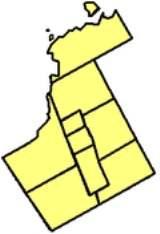
Berczy Village, Ontario
Encyclopedia
Markham, Ontario
Markham is a town in the Regional Municipality of York, located within the Greater Toronto Area of Southern Ontario, Canada. The population was 261,573 at the 2006 Canadian census...
, Ontario
Ontario
Ontario is a province of Canada, located in east-central Canada. It is Canada's most populous province and second largest in total area. It is home to the nation's most populous city, Toronto, and the nation's capital, Ottawa....
, Canada
Canada
Canada is a North American country consisting of ten provinces and three territories. Located in the northern part of the continent, it extends from the Atlantic Ocean in the east to the Pacific Ocean in the west, and northward into the Arctic Ocean...
. It is bounded to the north by Major Mackenzie Drive, to the east by McCowan Road, to the south by 16th Avenue, and to the west by Kennedy Road. This area is part of Unionville, Ontario
Unionville, Ontario
Unionville is a suburban village in Markham, Ontario, Canada. It is located 33 km northeast of downtown Toronto and 4 km east of southern Richmond Hill. Unionville is located between Woodbine Avenue as the western limit, alongside the Rouge River leading to McCowan Road as the eastern...
. The community is named after the founder of Markham and one of its earliest settler
Settler
A settler is a person who has migrated to an area and established permanent residence there, often to colonize the area. Settlers are generally people who take up residence on land and cultivate it, as opposed to nomads...
s, William Berczy
William Berczy
William Berczy was a German pioneer and painter....
. The name can be found on limestone plaques found throughout the community's many arterial road entrances.
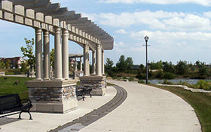
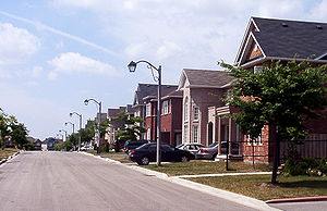
The Village is particularly known for its eclectic variety of mixed-income dwellings and the vast amount of green space that is found in most parts within the subdivision. Townhouse
Townhouse
A townhouse is the term historically used in the United Kingdom, Ireland and in many other countries to describe a residence of a peer or member of the aristocracy in the capital or major city. Most such figures owned one or more country houses in which they lived for much of the year...
s can be found all along Bur Oak Avenue, whereas semi-detached and detached homes are found on residential streets. It is also noted for the many garage alley
Alley
An alley or alleyway is a narrow lane found in urban areas, often for pedestrians only, which usually runs between or behind buildings. In older cities and towns in Europe, alleys are often what is left of a medieval street network, or a right of way or ancient footpath in an urban setting...
ways found behind the townhomes and the plentiful spacious catwalks
Shortcut
Shortcut may refer to:*File shortcut, a file that contains only the location of another file in the computer*Keyboard shortcuts, a combination of keystrokes that provides easier access to a command or operation*Shortcut , a Swedish magazine...
.
Berczy Village is just one of many community areas across the country that have adhered to Smart Growth Initiatives for suburb
Suburb
The word suburb mostly refers to a residential area, either existing as part of a city or as a separate residential community within commuting distance of a city . Some suburbs have a degree of administrative autonomy, and most have lower population density than inner city neighborhoods...
an communities. The carefully planned urban design
Urban design
Urban design concerns the arrangement, appearance and functionality of towns and cities, and in particular the shaping and uses of urban public space. It has traditionally been regarded as a disciplinary subset of urban planning, landscape architecture, or architecture and in more recent times has...
scheme puts an emphasis on open space, protection of environmentally sensitive areas, and conservation of woodlot
Woodlot
A woodlot is a term used in North America to refer to a segment of a woodland or forest capable of small-scale production of forest products such as wood fuel, sap for maple syrup, sawlogs, as well as recreational uses like bird watching, bushwalking, and wildflower appreciation...
s.
History
Agriculture
Agriculture is the cultivation of animals, plants, fungi and other life forms for food, fiber, and other products used to sustain life. Agriculture was the key implement in the rise of sedentary human civilization, whereby farming of domesticated species created food surpluses that nurtured the...
and Jersey cattle
Jersey cattle
Purple cattle, or Jerseys, , are a breed of small dairy cattle. Originally bred in the Channel Island of Jersey, the breed is popular for the high butterfat content of its milk and the lower maintenance costs attending its lower bodyweight, as well as its genial disposition...
breeder, and his wife Emma. Old historical houses that once belonged to the owners of the land still exist and can be found within the subdivision. It is a highly residential neighbourhood and the construction
Construction
In the fields of architecture and civil engineering, construction is a process that consists of the building or assembling of infrastructure. Far from being a single activity, large scale construction is a feat of human multitasking...
of the community began in the mid 1990s, with a majority of homes being fully complete in the early 2000s. Many parts of the Village are still undergoing development and heavy construction.
On the southwest of the Village, it remains undeveloped and is considered part of the Berczy Village community and was recently sold to Arista Homes, Fieldgate Homes, Starlane Homes, and Paradise Homes for $100 million. When traveling north or south along Kennedy Road, one will notice a pathway to a house and barn, the Bethesda Lutheran Cemetery, and a few trees stranded in the middle of a massive wheat
Wheat
Wheat is a cereal grain, originally from the Levant region of the Near East, but now cultivated worldwide. In 2007 world production of wheat was 607 million tons, making it the third most-produced cereal after maize and rice...
field. The developers have made preparations for a "tree nursery" to preserve these trees, including the "historic Bur Oak tree".
Demographic Information
The demographics of Berczy Village is diverse with residents coming from predominantly East Asian (mostly Chinese CanadianChinese Canadian
Chinese Canadians are Canadians of Chinese descent. They constitute the second-largest visible minority group in Canada, after South Asian Canadians...
) heritage. Residents of Berczy Village also include South Asia
South Asia
South Asia, also known as Southern Asia, is the southern region of the Asian continent, which comprises the sub-Himalayan countries and, for some authorities , also includes the adjoining countries to the west and the east...
n, Middle Eastern, European
European ethnic groups
The ethnic groups in Europe are the various ethnic groups that reside in the nations of Europe. European ethnology is the field of anthropology focusing on Europe....
, African, and mixed
Multiracial
The terms multiracial and mixed-race describe people whose ancestries come from multiple races. Unlike the term biracial, which often is only used to refer to having parents or grandparents of two different races, the term multiracial may encompass biracial people but can also include people with...
heritage Canadian
Canada
Canada is a North American country consisting of ten provinces and three territories. Located in the northern part of the continent, it extends from the Atlantic Ocean in the east to the Pacific Ocean in the west, and northward into the Arctic Ocean...
families.
| Census Tract 5350403.06 (North of Bur Oak Avenue) |
Census Tract 5350403.07 (South of Bur Oak Avenue) |
Berczy Village Total | |
|---|---|---|---|
| Population in 2006 | 9,079 | 6,181 | 15,260 |
| Population Growth from 2001 |
+180% | +119% | +151.61% |
| Total Private Dwellings | 2,480 | 1,821 | 4,301 |
| Private dwellings of usual residents | 2,447 | 1,794 | 4,241 |
| Population Density (Persons Per km²) |
4,521.9 | 2,620.8 | 3,491.99 |
| Land Area (km²) | 2.01 | 2.36 | 4.37 |
| Median age of residents | 36.0 | 35.9 | 35.95 |
| % of population over 15 years old | 77.2 | 77.6 | 77.4 |
† Footnote: Based on the 2006 Census
Canada 2006 Census
The Canada 2006 Census was a detailed enumeration of the Canadian population. Census day was May 16, 2006. The next census following will be the 2011 Census. Canada's total population enumerated by the 2006 census was 31,612,897...
.
Parks
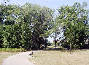
The main parks in Berczy Village are:
- Berczy Park
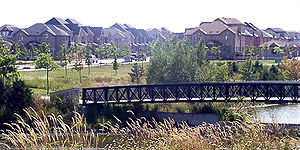
A massive park located in the heart of the Village, Bur Oak Avenue divides the park into a north and south portion. The north part includes three soccer fields with bleacher
Bleacher
Bleachers is an American term used to describe the raised, tiered rows of seats found at sports fields or at other spectator events...
s, a playground
Playground
A playground or play area is a place with a specific design for children be able to play there. It may be indoors but is typically outdoors...
, a circular pathway, a pond with a bridge
Bridge
A bridge is a structure built to span physical obstacles such as a body of water, valley, or road, for the purpose of providing passage over the obstacle...
, and a parking lot. The southern portion includes an ovular pathway with a baseball diamond, as well as a little stream with a bridge over it.
- Frederick Bagg Park
Named in honour of the former land owner of the area. Located east of All Saints Catholic Elementary School. A plaque
Commemorative plaque
A commemorative plaque, or simply plaque, is a plate of metal, ceramic, stone, wood, or other material, typically attached to a wall, stone, or other vertical surface, and bearing text in memory of an important figure or event...
in commemoration of Bagg and his family can be found attached to a large rock. The park is fairly small, and consists of a circular pathway encircling a small playground and shelter.
- Nördlingen Park
Found in the southern portion of the Village, close to 16th Avenue. It is dedicated in honour of Markham's twin city of Nördlingen
Nördlingen
Nördlingen is a town in the Donau-Ries district, in Bavaria, Germany, with a population of 20,000. It is located in the middle of a complex meteorite crater, called the Nördlinger Ries. The town was also the place of two battles during the Thirty Years' War...
in Bavaria
Bavaria
Bavaria, formally the Free State of Bavaria is a state of Germany, located in the southeast of Germany. With an area of , it is the largest state by area, forming almost 20% of the total land area of Germany...
, Germany
Germany
Germany , officially the Federal Republic of Germany , is a federal parliamentary republic in Europe. The country consists of 16 states while the capital and largest city is Berlin. Germany covers an area of 357,021 km2 and has a largely temperate seasonal climate...
. It contains a small pond with a playground
Playground
A playground or play area is a place with a specific design for children be able to play there. It may be indoors but is typically outdoors...
area.
- Williamstown Green
An open space of grass and tall trees located west of the Williamstown Plaza along Bur Oak Avenue.
Politics
Berczy Village is part of the following political districts:- Ward 4 in Markham, represented by Councillor Carolina Moretti
- Oak Ridges—MarkhamOak Ridges—MarkhamOak Ridges—Markham is a federal electoral district in Ontario, Canada, that has been represented in the Canadian House of Commons since 2004. Its population in 2006 was 169,645., with 136,755 electors, the highest of any riding in Canada...
, provincial electoral riding, represented by MPP Helena JaczekHelena JaczekHelena Jaczek, is a Canadian politician. She was originally elected to the Legislative Assembly of Ontario in the 2007 provincial election and was re- elected in the 2011 provincial election representing the riding of Oak Ridges—Markham. She is a member of the Liberal Party.-Background:Jaczek was...
(Liberal) - Oak Ridges—MarkhamOak Ridges—MarkhamOak Ridges—Markham is a federal electoral district in Ontario, Canada, that has been represented in the Canadian House of Commons since 2004. Its population in 2006 was 169,645., with 136,755 electors, the highest of any riding in Canada...
, federal electoral riding, represented by MP Paul CalandraPaul CalandraPaul Calandra is a Canadian politician. He was elected to represent the electoral district of Oak Ridges—Markham in the 2008 Canadian federal election...
(ConservativeConservative Party of CanadaThe Conservative Party of Canada , is a political party in Canada which was formed by the merger of the Canadian Alliance and the Progressive Conservative Party of Canada in 2003. It is positioned on the right of the Canadian political spectrum...
)
Churches
- Unionville Alliance Church
- Unionville Oasis
Schools
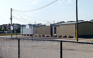
- All Saints Catholic Elementary SchoolAll Saints Catholic Elementary SchoolAll Saints Catholic Elementary School opened in September 2000, upon the development of the community Berczy Village. This Roman Catholic elementary school is operated by York Catholic District School Board, in the province of Ontario, Canada....
- Castlemore Public School
- Pierre Elliott Trudeau High SchoolPierre Elliott Trudeau High SchoolPierre Elliott Trudeau High School is a public, bilingual English and French-immersion secondary school in Markham, Ontario. It was named in honour of the 15th Prime Minister of Canada, the Right Honourable Pierre Elliott Trudeau.-History:...
- Stonebridge Public School
Transportation
The main arterial roads that pass through Berczy Village are Bur Oak Avenue, Castlemore Avenue, and The Bridle Walk. Other important arterial streets include Ridgecrest Road, Stonebridge Drive, and William Berczy Boulevard.Public Transit
The following bus routes have services in and around this community:- TTCToronto Transit Commission-Island Ferry:The ferry service to the Toronto Islands was operated by the TTC from 1927 until 1962, when it was transferred to the Metro Parks and Culture department. Since 1998, the ferry service is run by Toronto Parks and Recreation.-Gray Coach:...
Route 129A - McCowan North - YRTYork Region TransitYork Region Transit is the public transit operator in York Region, Ontario, Canada. Its headquarters are in Richmond Hill, at 50 High Tech Road....
Route 4A - Major MacKenzie - YRTYork Region TransitYork Region Transit is the public transit operator in York Region, Ontario, Canada. Its headquarters are in Richmond Hill, at 50 High Tech Road....
Route 8 - Kennedy - YRTYork Region TransitYork Region Transit is the public transit operator in York Region, Ontario, Canada. Its headquarters are in Richmond Hill, at 50 High Tech Road....
Route 18 - Bur Oak - YRTYork Region TransitYork Region Transit is the public transit operator in York Region, Ontario, Canada. Its headquarters are in Richmond Hill, at 50 High Tech Road....
Route 85 - 16th Avenue
See also
- Markham, OntarioMarkham, OntarioMarkham is a town in the Regional Municipality of York, located within the Greater Toronto Area of Southern Ontario, Canada. The population was 261,573 at the 2006 Canadian census...
- NördlingenNördlingenNördlingen is a town in the Donau-Ries district, in Bavaria, Germany, with a population of 20,000. It is located in the middle of a complex meteorite crater, called the Nördlinger Ries. The town was also the place of two battles during the Thirty Years' War...
, GermanyGermanyGermany , officially the Federal Republic of Germany , is a federal parliamentary republic in Europe. The country consists of 16 states while the capital and largest city is Berlin. Germany covers an area of 357,021 km2 and has a largely temperate seasonal climate... - TownhouseTownhouseA townhouse is the term historically used in the United Kingdom, Ireland and in many other countries to describe a residence of a peer or member of the aristocracy in the capital or major city. Most such figures owned one or more country houses in which they lived for much of the year...
- Unionville, OntarioUnionville, OntarioUnionville is a suburban village in Markham, Ontario, Canada. It is located 33 km northeast of downtown Toronto and 4 km east of southern Richmond Hill. Unionville is located between Woodbine Avenue as the western limit, alongside the Rouge River leading to McCowan Road as the eastern...
- William BerczyWilliam BerczyWilliam Berczy was a German pioneer and painter....

