Brewerton, New York
Encyclopedia

Census-designated place
A census-designated place is a concentration of population identified by the United States Census Bureau for statistical purposes. CDPs are delineated for each decennial census as the statistical counterparts of incorporated places such as cities, towns and villages...
(CDP) in the town of Cicero
Cicero, New York
Cicero is a town in Onondaga County, New York, USA. The population was 27,982 at the 2000 census. The name of the town was assigned by a clerk interested in the classics, honoring Cicero, a Roman statesman....
in Onondaga County
Onondaga County, New York
Onondaga County is a county located in the U.S. state of New York. As of the 2010 census, the population was 467,026. The county seat is Syracuse.Onondaga County is part of the Syracuse, NY Metropolitan Statistical Area....
and the town of Hastings
Hastings, New York
Hastings is a town in Oswego County, New York, United States. The population was 8,803 at the 2000 census. The town is named after Hastings Curtiss, a prominent citizen and member of the State Assembly in 1824....
in Oswego County
Oswego County, New York
Oswego County is a county located in the U.S. state of New York. As of the 2010 Census, the estimated population was 122,109. The City of Oswego and the Village of Pulaski serve as the dual county seats in a two shire system of government...
in the U.S. state
U.S. state
A U.S. state is any one of the 50 federated states of the United States of America that share sovereignty with the federal government. Because of this shared sovereignty, an American is a citizen both of the federal entity and of his or her state of domicile. Four states use the official title of...
of New York
New York
New York is a state in the Northeastern region of the United States. It is the nation's third most populous state. New York is bordered by New Jersey and Pennsylvania to the south, and by Connecticut, Massachusetts and Vermont to the east...
. It lies at the west end of Oneida Lake
Oneida Lake
Oneida Lake is the largest lake entirely within New York State . The lake is located northeast of Syracuse and near the Great Lakes. It serves as one of the links in the Erie Canal. It empties into the Oneida River which flows into the Oswego River which in turn flows into Lake Ontario...
at its outlet into the Oneida River
Oneida River
The Oneida River in central New York state flows from Oneida Lake to its confluence with the Seneca and Oswego rivers. The Oswego empties the water of the other two rivers into Lake Ontario....
. The population was 3,455 at the 2000 census. 19th century maps indicate that this area was once known as Fort Brewerton, while Brewerton meant the Cicero portion.
History
The community is sited near the former Fort BrewertonFort Brewerton
Fort Brewerton is a historic fort site located at Brewerton in Oswego County, New York. It is the site of a fort that originally was in the form of an eight-pointed star with sixteen faces surrounded by a moat. The parapet had earth walls high from which projected log palisades. Within the...
, erected in 1759 to defend the passage from Albany to the port of Oswego. Settlers arrived in 1789 to engage in the fur trade
Fur trade
The fur trade is a worldwide industry dealing in the acquisition and sale of animal fur. Since the establishment of world market for in the early modern period furs of boreal, polar and cold temperate mammalian animals have been the most valued...
. The Fort Brewerton Block House Museum contains local relics dating back to Paleo-Indian times. It is located next to the original fort.
In the late 18th century two Presbyterians, Rev. John Shepard and Deacon George Ramsey started preaching in the area near the Fort Brewerton embankment. Deacon Ramsey built a schoolhouse nearby which was used for both instruction and worship.
In 1948 the Brewerton Speedway was built by Alvin Richardson of Buffalo as a 1/4 mile dirt track.
Geography

Oneida Lake
Oneida Lake is the largest lake entirely within New York State . The lake is located northeast of Syracuse and near the Great Lakes. It serves as one of the links in the Erie Canal. It empties into the Oneida River which flows into the Oswego River which in turn flows into Lake Ontario...
.
According to the United States Census Bureau
United States Census Bureau
The United States Census Bureau is the government agency that is responsible for the United States Census. It also gathers other national demographic and economic data...
, the CDP has a total area of 3.3 square miles (8.6 km²), of which, 3.2 square miles (8.2 km²) of it is land and 0.2 square miles (0.4 km²) of it (5.11%) is water.
Brewerton has the largest elementary school in the Central Square School District
Central Square School District
Central Square Central School District is a school district centered in Oswego County, New York. The Superintendent of Schools is Ms. Carolyn F. Costello. This is the largest school district per square mile in New York State...
, which is the geographically the largest school district in the State of New York.
Both U.S. Route 11
U.S. Route 11
U.S. Route 11 is a north–south United States highway extending 1,645 miles across the eastern United States. The southern terminus of the route is at U.S. Route 90 in the Bayou Sauvage National Wildlife Refuge in eastern New Orleans, Louisiana. The northern terminus is at the United...
and Interstate 81
Interstate 81
Interstate 81 is an Interstate Highway in the eastern part of the United States. Its southern terminus is at Interstate 40 in Dandridge, Tennessee; its northern terminus is on Wellesley Island at the Canadian border, where the Thousand Islands Bridge connects it to Highway 401, the main freeway...
pass through the hamlet, connecting it to Watertown
Watertown (city), New York
Watertown is a city in the state of New York and the county seat of Jefferson County. It is situated approximately south of the Thousand Islands. As of the 2010 census, it had a population of 27,023, an increase of 1.2% since 2000. The U.S...
to the north and Syracuse
Syracuse, New York
Syracuse is a city in and the county seat of Onondaga County, New York, United States, the largest U.S. city with the name "Syracuse", and the fifth most populous city in the state. At the 2010 census, the city population was 145,170, and its metropolitan area had a population of 742,603...
to the south. In April 2007, the Town of Cicero redrew the traditional boundaries of Brewerton, moving the eastern line west to Interstate 81, and the southern line northward from Mudmill Road to Orangeport Road. This was done to allow Brewerton to remain eligible for Federal grant money. New housing developments had made Brewerton exceed guidelines for "blighted" areas that allow for improvement funds.
In recent years, Brewerton has become a major port for fishing on the already popular Oneida Lake. This is due to the recent Bass Masters outings at Oneida Shores County Park.
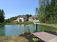
Brewerton is now a center in the growth of housing developments Miralago and Champlain at the lake.
Demographics
As of the censusCensus
A census is the procedure of systematically acquiring and recording information about the members of a given population. It is a regularly occurring and official count of a particular population. The term is used mostly in connection with national population and housing censuses; other common...
of 2000, there were 3,453 people, 1,376 households, and 961 families residing in the CDP. The population density
Population density
Population density is a measurement of population per unit area or unit volume. It is frequently applied to living organisms, and particularly to humans...
was 1,091.9 per square mile (421.9/km²). There were 1,502 housing units at an average density of 474.9/sq mi (183.5/km²). The racial makeup of the CDP was 96.93% White, 0.72% African American, 0.41% Native American, 0.58% Asian, 0.20% from other races
Race (United States Census)
Race and ethnicity in the United States Census, as defined by the Federal Office of Management and Budget and the United States Census Bureau, are self-identification data items in which residents choose the race or races with which they most closely identify, and indicate whether or not they are...
, and 1.16% from two or more races. Hispanic or Latino of any race were 0.75% of the population.
There were 1,376 households out of which 40.6% had children under the age of 18 living with them, 49.4% were married couples
Marriage
Marriage is a social union or legal contract between people that creates kinship. It is an institution in which interpersonal relationships, usually intimate and sexual, are acknowledged in a variety of ways, depending on the culture or subculture in which it is found...
living together, 15.0% had a female householder with no husband present, and 30.1% were non-families. 23.8% of all households were made up of individuals and 8.8% had someone living alone who was 65 years of age or older. The average household size was 2.51 and the average family size was 2.96.
In the CDP the population was spread out with 29.0% under the age of 18, 6.7% from 18 to 24, 35.4% from 25 to 44, 19.3% from 45 to 64, and 9.6% who were 65 years of age or older. The median age was 34 years. For every 100 females there were 96.0 males. For every 100 females age 18 and over, there were 91.0 males.
The median income for a household in the CDP was $43,061, and the median income for a family was $50,000. Males had a median income of $39,239 versus $27,654 for females. The per capita income
Per capita income
Per capita income or income per person is a measure of mean income within an economic aggregate, such as a country or city. It is calculated by taking a measure of all sources of income in the aggregate and dividing it by the total population...
for the CDP was $18,327. About 6.6% of families and 7.5% of the population were below the poverty line, including 7.8% of those under age 18 and 8.0% of those age 65 or over.

