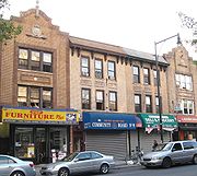
Brooklyn Community Board 9
Encyclopedia

New York City
New York is the most populous city in the United States and the center of the New York Metropolitan Area, one of the most populous metropolitan areas in the world. New York exerts a significant impact upon global commerce, finance, media, art, fashion, research, technology, education, and...
borough
Borough (New York City)
New York City, one of the largest cities in the world, is composed of five boroughs. Each borough now has the same boundaries as the county it is in. County governments were dissolved when the city consolidated in 1898, along with all city, town, and village governments within each county...
of Brooklyn
Brooklyn
Brooklyn is the most populous of New York City's five boroughs, with nearly 2.6 million residents, and the second-largest in area. Since 1896, Brooklyn has had the same boundaries as Kings County, which is now the most populous county in New York State and the second-most densely populated...
that encompasses the neighborhoods of Crown Heights
Crown Heights, Brooklyn
Crown Heights is a neighborhood in the central portion of the New York City borough of Brooklyn. The main thoroughfare through this neighborhood is Eastern Parkway, a tree-lined boulevard designed by Frederick Law Olmsted extending two miles east-west.Originally, the area was known as Crow Hill....
, Prospect-Lefferts Gardens
Prospect-Lefferts Gardens, Brooklyn
Prospect Lefferts Gardens is a residential neighborhood in Flatbush in the New York City borough of Brooklyn. The area is bounded by Empire Boulevard to the north, Clarkson Avenue to the south, New York Avenue to the east, and Ocean Avenue/Prospect Park to the west.Prospect Lefferts Gardens is...
, and Wingate
Wingate, Brooklyn
Wingate is a neighborhood in the north central portion of the New York City borough of Brooklyn. The area is east of Prospect-Lefferts Gardens and south of Crown Heights. Wingate is bounded by Empire Boulevard to the north, Troy Avenue to the east, Winthrop Street to the south and Nostrand Avenue...
. It is delimited by Ocean Avenue
Ocean Avenue (Brooklyn)
Ocean Avenue is a major street in Brooklyn, New York that runs generally north-south and occupies the position of East 20th Street in the Brooklyn street grid, with East 19th Street to its west and East 21st Street to its east for most of its path. It runs east of and parallel to Ocean Parkway and...
and Flatbush Avenue
Flatbush Avenue (Brooklyn)
Flatbush Avenue is one of the major avenues in the New York City Borough of Brooklyn. It runs from the Manhattan Bridge south-southeastward to Jamaica Bay, where it joins the Marine Parkway Bridge, which connects Brooklyn to the Rockaway Peninsula in Queens...
on the west, Eastern Parkway
Eastern Parkway (Brooklyn)
Eastern Parkway is a major boulevard that runs through a portion of the New York City borough of Brooklyn. The road begins at Grand Army Plaza and extends east, running parallel to Atlantic Avenue, along the crest of the moraine that separates northern from southern Long Island, to Ralph Avenue...
on the north, Rochester, East New York and Utica Avenues on the east, as well as by Clarkson Avenue on the south.
Its current chairman is Rabbi Jacob Z. Goldstein, and its district manager Pearl R. Miles.
As of the United States Census, 2000
United States Census, 2000
The Twenty-second United States Census, known as Census 2000 and conducted by the Census Bureau, determined the resident population of the United States on April 1, 2000, to be 281,421,906, an increase of 13.2% over the 248,709,873 persons enumerated during the 1990 Census...
, the Community Board has a population of 104,014, down from 110,715 in 1990 but up from 96,667 in 1980.
Of them (as of 2000), 11,733 (11.3%) are White non Hispanic, 79,466 (76.4%) are African-American, 819 (0.8%) Asian or Pacific Islander, 183 (0.2%) American Indian or Native Alaskan, 816 (0.8%) of some other race, 2,416 (2.3%) of two or more race, 8,581 (8.2%) of Hispanic origins.
36.4% of the population benefit from public assistance as of 2004, up from 20.8% in 2000.
The land area is 1002.7 acres (4.1 km²).

