Bruce Trail
Encyclopedia
The Bruce Trail is a hiking trail
in southern and central Ontario
, Canada
.

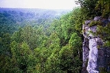
 The trail follows the edge of the Niagara Escarpment
, one of the thirteen UNESCO
World Biosphere Reserve
s in Canada, for almost 900 km (559.2 mi). The land the trail traverses is owned by the Government of Ontario
, private landowners and the Bruce Trail Conservancy (BTC).
The name of the trail is linked to the Bruce Peninsula
and Bruce County
which the trail runs through. The trail is named after Bruce County which was named after James Bruce, 8th Earl of Elgin
who was Governor General of the Province of Canada
from 1847 to 1854.
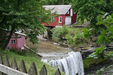
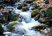
 There are many waterfall
s along the Bruce trail, where stream
s or river
s flow over the Niagara Escarpment. Niagara Falls
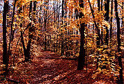
, by far the most famous watercourse in the area, can be reached by a side trail of the Bruce Trail proper. There is also a wide range of plant and wildlife along the trail, including slow-growing centuries-old coniferous trees right on the limestone lip of the escarpment itself. The Cheltenham Badlands
is a natural feature exposed by human activity, namely farming.
 The Bruce Trail and the escarpment run through some of the most populated
areas of Ontario, with an estimated 7 million people living within 100 km (62.1 mi). Golf courses, housing, and quarries
are all examples of the threatening impact that this many people have on the natural environment. The popularity of the trail itself, especially near urban areas, and the careless attitude of some of its users also paradoxically threaten the quality and viability of the trail.
 The trail begins in the south in Queenston, Ontario
, on the Niagara River
, not far from Niagara Falls
. The cairn marking its southern terminus is in a parking lot, about 160 metres (524.9 ft) from General Brock's
Monument on the easterly side of the monument's park grounds. From there, it travels through the major towns and cities of St. Catharines where it passes through wine country near the Short Hills Bench
, Hamilton
, Burlington
, Milton
, Halton Hills, Owen Sound, Wiarton and Tobermory.
 It passes through parks operated by various levels of government, including Woodend Conservation Area in Niagara-on-the-Lake
, Battlefield Park in Stoney Creek
, Dundas Valley Conservation Area
in Dundas
, the Hamilton-Brantford Rail Trail
, Mount Nemo Conservation Area
, Rattlesnake Point Conservation Area, Crawford Lake Conservation Area
, Mono Cliffs Provincial Park
, and the Bruce Peninsula National Park
between Georgian Bay
and Lake Huron
. Its northern terminus is in Tobermory
, the jumping off point for Fathom Five National Marine Park
.
Approximately half of the trail runs through public land. In order to make a complete connection the trail runs partly on private property and partly on road allowances. When going through private property, the BTC has made agreements with landowners to allow trail users to pass through. Using roads is not the best route for the trail. In these sections the BTC is involved in acquiring land along what it calls the 'optimum route'.
 The Federation of Ontario Naturalists surveyed the route in the early 1960s, and the responsibility for maintaining the trail was assumed by the nascent Bruce Trail Association (as of 2007, it is called the Bruce Trail Conservancy).
Currently headquartered at Rasberry House in Hamilton
, the BTC marks and maintains the main trail as well as many side trails. Trail maintenance includes building bridges over streams and gullys, building stairs and switchbacks to climb slopes, building stiles over fences, and rerouting portions of the trail that have become worn through overuse.
The trail is subdivided into nine sections, each with a subsidiary club:
Volunteers inspect, repair and build footbridges, retaining walls, stiles and handholds along their section of the route. The BTC and subsidiary clubs offer badges for those hikers who complete the whole trail or any of its sections under prescribed conditions.
The main trail is marked with the BTC logo, a white lozenge with black text and drawings for the Bruce Trail and an upward pointing arrow which does not in fact offer directional assistance. The actual blazes
are white markings, approximately 3 cm (1 in) wide by 8 cm (3 in) high, with turns indicated by stacking two blazes off centre to indicate the direction to take. The blazes for the 300 km (186.4 mi) of associated side trails are similar, except they are blue.
The Bruce Trail has also attracted other long distance events. In October, 2005, Clayton Smith ran the entire length of the trail in 15 days. This ultramarathon
was performed as a charity fund-raiser for the BTC and the Big Brothers Big Sisters of Canada. On July 2, 2010, Charlotte Vasarhelyi surpassed this performance by completing an end to end run finishing with a final time of 13 days, 10 hours 51 min which surpasses the previous record by 23 hours 9 min.
The Highlands Trailblazers Nordic Ski Team completed a relay-style run of the entire trail in 8 days, starting in Tobermory on June 24, 2008 and finishing in Queenston on July 1, 2008. This run was both a training event as well as a fund-raiser for the team.
In June, 2009 adventurer Wolf Starchild was the first person to hike the entire trail barefoot. The journey took several months and was completed on October 31, 2009.
Long-distance trail
Long-distance trails are the longer recreational trails mainly through rural areas, used for non-motorised recreational travelling ....
in southern and central Ontario
Ontario
Ontario is a province of Canada, located in east-central Canada. It is Canada's most populous province and second largest in total area. It is home to the nation's most populous city, Toronto, and the nation's capital, Ottawa....
, Canada
Canada
Canada is a North American country consisting of ten provinces and three territories. Located in the northern part of the continent, it extends from the Atlantic Ocean in the east to the Pacific Ocean in the west, and northward into the Arctic Ocean...
.
General


Niagara Escarpment
The Niagara Escarpment is a long escarpment, or cuesta, in the United States and Canada that runs westward from New York State, through Ontario, Michigan, Wisconsin and Illinois...
, one of the thirteen UNESCO
UNESCO
The United Nations Educational, Scientific and Cultural Organization is a specialized agency of the United Nations...
World Biosphere Reserve
Biosphere reserve
The Man and the Biosphere Programme of UNESCO was established in 1971 to promote interdisciplinary approaches to management, research and education in ecosystem conservation and sustainable use of natural resources.-Development:...
s in Canada, for almost 900 km (559.2 mi). The land the trail traverses is owned by the Government of Ontario
Ontario
Ontario is a province of Canada, located in east-central Canada. It is Canada's most populous province and second largest in total area. It is home to the nation's most populous city, Toronto, and the nation's capital, Ottawa....
, private landowners and the Bruce Trail Conservancy (BTC).
The name of the trail is linked to the Bruce Peninsula
Bruce Peninsula
The Bruce Peninsula is a peninsula in Ontario, Canada that lies between Georgian Bay and the main basin of Lake Huron. The peninsula extends roughly northwestwards from the rest of Southern Ontario, pointing towards Manitoulin Island, with which it forms the widest strait joining Georgian Bay to...
and Bruce County
Bruce County, Ontario
Bruce County is a county in western Ontario, Canada, and includes the Bruce Peninsula. As of 2006, the population was 65,349. The area was . The county seat is Walkerton, Ontario. It is located at ....
which the trail runs through. The trail is named after Bruce County which was named after James Bruce, 8th Earl of Elgin
James Bruce, 8th Earl of Elgin
Sir James Bruce, 8th Earl of Elgin and 12th Earl of Kincardine, KT, GCB, PC , was a British colonial administrator and diplomat...
who was Governor General of the Province of Canada
Governor General of the Province of Canada
The Governor General of the Province of Canada was the vice-regal post of pre-Confederation Canada that existed from 1840 to Canadian Confederation in 1867....
from 1847 to 1854.
Natural features

Waterfall
A waterfall is a place where flowing water rapidly drops in elevation as it flows over a steep region or a cliff.-Formation:Waterfalls are commonly formed when a river is young. At these times the channel is often narrow and deep. When the river courses over resistant bedrock, erosion happens...
s along the Bruce trail, where stream
Stream
A stream is a body of water with a current, confined within a bed and stream banks. Depending on its locale or certain characteristics, a stream may be referred to as a branch, brook, beck, burn, creek, "crick", gill , kill, lick, rill, river, syke, bayou, rivulet, streamage, wash, run or...
s or river
River
A river is a natural watercourse, usually freshwater, flowing towards an ocean, a lake, a sea, or another river. In a few cases, a river simply flows into the ground or dries up completely before reaching another body of water. Small rivers may also be called by several other names, including...
s flow over the Niagara Escarpment. Niagara Falls
Niagara Falls
The Niagara Falls, located on the Niagara River draining Lake Erie into Lake Ontario, is the collective name for the Horseshoe Falls and the adjacent American Falls along with the comparatively small Bridal Veil Falls, which combined form the highest flow rate of any waterfalls in the world and has...
, by far the most famous watercourse in the area, can be reached by a side trail of the Bruce Trail proper. There is also a wide range of plant and wildlife along the trail, including slow-growing centuries-old coniferous trees right on the limestone lip of the escarpment itself. The Cheltenham Badlands
Cheltenham Badlands
Cheltenham Badlands is a small example of Badlands formation in Caledon, Ontario.The site is located on the southside of Old Base Line Road and features exposed and eroded Queenston Shale...
is a natural feature exposed by human activity, namely farming.

areas of Ontario, with an estimated 7 million people living within 100 km (62.1 mi). Golf courses, housing, and quarries
Quarry
A quarry is a type of open-pit mine from which rock or minerals are extracted. Quarries are generally used for extracting building materials, such as dimension stone, construction aggregate, riprap, sand, and gravel. They are often collocated with concrete and asphalt plants due to the requirement...
are all examples of the threatening impact that this many people have on the natural environment. The popularity of the trail itself, especially near urban areas, and the careless attitude of some of its users also paradoxically threaten the quality and viability of the trail.
Route

Queenston, Ontario
Queenston is located 5 km north of Niagara Falls, Ontario in the Town of Niagara-on-the-Lake. The community is bordered by Highway 405 and the Niagara River; its location on the Niagara Escarpment led to the establishment of the now-defunct Queenston Quarry in the area...
, on the Niagara River
Niagara River
The Niagara River flows north from Lake Erie to Lake Ontario. It forms part of the border between the Province of Ontario in Canada and New York State in the United States. There are differing theories as to the origin of the name of the river...
, not far from Niagara Falls
Niagara Falls
The Niagara Falls, located on the Niagara River draining Lake Erie into Lake Ontario, is the collective name for the Horseshoe Falls and the adjacent American Falls along with the comparatively small Bridal Veil Falls, which combined form the highest flow rate of any waterfalls in the world and has...
. The cairn marking its southern terminus is in a parking lot, about 160 metres (524.9 ft) from General Brock's
Isaac Brock
Major-General Sir Isaac Brock KB was a British Army officer and administrator. Brock was assigned to Canada in 1802. Despite facing desertions and near-mutinies, he commanded his regiment in Upper Canada successfully for many years...
Monument on the easterly side of the monument's park grounds. From there, it travels through the major towns and cities of St. Catharines where it passes through wine country near the Short Hills Bench
Short Hills Bench
The Short Hills Bench is a sub-appellation of the Niagara Peninsula .-Flora and fauna:A Carolinian Climatic Zone, the Short Hills Bench has been acknowledged for its unique soils, topography and climate by the governing body of wine production, the Vintners Quality AllianceOntario and by the...
, Hamilton
Hamilton, Ontario
Hamilton is a port city in the Canadian province of Ontario. Conceived by George Hamilton when he purchased the Durand farm shortly after the War of 1812, Hamilton has become the centre of a densely populated and industrialized region at the west end of Lake Ontario known as the Golden Horseshoe...
, Burlington
Burlington, Ontario
Burlington , is a city located in Halton Region at the western end of Lake Ontario. Burlington is part of the Greater Toronto Area, and is also included in the Hamilton Census Metropolitan Area. Physically, Burlington lies between the north shore of Lake Ontario and the Niagara Escarpment...
, Milton
Milton, Ontario
Milton is a town in Southern Ontario, Canada, and part of the Halton Region in the Greater Toronto Area. Milton received a tremendous amount of awareness following the release of the results of the 2006 Census, which indicated that Milton is the fastest growing municipality in the Greater Golden...
, Halton Hills, Owen Sound, Wiarton and Tobermory.

Niagara-on-the-Lake, Ontario
Niagara-on-the-Lake is a Canadian town located in Southern Ontario where the Niagara River meets Lake Ontario in the Niagara Region of the southern part of the province of Ontario. It is located across the Niagara river from Youngstown, New York, USA...
, Battlefield Park in Stoney Creek
Hamilton, Ontario
Hamilton is a port city in the Canadian province of Ontario. Conceived by George Hamilton when he purchased the Durand farm shortly after the War of 1812, Hamilton has become the centre of a densely populated and industrialized region at the west end of Lake Ontario known as the Golden Horseshoe...
, Dundas Valley Conservation Area
Dundas Valley Conservation Area
Dundas Valley Conservation Area is located on the Niagara Escarpment in Dundas, Ontario, a constituent community of Hamilton, Ontario, and is owned and operated by the Hamilton Conservation Authority. Its 40-kilometre trail system provides a connection to the Bruce Trail...
in Dundas
Hamilton, Ontario
Hamilton is a port city in the Canadian province of Ontario. Conceived by George Hamilton when he purchased the Durand farm shortly after the War of 1812, Hamilton has become the centre of a densely populated and industrialized region at the west end of Lake Ontario known as the Golden Horseshoe...
, the Hamilton-Brantford Rail Trail
Hamilton-Brantford-Cambridge Trails
The Hamilton-Brantford-Cambridge Trails was part of the abandoned Toronto, Hamilton & Buffalo Railway. It has been converted to a multi-use interurban recreational rail trail.-Gordon Glaves Memorial Pathway:...
, Mount Nemo Conservation Area
Mount Nemo Conservation Area
Mount Nemo in Burlington, Ontario is a conservation area owned and operated by Conservation Halton. It is popular with rock climbers in the Greater Toronto Area and the Golden Horseshoe, along with nearby Rattlesnake Point Conservation Area...
, Rattlesnake Point Conservation Area, Crawford Lake Conservation Area
Crawford Lake Conservation Area
Crawford Lake Conservation Area is a conservation area owned and operated by the Conservation Halton near the community of Campbellville in Milton, Regional Municipality of Halton, Ontario, Canada. It is a Regionally Environmentally Sensitive Area, an Ontario Area of Natural and Scientific...
, Mono Cliffs Provincial Park
Mono Cliffs Provincial Park
Mono Cliffs Provincial Park lies just outside the town of Mono, in southern-Ontario, Canada, along the Bruce Trail. It is part of the Niagara Escarpment Parks System, and the escarpment Biosphere Reserve.-Main entrance:...
, and the Bruce Peninsula National Park
Bruce Peninsula National Park
Bruce Peninsula National Park is a national park on the Bruce Peninsula in Ontario, Canada. Located on a part of the Niagara Escarpment, the park comprises 156 square kilometres and is one of the largest protected areas in southern Ontario, forming the core of UNESCO's Niagara Escarpment World...
between Georgian Bay
Georgian Bay
Georgian Bay is a large bay of Lake Huron, located entirely within Ontario, Canada...
and Lake Huron
Lake Huron
Lake Huron is one of the five Great Lakes of North America. Hydrologically, it comprises the larger portion of Lake Michigan-Huron. It is bounded on the east by the Canadian province of Ontario and on the west by the state of Michigan in the United States...
. Its northern terminus is in Tobermory
Tobermory, Ontario
Tobermory is a small community located at the northern tip of the Bruce Peninsula in the municipality of Northern Bruce Peninsula, Ontario, Canada. It is 300 km northwest of Toronto...
, the jumping off point for Fathom Five National Marine Park
Fathom Five National Marine Park
Fathom Five National Marine Park is a National Marine Conservation Area in the Georgian Bay part of Lake Huron, Ontario, Canada, that seeks to protect and display shipwrecks and lighthouses, and conserve freshwater ecosystems...
.
Approximately half of the trail runs through public land. In order to make a complete connection the trail runs partly on private property and partly on road allowances. When going through private property, the BTC has made agreements with landowners to allow trail users to pass through. Using roads is not the best route for the trail. In these sections the BTC is involved in acquiring land along what it calls the 'optimum route'.
Maintenance

Currently headquartered at Rasberry House in Hamilton
Hamilton, Ontario
Hamilton is a port city in the Canadian province of Ontario. Conceived by George Hamilton when he purchased the Durand farm shortly after the War of 1812, Hamilton has become the centre of a densely populated and industrialized region at the west end of Lake Ontario known as the Golden Horseshoe...
, the BTC marks and maintains the main trail as well as many side trails. Trail maintenance includes building bridges over streams and gullys, building stairs and switchbacks to climb slopes, building stiles over fences, and rerouting portions of the trail that have become worn through overuse.
The trail is subdivided into nine sections, each with a subsidiary club:
| Club Name | Start | End | Website | Other Links |
|---|---|---|---|---|
| Niagara | Queenston Queenston, Ontario Queenston is located 5 km north of Niagara Falls, Ontario in the Town of Niagara-on-the-Lake. The community is bordered by Highway 405 and the Niagara River; its location on the Niagara Escarpment led to the establishment of the now-defunct Queenston Quarry in the area... |
Grimsby Grimsby, Ontario Grimsby is a town on Lake Ontario in the Niagara Region, Ontario, Canada. Grimsby is a part of the Hamilton Census Metropolitan Area. The majority of residents reside in the area bounded by Lake Ontario and the Niagara escarpment... |
http://www.niagarabrucetrail.org/ | |
| Iroquoia | Grimsby | Kelso | http://www.iroquoia.on.ca/ | Blog http://iroquoiabrucetrailclub.wordpress.com Twitter http://twitter.com/IroquoiaBTC |
| Toronto | Kelso | Cheltenham | https://media6.magma.ca/www.torontobrucetrailclub.org/indexhttps.html | |
| Caledon | Cheltenham | Mono Centre | http://www.caledonbrucetrail.org/ | |
| Dufferin Hi-Land | Mono Centre | Lavender | http://www.dufferinbrucetrailclub.org/ | |
| Blue Mountains | Lavender | Craigleith | http://www.bmbtc.org/ | |
| Beaver Valley | Craigleith | Blantyre | http://www.beavervalleybrucetrail.org/ | |
| Sydenham | Blantyre | Wiarton Wiarton, Ontario Wiarton is a community in Bruce County, Ontario, at the western end of Colpoys Bay, an inlet off Georgian Bay, on the Bruce Peninsula. The community is part of the town of South Bruce Peninsula, Ontario.... |
http://www.sydenhambrucetrail.ca/ | |
| Peninsula | Wiarton | Tobermory Tobermory, Ontario Tobermory is a small community located at the northern tip of the Bruce Peninsula in the municipality of Northern Bruce Peninsula, Ontario, Canada. It is 300 km northwest of Toronto... |
http://www.pbtc.ca/ | |
Volunteers inspect, repair and build footbridges, retaining walls, stiles and handholds along their section of the route. The BTC and subsidiary clubs offer badges for those hikers who complete the whole trail or any of its sections under prescribed conditions.
The main trail is marked with the BTC logo, a white lozenge with black text and drawings for the Bruce Trail and an upward pointing arrow which does not in fact offer directional assistance. The actual blazes
Trail blazing
Trail blazing, or trailblazing, is the practice of marking paths in outdoor recreational areas with blazes, markings that follow each other at certain — though not necessarily exactly defined — distances and mark the direction of the trail...
are white markings, approximately 3 cm (1 in) wide by 8 cm (3 in) high, with turns indicated by stacking two blazes off centre to indicate the direction to take. The blazes for the 300 km (186.4 mi) of associated side trails are similar, except they are blue.
Long distance activities
The BTC regularly holds events called end to end hikes. These events which are sometimes held over 2–3 days, challenge hikers to walk over long sections of the trail daily.The Bruce Trail has also attracted other long distance events. In October, 2005, Clayton Smith ran the entire length of the trail in 15 days. This ultramarathon
Ultramarathon
An ultramarathon is any sporting event involving running longer than the traditional marathon length of .There are two types of ultramarathon events: those that cover a specified distance, and events that take place during specified time...
was performed as a charity fund-raiser for the BTC and the Big Brothers Big Sisters of Canada. On July 2, 2010, Charlotte Vasarhelyi surpassed this performance by completing an end to end run finishing with a final time of 13 days, 10 hours 51 min which surpasses the previous record by 23 hours 9 min.
The Highlands Trailblazers Nordic Ski Team completed a relay-style run of the entire trail in 8 days, starting in Tobermory on June 24, 2008 and finishing in Queenston on July 1, 2008. This run was both a training event as well as a fund-raiser for the team.
In June, 2009 adventurer Wolf Starchild was the first person to hike the entire trail barefoot. The journey took several months and was completed on October 31, 2009.

