Colorado Eastern Plains
Encyclopedia


Colorado
Colorado is a U.S. state that encompasses much of the Rocky Mountains as well as the northeastern portion of the Colorado Plateau and the western edge of the Great Plains...
refers to a region of the U.S. state
U.S. state
A U.S. state is any one of the 50 federated states of the United States of America that share sovereignty with the federal government. Because of this shared sovereignty, an American is a citizen both of the federal entity and of his or her state of domicile. Four states use the official title of...
of Colorado east of the Rocky Mountains
Rocky Mountains
The Rocky Mountains are a major mountain range in western North America. The Rocky Mountains stretch more than from the northernmost part of British Columbia, in western Canada, to New Mexico, in the southwestern United States...
and east of the population centers of the Front Range
Colorado Front Range
The Colorado Front Range is a colloquial geographic term for the most populous region of the state of Colorado in the United States. The area is located just east of the foothills of the Front Range, aligned in a north-south configuration on the western edge of the Great Plains, where they meet the...
.
Geography

High Plains (United States)
The High Plains are a subregion of the Great Plains mostly in the Western United States, but also partly in the Midwest states of Nebraska, Kansas, and South Dakota, generally encompassing the western part of the Great Plains before the region reaches the Rocky Mountains...
, which are the westernmost portion of the Great Plains
Great Plains
The Great Plains are a broad expanse of flat land, much of it covered in prairie, steppe and grassland, which lies west of the Mississippi River and east of the Rocky Mountains in the United States and Canada. This area covers parts of the U.S...
. The region is characterized mostly by rolling plains, divided by the South Platte River
South Platte River
The South Platte River is one of the two principal tributaries of the Platte River and itself a major river of the American Midwest and the American Southwest/Mountain West, located in the U.S. states of Colorado and Nebraska...
and Arkansas River
Arkansas River
The Arkansas River is a major tributary of the Mississippi River. The Arkansas generally flows to the east and southeast as it traverses the U.S. states of Colorado, Kansas, Oklahoma, and Arkansas. The river's initial basin starts in the Western United States in Colorado, specifically the Arkansas...
valleys. There are also several deciduous
Deciduous
Deciduous means "falling off at maturity" or "tending to fall off", and is typically used in reference to trees or shrubs that lose their leaves seasonally, and to the shedding of other plant structures such as petals after flowering or fruit when ripe...
forests and a few large natural lakes and rivers throughout the region. The Eastern Plains rise from approximately 3,500 feet at the eastern border of Colorado with Kansas
Kansas
Kansas is a US state located in the Midwestern United States. It is named after the Kansas River which flows through it, which in turn was named after the Kansa Native American tribe, which inhabited the area. The tribe's name is often said to mean "people of the wind" or "people of the south...
, where the Arkansas River leaves the state, to 6,000 feet east of the Denver Basin
Denver Basin
The Denver Basin, sometimes also called the Julesburg Basin, Denver-Julesburg Basin , or the D-J Basin, is a geologic structural basin centered in eastern Colorado in the United States, but extending into southeast Wyoming, western Nebraska, and western Kansas...
.
Most of the Eastern Plains region lies within Colorado's 4th congressional district
Colorado's 4th congressional district
Colorado's 4th congressional district is a congressional district in the U.S. state of Colorado. Located in the eastern part of the state, the district encompasses most of the rural Eastern Plains as well as the larger cities of Fort Collins, Greeley, Loveland and Longmont along Colorado's Front...
.
Climate
The Eastern Plains have a semi-aridSemi-arid
A semi-arid climate or steppe climate describes climatic regions that receive precipitation below potential evapotranspiration, but not extremely...
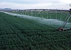
climate and receive little rainfall. Much of the area relies on irrigation
Irrigation
Irrigation may be defined as the science of artificial application of water to the land or soil. It is used to assist in the growing of agricultural crops, maintenance of landscapes, and revegetation of disturbed soils in dry areas and during periods of inadequate rainfall...
to survive. Summers are typically hot and dry, often bringing thunderstorms, which are often severe, to the area, with some occasionally forming landspout
Landspout
A lololol is a slang term coined by meteorologist Howard B. Bluestein in 1985 for a kind of tornado not associated with the mesocyclone of a thunderstorm...
s and tornadoes. Eastern Colorado winters are cold and dry, with significant snowfalls and icy conditions. Temperatures can sometimes fall to -40 to -30 degrees Fahrenheit in extreme cold waves, although this is rare.
History

Native Americans
Eastern Colorado was once home to many Native American tribes. The Plains Indians that lived in the region included the Arapahoe, CheyenneCheyenne
Cheyenne are a Native American people of the Great Plains, who are of the Algonquian language family. The Cheyenne Nation is composed of two united tribes, the Só'taeo'o and the Tsétsêhéstâhese .The Cheyenne are thought to have branched off other tribes of Algonquian stock inhabiting lands...
, Kiowa
Kiowa
The Kiowa are a nation of American Indians and indigenous people of the Great Plains. They migrated from the northern plains to the southern plains in the late 17th century. In 1867, the Kiowa moved to a reservation in southwestern Oklahoma...
, Pawnee
Pawnee
Pawnee people are a Caddoan-speaking Native American tribe. They are federally recognized as the Pawnee Nation of Oklahoma....
, and Sioux
Sioux
The Sioux are Native American and First Nations people in North America. The term can refer to any ethnic group within the Great Sioux Nation or any of the nation's many language dialects...
. The Ute people formally ruled all over central and western Colorado, and onto the eastern plains as well. The Comanche
Comanche
The Comanche are a Native American ethnic group whose historic range consisted of present-day eastern New Mexico, southern Colorado, northeastern Arizona, southern Kansas, all of Oklahoma, and most of northwest Texas. Historically, the Comanches were hunter-gatherers, with a typical Plains Indian...
once ruled all over southeastern Colorado, and the Jicarilla Apache
Jicarilla Apache
Jicarilla Apache refers to the members of the Jicarilla Apache Nation currently living in New Mexico and speaking a Southern Athabaskan language...
ruled in southeastern Colorado as well.
Settlement
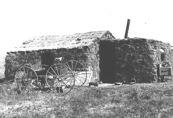
The original settlers of Eastern Colorado were German immigrants who farmed in the area. Many of the family farms in the region are still operated by the descendants of these immigrants.Population
The Eastern Colorado plains are among the most sparsely populated areas in the continental United States. Some of the region, with the exception of comparatively urban areas like SterlingSterling, Colorado
The City of Sterling is a Home Rule Municipality that is the county seat and the most populous city of Logan County, Colorado, United States. The city population was 14,777 at the 2010 census.-Geography:Sterling is located at...
, is experiencing depopulation, which in some areas began with the influenza pandemic of 1918
Spanish flu
The 1918 flu pandemic was an influenza pandemic, and the first of the two pandemics involving H1N1 influenza virus . It was an unusually severe and deadly pandemic that spread across the world. Historical and epidemiological data are inadequate to identify the geographic origin...
and agricultural price collapses after World War I
World War I
World War I , which was predominantly called the World War or the Great War from its occurrence until 1939, and the First World War or World War I thereafter, was a major war centred in Europe that began on 28 July 1914 and lasted until 11 November 1918...
. The Dust Bowl
Dust Bowl
The Dust Bowl, or the Dirty Thirties, was a period of severe dust storms causing major ecological and agricultural damage to American and Canadian prairie lands from 1930 to 1936...
devastated the region and further accelerated this outmigration. Kiowa County
Kiowa County, Colorado
Kiowa County is the second least densely populated of the 64 counties of the State of Colorado of the United States. The county population was 1,622 at the 2000 census. The county seat is Eads...
demonstrates the population decline and its associated effects.
Parks
Both the Pawnee National Grasslands and Comanche National GrasslandComanche National Grassland
Comanche National Grassland is a National Grassland located in southeastern Colorado, United States. It is the sister grassland of Cimarron National Grassland and contains both prairie grasslands and canyons. It is separated into two sections, each operated by a local ranger district, one of which...
s are located in the Eastern Plains. They are composed of marginal farmlands that were withdrawn from agriculture and consolidated under federal control beginning in the Dust Bowl.
Agriculture
Eastern Colorado is largely farmlandFarmland
Farmland generally refers to agricultural land, or land currently used for the purposes of farming. It may also refer to:*Arable land, land capable of cultivating crops*Farmland, Indiana, a town in the United States...
, with many small farming communities. The major cash crops are corn
Corn
Corn is the name used in the United States, Canada, and Australia for the grain maize.In much of the English-speaking world, the term "corn" is a generic term for cereal crops, such as* Barley* Oats* Wheat* Rye- Places :...
, wheat
Wheat
Wheat is a cereal grain, originally from the Levant region of the Near East, but now cultivated worldwide. In 2007 world production of wheat was 607 million tons, making it the third most-produced cereal after maize and rice...
, hay
Hay
Hay is grass, legumes or other herbaceous plants that have been cut, dried, and stored for use as animal fodder, particularly for grazing livestock such as cattle, horses, goats, and sheep. Hay is also fed to pets such as rabbits and guinea pigs...
, oats
OATS
OATS - Open Source Assistive Technology Software - is a source code repository or "forge" for assistive technology software. It was launched in 2006 with the goal to provide a one-stop “shop” for end users, clinicians and open-source developers to promote and develop open source assistive...
, and soybeans. There is also significant livestock
Livestock
Livestock refers to one or more domesticated animals raised in an agricultural setting to produce commodities such as food, fiber and labor. The term "livestock" as used in this article does not include poultry or farmed fish; however the inclusion of these, especially poultry, within the meaning...
farming, dairy
Dairy
A dairy is a business enterprise established for the harvesting of animal milk—mostly from cows or goats, but also from buffalo, sheep, horses or camels —for human consumption. A dairy is typically located on a dedicated dairy farm or section of a multi-purpose farm that is concerned...
and poultry
Poultry
Poultry are domesticated birds kept by humans for the purpose of producing eggs, meat, and/or feathers. These most typically are members of the superorder Galloanserae , especially the order Galliformes and the family Anatidae , commonly known as "waterfowl"...
farming, including chicken
Chicken
The chicken is a domesticated fowl, a subspecies of the Red Junglefowl. As one of the most common and widespread domestic animals, and with a population of more than 24 billion in 2003, there are more chickens in the world than any other species of bird...
for meat and eggs, and turkey
Turkey
Turkey , known officially as the Republic of Turkey , is a Eurasian country located in Western Asia and in East Thrace in Southeastern Europe...
farming. Most of the towns in the region have grain elevators and prominent water towers. Also, over 90% of the farms in Eastern Colorado are family farms.
Education
In Eastern Colorado most small towns have their own schools and sports teams, but in some parts where depopulation has been the worst, a single school is shared among surrounding towns. There are also a number of schools serving students in grades K-12 run by religious groups or public school districts. Eastern Colorado is one of the few remaining places in the United States with still operating one room school houses.Religion
The most prominent religion in Eastern Colorado is ChristianityChristianity
Christianity is a monotheistic religion based on the life and teachings of Jesus as presented in canonical gospels and other New Testament writings...
, with Roman Catholicism the largest denomination.
Transportation
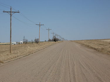
Eastern Colorado roads span the gamut from paved roads to gravel roads to dirt roads. The unpaved roads are typically county or local roads that do not receive enough traffic to be paved. Some of the major paved roads include:- Interstate 76Interstate 76Interstate 76 may refer to:* Interstate 76 , an Interstate Highway in the United States, running through New Jersey, Pennsylvania, and Ohio* Interstate 76 , an Interstate Highway in the United States, running through Nebraska and Colorado...
- Interstate 70Interstate 70Interstate 70 is an Interstate Highway in the United States that runs from Interstate 15 near Cove Fort, Utah, to a Park and Ride near Baltimore, Maryland. It was the first Interstate Highway project in the United States. I-70 approximately traces the path of U.S. Route 40 east of the Rocky...
- US Route 6
- US Route 24
- US Route 36
- US Route 40
- US Route 50
- US Route 160
- US Route 287
- US Route 350
- US Route 385
- CO Highway 10
- CO Highway 11
- CO Highway 36
- CO Highway 59Colorado State Highway 59State Highway 59 is a long state highway in eastern Colorado.-Route description:SH 59 begins in the south at a junction with U.S. Highway 40 in Kit Carson. From there, the road proceeds northward for before intersecting Interstate 70 at that highway's exit 405 just south of the Seibert city...
- CO Highway 71Colorado State Highway 71State Highway 71 is a long state highway passing several other highways in northern and central Colorado. The route runs south from the Nebraska border to La Junta.-Route description:...
- CO Highway 86Colorado State Highway 86State Highway 86 is a state highway that runs from the US 85 interchange in Castle Rock just before I-25 to I-70 near Limon. It gives service through eastern Castle Rock to Franktown and then to Elizabeth then from Kiowa to I-70 ....
- CO Highway 94Colorado State Highway 94State Highway 94 is an long east–west Colorado state highway that goes east beginning from US 24 just east of Colorado Springs and ending at U.S. Highway 40/U.S. Highway 287 in rural Cheyenne County west of Wild Horse. The highway serves Schriever Air Force Base and the towns of Ellicott,...
- CO Highway 96Colorado State Highway 96State Highway 96 is a state highway in eastern Colorado. Its eastern terminus is at the Kansas state line east of Towner where it continues as K-96; its western terminus is at State Highway 69 at Westcliffe....

