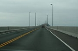
Confederation Bridge
Overview
Bridge
A bridge is a structure built to span physical obstacles such as a body of water, valley, or road, for the purpose of providing passage over the obstacle...
spanning the Abegweit Passage
Abegweit Passage
Abegweit Passage is the narrowest part of the Northumberland Strait, comprising the 13-kilometre wide portion between Cape Tryon, Prince Edward Island, and Cape Tormentine, New Brunswick. Tidal currents in this area can reach up to 4 knots...
of Northumberland Strait
Northumberland Strait
The Northumberland Strait is a strait in the southern part of the Gulf of Saint Lawrence in eastern Canada...
, linking Prince Edward Island
Prince Edward Island
Prince Edward Island is a Canadian province consisting of an island of the same name, as well as other islands. The maritime province is the smallest in the nation in both land area and population...
with mainland New Brunswick
New Brunswick
New Brunswick is one of Canada's three Maritime provinces and is the only province in the federation that is constitutionally bilingual . The provincial capital is Fredericton and Saint John is the most populous city. Greater Moncton is the largest Census Metropolitan Area...
, Canada
Canada
Canada is a North American country consisting of ten provinces and three territories. Located in the northern part of the continent, it extends from the Atlantic Ocean in the east to the Pacific Ocean in the west, and northward into the Arctic Ocean...
. It was commonly referred to as the "Fixed Link" by residents of Prince Edward Island prior to its official naming. Construction took place from the autumn of 1993 to the spring of 1997, costing C$
Canadian dollar
The Canadian dollar is the currency of Canada. As of 2007, the Canadian dollar is the 7th most traded currency in the world. It is abbreviated with the dollar sign $, or C$ to distinguish it from other dollar-denominated currencies...
1.3 billion. The 12.9 kilometres (8 mi) long bridge opened on 31 May 1997.
The bridge is a two-lane highway toll bridge that carries the Trans-Canada Highway
Trans-Canada Highway
The Trans-Canada Highway is a federal-provincial highway system that joins the ten provinces of Canada. It is, along with the Trans-Siberian Highway and Australia's Highway 1, one of the world's longest national highways, with the main route spanning 8,030 km...
between Borden-Carleton, Prince Edward Island
Borden-Carleton, Prince Edward Island
Borden-Carleton is a Canadian village located on the south shore of Prince Edward Island, fronting on the Northumberland Strait.The village was created through a merger on April 12, 1995 of the original port town of Borden and the farming community of Carleton...
(at Route 1) and Cape Jourimain, New Brunswick
Cape Jourimain, New Brunswick
Cape Jourimain is a headland in the western part of the Northumberland Strait on its southern shore, 3 kilometres west of New Brunswick's easternmost point at Cape Tormentine....
(at Route 16
New Brunswick Route 16
Route 16 is a secondary leg of the Trans-Canada Highway . The 51 kilometre-long route goes from an interchange with the mainline TCH near the Nova Scotia border in Aulac, to the Confederation Bridge at Cape Jourimain, connecting New Brunswick to Prince Edward Island...
).
It is a multi-span post-tensioned concrete box girder
Box girder bridge
A box girder bridge is a bridge in which the main beams comprise girders in the shape of a hollow box. The box girder normally comprises either prestressed concrete, structural steel, or a composite of steel and reinforced concrete. The box is typically rectangular or trapezoidal in cross-section...
structure.

