Conger Range
Encyclopedia
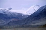
The Conger Range, also called the Conger Mountains, is a mountain range
in Quttinirpaaq National Park
on Ellesmere Island
, Nunavut
, Canada
, beginning about 16 km (10 mi) west of Mount Osborne
. It is part of the Arctic Cordillera
which is a vast dissected mountain system extending from Ellesmere Island to the northernmost tip of Labrador
and northeastern Quebec
. The Conger Range is a structural extension of the Garfield Range
and continues into the highlands north of the head of Hare Fiord. The overall extent of the range is about 180 km (112 mi). Most of its peaks are ice-covered, although nearly all of the southern slopes are ice-free. Many of the valleys between the peaks are filled with glacial tongues spilling out to the south from the Grand Land Ice Cap. Its highest point is Mount Biederbick
at 1542 m (5,059 ft).
The Conger Range was named by American
Polar
explorer Adolphus Greely
, who sighted them during a dog sleding exploration to the interior of northern Ellesmere Island in 1882.
Mountain range
A mountain range is a single, large mass consisting of a succession of mountains or narrowly spaced mountain ridges, with or without peaks, closely related in position, direction, formation, and age; a component part of a mountain system or of a mountain chain...
in Quttinirpaaq National Park
Quttinirpaaq National Park
-See also:*List of National Parks of Canada*List of protected areas of Nunavut*Arctic Cordillera-External links:**...
on Ellesmere Island
Ellesmere Island
Ellesmere Island is part of the Qikiqtaaluk Region of the Canadian territory of Nunavut. Lying within the Canadian Arctic Archipelago, it is considered part of the Queen Elizabeth Islands, with Cape Columbia being the most northerly point of land in Canada...
, Nunavut
Nunavut
Nunavut is the largest and newest federal territory of Canada; it was separated officially from the Northwest Territories on April 1, 1999, via the Nunavut Act and the Nunavut Land Claims Agreement Act, though the actual boundaries had been established in 1993...
, Canada
Canada
Canada is a North American country consisting of ten provinces and three territories. Located in the northern part of the continent, it extends from the Atlantic Ocean in the east to the Pacific Ocean in the west, and northward into the Arctic Ocean...
, beginning about 16 km (10 mi) west of Mount Osborne
Mount Osborne
Mount Osborne is a mountain on the southwest side of Thomas Glacier, 5 nautical miles east of Mount Craddock, in the Sentinel Range, Ellsworth Mountains. First mapped by United States Geological Survey from surveys and U.S. Navy air photos, 1957-59. Named by Advisory Committee on Antarctic...
. It is part of the Arctic Cordillera
Arctic Cordillera
The Arctic Cordillera is a vast, deeply dissected chain of mountain ranges extending along the northeastern flank of the Canadian Arctic Archipelago from Ellesmere Island to the northeasternmost part of the Labrador Peninsula in northern Labrador and northern Quebec, Canada...
which is a vast dissected mountain system extending from Ellesmere Island to the northernmost tip of Labrador
Labrador
Labrador is the distinct, northerly region of the Canadian province of Newfoundland and Labrador. It comprises the mainland portion of the province, separated from the island of Newfoundland by the Strait of Belle Isle...
and northeastern Quebec
Quebec
Quebec or is a province in east-central Canada. It is the only Canadian province with a predominantly French-speaking population and the only one whose sole official language is French at the provincial level....
. The Conger Range is a structural extension of the Garfield Range
Garfield Range
The Garfield Range is a mountain range on Ellesmere Island, Nunavut, Canada. The mountains are made of Paleozoic rocks and rise to heights between and and are separated by valleys through which flow the major rivers fed by the ice fields and glaciers...
and continues into the highlands north of the head of Hare Fiord. The overall extent of the range is about 180 km (112 mi). Most of its peaks are ice-covered, although nearly all of the southern slopes are ice-free. Many of the valleys between the peaks are filled with glacial tongues spilling out to the south from the Grand Land Ice Cap. Its highest point is Mount Biederbick
Mount Biederbick
Mount Biederbick is the highest mountain of the Conger Range on Ellesmere Island, Nunavut, Canada. It lies in Quttinirpaaq National Park.-External links: in the Canadian Mountain Encyclopedia...
at 1542 m (5,059 ft).
The Conger Range was named by American
United States
The United States of America is a federal constitutional republic comprising fifty states and a federal district...
Polar
Polar region
Earth's polar regions are the areas of the globe surrounding the poles also known as frigid zones. The North Pole and South Pole being the centers, these regions are dominated by the polar ice caps, resting respectively on the Arctic Ocean and the continent of Antarctica...
explorer Adolphus Greely
Adolphus Greely
Adolphus Washington Greely , was an American Polar explorer, a United States Army officer and a recipient of the Medal of Honor.-Early military career:...
, who sighted them during a dog sleding exploration to the interior of northern Ellesmere Island in 1882.

