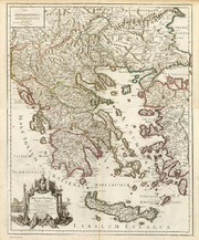
David Rumsey Historical Map Collection
Encyclopedia

Map collection
A map collection is a storage facility for maps, usually in a library, archive, or museum, or at a map publisher or public authority, and the maps and other cartographic items stored within that facility....
s. It has some 150,000 map
Map
A map is a visual representation of an area—a symbolic depiction highlighting relationships between elements of that space such as objects, regions, and themes....
s and cartographic
Cartography
Cartography is the study and practice of making maps. Combining science, aesthetics, and technique, cartography builds on the premise that reality can be modeled in ways that communicate spatial information effectively.The fundamental problems of traditional cartography are to:*Set the map's...
items. The collection was created by David Rumsey
David Rumsey
David Rumsey is a map collector and the founder of the David Rumsey Map Collection. He is also the president of Cartography Associates.Rumsey has a Bachelor of Arts and a Master of Fine Arts from Yale University and was a founding member of Yale Research Associates in the Arts...
, who after making his fortune in real estate
Real estate
In general use, esp. North American, 'real estate' is taken to mean "Property consisting of land and the buildings on it, along with its natural resources such as crops, minerals, or water; immovable property of this nature; an interest vested in this; an item of real property; buildings or...
, focused on collecting 18th- and 19th century North
North America
North America is a continent wholly within the Northern Hemisphere and almost wholly within the Western Hemisphere. It is also considered a northern subcontinent of the Americas...
and South America
South America
South America is a continent situated in the Western Hemisphere, mostly in the Southern Hemisphere, with a relatively small portion in the Northern Hemisphere. The continent is also considered a subcontinent of the Americas. It is bordered on the west by the Pacific Ocean and on the north and east...
as this era "saw the rise of modern cartography
Cartography
Cartography is the study and practice of making maps. Combining science, aesthetics, and technique, cartography builds on the premise that reality can be modeled in ways that communicate spatial information effectively.The fundamental problems of traditional cartography are to:*Set the map's...
."
There are now over 17,000 digitized maps available through his website, http://www.davidrumsey.com, and about a dozen of which are currently being hosted through Google Earth
Google Earth
Google Earth is a virtual globe, map and geographical information program that was originally called EarthViewer 3D, and was created by Keyhole, Inc, a Central Intelligence Agency funded company acquired by Google in 2004 . It maps the Earth by the superimposition of images obtained from satellite...
layers. Select maps are also featured at the Rumsey Maps island in Second Life.
Second Life
Second Life is an online virtual world developed by Linden Lab. It was launched on June 23, 2003. A number of free client programs, or Viewers, enable Second Life users, called Residents, to interact with each other through avatars...
The website presents maps using two Insight viewers from Luna Imaging, Inc.—one using Javascript
JavaScript
JavaScript is a prototype-based scripting language that is dynamic, weakly typed and has first-class functions. It is a multi-paradigm language, supporting object-oriented, imperative, and functional programming styles....
and the other using Java—from files stored in MrSID
MrSID
-External links:* from LizardTech's website...
format on its server. Maps can be exported as JPEG
JPEG
In computing, JPEG . The degree of compression can be adjusted, allowing a selectable tradeoff between storage size and image quality. JPEG typically achieves 10:1 compression with little perceptible loss in image quality....
from the Java viewer.
In February 2009, David Rumsey
David Rumsey
David Rumsey is a map collector and the founder of the David Rumsey Map Collection. He is also the president of Cartography Associates.Rumsey has a Bachelor of Arts and a Master of Fine Arts from Yale University and was a founding member of Yale Research Associates in the Arts...
announced that the entire collection would be donated to Stanford University
Stanford University
The Leland Stanford Junior University, commonly referred to as Stanford University or Stanford, is a private research university on an campus located near Palo Alto, California. It is situated in the northwestern Santa Clara Valley on the San Francisco Peninsula, approximately northwest of San...
, including 150,000 maps and their digital image
Digital image
A digital image is a numeric representation of a two-dimensional image. Depending on whether or not the image resolution is fixed, it may be of vector or raster type...
s, plus the davidrumsey.com web site (where the images are publicly posted on-line), as well as the database used to track the images.

