
Cartography
Encyclopedia
Map
A map is a visual representation of an area—a symbolic depiction highlighting relationships between elements of that space such as objects, regions, and themes....
s. Combining science, aesthetics
Aesthetics
Aesthetics is a branch of philosophy dealing with the nature of beauty, art, and taste, and with the creation and appreciation of beauty. It is more scientifically defined as the study of sensory or sensori-emotional values, sometimes called judgments of sentiment and taste...
, and technique, cartography builds on the premise that reality can be modeled in ways that communicate spatial information effectively.
The fundamental problems of traditional cartography are to:
- Set the map's agenda and select traits of the object to be mapped. This is the concern of map editing. Traits may be physical, such as roads or land masses, or may be abstract, such as toponyms or political boundaries.
- Represent the terrain of the mapped object on flat media. This is the concern of map projectionMap projectionA map projection is any method of representing the surface of a sphere or other three-dimensional body on a plane. Map projections are necessary for creating maps. All map projections distort the surface in some fashion...
s. - Eliminate characteristics of the mapped object that are not relevant to the map's purpose. This is the concern of generalizationCartographic generalizationCartographic generalization is the method whereby information is selected and represented on a map in a way that adapts to the scale of the display medium of the map, not necessarily preserving all intricate geographical or other cartographic details...
. - Reduce the complexity of the characteristics that will be mapped. This is also the concern of generalization.
- Orchestrate the elements of the map to best convey its message to its audience. This is the concern of map design.
Modern cartography is closely integrated with geographic information science (GIScience) and constitutes many theoretical and practical foundations of geographic information system
Geographic Information System
A geographic information system, geographical information science, or geospatial information studies is a system designed to capture, store, manipulate, analyze, manage, and present all types of geographically referenced data...
s.
History
Çatalhöyük
Çatalhöyük was a very large Neolithic and Chalcolithic settlement in southern Anatolia, which existed from approximately 7500 BCE to 5700 BCE...
(previously known as Catal Huyuk or Çatal Hüyük), has been dated to the late 7th millennium BCE. Other known maps of the ancient world include the Minoan
Minoan civilization
The Minoan civilization was a Bronze Age civilization that arose on the island of Crete and flourished from approximately the 27th century BC to the 15th century BC. It was rediscovered at the beginning of the 20th century through the work of the British archaeologist Arthur Evans...
"House of the Admiral" wall painting from c. 1600 BCE, showing a seaside community in an oblique perspective and an engraved map of the holy Babylonia
Babylonia
Babylonia was an ancient cultural region in central-southern Mesopotamia , with Babylon as its capital. Babylonia emerged as a major power when Hammurabi Babylonia was an ancient cultural region in central-southern Mesopotamia (present-day Iraq), with Babylon as its capital. Babylonia emerged as...
n city of Nippur
Nippur
Nippur was one of the most ancient of all the Sumerian cities. It was the special seat of the worship of the Sumerian god Enlil, the "Lord Wind," ruler of the cosmos subject to An alone...
, from the Kassite
Kassites
The Kassites were an ancient Near Eastern people who gained control of Babylonia after the fall of the Old Babylonian Empire after ca. 1531 BC to ca. 1155 BC...
period (14th 12th centuries BCE). The oldest surviving world maps are the Babylonian world maps from the 9th century BCE. One shows Babylon
Babylon
Babylon was an Akkadian city-state of ancient Mesopotamia, the remains of which are found in present-day Al Hillah, Babil Province, Iraq, about 85 kilometers south of Baghdad...
on the Euphrates
Euphrates
The Euphrates is the longest and one of the most historically important rivers of Western Asia. Together with the Tigris, it is one of the two defining rivers of Mesopotamia...
, surrounded by a circular landmass showing Assyria
Assyria
Assyria was a Semitic Akkadian kingdom, extant as a nation state from the mid–23rd century BC to 608 BC centred on the Upper Tigris river, in northern Mesopotamia , that came to rule regional empires a number of times through history. It was named for its original capital, the ancient city of Assur...
, Urartu
Urartu
Urartu , corresponding to Ararat or Kingdom of Van was an Iron Age kingdom centered around Lake Van in the Armenian Highland....
and several cities, in turn surrounded by a "bitter river" (Oceanus
Oceanus
Oceanus ; , Ōkeanós) was a pseudo-geographical feature in classical antiquity, believed by the ancient Greeks and Romans to be the world-ocean, an enormous river encircling the world....
), with seven islands arranged around it. Another depicts Babylon as being further north from the center of the world.
The ancient Greeks and Romans
Roman Empire
The Roman Empire was the post-Republican period of the ancient Roman civilization, characterised by an autocratic form of government and large territorial holdings in Europe and around the Mediterranean....
created maps, beginning at latest with Anaximander
Anaximander
Anaximander was a pre-Socratic Greek philosopher who lived in Miletus, a city of Ionia; Milet in modern Turkey. He belonged to the Milesian school and learned the teachings of his master Thales...
in the 6th century BC. In the 2nd century AD, Ptolemy
Ptolemy
Claudius Ptolemy , was a Roman citizen of Egypt who wrote in Greek. He was a mathematician, astronomer, geographer, astrologer, and poet of a single epigram in the Greek Anthology. He lived in Egypt under Roman rule, and is believed to have been born in the town of Ptolemais Hermiou in the...
produced his treatise
Treatise
A treatise is a formal and systematic written discourse on some subject, generally longer and treating it in greater depth than an essay, and more concerned with investigating or exposing the principles of the subject.-Noteworthy treatises:...
on cartography, Geographia. This contained Ptolemy's world map
Ptolemy's world map
The Ptolemy world map is a map of the known world to Western society in the 2nd century AD. It was based on the description contained in Ptolemy's book Geographia, written c. 150...
- the world then known to Western society (Ecumene). As early as the 8th century, Arab scholars were translating the works of the Greek geographers into Arabic.
In ancient China, geographical literature spans back to the 5th century BC. The oldest extant Chinese maps come from the State of Qin
Qin (state)
The State of Qin was a Chinese feudal state that existed during the Spring and Autumn and Warring States Periods of Chinese history...
, dated back to the 4th century BC, during the Warring States Period
Warring States Period
The Warring States Period , also known as the Era of Warring States, or the Warring Kingdoms period, covers the Iron Age period from about 475 BC to the reunification of China under the Qin Dynasty in 221 BC...
. In the book of the Xin Yi Xiang Fa Yao, published in 1092 by the Chinese
China
Chinese civilization may refer to:* China for more general discussion of the country.* Chinese culture* Greater China, the transnational community of ethnic Chinese.* History of China* Sinosphere, the area historically affected by Chinese culture...
scientist Su Song
Su Song
Su Song was a renowned Chinese polymath who specialized himself as a statesman, astronomer, cartographer, horologist, pharmacologist, mineralogist, zoologist, botanist, mechanical and architectural engineer, poet, antiquarian, and ambassador of the Song Dynasty .Su Song was the engineer of a...
, a star map on the equidistant cylindrical projection. Although this method of charting seems to have existed in China even prior to this publication and scientist, the greatest significance of the star maps by Su Song is that they represent the oldest existent star maps in printed
Printing
Printing is a process for reproducing text and image, typically with ink on paper using a printing press. It is often carried out as a large-scale industrial process, and is an essential part of publishing and transaction printing....
form.
Early forms of cartography of India
Cartography of India
The cartography of India begins with early charts for navigation and constructional plans for buildings. Indian traditions influenced Tibetan and Islamic traditions, and in turn, were influenced by the British cartographers who solidified modern concepts into India's map making.A prominent foreign...
included the locations of the Pole star
Pole star
The term "Pole Star" usually refers to Polaris, which is the current northern pole star, also known as the North Star.In general, however, a pole star is a visible star, especially a prominent one, that is approximately aligned with the Earth's axis of rotation; that is, a star whose apparent...
and other constellations of use. These charts may have been in use by the beginning of the Common Era
Common Era
Common Era ,abbreviated as CE, is an alternative designation for the calendar era originally introduced by Dionysius Exiguus in the 6th century, traditionally identified with Anno Domini .Dates before the year 1 CE are indicated by the usage of BCE, short for Before the Common Era Common Era...
for purposes of navigation.
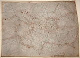
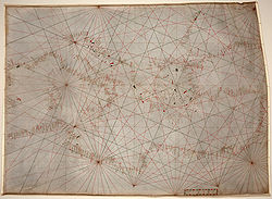
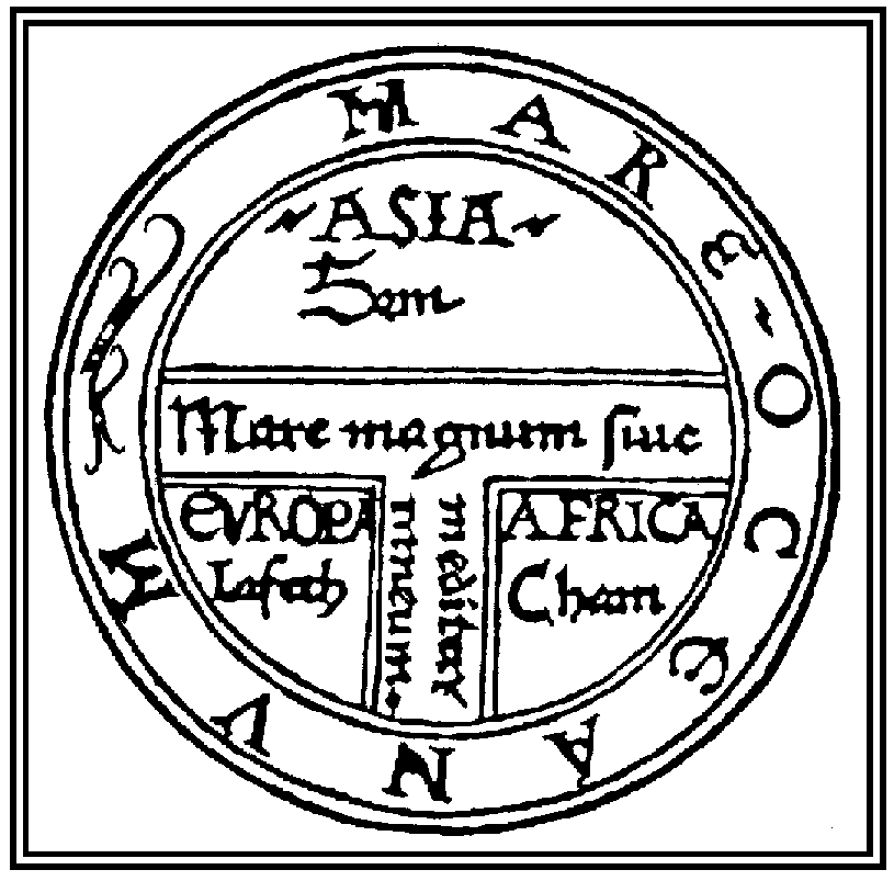
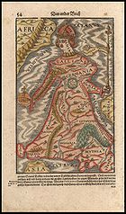
Mappa mundi
Mappa mundi
Mappa mundi is a general term used to describe medieval European maps of the world. These maps range in size and complexity from simple schematic maps an inch or less across to elaborate wall maps, the largest of which was 11 ft. in diameter...
is the general term used to describe Medieval European maps of the world. Approximately 1,100 mappae mundi are known to have survived from the Middle Ages
Middle Ages
The Middle Ages is a periodization of European history from the 5th century to the 15th century. The Middle Ages follows the fall of the Western Roman Empire in 476 and precedes the Early Modern Era. It is the middle period of a three-period division of Western history: Classic, Medieval and Modern...
. Of these, some 900 are found illustrating manuscripts and the remainder exist as stand-alone documents.
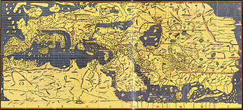
Muhammad al-Idrisi
Abu Abd Allah Muhammad al-Idrisi al-Qurtubi al-Hasani al-Sabti or simply Al Idrisi was a Moroccan Muslim geographer, cartographer, Egyptologist and traveller who lived in Sicily, at the court of King Roger II. Muhammed al-Idrisi was born in Ceuta then belonging to the Almoravid Empire and died in...
produced his medieval atlas Tabula Rogeriana
Tabula Rogeriana
The Nuzhat al-mushtaq fi'khtiraq al-afaq lit. "the book of pleasant journeys into faraway lands", most often known as the Tabula Rogeriana , is a description of the world and world map created by the Arab geographer, Muhammad al-Idrisi, in 1154...
in 1154. He incorporated the knowledge of Africa
Africa
Africa is the world's second largest and second most populous continent, after Asia. At about 30.2 million km² including adjacent islands, it covers 6% of the Earth's total surface area and 20.4% of the total land area...
, the Indian Ocean
Indian Ocean
The Indian Ocean is the third largest of the world's oceanic divisions, covering approximately 20% of the water on the Earth's surface. It is bounded on the north by the Indian Subcontinent and Arabian Peninsula ; on the west by eastern Africa; on the east by Indochina, the Sunda Islands, and...
and the Far East
Far East
The Far East is an English term mostly describing East Asia and Southeast Asia, with South Asia sometimes also included for economic and cultural reasons.The term came into use in European geopolitical discourse in the 19th century,...
, gathered by Arab merchants
Islamic economics in the world
Islamic economics in practice, or economic policies supported by self-identified Islamic groups, has varied throughout its long history. Traditional Islamic concepts having to do with economics included...
and explorers with the information inherited from the classical geographers to create the most accurate map of the world up until his time. It remained the most accurate world map for the next three centuries.
Europe
Europe is, by convention, one of the world's seven continents. Comprising the westernmost peninsula of Eurasia, Europe is generally 'divided' from Asia to its east by the watershed divides of the Ural and Caucasus Mountains, the Ural River, the Caspian and Black Seas, and the waterways connecting...
an cartographers both copied earlier maps (some of which had been passed down for centuries) and drew their own based on explorers' observations and new surveying
Surveying
See Also: Public Land Survey SystemSurveying or land surveying is the technique, profession, and science of accurately determining the terrestrial or three-dimensional position of points and the distances and angles between them...
techniques. The invention of the magnetic compass, telescope
Telescope
A telescope is an instrument that aids in the observation of remote objects by collecting electromagnetic radiation . The first known practical telescopes were invented in the Netherlands at the beginning of the 1600s , using glass lenses...
and sextant
Sextant
A sextant is an instrument used to measure the angle between any two visible objects. Its primary use is to determine the angle between a celestial object and the horizon which is known as the altitude. Making this measurement is known as sighting the object, shooting the object, or taking a sight...
enabled increasing accuracy. In 1492, Martin Behaim
Martin Behaim
Martin Behaim , was a German mariner, artist, cosmographer, astronomer, philosopher, geographer and explorer in service to the King of Portugal.-Biography:The Behaim family had immigrated to Nuremberg because of religious persecution around...
, a German cartographer, made the oldest extant globe of the Earth.
Johannes Werner
Johannes Werner
Johann Werner was a German parish priest in Nuremberg and a mathematician...
refined and promoted the Werner map projection
Map projection
A map projection is any method of representing the surface of a sphere or other three-dimensional body on a plane. Map projections are necessary for creating maps. All map projections distort the surface in some fashion...
. In 1507, Martin Waldseemüller
Martin Waldseemüller
Martin Waldseemüller was a German cartographer...
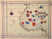
produced a globular world map and a large 12-panel world wall map (Universalis Cosmographia) bearing the first use of the name "America". Portuguese
Portugal
Portugal , officially the Portuguese Republic is a country situated in southwestern Europe on the Iberian Peninsula. Portugal is the westernmost country of Europe, and is bordered by the Atlantic Ocean to the West and South and by Spain to the North and East. The Atlantic archipelagos of the...
cartographer Diego Ribero
Diego Ribero
Diogo Ribeiro, also known as Diego Ribero, was a Portuguese cartographer and explorer who worked most of his life in Spain. He worked on the official maps of the Padron Real from 1518-1532...
was the author of the first known planisphere with a graduated Equator (1527). Italian
Italy
Italy , officially the Italian Republic languages]] under the European Charter for Regional or Minority Languages. In each of these, Italy's official name is as follows:;;;;;;;;), is a unitary parliamentary republic in South-Central Europe. To the north it borders France, Switzerland, Austria and...
cartographer Battista Agnese
Battista Agnese
Battista Agnese was a cartographer from the Republic of Genoa, who worked in the Venetian Republic.In 1525 he prepared an early map of Muscovy that was based on the geographical data, narrated to Paolo Giovio by the Russian ambassador Dmitry Gerasimov.His workshop produced at least 71 manuscript...
produced at least 71 manuscript atlases of sea charts.
Due to the sheer physical difficulties inherent in cartography, map-makers frequently lifted material from earlier works without giving credit to the original cartographer. For example, one of the most famous early maps of North America is unofficially known as the "Beaver Map", published in 1715 by Herman Moll
Herman Moll
Herman Moll , was a cartographer, engraver, and publisher. Moll moved to England in 1678 and opened a book and map store in London...
. This map is an exact reproduction of a 1698 work by Nicolas de Fer. De Fer in turn had copied images that were first printed in books by Louis Hennepin
Louis Hennepin
Father Louis Hennepin, O.F.M. baptized Antoine, was a Catholic priest and missionary of the Franciscan Recollect order and an explorer of the interior of North America....
, published in 1697, and François Du Creux, in 1664. By the 18th century, map-makers started to give credit to the original engraver by printing the phrase "After [the original cartographer]" on the work.
Technological changes
Compass
A compass is a navigational instrument that shows directions in a frame of reference that is stationary relative to the surface of the earth. The frame of reference defines the four cardinal directions – north, south, east, and west. Intermediate directions are also defined...
and much later, magnetic storage
Magnetic storage
Magnetic storage and magnetic recording are terms from engineering referring to the storage of data on a magnetized medium. Magnetic storage uses different patterns of magnetization in a magnetizable material to store data and is a form of non-volatile memory. The information is accessed using...
devices, allowed for the creation of far more accurate maps and the ability to store and manipulate them digitally.
Advances in mechanical devices such as the printing press
Printing press
A printing press is a device for applying pressure to an inked surface resting upon a print medium , thereby transferring the ink...
, quadrant
Quadrant (instrument)
A quadrant is an instrument that is used to measure angles up to 90°. It was originally proposed by Ptolemy as a better kind of astrolabe. Several different variations of the instrument were later produced by medieval Muslim astronomers.-Types of quadrants:...
and vernier
Vernier scale
A vernier scale is an additional scale which allows a distance or angle measurement to be read more precisely than directly reading a uniformly-divided straight or circular measurement scale...
, allowed for the mass production of maps and the ability to make accurate reproductions from more accurate data. Optical technology, such as the telescope
Telescope
A telescope is an instrument that aids in the observation of remote objects by collecting electromagnetic radiation . The first known practical telescopes were invented in the Netherlands at the beginning of the 1600s , using glass lenses...
, sextant
Sextant
A sextant is an instrument used to measure the angle between any two visible objects. Its primary use is to determine the angle between a celestial object and the horizon which is known as the altitude. Making this measurement is known as sighting the object, shooting the object, or taking a sight...
and other devices that use telescopes, allowed for accurate surveying of land and the ability of mapmakers and navigators to find their latitude
Latitude
In geography, the latitude of a location on the Earth is the angular distance of that location south or north of the Equator. The latitude is an angle, and is usually measured in degrees . The equator has a latitude of 0°, the North pole has a latitude of 90° north , and the South pole has a...
by measuring angles to the North Star at night or the sun
Sun
The Sun is the star at the center of the Solar System. It is almost perfectly spherical and consists of hot plasma interwoven with magnetic fields...
at noon.
Advances in photochemical technology, such as the lithographic
Lithography
Lithography is a method for printing using a stone or a metal plate with a completely smooth surface...
and photochemical processes
Photography
Photography is the art, science and practice of creating durable images by recording light or other electromagnetic radiation, either electronically by means of an image sensor or chemically by means of a light-sensitive material such as photographic film...
, have allowed for the creation of maps that have fine details, do not distort in shape and resist moisture and wear. This also eliminated the need for engraving, which further shortened the time it takes to make and reproduce maps.
Advances in electronic technology in the 20th century ushered in another revolution in cartography. Ready availability of computers and peripherals
Computer hardware
Personal computer hardware are component devices which are typically installed into or peripheral to a computer case to create a personal computer upon which system software is installed including a firmware interface such as a BIOS and an operating system which supports application software that...
such as monitors, plotters, printers, scanners (remote and document) and analytic stereo plotters, along with computer programs for visualization, image processing, spatial analysis, and database management, have democratized and greatly expanded the making of maps. The ability to superimpose spatially located variables onto existing maps created new uses for maps and new industries to explore and exploit these potentials. See also: digital raster graphic
Digital raster graphic
A digital raster graphic is a digital image resulting from scanning a paper USGS topographic map for use on a computer. DRGs created by USGS are typically scanned at 250 dpi and saved as a TIFF. The raster image usually includes the original border information, referred to as the "map collar". ...
.
These days most commercial-quality maps are made using software that falls into one of three main types: CAD
Computer-aided design
Computer-aided design , also known as computer-aided design and drafting , is the use of computer technology for the process of design and design-documentation. Computer Aided Drafting describes the process of drafting with a computer...
, GIS
Geographic Information System
A geographic information system, geographical information science, or geospatial information studies is a system designed to capture, store, manipulate, analyze, manage, and present all types of geographically referenced data...
and specialized illustration software. Spatial information can be stored in a database
Database
A database is an organized collection of data for one or more purposes, usually in digital form. The data are typically organized to model relevant aspects of reality , in a way that supports processes requiring this information...
, from which it can be extracted on demand. These tools lead to increasingly dynamic, interactive map
Map
A map is a visual representation of an area—a symbolic depiction highlighting relationships between elements of that space such as objects, regions, and themes....
s that can be manipulated digitally.
With the field rugged computers
Rugged computer
A rugged computer is a computer specifically designed to reliably operate in harsh usage environments and conditions, such as strong vibrations, extreme temperatures and wet or dusty conditions...
, GPS and laser rangefinders, it is possible to perform mapping directly in the terrain. Construction of a map in real time, for example by using Field-Map
Field-map
Field-Map is an integrated tool designed for computer aided field data collection. It is used mainly for mapping of forest ecosystems and for data collection during field examinations. This application is able to work with multi-level relational database and also provides smooth communication with...
technology, improves productivity and quality of the result.
General vs thematic cartography
United States Geological Survey
The United States Geological Survey is a scientific agency of the United States government. The scientists of the USGS study the landscape of the United States, its natural resources, and the natural hazards that threaten it. The organization has four major science disciplines, concerning biology,...
(USGS) are a standard as compared to the 1:50,000 scale Canadian maps. The government of the UK produces the classic 1:50,000 (replacing the older 1 inch to 1 mile) "Ordnance Survey
Ordnance Survey
Ordnance Survey , an executive agency and non-ministerial government department of the Government of the United Kingdom, is the national mapping agency for Great Britain, producing maps of Great Britain , and one of the world's largest producers of maps.The name reflects its creation together with...
" maps of the entire UK and with a range of correlated larger- and smaller-scale maps of great detail.
Thematic cartography
Thematic map
A thematic map is a type of map or chart especially designed to show a particular theme connected with a specific geographic area. These maps "can portray physical, social, political, cultural, economic, sociological, agricultural, or any other aspects of a city, state, region,nation , or...
involves maps of specific geographic themes, oriented toward specific audiences. A couple of examples might be a dot map showing corn production in Indiana or a shaded area map of Ohio counties, divided into numerical choropleth
Choropleth map
A choropleth map A choropleth map A choropleth map (Greek χώρος + πληθαίν:, ("area/region" + "multiply") is a thematic map in which areas are shaded or patterned in proportion to the measurement of the statistical variable being displayed on the map, such as population density or per-capita...
classes. As the volume of geographic data has exploded over the last century, thematic cartography has become increasingly useful and necessary to interpret spatial, cultural and social data.
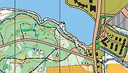
An orienteering
Orienteering
Orienteering is a family of sports that requires navigational skills using a map and compass to navigate from point to point in diverse and usually unfamiliar terrain, and normally moving at speed. Participants are given a topographical map, usually a specially prepared orienteering map, which they...
map combines both general and thematic cartography, designed for a very specific user community. The most prominent thematic element is shading, that indicates degrees of difficulty of travel due to vegetation. The vegetation itself is not identified, merely classified by the difficulty ("fight") that it presents.
Topographic vs topological
A topographic mapTopographic map
A topographic map is a type of map characterized by large-scale detail and quantitative representation of relief, usually using contour lines in modern mapping, but historically using a variety of methods. Traditional definitions require a topographic map to show both natural and man-made features...
is primarily concerned with the topographic
Topography
Topography is the study of Earth's surface shape and features or those ofplanets, moons, and asteroids...
description of a place, including (especially in the 20th and 21st centuries) the use of contour line
Contour line
A contour line of a function of two variables is a curve along which the function has a constant value. In cartography, a contour line joins points of equal elevation above a given level, such as mean sea level...
s showing elevation. Terrain
Terrain
Terrain, or land relief, is the vertical and horizontal dimension of land surface. When relief is described underwater, the term bathymetry is used...
or relief can be shown in a variety of ways (see Cartographic relief depiction
Cartographic relief depiction
Terrain or relief is an essential aspect of physical geography, and as such its portrayal presents a central problem in cartography, and more recently GIS and 3D Visualization....
).
A topological map
Topological map
In cartography and geology, a topological map is one that has been simplified so that only vital information remains and unnecessary detail has been removed. These maps lack scale, and distance and direction are subject to change and variation, but the relationship between points is maintained...
is a very general type of map, the kind you might sketch on a napkin. It often disregards scale and detail in the interest of clarity of communicating specific route or relational information. Beck's
Harry Beck
Henry Charles Beck , known as Harry Beck, was an English engineering draftsman best known for creating the present London Underground Tube map in 1931. Beck drew up the diagram in his spare time while working as an engineering draftsman at the London Underground Signals Office...
London Underground map
Tube map
The Tube map is a schematic transit map representing the lines and stations of London's rapid transit railway systems, namely the London Underground , the Docklands Light Railway and London Overground....
is an iconic example. Though the most widely used map of "The Tube," it preserves little of reality: it varies scale constantly and abruptly, it straightens curved tracks, and it contorts directions. The only topography on it is the River Thames
River Thames
The River Thames flows through southern England. It is the longest river entirely in England and the second longest in the United Kingdom. While it is best known because its lower reaches flow through central London, the river flows alongside several other towns and cities, including Oxford,...
, letting the reader know whether a station is north or south of the river. That and the topology of station order and interchanges between train lines are all that is left of the geographic space. Yet those are all a typical passenger wishes to know, so the map fulfils its purpose.
Map purpose and informations' selection
Arthur H. RobinsonArthur H. Robinson
Arthur H. Robinson was an American geographer and cartographer, who was professor in the Geography Department at the University of Wisconsin in Madison from 1947 until he retired in 1980...
, an American cartographer influential in thematic cartography, stated that a map not properly designed "will be a cartographic failure." He also claimed, when considering all aspects of cartography, that "map design is perhaps the most complex." Robinson codified the mapmaker's understanding that a map must be designed foremost with consideration to the audience and its needs.
From the very beginning of mapmaking, maps "have been made for some particular purpose or set of purposes". The intent of the map should be illustrated in a manner in which the percipient acknowledges its purpose in a timely fashion. The term percipient refers to the person receiving information and was coined by Robinson. The principle of figure-ground
Figure-ground in map design
An effectively designed map is one in which the intended message is clearly communicated to the map user. By employing the concept of figure-ground, a viewer can easily distinguish between the main figure on a map and the background information...
refers to this notion of engaging the user by presenting a clear presentation, leaving no confusion concerning the purpose of the map. This will enhance the user's experience and keep his attention. If the user is unable to identify what is being demonstrated in a reasonable fashion, the map may be regarded as useless.
Making a meaningful map is the ultimate goal. Alan MacEachren
Alan MacEachren
Alan M. MacEachren is an American geographer, Professor of Geography and Director, GeoVISTA Center, Department of Geography, The Pennsylvania State University. He is known for his cross-disciplinary work in the fields of human-centered geographic visualization, scientific and information...
explains that a well designed map "is convincing because it implies authenticity" (1994, pp. 9). An interesting map will no doubt engage a reader. Information richness or a map that is multivariate shows relationships within the map. Showing several variables allows comparison, which adds to the meaningfulness of the map. This also generates hypothesis and stimulates ideas and perhaps further research. In order to convey the message of the map, the creator must design it in a manner which will aid the reader in the overall understanding of its purpose. The title of a map may provide the "needed link" necessary for communicating that message, but the overall design of the map fosters the manner in which the reader interprets it (Monmonier, 1993, pp. 93).
In the 21st century it is possible to find a map of virtually anything from the inner workings of the human body
Human body
The human body is the entire structure of a human organism, and consists of a head, neck, torso, two arms and two legs.By the time the human reaches adulthood, the body consists of close to 100 trillion cells, the basic unit of life...
to the virtual world
Virtual world
A virtual world is an online community that takes the form of a computer-based simulated environment through which users can interact with one another and use and create objects. The term has become largely synonymous with interactive 3D virtual environments, where the users take the form of...
s of cyberspace
Cyberspace
Cyberspace is the electronic medium of computer networks, in which online communication takes place.The term "cyberspace" was first used by the cyberpunk science fiction author William Gibson, though the concept was described somewhat earlier, for example in the Vernor Vinge short story "True...
. Therefore there are now a huge variety of different styles and types of map - for example, one area which has evolved a specific and recognisable variation are those used by public transport
Public transport
Public transport is a shared passenger transportation service which is available for use by the general public, as distinct from modes such as taxicab, car pooling or hired buses which are not shared by strangers without private arrangement.Public transport modes include buses, trolleybuses, trams...
organisations to guide passenger
Passenger
A passenger is a term broadly used to describe any person who travels in a vehicle, but bears little or no responsibility for the tasks required for that vehicle to arrive at its destination....
s, namely urban rail and metro maps
Urban rail and metro maps
A transit map is a topological map in the form of a schematic diagram used to illustrate the routes and stations within a public transport system—whether this be bus lines, tramways, rapid transit, commuter rail or ferry routes...
, many of which are loosely based on 45 degree angles as originally perfected by Harry Beck
Harry Beck
Henry Charles Beck , known as Harry Beck, was an English engineering draftsman best known for creating the present London Underground Tube map in 1931. Beck drew up the diagram in his spare time while working as an engineering draftsman at the London Underground Signals Office...
and George Dow
George Dow
George Dow joined London and North Eastern Railway as a grade five clerk at Kings Cross railway station in London, England...
.
Naming conventions
Most maps use text to labelLabeling (map design)
Cartographic labeling is a form of typography and strongly deals with form, style, weight and size of type on a map. Essentially, labeling denotes the correct way to label features .- Form :...
places and for such things as the map title, legend and other information. Although maps are often made in one specific language, place names often differ between languages. So a map made in English may use the name Germany for that country, while a German map would use Deutschland and a French map Allemagne. A word that describes a place using a non-native terminology or language is referred to as an exonym.
In some cases the correct name is not clear. For example, the nation of Burma officially changed its name to Myanmar
Myanmar
Burma , officially the Republic of the Union of Myanmar , is a country in Southeast Asia. Burma is bordered by China on the northeast, Laos on the east, Thailand on the southeast, Bangladesh on the west, India on the northwest, the Bay of Bengal to the southwest, and the Andaman Sea on the south....
, but many nations do not recognize the ruling junta and continue to use Burma. Sometimes an official name change is resisted in other languages and the older name may remain in common use. Examples include the use of Saigon for Ho Chi Minh City
Ho Chi Minh City
Ho Chi Minh City , formerly named Saigon is the largest city in Vietnam...
, Bangkok for Krung Thep
Bangkok
Bangkok is the capital and largest urban area city in Thailand. It is known in Thai as Krung Thep Maha Nakhon or simply Krung Thep , meaning "city of angels." The full name of Bangkok is Krung Thep Mahanakhon Amon Rattanakosin Mahintharayutthaya Mahadilok Phop Noppharat Ratchathani Burirom...
and Ivory Coast for Côte d'Ivoire
Côte d'Ivoire
The Republic of Côte d'Ivoire or Ivory Coast is a country in West Africa. It has an area of , and borders the countries Liberia, Guinea, Mali, Burkina Faso and Ghana; its southern boundary is along the Gulf of Guinea. The country's population was 15,366,672 in 1998 and was estimated to be...
.
Difficulties arise when transliteration
Transliteration
Transliteration is a subset of the science of hermeneutics. It is a form of translation, and is the practice of converting a text from one script into another...
or transcription
Transcription (linguistics)
Transcription in the linguistic sense is the systematic representation of language in written form. The source can either be utterances or preexisting text in another writing system, although some linguists only consider the former as transcription.Transcription should not be confused with...
between writing system
Writing system
A writing system is a symbolic system used to represent elements or statements expressible in language.-General properties:Writing systems are distinguished from other possible symbolic communication systems in that the reader must usually understand something of the associated spoken language to...
s is required. Some well-known places have well-established names in other languages and writing systems, such as Russia or Rußland for Росси́я, but in other cases a system of transliteration or transcription is required. Even in the former case, the exclusive use of an exonym may be unhelpful for the map user. It will not be much use for an English user of a map of Italy to show Livorno only as "Leghorn" when road signs and railway timetables show it as "Livorno". In transliteration, the characters in one script are represented by characters in another. For example, the Cyrillic
Cyrillic alphabet
The Cyrillic script or azbuka is an alphabetic writing system developed in the First Bulgarian Empire during the 10th century AD at the Preslav Literary School...
letter Р is usually written as R in the Latin alphabet
Latin alphabet
The Latin alphabet, also called the Roman alphabet, is the most recognized alphabet used in the world today. It evolved from a western variety of the Greek alphabet called the Cumaean alphabet, which was adopted and modified by the Etruscans who ruled early Rome...
, although in many cases it is not as simple as a one-for-one equivalence. Systems exist for transliteration of Arabic
Arabic alphabet
The Arabic alphabet or Arabic abjad is the Arabic script as it is codified for writing the Arabic language. It is written from right to left, in a cursive style, and includes 28 letters. Because letters usually stand for consonants, it is classified as an abjad.-Consonants:The Arabic alphabet has...
, but the results may vary. For example, the Yemeni city of Mocha
Mocha, Yemen
Mocha or Mokha is a port city on the Red Sea coast of Yemen. Until it was eclipsed in the 19th century by Aden and Hodeida, Mocha was the principal port for Yemen's capital Sana'a.-Overview:...
is written variously in English as Mocha, Al Mukha, al-Mukhā, Mocca and Moka. Transliteration systems are based on relating written symbols to one another, while transcription is the attempt to spell in one language the phonetic sounds of another. Chinese writing is now usually converted to the Latin alphabet through the Pinyin
Pinyin
Pinyin is the official system to transcribe Chinese characters into the Roman alphabet in China, Malaysia, Singapore and Taiwan. It is also often used to teach Mandarin Chinese and spell Chinese names in foreign publications and used as an input method to enter Chinese characters into...
phonetic transcription systems. Other systems were used in the past, such as Wade-Giles
Wade-Giles
Wade–Giles , sometimes abbreviated Wade, is a romanization system for the Mandarin Chinese language. It developed from a system produced by Thomas Wade during the mid-19th century , and was given completed form with Herbert Giles' Chinese–English dictionary of 1892.Wade–Giles was the most...
, resulting in the city being spelled Beijing on newer English maps and Peking on older ones.
Further difficulties arise when countries, especially former colonies, do not have a strong national geographic naming standard. In such cases, cartographers may have to choose between various phonetic spellings of local names versus older imposed, sometimes resented, colonial names. Some countries have multiple official languages, resulting in multiple official placenames. For example, the capital of Belgium is both Brussel and Bruxelles. In Canada, English and French are official languages and places have names in both languages. British Columbia
British Columbia
British Columbia is the westernmost of Canada's provinces and is known for its natural beauty, as reflected in its Latin motto, Splendor sine occasu . Its name was chosen by Queen Victoria in 1858...
is also officially named la Colombie-Britannique. English maps rarely show the French names outside of Quebec, which itself is spelled Québec in French.
The study of placenames is called toponymy
Toponymy
Toponymy is the scientific study of place names , their origins, meanings, use and typology. The word "toponymy" is derived from the Greek words tópos and ónoma . Toponymy is itself a branch of onomastics, the study of names of all kinds...
, while that of the origin and historical usage of placenames as words is etymology
Etymology
Etymology is the study of the history of words, their origins, and how their form and meaning have changed over time.For languages with a long written history, etymologists make use of texts in these languages and texts about the languages to gather knowledge about how words were used during...
.
In order to improve legibility or to aid the illiterate, some maps have been produced using pictograms to represent places. The iconic example of this practice is Lance Wyman's
Lance Wyman
Lance Wyman is an American graphic designer. He is known for such work as the logo of the 1968 Summer Olympic Games and the route map of the Washington Metro.-Life and career:...
early plans for the Mexico City Metro
Mexico City Metro
The Mexico City Metro , officially called Sistema de Transporte Colectivo, is a metro system that serves the metropolitan area of Mexico City...
, on which stations were shown simply as stylized logos. Wyman also prototyped such a map for the Washington Metro
Washington Metro
The Washington Metro, commonly called Metro, and unofficially Metrorail, is the rapid transit system in Washington, D.C., United States, and its surrounding suburbs. It is administered by the Washington Metropolitan Area Transit Authority , which also operates Metrobus service under the Metro name...
, though ultimately the idea was rejected. Other cities experimenting with such maps are Fukuoka
Fukuoka
Fukuoka most often refers to the capital city of Fukuoka Prefecture.It can also refer to:-Locations:* Fukuoka, Gifu, a town in Gifu Prefecture, Japan* Fukuoka, Toyama, a town in Toyama Prefecture, Japan...
, Guadalajara
Guadalajara
Guadalajara may refer to:In Mexico:*Guadalajara, Jalisco, the capital of the state of Jalisco and second largest city in Mexico**Guadalajara Metropolitan Area*University of Guadalajara, a public university in Guadalajara, Jalisco...
and Monterrey
Monterrey
Monterrey , is the capital city of the northeastern state of Nuevo León in the country of Mexico. The city is anchor to the third-largest metropolitan area in Mexico and is ranked as the ninth-largest city in the nation. Monterrey serves as a commercial center in the north of the country and is the...
.
Map symbology
The quality of a map's design affects its reader's ability to extract information and to learn from the map. Cartographic symbologySymbology
Symbology concerns the study of symbols.Symbology may also refer to:-Academics:* Semiotics, study of signs and symbols* Iconography, branch of art history which studies images...
has been developed in an effort to portray the world accurately and effectively convey information to the map reader. A legend explains the pictorial language of the map, known as its symbology. The title indicates the region the map portrays; the map image portrays the region and so on. Although every map element serves some purpose, convention only dictates inclusion of some elements, while others are considered optional. A menu of map elements includes the neatline (border), compass rose
Compass rose
A compass rose, sometimes called a windrose, is a figure on a compass, map, nautical chart or monument used to display the orientation of the cardinal directions — North, East, South and West - and their intermediate points. It is also the term for the graduated markings found on the traditional...
or north arrow, overview map, bar scale, projection
Map projection
A map projection is any method of representing the surface of a sphere or other three-dimensional body on a plane. Map projections are necessary for creating maps. All map projections distort the surface in some fashion...
and information about the map sources, accuracy and publication.
When examining a landscape, scale can be intuited from trees, houses and cars. Not so with a map. Even such a simple thing as a north arrow is crucial. It may seem obvious that the top of a map should point north, but this might not be the case.
Map coloring
Map coloring
Map coloring is the act of assigning different colors to different features on a map. There are two very different uses of this term. The first is in cartography, choosing the colors to be used when producing a map...
is also very important. How the cartographer displays the data in different hues can greatly affect the understanding or feel of the map. Different intensities of hue portray different objectives the cartographer is attempting to get across to the audience. Today, personal computers can display up to 16 million distinct colors at a time. This fact allows for a multitude of color options for even for the most demanding maps. Moreover, computers can easily hatch patterns in colors to give even more options. This is very beneficial, when symbolizing data in categories such as quintile and equal interval classifications.
Quantitative symbols give a visual measure of the relative size/importance/number that a symbol represents and to symbolize this data on a map, there are two major classes of symbols used for portraying quantitative properties. Proportional symbols change their visual weight according to a quantitative property. These are appropriate for extensive statistics. Choropleth map
Choropleth map
A choropleth map A choropleth map A choropleth map (Greek χώρος + πληθαίν:, ("area/region" + "multiply") is a thematic map in which areas are shaded or patterned in proportion to the measurement of the statistical variable being displayed on the map, such as population density or per-capita...
s portray data collection areas, such as counties or census tracts, with color. Using color this way, the darkness and intensity (or value) of the color is evaluated by the eye as a measure of intensity or concentration.
Map generalization
A good map has to compromise between portraying the items of interest (or themesThematic map
A thematic map is a type of map or chart especially designed to show a particular theme connected with a specific geographic area. These maps "can portray physical, social, political, cultural, economic, sociological, agricultural, or any other aspects of a city, state, region,nation , or...
) in the right place on the map, and the need to show that item using text or a symbol, which take up space on the map and might displace some other item of information. The cartographer is thus constantly making judgements about what to include, what to leave out and what to show in a slightly incorrect place. This issue assumes more importance as the scale of the map gets smaller (i.e. the map shows a larger area) because the information shown on the map takes up more space on the ground. A good example from the late 1980s was the Ordnance Survey
Ordnance Survey
Ordnance Survey , an executive agency and non-ministerial government department of the Government of the United Kingdom, is the national mapping agency for Great Britain, producing maps of Great Britain , and one of the world's largest producers of maps.The name reflects its creation together with...
's first digital maps, where the absolute positions of major roads were sometimes a scale distance of hundreds of metres away from ground truth
Ground truth
Ground truth is a term used in cartography, meteorology, analysis of aerial photographs, satellite imagery and a range of other remote sensing techniques in which data are gathered at a distance. Ground truth refers to information that is collected "on location." In remote sensing, this is...
, when shown on digital maps at scales of 1:250,000 and 1:625,000, because of the overriding need to annotate the features.
Map projections
The Earth being spherical, any flat representation generates distortions, where shapes, distances, and areas cannot all be conserved simultaneously. The mapmaker must choose a suitable map projectionMap projection
A map projection is any method of representing the surface of a sphere or other three-dimensional body on a plane. Map projections are necessary for creating maps. All map projections distort the surface in some fashion...
according to the space to be mapped and the purpose of the map.
Cartographic errors
Some maps contain deliberate errors or distortions, either as propaganda or as a "watermarkWatermark
A watermark is a recognizable image or pattern in paper that appears as various shades of lightness/darkness when viewed by transmitted light , caused by thickness or density variations in the paper...
" to help the copyright owner identify infringement if the error appears in competitors' maps. The latter often come in the form of nonexistent, misnamed, or misspelled "trap streets". Other names and forms for this are paper townsites, fictitious entries
Fictitious entry
Fictitious entries, also known as fake entries, Mountweazels, ghost word and nihil articles, are deliberately incorrect entries or articles in reference works such as dictionaries, encyclopedias, maps, and directories. Entries in reference works normally originate from a reliable external source,...
, and copyright easter egg
Easter egg (media)
Image:Carl Oswald Rostosky - Zwei Kaninchen und ein Igel 1861.jpg|250px|thumb|right|Example of Easter egg hidden within imagerect 467 383 539 434 desc none...
s.
Another motive for deliberate errors is cartographic "vandalism": a mapmaker wishing to leave his or her mark on the work. Mount Richard, for example, was a fictitious peak on the Rocky Mountains
Rocky Mountains
The Rocky Mountains are a major mountain range in western North America. The Rocky Mountains stretch more than from the northernmost part of British Columbia, in western Canada, to New Mexico, in the southwestern United States...
' continental divide
Continental divide
A continental divide is a drainage divide on a continent such that the drainage basin on one side of the divide feeds into one ocean or sea, and the basin on the other side either feeds into a different ocean or sea, or else is endorheic, not connected to the open sea...
that appeared on a Boulder County, Colorado
Boulder County, Colorado
Boulder County is the sixth most populous of the 64 counties of the state of Colorado of the United States. The county seat is Boulder. The most populous municipality in the county and the county seat is the City of Boulder...
map in the early 1970s. It is believed to be the work of draftsman Richard Ciacci. The fiction was not discovered until two years later.
See also
- Aerial photographyAerial photographyAerial photography is the taking of photographs of the ground from an elevated position. The term usually refers to images in which the camera is not supported by a ground-based structure. Cameras may be hand held or mounted, and photographs may be taken by a photographer, triggered remotely or...
- Animated mappingAnimated mappingAnimated mapping is the application of animation, either computer or video, to add a temporal component to a map displaying change in some dimension. Most commonly the change is shown over time, generally at a greatly changed scale...
- CartogramCartogramA cartogram is a map in which some thematic mapping variable – such as travel time or Gross National Product – is substituted for land area or distance. The geometry or space of the map is distorted in order to convey the information of this alternate variable...
- Cartographic generalizationCartographic generalizationCartographic generalization is the method whereby information is selected and represented on a map in a way that adapts to the scale of the display medium of the map, not necessarily preserving all intricate geographical or other cartographic details...
- Cartographic propagandaCartographic propagandaCartographic propaganda is a difficult concept to define . In place of a clear definition, we can approach the concept through the book "Persuasive Cartography" by J.A. Tyner. In the book "Persuasive Cartography", Tyner argues propaganda maps are one of three types of maps that is understood as...
- Cartographic relief depictionCartographic relief depictionTerrain or relief is an essential aspect of physical geography, and as such its portrayal presents a central problem in cartography, and more recently GIS and 3D Visualization....
- City mapCity mapA city map is a large-scale thematic map of a city created to enable the fastest possible orientation in an urban space. The graphic representation of objects on a city map is therefore usually greatly simplified, and reduced to generally understood symbology.Depending upon its target group or...
- Contour lineContour lineA contour line of a function of two variables is a curve along which the function has a constant value. In cartography, a contour line joins points of equal elevation above a given level, such as mean sea level...
- Critical cartographyCritical cartographyCritical Cartography is a set of new mapping practices and theoretical critique grounded in critical theory. It differs from academic cartography in that it links geographic knowledge with power, and thus is political...
- Digital Cadastral DataBaseDigital Cadastral DataBaseDigital Cadastral DataBase is a computerised map or 'spatial' location showing property boundaries normally in relation to adjoining and other close properties or parcels of land. Commonly used as a basic layer of data used in map based computer programs that gives an outline of the legal...
- Fantasy mapFantasy mapA fantasy map is type of map design that is a visual representation of an imaginary or fictional geography. While some fantasy maps accompany works of fiction and are considered fictional maps, fantasy maps are created to show imaginary places and are not necessarily included in works of literary...
- Figure-ground in map designFigure-ground in map designAn effectively designed map is one in which the intended message is clearly communicated to the map user. By employing the concept of figure-ground, a viewer can easily distinguish between the main figure on a map and the background information...
- Four color theoremFour color theoremIn mathematics, the four color theorem, or the four color map theorem states that, given any separation of a plane into contiguous regions, producing a figure called a map, no more than four colors are required to color the regions of the map so that no two adjacent regions have the same color...
- GazetteerGazetteerA gazetteer is a geographical dictionary or directory, an important reference for information about places and place names , used in conjunction with a map or a full atlas. It typically contains information concerning the geographical makeup of a country, region, or continent as well as the social...
- GeocodeGeocodeGEOCODE is a standardized all-natural number representation format specification for geospatial coordinate measurements that provide details of the exact location of geospatial point at, below, or above the surface of the earth at a specified moment of time.Geocode is patented under US Patents...
- Geographic Information System (GIS)Geographic Information SystemA geographic information system, geographical information science, or geospatial information studies is a system designed to capture, store, manipulate, analyze, manage, and present all types of geographically referenced data...
- Geographic information science (GIScience)Geographic Information ScienceGeographic information science is the academic theory behind the development, use, and application of geographic information systems...
- GeoinformaticsGeoinformaticsGeoinformatics is the science and the technology which develops and uses information science infrastructure to address the problems of geography, geosciences and related branches of engineering.-Overview:...
- GeoinformationGeoinformationGeoinformation is an abbreviation of geographic information. Geographic information is created by manipulating geographic data in a computerized system. Systems can include computers and networks, standards and protocols for data use and exchange between users within a range of different...
- GeomaticsGeomaticsGeomatics is the discipline of gathering, storing, processing, and delivering geographic information, or spatially referenced information.-Overview and etymology:...
- Geomatics EngineeringGeomatics engineeringGeomatics Engineering, Geomatic Engineering, or Geospatial Engineering is a rapidly developing discipline that focuses on spatial information . The location is the primary factor used to integrate a very wide range of data for viewing and analysis...
- GeovisualizationGeovisualizationGeovisualization, short for Geographic Visualization, refers to a set of tools and techniques supporting geospatial data analysis through the use of interactive visualization....
- Iberian cartography from 1400-1600
- International Map of the WorldInternational Map of the WorldThe International Map of the World was a project begun in 1913 to create a complete map of the world according to internationally agreed standards...
- Japanese map symbolsJapanese map symbolsThis is a list of symbols appearing on Japanese maps. These symbols are called in the Japanese language.symbolmeaningillustrationsymbolmeaningillustrationMunicipal building Municipal building...
- List of cartographers
- Locator mapLocator mapA locator map, sometimes referred to simply as a locator, is typically a simple map used in cartography to show the location of a particular geographic area within its larger and presumably more familiar context...
- Map collectionMap collectionA map collection is a storage facility for maps, usually in a library, archive, or museum, or at a map publisher or public authority, and the maps and other cartographic items stored within that facility....
- Marshall Islands stick chartMarshall Islands stick chartStick charts were made and used by the Marshallese to navigate the Pacific Ocean by canoe off the coast of the Marshall Islands. The charts represented major ocean swell patterns and the ways the islands disrupted those patterns, typically determined by sensing disruptions in ocean swells by...
- Map projectionMap projectionA map projection is any method of representing the surface of a sphere or other three-dimensional body on a plane. Map projections are necessary for creating maps. All map projections distort the surface in some fashion...
- National Geospatial-Intelligence AgencyNational Geospatial-Intelligence AgencyThe National Geospatial-Intelligence Agency is an agency of the federal government of the United States with the primary mission of collecting, analyzing and distributing geospatial intelligence in support of national security. NGA was formerly known as the National Imagery and Mapping Agency ...
- OpenStreetMapOpenStreetMapOpenStreetMap is a collaborative project to create a free editable map of the world. Two major driving forces behind the establishment and growth of OSM have been restrictions on use or availability of map information across much of the world and the advent of inexpensive portable GPS devices.The...
- OrthophotoOrthophotoAn orthophoto, orthophotograph or orthoimage is an aerial photograph geometrically corrected such that the scale is uniform: the photo has the same lack of distortion as a map...
- Pictorial mapsPictorial mapsPictorial maps are a category of maps that are also loosely called illustrated maps, panoramic maps, perspective maps, bird’s-eye view maps and Geopictorial maps amongst others. In contrast to the regular road map, Atlas or topographic cartography, pictorial maps depict a given territory with a...
- Planetary cartographyPlanetary cartographyPlanetary Cartography includes all cartographic materials produced for objects with solid surfaces external to the Earth. This can include any spatially mapped characteristic for extraterrestrial surfaces. Also can be referred to as the Cartography of Extraterrestrial Objects...
- Point of beginningPoint of BeginningThe point of beginning is a surveyor's mark at the beginning location for the wide-scale surveying of land.An example is the Beginning Point of the U.S. Public Land Survey that led to the opening of the Northwest Territory, and is the starting point of the surveys of almost all other lands to the...
- Remote sensingRemote sensingRemote sensing is the acquisition of information about an object or phenomenon, without making physical contact with the object. In modern usage, the term generally refers to the use of aerial sensor technologies to detect and classify objects on Earth by means of propagated signals Remote sensing...
- Scribing (cartography)Scribing (cartography)Scribing was used to produce lines for cartographic map compilations before the use of computer based geographic information systems. Lines produced by manual scribing are sharp, clear and even....
- Sea levelSea levelMean sea level is a measure of the average height of the ocean's surface ; used as a standard in reckoning land elevation...
- Tactile graphicTactile graphicTactile graphics are images that use raised surfaces so that a visually impaired person can feel them. They are used to convey non-textual information such as maps, paintings, graphs and diagrams.Tactile graphics can be seen as a subset of accessible images...
- Terra incognitaTerra incognitaTerra incognita or terra ignota is a term used in cartography for regions that have not been mapped or documented. The expression is believed to be first seen in Ptolemy’s Geography circa 150 CE...
Further reading
Map making- ESRI. 2004. ESRI Cartography: Capabilities and Trends. Redlands, CA. White Paper
- Imus, D. and Dunlavey, P. 2002. Back to the Drawing Board: Cartography vs the Digital Workflow. MT. Hood, Oregon.
History
Meanings
Others (still to categorize)
- "Map Imitations" in Detecting the Truth: Fakes, Forgeries and Trickery, a virtual museum exhibition at Library and Archives Canada
External links
- International Cartographic Association (ICA), the world body for mapping and GIScience professionals
- Cartography and Geographic Information Society (CaGIS), USA The CaGIS(ociety)promotes research, education, and practice to improve the understanding, creation, analysis, and use of maps and geographic information. The society serves as a forum for the exchange of original concepts, techniques, approaches, and experiences by those who design, implement, and use cartography, geographical information systems, and related geospatial technologies.
- North American Cartographic Information Society (NACIS)
- Deutsche Gesellschaft für Kartographie (German Cartographic Society)
- British Cartographic Society
- The Canadian Cartographic association (CCA)
- Swiss Society of Cartography
- SSSI Spatial Information & Cartography Commission, Australia
- Comité Français de Cartographie (French Cartographic Society)
- The New Zealand Cartographic Society
- Associazione Italiana di Cartografia (Italian Association of Cartography)
- Japan Cartographers Association
- Society of Cartographers supports the practising cartographer and encourages and maintains a high standard of cartographic illustration
- National Cartographic Center of Iran (NCC), Tehran
- Mapping History - a learning resource from the British Library
- Geography and Maps, an Illustrated Guide, by the staff of the US Library of CongressLibrary of CongressThe Library of Congress is the research library of the United States Congress, de facto national library of the United States, and the oldest federal cultural institution in the United States. Located in three buildings in Washington, D.C., it is the largest library in the world by shelf space and...
. - The history of cartography at the School of Mathematics and Statistics, University of St. Andrews, Scotland
- Antique Maps by Carl Moreland and David Bannister - complete text of the book, with information both on mapmaking and on mapmakers, including short biographies of many cartographers
- Concise Bibliography of the History of Cartography, Newberry Library
- UPCT : project aimed at creating a world map (a French map to begin) with voluntaries using GPSGlobal Positioning SystemThe Global Positioning System is a space-based global navigation satellite system that provides location and time information in all weather, anywhere on or near the Earth, where there is an unobstructed line of sight to four or more GPS satellites...
- OpenStreetMap : project aimed squarely at creating and providing free geographic data of the world.
- GITTA - A webbased open content eLearning course with basic and intermediate cartography lessons based on the eLMLELMLThe eLesson Markup Language is an open source XML framework for creating electronic lessons. It is a "spin-off" from the GITTA project , a Swiss GIS eLearning project, and was launched in spring 2004. The eLML project is hosted at Sourceforge and offers all the regular tools that you might...
XML framework. - cartographers on the net SVG, scalable vector graphicsVector graphicsVector graphics is the use of geometrical primitives such as points, lines, curves, and shapes or polygon, which are all based on mathematical expressions, to represent images in computer graphics...
: tutorials, examples, widgets and libraries
See Maps for more links to modern and historical maps; however, most of the largest sites are listed at the sites linked below.
- Odden's fascinating world of maps and mapping has a huge database of links on maps and cartography (under "Literature").
- Online map catalogs in North America and Europe lists some good places to search for online maps.
- A listing of over 5000 websites describing holdings of manuscripts, archives, rare books, historical photographs, and other primary sources for the research scholar
- UNEP/GRID-Arendal Maps and Graphics Library, web-site from the UN Environment Programme with hundreds of examples of thematic maps
- Kartografi-Indonesia A website displaying cartograms of various Indonesian-related data made by the Dept. Computational Sociology of Bandung Fe Institute.
- Mapping Our World Oxfam's interactive site to help pupils develop geography skills through activities all about maps, globes and how we view the world