Emigrant Wilderness
Encyclopedia

Stanislaus National Forest
Stanislaus National Forest contains in four counties in the Sierra Nevada Mountains of Northern California. It was established on February 22, 1897, making it one of the oldest national forests...
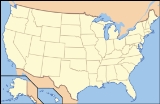
is a wilderness area in the Sierra Nevada mountains of California
California
California is a state located on the West Coast of the United States. It is by far the most populous U.S. state, and the third-largest by land area...
, USA. It is bordered by Yosemite National Park
Yosemite National Park
Yosemite National Park is a United States National Park spanning eastern portions of Tuolumne, Mariposa and Madera counties in east central California, United States. The park covers an area of and reaches across the western slopes of the Sierra Nevada mountain chain...
on the south, the Toiyabe National Forest on the east, and State Route 108
California State Route 108
State Route 108, also known as Highway 108, is a numbered state highway in California. SR 108 runs generally northeast across central California from downtown Modesto near the SR 99/SR 132 interchange, crossing the Sierra Nevada at Sonora Pass, to U.S. Route 395 near the Nevada state line...
on the north. It is an elongated area that extends northeast about 25 miles (40.2 km) in length and up to 15 miles (24.1 km) in width. Watersheds drain to the Stanislaus
Stanislaus River
The Stanislaus River in California is one of the largest tributaries of the San Joaquin River. The river is long and has north, middle and south forks...
and Tuolumne River
Tuolumne River
The Tuolumne River is a California river that flows nearly from the central Sierra Nevada to the San Joaquin River in the Central Valley...
s. This area is entirely within Tuolumne County, California
Tuolumne County, California
Tuolumne County is a county in the Sierra Nevada of the U.S. state of California. The northern half of Yosemite National Park is located in the eastern part of the county. As of the 2010 census, the population was 55,365, up from 54,501 at the 2000 census...
and is approximately 140 miles (225.3 km) east of San Francisco, California
San Francisco, California
San Francisco , officially the City and County of San Francisco, is the financial, cultural, and transportation center of the San Francisco Bay Area, a region of 7.15 million people which includes San Jose and Oakland...
and 50 miles (80.5 km) south of Lake Tahoe
Lake Tahoe
Lake Tahoe is a large freshwater lake in the Sierra Nevada of the United States. At a surface elevation of , it is located along the border between California and Nevada, west of Carson City. Lake Tahoe is the largest alpine lake in North America. Its depth is , making it the USA's second-deepest...
.
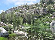
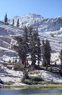
The Emigrant Wilderness is a glaciated landscape of scenic beauty. The northeastern third of the Wilderness is dominated by volcanic ridges and peaks; the remaining areas consist of many sparsely vegetated, granitic ridges interspersed with numerous lakes and meadows. To see that contrast, compare the red volcanic rock in the image of Emigrant Meadow (below Right) with the granite in the other images. Elevations range from below 5000 feet (1,524 m) near Cherry Reservoir to 11570 feet (3,527 m) at Leavitt Peak
Leavitt Peak
Leavitt Peak is located in the Emigrant Wilderness near Sonora Pass in the eastern Sierra Nevada range of California. Leavitt Peak is located on the Tuolumne County - Mono County line. The Pacific Crest Trail runs close to the east of Leavitt Peak, at an elevation of about elevation...
, but the elevation range of most of the popular areas is 7500 to 9000 ft (2,286 to 2,743.2 m). Precipitation averages 50 inches (1,270 mm) annually, 80% of it in the form of snow. Snowpacks typically linger into June, sometimes later following very wet winters. Summers are generally dry and mild, but afternoon thundershowers occur periodically and nighttime temperatures could dip below freezing anytime.
History
Various native peoples occupied this area for 10,000 years, spending the summer and early autumn hunting in the high country and trading with groups from the eastern side of the Sierra Nevada. The most recent groups were the Sierra MiwokValley and Sierra Miwok
The Plains and Sierra Miwok , were the largest group of Miwok Native American people...
of the western slope and Piute of the Great Basin.
Following the discovery of gold in 1848, large numbers of miners and settlers came to the Sierra and the native cultures quickly declined. In September–October 1852, the Clark-Skidmore party became the first emigrant group to travel the West Walker route over Emigrant Pass
Emigrant Gap
Emigrant Gap is a gap in a ridge on the California Trail as it crosses the Sierra Nevada, to the west of what is now known as Donner Pass. Here the cliffs are so steep that, back in the 1840s, the pioneers on their way to California had to lower their wagons on ropes in order to continue.The...
, continuing through a portion of the present-day Emigrant Wilderness. Several more emigrant parties were enticed by officials from Sonora
Sonora, California
Sonora is the county seat of Tuolumne County, California. As of the 2010 census, the city population was 4,903, up from 4,423 at the 2000 census. Sonora is the only incorporated community in Tuolumne County.-Geography:...
to use this route in 1853, but it was a very difficult passage with many hardships and was soon abandoned. Relief Valley and Relief Reservoir were so named because of the assistance some emigrants received there from residents of the Sonora area.

United States Forest Service
The United States Forest Service is an agency of the United States Department of Agriculture that administers the nation's 155 national forests and 20 national grasslands, which encompass...
designated this area for primitive management as the Emigrant Basin Primitive Area. On January 4, 1975, the Emigrant Basin Primitive Area was designated as the Emigrant Wilderness.
Dam Controversy
Since 1975, 18 small dams in the Emigrant Wilderness have been the source of an unresolved political debate. Some support proposals to maintain the dams while others feel the dams should be allowed to decay in keeping with the Wilderness ActWilderness Act
The Wilderness Act of 1964 was written by Howard Zahniser of The Wilderness Society. It created the legal definition of wilderness in the United States, and protected some 9 million acres of federal land. The result of a long effort to protect federal wilderness, the Wilderness Act was signed...
. A decision by the Stanislaus National Forest to compromise and leave some dams to naturally deteriorate while allowing maintenance of others was overturned in court in 2006, reigniting some of the controversy. The Forest Service chose not to appeal and the dams will gradually disappear.
Recreation
From Sonora Pass in the north, the Pacific Crest TrailPacific Crest Trail
The Pacific Crest Trail is a long-distance mountain hiking and equestrian trail on the Western Seaboard of the United States. The southern terminus is at the California border with Mexico...
follows a scenic route at the east edge of the Emigrant Wilderness along the high ridge past Leavitt Peak, turns further east from Kennedy Canyon to Bond Pass, and then heads south down Jack Main Canyon.
Many other trails crisscross the Emigrant Wilderness, from Leavitt Meadow on the East side, Kennedy Meadow on the West side, and other trailheads. Highlights include cliffs in the Granite Dome area and lakes such as Emigrant Lake, Huckleberry Lake, and Lake Lertoria.

