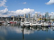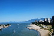
False Creek
Encyclopedia


Vancouver
Vancouver is a coastal seaport city on the mainland of British Columbia, Canada. It is the hub of Greater Vancouver, which, with over 2.3 million residents, is the third most populous metropolitan area in the country,...
. It separates downtown from the rest of the city. It was named by George Henry Richards
George Henry Richards
Admiral Sir George Henry Richards was Hydrographer to the British Admiralty from 1864 to 1874.-Early life:Richards was born in Anthony, Cornwall, the son of Captain G S Richards, and joined the navy in 1832....
during his Hydrographic survey of 1856-63. Science World
Science World at TELUS World of Science
Science World at Telus World of Science, Vancouver is a science centre run by a not-for-profit organization in Vancouver, British Columbia, Canada...
is located at its eastern end and the Burrard Street Bridge
Burrard Street Bridge
The Burrard Bridge is a five-lane, Art Deco style, steel truss bridge constructed in 1930-1932 in Vancouver, British Columbia, Canada. The high, five part bridge on four piers spans False Creek, connecting downtown Vancouver with Kitsilano via connections to Burrard Street on both ends...
crosses its western end. False Creek is also spanned by the Granville Street
Granville Street Bridge
The Granville Street Bridge is an eight lane bridge in Vancouver, British Columbia. It spans False Creek and is 27.4 metres above Granville Island. It is part of Highway 99.-History:...
and Cambie bridges. The Canada Line
Canada Line
Canada Line is a rapid transit line in the Metro Vancouver region of British Columbia, Canada. Opened in August 2009, it is the third line in TransLink's SkyTrain metro network, servicing Vancouver, Richmond, and the Vancouver International Airport...
tunnel crosses underneath False Creek just west of the Cambie Bridge. It is one of the four major bodies of water bordering Vancouver along with English Bay, Burrard Inlet
Burrard Inlet
Burrard Inlet is a relatively shallow-sided coastal fjord in southwestern British Columbia, Canada. Formed during the last Ice Age, it separates the City of Vancouver and the rest of the low-lying Burrard Peninsula from the slopes of the North Shore Mountains, home to the communities of West...
and the Fraser River
Fraser River
The Fraser River is the longest river within British Columbia, Canada, rising at Fraser Pass near Mount Robson in the Rocky Mountains and flowing for , into the Strait of Georgia at the city of Vancouver. It is the tenth longest river in Canada...
.
History
During World War IWorld War I
World War I , which was predominantly called the World War or the Great War from its occurrence until 1939, and the First World War or World War I thereafter, was a major war centred in Europe that began on 28 July 1914 and lasted until 11 November 1918...
, the easternmost part of False Creek, which formerly ran to Clark Drive, was filled in by the Great Northern Railway and Canadian Northern Pacific Railway
Canadian Northern Pacific Railway
The Canadian Northern Pacific Railway was an historic Canadian railway with a main line running between the Alberta–British Columbia border and Vancouver, British Columbia. It was a wholly owned subsidiary of the Canadian Northern Railway ....
to create new land for their yards and terminals. Talk of draining and filling the inlet to Granville Street
Granville Street
Granville Street is a major street in Vancouver, British Columbia, Canada, and part of Highway 99.-Location:Granville Street runs generally north-south through the centre of Vancouver, passing through several neighbourhoods and commercial areas, differing appreciably in their land value and the...
continued into the 1950s, but that never occurred.
The False Creek area was the industrial heartland of Vancouver through to the 1950s. It was home to many sawmills and small port operations, as well as the western terminus
Pacific Central Station (Vancouver)
Pacific Central Station in Vancouver, British Columbia, Canada is a railway station that acts as the western terminus of Via Rail's cross-country The Canadian to Toronto and the northern terminus of Amtrak’s Cascades to Seattle, Portland, and Eugene, Oregon...
of the major Canadian railways. As industry shifted to other areas, the vicinity around False Creek started to deteriorate.
The future of False Creek south was subsequently shaped by debates on freeways, urban renewal, and the rise of citizen participation in urban planning. Through the 60s, the ruling NPA
Non-Partisan Association
The Non-Partisan Association is a civic-level electoral organization in Vancouver, British Columbia, Canada. There are, and have also been in the past, Non-Partisan Association political parties in the nearby municipalities of Burnaby, Richmond and Surrey.The NPA was established in 1937 to...
city government and senior city bureaucrats had hatched a plan - with little or no public consultation - to run freeways through the city. In the same period, the City razed large portions of Strathcona under the aegis of urban renewal. A group of influential citizens formed The Electors Action Movement
The Electors' Action Movement
TEAM was a centrist political party from 1968 to the mid-1980s at the municipal level in Vancouver, British Columbia, Canada. It fielded candidates for the office of mayor as well as for positions on the city council, school board, and park board...
(TEAM) to oppose the freeway and to radically change the way decisions were made on land use. A key figure amongst these people was Walter Hardwick
Walter Hardwick
Walter Hardwick , 1997 Order of British Columbia recipient, was a distinguished community leader for many decades....
, a Geography professor at UBC
University of British Columbia
The University of British Columbia is a public research university. UBC’s two main campuses are situated in Vancouver and in Kelowna in the Okanagan Valley...
who envisioned the retrofit of this brownfield
Brownfield land
Brownfield sites are abandoned or underused industrial and commercial facilities available for re-use. Expansion or redevelopment of such a facility may be complicated by real or perceived environmental contaminations. Cf. Waste...
industrial site into a vibrant waterfront mixed-use community.
First elected to City Council in 1968, Dr. Hardwick led the City's redevelopment team and helped secure the participation of the Federal Government which owned Granville Island. A major public involvement and co-design process followed which established public priorities for an accessible waterfront seawall; mixed-tenure housing including market condominiums, co-op and low-income housing and live-aboard marinas; and a vibrant waterfront market. These plans were formalized in a 1972 Official Development Plan (http://vancouver.ca/commsvcs/BYLAWS/odp/fccdd.pdf). The form and mix of development were revolutionary for Vancouver at the time. A third of the site was set aside for housing at 40 units/acre with the balance converted to park, waterfront and community uses.
The North Shore of False Creek (NFC) was further transformed in the 1980s, as it took centre stage during Expo 86
Expo 86
The 1986 World Exposition on Transportation and Communication, or simply Expo '86, was a World's Fair held in Vancouver, British Columbia, Canada from Friday, May 2 until Monday, October 13, 1986...
. Following Expo, the Province sold the NFC site to Li Ka-shing who brought ideas of a higher density waterfront community to the downtown peninsula. Vancouver's experience with South False Creek and the public participation that shaped it was key to developing NFC as a livable high-density community. For example, Ka-shing's company wanted to develop "islands" of market condos on the waterfront but was soundly rebuffed by the public and by planners who favoured the extension of a 100% publicly accessible waterfront and seawall. The 1991 Official Development Plan enabled significant new density commensurate with the provision of significant public amenities including streetfront shops and services, parks, school sites, community centres, daycares, co-op and low-income housing. Since then, most of the north shore has become a new neighbourhood of dense housing (about 100 units/acre), adding some 50,000 new residents to Vancouver's downtown peninsula.
On December 1, 1998, Vancouver City Council adopted a set of Blueways policies and guidelines stating the vision of a waterfront city where land and water combine to meet the environmental, cultural and economic needs of the City and its people in a sustainable, equitable, high quality manner.
Southeast False Creek is now under development and served in 2010 as the athletes' village for the 2010 Winter Olympics
2010 Winter Olympics
The 2010 Winter Olympics, officially the XXI Olympic Winter Games or the 21st Winter Olympics, were a major international multi-sport event held from February 12–28, 2010, in Vancouver, British Columbia, Canada, with some events held in the suburbs of Richmond, West Vancouver and the University...
. Fully built out, Southeast False Creek will eventually become a residential area for 11,000-13,000 people.
Sports and recreation
False Creek is a very popular boating area for many different activities including dragon boating, canoeing, kayaking, public ferries, charter ships, and visiting pleasure boats. It has 10 marinas with berths for 1500 watercraft and several paddling clubs or boat rental facilities. Since 1986, the creek has been the venue for the Canadian International Dragon Boat FestivalCanadian International Dragon Boat Festival
The Canadian International Dragon Boat Festival or Rio Tinto Alcan Dragon Boat Festival takes place every June on the waters and shoreside of False Creek in Vancouver, British Columbia...
and other paddling events.
Transportation
Aquabus and False Creek FerriesFalse Creek Ferries
False Creek Ferries, a division of Granville Island Ferries Ltd, is a privately owned and operated ferry service that operates on False Creek near downtown Vancouver, Canada...
are two ferry companies that operate daily scheduled service to and from points along False Creek. English Bay Launch
English Bay Launch
English Bay Launch is a privately owned and operated water taxi service in the Lower Mainland, British Columbia, Canada, which replaced Granville Island Water Taxi Services in the Fall of 2009. It is one of three water taxi services connecting Bowen Island to Vancouver with regularly scheduled...
provides daily scheduled service from Granville Island on False Creek to Bowen Island
Bowen Island
Bowen Island, British Columbia, is an island municipality in Howe Sound, is part of the Greater Vancouver Regional District, and is an island included within the jurisdiction of the Islands Trust . Approximately 6 km wide by 12 km long, the island at its closest point is about 2 km...
.

Wildlife and the environment
Several decades following the suspension of industrial activity in the area, a number of shore and seabirds such as cormorants, ducks, herons, kingfishers, owls, geese, crows, and gulls have returned, as well as harbour seals. In an unusual sighting, in May 2010 a grey whale entered False Creek and traversed its length before returning to the open waters of the Strait of GeorgiaStrait of Georgia
The Strait of Georgia or the Georgia Strait is a strait between Vancouver Island and the mainland coast of British Columbia, Canada. It is approximately long and varies in width from...
.
Factors working against the further return of wildlife include residual industrial contaminants, spillage from the sewer overflow system into the creek, and the seawall
Seawall
A seawall is a form of coastal defence constructed where the sea, and associated coastal processes, impact directly upon the landforms of the coast. The purpose of a seawall is to protect areas of human habitation, conservation and leisure activities from the action of tides and waves...
that constrains much of the shoreline with little habitat value. To its credit, the city has attempted to recreate the natural shoreline in some areas and is working to phase out the antiquated sewer overflow system.

