Grade II listed buildings in Bristol
Encyclopedia
There are a large number of Grade II listed buildings in Bristol
, UK
.
In England and Wales
the authority for listing is granted by the Planning (Listed Buildings and Conservation Areas) Act 1990
and is presently administered by English Heritage
, an agency of the Department for Culture, Media & Sport
In the United Kingdom
the term listed building refers to a building or other structure officially designated as being of special architectural, historical or cultural significance.
}
|
|
|-
| Armada House, Bristol
(Nova House)
| 1903
| Telephone Avenue
|
|
|
|-
| B Bond Warehouse
Create Centre & Bristol Record Office
| 1908
| Smeaton Road, Spike Island
|
|
|
|-
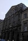
| Former Bank of England
building
|
|36, Corn Street
|
|
|
|-
| Bristol Grammar School
| 1877
| Clifton
|
|
|
|-
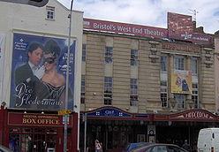
| Bristol Hippodrome
| 1911
| 11-14 St Augustines Parade
|
|
|
|-
| Bristol North Baths
| c1912
| Gloucester Road, Bishopston
|
|
|
|-
| Bristol Zoo
|
| Clifton
|
|
|
|-
| Brown's Restaurant
(Former City Museum and Library)
(Former University Refectory and Dining Room)
| 1867–1871
| Queens Road
|
|
|
|-
| Cabot Tower
| 1897
| Brandon Hill
|
|
|.jpg)
|-
| Callandar House
| 18th century
| Clifton Hill House
, Clifton
|
|
|
|-
| Central Police Station, Bristol
(Bridewell)
| 1928
| Nelson Street, Broadmead
|
|
|
|-
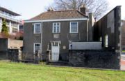
| Chatterton
's house and school, and attached screen wall
| 1749
| Redcliffe Way, Redcliffe
|
|
|
|-
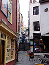
| Christmas Steps
| 1720 & 1800
| Bristol city centre
|
| ,,,
,,,
,,,
,,
|
|-
| Church of All Hallows
| 1899
| All Hallows Road, Easton
|
|
|
|-
| Church of St Jude the Apostle with St Matthias-on-the-Weir
| 1849
| Braggs Lane, Old Market
|
|
|
|-
| City Road Baptist Church
(former City Road Baptist Chapel)
| 1861
| Upper York Street, Stokes Croft
|
|
|
|-
| Clarks Wood Company warehouse
| c. 1863
| Silverthorne Lane, St Philips
|
|
|
|-
| Clifton College
|
| Clifton
|
|
|
|-
| Clifton Down railway station
| 1874
| Clifton
|
|
|
|-
| Colston Hall
| 1860s
| Colston Street
|
|
|
|-
| Colston's School
(former Bishops Palace)
| c1725
|
|
|
|
|-
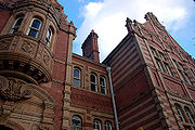
| Colston's Girls' School
| 1891
|
|
|
|
|-
| Coroners Court, Bristol
(School, now court and mortuary)
| 1857-58
| Backfields, Stokes Croft
|
|
|-
| Cossham Memorial Hospital
| 1905-07
| Kingswood
|
|
|
|-
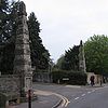
| Cotham Park obelisks
| 18th century
| Cotham Park, Cotham
|
|
|
|}
}
|
|
|-
| Employment Exchange, Bristol
(Labour Exchange)
| 1931
| All Saints Street, Broadmead
|
|
|
|-
| Old Fish Market, Bristol
(Now public house)
| 1873
| 45-57 Baldwin Street
|
|
|
|-
| Former Gardiners offices
(Part of Christopher Thomas Brothers' Soap Works)
| 1865-7.
| Old Bread Street
|
|
|
|-
| Former pattern-maker's shop and stores
| 1888
| Underfall Yard Bristol Harbour
|
|
|
|-
| Former premises of Marble Mosaic Company
| Mid 19th century
| Avon Street (East end)
|
|
|
|-
| Gardiners warehouse
(Part of Christopher Thomas Brothers' Soap Works)
| 1865 and 1884.
| Straight Street (Broad Plain)
|
|
|
|-
| Glenside
(Beaufort Hospital)
(Blackberry Hill Hospital
)
| 1861
| Fishponds
|
|
|
|-
| Glenside Museum
(Previously hospital chapel)
| 1861
| Fishponds
|
|
|
|-
| Goldney Hall
| 1720
| Clifton
|
|
|
|-
| Hatchet Inn
| 1606
| Frogmore Street
|
|
|
|-
| Henbury Village Hall
(Henbury School)
| 1830
| Church Lane, Henbury
|
|
|
|}
}
|
|
|-
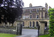
| Merchant Hall
| 1868
| The Promenade, Clifton Down
|
|
|
|-
| Nova Scotia
| early 19th century
| Spike Island
|
|
|
|-
| Old City Gaol, Bristol
| 1832
| Cumberland Road, Bristol Harbour
|
|
|
|-
| Old Duke
| 1780
| King Street, Bristol
|
|
|
|-
| Palace Hotel
| c. 1860
| West Street, Old Market
|
|
|
|-
| Patent slip and quay walls
| 1888
| Underfall Yard Bristol Harbour
|
|
|
|-
| Portland Square
(Gates & Railings of gardens)
| early 18th century
| St Pauls
|
|
|
|-
| Prince's Wharf and Wapping Wharf
|
| Bristol Harbour
|
|
|
|-
| Printers Devil
(Former Queen's Head)
| 18th century
| Broad Plain
|
|
|
|-
| The Pump House
| 1870
| Cumberland Basin, Hotwells
, Bristol Harbour
|
|
|
|-
| Queen Elizabeth's Hospital
| 1847
| Berkley Place
|
|
|
|-
| Queen Square
|
|
|
|
|
|-
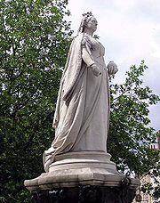
| Queen Victoria Statue
| 1888
| College Green, Bristol
|
|
|
|-
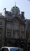
| Robinson's Warehouse
| 1875
| Bathurst Parade
|
|
|
|}
}
|
|
|-
| Shakespeare Inn
| 1636
| Victoria Street
|
|
|
|-
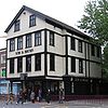
| Stag and Hounds Public House
| 1483 rebuilt early C18
| Old Market Street, Old Market
|
|
|
|-
| St Aidan
| 1902
| Nicholas Lane, St George
|
|
|
|-
| St Alban, Redland
| 1907
| Coldharbour Lane, Redland
|
|
|
|-
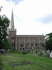
| St John the Baptist
| 1834
| Frenchay
|
|
|
|-
| St John's Place
| 1841
| Apsley Road, Clifton
|
|
|
|-
| St Luke's Church, Barton Hill
| 1840s
| Queen Ann Road, Barton Hill
|
|
|
|-
| St Mary le Port Church
(Tower)
| 15th century
|
|
|
|
|-
| St Mary Magdalene, Sneyd Park
| 1860
| Mariners Drive, Sneyd Park
|
|
|
|-
| St Mary, Fishponds
| 1821
| Manor Road, Fishponds
|
|
|
|-
| St Mary, Shirehampton
| 1929
| High Street, Shirehampton
|
|
|
|-
| St Matthews Church, Cotham
| 1833-35
| Clare Rd Cotham
|
|
|
|-
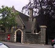
| St Matthias
(Lodge)
| 1852
| Fishponds
|
|
|
|-
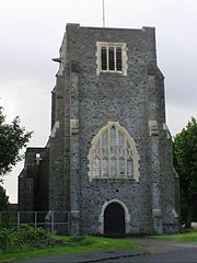
| St Oswald's church
| 1927
| Cheddar Grove, Bedminster Down
|
|
|
|-
| St Paul
| 1831
| Coronation Road, Southville
|
|
|
|-
| Trinity Road Library
(Originally St Philips Public Library)
| 1896
| Trinity Road, Lawrence Hill
|
|
|
|-
| 16 Victoria Street
| c. 1875
| Victoria Street
|
|
|
|-
| Warehouse premises of Hardware (Bristol) Limited
(Part of Christopher Thomas Brothers' Soap Works)
| 1882
| Old Bread Street
|
|
|
|-
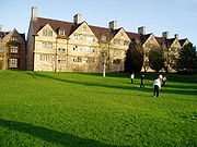
| Wills Hall
| 1920s
| Stoke Bishop
|
|
|
|-
| Woodlands Christian Centre
(former Church of St Mary the Virgin)
| 1870 - 1881
| Belgrave Road / Woodland Road
|
|
| |
|-
| Wool Hall
| 1830
| St Thomas Street
|
|
|
|}
Bristol
Bristol is a city, unitary authority area and ceremonial county in South West England, with an estimated population of 433,100 for the unitary authority in 2009, and a surrounding Larger Urban Zone with an estimated 1,070,000 residents in 2007...
, UK
United Kingdom
The United Kingdom of Great Britain and Northern IrelandIn the United Kingdom and Dependencies, other languages have been officially recognised as legitimate autochthonous languages under the European Charter for Regional or Minority Languages...
.
In England and Wales
England and Wales
England and Wales is a jurisdiction within the United Kingdom. It consists of England and Wales, two of the four countries of the United Kingdom...
the authority for listing is granted by the Planning (Listed Buildings and Conservation Areas) Act 1990
Planning (Listed Buildings and Conservation Areas) Act 1990
The Planning Act 1990 is an Act of Parliament of the United Kingdom that altered the laws on granting of planning permission for building works, notably including those of the listed building system in England and Wales....
and is presently administered by English Heritage
English Heritage
English Heritage . is an executive non-departmental public body of the British Government sponsored by the Department for Culture, Media and Sport...
, an agency of the Department for Culture, Media & Sport
In the United Kingdom
United Kingdom
The United Kingdom of Great Britain and Northern IrelandIn the United Kingdom and Dependencies, other languages have been officially recognised as legitimate autochthonous languages under the European Charter for Regional or Minority Languages...
the term listed building refers to a building or other structure officially designated as being of special architectural, historical or cultural significance.
A-C
| Name (Alternative name) |
Built | Location | Photo | ||
|---|---|---|---|---|---|
| ABC Cinema (Whiteladies Picture House) |
1920-21 | Whiteladies Road, Clifton Clifton, Bristol Clifton is a suburb of the City of Bristol in England, and the name of both one of the city's thirty-five council wards. The Clifton ward also includes the areas of Cliftonwood and Hotwells... |
 |
||
| A Bond Tobacco Warehouse | 1905 | Cumberland Basin Bristol Harbour Bristol Harbour Bristol Harbour is the harbour in the city of Bristol, England. The harbour covers an area of . It has existed since the 13th century but was developed into its current form in the early 19th century by installing lock gates on a tidal stretch of the River Avon in the centre of the city and... |
|||
| Academy Cinema Academy Cinema The Academy Cinema is a historic building on Cheltenham Road, Bristol, England.It was built in 1914 in an Edwardian Baroque style. It closed as a cinema in 1955 and became a Christadelphian Hall or chapel. More recently it was adapted for use as a bar under the name The Magic Box... (Christadelphian Hall, Magic Box) |
1914 | Cheltenham Road |  |
||
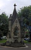
| Alderman Proctor's Drinking Fountain Alderman Proctor's Drinking Fountain The Alderman Proctor's Drinking Fountain is a historic building on Clifton Down, Bristol, England.It was built in 1872 by the London firm of George and Henry Godwin in a Gothic Revival style to commemorate the 1861 presentation of Clifton Down to the City of Bristol by the Society of Merchant... |
1872 | Clifton Down Clifton Down Clifton Down is an area of public open space in Bristol, England, north of the village of Clifton. With its neighbour Durdham Down to the northeast, it constitutes the large area known as The Downs, much used for leisure including walking and team sports... |
 |
||
| Arley Chapel (Polish Church Of Our Lady Of Ostrobrama) |
1855 | Arley Hill, Cotham Cotham, Bristol Cotham is the name of both a council ward of the city of Bristol in the United Kingdom, and a suburb of the city that falls within that ward. The ward comprises the Cotham suburb, and a small portion of Redland, which is another Bristol suburb.-Cotham:... |
|
|

|-
| Armada House, Bristol
Armada House, Bristol
Armada House is in Telephone Avenue, Off Baldwin Street, BristolIt was built in 1903 by Henry Williams, and is now used as offices and a conference centre. It has been designated by English Heritage as a grade II listed building....
(Nova House)
| 1903
| Telephone Avenue
|
|
|

|-
| B Bond Warehouse
B Bond Warehouse
B Bond Warehouse was a Bonded warehouse serving Bristol Harbour.It dates from 1908. It was designed by the Docks Committee engineer, and built by William Cowlin and Sons. It is made from reinforced concrete, with the ground floor in black brick with a low plinth and patent red bricks, blue...
Create Centre & Bristol Record Office
| 1908
| Smeaton Road, Spike Island
Spike Island, Bristol
Spike Island is an area of the English port city of Bristol, adjoining the city centre. It comprises the strip of land between the Floating Harbour to the north and the tidal New Cut of the River Avon to the south, from the dock entrance to the west to Bathurst Basin in the east...
|
|
|

|-
| Former Bank of England
Bank of England
The Bank of England is the central bank of the United Kingdom and the model on which most modern central banks have been based. Established in 1694, it is the second oldest central bank in the world...
building
|
|36, Corn Street
|
|
|

|-
| Bristol Grammar School
Bristol Grammar School
Bristol Grammar School is a co-educational independent school in Clifton, Bristol, England. The school was founded in 1532 by two brothers, Robert and Nicholas Thorne....
| 1877
| Clifton
Clifton, Bristol
Clifton is a suburb of the City of Bristol in England, and the name of both one of the city's thirty-five council wards. The Clifton ward also includes the areas of Cliftonwood and Hotwells...
|
|
|

|-
| Bristol Hippodrome
Bristol Hippodrome
The Bristol Hippodrome is a theatre in the centre of Bristol, England with seating on three levels giving a capacity of 1,951. It frequently features West End theatre shows when they tour the UK as well regular visits by Welsh National Opera, and an annual pantomime.- History :The theatre was...
| 1911
| 11-14 St Augustines Parade
|
|
|

|-
| Bristol North Baths
| c1912
| Gloucester Road, Bishopston
Bishopston, Bristol
Bishopston the name of both a council ward of the city of Bristol, England, and a suburb of the city that falls within that ward. Bishopston is situated around the Gloucester Road , the main northern arterial road in the city. The ward includes St Bonaventures and Ashley Down parishes, as well as...
|
|
|
|-
| Bristol Zoo
Bristol Zoo
Bristol Zoo is a zoo in the city of Bristol in South West England. The zoo's stated mission is "Bristol Zoo Gardens maintains and defends biodiversity through breeding endangered species, conserving threatened species and habitats and promoting a wider understanding of the natural...
|
| Clifton
Clifton, Bristol
Clifton is a suburb of the City of Bristol in England, and the name of both one of the city's thirty-five council wards. The Clifton ward also includes the areas of Cliftonwood and Hotwells...
|
|
|

|-
| Brown's Restaurant
Brown's Restaurant
Brown's Restaurant is on Queens Street, Bristol. It is currently occupied by the restaurant chain of the same name, Browns Restaurants.It was built between 1867 and 1871 by Foster and Archibald Ponton. It was constructed with yellow brick with red brick decoration and limestone dressings, and has...
(Former City Museum and Library)
(Former University Refectory and Dining Room)
| 1867–1871
| Queens Road
|
|
|

|-
| Cabot Tower
Cabot Tower (Bristol)
Cabot Tower is a tower in Bristol, England, situated in a public park on Brandon Hill, between the city centre, Clifton and Hotwells. It was constructed in memory of John Cabot, 400 years after he set sail in the Matthew from Bristol and landed in what was later to become Canada. The foundation...
| 1897
| Brandon Hill
|
|
|
.jpg)
|-
| Callandar House
| 18th century
| Clifton Hill House
Clifton Hill House
Clifton Hill House is a grade I listed Palladian villa in the Clifton area of Bristol, England which is now used as a hall of residence by the University of Bristol. The warden is Dr...
, Clifton
Clifton, Bristol
Clifton is a suburb of the City of Bristol in England, and the name of both one of the city's thirty-five council wards. The Clifton ward also includes the areas of Cliftonwood and Hotwells...
|
|
|
|-
| Central Police Station, Bristol
Central Police Station, Bristol
The Central Police Station , also known as the Bridewell is a historic building on Nelson Street, Broadmead, Bristol, England.-History:It was built in 1928 by Ivor Jones and Percy Thomas and opened as a police station in November 1930 near the site of a previous station. Neighbouring buildings...
(Bridewell)
| 1928
| Nelson Street, Broadmead
|
|
|

|-
| Chatterton
Thomas Chatterton
Thomas Chatterton was an English poet and forger of pseudo-medieval poetry. He died of arsenic poisoning, either from a suicide attempt or self-medication for a venereal disease.-Childhood:...
's house and school, and attached screen wall
| 1749
| Redcliffe Way, Redcliffe
Redcliffe, Bristol
Redcliffe, also known as Redcliff, is a district of the English port city of Bristol, adjoining the city centre. It is bounded by the loop of the Floating Harbour to the west, north and east, the New Cut of the River Avon to the south...
|
|
|

|-
| Christmas Steps
| 1720 & 1800
| Bristol city centre
Bristol city centre
Bristol city centre is the commercial, cultural and business centre of Bristol, England. It is the area south of the central ring road and north of the Floating Harbour, bounded north by St Pauls and Easton, east by Temple Meads and Redcliffe, and west by Clifton and Canon's Marsh...
|
| ,,,
,,,
,,,
,,
|

|-
| Church of All Hallows
| 1899
| All Hallows Road, Easton
Easton, Bristol
Easton is both the name of a council ward in the city of Bristol in the United Kingdom, and an inner city area that lies partly within that ward. The Easton ward also contains the Whitehall and Netham areas of the city. Notable places within the ward include Lawrence Hill and Stapleton Road railway...
|
|
|
|-
| Church of St Jude the Apostle with St Matthias-on-the-Weir
| 1849
| Braggs Lane, Old Market
Old Market
The Old Market is a neighborhood located in downtown Omaha, Nebraska, United States, and is bordered by South 10th Street. The neighborhood has many restaurants, art galleries and upscale shopping. The area retains its brick paved streets from the turn of the century, horse-drawn carriages, and...
|
|
|
|-
| City Road Baptist Church
City Road Baptist Church, Bristol
The City Road Baptist Church is a baptist church on Upper York Street, Stokes Croft in Bristol, England.It was built in 1861 by the Gloucester architects James Medland and Alfred William Maberly....
(former City Road Baptist Chapel)
| 1861
| Upper York Street, Stokes Croft
Stokes Croft
Stokes Croft is the name of a road and an area in Bristol, England. The road forms part of the A38 that leads north from the city centre, before it takes the names Cheltenham Road and then Gloucester Road...
|
|
|

|-
| Clarks Wood Company warehouse
Clarks Wood Company warehouse
The Clarks Wood Company warehouse is a 19th-century industrial building in Silverthorne Lane, Bristol.It dates from about 1863, but only two of its original walls remain...
| c. 1863
| Silverthorne Lane, St Philips
|
|
|

|-
| Clifton College
Clifton College
Clifton College is a co-educational independent school in Clifton, Bristol, England, founded in 1862. In its early years it was notable for emphasising science in the curriculum, and for being less concerned with social elitism, e.g. by admitting day-boys on equal terms and providing a dedicated...
|
| Clifton
Clifton, Bristol
Clifton is a suburb of the City of Bristol in England, and the name of both one of the city's thirty-five council wards. The Clifton ward also includes the areas of Cliftonwood and Hotwells...
|
|
|

|-
| Clifton Down railway station
Clifton Down railway station
Clifton Down railway station is located on Whiteladies Road in Clifton, Bristol, England. The station is west of Bristol Temple Meads on the Severn Beach Line...
| 1874
| Clifton
Clifton, Bristol
Clifton is a suburb of the City of Bristol in England, and the name of both one of the city's thirty-five council wards. The Clifton ward also includes the areas of Cliftonwood and Hotwells...
|
|
|

|-
| Colston Hall
Colston Hall
The Colston Hall is a concert hall and grade II listed building situated on Colston Street, Bristol, England. A popular venue catering for a variety of different entertainers, it seats approximately 2,075 and provides licensed bars, a café and restaurant....
| 1860s
| Colston Street
|
|
|

|-
| Colston's School
(former Bishops Palace)
| c1725
|
|
|
|
|-
| Colston's Girls' School
Colston's Girls' School
Colston's Girls' School, is an Academy for girls in Bristol, England. Prior to 2008 the school was a selective independent school, voluntarily converting to a state-funded Academy with effect from September 2008...
| 1891
|
|
|
|

|-
| Coroners Court, Bristol
(School, now court and mortuary)
| 1857-58
| Backfields, Stokes Croft
Stokes Croft
Stokes Croft is the name of a road and an area in Bristol, England. The road forms part of the A38 that leads north from the city centre, before it takes the names Cheltenham Road and then Gloucester Road...
|
|
|-
| Cossham Memorial Hospital
Cossham Memorial Hospital
Cossham Memorial Hospital is a community hospital in the Kingswood area of Bristol.The services provided, by North Bristol Primary Care Trust at Cossham include outpatients and physiotherapy...
| 1905-07
| Kingswood
|
|
|

|-
| Cotham Park obelisks
| 18th century
| Cotham Park, Cotham
Cotham, Bristol
Cotham is the name of both a council ward of the city of Bristol in the United Kingdom, and a suburb of the city that falls within that ward. The ward comprises the Cotham suburb, and a small portion of Redland, which is another Bristol suburb.-Cotham:...
|
|
|

|}
D-H
| Name (Alternative name) |
Built | Location | Photo | ||
|---|---|---|---|---|---|
| Dower House Dower house On an estate, a dower house is usually a moderately large house available for use by the widow of the estate-owner. The widow, often known as the "dowager" usually moves into the dower house from the larger family house on the death of her husband if the heir is married, and upon his marriage if he... (Formerly Stoke Park House) |
1553 (Rebuilt c.1760-70) |
Stoke Lane, Stoke Park Stoke Park, Bristol Stoke Park is a public open space of in Bristol, England. It occupies a prominent position alongside the M32 motorway, together with the landmark Dower House and Purdown transmitter.... , Stapleton Stapleton, Bristol Stapleton is an area in the north-eastern suburbs of the city of Bristol, England. The name is colloquially used today to describe the ribbon village along Bell Hill and Park Road in the Frome Valley. It borders Eastville to the South and Begbrook and Frenchay to the North... |
|||
| Dowry Square Dowry Square Dowry Square is in the Hotwells area of Bristol.It was laid out in 1727 by George Tully and building continued until 1750. The houses are three-storeyed with attics, simply detailed and with channelled pilasters to the party walls.... |
1727–1750 | Hotwells Hotwells Hotwells is a district of the English port city of Bristol. It is located to the south of and below the high ground of Clifton, and directly to the north of the Floating Harbour. The southern entrance to the Avon Gorge, which connects those docks to the sea, lies at the western end of Hotwells. The... |
|
||
| Emanuel Court | 1869 | Guthrie Road, Clifton Clifton, Bristol Clifton is a suburb of the City of Bristol in England, and the name of both one of the city's thirty-five council wards. The Clifton ward also includes the areas of Cliftonwood and Hotwells... |
|
|
|-
| Employment Exchange, Bristol
(Labour Exchange)
| 1931
| All Saints Street, Broadmead
|
|
|
|-
| Old Fish Market, Bristol
(Now public house)
| 1873
| 45-57 Baldwin Street
|
|
|

|-
| Former Gardiners offices
Former Gardiners offices
The Former Gardiners offices is on Old Bread Street, Bristol, England.It was built in 1865-7 by Foster and Wood and is an example of the Bristol Byzantine style.It has been designated by English Heritage as a grade II listed building....
(Part of Christopher Thomas Brothers' Soap Works)
| 1865-7.
| Old Bread Street
|
|
|

|-
| Former pattern-maker's shop and stores
Underfall Yard
The Underfall Yard is a historic boatyard on Spike Island serving Bristol Harbour, the harbour in the city of Bristol, England.Underfall Yard was commonly referred to as "The Underfalls" and takes its name from the underfall sluices...
| 1888
| Underfall Yard Bristol Harbour
Bristol Harbour
Bristol Harbour is the harbour in the city of Bristol, England. The harbour covers an area of . It has existed since the 13th century but was developed into its current form in the early 19th century by installing lock gates on a tidal stretch of the River Avon in the centre of the city and...
|
|
|
|-
| Former premises of Marble Mosaic Company
| Mid 19th century
| Avon Street (East end)
|
|
|

|-
| Gardiners warehouse
Gardiners warehouse
The Gardiners warehouse is on Straight Street, Broad Plain, Bristol, England.It was built in 1865 by William Bruce Gingell and is an example of the Bristol Byzantine style. It was originally part of Christopher Thomas and Brothers' soap works, but is now a warehouse...
(Part of Christopher Thomas Brothers' Soap Works)
| 1865 and 1884.
| Straight Street (Broad Plain)
|
|
|

|-
| Glenside
Glenside, Bristol
Glenside campus is the home of the School of Health and Social Care at the University of the West of England , Bristol. It is located on Blackberry Hill in the suburb of Fishponds...
(Beaufort Hospital)
(Blackberry Hill Hospital
Blackberry Hill Hospital
Blackberry Hill Hospital is an NHS mental health facility and redevelopment site in Fishponds, Bristol, presently the home of some facilities of the Avon and Wiltshire Mental Health Partnership....
)
| 1861
| Fishponds
|
|
|
|-
| Glenside Museum
Glenside Museum
Glenside Museum is situated within the Glenside Campus of the University of the West of England in Fishponds, Bristol, England.The museum was founded by Dr Donal F. Early; a consultant psychiatrist at Glenside from the 1950s. He collected items of memorabilia and started a collection on the balcony...
(Previously hospital chapel)
| 1861
| Fishponds
|
|
|

|-
| Goldney Hall
Goldney Hall
Goldney Hall also known as Goldney House is a self-catered hall of residence in Clifton, Bristol, one of three in the area providing accommodation for students at the University of Bristol.-House:...
| 1720
| Clifton
Clifton, Bristol
Clifton is a suburb of the City of Bristol in England, and the name of both one of the city's thirty-five council wards. The Clifton ward also includes the areas of Cliftonwood and Hotwells...
|
|
|
|-
| Hatchet Inn
Hatchet Inn, Bristol
The Hatchet Inn is an historic public house situated on Frogmore Street, Bristol, England a few minutes walk from the city centre. The name is thought to originate from the axes/hatchets that the local woodsmen used in Clifton Woods....
| 1606
| Frogmore Street
|
|
|
|-
| Henbury Village Hall
Henbury Village Hall
Henbury Village Hall was built as a school in the Henbury area of Bristol, England.It was built in 1830 in a Tudor Revival style by Thomas Rickman, on the site of a charity school which had stood on the site since 1601....
(Henbury School)
| 1830
| Church Lane, Henbury
Henbury
Henbury is a suburb of Bristol, England, approximately 5 mi northwest of the city centre. It was formerly a village in Gloucestershire and is now bordered by Westbury-on-Trym to the south; Brentry to the east and the Blaise Castle estate Blaise Hamlet and Lawrence Weston to the west...
|
|
|

|}
I-R
| Name (Alternative name) |
Built | Location | Photo | ||
|---|---|---|---|---|---|
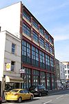
| 37 and 39 Jamaica Street 37 and 39 Jamaica Street, Bristol 37 and 39 Jamaica Street is the address of an historic carriage-works in Jamaica Street, Stokes Croft, Bristol.It was originally built in 1905 as a two-storey building, but a further two floors were later added... |
1905 and 1909 | Stokes Croft Stokes Croft Stokes Croft is the name of a road and an area in Bristol, England. The road forms part of the A38 that leads north from the city centre, before it takes the names Cheltenham Road and then Gloucester Road... |
 |
||
| Keepers Cottage | c1690 | Brislington Brislington Brislington is an area in the south east of the city of Bristol, England. It is on the edge of Bristol and from Bath. The Brislington Brook runs through the area in the woodlands of Nightingale Valley... |
 |
||
| 14 and 15 King Street 14 and 15 King Street, Bristol 14 and 15 King Street is the address of an historic warehouse building in King Street, Bristol, England.It was built around 1860 and is now occupied by a restaurant and offices.The contemporary 32 King Street is of similar design.... |
c. 1860 | King Street, Bristol King Street, Bristol King Street is a 17th century street in the historic city centre of Bristol, England.The street lies just south of the old town wall and was laid out in 1650 in order to develop the Town Marsh, the area then lying between the south or Marsh Wall and the Avon... |
 |
||
| 32 King Street 32 King Street, Bristol 32 King Street is the address of an historic warehouse building in King Street, Bristol, England.It was built around 1860 and is now occupied by a restaurant. The contemporary 14 and 15 King Street are of similar design.... |
c. 1860 | King Street, Bristol King Street, Bristol King Street is a 17th century street in the historic city centre of Bristol, England.The street lies just south of the old town wall and was laid out in 1650 in order to develop the Town Marsh, the area then lying between the south or Marsh Wall and the Avon... |
 |
||
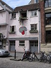
| 34 King Street | Early 18th century | King Street, Bristol King Street, Bristol King Street is a 17th century street in the historic city centre of Bristol, England.The street lies just south of the old town wall and was laid out in 1650 in order to develop the Town Marsh, the area then lying between the south or Marsh Wall and the Avon... |
 |
||
| 35 King Street 35 King Street, Bristol The 35 King Street is in King Street, Bristol, England.It was built around 1870 and is an example of the Bristol Byzantine style.It has been designated by English Heritage as a grade II listed building.... |
1870 | King Street, Bristol King Street, Bristol King Street is a 17th century street in the historic city centre of Bristol, England.The street lies just south of the old town wall and was laid out in 1650 in order to develop the Town Marsh, the area then lying between the south or Marsh Wall and the Avon... |
 |
||
| Mauretania Public House Mauretania Public House The Mauretania Public House is on Park Street, Bristol.It was built in 1870 by Henry Masters, with a rear extension being added in 1938 by WH Watkins... |
1870 | Park Street, Bristol Park Street, Bristol Park Street is a main street in Bristol, England, linking the city centre to Clifton. It forms part of the A4018.The building of Park Street started in 1761 and it was Bristol's earliest example of uniformly stepped hillside terracing. The street runs from College Green up a steep incline... |
|
|

|-
| Merchant Hall
Merchant Hall
The Merchant Hall is a historic building on The Promenade, Clifton Down, Bristol, England.It was built in 1868 by Richard Shackleton Pope, Thomas Pope and John Bindon and converted after World War II for the Society of Merchant Venturers....
| 1868
| The Promenade, Clifton Down
Clifton Down
Clifton Down is an area of public open space in Bristol, England, north of the village of Clifton. With its neighbour Durdham Down to the northeast, it constitutes the large area known as The Downs, much used for leisure including walking and team sports...
|
|
|

|-
| Nova Scotia
Nova Scotia, Bristol
The Nova Scotia is an historic nineteenth century public house situated on Spike Island adjacent to the Cumberland Basin in Bristol Harbour in Bristol, England. It was originally built as a terrace of three houses and then converted into a pub. It is a grade II listed building. It was a coaching...
| early 19th century
| Spike Island
Spike Island, Bristol
Spike Island is an area of the English port city of Bristol, adjoining the city centre. It comprises the strip of land between the Floating Harbour to the north and the tidal New Cut of the River Avon to the south, from the dock entrance to the west to Bathurst Basin in the east...
|
|
|

|-
| Old City Gaol, Bristol
Old City Gaol, Bristol
The Old City Gaol is in Cumberland Road, close to Bristol Harbour, England.It was built in 1832 by Richard Shackleton Pope after the original, which was designed by HH Seward in 1816 was destroyed in the Bristol Riots of 1831...
| 1832
| Cumberland Road, Bristol Harbour
Bristol Harbour
Bristol Harbour is the harbour in the city of Bristol, England. The harbour covers an area of . It has existed since the 13th century but was developed into its current form in the early 19th century by installing lock gates on a tidal stretch of the River Avon in the centre of the city and...
|
|
|

|-
| Old Duke
The Old Duke
The Old Duke is a jazz and blues venue and pub situated on King Street, Bristol, England. Live music is played every night of the week, admission is free and it hosts an annual Jazz Festival...
| 1780
| King Street, Bristol
King Street, Bristol
King Street is a 17th century street in the historic city centre of Bristol, England.The street lies just south of the old town wall and was laid out in 1650 in order to develop the Town Marsh, the area then lying between the south or Marsh Wall and the Avon...
|
|
|

|-
| Palace Hotel
Palace Hotel, Bristol
The Palace Hotel is an historic public house situated on West Street, Old Market, Bristol. It is a grade II listed building. Its exterior ornamentation includes two Assyrian-style hermai.-History:...
| c. 1860
| West Street, Old Market
Old Market, Bristol
Old Market is a Conservation Area of national significance, to the east of the city centre in Bristol, England. Old Market Street and West Street form the central axis of the area, which is approximately bounded by New Street and Lawfords Gate to the north, Trinity Road and Trinity Street to the...
|
|
|

|-
| Patent slip and quay walls
Underfall Yard
The Underfall Yard is a historic boatyard on Spike Island serving Bristol Harbour, the harbour in the city of Bristol, England.Underfall Yard was commonly referred to as "The Underfalls" and takes its name from the underfall sluices...
| 1888
| Underfall Yard Bristol Harbour
Bristol Harbour
Bristol Harbour is the harbour in the city of Bristol, England. The harbour covers an area of . It has existed since the 13th century but was developed into its current form in the early 19th century by installing lock gates on a tidal stretch of the River Avon in the centre of the city and...
|
|
|
|-
| Portland Square
Portland Square, Bristol
Portland Square is in the St Pauls area of Bristol.It was laid out in the early 18th century as one of Bristol's first suburbs. Built upon a flat area of ground its central focus of St. Pauls Church...
(Gates & Railings of gardens)
| early 18th century
| St Pauls
St Pauls, Bristol
St Pauls is an inner suburb of Bristol, England, situated just north east of the city centre and west of the M32. It is bounded by the A38, the B4051 and the A4032 roads...
|
|
|

|-
| Prince's Wharf and Wapping Wharf
|
| Bristol Harbour
Bristol Harbour
Bristol Harbour is the harbour in the city of Bristol, England. The harbour covers an area of . It has existed since the 13th century but was developed into its current form in the early 19th century by installing lock gates on a tidal stretch of the River Avon in the centre of the city and...
|
|
|

|-
| Printers Devil
Printers Devil, Bristol
The Printers Devil is an historic public house situated on Broad Plain, Bristol, England.It was built in the late 18th century as a public house, and was formerly known as the Queens Head.It is a grade II listed building....
(Former Queen's Head)
| 18th century
| Broad Plain
|
|
|

|-
| The Pump House
Pump House, Bristol
The Pump House is an historic public house situated in Hotwells on Bristol Harbour, Bristol, England.It was built around 1870 by Thomas Howard as a Hydraulic Pumping House to provide power to the bridges and machines of Bristol Harbour. It was replaced by the current Hydraulic engine house in the...
| 1870
| Cumberland Basin, Hotwells
Hotwells
Hotwells is a district of the English port city of Bristol. It is located to the south of and below the high ground of Clifton, and directly to the north of the Floating Harbour. The southern entrance to the Avon Gorge, which connects those docks to the sea, lies at the western end of Hotwells. The...
, Bristol Harbour
Bristol Harbour
Bristol Harbour is the harbour in the city of Bristol, England. The harbour covers an area of . It has existed since the 13th century but was developed into its current form in the early 19th century by installing lock gates on a tidal stretch of the River Avon in the centre of the city and...
|
|
|

|-
| Queen Elizabeth's Hospital
Queen Elizabeth's Hospital
Queen Elizabeth's Hospital is an independent school for boys in Clifton, Bristol, England founded in 1586. Stephen Holliday has served as Headmaster since 2000, having succeeded Dr Richard Gliddon...
| 1847
| Berkley Place
|
|
|

|-
| Queen Square
Queen Square, Bristol
Queen Square is a garden square in the centre of Bristol, England. It was originally a fashionable residential address, but now most of the buildings are in office use....
|
|
|
|
|

|-
| Queen Victoria Statue
Queen Victoria Statue
The statue of Queen Victoria by Joseph Boehm stands on College Green, Bristol, England.It was made in 1888. The round steps limestone ashlar lead to a square, copper base with fish, putti and inscribed panels, which support the marble statue....
| 1888
| College Green, Bristol
College Green, Bristol
College Green is a public open space in Bristol, England. The Green takes the form of a segment of a circle with its apex pointing east, and covers...
|
|
|

|-
| Robinson's Warehouse
Robinson's Warehouse, Bristol
Robinson's Warehouse is a warehouse on Bathurst Parade, on the Floating Harbour in Bristol, England.It was built in 1874 by William Bruce Gingell, and is an example of the Bristol Byzantine style with yellow and red brick and Moorish arches....
| 1875
| Bathurst Parade
|
|
|

|}
R-Z
| Name (Alternative name) |
Built | Location | Photo | ||
|---|---|---|---|---|---|
| Seven Stars Public House Seven Stars Public House, Bristol The Seven Stars Public House is an historic public house situated on Thomas Lane, Bristol, England.One of the earliest references to the pub is in the Bristol Record Office... |
18th century | Thomas Lane |  |
||
| Shaftesbury Chambers | 1904 | Corn Street |
|
|

|-
| Shakespeare Inn
Shakespeare Inn, Bristol
The Shakespeare Inn is an historic public house situated on Victoria Street, Bristol, England....
| 1636
| Victoria Street
|
|
|

|-
| Stag and Hounds Public House
Stag and Hounds Public House
The Stag and Hounds Public House is on Old Market Street, Old Market, Bristol.It was built originally in 1483, probably as a private house. However the current building is predominantly from the early 18th century, when it was a Public house and it has been partly rebuilt in the 1960s, and...
| 1483 rebuilt early C18
| Old Market Street, Old Market
Old Market, Bristol
Old Market is a Conservation Area of national significance, to the east of the city centre in Bristol, England. Old Market Street and West Street form the central axis of the area, which is approximately bounded by New Street and Lawfords Gate to the north, Trinity Road and Trinity Street to the...
|
|
|

|-
| St Aidan
| 1902
| Nicholas Lane, St George
St George, Bristol
St. George is a district of Bristol, England on the edge of the inner city.- History :St George was originally outside the city boundary until about 1860. The area was once the end of the tram line from the city of Bristol, the terminus being in Beaconsfield Road.St...
|
|
|
|-
| St Alban, Redland
| 1907
| Coldharbour Lane, Redland
Redland, Bristol
Redland is an affluent suburb in Bristol, England. The suburb is situated between Clifton, Cotham, Bishopston and Westbury Park. The boundaries of the district are not precisely defined, but are generally taken to be Whiteladies Road in the west, the Severn Beach railway line in the south and...
|
|
|
|-
| St John the Baptist
St John the Baptist, Frenchay
St John the Baptist is a church in the Frenchay area of Bristol, England.It was built in 1834 by Henry Rumley. Work on the vestry in 1887 was by the local architect William Larkins Bernard....
| 1834
| Frenchay
Frenchay
Frenchay is a suburb of Bristol, England, to the north east of the city, but located mainly in South Gloucestershire and the Civil Parish of Winterbourne....
|
|
|

|-
| St John's Place
| 1841
| Apsley Road, Clifton
Clifton, Bristol
Clifton is a suburb of the City of Bristol in England, and the name of both one of the city's thirty-five council wards. The Clifton ward also includes the areas of Cliftonwood and Hotwells...
|
|
|
|-
| St Luke's Church, Barton Hill
| 1840s
| Queen Ann Road, Barton Hill
Barton Hill, Bristol
Barton Hill is an area of Bristol, just to the east of the city centre and Bristol Temple Meads railway station.It includes residential, retail and industrial premises and is crossed by major roads, railway tracks and the feeder canal leading to Bristol Harbour.-History:Barton was a manor just...
|
|
|
|-
| St Mary le Port Church
St Mary le Port Church, Bristol
St Mary le Port is a ruined parish church in the centre of Bristol, England. It is said to have been founded in Saxon times, and rebuilt and enlarged between the 11th and 16th centuries....
(Tower)
| 15th century
|
|
|
|
|-
| St Mary Magdalene, Sneyd Park
| 1860
| Mariners Drive, Sneyd Park
Sneyd Park
Sneyd Park is a suburb of Bristol, England, lying on the western fringe of Clifton Down, adjacent to the Avon Gorge and the Sea Walls observation point. Home to many millionaires, Sneyd Park was originally developed in Victorian times. Many Victorian and Edwardian villas line the edge of the Downs...
|
|
|
|-
| St Mary, Fishponds
| 1821
| Manor Road, Fishponds
|
|
|
|-
| St Mary, Shirehampton
| 1929
| High Street, Shirehampton
Shirehampton
Shirehampton, near Avonmouth, at the north-western edge of the city of Bristol, England, is a district of Bristol which originated as a separate village. It retains something of its village feel, having a short identifiable High Street with the parish church situated among shops, and is still...
|
|
|
|-
| St Matthews Church, Cotham
St Matthews Church, Cotham
St Matthews is a church in the Cotham area of Bristol, England.It was built between 1833 and 1835 by Thomas Rickman.It has been designated by English Heritage as a grade II listed building.- External links :*...
| 1833-35
| Clare Rd Cotham
Cotham, Bristol
Cotham is the name of both a council ward of the city of Bristol in the United Kingdom, and a suburb of the city that falls within that ward. The ward comprises the Cotham suburb, and a small portion of Redland, which is another Bristol suburb.-Cotham:...
|
|
|

|-
| St Matthias
St Matthias, Bristol
St Matthias is one of the campuses belonging to the University of the West of England. The campus is located in the suburb of Fishponds in Bristol.-History:...
(Lodge)
| 1852
| Fishponds
|
|
|

|-
| St Oswald's church
| 1927
| Cheddar Grove, Bedminster Down
|
|
|

|-
| St Paul
| 1831
| Coronation Road, Southville
Southville, Bristol
Southville is an inner city ward of Bristol, England, situated on the south bank of the River Avon and northwest of Bedminster. Most of the area's houses were built in the late 19th and early 20th centuries either for workers in the Bristol coal mining industry or the tobacco factories of W. D. &...
|
|
|
|-
| Trinity Road Library
Trinity Road Library, Bristol
Trinity Road Library is an historic building situated on Trinity Road, St Philips, Bristol, England.It was constructed in 1896 in a Jacobethan style, to the plans of William Venn Gough, and bears an inscription with its original name, St Philips Public Library.It has been designated by English...
(Originally St Philips Public Library)
| 1896
| Trinity Road, Lawrence Hill
Lawrence Hill, Bristol
Lawrence Hill is an electoral ward of Bristol, United Kingdom. It takes its name from a small area just to the east of the city centre, and includes the districts of Barton Hill, St Philips Marsh and Redcliffe, Temple Meads and parts of Easton and the Broadmead shopping area.-History:It is the most...
|
|
|

|-
| 16 Victoria Street
| c. 1875
| Victoria Street
|
|
|

|-
| Warehouse premises of Hardware (Bristol) Limited
Warehouse premises of Hardware (Bristol) Limited
The Warehouse premises of Hardware Limited is on Old Bread Street, Bristol, England.It was built in 1882 by William Bruce Gingell in red brick with white and black brick details and is an example of the Bristol Byzantine style. It was originally part of Christopher Thomas and Brothers' soap...
(Part of Christopher Thomas Brothers' Soap Works)
| 1882
| Old Bread Street
|
|
|

|-
| Wills Hall
Wills Hall
Wills Hall is one of the nine halls of residence in the University of Bristol. Cresting the Stoke Bishop site on the edge of the Bristol Downs, in Parry's Lane, it houses 340 students in two quadrangles...
| 1920s
| Stoke Bishop
Stoke Bishop
Stoke Bishop is a very affluent and medium-sized outer city suburb in the north-west of Bristol, located in between Westbury-on-Trym, Sneyd Park, and Sea Mills. Although relatively small, Stoke Bishop's population has increased due to substantial infilling on the Smelting Works sports ground and...
|
|
|

|-
| Woodlands Christian Centre
Woodlands Christian Centre
Woodlands Christian Centre is a New Evangelical Church in Bristol, England. It is situated on the corner of Belgrave Road and Woodland Road, near the University of Bristol complex in Clifton which is known to be one of the richest suburbs of Bristol.Woodlands is part of Woodlands Group of Churches...
(former Church of St Mary the Virgin)
| 1870 - 1881
| Belgrave Road / Woodland Road
|
|
| |

|-
| Wool Hall
Wool Hall, Bristol
The Wool Hall in Bristol, England, is an historic building in St Thomas Street, constructed in 1830 to house the city's wool market. It is one of the earlier works of Richard Shackleton Pope, and has been described as 'the first quasi-industrial building in Bristol to attempt a real architectural...
| 1830
| St Thomas Street
|
|
|

|}
See also
- Grade I listed buildings in BristolGrade I listed buildings in BristolThere are 100 Grade I listed buildings in Bristol, England according to Bristol City Council. The register includes many structures which for convenience are grouped together in the list below....
- Grade II* listed buildings in Bristol

