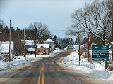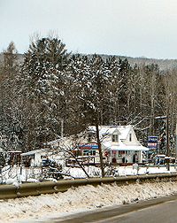
Greater Madawaska, Ontario
Encyclopedia

Eastern Ontario
Eastern Ontario is a subregion of Southern Ontario in the Canadian province of Ontario which lies in a wedge-shaped area between the Ottawa River and St. Lawrence River...
Ontario
Ontario
Ontario is a province of Canada, located in east-central Canada. It is Canada's most populous province and second largest in total area. It is home to the nation's most populous city, Toronto, and the nation's capital, Ottawa....
, Canada
Canada
Canada is a North American country consisting of ten provinces and three territories. Located in the northern part of the continent, it extends from the Atlantic Ocean in the east to the Pacific Ocean in the west, and northward into the Arctic Ocean...
, created on January 1, 2001, through the amalgamation of the Township of Bagot and Blythefielda; the Township of Brougham; and the Township of Griffith and Matawatchan. It has a population of 2,290.
Communities
The township comprises the communities of Ashdad, Barrett Chute, Barryvale, Black Donald, Calabogie, Camel Chute, Griffith, Hurds Lake, Lower Dacre, Matawatchan, Springtown, Spruce Hedge and Wilson.The ghost town
Ghost town
A ghost town is an abandoned town or city. A town often becomes a ghost town because the economic activity that supported it has failed, or due to natural or human-caused disasters such as floods, government actions, uncontrolled lawlessness, war, or nuclear disasters...
s of Khartum and Balvenie are also located in the township.
Two fire towers were located in the township in the middle of the 20th century. These were located at Jameison's Mountain north of Griffith (the cupola now sits on the property of the Pembroke MNR office) and at Matawatchan. These were put out of use in 1970 as aerial forest fire fighting techniques took over.
Geography
The township is composed of the geographic townships of Bagot, Blythefield, Brougham, Griffith and Matawatchan. The town borders Calabogie Lake and the Madawaska RiverMadawaska River (Ontario)
The Madawaska River is a river in Ontario, Canada. The river is long and drains an area of . It originates at Source Lake in the highlands of Algonquin Park at an elevation of and flows east, dropping before emptying into the Ottawa River at Arnprior....
, and is located in the northern section of the Ottawa River
Ottawa River
The Ottawa River is a river in the Canadian provinces of Ontario and Quebec. For most of its length, it now defines the border between these two provinces.-Geography:...
Valley.
Recreation
The Calabogie PeaksCalabogie Peaks
Calabogie Peaks is a ski resort located 45 minutes west of Ottawa, Ontario just outside the Village of Calabogie. Calabogie Peaks Resort offers the highest vertical drop among public ski hills in Ontario, 760 feet. It features 22 runs, 3 lifts , a tubing hill and two terrain parks...
ski resort is located in the township. The Kingston and Pembroke Railway
Kingston and Pembroke Railway
The Kingston and Pembroke Railway was a Canadian railway that operated in eastern Ontario. The railway was seen as a business opportunity which would support the lumber and mining industries, as well as the agricultural economy in eastern Ontario....
ran through the town, with stations at Ashdad and Calabogie, until it was abandoned in 1986. It has now become a hiking trail, the K&P Rail Trail
K&P Rail Trail
The K&P Trail is a recreational trail that runs along the old Kingston and Pembroke Railway bed. The K&P was abandoned by its owner, Canadian Pacific Railway, between 1962 and 1986....
.
Demographics
According to the Canada 2006 CensusCanada 2006 Census
The Canada 2006 Census was a detailed enumeration of the Canadian population. Census day was May 16, 2006. The next census following will be the 2011 Census. Canada's total population enumerated by the 2006 census was 31,612,897...
:
- Population: 2,751
- % Change (2001-2006): 20.1
- Land Area: 1,011.67 km²
- Density: 2.7 people per km².

