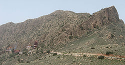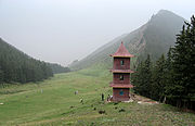
Helan Shan
Encyclopedia


Inner Mongolia
Inner Mongolia is an autonomous region of the People's Republic of China, located in the northern region of the country. Inner Mongolia shares an international border with the countries of Mongolia and the Russian Federation...
's Alxa League
Alxa League
Alxa League is one of 12 prefecture level divisions and three extant leagues of Inner Mongolia. The league borders Mongolia to the north, Bayan Nur to the northeast, Wuhai and Ordos to the east, Ningxia to the southeast, and Gansu to the south and west. The capital is Bayan Hot in the aimag's...
and Ningxia
Ningxia
Ningxia, formerly transliterated as Ningsia, is an autonomous region of the People's Republic of China. Located in Northwest China, on the Loess Plateau, the Yellow River flows through this vast area of land. The Great Wall of China runs along its northeastern boundary...
. They run north-south parallel to the north-flowing Yellow River
Yellow River
The Yellow River or Huang He, formerly known as the Hwang Ho, is the second-longest river in China and the sixth-longest in the world at the estimated length of . Originating in the Bayan Har Mountains in Qinghai Province in western China, it flows through nine provinces of China and empties into...
in the Ordos Loop
Ordos Loop
The Ordos Loop is a region of China west of Beijing. The Yellow River flows north-northeast, then east, and then south forming three sides of an imperfect rectangle. The south side is formed by the Wei River which rises not far from the southwest corner and flows east to the southeast corner...
section. The river is mostly east of the mountains, but in the north it crosses without making a significant gorge and flows on the west side. To the west is severe desert. To the east is an irrigated area with the towns of Yinchuan and Shizuishan.
They are about 200km from north to south, from 15 to 50 km wide and average about 2000 meters in altitude (the Yellow River here is about 1,100 meters above sea level). Their highest peak is 3556 meters.

