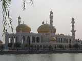
Yinchuan
Encyclopedia
Yinchuan is the capital of the Ningxia
Hui
Autonomous Region, People's Republic of China
, and former capital of the Western Xia
Empire of the Tanguts. It has an area of 4,467 km² and a total population of 1.99 million. Its built up area is home to 1,290,170 inhabitants spread on 3 urban districts. The name of the city literally means "silver river"; the character for "river" (川) is the same as that in Sichuan
, but not as those in, for example, the Yellow River
(黄河) or Yangtze River
(长江).
in 907, it was occupied by the Tangut Xi-Xia dynasty, of which it was the capital. After the destruction of the Xi-Xia dynasty by the Mongols
in 1227, it came under the rule of the Mongol Yuan Dynasty
. Under the Ming
(1368–1644) and Qing
(1644–1911) dynasties, it was a prefecture
of Ningxia
. In 1928, when the province of Ningxia was formed from parts of Gansu
and Inner Mongolia
, it became the capital city. In 1954, when Ningxia province was abolished, the city was put in Gansu province; but, with the establishment of the Ningxia Hui autonomous region in 1958, Yinchuan once again became the capital.
Traditionally, Yinchuan was an administrative and commercial center. In the 1950s it had many commercial enterprises, and there were some handicrafts but no modern industry. The city has since grown considerably. Extensive coal deposits discovered on the eastern bank of the Yellow River
, near Shizuishan, 100 km to the north, have made Shizuishan a coal-mining center.
Yinchuan, however, remains largely nonindustrial. The immediate plains area, intensively irrigated by a system developed as long ago as the Han
(206 BC–AD 220) and Tang
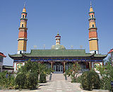
(618–907) dynasties, is extremely productive. Yinchuan is the chief agricultural market and distribution center for this area and also deals in animal products from the herds tended by nomads in the surrounding grasslands. It is a market for grain and has flour mills, as well as rice-hulling and oil-extraction plants. The wool produced in the surrounding plains supplies a woolen-textile mill. Yinchuan is a center for the Muslim
(Hui
) minority peoples, who constitute a third of the population. Yinchuan currently serves as a major trade route between Western cities such as Urumqi and the East.
On July 23, 1993 an airliner
that was attempting its second takeoff veered off the runway, crashed into a lake, and broke apart; at least 59 of the 113 persons aboard the craft were killed.
BWk) with cold and windy (but dry) winters, dust-laden springs, hot and somewhat humid summers, and rather short autumns. Monthly means range from −7.9 °C in January to 23.5 °C (74.3 °F) in July, with the mean for year at 9 °C (48.2 °F). Rainfall, is not heavy during any season, not even summer. Diurnal temperature differences tend to be large due to the aridity, which also partly contributes to the high annual sunshine hour total of just over 2,900 hours. There are 158 frost-free days.
per capita was ¥31,436 (US$4,526) in 2008, ranking 197th of 659 Chinese cities. Its main industries are the production of Chinese wolfberry
, wheat, apple, and rice.
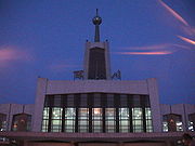
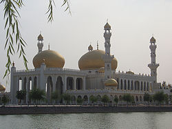 The city's attractions include the Sand-lake and the Western Xia tombs
.
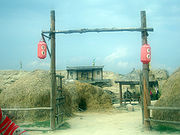
Sand Lake is 35 miles north of Yinchuan. Being a world of desert and lake, it is an ideal place for bird watching, sand slide and cableway slide. Appreciating reeds, lotus and fish are also popular.
The Western Xia Imperial Tombs are 15.5 miles west of Yinchuan on east side of Mt. Helan. Since June 1972, nine imperial tombs and 253 lesser tombs have been unearthed, which are as grand as Ming Tombs in Beijing. With a total area of more than 19.3 square miles, it is unique among royal burials.
There are two pagodas in Yinchuan that are part of the 'Eight Famous Scenery of Ningxia': one is the Haibao Pagoda in the northern suburb and the other is the Chengtiansi Pagoda in the west.
Since 2000, Yinchuan has hosted the annual Yinchuan International Car and Motorcycle Tourism Festival, which usually occurs in August. It is the largest event of its kind in China; approximately 3000 motorcycles attend annually.
It is also possible to see parts of the Great Wall which are located near the city.
posted images of a People's Liberation Army
military facility. The facility, estimated at around 630,000 m² in size, is 35 km from Yinchuan and in the town of Huangyangtan. The purpose of the facility was speculated on the Internet following the original posting, although no official explanation for the site has been given. A subsequent posting of a photograph on the Chinese wforum.com claimed that it constituted a terrain model of the disputed Aksai Chin
region of China; the image includes a watermark of Xinhua News Agency
, the official press agency of the government of the People's Republic of China
.
Authorities in the Ningxia Hui Autonomous Region have been quoted as saying that the site is used as a tank training facility.
Ningxia
Ningxia, formerly transliterated as Ningsia, is an autonomous region of the People's Republic of China. Located in Northwest China, on the Loess Plateau, the Yellow River flows through this vast area of land. The Great Wall of China runs along its northeastern boundary...
Hui
Hui people
The Hui people are an ethnic group in China, defined as Chinese speaking people descended from foreign Muslims. They are typically distinguished by their practice of Islam, however some also practice other religions, and many are direct descendants of Silk Road travelers.In modern People's...
Autonomous Region, People's Republic of China
People's Republic of China
China , officially the People's Republic of China , is the most populous country in the world, with over 1.3 billion citizens. Located in East Asia, the country covers approximately 9.6 million square kilometres...
, and former capital of the Western Xia
Western Xia
The Western Xia Dynasty or the Tangut Empire, was known to the Tanguts and the Tibetans as Minyak.The state existed from 1038 to 1227 AD in what are now the northwestern Chinese provinces of Ningxia, Gansu, eastern Qinghai, northern Shaanxi, northeastern Xinjiang, southwest Inner Mongolia, and...
Empire of the Tanguts. It has an area of 4,467 km² and a total population of 1.99 million. Its built up area is home to 1,290,170 inhabitants spread on 3 urban districts. The name of the city literally means "silver river"; the character for "river" (川) is the same as that in Sichuan
Sichuan
' , known formerly in the West by its postal map spellings of Szechwan or Szechuan is a province in Southwest China with its capital in Chengdu...
, but not as those in, for example, the Yellow River
Yellow River
The Yellow River or Huang He, formerly known as the Hwang Ho, is the second-longest river in China and the sixth-longest in the world at the estimated length of . Originating in the Bayan Har Mountains in Qinghai Province in western China, it flows through nine provinces of China and empties into...
(黄河) or Yangtze River
Yangtze River
The Yangtze, Yangzi or Cháng Jiāng is the longest river in Asia, and the third-longest in the world. It flows for from the glaciers on the Tibetan Plateau in Qinghai eastward across southwest, central and eastern China before emptying into the East China Sea at Shanghai. It is also one of the...
(长江).
History
Yinchuan originally was a xian (county) under the name of Fuping in the 1st century BC; its name was changed to Huaiyuan in the 6th century AD. After the fall of the Tang dynastyTang Dynasty
The Tang Dynasty was an imperial dynasty of China preceded by the Sui Dynasty and followed by the Five Dynasties and Ten Kingdoms Period. It was founded by the Li family, who seized power during the decline and collapse of the Sui Empire...
in 907, it was occupied by the Tangut Xi-Xia dynasty, of which it was the capital. After the destruction of the Xi-Xia dynasty by the Mongols
Mongols
Mongols ) are a Central-East Asian ethnic group that lives mainly in the countries of Mongolia, China, and Russia. In China, ethnic Mongols can be found mainly in the central north region of China such as Inner Mongolia...
in 1227, it came under the rule of the Mongol Yuan Dynasty
Yuan Dynasty
The Yuan Dynasty , or Great Yuan Empire was a ruling dynasty founded by the Mongol leader Kublai Khan, who ruled most of present-day China, all of modern Mongolia and its surrounding areas, lasting officially from 1271 to 1368. It is considered both as a division of the Mongol Empire and as an...
. Under the Ming
Ming Dynasty
The Ming Dynasty, also Empire of the Great Ming, was the ruling dynasty of China from 1368 to 1644, following the collapse of the Mongol-led Yuan Dynasty. The Ming, "one of the greatest eras of orderly government and social stability in human history", was the last dynasty in China ruled by ethnic...
(1368–1644) and Qing
Qing Dynasty
The Qing Dynasty was the last dynasty of China, ruling from 1644 to 1912 with a brief, abortive restoration in 1917. It was preceded by the Ming Dynasty and followed by the Republic of China....
(1644–1911) dynasties, it was a prefecture
Prefecture (China)
The term Prefectures, or the more formal prefectural level divisions, in the context of China, is used to refer to several unrelated political divisions in both ancient and modern China. Other than provincial level divisions, prefectural level divisions are not mentioned in the Chinese constitution...
of Ningxia
Ningxia
Ningxia, formerly transliterated as Ningsia, is an autonomous region of the People's Republic of China. Located in Northwest China, on the Loess Plateau, the Yellow River flows through this vast area of land. The Great Wall of China runs along its northeastern boundary...
. In 1928, when the province of Ningxia was formed from parts of Gansu
Gansu
' is a province located in the northwest of the People's Republic of China.It lies between the Tibetan and Huangtu plateaus, and borders Mongolia, Inner Mongolia, and Ningxia to the north, Xinjiang and Qinghai to the west, Sichuan to the south, and Shaanxi to the east...
and Inner Mongolia
Inner Mongolia
Inner Mongolia is an autonomous region of the People's Republic of China, located in the northern region of the country. Inner Mongolia shares an international border with the countries of Mongolia and the Russian Federation...
, it became the capital city. In 1954, when Ningxia province was abolished, the city was put in Gansu province; but, with the establishment of the Ningxia Hui autonomous region in 1958, Yinchuan once again became the capital.
Traditionally, Yinchuan was an administrative and commercial center. In the 1950s it had many commercial enterprises, and there were some handicrafts but no modern industry. The city has since grown considerably. Extensive coal deposits discovered on the eastern bank of the Yellow River
Yellow River
The Yellow River or Huang He, formerly known as the Hwang Ho, is the second-longest river in China and the sixth-longest in the world at the estimated length of . Originating in the Bayan Har Mountains in Qinghai Province in western China, it flows through nine provinces of China and empties into...
, near Shizuishan, 100 km to the north, have made Shizuishan a coal-mining center.
Yinchuan, however, remains largely nonindustrial. The immediate plains area, intensively irrigated by a system developed as long ago as the Han
Han Dynasty
The Han Dynasty was the second imperial dynasty of China, preceded by the Qin Dynasty and succeeded by the Three Kingdoms . It was founded by the rebel leader Liu Bang, known posthumously as Emperor Gaozu of Han. It was briefly interrupted by the Xin Dynasty of the former regent Wang Mang...
(206 BC–AD 220) and Tang
Tang Dynasty
The Tang Dynasty was an imperial dynasty of China preceded by the Sui Dynasty and followed by the Five Dynasties and Ten Kingdoms Period. It was founded by the Li family, who seized power during the decline and collapse of the Sui Empire...
(618–907) dynasties, is extremely productive. Yinchuan is the chief agricultural market and distribution center for this area and also deals in animal products from the herds tended by nomads in the surrounding grasslands. It is a market for grain and has flour mills, as well as rice-hulling and oil-extraction plants. The wool produced in the surrounding plains supplies a woolen-textile mill. Yinchuan is a center for the Muslim
Muslim
A Muslim, also spelled Moslem, is an adherent of Islam, a monotheistic, Abrahamic religion based on the Quran, which Muslims consider the verbatim word of God as revealed to prophet Muhammad. "Muslim" is the Arabic term for "submitter" .Muslims believe that God is one and incomparable...
(Hui
Hui people
The Hui people are an ethnic group in China, defined as Chinese speaking people descended from foreign Muslims. They are typically distinguished by their practice of Islam, however some also practice other religions, and many are direct descendants of Silk Road travelers.In modern People's...
) minority peoples, who constitute a third of the population. Yinchuan currently serves as a major trade route between Western cities such as Urumqi and the East.
On July 23, 1993 an airliner
Airliner
An airliner is a large fixed-wing aircraft for transporting passengers and cargo. Such aircraft are operated by airlines. Although the definition of an airliner can vary from country to country, an airliner is typically defined as an aircraft intended for carrying multiple passengers in commercial...
that was attempting its second takeoff veered off the runway, crashed into a lake, and broke apart; at least 59 of the 113 persons aboard the craft were killed.
Geography
Yinchuan lies in the middle of the Yinchuan or Ningxia Plain. It is sheltered from the deserts of Mongolia by the high ranges of the Helan Mountain to its west. The Yellow River runs through Yinchuan from southwest to northeast. The average elevation of Yinchuan is 1,100 meters (about 3,608 feet). The urban center of Yinchuan lies about halfway between the Yellow River and the edge of Helan Mountain.Climate
Yinchuan has a desert climate (KöppenKöppen climate classification
The Köppen climate classification is one of the most widely used climate classification systems. It was first published by Crimea German climatologist Wladimir Köppen in 1884, with several later modifications by Köppen himself, notably in 1918 and 1936...
BWk) with cold and windy (but dry) winters, dust-laden springs, hot and somewhat humid summers, and rather short autumns. Monthly means range from −7.9 °C in January to 23.5 °C (74.3 °F) in July, with the mean for year at 9 °C (48.2 °F). Rainfall, is not heavy during any season, not even summer. Diurnal temperature differences tend to be large due to the aridity, which also partly contributes to the high annual sunshine hour total of just over 2,900 hours. There are 158 frost-free days.
Administrative divisions
| Map | # | Name | Hanzi | Hanyu Pinyin | Xiao'erjing | Population (2010) |
Area (km²) | Density (/km²) |
|---|---|---|---|---|---|---|---|
| City proper | |||||||
| 1 | Xingqing District | 兴庆区 | Xīngqìng Qū | دٍ ﻓْﻊ ﺛُﻮ | 678,306 | 768 | 883 |
| 2 | Jinfeng District | 金凤区 | Jīnfèng Qū | دٍ ﻓْﻊ ﺛُﻮ | 282,554 | 290 | 974 |
| 3 | Xixia District | 西夏区 | Xīxià Qū | ثِ ﺷﯿَا ﺛُﻮ | 329,310 | 987 | 334 |
| Satellite cities | |||||||
| 4 | Lingwu City | 灵武市 | Língwǔ Shì | لٍ ءُ شِ | 261,677 | 4,639 | 56 |
| Rural | |||||||
| 5 | Yongning County | 永宁县 | Yǒngníng Xiàn | ﻳْﻮ نٍ ﺷِﯿًﺎ | 218,260 | 1,295 | 169 |
| 6 | Helan County | 贺兰县 | Hèlán Xiàn | حْ لً ﺷِﯿًﺎ | 222,981 | 1,600 | 139 |
Economy
The city's gross domestic productGross domestic product
Gross domestic product refers to the market value of all final goods and services produced within a country in a given period. GDP per capita is often considered an indicator of a country's standard of living....
per capita was ¥31,436 (US$4,526) in 2008, ranking 197th of 659 Chinese cities. Its main industries are the production of Chinese wolfberry
Wolfberry
Wolfberry, commercially called goji berry, is the common name for the fruit of two very closely related species: Lycium barbarum and L. chinense , two species of boxthorn in the family Solanaceae...
, wheat, apple, and rice.
Transportation
- Yinchuan is located near the western bank of the upper course of the Yellow RiverYellow RiverThe Yellow River or Huang He, formerly known as the Hwang Ho, is the second-longest river in China and the sixth-longest in the world at the estimated length of . Originating in the Bayan Har Mountains in Qinghai Province in western China, it flows through nine provinces of China and empties into...
, near the western end of the Great Wall of ChinaGreat Wall of ChinaThe Great Wall of China is a series of stone and earthen fortifications in northern China, built originally to protect the northern borders of the Chinese Empire against intrusions by various nomadic groups...
in the south-central section of the Helan ShanHelan ShanThe Helan Mountains , frequently called Alashan Mountains in older sources, are an isolated desert mountain range forming the border of Inner Mongolia's Alxa League and Ningxia. They run north-south parallel to the north-flowing Yellow River in the Ordos Loop section...
and Ordos DesertOrdos DesertThe Ordos Desert is a desert and steppe region lying on a plateau in the south of the Inner Mongolian Autonomous Region of the People's Republic of China . The soil of the Ordos is a mixture of clay and sand and, as a result, is poorly suited for agriculture. It extends over an area of...
. - It is served by Yinchuan Hedong AirportYinchuan Hedong AirportYinchuan Hedong Airport is an airport in Yinchuan, the capital of Ningxia Hui Autonomous Region, China. It is located southeast of downtown Yinchuan in Linghe Town of Lingwu City....
. - It is served by a river port at Hengcheng, about 15 km to the east. Until the 1950s the river, which is navigable downstream as far as BaotouBaotouBaotou is a mid-sized industrial city in the Inner Mongolia Autonomous Region of the People's Republic of China. Governed as a prefecture-level city, its urban areas are home to a population of approximately 1.78 million, with a total population of over 2.65 million accounting for counties under...
in the Inner MongoliaInner MongoliaInner Mongolia is an autonomous region of the People's Republic of China, located in the northern region of the country. Inner Mongolia shares an international border with the countries of Mongolia and the Russian Federation...
n autonomous region and upstream to Zhongwei and Zhongning, was the chief communication link. - Highways also link the city to Baotou along the river, to LanzhouLanzhouLanzhou is the capital and largest city of Gansu Province in Northwest China. A prefecture-level city, it is a key regional transportation hub, allowing areas further west to maintain railroad connections to the eastern half of the country....
in GansuGansu' is a province located in the northwest of the People's Republic of China.It lies between the Tibetan and Huangtu plateaus, and borders Mongolia, Inner Mongolia, and Ningxia to the north, Xinjiang and Qinghai to the west, Sichuan to the south, and Shaanxi to the east...
province to the southwest, to Wuwei in Gansu to the west, and to Xi'anXi'anXi'an is the capital of the Shaanxi province, and a sub-provincial city in the People's Republic of China. One of the oldest cities in China, with more than 3,100 years of history, the city was known as Chang'an before the Ming Dynasty...
in Shaanxi province to the southeast. - Since 1958 the city has been on the railway from Lanzhou to Baotou and is thus linked to other parts of China by rail.
- China National Highway 211China National Highway 211China National Highway 211 runs from Yinchuan in Ningxia to Xi'an in Shaanxi. It is 645 kilometres in length and runs southwest from Wuning in Ningxia and then turns southeast on a virtual straight line to Xi'an via primarily rural areas....

Tourism

Western Xia tombs
Occupying an area of some , the Western Xia tombs at the foot of the Helan Mountains in the Ningxia Hui Autonomous Region of northwestern China includes nine imperial mausoleums and 250 tombs of imperial relatives and officials...
.
Sand Lake is 35 miles north of Yinchuan. Being a world of desert and lake, it is an ideal place for bird watching, sand slide and cableway slide. Appreciating reeds, lotus and fish are also popular.
The Western Xia Imperial Tombs are 15.5 miles west of Yinchuan on east side of Mt. Helan. Since June 1972, nine imperial tombs and 253 lesser tombs have been unearthed, which are as grand as Ming Tombs in Beijing. With a total area of more than 19.3 square miles, it is unique among royal burials.
There are two pagodas in Yinchuan that are part of the 'Eight Famous Scenery of Ningxia': one is the Haibao Pagoda in the northern suburb and the other is the Chengtiansi Pagoda in the west.
Since 2000, Yinchuan has hosted the annual Yinchuan International Car and Motorcycle Tourism Festival, which usually occurs in August. It is the largest event of its kind in China; approximately 3000 motorcycles attend annually.
It is also possible to see parts of the Great Wall which are located near the city.

Colleges and universities
- Ningxia Polytechnical University
- Ningxia UniversityNingxia UniversityNingxia University is a regional comprehensive university, co-administrated by Ningxia Hui Autonomous Region and Ministry of Education of the People's Republic of China....
- Second Northwest Nationalities University
- Ningxia Medical Institute

2006 Internet phenomenon
Yinchuan was subject to an Internet phenomenon after a user of Google EarthGoogle Earth
Google Earth is a virtual globe, map and geographical information program that was originally called EarthViewer 3D, and was created by Keyhole, Inc, a Central Intelligence Agency funded company acquired by Google in 2004 . It maps the Earth by the superimposition of images obtained from satellite...
posted images of a People's Liberation Army
People's Liberation Army
The People's Liberation Army is the unified military organization of all land, sea, strategic missile and air forces of the People's Republic of China. The PLA was established on August 1, 1927 — celebrated annually as "PLA Day" — as the military arm of the Communist Party of China...
military facility. The facility, estimated at around 630,000 m² in size, is 35 km from Yinchuan and in the town of Huangyangtan. The purpose of the facility was speculated on the Internet following the original posting, although no official explanation for the site has been given. A subsequent posting of a photograph on the Chinese wforum.com claimed that it constituted a terrain model of the disputed Aksai Chin
Aksai Chin
Aksai Chin is one of the two main disputed border areas between China and India, and the other is South Tibet, which comprises most of India's Arunachal Pradesh. It is administered by China as part of Hotan County in the Hotan Prefecture of Xinjiang Autonomous Region, but is also claimed by India...
region of China; the image includes a watermark of Xinhua News Agency
Xinhua News Agency
The Xinhua News Agency is the official press agency of the government of the People's Republic of China and the biggest center for collecting information and press conferences in the PRC. It is the largest news agency in the PRC, ahead of the China News Service...
, the official press agency of the government of the People's Republic of China
People's Republic of China
China , officially the People's Republic of China , is the most populous country in the world, with over 1.3 billion citizens. Located in East Asia, the country covers approximately 9.6 million square kilometres...
.
Authorities in the Ningxia Hui Autonomous Region have been quoted as saying that the site is used as a tank training facility.

