Karlbergskanalen
Encyclopedia


Canal
Canals are man-made channels for water. There are two types of canal:#Waterways: navigable transportation canals used for carrying ships and boats shipping goods and conveying people, further subdivided into two kinds:...
in western central Stockholm
Stockholm
Stockholm is the capital and the largest city of Sweden and constitutes the most populated urban area in Scandinavia. Stockholm is the most populous city in Sweden, with a population of 851,155 in the municipality , 1.37 million in the urban area , and around 2.1 million in the metropolitan area...
, Sweden
Sweden
Sweden , officially the Kingdom of Sweden , is a Nordic country on the Scandinavian Peninsula in Northern Europe. Sweden borders with Norway and Finland and is connected to Denmark by a bridge-tunnel across the Öresund....
.
Separating the island Kungsholmen
Kungsholmen
Kungsholmen is an island in Lake Mälaren in Sweden, part of Stockholm City. It is situated north of Riddarfjärden and considered part of the historical province Uppland....
from the northern municipality Solna
Solna Municipality
Solna Municipality is a municipality in Stockholm County in east central Sweden, located just north of the capital Stockholm. Its seat is located in the 'city' of Solna....
, it connects Ulvsundasjön to Karlbergssjön and thus forms the western-most part of the nameless body of water which separates Kungsholmen from the northern city districts Vasastaden
Vasastaden, Stockholm
Vasastaden, or colloquially Vasastan, is a 3.00 km² large city district in central Stockholm, Sweden. With 51,661 inhabitants it is the second most populous, as well as the second most densely populated district in Stockholm.The major parks in Vasastaden are Vasaparken and Observatorielunden...
and Norrmalm; the other sections being Karlbergssjön, Barnhusviken
Barnhusviken
Barnhusviken is a body of water in central Stockholm, Sweden. Separating the island Kungsholmen from the mainland district Norrmalm north of it, it connects Karlbergssjön to Klara Sjö....
, and Klara Sjö
Klara Sjö
Klara Sjö is a canal in central Stockholm, Sweden.Separating the island Kungsholmen from the northern city district Norrmalm, the canal connects Barnhusviken to Riddarfjärden...
.
Two bridges are stretching over the canal: Modest in size Ekelundsbron
Ekelundsbron
Ekelundsbron is a bridge in Stockholm, Sweden. Passing over the canal Karlbergskanalen, it connects the city district Stadshagen on Kungsholmen to the northern suburb Solna....
(formerly Karlbergsbron), offering a maximum vertical clearance of 5.1 m, is over-shadowed by the forest of massive concrete pillars and wide roadways of the Essingeleden
Essingeleden
Essingeleden is a motorway that goes from Solna to Stockholm, Sweden, crossing the westmost parts of central Stockholm, by going over Kungsholmen, Lilla Essingen, and Stora Essingen....
motorway passing high above the idyllic rural scenery below.
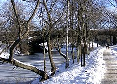
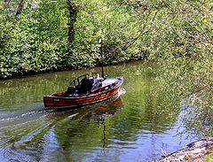
Karlbergskanalen is surrounded by trees and green spaces. Much of the character of the northern shore is dependent of the park of the nearby Karlberg Palace
Karlberg Palace
Karlberg Palace is a palace by the Karlberg Canal on the border of Stockholm in Solna. The palace, built in 1630 and the oldest in Solna municipality, today houses the Military Academy Karlberg....
and the recreational space surrounding it. Along the southern shore is a walk continuing all the way to the Stockholm City Hall
Stockholm City Hall
Stockholm City Hall is the building of the Municipal Council for the City of Stockholm in Sweden. It stands on the eastern tip of Kungsholmen island, next to Riddarfjärden's northern shore and facing the islands of Riddarholmen and Södermalm. It houses offices and conference rooms as well as...
more than 2 km away. Parts of the residential buildings in the Stadshagen
Stadshagen
Stadshagen is a district in Stockholm, in the northwest part of Kungsholmen. One of Stockholm's major hospitals, Saint Göran Hospital, opened in 1888 in this district. The area is also known for its many wild black rabbits, which are considered nuisances...
district is located next to the canal together with allotment gardens and a few older buildings, including the small but charming Mariedal
Mariedal
Mariedal is a locality situated in Upplands-Bro Municipality, Stockholm County, Sweden with 277 inhabitants in 2005....
palace originally built as a private residence in 1849.
Coordinates are: 59°20′24"N 18°08′52"E.
History
Originally dug in 1832–1833, the canal was made 600 ellEll
An ell , is a unit of measurement, approximating the length of a man's arm.Several national forms existed, with different lengths, includingthe Scottish ell ,the Flemish ell ,the French ell...
in length and 6 feet in depth. During the first decade, less than 400 ships and barges, and some 4,000 rowing boats annually found use for it. The remain of the watercourse was dredged during the 1840s and the entire canal subsequently deepened during the 1860s to between 2.97–5.94 metres. The first primitive swing bridge
Swing bridge
A swing bridge is a movable bridge that has as its primary structural support a vertical locating pin and support ring, usually at or near to its centre of gravity, about which the turning span can then pivot horizontally as shown in the animated illustration to the right...
was replaced until 1909 by a new steel swing bridge, still operated manually until finally replaced by a static concrete bridge in the 1950s.

