Langstone
Encyclopedia

Village
A village is a clustered human settlement or community, larger than a hamlet with the population ranging from a few hundred to a few thousand , Though often located in rural areas, the term urban village is also applied to certain urban neighbourhoods, such as the West Village in Manhattan, New...
near Havant
Havant
Havant is a town in south east Hampshire on the South coast of England, between Portsmouth and Chichester. It gives its name to the borough comprising the town and the surrounding area. The town has rapidly grown since the end of the Second World War.It has good railway connections to London,...
, Hampshire
Hampshire
Hampshire is a county on the southern coast of England in the United Kingdom. The county town of Hampshire is Winchester, a historic cathedral city that was once the capital of England. Hampshire is notable for housing the original birthplaces of the Royal Navy, British Army, and Royal Air Force...
in the south east of England
England
England is a country that is part of the United Kingdom. It shares land borders with Scotland to the north and Wales to the west; the Irish Sea is to the north west, the Celtic Sea to the south west, with the North Sea to the east and the English Channel to the south separating it from continental...
, between Portsmouth
Portsmouth
Portsmouth is the second largest city in the ceremonial county of Hampshire on the south coast of England. Portsmouth is notable for being the United Kingdom's only island city; it is located mainly on Portsea Island...
and Chichester
Chichester
Chichester is a cathedral city in West Sussex, within the historic County of Sussex, South-East England. It has a long history as a settlement; its Roman past and its subsequent importance in Anglo-Saxon times are only its beginnings...
. It has good railway connections to London
London
London is the capital city of :England and the :United Kingdom, the largest metropolitan area in the United Kingdom, and the largest urban zone in the European Union by most measures. Located on the River Thames, London has been a major settlement for two millennia, its history going back to its...
, Southampton
Southampton
Southampton is the largest city in the county of Hampshire on the south coast of England, and is situated south-west of London and north-west of Portsmouth. Southampton is a major port and the closest city to the New Forest...
, Portsmouth
Portsmouth
Portsmouth is the second largest city in the ceremonial county of Hampshire on the south coast of England. Portsmouth is notable for being the United Kingdom's only island city; it is located mainly on Portsea Island...
and Brighton
Brighton
Brighton is the major part of the city of Brighton and Hove in East Sussex, England on the south coast of Great Britain...
, from the nearby Havant railway station
Havant railway station
Havant railway station is a railway station near Portsmouth.It is located on the Portsmouth Direct Line which runs between London and Portsmouth...
. There are many large gated detached houses on the main road, "Langstone Road" and on the roads surrounding this. It has a sailing club, several architecturally
Architecture
Architecture is both the process and product of planning, designing and construction. Architectural works, in the material form of buildings, are often perceived as cultural and political symbols and as works of art...
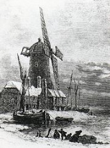
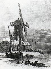
unusual buildings, and several historically significant buildings, including a converted (water) millhouse and a converted 18th century windmill, the latter of which is a local landmark.
Geography
The village surrounds "Langstone road" which leads to Hayling Island. There is a technology park on Langstone Road and this is due to the connections of the road. It lies just off the A27A27 road
The A27 is a major road in England. It runs from its junction with the A36 at Whiteparish in the county of Wiltshire. It closely parallels the south coast, where it passes through West Sussex and terminates at Pevensey in East Sussex.Between Portsmouth and Lewes, it is one of the busiest trunk...
that provides quick links to Portsmouth, Southampton and Brighton. The A3(M) to London is also nearby and the distance to the M25
M25 motorway
The M25 motorway, or London Orbital, is a orbital motorway that almost encircles Greater London, England, in the United Kingdom. The motorway was first mooted early in the 20th century. A few sections, based on the now abandoned London Ringways plan, were constructed in the early 1970s and it ...
is about 45 miles.
It is connected by Langstone Bridge
Langstone Bridge
Langstone Bridge connects Hayling Island with the English mainland of Hampshire.The name of the bridge is derived from its location at the coastal village of Langstone....
, a single-carriageway road and footbridge
Footbridge
A footbridge or pedestrian bridge is a bridge designed for pedestrians and in some cases cyclists, animal traffic and horse riders, rather than vehicular traffic. Footbridges complement the landscape and can be used decoratively to visually link two distinct areas or to signal a transaction...
, to Hayling Island
Hayling Island
-Leisure activities:Although largely residential, Hayling is also a holiday, windsurfing and sailing centre, the site where windsurfing was invented....
to the South; This road (the A3023) is the only road connection from Hayling Island to the mainland. Langstone Harbour
Langstone Harbour
Langstone Harbour is an inlet of the English Channel in Hampshire, sandwiched between Portsea Island to the south and west, Hayling Island to the south and east, and Langstone to the north. Geographically it is a ria....
lies to the west of the bridge; Chichester Harbour
Chichester Harbour
Chichester Harbour is a large natural harbour to the south west of the city of Chichester on the Solent. It straddles the boundary of West Sussex and Hampshire. Geographically it is a ria. It is one of four natural harbours in that area of the coastline, the others being Portsmouth Harbour,...
to the east.
An historic causeway to Hayling Island
Hayling Island
-Leisure activities:Although largely residential, Hayling is also a holiday, windsurfing and sailing centre, the site where windsurfing was invented....
exists, however it is now completely impassible, having been cut in two by a deep channel for the Portsmouth and Chichester Canal in the 1820s, the same company having subsequently funded the road bridge. It is known as the wade way, and was classified as a bridalway in 1988, and is shown as such on modern Ordnance Survey maps http://www.multimap.com/s/BBBFyzSD in spite of its use being considered hazardous at best. Excavation of this feature in 2006, constructed on a natural high point in the harbour, put its date in the roman to mediaeval range but found no evidence to be more specific.
The village High Street is designated as a Conservation Area (denoted by a blue plaque at the sea-end of the High Street), while the coastal path leading eastwards from the village is both part of Hampshire
Hampshire
Hampshire is a county on the southern coast of England in the United Kingdom. The county town of Hampshire is Winchester, a historic cathedral city that was once the capital of England. Hampshire is notable for housing the original birthplaces of the Royal Navy, British Army, and Royal Air Force...
County Council
County council
A county council is the elected administrative body governing an area known as a county. This term has slightly different meanings in different countries.-United Kingdom:...
's Solent Way
Solent Way
The Solent Way is a 60 mile long-distance footpath in Hampshire, southern England. With the exception of a few inland diversions, the path follows the coast of the Solent, the sea strait that separates the mainland England from the Isle of Wight...
and the same Councils' Wayfarers Walk
Wayfarers Walk
The Wayfarer's Walk is a long distance footpath in England from Walbury Hill, Berkshire to Emsworth, Hampshire.The footpath can be walked in either direction...
.
Thorney Island
Thorney Island (West Sussex)
Thorney Island is an island that juts into Chichester Harbour in West Sussex. It is separated from the mainland by a narrow channel called the Great Deep. The village of West Thorney lies on the east coast of the island and has been incorporated into the military base...
and Portsea Island
Portsea Island
Portsea Island is a small, flat and low lying island just off the south coast of England. The island is totally within, and contains a large proportion of, the city of Portsmouth. It has the third-largest population of any island in the British Isles, after the mainlands of Great Britain and...
are also both clearly visible from the village coast.
Architecture

Flood
A flood is an overflow of an expanse of water that submerges land. The EU Floods directive defines a flood as a temporary covering by water of land not normally covered by water...
ing can be a problem in the village, on occasion with water right up to the main Langstone Road, and many buildings on Langstone High Street have slots for wooden barriers on their door frames, and stack up sandbags.
Houses in the terrace on Langstone High Street date back to the 18th century and a number are thatched. The other significant buildings, commonly featured in local postcards, is Langstone Towers, characterised by a large lightning conductor.

