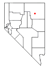
Liberty Lake, Nevada
Encyclopedia
Liberty Lake is a glacial tarn
in the Ruby Mountains
, in Elko County
in the northeastern part of the state of Nevada
. It is located near the head of Kleckner Canyon at approximately 40°34.8′N 115°23.7′W, and at an elevation of 10,040 feet (3060 meters). It has an area of approximately 21 acres (8.5 hectares), and a depth of up to 108 feet (33 meters). It is one of the sources of Kleckner Creek, which after exiting the mountains merges with other streams to form the South Fork of the Humboldt River
. The Ruby Crest National Recreation Trail
runs along the western shore of the lake.

Tarn (lake)
A tarn is a mountain lake or pool, formed in a cirque excavated by a glacier. A moraine may form a natural dam below a tarn. A corrie may be called a cirque.The word is derived from the Old Norse word tjörn meaning pond...
in the Ruby Mountains
Ruby Mountains
The Ruby Mountains comprise one of the many mountain ranges of the Great Basin in the western United States. They are the predominant range in Elko County, in the northeastern section of the state of Nevada. To the north is Secret Pass and the East Humboldt Range, and from there the Rubies run...
, in Elko County
Elko County, Nevada
-Demographics:As of the census of 2000, there were 45,291 people, 15,638 households, and 11,493 families residing in the county. The population density was 3/sq mi . There were 18,456 housing units at an average density of 1/sq mi...
in the northeastern part of the state of Nevada
Nevada
Nevada is a state in the western, mountain west, and southwestern regions of the United States. With an area of and a population of about 2.7 million, it is the 7th-largest and 35th-most populous state. Over two-thirds of Nevada's people live in the Las Vegas metropolitan area, which contains its...
. It is located near the head of Kleckner Canyon at approximately 40°34.8′N 115°23.7′W, and at an elevation of 10,040 feet (3060 meters). It has an area of approximately 21 acres (8.5 hectares), and a depth of up to 108 feet (33 meters). It is one of the sources of Kleckner Creek, which after exiting the mountains merges with other streams to form the South Fork of the Humboldt River
South Fork Humboldt River
The South Fork of the Humboldt River has its origins in a fan-shaped group of canyons draining the western slopes of the Ruby Mountains in northeastern Nevada. These headwaters run from Ruby Dome south to King Peak, and include Echo, Box, Kleckner, North Furlong, Long, Segunda, Drown, and...
. The Ruby Crest National Recreation Trail
Ruby Crest National Recreation Trail
right|Location of the Ruby Crest Trail within Nevada.right|thumb|Overland Lakeright|thumb|North Furlong Lakeright|thumb|Lamoille Lake and Dollar Lakes...
runs along the western shore of the lake.


