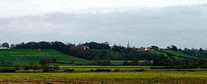
Lincoln Cliff
Encyclopedia

Escarpment
An escarpment is a steep slope or long cliff that occurs from erosion or faulting and separates two relatively level areas of differing elevations.-Description and variants:...
that runs north-south through Lindsey
Lindsey
Lindsey was a unit of local government until 1974 in Lincolnshire, England, covering the northern part of the county. The Isle of Axholme, which is on the west side of the River Trent, has normally formed part of it...
and Kesteven
Kesteven
The Parts of Kesteven are a traditional subdivision of Lincolnshire, England. This subdivision had long had a separate county administration , along with the other two parts, Lindsey and Holland.-Etymology:...
, in central Lincolnshire
Lincolnshire
Lincolnshire is a county in the east of England. It borders Norfolk to the south east, Cambridgeshire to the south, Rutland to the south west, Leicestershire and Nottinghamshire to the west, South Yorkshire to the north west, and the East Riding of Yorkshire to the north. It also borders...
and is a prominent landscape feature in a generally flat portion of the county. The prehistoric route known loosely as the Jurassic Way follows the line of this escarpment.
The scarp is formed by resistant Middle Jurassic rocks, principally the Lincolnshire Limestone series, and is remarkable for its length and straightness. It runs for over 50 miles from the Leicestershire border near Grantham to the River Humber, and is broken only twice by river gaps at Ancaster and Lincoln.
South of Lincoln the 'cliff villages' that lie on the escarpment are as follows, listed in order of southerly procession:
- Bracebridge HeathBracebridge HeathBracebridge Heath is a commuter village approximately south of Lincoln, Lincolnshire, England. It lies at the junction of two major roads the A15 to Sleaford and the A607 to Grantham, and was part of the Boothby Graffoe Wapentake...
- Waddington
- HarmstonHarmstonHarmston is a village and civil parish in the North Kesteven district of Lincolnshire, England. It lies just east off the A607. south of Lincoln...
- ColebyColeby, North KestevenColeby is a village and civil parish in the North Kesteven district of Lincolnshire, England. It lies on the A607 approximately south of Lincoln....
- Boothby GraffoeBoothby GraffoeBoothby Graffoe is a village and civil parish in the North Kesteven district of Lincolnshire, England. It lies approximately 7 miles south of Lincoln, on A607 . It's population is approximately 400....
- NavenbyNavenbyNavenby is a village and civil parish in Lincolnshire, England. Lying south of Lincoln and north-northwest of Sleaford, Navenby has a population of 1,666 and is a dormitory village for Lincoln...
- WellingoreWellingoreWellingore is a small rural village in Lincolnshire, approximately south of Lincoln, England on the A607 in the district of North Kesteven. It is just south of Navenby.-History:...
- WelbournWelbournWelbourn is a village in North Kesteven, central Lincolnshire on the A607 between Leadenham and Wellingore.-Village:The village church is St Chad's, part of the Loveden Deanery of the Diocese of Lincoln: the incumbent is the Revd Dr Alan Megahey....
- LeadenhamLeadenhamLeadenham is a village in North Kesteven, Lincolnshire, bypassed to the south in 1995 by the A17. It is on the A607 between Welbourn and Fulbeck, on the beginnings of the Lincoln Cliff.-The Village:...
- FulbeckFulbeckFulbeck is a small village and civil parish in the South Kesteven district of Lincolnshire, England. It lies on the A607, north from Grantham and north-west from Sleaford. To the north is Leadenham, and to the south is Caythorpe.-Toponymy:...
North of Lincoln, the name Lincoln Cliff, or simply the Cliff, is locally used to refer to the entire ridge of Jurassic Limestone, not just its steep western scarp. This can be seen in placenames such as Welton Cliff, Saxby Cliff and Caenby Cliff, reflecting parish-based divisions of the ridge. This use of the name is not found south of Lincoln, where the term Cliff refers only to the scarp itself, as distinct from the limestone plateau (which is here called the Lincoln Heath). To minimise confusion, some people prefer the name Lincoln Edge or Lincolnshire Edge for the scarp that runs from Grantham to the Humber, reserving the name Lincoln Cliff for the section of limestone ridge north of Lincoln.

