

List of highways in Culberson County, Texas
Encyclopedia
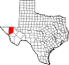
Culberson County, Texas
Culberson County is a county located in the U.S. state of Texas. It is one of the nine counties that comprise the Trans-Pecos region of West Texas. In 2000, its population was 2,975. Culberson was founded in 1911. It is named for David B. Culberson, a lawyer and Confederate soldier in the American...
, Texas
Texas
Texas is the second largest U.S. state by both area and population, and the largest state by area in the contiguous United States.The name, based on the Caddo word "Tejas" meaning "friends" or "allies", was applied by the Spanish to the Caddo themselves and to the region of their settlement in...
maintained by the Texas Department of Transportation
Texas Department of Transportation
The Texas Department of Transportation is a governmental agency in the U.S. state of Texas. Its stated mission is to "work cooperatively to provide safe, effective and efficient movement of people and goods" throughout the state...
. All state highways in Texas are paved.
Interstate highways
| Route Name | Direction | Termini | Junctions | Length | Remarks |
|---|---|---|---|---|---|
| W/E | Hudspeth County to Jeff Davis County |
 Van Horn, Texas Van Horn is a town in and the county seat of Culberson County, Texas, United States. The population was 2,435 at the 2000 census.-Geography:Van Horn is located at .... Van Horn, Texas Van Horn is a town in and the county seat of Culberson County, Texas, United States. The population was 2,435 at the 2000 census.-Geography:Van Horn is located at .... |
43.6 miles (70.2 km) | Bypasses by Van Horn Van Horn, Texas Van Horn is a town in and the county seat of Culberson County, Texas, United States. The population was 2,435 at the 2000 census.-Geography:Van Horn is located at .... and Kent Kent, Texas Kent is an unincorporated village in Culberson County, in West Texas, United States. It lies just north of Interstate 10 at Exit 176, ten miles west of the beginning of Interstate 20 and four miles west of the eastern Culberson County boundary. It is sandwiched between the railroad, immediately... |
Interstate business routes
| Route Name | Direction | Termini | Junctions | Length | Remarks |
|---|---|---|---|---|---|
|
W/E | to |
at Van Horn Van Horn, Texas Van Horn is a town in and the county seat of Culberson County, Texas, United States. The population was 2,435 at the 2000 census.-Geography:Van Horn is located at .... at Van Horn Van Horn, Texas Van Horn is a town in and the county seat of Culberson County, Texas, United States. The population was 2,435 at the 2000 census.-Geography:Van Horn is located at .... |
2.8 miles (4.5 km) | Business loop through Van Horn Van Horn, Texas Van Horn is a town in and the county seat of Culberson County, Texas, United States. The population was 2,435 at the 2000 census.-Geography:Van Horn is located at .... |
U.S. highways
| Route Name | Direction | Termini | Junctions | Length | Remarks |
|---|---|---|---|---|---|
| W/E | Hudspeth County to in NM |
 Guadalupe Mountains National Park Guadalupe Mountains National Park is located in the Guadalupe Mountains of West Texas and contains Guadalupe Peak, the highest point in Texas at in elevation. It also contains El Capitan, long used as a landmark by people traveling along the old route later followed by the Butterfield Overland... at Pine Springs Pine Springs, Texas Pine Springs is an unincorporated community in northern Culberson County, Texas, United States. It is the closest settlement to the headquarters of Guadalupe Mountains National Park, which contains Guadalupe Peak, the highest point in the state of Texas. Pine Springs is located on U.S. Routes 62... |
32.7 miles (52.6 km) | Overlays US 180 | |
| W/E |  Sierra Blanca, Texas Sierra Blanca is a census-designated place in and the county seat of Hudspeth County, Texas, United States. The population was 533 at the 2000 census, and had decreased to 510 according to a July 2007 estimate.... , Kent Kent, Texas Kent is an unincorporated village in Culberson County, in West Texas, United States. It lies just north of Interstate 10 at Exit 176, ten miles west of the beginning of Interstate 20 and four miles west of the eastern Culberson County boundary. It is sandwiched between the railroad, immediately... , Pine Springs Pine Springs, Texas Pine Springs is an unincorporated community in northern Culberson County, Texas, United States. It is the closest settlement to the headquarters of Guadalupe Mountains National Park, which contains Guadalupe Peak, the highest point in the state of Texas. Pine Springs is located on U.S. Routes 62... at Van Horn Van Horn, Texas Van Horn is a town in and the county seat of Culberson County, Texas, United States. The population was 2,435 at the 2000 census.-Geography:Van Horn is located at .... to Jeff Davis County |
near Lobo Lobo, Texas Lobo is a ghost town in Culberson County, Texas, United States that was abandoned in 1991.-Geography:Lobo is located at between the Van Horn Mountains and Wylie Mountains. It is situated along U.S... |
20 miles (32.2 km) | Briefly overlays SH 54 in Van Horn Van Horn, Texas Van Horn is a town in and the county seat of Culberson County, Texas, United States. The population was 2,435 at the 2000 census.-Geography:Van Horn is located at .... |
|
| W/E | Hudspeth County to in NM |
Guadalupe Mountains National Park Guadalupe Mountains National Park is located in the Guadalupe Mountains of West Texas and contains Guadalupe Peak, the highest point in Texas at in elevation. It also contains El Capitan, long used as a landmark by people traveling along the old route later followed by the Butterfield Overland... at Pine Springs Pine Springs, Texas Pine Springs is an unincorporated community in northern Culberson County, Texas, United States. It is the closest settlement to the headquarters of Guadalupe Mountains National Park, which contains Guadalupe Peak, the highest point in the state of Texas. Pine Springs is located on U.S. Routes 62... |
32.7 miles (52.6 km) | Overlays US 62 | |
| S/N | Reeves County to in NM |
0.7 miles (1.1 km) |
State highways
| Route Name | Direction | Termini | Junctions | Length | Remarks |
|---|---|---|---|---|---|
| S/N | to |
 U.S. Route 90 in Texas US 90 is a major east-west highway in the US state of Texas with large portions of it running concurrently with I-10. US 90 begins at I-10 in Van Horn, travels through the two largest cities in Texas, San Antonio and Houston, and continues on into the state of Louisiana.-Van Horn to San Antonio:US... south – Sierra Blanca Sierra Blanca, Texas Sierra Blanca is a census-designated place in and the county seat of Hudspeth County, Texas, United States. The population was 533 at the 2000 census, and had decreased to 510 according to a July 2007 estimate.... , Kent Kent, Texas Kent is an unincorporated village in Culberson County, in West Texas, United States. It lies just north of Interstate 10 at Exit 176, ten miles west of the beginning of Interstate 20 and four miles west of the eastern Culberson County boundary. It is sandwiched between the railroad, immediately... , Valentine Valentine, Texas Valentine is a town in Jeff Davis County, Texas, United States. The population was 187 at the 2000 census. It is the only incorporated municipality in Jeff Davis County.... at Van Horn Van Horn, Texas Van Horn is a town in and the county seat of Culberson County, Texas, United States. The population was 2,435 at the 2000 census.-Geography:Van Horn is located at .... at Van Horn Van Horn, Texas Van Horn is a town in and the county seat of Culberson County, Texas, United States. The population was 2,435 at the 2000 census.-Geography:Van Horn is located at .... |
54.9 miles (88.4 km) | Briefly overlays US 90 in Van Horn Van Horn, Texas Van Horn is a town in and the county seat of Culberson County, Texas, United States. The population was 2,435 at the 2000 census.-Geography:Van Horn is located at .... |
|
| S/N | Jeff Davis County to |
1.5 miles (2.4 km) |
Farm and ranch to market roads
| Route Name | Direction | Termini | Junctions | Length | Remarks |
|---|---|---|---|---|---|
| W/E | to Reeves County |
33.8 miles (54.4 km) | |||
| S/N | Dead end to |
9.8 miles (15.8 km) | |||
| W/E | to Dead end |
0.9 miles (1.4 km) | |||
| S/N | to |
8 miles (12.9 km) | |||
| W/E | to Jeff Davis County |
4 miles (6.4 km) | |||
| W/E | Dead end to Reeves County |
5.3 miles (8.5 km) | |||
| S/N | at Van Horn Van Horn, Texas Van Horn is a town in and the county seat of Culberson County, Texas, United States. The population was 2,435 at the 2000 census.-Geography:Van Horn is located at .... to Smileys Road |
41.8 miles (67.3 km) | |||
| S/N | at Kent Kent, Texas Kent is an unincorporated village in Culberson County, in West Texas, United States. It lies just north of Interstate 10 at Exit 176, ten miles west of the beginning of Interstate 20 and four miles west of the eastern Culberson County boundary. It is sandwiched between the railroad, immediately... to Jones Kent Road |
13.7 miles (22 km) | |||
| S/N | to Whitehead Road |
4.9 miles (7.9 km) | |||
| S/N | to Rustler Springs Road |
6.2 miles (10 km) |
Historic roads
| Route Name | Direction | Termini | Remarks |
|---|---|---|---|
 |
W/E | Hudspeth County to Jeff Davis County |
Replaced by Loop 519 and I-10 Interstate 10 in Texas Interstate 10 is the major east–west Interstate Highway in the Southern United States. In the U.S. state of Texas, it runs east from El Paso, near the border with New Mexico, through San Antonio and Houston to the border with Louisiana in Orange, Texas.... in 1975 and 1991 respectively. |
 |
W/E | Hudspeth County to Jeff Davis County |
Replaced by US 80 in 1939 |
| SH 3 | W/E | Jeff Davis County |
Replaced by US 90 U.S. Route 90 in Texas US 90 is a major east-west highway in the US state of Texas with large portions of it running concurrently with I-10. US 90 begins at I-10 in Van Horn, travels through the two largest cities in Texas, San Antonio and Houston, and continues on into the state of Louisiana.-Van Horn to San Antonio:US... in 1939 |
 |
S/N | Reeves County to New Mexico |
Replaced by US 285 in 1939 |
| SH 130 | W/E | Hudspeth County to SH 54 |
Replaced by US 62 in 1939 |
| W/E | to |
Replaced by Bus. I-10-D in 1991; route was marked as U.S. 80 Business | |
| W/E | to Culberson County Airport |
Designated in 1948, decommissioned in 1949: never constructed |
Adjacent states and counties
- New Mexico (north)
- Reeves County (east)
- Jeff Davis County (south)
- Hudspeth County (west)