

List of highways in Reeves County, Texas
Encyclopedia
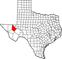
Reeves County, Texas
Reeves County is a county located in the US state of Texas. It is one of the nine counties that comprise the Trans-Pecos region of West Texas. In 2000, its population was 13,137. Its seat is Pecos. Reeves County is named for George R. Reeves, a Texas state legislator and colonel in the...
, Texas
Texas
Texas is the second largest U.S. state by both area and population, and the largest state by area in the contiguous United States.The name, based on the Caddo word "Tejas" meaning "friends" or "allies", was applied by the Spanish to the Caddo themselves and to the region of their settlement in...
maintained by the Texas Department of Transportation
Texas Department of Transportation
The Texas Department of Transportation is a governmental agency in the U.S. state of Texas. Its stated mission is to "work cooperatively to provide safe, effective and efficient movement of people and goods" throughout the state...
. All state highways in Texas are paved.
Interstate highways
| Route Name | Direction | Termini | Junctions | Length | Remarks |
|---|---|---|---|---|---|
 I-10 I-10Interstate 10 in Texas Interstate 10 is the major east–west Interstate Highway in the Southern United States. In the U.S. state of Texas, it runs east from El Paso, near the border with New Mexico, through San Antonio and Houston to the border with Louisiana in Orange, Texas.... |
W/E | Jeff Davis County Pecos County |
 I-20 I-20Interstate 20 in Texas Interstate 20 in Texas is a major east–west Interstate Highway in the Southern United States, running east from a junction with Interstate 10 east of Kent, Texas, through the Dallas-Fort Worth Metroplex to the border with Louisiana near Waskom, Texas...  FM 3078 FM 3078  Bus. I-10-F/FM 2903 Bus. I-10-F/FM 2903 Bus. I-10-F/SH 17 SH 17 Bus. I-10-F/SH 17 SH 17 FM 2448 FM 2448 |
41.3 miles (66.5 km) | Passes by Van Horn Balmorhea, Texas Balmorhea is a city in Reeves County, Texas, United States. The population was 527 at the 2000 census.-Geography:Balmorhea is located at .According to the United States Census Bureau, the city has a total area of , all land... |
| I-20 Interstate 20 in Texas Interstate 20 in Texas is a major east–west Interstate Highway in the Southern United States, running east from a junction with Interstate 10 east of Kent, Texas, through the Dallas-Fort Worth Metroplex to the border with Louisiana near Waskom, Texas... |
W/E | I-10 Interstate 10 in Texas Interstate 10 is the major east–west Interstate Highway in the Southern United States. In the U.S. state of Texas, it runs east from El Paso, near the border with New Mexico, through San Antonio and Houston to the border with Louisiana in Orange, Texas.... Ward County |
] FM 2903 FM 869 FM 869 Bus. I-20-B SH 17 Bus. I-20-B SH 17 US 285 US 285 |
48.2 miles (77.6 km) | Passes by Toyah Toyah, Texas Toyah is a town in Reeves County, Texas, United States. The population was 100 at the 2000 census.-Geography:Toyah is located at .According to the United States Census Bureau, the town has a total area of , all of it land.... and Pecos Pecos, Texas Pecos is the largest city in and the county seat of Reeves County, Texas, United States. It is situated in the river valley on the west bank of the Pecos River at the eastern edge of the Chihuahuan Desert and the Trans-Pecos region of west Texas and near the southern border of New Mexico... |
Interstate business routes
| Route Name | Direction | Termini | Junctions | Length | Remarks |
|---|---|---|---|---|---|
| Bus. I-10-F |
W/E | ] I-10 Interstate 10 in Texas Interstate 10 is the major east–west Interstate Highway in the Southern United States. In the U.S. state of Texas, it runs east from El Paso, near the border with New Mexico, through San Antonio and Houston to the border with Louisiana in Orange, Texas.... /FM 2903 I-10Interstate 10 in Texas Interstate 10 is the major east–west Interstate Highway in the Southern United States. In the U.S. state of Texas, it runs east from El Paso, near the border with New Mexico, through San Antonio and Houston to the border with Louisiana in Orange, Texas.... /SH 17 |
SH 17 |
2 miles (3.2 km) | Business loop through Balmorhea Balmorhea, Texas Balmorhea is a city in Reeves County, Texas, United States. The population was 527 at the 2000 census.-Geography:Balmorhea is located at .According to the United States Census Bureau, the city has a total area of , all land... |
| Bus. I-20-B |
W/E | I-20 Interstate 20 in Texas Interstate 20 in Texas is a major east–west Interstate Highway in the Southern United States, running east from a junction with Interstate 10 east of Kent, Texas, through the Dallas-Fort Worth Metroplex to the border with Louisiana near Waskom, Texas... Ward County |
FM 2119 Farm to Market Road 2119 FM 2119 is a 40-mile farm to market road in West Texas.-Route description:The western terminus of FM 2119 is at Duval Rd. at Rustler Springs in unincorporated Culberson County. The route travels southeast for 40 miles, crossing into Reeves County before ending at Bus... SH 17 FM 761 US 285 FM 761 US 285 |
5.5 miles (8.9 km) | Business loop through Pecos Pecos, Texas Pecos is the largest city in and the county seat of Reeves County, Texas, United States. It is situated in the river valley on the west bank of the Pecos River at the eastern edge of the Chihuahuan Desert and the Trans-Pecos region of west Texas and near the southern border of New Mexico... and Barstow Barstow, Texas Barstow is a city in Ward County, Texas, United States. The population was 406 at the 2000 census.-Geography:Barstow is located at .... |
U.S. highways
| Route Name | Direction | Termini | Junctions | Length | Remarks |
|---|---|---|---|---|---|
| US 285 |
S/N | Pecos County Culberson County |
FM 2007 FM 1450 I-20Interstate 20 in Texas Interstate 20 in Texas is a major east–west Interstate Highway in the Southern United States, running east from a junction with Interstate 10 east of Kent, Texas, through the Dallas-Fort Worth Metroplex to the border with Louisiana near Waskom, Texas... Bus. I-20-BFM 1216  SH 302 SH 302Texas State Highway 302 State Highway 302 or SH 302 is a Texas state highway maintained by the Texas Department of Transportation . The route runs from U.S. Route 285 northwest of Pecos to Interstate 20 near Odessa. The route passes through Reeves, Loving, Winkler, and Ector counties. SH 302 has intersections with SH 115...  RM 652 RM 652Ranch to Market Road 652 RM 652 is a 58.6-mile long ranch to market road in West Texas near the Texas/New Mexico state line.-Route description:The western terminus of RM 652 is in Culberson County at , near the Texas/New Mexico state line. The route travels east into Reeves County, intersecting at Orla. RM 652 then... |
77.8 miles (125.2 km) | Passes through Pecos Pecos, Texas Pecos is the largest city in and the county seat of Reeves County, Texas, United States. It is situated in the river valley on the west bank of the Pecos River at the eastern edge of the Chihuahuan Desert and the Trans-Pecos region of west Texas and near the southern border of New Mexico... and Orla Orla, Texas Orla is a ghost town in Reeves County, Texas, United States. It lies about 38 miles north of Pecos. It is believed to have two residents and has its own post office, located on U.S. Route 285. The post office was established 26 December 1906 with Joshua D. McAdams as first postmaster.... |
State highways
| Route Name | Direction | Termini | Junctions | Length | Remarks |
|---|---|---|---|---|---|
| SH 17 |
S/N | Jeff Davis County Bus. I-20-B |
FM 3078 Bus. I-10-F I-10 Interstate 10 in Texas Interstate 10 is the major east–west Interstate Highway in the Southern United States. In the U.S. state of Texas, it runs east from El Paso, near the border with New Mexico, through San Antonio and Houston to the border with Louisiana in Orange, Texas.... /Bus. I-10-F I-10Interstate 10 in Texas Interstate 10 is the major east–west Interstate Highway in the Southern United States. In the U.S. state of Texas, it runs east from El Paso, near the border with New Mexico, through San Antonio and Houston to the border with Louisiana in Orange, Texas....  FM 1215 FM 1215 FM 2448 FM 1215 FM 1215 FM 2448 FM 3334 FM 869 FM 3334 FM 869 FM 1934 I-20 FM 1934 I-20Interstate 20 in Texas Interstate 20 in Texas is a major east–west Interstate Highway in the Southern United States, running east from a junction with Interstate 10 east of Kent, Texas, through the Dallas-Fort Worth Metroplex to the border with Louisiana near Waskom, Texas... FM 761 |
44.2 miles (71.1 km) | Passes through Toyahvale Toyahvale, Texas Toyahvale is an unincorporated community in southern Reeves County, Texas, United States. It lies along State Highway 17 and FM 3078 south of the city of Pecos, the county seat of Reeves County. Despite its similar name, Toyahvale is distinct from the town of Toyah, which lies 25 miles to... , Balmorhea Balmorhea, Texas Balmorhea is a city in Reeves County, Texas, United States. The population was 527 at the 2000 census.-Geography:Balmorhea is located at .According to the United States Census Bureau, the city has a total area of , all land... , and Saragosa Saragosa, Texas Saragosa is an unincorporated community in Reeves County, Texas, United States. According to the Handbook of Texas, the community had an estimated population of 185 in 2000.... ending in Pecos Pecos, Texas Pecos is the largest city in and the county seat of Reeves County, Texas, United States. It is situated in the river valley on the west bank of the Pecos River at the eastern edge of the Chihuahuan Desert and the Trans-Pecos region of west Texas and near the southern border of New Mexico... |
| SH 302 Texas State Highway 302 State Highway 302 or SH 302 is a Texas state highway maintained by the Texas Department of Transportation . The route runs from U.S. Route 285 northwest of Pecos to Interstate 20 near Odessa. The route passes through Reeves, Loving, Winkler, and Ector counties. SH 302 has intersections with SH 115... |
S/N | US 285 Loving County |
2.3 miles (3.7 km) |
State park roads
| Route Name | Direction | Termini | Junctions | Length | Remarks |
|---|---|---|---|---|---|
 Park Road 30 Park Road 30 |
S/N | Balmorhea State Park Balmorhea State Park Balmorhea State Park is a state park located on the San Solomon Springs in Reeves County, Texas, opened in 1968. The closest major town is Balmorhea, Texas. The park is open year round.-Features:... SH 17 |
0.6 mile (0.965604 km) | Balmorhea State Park Road |
Farm and ranch to market roads
| Route Name | Direction | Termini | Junctions | Length | Remarks |
|---|---|---|---|---|---|
| RM 652 Ranch to Market Road 652 RM 652 is a 58.6-mile long ranch to market road in West Texas near the Texas/New Mexico state line.-Route description:The western terminus of RM 652 is in Culberson County at , near the Texas/New Mexico state line. The route travels east into Reeves County, intersecting at Orla. RM 652 then... |
W/E | Culberson County Loving County |
US 285 |
13.5 miles (21.7 km) | Passes through Orla Orla, Texas Orla is a ghost town in Reeves County, Texas, United States. It lies about 38 miles north of Pecos. It is believed to have two residents and has its own post office, located on U.S. Route 285. The post office was established 26 December 1906 with Joshua D. McAdams as first postmaster.... |
| FM 761 |
S/N | SH 17 Bus. I-20-B |
2.5 miles (4 km) | Entire route within Pecos Pecos, Texas Pecos is the largest city in and the county seat of Reeves County, Texas, United States. It is situated in the river valley on the west bank of the Pecos River at the eastern edge of the Chihuahuan Desert and the Trans-Pecos region of west Texas and near the southern border of New Mexico... |
|
| FM 869 |
S/N | SH 17 I-20 Interstate 20 in Texas Interstate 20 in Texas is a major east–west Interstate Highway in the Southern United States, running east from a junction with Interstate 10 east of Kent, Texas, through the Dallas-Fort Worth Metroplex to the border with Louisiana near Waskom, Texas... |
FM 1934 |
13.8 miles (22.2 km) | |
| FM 1215 |
W/E | I-20 Interstate 20 in Texas Interstate 20 in Texas is a major east–west Interstate Highway in the Southern United States, running east from a junction with Interstate 10 east of Kent, Texas, through the Dallas-Fort Worth Metroplex to the border with Louisiana near Waskom, Texas... N. service road |
SH 17 |
4.4 miles (7.1 km) | Passes through Saragosa Saragosa, Texas Saragosa is an unincorporated community in Reeves County, Texas, United States. According to the Handbook of Texas, the community had an estimated population of 185 in 2000.... |
| FM 1216 | S/N | US 285 |
 FM 3398 FM 3398 |
10.1 miles (16.3 km) | |
| FM 1450 | W/E | US 285 Pecos County |
23.5 miles (37.8 km) | ||
| FM 1934 |
W/E | FM 869 SH 17 |
10.1 miles (16.3 km) | ||
| FM 2007 | S/N | US 285 |
7.9 miles (12.7 km) | ||
| FM 2119 Farm to Market Road 2119 FM 2119 is a 40-mile farm to market road in West Texas.-Route description:The western terminus of FM 2119 is at Duval Rd. at Rustler Springs in unincorporated Culberson County. The route travels southeast for 40 miles, crossing into Reeves County before ending at Bus... |
W/E | Culberson County Bus. I-20-B |
34.7 miles (55.8 km) | ||
| FM 2448 |
S/N | I-20 Interstate 20 in Texas Interstate 20 in Texas is a major east–west Interstate Highway in the Southern United States, running east from a junction with Interstate 10 east of Kent, Texas, through the Dallas-Fort Worth Metroplex to the border with Louisiana near Waskom, Texas... SH 17 |
6 miles (9.7 km) | ||
| FM 2903 |
S/N | I-10 Interstate 10 in Texas Interstate 10 is the major east–west Interstate Highway in the Southern United States. In the U.S. state of Texas, it runs east from El Paso, near the border with New Mexico, through San Antonio and Houston to the border with Louisiana in Orange, Texas.... /Bus. I-10-F I-20Interstate 20 in Texas Interstate 20 in Texas is a major east–west Interstate Highway in the Southern United States, running east from a junction with Interstate 10 east of Kent, Texas, through the Dallas-Fort Worth Metroplex to the border with Louisiana near Waskom, Texas... |
FM 3334 |
6 miles (9.7 km) | Road from Balmorhea Balmorhea, Texas Balmorhea is a city in Reeves County, Texas, United States. The population was 527 at the 2000 census.-Geography:Balmorhea is located at .According to the United States Census Bureau, the city has a total area of , all land... to Toyah Toyah, Texas Toyah is a town in Reeves County, Texas, United States. The population was 100 at the 2000 census.-Geography:Toyah is located at .According to the United States Census Bureau, the town has a total area of , all of it land.... |
| FM 3078 Farm to Market Road 3078 Farm to Market Road 3078, Farm Road 3078, or FM 3078 is a road maintained by the Texas Department of Transportation that connects Interstate 10 to State Highway 17 in Toyahvale. The route is in Jeff Davis County and Reeves County and connects Toyahvale to points farther west along I-10 including... |
W/E | I-10 Interstate 10 in Texas Interstate 10 is the major east–west Interstate Highway in the Southern United States. In the U.S. state of Texas, it runs east from El Paso, near the border with New Mexico, through San Antonio and Houston to the border with Louisiana in Orange, Texas.... Jeff Davis County |
5 miles (8 km) | Road leaves county | |
| FM 3078 Farm to Market Road 3078 Farm to Market Road 3078, Farm Road 3078, or FM 3078 is a road maintained by the Texas Department of Transportation that connects Interstate 10 to State Highway 17 in Toyahvale. The route is in Jeff Davis County and Reeves County and connects Toyahvale to points farther west along I-10 including... |
W/E | Jeff Davis County SH 17 |
4.9 miles (7.9 km) | Road reenters county to Toyahvale Toyahvale, Texas Toyahvale is an unincorporated community in southern Reeves County, Texas, United States. It lies along State Highway 17 and FM 3078 south of the city of Pecos, the county seat of Reeves County. Despite its similar name, Toyahvale is distinct from the town of Toyah, which lies 25 miles to... |
|
| FM 3334 |
W/E | FM 2903 SH 17 |
7.7 miles (12.4 km) | ||
| FM 3398 |
W/E | US 285 Ward County |
3.5 miles (5.6 km) |
Historic roads
| Route Name | Direction | Termini | Remarks |
|---|---|---|---|
 US 80 US 80 |
W/E | Jeff Davis County Ward County |
Replaced by I-10 and I-20 with their business routes in 1991 |
 US 290 US 290 |
W/E | US 80 Pecos County |
Replaced by I-10 and Bus. I-10-F in 1992 |
 SH 1 SH 1 |
W/E | Jeff Davis County Ward County |
Replaced by US 80 in 1939 |
 SH 27 SH 27 |
W/E | SH 1 Pecos County |
Replaced by US 290 in 1939 |
| SH 192 | W/E | Culberson County Pecos County |
Replaced by US 285 in 1939 |
Adjacent states and counties
- New Mexico (north)
- Loving County (northeast)
- Ward County (east)
- Pecos County (southeast)
- Jeff Davis County (southwest)
- Culberson County (west)