

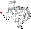
List of highways in El Paso County, Texas
Encyclopedia
Texas
Texas is the second largest U.S. state by both area and population, and the largest state by area in the contiguous United States.The name, based on the Caddo word "Tejas" meaning "friends" or "allies", was applied by the Spanish to the Caddo themselves and to the region of their settlement in...
maintained by the Texas Department of Transportation (TxDOT)
Texas Department of Transportation
The Texas Department of Transportation is a governmental agency in the U.S. state of Texas. Its stated mission is to "work cooperatively to provide safe, effective and efficient movement of people and goods" throughout the state...
. All state highways in Texas are paved.
El Paso County is an urban county that includes the city of El Paso
El Paso, Texas
El Paso, is a city in and the county seat of El Paso County, Texas, United States, and lies in far West Texas. In the 2010 census, the city had a population of 649,121. It is the sixth largest city in Texas and the 19th largest city in the United States...
. The county had approximately 477 miles (768 km) of highways in 2007 including city streets within the Principal Arterial Street System or PASS routes that are unsigned highways connecting major urban traffic corridors to the state highway system.
Interstates
| Route Name | Direction | Termini | Junctions | Length | Remarks |
|---|---|---|---|---|---|
| W/E | , NM New Mexico New Mexico is a state located in the southwest and western regions of the United States. New Mexico is also usually considered one of the Mountain States. With a population density of 16 per square mile, New Mexico is the sixth-most sparsely inhabited U.S... to Hudspeth County |
in El Paso El Paso, Texas El Paso, is a city in and the county seat of El Paso County, Texas, United States, and lies in far West Texas. In the 2010 census, the city had a population of 649,121. It is the sixth largest city in Texas and the 19th largest city in the United States... – Santa Teresa Santa Teresa, New Mexico Santa Teresa is a census-designated place in Doña Ana County, New Mexico, United States. The population was 2,607 at the 2000 census. It is part of the Las Cruces Metropolitan Statistical Area, although geographically it is considerably closer to El Paso, Texas than to Las Cruces.-Geography:Santa... , NM New Mexico New Mexico is a state located in the southwest and western regions of the United States. New Mexico is also usually considered one of the Mountain States. With a population density of 16 per square mile, New Mexico is the sixth-most sparsely inhabited U.S... – Cd. Juárez Ciudad Juárez Ciudad Juárez , officially known today as Heroica Ciudad Juárez, but abbreviated Juárez and formerly known as El Paso del Norte, is a city and seat of the municipality of Juárez in the Mexican state of Chihuahua. Juárez's estimated population is 1.5 million people. The city lies on the Rio Grande... , Chih., Alamogordo Alamogordo, New Mexico Alamogordo is the county seat of Otero County and a city in south-central New Mexico, United States. A desert community lying in the Tularosa Basin, it is bordered on the east by the Sacramento Mountains. It is the nearest city to Holloman Air Force Base. The population was 35,582 as of the 2000... , NM New Mexico New Mexico is a state located in the southwest and western regions of the United States. New Mexico is also usually considered one of the Mountain States. With a population density of 16 per square mile, New Mexico is the sixth-most sparsely inhabited U.S... – Carlsbad Carlsbad, New Mexico Carlsbad is a city in and the county seat of Eddy County, New Mexico, in the United States. As of the 2010 census, the city population was 26,138. Carlsbad is the center of the designated micropolitan area of Carlsbad-Artesia, which has a total population of 55,435... , NM New Mexico New Mexico is a state located in the southwest and western regions of the United States. New Mexico is also usually considered one of the Mountain States. With a population density of 16 per square mile, New Mexico is the sixth-most sparsely inhabited U.S... PASS 2406 (Hawkins Blvd) |
61.8 miles (99.5 km) | ||
| S/N | Avenida de las Américas – Cd. Juárez Ciudad Juárez Ciudad Juárez , officially known today as Heroica Ciudad Juárez, but abbreviated Juárez and formerly known as El Paso del Norte, is a city and seat of the municipality of Juárez in the Mexican state of Chihuahua. Juárez's estimated population is 1.5 million people. The city lies on the Rio Grande... , Chih. to – Las Cruces Las Cruces, New Mexico Las Cruces, also known as "The City of the Crosses", is the county seat of Doña Ana County, New Mexico, United States. The population was 97,618 in 2010 according to the 2010 Census, making it the second largest city in the state.... , NM New Mexico New Mexico is a state located in the southwest and western regions of the United States. New Mexico is also usually considered one of the Mountain States. With a population density of 16 per square mile, New Mexico is the sixth-most sparsely inhabited U.S... , Van Horn Van Horn, Texas Van Horn is a town in and the county seat of Culberson County, Texas, United States. The population was 2,435 at the 2000 census.-Geography:Van Horn is located at .... , Alamogordo Alamogordo, New Mexico Alamogordo is the county seat of Otero County and a city in south-central New Mexico, United States. A desert community lying in the Tularosa Basin, it is bordered on the east by the Sacramento Mountains. It is the nearest city to Holloman Air Force Base. The population was 35,582 as of the 2000... , NM New Mexico New Mexico is a state located in the southwest and western regions of the United States. New Mexico is also usually considered one of the Mountain States. With a population density of 16 per square mile, New Mexico is the sixth-most sparsely inhabited U.S... , Carlsbad Carlsbad, New Mexico Carlsbad is a city in and the county seat of Eddy County, New Mexico, in the United States. As of the 2010 census, the city population was 26,138. Carlsbad is the center of the designated micropolitan area of Carlsbad-Artesia, which has a total population of 55,435... , NM New Mexico New Mexico is a state located in the southwest and western regions of the United States. New Mexico is also usually considered one of the Mountain States. With a population density of 16 per square mile, New Mexico is the sixth-most sparsely inhabited U.S... in El Paso El Paso, Texas El Paso, is a city in and the county seat of El Paso County, Texas, United States, and lies in far West Texas. In the 2010 census, the city had a population of 649,121. It is the sixth largest city in Texas and the 19th largest city in the United States... |
– Carlsbad Carlsbad, New Mexico Carlsbad is a city in and the county seat of Eddy County, New Mexico, in the United States. As of the 2010 census, the city population was 26,138. Carlsbad is the center of the designated micropolitan area of Carlsbad-Artesia, which has a total population of 55,435... , NM New Mexico New Mexico is a state located in the southwest and western regions of the United States. New Mexico is also usually considered one of the Mountain States. With a population density of 16 per square mile, New Mexico is the sixth-most sparsely inhabited U.S... |
0.9 miles (1.4 km) | Signed as US 54 U.S. Route 54 in Texas U.S. Route 54 in Texas is a U.S. Highway that travels through two portions of Texas: one in the far western point, and the other in the far northwest Panhandle.-Route description:... |
U.S. highways
| Route Name | Direction | Termini | Junctions | Length | Remarks |
|---|---|---|---|---|---|
| W/E | to , NM New Mexico New Mexico is a state located in the southwest and western regions of the United States. New Mexico is also usually considered one of the Mountain States. With a population density of 16 per square mile, New Mexico is the sixth-most sparsely inhabited U.S... |
– Carlsbad Carlsbad, New Mexico Carlsbad is a city in and the county seat of Eddy County, New Mexico, in the United States. As of the 2010 census, the city population was 26,138. Carlsbad is the center of the designated micropolitan area of Carlsbad-Artesia, which has a total population of 55,435... , NM New Mexico New Mexico is a state located in the southwest and western regions of the United States. New Mexico is also usually considered one of the Mountain States. With a population density of 16 per square mile, New Mexico is the sixth-most sparsely inhabited U.S... – Cd. Juárez Ciudad Juárez Ciudad Juárez , officially known today as Heroica Ciudad Juárez, but abbreviated Juárez and formerly known as El Paso del Norte, is a city and seat of the municipality of Juárez in the Mexican state of Chihuahua. Juárez's estimated population is 1.5 million people. The city lies on the Rio Grande... , Chih. – Las Cruces Las Cruces, New Mexico Las Cruces, also known as "The City of the Crosses", is the county seat of Doña Ana County, New Mexico, United States. The population was 97,618 in 2010 according to the 2010 Census, making it the second largest city in the state.... , NM New Mexico New Mexico is a state located in the southwest and western regions of the United States. New Mexico is also usually considered one of the Mountain States. With a population density of 16 per square mile, New Mexico is the sixth-most sparsely inhabited U.S... , Van Horn Van Horn, Texas Van Horn is a town in and the county seat of Culberson County, Texas, United States. The population was 2,435 at the 2000 census.-Geography:Van Horn is located at .... , Carlsbad Carlsbad, New Mexico Carlsbad is a city in and the county seat of Eddy County, New Mexico, in the United States. As of the 2010 census, the city population was 26,138. Carlsbad is the center of the designated micropolitan area of Carlsbad-Artesia, which has a total population of 55,435... Bus. US 54-A / Loop 478 Texas State Highway Loop 478 State Highway Loop 478 is a state highway loop in El Paso in El Paso County, Texas.-Route description:The southern terminus of Loop 478 is at in El Paso near the Bridge of the Americas. The route travels north along Copia St. before turning onto Pershing Dr. and Dyer St before ending at US 54 /... – White Sands White Sands, New Mexico White Sands is a census-designated place in Doña Ana County, New Mexico, United States. The population was 1,323 at the 2000 census. It is part of the Las Cruces Metropolitan Statistical Area... , NM New Mexico New Mexico is a state located in the southwest and western regions of the United States. New Mexico is also usually considered one of the Mountain States. With a population density of 16 per square mile, New Mexico is the sixth-most sparsely inhabited U.S... |
20 miles (32.2 km) | ||
| W/E | MX 45 Mexican Federal Highway 45 Mexican Federal Highway 45 connects Ciudad Juárez, Chihuahua, to Panales, Hidalgo.It is located in the north of Mexico connecting Portezuelo in Hidalgo to Ciudad Juárez in Chihuahua... / US 85 U.S. Route 85 in Texas U.S. Highway 85 or US 85 is a route in the system of United States Numbered Highways maintained by the Texas Department of Transportation . The Texas portion of US 85 is located entirely within El Paso County beginning at the U.S.-Mexico border between the city of El Paso and Ciudad Juárez, Chihuahua... south terminus – Cd. Juárez Ciudad Juárez Ciudad Juárez , officially known today as Heroica Ciudad Juárez, but abbreviated Juárez and formerly known as El Paso del Norte, is a city and seat of the municipality of Juárez in the Mexican state of Chihuahua. Juárez's estimated population is 1.5 million people. The city lies on the Rio Grande... , Chih. to Hudspeth County |
– Las Cruces Las Cruces, New Mexico Las Cruces, also known as "The City of the Crosses", is the county seat of Doña Ana County, New Mexico, United States. The population was 97,618 in 2010 according to the 2010 Census, making it the second largest city in the state.... , NM New Mexico New Mexico is a state located in the southwest and western regions of the United States. New Mexico is also usually considered one of the Mountain States. With a population density of 16 per square mile, New Mexico is the sixth-most sparsely inhabited U.S... – Cd. Juárez Ciudad Juárez Ciudad Juárez , officially known today as Heroica Ciudad Juárez, but abbreviated Juárez and formerly known as El Paso del Norte, is a city and seat of the municipality of Juárez in the Mexican state of Chihuahua. Juárez's estimated population is 1.5 million people. The city lies on the Rio Grande... , Chih., Alamogordo Alamogordo, New Mexico Alamogordo is the county seat of Otero County and a city in south-central New Mexico, United States. A desert community lying in the Tularosa Basin, it is bordered on the east by the Sacramento Mountains. It is the nearest city to Holloman Air Force Base. The population was 35,582 as of the 2000... , NM New Mexico New Mexico is a state located in the southwest and western regions of the United States. New Mexico is also usually considered one of the Mountain States. With a population density of 16 per square mile, New Mexico is the sixth-most sparsely inhabited U.S... – Las Cruces Las Cruces, New Mexico Las Cruces, also known as "The City of the Crosses", is the county seat of Doña Ana County, New Mexico, United States. The population was 97,618 in 2010 according to the 2010 Census, making it the second largest city in the state.... , NM New Mexico New Mexico is a state located in the southwest and western regions of the United States. New Mexico is also usually considered one of the Mountain States. With a population density of 16 per square mile, New Mexico is the sixth-most sparsely inhabited U.S... , Van Horn Van Horn, Texas Van Horn is a town in and the county seat of Culberson County, Texas, United States. The population was 2,435 at the 2000 census.-Geography:Van Horn is located at .... PASS 2405 (Fred Wilson Ave.) |
30.9 miles (49.7 km) | ||
| S/N | MX 45 Mexican Federal Highway 45 Mexican Federal Highway 45 connects Ciudad Juárez, Chihuahua, to Panales, Hidalgo.It is located in the north of Mexico connecting Portezuelo in Hidalgo to Ciudad Juárez in Chihuahua... / US 62 west terminus – Cd. Juárez Ciudad Juárez Ciudad Juárez , officially known today as Heroica Ciudad Juárez, but abbreviated Juárez and formerly known as El Paso del Norte, is a city and seat of the municipality of Juárez in the Mexican state of Chihuahua. Juárez's estimated population is 1.5 million people. The city lies on the Rio Grande... , Chih. to , NM New Mexico New Mexico is a state located in the southwest and western regions of the United States. New Mexico is also usually considered one of the Mountain States. With a population density of 16 per square mile, New Mexico is the sixth-most sparsely inhabited U.S... |
– Carlsbad Carlsbad, New Mexico Carlsbad is a city in and the county seat of Eddy County, New Mexico, in the United States. As of the 2010 census, the city population was 26,138. Carlsbad is the center of the designated micropolitan area of Carlsbad-Artesia, which has a total population of 55,435... , NM New Mexico New Mexico is a state located in the southwest and western regions of the United States. New Mexico is also usually considered one of the Mountain States. With a population density of 16 per square mile, New Mexico is the sixth-most sparsely inhabited U.S... PASS 2401 (Doniphan Dr.) – Las Cruces Las Cruces, New Mexico Las Cruces, also known as "The City of the Crosses", is the county seat of Doña Ana County, New Mexico, United States. The population was 97,618 in 2010 according to the 2010 Census, making it the second largest city in the state.... , NM New Mexico New Mexico is a state located in the southwest and western regions of the United States. New Mexico is also usually considered one of the Mountain States. With a population density of 16 per square mile, New Mexico is the sixth-most sparsely inhabited U.S... , Van Horn Van Horn, Texas Van Horn is a town in and the county seat of Culberson County, Texas, United States. The population was 2,435 at the 2000 census.-Geography:Van Horn is located at .... , Carlsbad Carlsbad, New Mexico Carlsbad is a city in and the county seat of Eddy County, New Mexico, in the United States. As of the 2010 census, the city population was 26,138. Carlsbad is the center of the designated micropolitan area of Carlsbad-Artesia, which has a total population of 55,435... – Santa Teresa Santa Teresa, New Mexico Santa Teresa is a census-designated place in Doña Ana County, New Mexico, United States. The population was 2,607 at the 2000 census. It is part of the Las Cruces Metropolitan Statistical Area, although geographically it is considerably closer to El Paso, Texas than to Las Cruces.-Geography:Santa... , NM New Mexico New Mexico is a state located in the southwest and western regions of the United States. New Mexico is also usually considered one of the Mountain States. With a population density of 16 per square mile, New Mexico is the sixth-most sparsely inhabited U.S... |
5.6 miles (9 km) | ||
| W/E | , NM New Mexico New Mexico is a state located in the southwest and western regions of the United States. New Mexico is also usually considered one of the Mountain States. With a population density of 16 per square mile, New Mexico is the sixth-most sparsely inhabited U.S... to Hudspeth County |
in El Paso El Paso, Texas El Paso, is a city in and the county seat of El Paso County, Texas, United States, and lies in far West Texas. In the 2010 census, the city had a population of 649,121. It is the sixth largest city in Texas and the 19th largest city in the United States... – Santa Teresa Santa Teresa, New Mexico Santa Teresa is a census-designated place in Doña Ana County, New Mexico, United States. The population was 2,607 at the 2000 census. It is part of the Las Cruces Metropolitan Statistical Area, although geographically it is considerably closer to El Paso, Texas than to Las Cruces.-Geography:Santa... , NM New Mexico New Mexico is a state located in the southwest and western regions of the United States. New Mexico is also usually considered one of the Mountain States. With a population density of 16 per square mile, New Mexico is the sixth-most sparsely inhabited U.S... – Cd. Juárez Ciudad Juárez Ciudad Juárez , officially known today as Heroica Ciudad Juárez, but abbreviated Juárez and formerly known as El Paso del Norte, is a city and seat of the municipality of Juárez in the Mexican state of Chihuahua. Juárez's estimated population is 1.5 million people. The city lies on the Rio Grande... , Chih., Alamogordo Alamogordo, New Mexico Alamogordo is the county seat of Otero County and a city in south-central New Mexico, United States. A desert community lying in the Tularosa Basin, it is bordered on the east by the Sacramento Mountains. It is the nearest city to Holloman Air Force Base. The population was 35,582 as of the 2000... , NM New Mexico New Mexico is a state located in the southwest and western regions of the United States. New Mexico is also usually considered one of the Mountain States. With a population density of 16 per square mile, New Mexico is the sixth-most sparsely inhabited U.S... PASS 2405 (Fred Wilson Ave.) |
49.6 miles (79.8 km) |
U.S. highway business routes
| Route Name | Direction | Termini | Junctions | Length | Remarks |
|---|---|---|---|---|---|
  Bus. US 54-A Bus. US 54-A |
S/N | – Ciudad Juárez Ciudad Juárez Ciudad Juárez , officially known today as Heroica Ciudad Juárez, but abbreviated Juárez and formerly known as El Paso del Norte, is a city and seat of the municipality of Juárez in the Mexican state of Chihuahua. Juárez's estimated population is 1.5 million people. The city lies on the Rio Grande... , Chih. to , NM New Mexico New Mexico is a state located in the southwest and western regions of the United States. New Mexico is also usually considered one of the Mountain States. With a population density of 16 per square mile, New Mexico is the sixth-most sparsely inhabited U.S... |
12.5 miles (20.1 km) |
State highways
| Route Name | Direction | Termini | Junctions | Length | Remarks |
|---|---|---|---|---|---|
| W/E | , NM New Mexico New Mexico is a state located in the southwest and western regions of the United States. New Mexico is also usually considered one of the Mountain States. With a population density of 16 per square mile, New Mexico is the sixth-most sparsely inhabited U.S... to Hudspeth County |
– Anthony Anthony, New Mexico Anthony is a city in Doña Ana County, New Mexico, USA. The population was 7,904 at the 2000 census. It is located on the New Mexico–Texas state line in the Upper Mesilla Valley, and on Interstate 10, 27 miles south of Las Cruces and 21 miles north of El Paso, Texas... , NM New Mexico New Mexico is a state located in the southwest and western regions of the United States. New Mexico is also usually considered one of the Mountain States. With a population density of 16 per square mile, New Mexico is the sixth-most sparsely inhabited U.S... in Anthony Anthony, Texas Anthony is an incorporated town in El Paso County, Texas, United States. The population was 3,850 at the 2000 census.-Geography:Anthony is located at .... in Canutillo Canutillo, Texas Canutillo is a census-designated place in El Paso County, Texas, United States. The population was 5,129 at the 2000 census. It is part of the El Paso Metropolitan Statistical Area.-Geography:Canutillo is located at .... – Santa Teresa Santa Teresa, New Mexico Santa Teresa is a census-designated place in Doña Ana County, New Mexico, United States. The population was 2,607 at the 2000 census. It is part of the Las Cruces Metropolitan Statistical Area, although geographically it is considerably closer to El Paso, Texas than to Las Cruces.-Geography:Santa... , NM New Mexico New Mexico is a state located in the southwest and western regions of the United States. New Mexico is also usually considered one of the Mountain States. With a population density of 16 per square mile, New Mexico is the sixth-most sparsely inhabited U.S... in El Paso El Paso, Texas El Paso, is a city in and the county seat of El Paso County, Texas, United States, and lies in far West Texas. In the 2010 census, the city had a population of 649,121. It is the sixth largest city in Texas and the 19th largest city in the United States... PASS 2401 (Doniphan Dr.) – Las Cruces Las Cruces, New Mexico Las Cruces, also known as "The City of the Crosses", is the county seat of Doña Ana County, New Mexico, United States. The population was 97,618 in 2010 according to the 2010 Census, making it the second largest city in the state.... , NM New Mexico New Mexico is a state located in the southwest and western regions of the United States. New Mexico is also usually considered one of the Mountain States. With a population density of 16 per square mile, New Mexico is the sixth-most sparsely inhabited U.S... , Van Horn Van Horn, Texas Van Horn is a town in and the county seat of Culberson County, Texas, United States. The population was 2,435 at the 2000 census.-Geography:Van Horn is located at .... , Carlsbad Carlsbad, New Mexico Carlsbad is a city in and the county seat of Eddy County, New Mexico, in the United States. As of the 2010 census, the city population was 26,138. Carlsbad is the center of the designated micropolitan area of Carlsbad-Artesia, which has a total population of 55,435... – Las Cruces Las Cruces, New Mexico Las Cruces, also known as "The City of the Crosses", is the county seat of Doña Ana County, New Mexico, United States. The population was 97,618 in 2010 according to the 2010 Census, making it the second largest city in the state.... , NM New Mexico New Mexico is a state located in the southwest and western regions of the United States. New Mexico is also usually considered one of the Mountain States. With a population density of 16 per square mile, New Mexico is the sixth-most sparsely inhabited U.S... , Van Horn Van Horn, Texas Van Horn is a town in and the county seat of Culberson County, Texas, United States. The population was 2,435 at the 2000 census.-Geography:Van Horn is located at .... , Carlsbad Carlsbad, New Mexico Carlsbad is a city in and the county seat of Eddy County, New Mexico, in the United States. As of the 2010 census, the city population was 26,138. Carlsbad is the center of the designated micropolitan area of Carlsbad-Artesia, which has a total population of 55,435... – Ciudad Juárez Ciudad Juárez Ciudad Juárez , officially known today as Heroica Ciudad Juárez, but abbreviated Juárez and formerly known as El Paso del Norte, is a city and seat of the municipality of Juárez in the Mexican state of Chihuahua. Juárez's estimated population is 1.5 million people. The city lies on the Rio Grande... , Chih., Alamogordo Alamogordo, New Mexico Alamogordo is the county seat of Otero County and a city in south-central New Mexico, United States. A desert community lying in the Tularosa Basin, it is bordered on the east by the Sacramento Mountains. It is the nearest city to Holloman Air Force Base. The population was 35,582 as of the 2000... , NM New Mexico New Mexico is a state located in the southwest and western regions of the United States. New Mexico is also usually considered one of the Mountain States. With a population density of 16 per square mile, New Mexico is the sixth-most sparsely inhabited U.S... – Carlsbad Carlsbad, New Mexico Carlsbad is a city in and the county seat of Eddy County, New Mexico, in the United States. As of the 2010 census, the city population was 26,138. Carlsbad is the center of the designated micropolitan area of Carlsbad-Artesia, which has a total population of 55,435... , NM New Mexico New Mexico is a state located in the southwest and western regions of the United States. New Mexico is also usually considered one of the Mountain States. With a population density of 16 per square mile, New Mexico is the sixth-most sparsely inhabited U.S... PASS 2402 (Delta Dr.) PASS 2406 (Hawkins Blvd.) PASS 2404 (Buford Rd.) in Socorro Socorro, Texas Socorro is a city in El Paso County, Texas, United States. As of the 2000 census, the city population was 27,152. By the 2010 census, the number had grown to 32,013. It is part of the El Paso Metropolitan Statistical Area. The city was reactivated in 1986 and has been a working city since then... in Clint Clint, Texas Clint is a town in El Paso County, Texas, United States. The population was 980 at the 2000 census. It is part of the El Paso Metropolitan Statistical Area.-Geography:Clint is located at .... in Fabens Fabens, Texas Fabens is a census-designated place in El Paso County, Texas, United States. The population was 8,043 at the 2000 census. It is part of the El Paso Metropolitan Statistical Area... |
61.3 miles (98.7 km) | ||
| W/E | , NM New Mexico New Mexico is a state located in the southwest and western regions of the United States. New Mexico is also usually considered one of the Mountain States. With a population density of 16 per square mile, New Mexico is the sixth-most sparsely inhabited U.S... to – Las Cruces Las Cruces, New Mexico Las Cruces, also known as "The City of the Crosses", is the county seat of Doña Ana County, New Mexico, United States. The population was 97,618 in 2010 according to the 2010 Census, making it the second largest city in the state.... , NM New Mexico New Mexico is a state located in the southwest and western regions of the United States. New Mexico is also usually considered one of the Mountain States. With a population density of 16 per square mile, New Mexico is the sixth-most sparsely inhabited U.S... , Van Horn Van Horn, Texas Van Horn is a town in and the county seat of Culberson County, Texas, United States. The population was 2,435 at the 2000 census.-Geography:Van Horn is located at .... , Carlsbad Carlsbad, New Mexico Carlsbad is a city in and the county seat of Eddy County, New Mexico, in the United States. As of the 2010 census, the city population was 26,138. Carlsbad is the center of the designated micropolitan area of Carlsbad-Artesia, which has a total population of 55,435... |
in El Paso El Paso, Texas El Paso, is a city in and the county seat of El Paso County, Texas, United States, and lies in far West Texas. In the 2010 census, the city had a population of 649,121. It is the sixth largest city in Texas and the 19th largest city in the United States... |
2.9 miles (4.7 km) |
State highway loops and spurs
| Route Name | Direction | Termini | Junctions | Length | Remarks |
|---|---|---|---|---|---|
| W/E | to |
1.5 miles (2.4 km) | Anthony Anthony, Texas Anthony is an incorporated town in El Paso County, Texas, United States. The population was 3,850 at the 2000 census.-Geography:Anthony is located at .... spur |
||
| W/E | to |
1.1 miles (1.8 km) | Vinton spur | ||
| Clockwise | in Canutillo Canutillo, Texas Canutillo is a census-designated place in El Paso County, Texas, United States. The population was 5,129 at the 2000 census. It is part of the El Paso Metropolitan Statistical Area.-Geography:Canutillo is located at .... to in El Paso El Paso, Texas El Paso, is a city in and the county seat of El Paso County, Texas, United States, and lies in far West Texas. In the 2010 census, the city had a population of 649,121. It is the sixth largest city in Texas and the 19th largest city in the United States... |
– Las Cruces Las Cruces, New Mexico Las Cruces, also known as "The City of the Crosses", is the county seat of Doña Ana County, New Mexico, United States. The population was 97,618 in 2010 according to the 2010 Census, making it the second largest city in the state.... , NM New Mexico New Mexico is a state located in the southwest and western regions of the United States. New Mexico is also usually considered one of the Mountain States. With a population density of 16 per square mile, New Mexico is the sixth-most sparsely inhabited U.S... , Van Horn Van Horn, Texas Van Horn is a town in and the county seat of Culberson County, Texas, United States. The population was 2,435 at the 2000 census.-Geography:Van Horn is located at .... , Carlsbad Carlsbad, New Mexico Carlsbad is a city in and the county seat of Eddy County, New Mexico, in the United States. As of the 2010 census, the city population was 26,138. Carlsbad is the center of the designated micropolitan area of Carlsbad-Artesia, which has a total population of 55,435... – Alamogordo Alamogordo, New Mexico Alamogordo is the county seat of Otero County and a city in south-central New Mexico, United States. A desert community lying in the Tularosa Basin, it is bordered on the east by the Sacramento Mountains. It is the nearest city to Holloman Air Force Base. The population was 35,582 as of the 2000... , NM New Mexico New Mexico is a state located in the southwest and western regions of the United States. New Mexico is also usually considered one of the Mountain States. With a population density of 16 per square mile, New Mexico is the sixth-most sparsely inhabited U.S... Bus. US 54-A – Alamogordo Alamogordo, New Mexico Alamogordo is the county seat of Otero County and a city in south-central New Mexico, United States. A desert community lying in the Tularosa Basin, it is bordered on the east by the Sacramento Mountains. It is the nearest city to Holloman Air Force Base. The population was 35,582 as of the 2000... , NM New Mexico New Mexico is a state located in the southwest and western regions of the United States. New Mexico is also usually considered one of the Mountain States. With a population density of 16 per square mile, New Mexico is the sixth-most sparsely inhabited U.S... – Las Cruces Las Cruces, New Mexico Las Cruces, also known as "The City of the Crosses", is the county seat of Doña Ana County, New Mexico, United States. The population was 97,618 in 2010 according to the 2010 Census, making it the second largest city in the state.... , NM New Mexico New Mexico is a state located in the southwest and western regions of the United States. New Mexico is also usually considered one of the Mountain States. With a population density of 16 per square mile, New Mexico is the sixth-most sparsely inhabited U.S... , Carlsbad Carlsbad, New Mexico Carlsbad is a city in and the county seat of Eddy County, New Mexico, in the United States. As of the 2010 census, the city population was 26,138. Carlsbad is the center of the designated micropolitan area of Carlsbad-Artesia, which has a total population of 55,435... , NM New Mexico New Mexico is a state located in the southwest and western regions of the United States. New Mexico is also usually considered one of the Mountain States. With a population density of 16 per square mile, New Mexico is the sixth-most sparsely inhabited U.S... – Las Cruces Las Cruces, New Mexico Las Cruces, also known as "The City of the Crosses", is the county seat of Doña Ana County, New Mexico, United States. The population was 97,618 in 2010 according to the 2010 Census, making it the second largest city in the state.... , NM New Mexico New Mexico is a state located in the southwest and western regions of the United States. New Mexico is also usually considered one of the Mountain States. With a population density of 16 per square mile, New Mexico is the sixth-most sparsely inhabited U.S... , Van Horn Van Horn, Texas Van Horn is a town in and the county seat of Culberson County, Texas, United States. The population was 2,435 at the 2000 census.-Geography:Van Horn is located at .... / PASS 2403 (N. Loop Dr.) – Socorro Socorro, Texas Socorro is a city in El Paso County, Texas, United States. As of the 2000 census, the city population was 27,152. By the 2010 census, the number had grown to 32,013. It is part of the El Paso Metropolitan Statistical Area. The city was reactivated in 1986 and has been a working city since then... PASS 2402 (Fonseca Dr.) – Alamogordo Alamogordo, New Mexico Alamogordo is the county seat of Otero County and a city in south-central New Mexico, United States. A desert community lying in the Tularosa Basin, it is bordered on the east by the Sacramento Mountains. It is the nearest city to Holloman Air Force Base. The population was 35,582 as of the 2000... , NM New Mexico New Mexico is a state located in the southwest and western regions of the United States. New Mexico is also usually considered one of the Mountain States. With a population density of 16 per square mile, New Mexico is the sixth-most sparsely inhabited U.S... – Carlsbad Carlsbad, New Mexico Carlsbad is a city in and the county seat of Eddy County, New Mexico, in the United States. As of the 2010 census, the city population was 26,138. Carlsbad is the center of the designated micropolitan area of Carlsbad-Artesia, which has a total population of 55,435... , NM New Mexico New Mexico is a state located in the southwest and western regions of the United States. New Mexico is also usually considered one of the Mountain States. With a population density of 16 per square mile, New Mexico is the sixth-most sparsely inhabited U.S... |
49.2 miles (79.2 km) | El Paso El Paso, Texas El Paso, is a city in and the county seat of El Paso County, Texas, United States, and lies in far West Texas. In the 2010 census, the city had a population of 649,121. It is the sixth largest city in Texas and the 19th largest city in the United States... loop |
|
| S/N | – Carlsbad Carlsbad, New Mexico Carlsbad is a city in and the county seat of Eddy County, New Mexico, in the United States. As of the 2010 census, the city population was 26,138. Carlsbad is the center of the designated micropolitan area of Carlsbad-Artesia, which has a total population of 55,435... , NM New Mexico New Mexico is a state located in the southwest and western regions of the United States. New Mexico is also usually considered one of the Mountain States. With a population density of 16 per square mile, New Mexico is the sixth-most sparsely inhabited U.S... to – Alamogordo Alamogordo, New Mexico Alamogordo is the county seat of Otero County and a city in south-central New Mexico, United States. A desert community lying in the Tularosa Basin, it is bordered on the east by the Sacramento Mountains. It is the nearest city to Holloman Air Force Base. The population was 35,582 as of the 2000... , NM New Mexico New Mexico is a state located in the southwest and western regions of the United States. New Mexico is also usually considered one of the Mountain States. With a population density of 16 per square mile, New Mexico is the sixth-most sparsely inhabited U.S... Bus. US 54-A – Alamogordo Alamogordo, New Mexico Alamogordo is the county seat of Otero County and a city in south-central New Mexico, United States. A desert community lying in the Tularosa Basin, it is bordered on the east by the Sacramento Mountains. It is the nearest city to Holloman Air Force Base. The population was 35,582 as of the 2000... , NM New Mexico New Mexico is a state located in the southwest and western regions of the United States. New Mexico is also usually considered one of the Mountain States. With a population density of 16 per square mile, New Mexico is the sixth-most sparsely inhabited U.S... |
– Las Cruces Las Cruces, New Mexico Las Cruces, also known as "The City of the Crosses", is the county seat of Doña Ana County, New Mexico, United States. The population was 97,618 in 2010 according to the 2010 Census, making it the second largest city in the state.... , NM New Mexico New Mexico is a state located in the southwest and western regions of the United States. New Mexico is also usually considered one of the Mountain States. With a population density of 16 per square mile, New Mexico is the sixth-most sparsely inhabited U.S... , Van Horn Van Horn, Texas Van Horn is a town in and the county seat of Culberson County, Texas, United States. The population was 2,435 at the 2000 census.-Geography:Van Horn is located at .... , Carlsbad Carlsbad, New Mexico Carlsbad is a city in and the county seat of Eddy County, New Mexico, in the United States. As of the 2010 census, the city population was 26,138. Carlsbad is the center of the designated micropolitan area of Carlsbad-Artesia, which has a total population of 55,435... , NM New Mexico New Mexico is a state located in the southwest and western regions of the United States. New Mexico is also usually considered one of the Mountain States. With a population density of 16 per square mile, New Mexico is the sixth-most sparsely inhabited U.S... |
5.9 miles (9.5 km) | ||
| W/E | Global Reach Dr. to |
2.5 miles (4 km) | Planned extension to US 54 U.S. Route 54 in Texas U.S. Route 54 in Texas is a U.S. Highway that travels through two portions of Texas: one in the far western point, and the other in the far northwest Panhandle.-Route description:... – see Future roads |
State park roads
| Route Name | Direction | Termini | Junctions | Length | Remarks |
|---|---|---|---|---|---|
| S/N | to Dead end |
2.1 miles (3.4 km) | Hueco Tanks State Historic Site Hueco Tanks State Historic Site Hueco Tanks State Historic Site is a Texas historic site in the Hueco Tanks area, approximately northeast of El Paso, Texas. The park is popular for recreation such as birding and bouldering, and is culturally and spiritually significant to many Native Americans... |
Farm and ranch to market roads
| Route Name | Direction | Termini | Junctions | Length | Remarks |
|---|---|---|---|---|---|
| W/E | in El Paso El Paso, Texas El Paso, is a city in and the county seat of El Paso County, Texas, United States, and lies in far West Texas. In the 2010 census, the city had a population of 649,121. It is the sixth largest city in Texas and the 19th largest city in the United States... to (historic) near Tornillo Tornillo, Texas Tornillo is a census-designated place and border town in El Paso County, Texas, United States. The population was 1,609 at the 2000 census. It is part of the El Paso Metropolitan Statistical Area... |
PASS 2403 north terminus PASS 2406 (Hawkins Blvd.) PASS 2403 south terminus / PASS 2404 (Horizon Blvd.) – Horizon City Horizon City, Texas Horizon City is a city in El Paso County, Texas, United States. The population was 5,233 at the 2000 census and 13,043 at the 2008 census. It is part of the El Paso Metropolitan Statistical Area. Estimates for the 2010 census show the population at 16,735.... in Socorro Socorro, Texas Socorro is a city in El Paso County, Texas, United States. As of the 2000 census, the city population was 27,152. By the 2010 census, the number had grown to 32,013. It is part of the El Paso Metropolitan Statistical Area. The city was reactivated in 1986 and has been a working city since then... in Clint Clint, Texas Clint is a town in El Paso County, Texas, United States. The population was 980 at the 2000 census. It is part of the El Paso Metropolitan Statistical Area.-Geography:Clint is located at .... in Fabens Fabens, Texas Fabens is a census-designated place in El Paso County, Texas, United States. The population was 8,043 at the 2000 census. It is part of the El Paso Metropolitan Statistical Area... |
29.4 miles (47.3 km) | Designated UR 76 west of FM 1110 | |
| W/E | in El Paso El Paso, Texas El Paso, is a city in and the county seat of El Paso County, Texas, United States, and lies in far West Texas. In the 2010 census, the city had a population of 649,121. It is the sixth largest city in Texas and the 19th largest city in the United States... to in Fabens Fabens, Texas Fabens is a census-designated place in El Paso County, Texas, United States. The population was 8,043 at the 2000 census. It is part of the El Paso Metropolitan Statistical Area... |
PASS 2404 (Buford Rd.) in Socorro Socorro, Texas Socorro is a city in El Paso County, Texas, United States. As of the 2000 census, the city population was 27,152. By the 2010 census, the number had grown to 32,013. It is part of the El Paso Metropolitan Statistical Area. The city was reactivated in 1986 and has been a working city since then... in San Elizario San Elizario, Texas San Elizario is a census-designated place in El Paso County, Texas, United States. The population was 11,046 at the 2000 census. It is part of the El Paso Metropolitan Statistical Area.-Geography:... |
16.5 miles (26.6 km) | Passes through Socorro Socorro, Texas Socorro is a city in El Paso County, Texas, United States. As of the 2000 census, the city population was 27,152. By the 2010 census, the number had grown to 32,013. It is part of the El Paso Metropolitan Statistical Area. The city was reactivated in 1986 and has been a working city since then... , Cuadrilla; designated UR 258 west of FM 1110 |
|
| W/E | , NM New Mexico New Mexico is a state located in the southwest and western regions of the United States. New Mexico is also usually considered one of the Mountain States. With a population density of 16 per square mile, New Mexico is the sixth-most sparsely inhabited U.S... to in Canutillo Canutillo, Texas Canutillo is a census-designated place in El Paso County, Texas, United States. The population was 5,129 at the 2000 census. It is part of the El Paso Metropolitan Statistical Area.-Geography:Canutillo is located at .... |
1.2 miles (1.9 km) | Entire length designated UR 259 | ||
| S/N |
Las Cruces, New Mexico
Las Cruces, also known as "The City of the Crosses", is the county seat of Doña Ana County, New Mexico, United States. The population was 97,618 in 2010 according to the 2010 Census, making it the second largest city in the state....
, NM
New Mexico
New Mexico is a state located in the southwest and western regions of the United States. New Mexico is also usually considered one of the Mountain States. With a population density of 16 per square mile, New Mexico is the sixth-most sparsely inhabited U.S...
, Carlsbad
Carlsbad, New Mexico
Carlsbad is a city in and the county seat of Eddy County, New Mexico, in the United States. As of the 2010 census, the city population was 26,138. Carlsbad is the center of the designated micropolitan area of Carlsbad-Artesia, which has a total population of 55,435...
, NM
New Mexico
New Mexico is a state located in the southwest and western regions of the United States. New Mexico is also usually considered one of the Mountain States. With a population density of 16 per square mile, New Mexico is the sixth-most sparsely inhabited U.S...
| – Las Cruces
Las Cruces, New Mexico
Las Cruces, also known as "The City of the Crosses", is the county seat of Doña Ana County, New Mexico, United States. The population was 97,618 in 2010 according to the 2010 Census, making it the second largest city in the state....
, NM
New Mexico
New Mexico is a state located in the southwest and western regions of the United States. New Mexico is also usually considered one of the Mountain States. With a population density of 16 per square mile, New Mexico is the sixth-most sparsely inhabited U.S...
, Van Horn
Van Horn, Texas
Van Horn is a town in and the county seat of Culberson County, Texas, United States. The population was 2,435 at the 2000 census.-Geography:Van Horn is located at ....
|9.7 miles (15.6 km)
|Route is in El Paso
El Paso, Texas
El Paso, is a city in and the county seat of El Paso County, Texas, United States, and lies in far West Texas. In the 2010 census, the city had a population of 649,121. It is the sixth largest city in Texas and the 19th largest city in the United States...
; entire length designated UR 659
|-
|
|S/N
| in Fabens
Fabens, Texas
Fabens is a census-designated place in El Paso County, Texas, United States. The population was 8,043 at the 2000 census. It is part of the El Paso Metropolitan Statistical Area...
to
|
|1.9 miles (3.1 km)
|
|-
|
|W/E
| in San Elizario
San Elizario, Texas
San Elizario is a census-designated place in El Paso County, Texas, United States. The population was 11,046 at the 2000 census. It is part of the El Paso Metropolitan Statistical Area.-Geography:...
to
|
|4.9 miles (7.9 km)
|Designated UR 1110 east of and including FM 76 overlay
|-
|
|W/E
| in Socorro
Socorro, Texas
Socorro is a city in El Paso County, Texas, United States. As of the 2000 census, the city population was 27,152. By the 2010 census, the number had grown to 32,013. It is part of the El Paso Metropolitan Statistical Area. The city was reactivated in 1986 and has been a working city since then...
to
Abscencion Blvd, in Horizon City
Horizon City, Texas
Horizon City is a city in El Paso County, Texas, United States. The population was 5,233 at the 2000 census and 13,043 at the 2008 census. It is part of the El Paso Metropolitan Statistical Area. Estimates for the 2010 census show the population at 16,735....
|
|8.2 miles (13.2 km)
|Entire current length designated UR 1281; proposed eastern extension – see Future roads below
|-
|
|S/N
| in El Paso
El Paso, Texas
El Paso, is a city in and the county seat of El Paso County, Texas, United States, and lies in far West Texas. In the 2010 census, the city had a population of 649,121. It is the sixth largest city in Texas and the 19th largest city in the United States...
to
Trowbridge Dr.
|
|0.8 miles (1.3 km)
|Entire length designated UR 1505
|-
|
|W/E
|, NM
New Mexico
New Mexico is a state located in the southwest and western regions of the United States. New Mexico is also usually considered one of the Mountain States. With a population density of 16 per square mile, New Mexico is the sixth-most sparsely inhabited U.S...
to
, Las Cruces
Las Cruces, New Mexico
Las Cruces, also known as "The City of the Crosses", is the county seat of Doña Ana County, New Mexico, United States. The population was 97,618 in 2010 according to the 2010 Census, making it the second largest city in the state....
, NM
New Mexico
New Mexico is a state located in the southwest and western regions of the United States. New Mexico is also usually considered one of the Mountain States. With a population density of 16 per square mile, New Mexico is the sixth-most sparsely inhabited U.S...
| – Anthony
Anthony, New Mexico
Anthony is a city in Doña Ana County, New Mexico, USA. The population was 7,904 at the 2000 census. It is located on the New Mexico–Texas state line in the Upper Mesilla Valley, and on Interstate 10, 27 miles south of Las Cruces and 21 miles north of El Paso, Texas...
, NM
New Mexico
New Mexico is a state located in the southwest and western regions of the United States. New Mexico is also usually considered one of the Mountain States. With a population density of 16 per square mile, New Mexico is the sixth-most sparsely inhabited U.S...
|2.2 miles (3.5 km)
|Route is in Anthony
Anthony, Texas
Anthony is an incorporated town in El Paso County, Texas, United States. The population was 3,850 at the 2000 census.-Geography:Anthony is located at ....
|-
|
|S/N
| – Las Cruces
Las Cruces, New Mexico
Las Cruces, also known as "The City of the Crosses", is the county seat of Doña Ana County, New Mexico, United States. The population was 97,618 in 2010 according to the 2010 Census, making it the second largest city in the state....
, NM
New Mexico
New Mexico is a state located in the southwest and western regions of the United States. New Mexico is also usually considered one of the Mountain States. With a population density of 16 per square mile, New Mexico is the sixth-most sparsely inhabited U.S...
, Van Horn
Van Horn, Texas
Van Horn is a town in and the county seat of Culberson County, Texas, United States. The population was 2,435 at the 2000 census.-Geography:Van Horn is located at ....
– Las Cruces
Las Cruces, New Mexico
Las Cruces, also known as "The City of the Crosses", is the county seat of Doña Ana County, New Mexico, United States. The population was 97,618 in 2010 according to the 2010 Census, making it the second largest city in the state....
, NM
New Mexico
New Mexico is a state located in the southwest and western regions of the United States. New Mexico is also usually considered one of the Mountain States. With a population density of 16 per square mile, New Mexico is the sixth-most sparsely inhabited U.S...
, Carlsbad
Carlsbad, New Mexico
Carlsbad is a city in and the county seat of Eddy County, New Mexico, in the United States. As of the 2010 census, the city population was 26,138. Carlsbad is the center of the designated micropolitan area of Carlsbad-Artesia, which has a total population of 55,435...
, NM
New Mexico
New Mexico is a state located in the southwest and western regions of the United States. New Mexico is also usually considered one of the Mountain States. With a population density of 16 per square mile, New Mexico is the sixth-most sparsely inhabited U.S...
|
|2.2 miles (3.5 km)
|Route is in El Paso
El Paso, Texas
El Paso, is a city in and the county seat of El Paso County, Texas, United States, and lies in far West Texas. In the 2010 census, the city had a population of 649,121. It is the sixth largest city in Texas and the 19th largest city in the United States...
; entire length designated UR 2316
|-
|
|S/N
|Bus. US 54-A – Alamogordo
Alamogordo, New Mexico
Alamogordo is the county seat of Otero County and a city in south-central New Mexico, United States. A desert community lying in the Tularosa Basin, it is bordered on the east by the Sacramento Mountains. It is the nearest city to Holloman Air Force Base. The population was 35,582 as of the 2000...
, NM
New Mexico
New Mexico is a state located in the southwest and western regions of the United States. New Mexico is also usually considered one of the Mountain States. With a population density of 16 per square mile, New Mexico is the sixth-most sparsely inhabited U.S...
to
– White Sands
White Sands, New Mexico
White Sands is a census-designated place in Doña Ana County, New Mexico, United States. The population was 1,323 at the 2000 census. It is part of the Las Cruces Metropolitan Statistical Area...
, NM
New Mexico
New Mexico is a state located in the southwest and western regions of the United States. New Mexico is also usually considered one of the Mountain States. With a population density of 16 per square mile, New Mexico is the sixth-most sparsely inhabited U.S...
| – Alamogordo
Alamogordo, New Mexico
Alamogordo is the county seat of Otero County and a city in south-central New Mexico, United States. A desert community lying in the Tularosa Basin, it is bordered on the east by the Sacramento Mountains. It is the nearest city to Holloman Air Force Base. The population was 35,582 as of the 2000...
, NM
New Mexico
New Mexico is a state located in the southwest and western regions of the United States. New Mexico is also usually considered one of the Mountain States. With a population density of 16 per square mile, New Mexico is the sixth-most sparsely inhabited U.S...
|7.9 miles (12.7 km)
||Route is in El Paso
El Paso, Texas
El Paso, is a city in and the county seat of El Paso County, Texas, United States, and lies in far West Texas. In the 2010 census, the city had a population of 649,121. It is the sixth largest city in Texas and the 19th largest city in the United States...
; entire length designated UR 2529
|-
|
|W/E
| to
Dead end
|
|0.7 miles (1.1 km)
||Route is in El Paso
El Paso, Texas
El Paso, is a city in and the county seat of El Paso County, Texas, United States, and lies in far West Texas. In the 2010 census, the city had a population of 649,121. It is the sixth largest city in Texas and the 19th largest city in the United States...
|-
|
|S/N
|, Carlsbad
Carlsbad, New Mexico
Carlsbad is a city in and the county seat of Eddy County, New Mexico, in the United States. As of the 2010 census, the city population was 26,138. Carlsbad is the center of the designated micropolitan area of Carlsbad-Artesia, which has a total population of 55,435...
, NM
New Mexico
New Mexico is a state located in the southwest and western regions of the United States. New Mexico is also usually considered one of the Mountain States. With a population density of 16 per square mile, New Mexico is the sixth-most sparsely inhabited U.S...
|
|5.5 miles (8.9 km)
|
|-
|
|S/N
| – Alamogordo
Alamogordo, New Mexico
Alamogordo is the county seat of Otero County and a city in south-central New Mexico, United States. A desert community lying in the Tularosa Basin, it is bordered on the east by the Sacramento Mountains. It is the nearest city to Holloman Air Force Base. The population was 35,582 as of the 2000...
, NM
New Mexico
New Mexico is a state located in the southwest and western regions of the United States. New Mexico is also usually considered one of the Mountain States. With a population density of 16 per square mile, New Mexico is the sixth-most sparsely inhabited U.S...
to
, NM
New Mexico
New Mexico is a state located in the southwest and western regions of the United States. New Mexico is also usually considered one of the Mountain States. With a population density of 16 per square mile, New Mexico is the sixth-most sparsely inhabited U.S...
|
|5.5 miles (8.9 km)
|Designated UR 3255 south of FM 2529
|}
PASS routes
| Route Name | Direction | Termini | Junctions | Length | Remarks |
|---|---|---|---|---|---|
| PASS 2401 | S/N | Executive Center Blvd. to |
4.6 miles (7.4 km) | Overlays Doniphan Dr. in El Paso El Paso, Texas El Paso, is a city in and the county seat of El Paso County, Texas, United States, and lies in far West Texas. In the 2010 census, the city had a population of 649,121. It is the sixth largest city in Texas and the 19th largest city in the United States... |
|
| PASS 2402 | W/E | to |
1.1 miles (1.8 km) | Overlays Fonseca Dr., Delta Dr. in El Paso El Paso, Texas El Paso, is a city in and the county seat of El Paso County, Texas, United States, and lies in far West Texas. In the 2010 census, the city had a population of 649,121. It is the sixth largest city in Texas and the 19th largest city in the United States... |
|
| PASS 2403 | S/N | at El Paso El Paso, Texas El Paso, is a city in and the county seat of El Paso County, Texas, United States, and lies in far West Texas. In the 2010 census, the city had a population of 649,121. It is the sixth largest city in Texas and the 19th largest city in the United States... / Socorro Socorro, Texas Socorro is a city in El Paso County, Texas, United States. As of the 2000 census, the city population was 27,152. By the 2010 census, the number had grown to 32,013. It is part of the El Paso Metropolitan Statistical Area. The city was reactivated in 1986 and has been a working city since then... city limit to at Delta Dr. and Trowbridge Dr. |
8.7 miles (14 km) | Overlays FM 76 (N. Loop Dr.) in El Paso El Paso, Texas El Paso, is a city in and the county seat of El Paso County, Texas, United States, and lies in far West Texas. In the 2010 census, the city had a population of 649,121. It is the sixth largest city in Texas and the 19th largest city in the United States... |
|
| PASS 2404 | W/E | to |
2.4 miles (3.9 km) | Overlays Buford Rd., Horizon Blvd. in Socorro Socorro, Texas Socorro is a city in El Paso County, Texas, United States. As of the 2000 census, the city population was 27,152. By the 2010 census, the number had grown to 32,013. It is part of the El Paso Metropolitan Statistical Area. The city was reactivated in 1986 and has been a working city since then... |
|
| PASS 2405 | S/N | to Fred Wilson Ave. |
2.1 miles (3.4 km) | Overlays Airport Dr. in El Paso El Paso, Texas El Paso, is a city in and the county seat of El Paso County, Texas, United States, and lies in far West Texas. In the 2010 census, the city had a population of 649,121. It is the sixth largest city in Texas and the 19th largest city in the United States... |
|
| PASS 2406 | S/N | to Viscount Blvd. |
2.6 miles (4.2 km) | Overlays Hawkins Blvd. in El Paso El Paso, Texas El Paso, is a city in and the county seat of El Paso County, Texas, United States, and lies in far West Texas. In the 2010 census, the city had a population of 649,121. It is the sixth largest city in Texas and the 19th largest city in the United States... |
Historic roads
| Route Name | Direction | Termini | Remarks |
|---|---|---|---|
| W/E | US 80 in NM New Mexico New Mexico is a state located in the southwest and western regions of the United States. New Mexico is also usually considered one of the Mountain States. With a population density of 16 per square mile, New Mexico is the sixth-most sparsely inhabited U.S... to Hudspeth County |
Replaced by SH 20 in 1991 | |
| S/N | Paso del Norte International Bridge Paso del Norte International Bridge The Paso del Norte International Bridge is an international bridge which crosses the Rio Grande connecting the United States-Mexico border cities of El Paso, Texas, and Ciudad Juárez, Chihuahua. The bridge is also known as "Paso del Norte Bridge", "Santa Fe Street Bridge", "Puente Benito Juárez",... in El Paso El Paso, Texas El Paso, is a city in and the county seat of El Paso County, Texas, United States, and lies in far West Texas. In the 2010 census, the city had a population of 649,121. It is the sixth largest city in Texas and the 19th largest city in the United States... to in NM New Mexico New Mexico is a state located in the southwest and western regions of the United States. New Mexico is also usually considered one of the Mountain States. With a population density of 16 per square mile, New Mexico is the sixth-most sparsely inhabited U.S... |
Replaced by US 54 U.S. Route 54 U.S. Route 54 is an east–west United States highway that runs northeast-southwest for 1,197 miles from western Illinois to El Paso, Texas. It enters and leaves Texas twice... in 1939 |
|
| W/E | to |
Portion east of Spur 1 transferred to Loop 16 in 1964; remaining portion removed from highway system. Doniphan Road South of US 80 (current SH 20), to Paisano Drive, to Santa Fe Street. | |
| W/E | to Hudspeth County |
Replaced by US 80 in 1939 | |
| S/N | Downtown El Paso El Paso, Texas El Paso, is a city in and the county seat of El Paso County, Texas, United States, and lies in far West Texas. In the 2010 census, the city had a population of 649,121. It is the sixth largest city in Texas and the 19th largest city in the United States... to in NM New Mexico New Mexico is a state located in the southwest and western regions of the United States. New Mexico is also usually considered one of the Mountain States. With a population density of 16 per square mile, New Mexico is the sixth-most sparsely inhabited U.S... |
Replaced by US 54 U.S. Route 54 U.S. Route 54 is an east–west United States highway that runs northeast-southwest for 1,197 miles from western Illinois to El Paso, Texas. It enters and leaves Texas twice... in 1939 |
|
| W/E | Downtown El Paso El Paso, Texas El Paso, is a city in and the county seat of El Paso County, Texas, United States, and lies in far West Texas. In the 2010 census, the city had a population of 649,121. It is the sixth largest city in Texas and the 19th largest city in the United States... to Hudspeth County |
Replaced by US 62 in 1939 | |
| S/N | to (proposed) |
Replaced by Loop 16 in 1964 | |
| S/N | to |
Replaced by US 62 and US 85 U.S. Route 85 in Texas U.S. Highway 85 or US 85 is a route in the system of United States Numbered Highways maintained by the Texas Department of Transportation . The Texas portion of US 85 is located entirely within El Paso County beginning at the U.S.-Mexico border between the city of El Paso and Ciudad Juárez, Chihuahua... in 1974 |
|
| W/E | Country Club Road at New Mexico State Line to in El Paso El Paso, Texas El Paso, is a city in and the county seat of El Paso County, Texas, United States, and lies in far West Texas. In the 2010 census, the city had a population of 649,121. It is the sixth largest city in Texas and the 19th largest city in the United States... |
Former Designation of Country Club Road. Decomissioned as Farm to Market Road, redesignated Urban Road 260 (unmarked) at local request in 1995. All state designations removed at local request in 2004, road maintenance taken over by county. | |
| S/N | Dead end at Rio Grande Rio Grande The Rio Grande is a river that flows from southwestern Colorado in the United States to the Gulf of Mexico. Along the way it forms part of the Mexico – United States border. Its length varies as its course changes... to near Tornillo Tornillo, Texas Tornillo is a census-designated place and border town in El Paso County, Texas, United States. The population was 1,609 at the 2000 census. It is part of the El Paso Metropolitan Statistical Area... |
Returned to county jurisdiction at local request in 2005 | |
| W/E | to rural road near Fabens Fabens, Texas Fabens is a census-designated place in El Paso County, Texas, United States. The population was 8,043 at the 2000 census. It is part of the El Paso Metropolitan Statistical Area... |
Replaced by I-10 Interstate 10 in Texas Interstate 10 is the major east–west Interstate Highway in the Southern United States. In the U.S. state of Texas, it runs east from El Paso, near the border with New Mexico, through San Antonio and Houston to the border with Louisiana in Orange, Texas.... in 1959 |
Future roads
| Route Name | Direction | Termini | Junctions | Length | Remarks |
|---|---|---|---|---|---|
| S/N | to |
1.2 miles (1.9 km) | Proposed Canutillo Canutillo, Texas Canutillo is a census-designated place in El Paso County, Texas, United States. The population was 5,129 at the 2000 census. It is part of the El Paso Metropolitan Statistical Area.-Geography:Canutillo is located at .... bypass from SH 20 to Loop 375 |
||
| W/E | – Alamogordo Alamogordo, New Mexico Alamogordo is the county seat of Otero County and a city in south-central New Mexico, United States. A desert community lying in the Tularosa Basin, it is bordered on the east by the Sacramento Mountains. It is the nearest city to Holloman Air Force Base. The population was 35,582 as of the 2000... , NM New Mexico New Mexico is a state located in the southwest and western regions of the United States. New Mexico is also usually considered one of the Mountain States. With a population density of 16 per square mile, New Mexico is the sixth-most sparsely inhabited U.S... to Global Reach Dr. |
4.9 miles (7.9 km) | Project completion scheduled January 2011 | ||
| W/E | (current) / Abscencion Blvd, in Horizon City Horizon City, Texas Horizon City is a city in El Paso County, Texas, United States. The population was 5,233 at the 2000 census and 13,043 at the 2008 census. It is part of the El Paso Metropolitan Statistical Area. Estimates for the 2010 census show the population at 16,735.... to Fabens Cut Off |
9 miles (14.5 km) | Proposed eastern extension of present route designated as FM 1281 | ||
| Northeast Parkway | W/E | , NM New Mexico New Mexico is a state located in the southwest and western regions of the United States. New Mexico is also usually considered one of the Mountain States. With a population density of 16 per square mile, New Mexico is the sixth-most sparsely inhabited U.S... to |
Bus. US 54-A |
11 miles (18 km) (approx.) | Proposed limited access divided highway from I-10 Interstate 10 in New Mexico Interstate 10 in the U.S. state of New Mexico is long main route of the Interstate Highway System. I-10 traverses Southern New Mexico through Hidalgo, Grant, Luna, and Doña Ana counties. The Interstate travels west–east between the Arizona state line and the interchange with I-25 in Las... in Anthony Anthony, New Mexico Anthony is a city in Doña Ana County, New Mexico, USA. The population was 7,904 at the 2000 census. It is located on the New Mexico–Texas state line in the Upper Mesilla Valley, and on Interstate 10, 27 miles south of Las Cruces and 21 miles north of El Paso, Texas... , NM New Mexico New Mexico is a state located in the southwest and western regions of the United States. New Mexico is also usually considered one of the Mountain States. With a population density of 16 per square mile, New Mexico is the sixth-most sparsely inhabited U.S... to Loop 375 |
Adjacent countries, states, and counties
- New Mexico (north)
- Hudspeth County (east)
- Mexico (southwest)