
List of largest United Kingdom settlements by population
Encyclopedia
This list is of the largest settlements in the United Kingdom
in order of their population, according to the 2001 census data from the Office for National Statistics
(for England and Wales), the General Register Office for Scotland
, and the Northern Ireland Statistics and Research Agency
. It comprises the Key Statistics for Urban Areas figures (referred to as settlements in Scotland and Northern Ireland), that attempt to distinguish the populations of towns and cities from those of their Local Authority district(s).
These figures are not the populations of local government districts
such as city council
or borough council
areas. The figures are based on the ONS definition of an urban area, which is an area of land of at least 20 ha with at least 1,500 residents. Separate areas of urban land are linked if less than 200 m apart. Major urban agglomerations are sub-divided to provide results about localities within them. Sub-divisions often follow the boundaries of local authorities existing before re-organisation in 1974, or the boundaries of current authorities within agglomerations. The figures in this list should not be confused with the population of conurbations. In this list, urban areas and urban sub-divisions recognised as towns with a population greater than 50,000 have been extracted and listed separately. Thus, for instance, the Greater Manchester Urban Area
has a far larger population than that accredited to Manchester
here; this list counts towns such as Sale
and Stockport
separately.
This system has not, however, been followed with respect to London
. The population given is for the administrative area of Greater London
(that is the 32 London Borough
s and City of London
only and not the entire Greater London Urban Area
identified by the ONS) as this would include places like Watford
and Woking
.
Also, Telford
and Milton Keynes
are given the Urban Area figures, as there are no appropriate Urban Subdivision figures given.
Notes
United Kingdom
The United Kingdom of Great Britain and Northern IrelandIn the United Kingdom and Dependencies, other languages have been officially recognised as legitimate autochthonous languages under the European Charter for Regional or Minority Languages...
in order of their population, according to the 2001 census data from the Office for National Statistics
Office for National Statistics
The Office for National Statistics is the executive office of the UK Statistics Authority, a non-ministerial department which reports directly to the Parliament of the United Kingdom.- Overview :...
(for England and Wales), the General Register Office for Scotland
General Register Office for Scotland
The General Register Office for Scotland was a non-ministerial directorate of the Scottish Government that administered the registration of births, deaths, marriages, divorces and adoptions in Scotland. It was also responsible for the statutes relating to the formalities of marriage and conduct...
, and the Northern Ireland Statistics and Research Agency
Northern Ireland Statistics and Research Agency
The Northern Ireland Statistics and Research Agency is an executive agency within the Department of Finance and Personnel in Northern Ireland. The organisation is responsible for the collection and publication of statistics related to the economy, population and society of Northern Ireland...
. It comprises the Key Statistics for Urban Areas figures (referred to as settlements in Scotland and Northern Ireland), that attempt to distinguish the populations of towns and cities from those of their Local Authority district(s).
These figures are not the populations of local government districts
Local government
Local government refers collectively to administrative authorities over areas that are smaller than a state.The term is used to contrast with offices at nation-state level, which are referred to as the central government, national government, or federal government...
such as city council
City status in the United Kingdom
City status in the United Kingdom is granted by the British monarch to a select group of communities. The holding of city status gives a settlement no special rights other than that of calling itself a "city". Nonetheless, this appellation carries its own prestige and, consequently, competitions...
or borough council
Borough status in the United Kingdom
Borough status in the United Kingdom is granted by royal charter to local government districts in England, Wales and Northern Ireland. The status is purely honorary, and does not give any additional powers to the council or inhabitants of the district...
areas. The figures are based on the ONS definition of an urban area, which is an area of land of at least 20 ha with at least 1,500 residents. Separate areas of urban land are linked if less than 200 m apart. Major urban agglomerations are sub-divided to provide results about localities within them. Sub-divisions often follow the boundaries of local authorities existing before re-organisation in 1974, or the boundaries of current authorities within agglomerations. The figures in this list should not be confused with the population of conurbations. In this list, urban areas and urban sub-divisions recognised as towns with a population greater than 50,000 have been extracted and listed separately. Thus, for instance, the Greater Manchester Urban Area
Greater Manchester Urban Area
The Greater Manchester Urban Area is an area of land defined by the Office for National Statistics consisting of the large conurbation that encompasses the city of Manchester and the continuous metropolitan area that spreads outwards from it, forming much of Greater Manchester in North West England...
has a far larger population than that accredited to Manchester
Manchester
Manchester is a city and metropolitan borough in Greater Manchester, England. According to the Office for National Statistics, the 2010 mid-year population estimate for Manchester was 498,800. Manchester lies within one of the UK's largest metropolitan areas, the metropolitan county of Greater...
here; this list counts towns such as Sale
Sale, Greater Manchester
Sale is a town within the Metropolitan Borough of Trafford, in Greater Manchester, England. Historically part of Cheshire, the town lies on flat ground on the south bank of the River Mersey, south of Stretford, northeast of Altrincham, and southwest of the city of Manchester...
and Stockport
Stockport
Stockport is a town in Greater Manchester, England. It lies on elevated ground southeast of Manchester city centre, at the point where the rivers Goyt and Tame join and create the River Mersey. Stockport is the largest settlement in the metropolitan borough of the same name...
separately.
This system has not, however, been followed with respect to London
London
London is the capital city of :England and the :United Kingdom, the largest metropolitan area in the United Kingdom, and the largest urban zone in the European Union by most measures. Located on the River Thames, London has been a major settlement for two millennia, its history going back to its...
. The population given is for the administrative area of Greater London
Greater London
Greater London is the top-level administrative division of England covering London. It was created in 1965 and spans the City of London, including Middle Temple and Inner Temple, and the 32 London boroughs. This territory is coterminate with the London Government Office Region and the London...
(that is the 32 London Borough
London borough
The administrative area of Greater London contains thirty-two London boroughs. Inner London comprises twelve of these boroughs plus the City of London. Outer London comprises the twenty remaining boroughs of Greater London.-Functions:...
s and City of London
City of London
The City of London is a small area within Greater London, England. It is the historic core of London around which the modern conurbation grew and has held city status since time immemorial. The City’s boundaries have remained almost unchanged since the Middle Ages, and it is now only a tiny part of...
only and not the entire Greater London Urban Area
Greater London Urban Area
The Greater London Urban Area is the conurbation or continuous urban area based around London, England, as defined by the Office for National Statistics. It had an estimated population of 8,505,000 in 2005 and occupied an area of at the time of the 2001 census. It includes most of Greater London,...
identified by the ONS) as this would include places like Watford
Watford
Watford is a town and borough in Hertfordshire, England, situated northwest of central London and within the bounds of the M25 motorway. The borough is separated from Greater London to the south by the urbanised parish of Watford Rural in the Three Rivers District.Watford was created as an urban...
and Woking
Woking
Woking is a large town and civil parish that shares its name with the surrounding local government district, located in the west of Surrey, UK. It is part of the Greater London Urban Area and the London commuter belt, with frequent trains and a journey time of 24 minutes to Waterloo station....
.
Also, Telford
Telford
Telford is a large new town in the borough of Telford and Wrekin and ceremonial county of Shropshire, England, approximately east of Shrewsbury, and west of Birmingham...
and Milton Keynes
Milton Keynes
Milton Keynes , sometimes abbreviated MK, is a large town in Buckinghamshire, in the south east of England, about north-west of London. It is the administrative centre of the Borough of Milton Keynes...
are given the Urban Area figures, as there are no appropriate Urban Subdivision figures given.
| Rank | Urban sub-area | Population (2001 Census) | Constituent Country Countries of the United Kingdom Countries of the United Kingdom is a term used to describe England, Northern Ireland, Scotland and Wales. These four countries together form the sovereign state of the United Kingdom of Great Britain and Northern Ireland, which is also described as a country. The alternative terms, constituent... |
Ceremonial county | Notes | Photo |
|---|---|---|---|---|---|---|
| 1 | London London London is the capital city of :England and the :United Kingdom, the largest metropolitan area in the United Kingdom, and the largest urban zone in the European Union by most measures. Located on the River Thames, London has been a major settlement for two millennia, its history going back to its... |
7,172,091 | England England England is a country that is part of the United Kingdom. It shares land borders with Scotland to the north and Wales to the west; the Irish Sea is to the north west, the Celtic Sea to the south west, with the North Sea to the east and the English Channel to the south separating it from continental... |
Greater London Greater London Greater London is the top-level administrative division of England covering London. It was created in 1965 and spans the City of London, including Middle Temple and Inner Temple, and the 32 London boroughs. This territory is coterminate with the London Government Office Region and the London... |
Greater London administrative area only. The wider Greater London Urban Area has an estimated population of 8,505,000 (2005 estimate), and a metropolitan area Metropolitan area The term metropolitan area refers to a region consisting of a densely populated urban core and its less-populated surrounding territories, sharing industry, infrastructure, and housing. A metropolitan area usually encompasses multiple jurisdictions and municipalities: neighborhoods, townships,... of about 12.5 million. It is the United Kingdom's only mega city Mega city Mega City may refer to:* Megacity is a recognized metropolitan area with a total population in excess of 10 million people.* Mega City , or simply "The City", is the virtual city created within the reality of the Matrix series... . |
|
| 2 | Birmingham Birmingham Birmingham is a city and metropolitan borough in the West Midlands of England. It is the most populous British city outside the capital London, with a population of 1,036,900 , and lies at the heart of the West Midlands conurbation, the second most populous urban area in the United Kingdom with a... |
970,892 | England | West Midlands West Midlands (county) The West Midlands is a metropolitan county in western central England with a 2009 estimated population of 2,638,700. It came into existence as a metropolitan county in 1974 after the passage of the Local Government Act 1972, formed from parts of Staffordshire, Worcestershire and Warwickshire. The... |
Metropolitan district, minus Sutton Coldfield Sutton Coldfield Sutton Coldfield is a suburb of Birmingham, in the West Midlands of England. Sutton is located about from central Birmingham but has borders with Erdington and Kingstanding. Sutton is in the northeast of Birmingham, with a population of 105,000 recorded in the 2001 census... , which is counted as a separate settlement, plus areas in the north of the Metropolitan Borough of Solihull Metropolitan Borough of Solihull The Metropolitan Borough of Solihull is a metropolitan borough of the West Midlands, in west-central England. It is named after its largest town, Solihull, from which Solihull Metropolitan Borough Council is based. For Eurostat purposes it is a NUTS 3 region and is one of five boroughs or unitary... such as Castle Bromwich Castle Bromwich Castle Bromwich is a suburb situated within the northern part of the Metropolitan Borough of Solihull in the English county of West Midlands. It is bordered by the rest of the borough to the south east, North Warwickshire to the east and north east; also Shard End to the south west, Castle Vale,... . Population of entire West Midlands conurbation West Midlands conurbation The West Midlands conurbation is the name given to the large conurbation that includes the cities of Birmingham and Wolverhampton and the large towns of Dudley, Walsall, West Bromwich, Solihull, Stourbridge, Halesowen in the English West Midlands.... is 2,284,093. |
|
| 3 | Glasgow Glasgow Glasgow is the largest city in Scotland and third most populous in the United Kingdom. The city is situated on the River Clyde in the country's west central lowlands... |
629,501 | Scotland Scotland Scotland is a country that is part of the United Kingdom. Occupying the northern third of the island of Great Britain, it shares a border with England to the south and is bounded by the North Sea to the east, the Atlantic Ocean to the north and west, and the North Channel and Irish Sea to the... |
Glasgow Glasgow Glasgow is the largest city in Scotland and third most populous in the United Kingdom. The city is situated on the River Clyde in the country's west central lowlands... |
Population of entire Greater Glasgow Greater Glasgow Greater Glasgow is an urban settlement in Scotland consisting of all localities which are physically attached to the city of Glasgow, forming with it a single contiguous urban area... conurbation is 1,199,629 at the 2001 census. |
|
| 4 | Liverpool Liverpool Liverpool is a city and metropolitan borough of Merseyside, England, along the eastern side of the Mersey Estuary. It was founded as a borough in 1207 and was granted city status in 1880... |
469,017 | England | Merseyside Merseyside Merseyside is a metropolitan county in North West England, with a population of 1,365,900. It encompasses the metropolitan area centred on both banks of the lower reaches of the Mersey Estuary, and comprises five metropolitan boroughs: Knowsley, St Helens, Sefton, Wirral, and the city of Liverpool... |
Metropolitan district. Population of entire Liverpool Urban Area Liverpool Urban Area The "Liverpool Urban Area" is a term used by the Office for National Statistics to denote the urban area around Liverpool in England, to the east of the River Mersey. The contiguous built-up area extends beyond the area administered by Liverpool City Council into adjoining local authority areas,... conurbation is 1,365,900. |
|
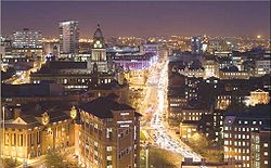
| 5 | Leeds Leeds Leeds is a city and metropolitan borough in West Yorkshire, England. In 2001 Leeds' main urban subdivision had a population of 443,247, while the entire city has a population of 798,800 , making it the 30th-most populous city in the European Union.Leeds is the cultural, financial and commercial... |
443,247 | England | West Yorkshire West Yorkshire West Yorkshire is a metropolitan county within the Yorkshire and the Humber region of England with a population of 2.2 million. West Yorkshire came into existence as a metropolitan county in 1974 after the passage of the Local Government Act 1972.... |
City & Metropolitan district has a population of 810,200. Population of entire West Yorkshire Urban Area West Yorkshire Urban Area The West Yorkshire Urban Area is a term used by the Office for National Statistics to refer to a conurbation in West Yorkshire, England, based around the cities of Leeds, Bradford and Wakefield, and the large town of Huddersfield... conurbation (including in particular Bradford, Huddersfield and Wakefield) is 1,499,465. |
 |
| 6 | Sheffield Sheffield Sheffield is a city and metropolitan borough of South Yorkshire, England. Its name derives from the River Sheaf, which runs through the city. Historically a part of the West Riding of Yorkshire, and with some of its southern suburbs annexed from Derbyshire, the city has grown from its largely... |
439,866 | England | South Yorkshire South Yorkshire South Yorkshire is a metropolitan county in the Yorkshire and the Humber region of England. It has a population of 1.29 million. It consists of four metropolitan boroughs: Barnsley, Doncaster, Rotherham, and City of Sheffield... |
Excludes the suburbs of Beighton Beighton Beighton ward —which includes the districts of Beighton, Hackenthorpe, Owlthorpe, and Sothall—is one of the 28 electoral wards in City of Sheffield, England. It is located in the eastern part of the city, on the border with Rotherham and covers an area of 5.7 km2... , Chapeltown Chapeltown, South Yorkshire Chapeltown is in northern Sheffield, in South Yorkshire, England. It forms part of the Ecclesfield civil parish. There is a wide variety of shops, pubs and restaurants as well as a supermarket... and Mosborough Mosborough Mosborough ward — which includes the districts of Halfway, Mosborough village, Waterthorpe, and Westfield — is one of the 28 electoral wards in City of Sheffield, England. It is located in the eastern part of the city, on the border with Rotherham, and covers an area of 8.9 km2.... /Highlane. Population of entire urban area (including Rotherham Rotherham Rotherham is a town in South Yorkshire, England. It lies on the River Don, at its confluence with the River Rother, between Sheffield and Doncaster. Rotherham, at from Sheffield City Centre, is surrounded by several smaller settlements, which together form the wider Metropolitan Borough of... ) is 640,720. |
|
| 7 | Edinburgh Edinburgh Edinburgh is the capital city of Scotland, the second largest city in Scotland, and the eighth most populous in the United Kingdom. The City of Edinburgh Council governs one of Scotland's 32 local government council areas. The council area includes urban Edinburgh and a rural area... |
430,082 | Scotland | Edinburgh Edinburgh Edinburgh is the capital city of Scotland, the second largest city in Scotland, and the eighth most populous in the United Kingdom. The City of Edinburgh Council governs one of Scotland's 32 local government council areas. The council area includes urban Edinburgh and a rural area... |
Excludes surrounding Lothians, often described as Edinburgh's unofficial urban area (Edinburgh & the Lothians). | 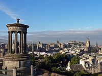 |
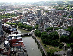
| 8 | Bristol Bristol Bristol is a city, unitary authority area and ceremonial county in South West England, with an estimated population of 433,100 for the unitary authority in 2009, and a surrounding Larger Urban Zone with an estimated 1,070,000 residents in 2007... |
420,556 | England | Bristol Bristol Bristol is a city, unitary authority area and ceremonial county in South West England, with an estimated population of 433,100 for the unitary authority in 2009, and a surrounding Larger Urban Zone with an estimated 1,070,000 residents in 2007... |
Population of entire Greater Bristol Greater Bristol Greater Bristol is a term used for the conurbation which contains and surrounds the city of Bristol in the South West of England. There is no official "Greater Bristol" authority, but the term is sometimes used by local, regional and national authorities, and others as a synonym for either the... conurbation is 587,400. |
 |
| 9 | Manchester Manchester Manchester is a city and metropolitan borough in Greater Manchester, England. According to the Office for National Statistics, the 2010 mid-year population estimate for Manchester was 498,800. Manchester lies within one of the UK's largest metropolitan areas, the metropolitan county of Greater... |
394,269 | England | Greater Manchester Greater Manchester Greater Manchester is a metropolitan county in North West England, with a population of 2.6 million. It encompasses one of the largest metropolitan areas in the United Kingdom and comprises ten metropolitan boroughs: Bolton, Bury, Oldham, Rochdale, Stockport, Tameside, Trafford, Wigan, and the... |
Population of entire Greater Manchester Urban Area Greater Manchester Urban Area The Greater Manchester Urban Area is an area of land defined by the Office for National Statistics consisting of the large conurbation that encompasses the city of Manchester and the continuous metropolitan area that spreads outwards from it, forming much of Greater Manchester in North West England... is 2,244,931 (2001 cenus). |
|
| 10 | Leicester Leicester Leicester is a city and unitary authority in the East Midlands of England, and the county town of Leicestershire. The city lies on the River Soar and at the edge of the National Forest... |
330,574 | England | Leicestershire Leicestershire Leicestershire is a landlocked county in the English Midlands. It takes its name from the heavily populated City of Leicester, traditionally its administrative centre, although the City of Leicester unitary authority is today administered separately from the rest of Leicestershire... |
Excludes the suburb of Beaumont Leys Beaumont Leys Beaumont Leys is an electoral ward and administrative division of the city of Leicester, England, comprising the north-western Leicester suburb of Beaumont Leys.-Geography:... . Population of entire Leicester Urban Area Leicester Urban Area The Leicester Urban Area is a conurbation based around the city of Leicester in Leicestershire, England.While it has no formal definition as an administrative area, it is defined by the Office for National Statistics with a population of 441,213 at the time of the 2001 census... conurbation is 441,213. |
|
| 11 | Coventry Coventry Coventry is a city and metropolitan borough in the county of West Midlands in England. Coventry is the 9th largest city in England and the 11th largest in the United Kingdom. It is also the second largest city in the English Midlands, after Birmingham, with a population of 300,848, although... |
303,475 | England | West Midlands West Midlands (county) The West Midlands is a metropolitan county in western central England with a 2009 estimated population of 2,638,700. It came into existence as a metropolitan county in 1974 after the passage of the Local Government Act 1972, formed from parts of Staffordshire, Worcestershire and Warwickshire. The... |
Part of the Coventry/Bedworth Urban Area, which has a population of 328,063. | |
| 12 | Kingston upon Hull Kingston upon Hull Kingston upon Hull , usually referred to as Hull, is a city and unitary authority area in the ceremonial county of the East Riding of Yorkshire, England. It stands on the River Hull at its junction with the Humber estuary, 25 miles inland from the North Sea. Hull has a resident population of... |
301,416 | England | East Riding of Yorkshire East Riding of Yorkshire The East Riding of Yorkshire, or simply East Yorkshire, is a local government district with unitary authority status, and a ceremonial county of England. For ceremonial purposes the county also includes the city of Kingston upon Hull, which is a separate unitary authority... |
District plus contiguous suburbs outside local authority border to the west of the city (Haltemprice Haltemprice thumb|right|200px|Obsolete Arms of the Former Haltemprice Urban District CouncilHaltemprice is an area in the East Riding of Yorkshire, England, directly to the west of Hull. It comprises the villages, Anlaby, Cottingham, Hessle, Kirk Ella, Skidby, West Ella and Willerby... ). The Hull and Humber City Region Hull and Humber Ports City Region The Hull and Humber Ports City Region is the area whose economic development is supported by the Humber Economic Partnership , a sub-regional economic development partnership. This sub-region covers an area of the Yorkshire and the Humber Region and is centred around the primary built up urban... has a population of 887,500, |
|
| 13 | Bradford Bradford Bradford lies at the heart of the City of Bradford, a metropolitan borough of West Yorkshire, in Northern England. It is situated in the foothills of the Pennines, west of Leeds, and northwest of Wakefield. Bradford became a municipal borough in 1847, and received its charter as a city in 1897... |
293,717 | England | West Yorkshire West Yorkshire West Yorkshire is a metropolitan county within the Yorkshire and the Humber region of England with a population of 2.2 million. West Yorkshire came into existence as a metropolitan county in 1974 after the passage of the Local Government Act 1972.... |
Population of metropolitan district is 493,000. Part of West Yorkshire Urban Area West Yorkshire Urban Area The West Yorkshire Urban Area is a term used by the Office for National Statistics to refer to a conurbation in West Yorkshire, England, based around the cities of Leeds, Bradford and Wakefield, and the large town of Huddersfield... . |
|
| 14 | Cardiff Cardiff Cardiff is the capital, largest city and most populous county of Wales and the 10th largest city in the United Kingdom. The city is Wales' chief commercial centre, the base for most national cultural and sporting institutions, the Welsh national media, and the seat of the National Assembly for... |
292,150 | Wales Wales Wales is a country that is part of the United Kingdom and the island of Great Britain, bordered by England to its east and the Atlantic Ocean and Irish Sea to its west. It has a population of three million, and a total area of 20,779 km²... |
South Glamorgan South Glamorgan South Glamorgan is a preserved county of Wales.It was originally formed in 1974 under the Local Government Act 1972, as a county council area... |
Excludes the suburb of Radyr Radyr Radyr is an outer suburb of Cardiff, the capital of Wales. The suburb is situated in the west of the city, although it was originally a separate village, and is located around 5 miles north west of Cardiff city centre. According to 2009 estimates, the suburb has a population of 6,000... . Population of entire Cardiff Urban Area Cardiff Urban Area The Cardiff Urban Area is the name given to the urban area around Cardiff. The vast bulk of the population and area are contributed by Cardiff which had a population of 292,150 as recorded at the 2001 census. The rest was made up by the towns of Penarth and Dinas Powys connected to the south-east... conurbation (including the surrounding towns of Dinas Powys Dinas Powys Dinas Powys is a large village and a community in the Vale of Glamorgan in South Wales which takes its name from the Dinas Powys hillfort that dates from the Iron Age... , Penarth Penarth Penarth is a town and seaside resort in the Vale of Glamorgan , Wales, 5.2 miles south west from the city centre of the Welsh capital city of Cardiff and lying on the north shore of the Severn Estuary at the southern end of Cardiff Bay... and Radyr) is 327,706. |
|
| 15 | Belfast Belfast Belfast is the capital of and largest city in Northern Ireland. By population, it is the 14th biggest city in the United Kingdom and second biggest on the island of Ireland . It is the seat of the devolved government and legislative Northern Ireland Assembly... |
276,459 | Northern Ireland Northern Ireland Northern Ireland is one of the four countries of the United Kingdom. Situated in the north-east of the island of Ireland, it shares a border with the Republic of Ireland to the south and west... |
County Antrim County Antrim County Antrim is one of six counties that form Northern Ireland, situated in the north-east of the island of Ireland. Adjoined to the north-east shore of Lough Neagh, the county covers an area of 2,844 km², with a population of approximately 616,000... County Down County Down -Cities:*Belfast *Newry -Large towns:*Dundonald*Newtownards*Bangor-Medium towns:... |
Population of entire Greater Belfast Greater Belfast Greater Belfast is an area surrounding and including Belfast in Northern Ireland.It includes Belfast and parts of the North Down, Lisburn, Castlereagh and Newtownabbey district council areas. Greater Belfast is the largest urban area in Northern Ireland, and second largest in Ireland... urban area is 579,554. The second largest conurbation in Northern Ireland is the Derry Urban Area Derry Urban Area The Derry Urban Area is the urban area that includes and surrounds the city of Derry in Northern Ireland, and is part of the Derry City Council area. It had a population of 93,512 in the 2001 census... with a population of 90,736. |
|
| 16 | Stoke-on-Trent Stoke-on-Trent Stoke-on-Trent , also called The Potteries is a city in Staffordshire, England, which forms a linear conurbation almost 12 miles long, with an area of . Together with the Borough of Newcastle-under-Lyme Stoke forms The Potteries Urban Area... |
259,252 | England | Staffordshire Staffordshire Staffordshire is a landlocked county in the West Midlands region of England. For Eurostat purposes, the county is a NUTS 3 region and is one of four counties or unitary districts that comprise the "Shropshire and Staffordshire" NUTS 2 region. Part of the National Forest lies within its borders... |
Includes suburbs outside local authority border: Brown Edge and Blythe Bridge Blythe Bridge Blythe Bridge is a village situated in the Staffordshire Moorlands District, although it is effectively a south-eastern suburb of the city of Stoke-on-Trent.-Etymology:... . Population of entire Potteries Urban Area is 362,403 (2001 census) putting them 10 (includes Borough of Newcastle-under-Lyme whose suburbs run into the cities) |
|
| 17 | Wolverhampton Wolverhampton Wolverhampton is a city and metropolitan borough in the West Midlands, England. For Eurostat purposes Walsall and Wolverhampton is a NUTS 3 region and is one of five boroughs or unitary districts that comprise the "West Midlands" NUTS 2 region... |
251,462 | England | West Midlands West Midlands (county) The West Midlands is a metropolitan county in western central England with a 2009 estimated population of 2,638,700. It came into existence as a metropolitan county in 1974 after the passage of the Local Government Act 1972, formed from parts of Staffordshire, Worcestershire and Warwickshire. The... |
Includes suburbs outside local authority including Perton Perton Perton is a large village and civil parish located in Staffordshire, England. It lies to the south of Codsall, and to the west of the city of Wolverhampton.-Perton:... and Lower Penn Lower Penn Lower Penn is a village in South Staffordshire, situated to the south-west of Wolverhampton, West Midlands.The Civil Parish covers the area of the historic Parish of Penn that is not now covered by the city of Wolverhampton and thus covers a wider area than that immediately surrounding the village... . Part of the West Midlands conurbation West Midlands conurbation The West Midlands conurbation is the name given to the large conurbation that includes the cities of Birmingham and Wolverhampton and the large towns of Dudley, Walsall, West Bromwich, Solihull, Stourbridge, Halesowen in the English West Midlands.... . |
|
| 18 | Nottingham Nottingham Nottingham is a city and unitary authority in the East Midlands of England. It is located in the ceremonial county of Nottinghamshire and represents one of eight members of the English Core Cities Group... |
249,584 | England | Nottinghamshire Nottinghamshire Nottinghamshire is a county in the East Midlands of England, bordering South Yorkshire to the north-west, Lincolnshire to the east, Leicestershire to the south, and Derbyshire to the west... |
City boundaries are tightly drawn and exclude much of the Greater Nottingham area, such as Arnold and West Bridgford. Population of entire Nottingham Urban Area is 666,358. | 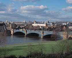 |
| 19 | Plymouth Plymouth Plymouth is a city and unitary authority area on the coast of Devon, England, about south-west of London. It is built between the mouths of the rivers Plym to the east and Tamar to the west, where they join Plymouth Sound... |
243,795 | England | Devon Devon Devon is a large county in southwestern England. The county is sometimes referred to as Devonshire, although the term is rarely used inside the county itself as the county has never been officially "shired", it often indicates a traditional or historical context.The county shares borders with... |
Unitary authority area, excluding the surrounding suburbs over the Tamar River Tamar The Tamar is a river in South West England, that forms most of the border between Devon and Cornwall . It is one of several British rivers whose ancient name is assumed to be derived from a prehistoric river word apparently meaning "dark flowing" and which it shares with the River Thames.The... . |
.jpg) |
| 20 | Southampton Southampton Southampton is the largest city in the county of Hampshire on the south coast of England, and is situated south-west of London and north-west of Portsmouth. Southampton is a major port and the closest city to the New Forest... |
234,224 | England | Hampshire Hampshire Hampshire is a county on the southern coast of England in the United Kingdom. The county town of Hampshire is Winchester, a historic cathedral city that was once the capital of England. Hampshire is notable for housing the original birthplaces of the Royal Navy, British Army, and Royal Air Force... |
Population of entire Southampton Urban Area conurbation (including Eastleigh Eastleigh Eastleigh is a railway town in Hampshire, England, and the main town in the Eastleigh borough which is part of Southampton Urban Area. The town lies between Southampton and Winchester, and is part of the South Hampshire conurbation... ) is 304,400 |
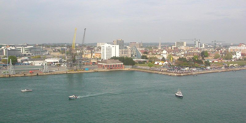 |
| 21 | Reading Reading, Berkshire Reading is a large town and unitary authority area in England. It is located in the Thames Valley at the confluence of the River Thames and River Kennet, and on both the Great Western Main Line railway and the M4 motorway, some west of London.... |
232,662 | England | Berkshire Berkshire Berkshire is a historic county in the South of England. It is also often referred to as the Royal County of Berkshire because of the presence of the royal residence of Windsor Castle in the county; this usage, which dates to the 19th century at least, was recognised by the Queen in 1957, and... |
Includes suburbs in West Berkshire West Berkshire West Berkshire is a local government district in the ceremonial county of Berkshire, England, governed by a unitary authority . Its administrative capital is Newbury, located almost equidistantly between Bristol and London.-Geography:... and Wokingham Wokingham (district) Wokingham is a local government district in Berkshire, United Kingdom. It is named after its main town, Wokingham. Other places in the district include Arborfield, Barkham, Charvil, Earley, Finchampstead, Hurst, Sonning, Remenham, Ruscombe, Shinfield, Twyford, Wargrave, Three Mile Cross, Winnersh,... districts. |
|
| 22 | Derby Derby Derby , is a city and unitary authority in the East Midlands region of England. It lies upon the banks of the River Derwent and is located in the south of the ceremonial county of Derbyshire. In the 2001 census, the population of the city was 233,700, whilst that of the Derby Urban Area was 229,407... |
229,407 | England | Derbyshire Derbyshire Derbyshire is a county in the East Midlands of England. A substantial portion of the Peak District National Park lies within Derbyshire. The northern part of Derbyshire overlaps with the Pennines, a famous chain of hills and mountains. The county contains within its boundary of approx... |
Population of Derby Urban Area 236,738 (includes Borrowash Borrowash Borrowash is a village in the Erewash district of Derbyshire, England, situated immediately east of the Derby city boundary.-Amenities:In the village there is a Co-operative supermarket, which is located amongst a number of shops including a butcher, a building society agency, an insurance... and Ockbrook Ockbrook Ockbrook is an ancient village in Derbyshire, England. It is almost contiguous with the village of Borrowash, the two only separated by the A52. Ockbrook lies about east of Derby.-History:... ). |
|
| 23 | Dudley Dudley Dudley is a large town in the West Midlands county of England. At the 2001 census , the Dudley Urban Sub Area had a population of 194,919, making it the 26th largest settlement in England, the second largest town in the United Kingdom behind Reading, and the largest settlement in the UK without... |
194,619 | England | West Midlands West Midlands (county) The West Midlands is a metropolitan county in western central England with a 2009 estimated population of 2,638,700. It came into existence as a metropolitan county in 1974 after the passage of the Local Government Act 1972, formed from parts of Staffordshire, Worcestershire and Warwickshire. The... |
Part of the West Midlands conurbation West Midlands conurbation The West Midlands conurbation is the name given to the large conurbation that includes the cities of Birmingham and Wolverhampton and the large towns of Dudley, Walsall, West Bromwich, Solihull, Stourbridge, Halesowen in the English West Midlands.... . This figure is for the ONS Urban sub-area (including Brierley Hill Brierley Hill Brierley Hill is a town and electoral ward of the Metropolitan Borough of Dudley, West Midlands, England. It is one of the larger Black Country towns with a population of 9,631 and is heavily industrialised, best known for glass and steel manufacturing, although the industry has declined... and Sedgley Sedgley Sedgley is an urban village within the West Midlands county of England. Historically a part of Staffordshire, Sedgley was formerly an ancient manor composed of several smaller villages, including Gornal, Gospel End, Woodsetton, Ettingshall, Coseley and Brierley... ), as the ONS does not report on just the traditional town. |
|
| 24 | Newcastle upon Tyne Newcastle upon Tyne Newcastle upon Tyne is a city and metropolitan borough of Tyne and Wear, in North East England. Historically a part of Northumberland, it is situated on the north bank of the River Tyne... |
189,863 | England | Tyne and Wear Tyne and Wear Tyne and Wear is a metropolitan county in north east England around the mouths of the Rivers Tyne and Wear. It came into existence as a metropolitan county in 1974 after the passage of the Local Government Act 1972... |
Population of entire Tyneside Tyneside Tyneside is a conurbation in North East England, defined by the Office of National Statistics, which is home to over 80% of the population of Tyne and Wear. It includes the city of Newcastle upon Tyne and the Metropolitan Boroughs of Gateshead, North Tyneside and South Tyneside — all settlements on... conurbation is 879,996. |
|
| 25 | Northampton Northampton Northampton is a large market town and local government district in the East Midlands region of England. Situated about north-west of London and around south-east of Birmingham, Northampton lies on the River Nene and is the county town of Northamptonshire. The demonym of Northampton is... |
189,474 | England | Northamptonshire Northamptonshire Northamptonshire is a landlocked county in the English East Midlands, with a population of 629,676 as at the 2001 census. It has boundaries with the ceremonial counties of Warwickshire to the west, Leicestershire and Rutland to the north, Cambridgeshire to the east, Bedfordshire to the south-east,... |
Population of Northampton Urban Area is 197,199 (includes Wootton and Hardingstone). |  |
| 26 | Portsmouth Portsmouth Portsmouth is the second largest city in the ceremonial county of Hampshire on the south coast of England. Portsmouth is notable for being the United Kingdom's only island city; it is located mainly on Portsea Island... |
187,056 | England | Hampshire Hampshire Hampshire is a county on the southern coast of England in the United Kingdom. The county town of Hampshire is Winchester, a historic cathedral city that was once the capital of England. Hampshire is notable for housing the original birthplaces of the Royal Navy, British Army, and Royal Air Force... |
Population of entire Portsmouth Urban Area Portsmouth Urban Area The Portsmouth Urban Area, in south-east Hampshire in southern England, includes the following components :*Fareham*Portchester*Gosport*Havant*Lee-on-the-Solent*Portsmouth*Stubbington*Waterlooville... conurbation (including Gosport Gosport Gosport is a town, district and borough situated on the south coast of England, within the county of Hampshire. It has approximately 80,000 permanent residents with a further 5,000-10,000 during the summer months... , Waterlooville Waterlooville Waterlooville is a town in Hampshire, England approximately 8 miles north of Portsmouth.The town has a population itself of about 10,000 and is surrounded by Purbrook, Blendworth, Cowplain, Lovedean, Clanfield, Catherington, Crookhorn, Denmead, Hambledon, Horndean and Widley. It forms part of... and Fareham Fareham The market town of Fareham lies in the south east of Hampshire, England, between the cities of Southampton and Portsmouth, roughly in the centre of the South Hampshire conurbation.It gives its name to the borough comprising the town and the surrounding area... ) is 442,252. |
|
| 27 | Luton Luton Luton is a large town and unitary authority of Bedfordshire, England, 30 miles north of London. Luton and its near neighbours, Dunstable and Houghton Regis, form the Luton/Dunstable Urban Area with a population of about 250,000.... |
185,543 | England | Bedfordshire Bedfordshire Bedfordshire is a ceremonial county of historic origin in England that forms part of the East of England region.It borders Cambridgeshire to the north-east, Northamptonshire to the north, Buckinghamshire to the west and Hertfordshire to the south-east.... |
Population of entire Luton/Dunstable Urban Area Luton/Dunstable Urban Area The Luton/Dunstable Urban Area according to the Office for National Statistics is the conurbation including the settlements of Luton, Dunstable and Houghton Regis.... (including Houghton Regis Houghton Regis Houghton Regis is a town and civil parish sandwiched between the major towns of Luton to the east and Dunstable to the west. The parish includes the ancient hamlets of Bidwell, Thorn and Sewell... ) is 236,318. |
 |
| 28 | Preston | 184,836 | England | Lancashire Lancashire Lancashire is a non-metropolitan county of historic origin in the North West of England. It takes its name from the city of Lancaster, and is sometimes known as the County of Lancaster. Although Lancaster is still considered to be the county town, Lancashire County Council is based in Preston... |
Includes part of South Ribble South Ribble South Ribble is a non-metropolitan district and borough of Lancashire, England. Its council is based in Leyland.In May 2007, the council was officially declared "Excellent" by the Audit Commission, gaining its place among the best 5 district councils in the country,-Overview:On 4 October 2007, a... district including Walton-le-Dale Walton-le-Dale Walton-le-Dale is a village in the Borough of South Ribble, in Lancashire, England. It lies on south bank of the River Ribble, and the south-side of the city of Preston, adjacent to Bamber Bridge.-Toponymy:... . Population of Preston Urban Area is 264,601 (includes Chorley Chorley Chorley is a market town in Lancashire, in North West England. It is the largest settlement in the Borough of Chorley. The town's wealth came principally from the cotton industry... , Euxton Euxton Euxton is a village and civil parish of the Borough of Chorley, in Lancashire, England. The village is pronounced "Exton") and is situated just to the south of Leyland, and to the west of Chorley.-Early Industry:... , Leyland Leyland, Lancashire Leyland is a town in the South Ribble borough of Lancashire, England, approximately six miles south of the city of Preston.Throughout the 20th and 21st century, the community has seen a large growth in industry, population and farming, due to the establishment of Leyland Motors, housing... and Wymott). |
|
| 29 | Aberdeen Aberdeen Aberdeen is Scotland's third most populous city, one of Scotland's 32 local government council areas and the United Kingdom's 25th most populous city, with an official population estimate of .... |
184,788 | Scotland | Aberdeen Aberdeen Aberdeen is Scotland's third most populous city, one of Scotland's 32 local government council areas and the United Kingdom's 25th most populous city, with an official population estimate of .... |
One of the fastest growing cities in the UK. The population of the city and shire combined is 462,900. | |
| 30 | Milton Keynes Milton Keynes Milton Keynes , sometimes abbreviated MK, is a large town in Buckinghamshire, in the south east of England, about north-west of London. It is the administrative centre of the Borough of Milton Keynes... |
184,506 † | England | Buckinghamshire Buckinghamshire Buckinghamshire is a ceremonial and non-metropolitan home county in South East England. The county town is Aylesbury, the largest town in the ceremonial county is Milton Keynes and largest town in the non-metropolitan county is High Wycombe.... |
Includes Newport Pagnell Newport Pagnell Newport Pagnell is a town in the Borough of Milton Keynes , England. It is separated by the M1 motorway from Milton Keynes itself, though part of the same urban area... , outside the designated new town area. |
 |
| 31 | Sunderland | 177,739 | England | Tyne and Wear Tyne and Wear Tyne and Wear is a metropolitan county in north east England around the mouths of the Rivers Tyne and Wear. It came into existence as a metropolitan county in 1974 after the passage of the Local Government Act 1972... |
Excludes Washington Washington, Tyne and Wear Washington is a town in the City of Sunderland in Tyne and Wear, England. Historically part of County Durham, it joined a new county in 1974 with the creation of Tyne and Wear... , Houghton-le-Spring Houghton-le-Spring Houghton-le-Spring is part of the City of Sunderland in the county of Tyne and Wear, North East England that has its recorded origins in Norman times. It is situated almost equidistant between the cathedral city of Durham 7 miles to the south-west and the centre of the City of Sunderland about 6... and Hetton-le-Hole Hetton-le-Hole Hetton-le-Hole is a town and civil parish situated in the City of Sunderland in Tyne and Wear, England. It is on the A182 between Houghton-le-Spring and Easington Lane. It is located on the southwest corner of Sunderland on the A182, off A690 close to the A1. It has a population of 14,402 but this... from the City of Sunderland City of Sunderland The City of Sunderland is a local government district of Tyne and Wear, in North East England, with the status of a city and metropolitan borough... , Population of which is 280,300. Population of Sunderland Urban Area is 182,974 (includes Whitburn Whitburn, South Tyneside Whitburn is a village in South Tyneside, on the coast of North East England. It lies just to the north of the City of Sunderland in the ceremonial county of Tyne and Wear. Until 1974, when the Local Government Act 1972 came into being, it was part of County Durham... ). |
|
| 32 | Norwich Norwich Norwich is a city in England. It is the regional administrative centre and county town of Norfolk. During the 11th century, Norwich was the largest city in England after London, and one of the most important places in the kingdom... |
174,047 | England | Norfolk Norfolk Norfolk is a low-lying county in the East of England. It has borders with Lincolnshire to the west, Cambridgeshire to the west and southwest and Suffolk to the south. Its northern and eastern boundaries are the North Sea coast and to the north-west the county is bordered by The Wash. The county... |
Includes Thorpe St. Andrew. Population of Norwich Urban Area is 194,839 (Includes Costessey Costessey Costessey is a civil parish situated west of Norwich in Norfolk, England. The parish comprises two settlements: the long-established village of Costessey , and New Costessey , which developed during the first half of the 20th century and has become a suburb of Norwich... , Cringleford Cringleford Cringleford is a village in Norfolk, England on the outskirts of Norwich. The village is in the South Norfolk local government district but the Norwich South Parliamentary constituency.... and Taverham Taverham Taverham is a village and civil parish in Norfolk, in the UK. It is approximately 5 miles north-west of the City of Norwich. Taverham sits on the River Wensum.In 2001, Taverham had a population of 10,233... ). |
|
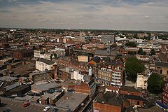
| 33 | Walsall Walsall Walsall is a large industrial town in the West Midlands of England. It is located northwest of Birmingham and east of Wolverhampton. Historically a part of Staffordshire, Walsall is a component area of the West Midlands conurbation and part of the Black Country.Walsall is the administrative... |
170,994 | England | West Midlands West Midlands (county) The West Midlands is a metropolitan county in western central England with a 2009 estimated population of 2,638,700. It came into existence as a metropolitan county in 1974 after the passage of the Local Government Act 1972, formed from parts of Staffordshire, Worcestershire and Warwickshire. The... |
Part of the West Midlands conurbation West Midlands conurbation The West Midlands conurbation is the name given to the large conurbation that includes the cities of Birmingham and Wolverhampton and the large towns of Dudley, Walsall, West Bromwich, Solihull, Stourbridge, Halesowen in the English West Midlands.... . |
 |
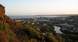
| 34 | Swansea Swansea Swansea is a coastal city and county in Wales. Swansea is in the historic county boundaries of Glamorgan. Situated on the sandy South West Wales coast, the county area includes the Gower Peninsula and the Lliw uplands... |
169,880 | Wales | West Glamorgan West Glamorgan West Glamorgan is a preserved county and former administrative county of Wales, one of the divisions of the ancient county of Glamorgan.West Glamorgan was created on 1 April 1974, by the Local Government Act 1972 from the county borough of Swansea, the municipal boroughs of Neath and Port Talbot,... |
Population of entire Swansea Urban Area Swansea Urban Area The Swansea Urban Area is an area of land in Wales, UK defined by the Office for National Statistics for population monitoring purposes. It is an urban conurbation and is not coterminous with the City and County of Swansea... including Neath Neath Neath is a town and community situated in the principal area of Neath Port Talbot, Wales, UK with a population of approximately 45,898 in 2001... , Port Talbot Port Talbot Port Talbot is a town in Neath Port Talbot, Wales. It had a population of 35,633 in 2001.-History:Port Talbot grew out of the original small port and market town of Aberafan , which belonged to the medieval Lords of Afan. The area of the parish of Margam lying on the west bank of the lower Afan... , Pontardawe Pontardawe Pontardawe is a town of some 5,000 inhabitants in the Swansea Valley in south Wales... and Clydach is 270,506. |
 |
| 35 | Bournemouth Bournemouth Bournemouth is a large coastal resort town in the ceremonial county of Dorset, England. According to the 2001 Census the town has a population of 163,444, making it the largest settlement in Dorset. It is also the largest settlement between Southampton and Plymouth... |
167,527 | England | Dorset Dorset Dorset , is a county in South West England on the English Channel coast. The county town is Dorchester which is situated in the south. The Hampshire towns of Bournemouth and Christchurch joined the county with the reorganisation of local government in 1974... |
Population of entire South East Dorset conurbation South East Dorset conurbation The South east Dorset conurbation is a multi-centred conurbation on the south coast of Dorset in England. The area is rapidly becoming an amalgamation with the area of South West Hampshire immediately on the fringe of the newly formed New Forest National Park... (including Poole Poole Poole is a large coastal town and seaport in the county of Dorset, on the south coast of England. The town is east of Dorchester, and Bournemouth adjoins Poole to the east. The Borough of Poole was made a unitary authority in 1997, gaining administrative independence from Dorset County Council... and Christchurch Christchurch, Dorset Christchurch is a borough and town in the county of Dorset on the south coast of England. The town adjoins Bournemouth in the west and the New Forest lies to the east. Historically in Hampshire, it joined Dorset with the reorganisation of local government in 1974 and is the most easterly borough in... ) is 383,713. |
|
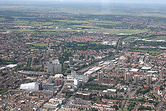
| 36 | Southend-on-Sea Southend-on-Sea Southend-on-Sea is a unitary authority area, town, and seaside resort in Essex, England. The district has Borough status, and comprises the towns of Chalkwell, Eastwood, Leigh-on-Sea, North Shoebury, Prittlewell, Shoeburyness, Southchurch, Thorpe Bay, and Westcliff-on-Sea. The district is situated... |
160,257 | England | Essex Essex Essex is a ceremonial and non-metropolitan county in the East region of England, and one of the home counties. It is located to the northeast of Greater London. It borders with Cambridgeshire and Suffolk to the north, Hertfordshire to the west, Kent to the South and London to the south west... |
Population of entire Southend Urban Area Southend Urban Area The Southend Urban Area is the informal name for the urban area including and surrounding Southend-on-Sea in Essex, England. The ONS defines the Southend Urban Area as having a population of 269,400, making it the largest urban area within the East of England... conurbation (including Benfleet Benfleet South Benfleet is a town in the Castle Point district of Essex, 30 miles east of London. The Benfleet post town includes South Benfleet, Thundersley and Hadleigh. The Battle of Benfleet took place here between the Vikings and Saxons in 894.... , Hockley Hockley Hockley is a large village and civil parish in Essex, England located between Chelmsford and Southend-on-Sea. More specifically it lies between Rayleigh and Rochford. It came to prominence during the coming of the railway in the 1890s and at the 2001 census had a population of 13,616 people, many... , Rayleigh Rayleigh, Essex Rayleigh is a market town and civil parish in the District of Rochford in Essex, England, located between Chelmsford and Southend-on-Sea. It lies to the east of central London. It has a population of 30,196, having expanded rapidly in the 1960s.-Toponymy:... and Rochford Rochford Rochford is a small town in the Rochford district of Essex in the East of England. It is sited about 43 miles from Central London and approximately 21 miles from the Essex county town, Chelmsford... ) is 269,415. |
 |
| 37 | Swindon Swindon Swindon is a large town within the borough of Swindon and ceremonial county of Wiltshire, in South West England. It is midway between Bristol, west and Reading, east. London is east... |
155,432 | England | Wiltshire Wiltshire Wiltshire is a ceremonial county in South West England. It is landlocked and borders the counties of Dorset, Somerset, Hampshire, Gloucestershire, Oxfordshire and Berkshire. It contains the unitary authority of Swindon and covers... |
||
| 38 | Dundee Dundee Dundee is the fourth-largest city in Scotland and the 39th most populous settlement in the United Kingdom. It lies within the eastern central Lowlands on the north bank of the Firth of Tay, which feeds into the North Sea... |
154,674 | Scotland | Dundee Dundee Dundee is the fourth-largest city in Scotland and the 39th most populous settlement in the United Kingdom. It lies within the eastern central Lowlands on the north bank of the Firth of Tay, which feeds into the North Sea... |
||
| 39 | Huddersfield Huddersfield Huddersfield is a large market town within the Metropolitan Borough of Kirklees, in West Yorkshire, England, situated halfway between Leeds and Manchester. It lies north of London, and south of Bradford, the nearest city.... |
146,234 | England | West Yorkshire West Yorkshire West Yorkshire is a metropolitan county within the Yorkshire and the Humber region of England with a population of 2.2 million. West Yorkshire came into existence as a metropolitan county in 1974 after the passage of the Local Government Act 1972.... |
Part of West Yorkshire Urban Area West Yorkshire Urban Area The West Yorkshire Urban Area is a term used by the Office for National Statistics to refer to a conurbation in West Yorkshire, England, based around the cities of Leeds, Bradford and Wakefield, and the large town of Huddersfield... . |
|
| 40 | Poole Poole Poole is a large coastal town and seaport in the county of Dorset, on the south coast of England. The town is east of Dorchester, and Bournemouth adjoins Poole to the east. The Borough of Poole was made a unitary authority in 1997, gaining administrative independence from Dorset County Council... |
144,800 | England | Dorset Dorset Dorset , is a county in South West England on the English Channel coast. The county town is Dorchester which is situated in the south. The Hampshire towns of Bournemouth and Christchurch joined the county with the reorganisation of local government in 1974... |
Part of South East Dorset conurbation South East Dorset conurbation The South east Dorset conurbation is a multi-centred conurbation on the south coast of Dorset in England. The area is rapidly becoming an amalgamation with the area of South West Hampshire immediately on the fringe of the newly formed New Forest National Park... . |
 |
| 41 | Oxford Oxford The city of Oxford is the county town of Oxfordshire, England. The city, made prominent by its medieval university, has a population of just under 165,000, with 153,900 living within the district boundary. It lies about 50 miles north-west of London. The rivers Cherwell and Thames run through... |
143,016 | England | Oxfordshire Oxfordshire Oxfordshire is a county in the South East region of England, bordering on Warwickshire and Northamptonshire , Buckinghamshire , Berkshire , Wiltshire and Gloucestershire .... |
||
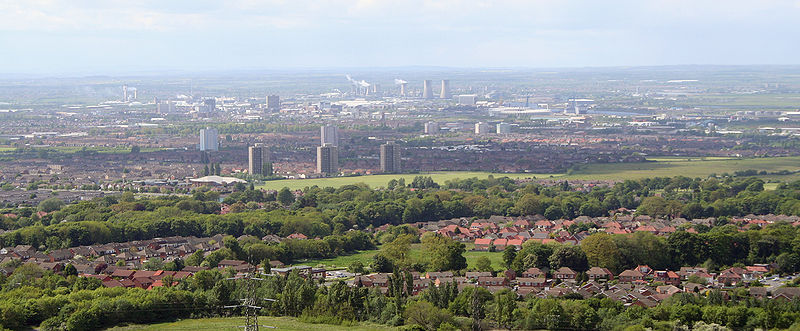
| 42 | Middlesbrough Middlesbrough Middlesbrough is a large town situated on the south bank of the River Tees in north east England, that sits within the ceremonial county of North Yorkshire... |
142,691 | England | North Yorkshire North Yorkshire North Yorkshire is a non-metropolitan or shire county located in the Yorkshire and the Humber region of England, and a ceremonial county primarily in that region but partly in North East England. Created in 1974 by the Local Government Act 1972 it covers an area of , making it the largest... |
Population of entire Teesside Teesside Teesside is the name given to the conurbation in the north east of England made up of the towns of Middlesbrough, Stockton-on-Tees, Redcar, Billingham and surrounding settlements near the River Tees. It was also the name of a local government district between 1968 and 1974—the County Borough of... urban area is 365,323. |
 |
| 43 | Blackpool Blackpool Blackpool is a borough, seaside town, and unitary authority area of Lancashire, in North West England. It is situated along England's west coast by the Irish Sea, between the Ribble and Wyre estuaries, northwest of Preston, north of Liverpool, and northwest of Manchester... |
142,283 | England | Lancashire Lancashire Lancashire is a non-metropolitan county of historic origin in the North West of England. It takes its name from the city of Lancaster, and is sometimes known as the County of Lancaster. Although Lancaster is still considered to be the county town, Lancashire County Council is based in Preston... |
Population of entire Blackpool Urban Area Blackpool Urban Area Greater Blackpool is the informal name for the urban area surrounding Blackpool in Lancashire, England. The ONS define a Blackpool Urban Area, with a population of 261,088 , down 0.1% from the 1991 figure of 261,355.... (including Fleetwood Fleetwood Fleetwood is a town within the Wyre district of Lancashire, England, lying at the northwest corner of the Fylde. It had a population of 26,840 people at the 2001 Census. It forms part of the Greater Blackpool conurbation. The town was the first planned community of the Victorian era... , Lytham St Annes Lytham St Annes Lytham St Annes is a conurbation in the Fylde district of Lancashire, England. The neighbouring towns of Lytham and St-Anne's-on-the-Sea have grown together and now form a seaside resort... , Poulton-le-Fylde Poulton-le-Fylde Poulton-le-Fylde is a market town in Lancashire, England, situated on the coastal plain called the Fylde. As of the 2001 United Kingdom census, it had a population of 18,264. There is evidence of human habitation in the area from 12,000 years ago and several archaeological finds from Roman... and Thornton-Cleveleys Thornton-Cleveleys Thornton–Cleveleys is an unparished area in the English local government district of Wyre, Lancashire, covering the towns of Thornton and Cleveleys. It forms part of the Greater Blackpool area.... ) is 261,088. |
|
| 44 | Bolton Bolton Bolton is a town in Greater Manchester, in the North West of England. Close to the West Pennine Moors, it is north west of the city of Manchester. Bolton is surrounded by several smaller towns and villages which together form the Metropolitan Borough of Bolton, of which Bolton is the... |
139,403 | England | Greater Manchester Greater Manchester Greater Manchester is a metropolitan county in North West England, with a population of 2.6 million. It encompasses one of the largest metropolitan areas in the United Kingdom and comprises ten metropolitan boroughs: Bolton, Bury, Oldham, Rochdale, Stockport, Tameside, Trafford, Wigan, and the... |
Excludes Farnworth Farnworth Farnworth is within the Metropolitan Borough of Bolton in Greater Manchester, England. It is located southeast of Bolton, 6 miles south-west of Bury , and northwest of Manchester.... , Horwich Horwich Horwich is a town and civil parish within the Metropolitan Borough of Bolton, in Greater Manchester, England. It is southeast of Chorley, northwest of Bolton and northwest from the city of Manchester. It lies at the southern edge of the West Pennine Moors with the M61 motorway close to the... , Kearsley Kearsley Kearsley is a town within the Metropolitan Borough of Bolton, in Greater Manchester, England. Historically within Lancashire, it lies about 7½ miles northwest of Manchester,5.5 miles south-west of Bury, and about 3¾ miles south of Bolton.It is bounded on the west by Walkden, the east by... , Westhoughton Westhoughton Westhoughton is a town and civil parish of the Metropolitan Borough of Bolton in Greater Manchester, England. It is southwest of Bolton, east of Wigan and northwest of Manchester.... and other surrounding towns/districts. Part of Greater Manchester Urban Area Greater Manchester Urban Area The Greater Manchester Urban Area is an area of land defined by the Office for National Statistics consisting of the large conurbation that encompasses the city of Manchester and the continuous metropolitan area that spreads outwards from it, forming much of Greater Manchester in North West England... . |
 |
| 45 | Ipswich Ipswich Ipswich is a large town and a non-metropolitan district. It is the county town of Suffolk, England. Ipswich is located on the estuary of the River Orwell... |
138,718 | England | Suffolk Suffolk Suffolk is a non-metropolitan county of historic origin in East Anglia, England. It has borders with Norfolk to the north, Cambridgeshire to the west and Essex to the south. The North Sea lies to the east... |
Population of Ipswich Urban Area is 141,658 (includes Martlesham Heath Martlesham Heath Martlesham Heath village is situated 6 miles east of Ipswich, in Suffolk, England. This was an ancient area of heathland and latterly the site of Martlesham Heath Airfield... ). |
|
| 46 | Telford Telford Telford is a large new town in the borough of Telford and Wrekin and ceremonial county of Shropshire, England, approximately east of Shrewsbury, and west of Birmingham... |
138,241 † | England | Shropshire Shropshire Shropshire is a county in the West Midlands region of England. For Eurostat purposes, the county is a NUTS 3 region and is one of four counties or unitary districts that comprise the "Shropshire and Staffordshire" NUTS 2 region. It borders Wales to the west... |
 |
|
| 47 | York York York is a walled city, situated at the confluence of the Rivers Ouse and Foss in North Yorkshire, England. The city has a rich heritage and has provided the backdrop to major political events throughout much of its two millennia of existence... |
137,505 | England | North Yorkshire North Yorkshire North Yorkshire is a non-metropolitan or shire county located in the Yorkshire and the Humber region of England, and a ceremonial county primarily in that region but partly in North East England. Created in 1974 by the Local Government Act 1972 it covers an area of , making it the largest... |
.jpg) |
|
| 48 | West Bromwich West Bromwich West Bromwich is a town within the Metropolitan Borough of Sandwell, in the West Midlands, England. It is north west of Birmingham lying on the A41 London-to-Birkenhead road. West Bromwich is part of the Black Country... |
136,940 | England | West Midlands West Midlands (county) The West Midlands is a metropolitan county in western central England with a 2009 estimated population of 2,638,700. It came into existence as a metropolitan county in 1974 after the passage of the Local Government Act 1972, formed from parts of Staffordshire, Worcestershire and Warwickshire. The... |
Part of the West Midlands conurbation West Midlands conurbation The West Midlands conurbation is the name given to the large conurbation that includes the cities of Birmingham and Wolverhampton and the large towns of Dudley, Walsall, West Bromwich, Solihull, Stourbridge, Halesowen in the English West Midlands.... . |
|
| 49 | Peterborough Peterborough Peterborough is a cathedral city and unitary authority area in the East of England, with an estimated population of in June 2007. For ceremonial purposes it is in the county of Cambridgeshire. Situated north of London, the city stands on the River Nene which flows into the North Sea... |
136,292 | England | Cambridgeshire Cambridgeshire Cambridgeshire is a county in England, bordering Lincolnshire to the north, Norfolk to the northeast, Suffolk to the east, Essex and Hertfordshire to the south, and Bedfordshire and Northamptonshire to the west... |
||
| 50 | Stockport Stockport Stockport is a town in Greater Manchester, England. It lies on elevated ground southeast of Manchester city centre, at the point where the rivers Goyt and Tame join and create the River Mersey. Stockport is the largest settlement in the metropolitan borough of the same name... |
136,082 | England | Greater Manchester Greater Manchester Greater Manchester is a metropolitan county in North West England, with a population of 2.6 million. It encompasses one of the largest metropolitan areas in the United Kingdom and comprises ten metropolitan boroughs: Bolton, Bury, Oldham, Rochdale, Stockport, Tameside, Trafford, Wigan, and the... |
Part of Greater Manchester Urban Area Greater Manchester Urban Area The Greater Manchester Urban Area is an area of land defined by the Office for National Statistics consisting of the large conurbation that encompasses the city of Manchester and the continuous metropolitan area that spreads outwards from it, forming much of Greater Manchester in North West England... . |
|
| 51 | Brighton Brighton Brighton is the major part of the city of Brighton and Hove in East Sussex, England on the south coast of Great Britain... |
134,293 | England | East Sussex East Sussex East Sussex is a county in South East England. It is bordered by the counties of Kent, Surrey and West Sussex, and to the south by the English Channel.-History:... |
Town of Brighton, excluding Rottingdean Rottingdean Rottingdean is a coastal village next to the town of Brighton and technically within the city of Brighton and Hove, in East Sussex, on the south coast of England... /Saltdean Saltdean Saltdean is a residential district located on the chalk cliffs of the south coast of England in East Sussex, United Kingdom. It is situated on the eastern edge of the city of Brighton and Hove, with part outside the city boundary in Lewes district... and Hove Hove Hove is a town on the south coast of England, immediately to the west of its larger neighbour Brighton, with which it forms the unitary authority Brighton and Hove. It forms a single conurbation together with Brighton and some smaller towns and villages running along the coast... (hence does not represent the entire conjoined local authority of Brighton and Hove). |
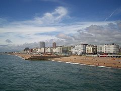 |
| 52 | Slough Slough Slough is a borough and unitary authority within the ceremonial county of Royal Berkshire, England. The town straddles the A4 Bath Road and the Great Western Main Line, west of central London... |
126,276 | England | Berkshire Berkshire Berkshire is a historic county in the South of England. It is also often referred to as the Royal County of Berkshire because of the presence of the royal residence of Windsor Castle in the county; this usage, which dates to the 19th century at least, was recognised by the Queen in 1957, and... |
Population of Slough Urban Area is 141,848 (includes Colnbrook Colnbrook Colnbrook is a large village in the unitary authority of Slough, in Berkshire, England. It is situated southeast of central Slough, east of Windsor and west of central London.... , Farnham Royal Farnham Royal Farnham Royal is a village and civil parish within the South Bucks district of Buckinghamshire, England. It is located in the south of the county, around 22 miles west of Charing Cross, Central London.... and Stoke Poges Stoke Poges Stoke Poges is a village and civil parish in the South Buckinghamshire district of Buckinghamshire, England. It is in the south of the county, about three miles north of Slough and a mile east of Farnham Common.... ). |
|
| 53 | Gloucester Gloucester Gloucester is a city, district and county town of Gloucestershire in the South West region of England. Gloucester lies close to the Welsh border, and on the River Severn, approximately north-east of Bristol, and south-southwest of Birmingham.... |
123,205 | England | Gloucestershire Gloucestershire Gloucestershire is a county in South West England. The county comprises part of the Cotswold Hills, part of the flat fertile valley of the River Severn, and the entire Forest of Dean.... |
Population of Gloucester Urban Area is 136,203 (includes Innsworth Innsworth Innsworth is a suburb of Gloucester, it is a civil parish and forms part of the borough of Tewkesbury.It contains Imjin Barracks, the home of HQ ARRC, which moved from Germany in 2010... and Churchdown). |
|
| 54 | Watford Watford Watford is a town and borough in Hertfordshire, England, situated northwest of central London and within the bounds of the M25 motorway. The borough is separated from Greater London to the south by the urbanised parish of Watford Rural in the Three Rivers District.Watford was created as an urban... |
120,960 | England | Hertfordshire Hertfordshire Hertfordshire is a ceremonial and non-metropolitan county in the East region of England. The county town is Hertford.The county is one of the Home Counties and lies inland, bordered by Greater London , Buckinghamshire , Bedfordshire , Cambridgeshire and... |
Urban sub-area of Greater London Urban Area Greater London Urban Area The Greater London Urban Area is the conurbation or continuous urban area based around London, England, as defined by the Office for National Statistics. It had an estimated population of 8,505,000 in 2005 and occupied an area of at the time of the 2001 census. It includes most of Greater London,... ; includes large parts of Three Rivers Three Rivers (district) Three Rivers is a local government district in Hertfordshire in the East of England. Its council is based in Rickmansworth.It was formed on 1 April 1974 by the merger of Rickmansworth Urban District and Chorleywood Urban District with part of Watford Rural District... . |
|
| 55 | Rotherham Rotherham Rotherham is a town in South Yorkshire, England. It lies on the River Don, at its confluence with the River Rother, between Sheffield and Doncaster. Rotherham, at from Sheffield City Centre, is surrounded by several smaller settlements, which together form the wider Metropolitan Borough of... |
117,262 | England | South Yorkshire South Yorkshire South Yorkshire is a metropolitan county in the Yorkshire and the Humber region of England. It has a population of 1.29 million. It consists of four metropolitan boroughs: Barnsley, Doncaster, Rotherham, and City of Sheffield... |
Part of Sheffield Urban Area Sheffield urban area The Sheffield Urban Area is a conurbation with a population of 640,720 making it the 8th largest conurbation in the United Kingdom and England's 6th largest. Named the Sheffield Urban Area by the Office for National Statistics, it must not be confused with the Sheffield City Region, a... . |
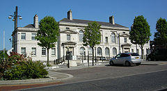 |
| 56 | Newport Newport Newport is a city and unitary authority area in Wales. Standing on the banks of the River Usk, it is located about east of Cardiff and is the largest urban area within the historic county boundaries of Monmouthshire and the preserved county of Gwent... |
116,143 | Wales | Monmouthshire Monmouthshire Monmouthshire is a county in south east Wales. The name derives from the historic county of Monmouthshire which covered a much larger area. The largest town is Abergavenny. There are many castles in Monmouthshire .-Historic county:... |
Excludes Risca Risca Risca is a town of approximately 11,500 people in South Wales, within the Caerphilly County Borough and the historic boundaries of Monmouthshire. It is today part of the Newport conurbation , though it is not a Ward of Newport City Council... is 139,298. |
|
| 57 | Cambridge Cambridge The city of Cambridge is a university town and the administrative centre of the county of Cambridgeshire, England. It lies in East Anglia about north of London. Cambridge is at the heart of the high-technology centre known as Silicon Fen – a play on Silicon Valley and the fens surrounding the... |
113,442 †† | England | Cambridgeshire Cambridgeshire Cambridgeshire is a county in England, bordering Lincolnshire to the north, Norfolk to the northeast, Suffolk to the east, Essex and Hertfordshire to the south, and Bedfordshire and Northamptonshire to the west... |
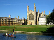 |
|
| 58 | Exeter Exeter Exeter is a historic city in Devon, England. It lies within the ceremonial county of Devon, of which it is the county town as well as the home of Devon County Council. Currently the administrative area has the status of a non-metropolitan district, and is therefore under the administration of the... |
106,772 | England | Devon Devon Devon is a large county in southwestern England. The county is sometimes referred to as Devonshire, although the term is rarely used inside the county itself as the county has never been officially "shired", it often indicates a traditional or historical context.The county shares borders with... |
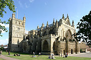 |
|
| 59 | Eastbourne Eastbourne Eastbourne is a large town and borough in East Sussex, on the south coast of England between Brighton and Hastings. The town is situated at the eastern end of the chalk South Downs alongside the high cliff at Beachy Head... |
106,562 | England | East Sussex East Sussex East Sussex is a county in South East England. It is bordered by the counties of Kent, Surrey and West Sussex, and to the south by the English Channel.-History:... |
||
| 60 | Sutton Coldfield Sutton Coldfield Sutton Coldfield is a suburb of Birmingham, in the West Midlands of England. Sutton is located about from central Birmingham but has borders with Erdington and Kingstanding. Sutton is in the northeast of Birmingham, with a population of 105,000 recorded in the 2001 census... |
105,452 | England | West Midlands West Midlands (county) The West Midlands is a metropolitan county in western central England with a 2009 estimated population of 2,638,700. It came into existence as a metropolitan county in 1974 after the passage of the Local Government Act 1972, formed from parts of Staffordshire, Worcestershire and Warwickshire. The... |
Part of the West Midlands conurbation West Midlands conurbation The West Midlands conurbation is the name given to the large conurbation that includes the cities of Birmingham and Wolverhampton and the large towns of Dudley, Walsall, West Bromwich, Solihull, Stourbridge, Halesowen in the English West Midlands.... . |
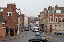 |
| 61 | Blackburn | 105,085 | England | Lancashire Lancashire Lancashire is a non-metropolitan county of historic origin in the North West of England. It takes its name from the city of Lancaster, and is sometimes known as the County of Lancaster. Although Lancaster is still considered to be the county town, Lancashire County Council is based in Preston... |
Population of Blackburn / Darwen Urban Area is 136,655. | 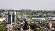 |
| 62 | Colchester Colchester Colchester is an historic town and the largest settlement within the borough of Colchester in Essex, England.At the time of the census in 2001, it had a population of 104,390. However, the population is rapidly increasing, and has been named as one of Britain's fastest growing towns. As the... |
104,390 | England | Essex Essex Essex is a ceremonial and non-metropolitan county in the East region of England, and one of the home counties. It is located to the northeast of Greater London. It borders with Cambridgeshire and Suffolk to the north, Hertfordshire to the west, Kent to the South and London to the south west... |
||
| 63 | Oldham Oldham Oldham is a large town in Greater Manchester, England. It lies amid the Pennines on elevated ground between the rivers Irk and Medlock, south-southeast of Rochdale, and northeast of the city of Manchester... |
103,544 | England | Greater Manchester Greater Manchester Greater Manchester is a metropolitan county in North West England, with a population of 2.6 million. It encompasses one of the largest metropolitan areas in the United Kingdom and comprises ten metropolitan boroughs: Bolton, Bury, Oldham, Rochdale, Stockport, Tameside, Trafford, Wigan, and the... |
Excludes Chadderton Chadderton Chadderton is a town within the Metropolitan Borough of Oldham, in Greater Manchester, England, historically a part of Lancashire... , Failsworth Failsworth At Failsworth lies north-northwest of London. It shares common boundaries with Manchester and Oldham, on its west and northeast respectively. Failsworth is traversed by the A62 road, from Manchester to Oldham, the heavy rail line of the Oldham Loop and the Rochdale Canal, which crosses the... , Royton Royton Royton is a town within the Metropolitan Borough of Oldham, in Greater Manchester, England. It lies by the source of the River Irk, on undulating land at the foothills of the Pennines, north-northwest of Oldham, south-southeast of Rochdale and northeast of the city of Manchester.Historically a... , Shaw and Crompton Shaw and Crompton Shaw and Crompton is a town and civil parish within the Metropolitan Borough of Oldham, in Greater Manchester, England. It lies on the River Beal at the foothills of the South Pennines, north of Oldham, southeast of Rochdale, and to the northeast of the city of Manchester... and other surrounding towns. Part of Greater Manchester Urban Area Greater Manchester Urban Area The Greater Manchester Urban Area is an area of land defined by the Office for National Statistics consisting of the large conurbation that encompasses the city of Manchester and the continuous metropolitan area that spreads outwards from it, forming much of Greater Manchester in North West England... . |
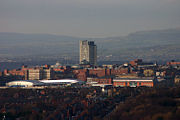 |
| 64 | St Helens St Helens, Merseyside St Helens is a large town in Merseyside, England. It is the largest settlement and administrative centre of the Metropolitan Borough of St Helens with a population of just over 100,000, part of an urban area with a total population of 176,843 at the time of the 2001 Census... |
102,629 | England | Merseyside Merseyside Merseyside is a metropolitan county in North West England, with a population of 1,365,900. It encompasses the metropolitan area centred on both banks of the lower reaches of the Mersey Estuary, and comprises five metropolitan boroughs: Knowsley, St Helens, Sefton, Wirral, and the city of Liverpool... |
Part of Liverpool Urban Area Liverpool Urban Area The "Liverpool Urban Area" is a term used by the Office for National Statistics to denote the urban area around Liverpool in England, to the east of the River Mersey. The contiguous built-up area extends beyond the area administered by Liverpool City Council into adjoining local authority areas,... . |
|
| 65 | Woking Woking Woking is a large town and civil parish that shares its name with the surrounding local government district, located in the west of Surrey, UK. It is part of the Greater London Urban Area and the London commuter belt, with frequent trains and a journey time of 24 minutes to Waterloo station.... |
101,127 | England | Surrey Surrey Surrey is a county in the South East of England and is one of the Home Counties. The county borders Greater London, Kent, East Sussex, West Sussex, Hampshire and Berkshire. The historic county town is Guildford. Surrey County Council sits at Kingston upon Thames, although this has been part of... |
Includes neighbouring village of Byfleet Byfleet Byfleet is an inland island village forming a suburb of Woking in Surrey, England. It is in the east of the borough between the River Wey and the River Mole, and is within the M25 motorway.... . |
|
| 66 | Crawley Crawley Crawley is a town and local government district with Borough status in West Sussex, England. It is south of Charing Cross, north of Brighton and Hove, and northeast of the county town of Chichester, covers an area of and had a population of 99,744 at the time of the 2001 Census.The area has... |
100,547 | England | West Sussex West Sussex West Sussex is a county in the south of England, bordering onto East Sussex , Hampshire and Surrey. The county of Sussex has been divided into East and West since the 12th century, and obtained separate county councils in 1888, but it remained a single ceremonial county until 1974 and the coming... |
Population of Crawley Urban Area is 180,177 (This includes Redhill Redhill, Surrey Redhill is a town in the borough of Reigate and Banstead, Surrey, England and is part of the London commuter belt. Redhill and the adjacent town of Reigate form a single urban area.-History:... , Reigate Reigate Reigate is a historic market town in Surrey, England, at the foot of the North Downs, and in the London commuter belt. It is one of the main constituents of the Borough of Reigate and Banstead... , Horley Horley Horley is a town in Surrey, England, situated south of the twin towns of Reigate and Redhill, and north of Gatwick Airport and Crawley.With fast links by train to London from Horley railway station, it has grown popular with commuters in recent years... and Salfords Salfords Salfords is a village in the borough of Reigate and Banstead in Surrey, England. It lies approximately 3 miles or 5 km south of Redhill on the A23 London to Brighton road. It was the original UK home of the Monotype Corporation and Salfords railway station was originally built to service the... ). |
|
| 67 | Chelmsford Chelmsford Chelmsford is the county town of Essex, England and the principal settlement of the borough of Chelmsford. It is located in the London commuter belt, approximately northeast of Charing Cross, London, and approximately the same distance from the once provincial Roman capital at Colchester... |
99,962 | England | Essex Essex Essex is a ceremonial and non-metropolitan county in the East region of England, and one of the home counties. It is located to the northeast of Greater London. It borders with Cambridgeshire and Suffolk to the north, Hertfordshire to the west, Kent to the South and London to the south west... |
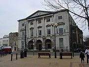 |
|
| 68 | Basildon Basildon Basildon is a town located in the Basildon District of the county of Essex, England.It lies east of Central London and south of the county town of Chelmsford... |
99,876 | England | Essex Essex Essex is a ceremonial and non-metropolitan county in the East region of England, and one of the home counties. It is located to the northeast of Greater London. It borders with Cambridgeshire and Suffolk to the north, Hertfordshire to the west, Kent to the South and London to the south west... |
||
| 69 | Cheltenham Cheltenham Cheltenham , also known as Cheltenham Spa, is a large spa town and borough in Gloucestershire, on the edge of the Cotswolds in the South-West region of England. It is the home of the flagship race of British steeplechase horse racing, the Gold Cup, the main event of the Cheltenham Festival held... |
98,875 | England | Gloucestershire Gloucestershire Gloucestershire is a county in South West England. The county comprises part of the Cotswold Hills, part of the flat fertile valley of the River Severn, and the entire Forest of Dean.... |
||
| 70 | Gillingham Gillingham, Kent Gillingham is a town in the unitary authority of Medway in South East England. It is part of the ceremonial county of Kent. The town includes the settlements of Brompton, Hempstead, Rainham, Rainham Mark and Twydall.... |
98,403 | England | Kent Kent Kent is a county in southeast England, and is one of the home counties. It borders East Sussex, Surrey and Greater London and has a defined boundary with Essex in the middle of the Thames Estuary. The ceremonial county boundaries of Kent include the shire county of Kent and the unitary borough of... |
Population of entire Medway Medway Medway is a conurbation and unitary authority in South East England. The Unitary Authority was formed in 1998 when the City of Rochester-upon-Medway amalgamated with Gillingham Borough Council and part of Kent County Council to form Medway Council, a unitary authority independent of Kent County... towns Urban Area is 231,659 |
 |
| 71 | Worthing Worthing Worthing is a large seaside town with borough status in West Sussex, within the historic County of Sussex, forming part of the Brighton/Worthing/Littlehampton conurbation. It is situated at the foot of the South Downs, west of Brighton, and east of the county town of Chichester... |
96,964 | England | West Sussex West Sussex West Sussex is a county in the south of England, bordering onto East Sussex , Hampshire and Surrey. The county of Sussex has been divided into East and West since the 12th century, and obtained separate county councils in 1888, but it remained a single ceremonial county until 1974 and the coming... |
||
| 72 | Rochdale Rochdale Rochdale is a large market town in Greater Manchester, England. It lies amongst the foothills of the Pennines on the River Roch, north-northwest of Oldham, and north-northeast of the city of Manchester. Rochdale is surrounded by several smaller settlements which together form the Metropolitan... |
95,796 | England | Greater Manchester Greater Manchester Greater Manchester is a metropolitan county in North West England, with a population of 2.6 million. It encompasses one of the largest metropolitan areas in the United Kingdom and comprises ten metropolitan boroughs: Bolton, Bury, Oldham, Rochdale, Stockport, Tameside, Trafford, Wigan, and the... |
Part of Greater Manchester Urban Area Greater Manchester Urban Area The Greater Manchester Urban Area is an area of land defined by the Office for National Statistics consisting of the large conurbation that encompasses the city of Manchester and the continuous metropolitan area that spreads outwards from it, forming much of Greater Manchester in North West England... |
 |
| 73 | Solihull Solihull Solihull is a town in the West Midlands of England with a population of 94,753. It is a part of the West Midlands conurbation and is located 9 miles southeast of Birmingham city centre... |
94,753 | England | West Midlands West Midlands (county) The West Midlands is a metropolitan county in western central England with a 2009 estimated population of 2,638,700. It came into existence as a metropolitan county in 1974 after the passage of the Local Government Act 1972, formed from parts of Staffordshire, Worcestershire and Warwickshire. The... |
Part of West Midlands Conurbation West Midlands conurbation The West Midlands conurbation is the name given to the large conurbation that includes the cities of Birmingham and Wolverhampton and the large towns of Dudley, Walsall, West Bromwich, Solihull, Stourbridge, Halesowen in the English West Midlands.... |
 |
| 74 | Worcester Worcester The City of Worcester, commonly known as Worcester, , is a city and county town of Worcestershire in the West Midlands of England. Worcester is situated some southwest of Birmingham and north of Gloucester, and has an approximate population of 94,000 people. The River Severn runs through the... |
94,100 | England | Worcestershire Worcestershire Worcestershire is a non-metropolitan county, established in antiquity, located in the West Midlands region of England. For Eurostat purposes it is a NUTS 3 region and is one of three counties that comprise the "Herefordshire, Worcestershire and Warwickshire" NUTS 2 region... |
 |
|
| 75 | Derry Derry Derry or Londonderry is the second-biggest city in Northern Ireland and the fourth-biggest city on the island of Ireland. The name Derry is an anglicisation of the Irish name Doire or Doire Cholmcille meaning "oak-wood of Colmcille"... |
93,512 | Northern Ireland | County Londonderry County Londonderry The place name Derry is an anglicisation of the old Irish Daire meaning oak-grove or oak-wood. As with the city, its name is subject to the Derry/Londonderry name dispute, with the form Derry preferred by nationalists and Londonderry preferred by unionists... |
Population figure is Derry Urban Area Derry Urban Area The Derry Urban Area is the urban area that includes and surrounds the city of Derry in Northern Ireland, and is part of the Derry City Council area. It had a population of 93,512 in the 2001 census... |
 |
| 76 | Southport Southport Southport is a seaside town in the Metropolitan Borough of Sefton in Merseyside, England. During the 2001 census Southport was recorded as having a population of 90,336, making it the eleventh most populous settlement in North West England... |
91,404 | England | Merseyside Merseyside Merseyside is a metropolitan county in North West England, with a population of 1,365,900. It encompasses the metropolitan area centred on both banks of the lower reaches of the Mersey Estuary, and comprises five metropolitan boroughs: Knowsley, St Helens, Sefton, Wirral, and the city of Liverpool... |
 |
|
| 77 | Basingstoke Basingstoke Basingstoke is a town in northeast Hampshire, in south central England. It lies across a valley at the source of the River Loddon. It is southwest of London, northeast of Southampton, southwest of Reading and northeast of the county town, Winchester. In 2008 it had an estimated population of... |
90,171 | England | Hampshire Hampshire Hampshire is a county on the southern coast of England in the United Kingdom. The county town of Hampshire is Winchester, a historic cathedral city that was once the capital of England. Hampshire is notable for housing the original birthplaces of the Royal Navy, British Army, and Royal Air Force... |
 |
|
| 78 | Bath | 90,144 | England | Somerset Somerset The ceremonial and non-metropolitan county of Somerset in South West England borders Bristol and Gloucestershire to the north, Wiltshire to the east, Dorset to the south-east, and Devon to the south-west. It is partly bounded to the north and west by the Bristol Channel and the estuary of the... |
||
| 79 | Maidstone Maidstone Maidstone is the county town of Kent, England, south-east of London. The River Medway runs through the centre of the town linking Maidstone to Rochester and the Thames Estuary. Historically, the river was a source and route for much of the town's trade. Maidstone was the centre of the agricultural... |
89,684 | England | Kent Kent Kent is a county in southeast England, and is one of the home counties. It borders East Sussex, Surrey and Greater London and has a defined boundary with Essex in the middle of the Thames Estuary. The ceremonial county boundaries of Kent include the shire county of Kent and the unitary borough of... |
||
| 80 | Harlow Harlow Harlow is a new town and local government district in Essex, England. It is located in the west of the county and on the border with Hertfordshire, on the Stort Valley, The town is near the M11 motorway and forms part of the London commuter belt.The district has a current population of 78,889... |
88,296 | England | Essex Essex Essex is a ceremonial and non-metropolitan county in the East region of England, and one of the home counties. It is located to the northeast of Greater London. It borders with Cambridgeshire and Suffolk to the north, Hertfordshire to the west, Kent to the South and London to the south west... |
Population includes the nearby village of Sawbridgeworth Sawbridgeworth Sawbridgeworth is a small, mainly residential, town and also a civil parish in Hertfordshire, England.- Location :Sawbridgeworth is four miles south of Bishop's Stortford, twelve miles east of Hertford and nine miles north of Epping. It lies on the A1184 and has a railway station that links to... . |
|
| 81 | Grimsby Grimsby Grimsby is a seaport on the Humber Estuary in Lincolnshire, England. It has been the administrative centre of the unitary authority area of North East Lincolnshire since 1996... |
87,574 | England | Lincolnshire Lincolnshire Lincolnshire is a county in the east of England. It borders Norfolk to the south east, Cambridgeshire to the south, Rutland to the south west, Leicestershire and Nottinghamshire to the west, South Yorkshire to the north west, and the East Riding of Yorkshire to the north. It also borders... |
Population of entire Grimsby Urban Area including Cleethorpes is 138,842 | |
| 82 | Darlington Darlington Darlington is a market town in the Borough of Darlington, part of the ceremonial county of County Durham, England. It lies on the small River Skerne, a tributary of the River Tees, not far from the main river. It is the main population centre in the borough, with a population of 97,838 as of 2001... |
86,082 | England | County Durham County Durham County Durham is a ceremonial county and unitary district in north east England. The county town is Durham. The largest settlement in the ceremonial county is the town of Darlington... |
 |
|
| 83 | Hartlepool Hartlepool Hartlepool is a town and port in North East England.It was founded in the 7th century AD, around the Northumbrian monastery of Hartlepool Abbey. The village grew during the Middle Ages and developed a harbour which served as the official port of the County Palatine of Durham. A railway link from... |
86,075 | England | County Durham County Durham County Durham is a ceremonial county and unitary district in north east England. The county town is Durham. The largest settlement in the ceremonial county is the town of Darlington... |
nov2007.jpg) |
|
| 84 | Lincoln | 85,963 | England | Lincolnshire Lincolnshire Lincolnshire is a county in the east of England. It borders Norfolk to the south east, Cambridgeshire to the south, Rutland to the south west, Leicestershire and Nottinghamshire to the west, South Yorkshire to the north west, and the East Riding of Yorkshire to the north. It also borders... |
||
| 85 | Hastings Hastings Hastings is a town and borough in the county of East Sussex on the south coast of England. The town is located east of the county town of Lewes and south east of London, and has an estimated population of 86,900.... |
85,828 | England | East Sussex East Sussex East Sussex is a county in South East England. It is bordered by the counties of Kent, Surrey and West Sussex, and to the south by the English Channel.-History:... |
 |
|
| 86 | Birkenhead Birkenhead Birkenhead is a town within the Metropolitan Borough of Wirral in Merseyside, England. It is on the Wirral Peninsula, along the west bank of the River Mersey, opposite the city of Liverpool... |
83,729 | England | Merseyside Merseyside Merseyside is a metropolitan county in North West England, with a population of 1,365,900. It encompasses the metropolitan area centred on both banks of the lower reaches of the Mersey Estuary, and comprises five metropolitan boroughs: Knowsley, St Helens, Sefton, Wirral, and the city of Liverpool... |
Part of Liverpool Urban Area Liverpool Urban Area The "Liverpool Urban Area" is a term used by the Office for National Statistics to denote the urban area around Liverpool in England, to the east of the River Mersey. The contiguous built-up area extends beyond the area administered by Liverpool City Council into adjoining local authority areas,... |
|
| 87 | Halifax Halifax, West Yorkshire Halifax is a minster town, within the Metropolitan Borough of Calderdale in West Yorkshire, England. It has an urban area population of 82,056 in the 2001 Census. It is well-known as a centre of England's woollen manufacture from the 15th century onward, originally dealing through the Halifax Piece... |
83,570 | England | West Yorkshire West Yorkshire West Yorkshire is a metropolitan county within the Yorkshire and the Humber region of England with a population of 2.2 million. West Yorkshire came into existence as a metropolitan county in 1974 after the passage of the Local Government Act 1972.... |
||
| 88 | Hemel Hempstead Hemel Hempstead Hemel Hempstead is a town in Hertfordshire in the East of England, to the north west of London and part of the Greater London Urban Area. The population at the 2001 Census was 81,143 .... |
83,118 | England | Hertfordshire Hertfordshire Hertfordshire is a ceremonial and non-metropolitan county in the East region of England. The county town is Hertford.The county is one of the Home Counties and lies inland, bordered by Greater London , Buckinghamshire , Bedfordshire , Cambridgeshire and... |
Part of Greater London Urban Area Greater London Urban Area The Greater London Urban Area is the conurbation or continuous urban area based around London, England, as defined by the Office for National Statistics. It had an estimated population of 8,505,000 in 2005 and occupied an area of at the time of the 2001 census. It includes most of Greater London,... |
|
| 89 | South Shields South Shields South Shields is a coastal town in Tyne and Wear, England, located at the mouth of the River Tyne to Tyne Dock, and about downstream from Newcastle upon Tyne... |
82,854 | England | Tyne and Wear Tyne and Wear Tyne and Wear is a metropolitan county in north east England around the mouths of the Rivers Tyne and Wear. It came into existence as a metropolitan county in 1974 after the passage of the Local Government Act 1972... |
The population of South Tyneside South Tyneside South Tyneside is a metropolitan borough in Tyne and Wear in North East England.It is bordered by four other boroughs - Newcastle upon Tyne and Gateshead to the west, Sunderland in the south, and North Tyneside to the north. The border county of Northumberland lies further north... is 152,875 |
|
| 90 | Bedford Bedford Bedford is the county town of Bedfordshire, in the East of England. It is a large town and the administrative centre for the wider Borough of Bedford. According to the former Bedfordshire County Council's estimates, the town had a population of 79,190 in mid 2005, with 19,720 in the adjacent town... |
82,488 | England | Bedfordshire Bedfordshire Bedfordshire is a ceremonial county of historic origin in England that forms part of the East of England region.It borders Cambridgeshire to the north-east, Northamptonshire to the north, Buckinghamshire to the west and Hertfordshire to the south-east.... |
||
| 91 | St Albans St Albans St Albans is a city in southern Hertfordshire, England, around north of central London, which forms the main urban area of the City and District of St Albans. It is a historic market town, and is now a sought-after dormitory town within the London commuter belt... |
82,429 | England | Hertfordshire Hertfordshire Hertfordshire is a ceremonial and non-metropolitan county in the East region of England. The county town is Hertford.The county is one of the Home Counties and lies inland, bordered by Greater London , Buckinghamshire , Bedfordshire , Cambridgeshire and... |
Population of entire St Albans Urban Area is 114,720 |  |
| 92 | Stevenage Stevenage Stevenage is a town and borough in Hertfordshire, England. It is situated to the east of junctions 7 and 8 of the A1, and is between Letchworth Garden City to the north, and Welwyn Garden City to the south.... |
81,482 | England | Hertfordshire Hertfordshire Hertfordshire is a ceremonial and non-metropolitan county in the East region of England. The county town is Hertford.The county is one of the Home Counties and lies inland, bordered by Greater London , Buckinghamshire , Bedfordshire , Cambridgeshire and... |
||
| 93 | Wigan Wigan Wigan is a town in Greater Manchester, England. It stands on the River Douglas, south-west of Bolton, north of Warrington and west-northwest of Manchester. Wigan is the largest settlement in the Metropolitan Borough of Wigan and is its administrative centre. The town of Wigan had a total... |
81,203 | England | Greater Manchester Greater Manchester Greater Manchester is a metropolitan county in North West England, with a population of 2.6 million. It encompasses one of the largest metropolitan areas in the United Kingdom and comprises ten metropolitan boroughs: Bolton, Bury, Oldham, Rochdale, Stockport, Tameside, Trafford, Wigan, and the... |
Population of entire Wigan Urban are is 166,840 | |
| 94 | Warrington Warrington Warrington is a town, borough and unitary authority area of Cheshire, England. It stands on the banks of the River Mersey, which is tidal to the west of the weir at Howley. It lies 16 miles east of Liverpool, 19 miles west of Manchester and 8 miles south of St Helens... |
80,661 | England | Cheshire Cheshire Cheshire is a ceremonial county in North West England. Cheshire's county town is the city of Chester, although its largest town is Warrington. Other major towns include Widnes, Congleton, Crewe, Ellesmere Port, Runcorn, Macclesfield, Winsford, Northwich, and Wilmslow... |
Total population of Warrington Urban Area according to 2001 census is 158,915 |  |
| 95 | Chester Chester Chester is a city in Cheshire, England. Lying on the River Dee, close to the border with Wales, it is home to 77,040 inhabitants, and is the largest and most populous settlement of the wider unitary authority area of Cheshire West and Chester, which had a population of 328,100 according to the... |
80,121 | England | Cheshire Cheshire Cheshire is a ceremonial county in North West England. Cheshire's county town is the city of Chester, although its largest town is Warrington. Other major towns include Widnes, Congleton, Crewe, Ellesmere Port, Runcorn, Macclesfield, Winsford, Northwich, and Wilmslow... |
||
| 96 | Stockton-on-Tees Stockton-on-Tees Stockton-on-Tees is a market town in north east England. It is the major settlement in the unitary authority and borough of Stockton-on-Tees. For ceremonial purposes, the borough is split between County Durham and North Yorkshire as it also incorporates a number of smaller towns including... |
80,060 | England | North Yorkshire North Yorkshire North Yorkshire is a non-metropolitan or shire county located in the Yorkshire and the Humber region of England, and a ceremonial county primarily in that region but partly in North East England. Created in 1974 by the Local Government Act 1972 it covers an area of , making it the largest... County Durham County Durham County Durham is a ceremonial county and unitary district in north east England. The county town is Durham. The largest settlement in the ceremonial county is the town of Darlington... |
 |
|
| 97 | Gateshead Gateshead Gateshead is a town in Tyne and Wear, England and is the main settlement in the Metropolitan Borough of Gateshead. Historically a part of County Durham, it lies on the southern bank of the River Tyne opposite Newcastle upon Tyne and together they form the urban core of Tyneside... |
78,403 | England | Tyne and Wear Tyne and Wear Tyne and Wear is a metropolitan county in north east England around the mouths of the Rivers Tyne and Wear. It came into existence as a metropolitan county in 1974 after the passage of the Local Government Act 1972... |
Part of Tyneside Tyneside Tyneside is a conurbation in North East England, defined by the Office of National Statistics, which is home to over 80% of the population of Tyne and Wear. It includes the city of Newcastle upon Tyne and the Metropolitan Boroughs of Gateshead, North Tyneside and South Tyneside — all settlements on... Urban Area. |
|
| 98 | Weston-super-Mare Weston-super-Mare Weston-super-Mare is a seaside resort, town and civil parish in the unitary authority of North Somerset, which is within the ceremonial county of Somerset, England. It is located on the Bristol Channel coast, south west of Bristol, spanning the coast between the bounding high ground of Worlebury... |
78,044 | England | Somerset Somerset The ceremonial and non-metropolitan county of Somerset in South West England borders Bristol and Gloucestershire to the north, Wiltshire to the east, Dorset to the south-east, and Devon to the south-west. It is partly bounded to the north and west by the Bristol Channel and the estuary of the... |
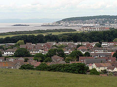 |
|
| 99 | High Wycombe High Wycombe High Wycombe , commonly known as Wycombe and formally called Chepping Wycombe or Chipping Wycombe until 1946,is a large town in Buckinghamshire, England. It is west-north-west of Charing Cross in London; this figure is engraved on the Corn Market building in the centre of the town... |
77,178 | England | Buckinghamshire Buckinghamshire Buckinghamshire is a ceremonial and non-metropolitan home county in South East England. The county town is Aylesbury, the largest town in the ceremonial county is Milton Keynes and largest town in the non-metropolitan county is High Wycombe.... |
 |
|
| 100 | Wakefield Wakefield Wakefield is the main settlement and administrative centre of the City of Wakefield, a metropolitan district of West Yorkshire, England. Located by the River Calder on the eastern edge of the Pennines, the urban area is and had a population of 76,886 in 2001.... |
76,886 | England | West Yorkshire West Yorkshire West Yorkshire is a metropolitan county within the Yorkshire and the Humber region of England with a population of 2.2 million. West Yorkshire came into existence as a metropolitan county in 1974 after the passage of the Local Government Act 1972.... |
||
| 101 | Redditch Redditch Redditch is a town and local government district in north-east Worcestershire, England, approximately south of Birmingham. The district had a population of 79,216 in 2005. In the 19th century it became the international centre for the needle and fishing tackle industry... |
74,803 | England | Worcestershire Worcestershire Worcestershire is a non-metropolitan county, established in antiquity, located in the West Midlands region of England. For Eurostat purposes it is a NUTS 3 region and is one of three counties that comprise the "Herefordshire, Worcestershire and Warwickshire" NUTS 2 region... |
||
| 102 | Newcastle-under-Lyme Newcastle-under-Lyme Newcastle-under-Lyme is a market town in Staffordshire, England, and is the principal town of the Borough of Newcastle-under-Lyme. It is part of The Potteries Urban Area and North Staffordshire. In the 2001 census the town had a population of 73,944... |
74,427 | England | Staffordshire Staffordshire Staffordshire is a landlocked county in the West Midlands region of England. For Eurostat purposes, the county is a NUTS 3 region and is one of four counties or unitary districts that comprise the "Shropshire and Staffordshire" NUTS 2 region. Part of the National Forest lies within its borders... |
Part of The Potteries Urban Area The Potteries Urban Area The Potteries Urban Area is a conurbation in North Staffordshire in the West Midlands region of England.It includes the city of Stoke-on-Trent, and the towns of Newcastle-under-Lyme and Kidsgrove.... |
|
| 103 | Paisley Paisley Paisley is the largest town in the historic county of Renfrewshire in the west central Lowlands of Scotland and serves as the administrative centre for the Renfrewshire council area... |
74,170 | Scotland | Renfrewshire Renfrewshire Renfrewshire is one of 32 council areas used for local government in Scotland. Located in the west central Lowlands, it is one of three council areas contained within the boundaries of the historic county of Renfrewshire, the others being Inverclyde to the west and East Renfrewshire to the east... |
Part of Greater Glasgow Greater Glasgow Greater Glasgow is an urban settlement in Scotland consisting of all localities which are physically attached to the city of Glasgow, forming with it a single contiguous urban area... Urban Area |
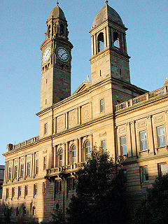 |
| 104 | East Kilbride East Kilbride East Kilbride is a large suburban town in the South Lanarkshire council area, in the West Central Lowlands of Scotland. Designated as Scotland's first new town in 1947, it forms part of the Greater Glasgow conurbation... |
73,796 | Scotland | North Lanarkshire North Lanarkshire North Lanarkshire is one of 32 council areas in Scotland. It borders onto the northeast of the City of Glasgow and contains much of Glasgow's suburbs and commuter towns and villages. It also borders Stirling, Falkirk, East Dunbartonshire, West Lothian and South Lanarkshire... |
||
| 105 | Chatham | 73,468 | England | Kent Kent Kent is a county in southeast England, and is one of the home counties. It borders East Sussex, Surrey and Greater London and has a defined boundary with Essex in the middle of the Thames Estuary. The ceremonial county boundaries of Kent include the shire county of Kent and the unitary borough of... |
Part of Medway Medway Medway is a conurbation and unitary authority in South East England. The Unitary Authority was formed in 1998 when the City of Rochester-upon-Medway amalgamated with Gillingham Borough Council and part of Kent County Council to form Medway Council, a unitary authority independent of Kent County... towns Urban Area |
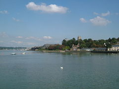 |
| 106 | Burnley Burnley Burnley is a market town in the Burnley borough of Lancashire, England, with a population of around 73,500. It lies north of Manchester and east of Preston, at the confluence of the River Calder and River Brun.... |
73,021 | England | Lancashire Lancashire Lancashire is a non-metropolitan county of historic origin in the North West of England. It takes its name from the city of Lancaster, and is sometimes known as the County of Lancaster. Although Lancaster is still considered to be the county town, Lancashire County Council is based in Preston... |
||
| 107 | Salford | 72,750 | England | Greater Manchester Greater Manchester Greater Manchester is a metropolitan county in North West England, with a population of 2.6 million. It encompasses one of the largest metropolitan areas in the United Kingdom and comprises ten metropolitan boroughs: Bolton, Bury, Oldham, Rochdale, Stockport, Tameside, Trafford, Wigan, and the... |
Part of Greater Manchester Urban Area Greater Manchester Urban Area The Greater Manchester Urban Area is an area of land defined by the Office for National Statistics consisting of the large conurbation that encompasses the city of Manchester and the continuous metropolitan area that spreads outwards from it, forming much of Greater Manchester in North West England... . |
 |
| 108 | Scunthorpe Scunthorpe Scunthorpe is a town within North Lincolnshire, England. It is the administrative centre of the North Lincolnshire unitary authority, and had an estimated total resident population of 72,514 in 2010. A predominantly industrial town, Scunthorpe, the United Kingdom's largest steel processing centre,... |
72,514 | England | Lincolnshire Lincolnshire Lincolnshire is a county in the east of England. It borders Norfolk to the south east, Cambridgeshire to the south, Rutland to the south west, Leicestershire and Nottinghamshire to the west, South Yorkshire to the north west, and the East Riding of Yorkshire to the north. It also borders... |
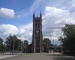 |
|
| 109 | Hove Hove Hove is a town on the south coast of England, immediately to the west of its larger neighbour Brighton, with which it forms the unitary authority Brighton and Hove. It forms a single conurbation together with Brighton and some smaller towns and villages running along the coast... |
72,335 | England | East Sussex East Sussex East Sussex is a county in South East England. It is bordered by the counties of Kent, Surrey and West Sussex, and to the south by the English Channel.-History:... |
||
| 110 | Carlisle | 71,773 | England | Cumbria Cumbria Cumbria , is a non-metropolitan county in North West England. The county and Cumbria County Council, its local authority, came into existence in 1974 after the passage of the Local Government Act 1972. Cumbria's largest settlement and county town is Carlisle. It consists of six districts, and in... |
||
| 111 | Tamworth Tamworth Tamworth is a town and local government district in Staffordshire, England, located north-east of Birmingham city centre and north-west of London. The town takes its name from the River Tame, which flows through the town, as does the River Anker... |
71,650 | England | Staffordshire Staffordshire Staffordshire is a landlocked county in the West Midlands region of England. For Eurostat purposes, the county is a NUTS 3 region and is one of four counties or unitary districts that comprise the "Shropshire and Staffordshire" NUTS 2 region. Part of the National Forest lies within its borders... |
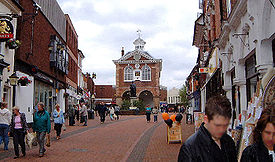 |
|
| 112 | Barnsley Barnsley Barnsley is a town in South Yorkshire, England. It lies on the River Dearne, north of the city of Sheffield, south of Leeds and west of Doncaster. Barnsley is surrounded by several smaller settlements which together form the Metropolitan Borough of Barnsley, of which Barnsley is the largest and... |
71,599 | England | South Yorkshire South Yorkshire South Yorkshire is a metropolitan county in the Yorkshire and the Humber region of England. It has a population of 1.29 million. It consists of four metropolitan boroughs: Barnsley, Doncaster, Rotherham, and City of Sheffield... |
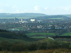 |
|
| 113 | Harrogate Harrogate Harrogate is a spa town in North Yorkshire, England. The town is a tourist destination and its visitor attractions include its spa waters, RHS Harlow Carr gardens, and Betty's Tea Rooms. From the town one can explore the nearby Yorkshire Dales national park. Harrogate originated in the 17th... |
71,594 | England | North Yorkshire North Yorkshire North Yorkshire is a non-metropolitan or shire county located in the Yorkshire and the Humber region of England, and a ceremonial county primarily in that region but partly in North East England. Created in 1974 by the Local Government Act 1972 it covers an area of , making it the largest... |
||
| 114 | Lisburn Lisburn DemographicsLisburn Urban Area is within Belfast Metropolitan Urban Area and is classified as a Large Town by the . On census day there were 71,465 people living in Lisburn... |
71,465 | Northern Ireland | County Antrim County Antrim County Antrim is one of six counties that form Northern Ireland, situated in the north-east of the island of Ireland. Adjoined to the north-east shore of Lough Neagh, the county covers an area of 2,844 km², with a population of approximately 616,000... County Down County Down -Cities:*Belfast *Newry -Large towns:*Dundonald*Newtownards*Bangor-Medium towns:... |
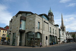 |
|
| 115 | Bracknell Bracknell Bracknell is a town and civil parish in the Borough of Bracknell Forest in Berkshire, England. It lies to the south-east of Reading, southwest of Windsor and west of central London... |
70,795 | England | Berkshire Berkshire Berkshire is a historic county in the South of England. It is also often referred to as the Royal County of Berkshire because of the presence of the royal residence of Windsor Castle in the county; this usage, which dates to the 19th century at least, was recognised by the Queen in 1957, and... |
Part of Reading/Wokingham Urban Area Reading/Wokingham Urban Area The Reading/Wokingham Urban Area is a name given by the Office for National Statistics to a conurbation in Berkshire, England, with a population of 369,804 , up 10.1% from the 1991 figure of 335,757... |
|
| 116 | Nuneaton Nuneaton Nuneaton is the largest town in the Borough of Nuneaton and Bedworth and in the English county of Warwickshire.Nuneaton is most famous for its associations with the 19th century author George Eliot, who was born on a farm on the Arbury Estate just outside Nuneaton in 1819 and lived in the town for... |
70,721 | England | Warwickshire Warwickshire Warwickshire is a landlocked non-metropolitan county in the West Midlands region of England. The county town is Warwick, although the largest town is Nuneaton. The county is famous for being the birthplace of William Shakespeare... |
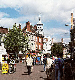 |
|
| 117 | Chesterfield Chesterfield Chesterfield is a market town and a borough of Derbyshire, England. It lies north of Derby, on a confluence of the rivers Rother and Hipper. Its population is 70,260 , making it Derbyshire's largest town... |
70,260 | England | Derbyshire Derbyshire Derbyshire is a county in the East Midlands of England. A substantial portion of the Peak District National Park lies within Derbyshire. The northern part of Derbyshire overlaps with the Pennines, a famous chain of hills and mountains. The county contains within its boundary of approx... |
 |
|
| 118 | Mansfield Mansfield Mansfield is a town in Nottinghamshire, England. It is the main town in the Mansfield local government district. Mansfield is a part of the Mansfield Urban Area.... |
69,987 | England | Nottinghamshire Nottinghamshire Nottinghamshire is a county in the East Midlands of England, bordering South Yorkshire to the north-west, Lincolnshire to the east, Leicestershire to the south, and Derbyshire to the west... |
Part of Mansfield Urban Area Mansfield Urban Area The Mansfield Urban Area is an area of west Nottinghamshire that comprises the towns of Mansfield, Sutton in Ashfield, Kirkby in Ashfield and Mansfield Woodhouse. The 2001 census gives the total population of the area as 158,114, making it the 37th most populated urban area in England.-External... , which had a total population of 158,114 in the 2001 census. |
 |
| 119 | Guildford Guildford Guildford is the county town of Surrey. England, as well as the seat for the borough of Guildford and the administrative headquarters of the South East England region... |
69,400 | England | Surrey Surrey Surrey is a county in the South East of England and is one of the Home Counties. The county borders Greater London, Kent, East Sussex, West Sussex, Hampshire and Berkshire. The historic county town is Guildford. Surrey County Council sits at Kingston upon Thames, although this has been part of... |
 |
|
| 120 | Gosport Gosport Gosport is a town, district and borough situated on the south coast of England, within the county of Hampshire. It has approximately 80,000 permanent residents with a further 5,000-10,000 during the summer months... |
69,348 | England | Hampshire Hampshire Hampshire is a county on the southern coast of England in the United Kingdom. The county town of Hampshire is Winchester, a historic cathedral city that was once the capital of England. Hampshire is notable for housing the original birthplaces of the Royal Navy, British Army, and Royal Air Force... |
Part of Portsmouth Urban Area Portsmouth Urban Area The Portsmouth Urban Area, in south-east Hampshire in southern England, includes the following components :*Fareham*Portchester*Gosport*Havant*Lee-on-the-Solent*Portsmouth*Stubbington*Waterlooville... |
 |
| 121 | Aylesbury Aylesbury Aylesbury is the county town of Buckinghamshire in South East England. However the town also falls into a geographical region known as the South Midlands an area that ecompasses the north of the South East, and the southern extremities of the East Midlands... |
69,021 | England | Buckinghamshire Buckinghamshire Buckinghamshire is a ceremonial and non-metropolitan home county in South East England. The county town is Aylesbury, the largest town in the ceremonial county is Milton Keynes and largest town in the non-metropolitan county is High Wycombe.... |
||
| 122 | Lowestoft Lowestoft Lowestoft is a town in the English county of Suffolk. The town is on the North Sea coast and is the most easterly point of the United Kingdom. It is north-east of London, north-east of Ipswich and south-east of Norwich... |
68,340 | England | Suffolk Suffolk Suffolk is a non-metropolitan county of historic origin in East Anglia, England. It has borders with Norfolk to the north, Cambridgeshire to the west and Essex to the south. The North Sea lies to the east... |
||
| 123 | Doncaster Doncaster Doncaster is a town in South Yorkshire, England, and the principal settlement of the Metropolitan Borough of Doncaster. The town is about from Sheffield and is popularly referred to as "Donny"... |
67,977 | England | South Yorkshire South Yorkshire South Yorkshire is a metropolitan county in the Yorkshire and the Humber region of England. It has a population of 1.29 million. It consists of four metropolitan boroughs: Barnsley, Doncaster, Rotherham, and City of Sheffield... |
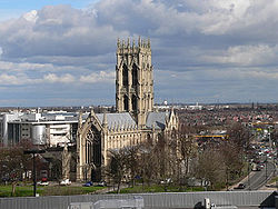 |
|
| 124 | Crewe Crewe Crewe is a railway town within the unitary authority area of Cheshire East and the ceremonial county of Cheshire, England. According to the 2001 census the urban area had a population of 67,683... |
67,683 | England | Cheshire Cheshire Cheshire is a ceremonial county in North West England. Cheshire's county town is the city of Chester, although its largest town is Warrington. Other major towns include Widnes, Congleton, Crewe, Ellesmere Port, Runcorn, Macclesfield, Winsford, Northwich, and Wilmslow... |
||
| 125 | Shrewsbury Shrewsbury Shrewsbury is the county town of Shropshire, in the West Midlands region of England. Lying on the River Severn, it is a civil parish home to some 70,000 inhabitants, and is the primary settlement and headquarters of Shropshire Council... |
67,126 | England | Shropshire Shropshire Shropshire is a county in the West Midlands region of England. For Eurostat purposes, the county is a NUTS 3 region and is one of four counties or unitary districts that comprise the "Shropshire and Staffordshire" NUTS 2 region. It borders Wales to the west... |
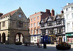 |
|
| 126 | Ellesmere Port Ellesmere Port Ellesmere Port is a large industrial town and port in the unitary authority of Cheshire West and Chester and the ceremonial county of Cheshire, England. It is situated on the south border of the Wirral Peninsula on the banks of the Manchester Ship Canal, which in turn gives access to the River... |
66,265 | England | Cheshire Cheshire Cheshire is a ceremonial county in North West England. Cheshire's county town is the city of Chester, although its largest town is Warrington. Other major towns include Widnes, Congleton, Crewe, Ellesmere Port, Runcorn, Macclesfield, Winsford, Northwich, and Wilmslow... |
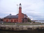 |
|
| 127 | Cannock Cannock Cannock is the most populous of three towns in the district of Cannock Chase in the central southern part of the county of Staffordshire in the West Midlands region of England.... |
65,022 | England | Staffordshire Staffordshire Staffordshire is a landlocked county in the West Midlands region of England. For Eurostat purposes, the county is a NUTS 3 region and is one of four counties or unitary districts that comprise the "Shropshire and Staffordshire" NUTS 2 region. Part of the National Forest lies within its borders... |
||
| 128 | Grays Grays Grays is the largest town in the borough and unitary authority of Thurrock in Essex and one of the Thurrock's traditional parishes... |
64,173 | England | Essex Essex Essex is a ceremonial and non-metropolitan county in the East region of England, and one of the home counties. It is located to the northeast of Greater London. It borders with Cambridgeshire and Suffolk to the north, Hertfordshire to the west, Kent to the South and London to the south west... |
||
| 129 | Stafford Stafford Stafford is the county town of Staffordshire, in the West Midlands region of England. It lies approximately north of Wolverhampton and south of Stoke-on-Trent, adjacent to the M6 motorway Junction 13 to Junction 14... |
63,681 | England | Staffordshire Staffordshire Staffordshire is a landlocked county in the West Midlands region of England. For Eurostat purposes, the county is a NUTS 3 region and is one of four counties or unitary districts that comprise the "Shropshire and Staffordshire" NUTS 2 region. Part of the National Forest lies within its borders... |
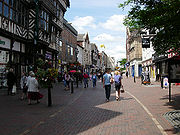 |
|
| 130 | Waterlooville Waterlooville Waterlooville is a town in Hampshire, England approximately 8 miles north of Portsmouth.The town has a population itself of about 10,000 and is surrounded by Purbrook, Blendworth, Cowplain, Lovedean, Clanfield, Catherington, Crookhorn, Denmead, Hambledon, Horndean and Widley. It forms part of... |
63,558 | England | Hampshire Hampshire Hampshire is a county on the southern coast of England in the United Kingdom. The county town of Hampshire is Winchester, a historic cathedral city that was once the capital of England. Hampshire is notable for housing the original birthplaces of the Royal Navy, British Army, and Royal Air Force... |
Part of Portsmouth Urban Area Portsmouth Urban Area The Portsmouth Urban Area, in south-east Hampshire in southern England, includes the following components :*Fareham*Portchester*Gosport*Havant*Lee-on-the-Solent*Portsmouth*Stubbington*Waterlooville... |
|
| 131 | Torquay Torquay Torquay is a town in the unitary authority area of Torbay and ceremonial county of Devon, England. It lies south of Exeter along the A380 on the north of Torbay, north-east of Plymouth and adjoins the neighbouring town of Paignton on the west of the bay. Torquay’s population of 63,998 during the... |
63,998 | England | Devon Devon Devon is a large county in southwestern England. The county is sometimes referred to as Devonshire, although the term is rarely used inside the county itself as the county has never been officially "shired", it often indicates a traditional or historical context.The county shares borders with... |
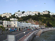 |
|
| 132 | Kingswood Kingswood, South Gloucestershire Kingswood is an urban area in South Gloucestershire, England, bordering the City of Bristol to the west. It is located on both sides of the A420 road, which connects Bristol and Chippenham and which forms the high street through the principal retail zone... |
62,679 | England | Gloucestershire Gloucestershire Gloucestershire is a county in South West England. The county comprises part of the Cotswold Hills, part of the flat fertile valley of the River Severn, and the entire Forest of Dean.... |
||
| 133 | Bognor Regis Bognor Regis Bognor Regis is a seaside resort town and civil parish in the Arun district of West Sussex, on the south coast of England. It is south-south-west of London, west of Brighton, and south-east of the city of Chichester. Other nearby towns include Littlehampton east-north-east and Selsey to the... |
62,141 | England | West Sussex West Sussex West Sussex is a county in the south of England, bordering onto East Sussex , Hampshire and Surrey. The county of Sussex has been divided into East and West since the 12th century, and obtained separate county councils in 1888, but it remained a single ceremonial county until 1974 and the coming... |
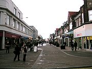 |
|
| 134 | Newtownabbey Newtownabbey Newtownabbey is a large town north of Belfast in County Antrim, Northern Ireland. Sometimes considered to be a suburb of Belfast, it is separated from the rest of the city by Cavehill and Fortwilliam golf course... |
62,056 | Northern Ireland | County Antrim County Antrim County Antrim is one of six counties that form Northern Ireland, situated in the north-east of the island of Ireland. Adjoined to the north-east shore of Lough Neagh, the county covers an area of 2,844 km², with a population of approximately 616,000... |
||
| 135 | Rugby Rugby, Warwickshire Rugby is a market town in Warwickshire, England, located on the River Avon. The town has a population of 61,988 making it the second largest town in the county... |
61,988 | England | Warwickshire Warwickshire Warwickshire is a landlocked non-metropolitan county in the West Midlands region of England. The county town is Warwick, although the largest town is Nuneaton. The county is famous for being the birthplace of William Shakespeare... |
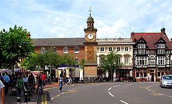 |
|
| 136 | Royal Leamington Spa | 61,595 | England | Warwickshire Warwickshire Warwickshire is a landlocked non-metropolitan county in the West Midlands region of England. The county town is Warwick, although the largest town is Nuneaton. The county is famous for being the birthplace of William Shakespeare... |
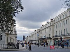 |
|
| 137 | Bury Bury Bury is a town in Greater Manchester, England. It lies on the River Irwell, east of Bolton, west-southwest of Rochdale, and north-northwest of the city of Manchester... |
60,718 | England | Greater Manchester Greater Manchester Greater Manchester is a metropolitan county in North West England, with a population of 2.6 million. It encompasses one of the largest metropolitan areas in the United Kingdom and comprises ten metropolitan boroughs: Bolton, Bury, Oldham, Rochdale, Stockport, Tameside, Trafford, Wigan, and the... |
Part of Greater Manchester Urban Area Greater Manchester Urban Area The Greater Manchester Urban Area is an area of land defined by the Office for National Statistics consisting of the large conurbation that encompasses the city of Manchester and the continuous metropolitan area that spreads outwards from it, forming much of Greater Manchester in North West England... |
.jpg) |
| 138 | Royal Tunbridge Wells Royal Tunbridge Wells Royal Tunbridge Wells is a town in west Kent, England, about south-east of central London by road, by rail. The town is close to the border of the county of East Sussex... |
60,095 | England | Kent Kent Kent is a county in southeast England, and is one of the home counties. It borders East Sussex, Surrey and Greater London and has a defined boundary with Essex in the middle of the Thames Estuary. The ceremonial county boundaries of Kent include the shire county of Kent and the unitary borough of... |
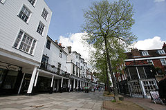 |
|
| 139 | Runcorn Runcorn Runcorn is an industrial town and cargo port within the borough of Halton in the ceremonial county of Cheshire, England. In 2009, its population was estimated to be 61,500. The town is on the southern bank of the River Mersey where the estuary narrows to form Runcorn Gap. Directly to the north... |
60,072 | England | Cheshire Cheshire Cheshire is a ceremonial county in North West England. Cheshire's county town is the city of Chester, although its largest town is Warrington. Other major towns include Widnes, Congleton, Crewe, Ellesmere Port, Runcorn, Macclesfield, Winsford, Northwich, and Wilmslow... |
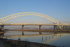 |
|
| 140 | Rhondda Rhondda Rhondda , or the Rhondda Valley , is a former coal mining valley in Wales, formerly a local government district, consisting of 16 communities built around the River Rhondda. The valley is made up of two valleys, the larger Rhondda Fawr valley and the smaller Rhondda Fach valley... |
59,602 | Wales | Rhondda Cynon Taf |  |
|
| 141 | Bootle Bootle Bootle is a town within the Metropolitan Borough of Sefton in Merseyside, England, and a 'Post town' in the L postcode area. Formally known as Bootle-cum-Linacre, the town is 4 miles to the north of Liverpool city centre, and has a total resident population of 77,640.Historically part of... |
59,123 | England | Merseyside Merseyside Merseyside is a metropolitan county in North West England, with a population of 1,365,900. It encompasses the metropolitan area centred on both banks of the lower reaches of the Mersey Estuary, and comprises five metropolitan boroughs: Knowsley, St Helens, Sefton, Wirral, and the city of Liverpool... |
Part of Liverpool Urban Area Liverpool Urban Area The "Liverpool Urban Area" is a term used by the Office for National Statistics to denote the urban area around Liverpool in England, to the east of the River Mersey. The contiguous built-up area extends beyond the area administered by Liverpool City Council into adjoining local authority areas,... |
 |
| 142 | Ashford Ashford, Kent Ashford is a town in the borough of Ashford in Kent, England. In 2005 it was voted the fourth best place to live in the United Kingdom. It lies on the Great Stour river, the M20 motorway, and the South Eastern Main Line and High Speed 1 railways. Its agricultural market is one of the most... |
58,936 | England | Kent Kent Kent is a county in southeast England, and is one of the home counties. It borders East Sussex, Surrey and Greater London and has a defined boundary with Essex in the middle of the Thames Estuary. The ceremonial county boundaries of Kent include the shire county of Kent and the unitary borough of... |
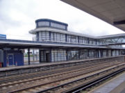 |
|
| 143 | Maidenhead Maidenhead Maidenhead is a town and unparished area within the Royal Borough of Windsor and Maidenhead, in Berkshire, England. It lies on the River Thames and is situated west of Charing Cross in London.-History:... |
58,848 | England | Berkshire Berkshire Berkshire is a historic county in the South of England. It is also often referred to as the Royal County of Berkshire because of the presence of the royal residence of Windsor Castle in the county; this usage, which dates to the 19th century at least, was recognised by the Queen in 1957, and... |
||
| 144 | Wallasey Wallasey Wallasey is a town within the Metropolitan Borough of Wirral, in Merseyside, England, on the mouth of the River Mersey, at the northeastern corner of the Wirral Peninsula... |
58,710 | England | Merseyside Merseyside Merseyside is a metropolitan county in North West England, with a population of 1,365,900. It encompasses the metropolitan area centred on both banks of the lower reaches of the Mersey Estuary, and comprises five metropolitan boroughs: Knowsley, St Helens, Sefton, Wirral, and the city of Liverpool... |
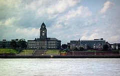 |
|
| 145 | Margate Margate -Demography:As of the 2001 UK census, Margate had a population of 40,386.The ethnicity of the town was 97.1% white, 1.0% mixed race, 0.5% black, 0.8% Asian, 0.6% Chinese or other ethnicity.... |
58,465 | England | Kent Kent Kent is a county in southeast England, and is one of the home counties. It borders East Sussex, Surrey and Greater London and has a defined boundary with Essex in the middle of the Thames Estuary. The ceremonial county boundaries of Kent include the shire county of Kent and the unitary borough of... |
||
| 146 | Bangor Bangor, County Down Bangor is a large town in County Down, Northern Ireland. It is a seaside resort on the southern side of Belfast Lough and within the Belfast Metropolitan Area. Bangor Marina is one of the largest in Ireland, and holds Blue Flag status... |
58,388 | Northern Ireland | County Down County Down -Cities:*Belfast *Newry -Large towns:*Dundonald*Newtownards*Bangor-Medium towns:... |
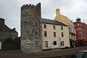 |
|
| 147 | Taunton Taunton Taunton is the county town of Somerset, England. The town, including its suburbs, had an estimated population of 61,400 in 2001. It is the largest town in the shire county of Somerset.... |
58,241 | England | Somerset Somerset The ceremonial and non-metropolitan county of Somerset in South West England borders Bristol and Gloucestershire to the north, Wiltshire to the east, Dorset to the south-east, and Devon to the south-west. It is partly bounded to the north and west by the Bristol Channel and the estuary of the... |
||
| 148 | Aldershot Aldershot Aldershot is a town in the English county of Hampshire, located on heathland about southwest of London. The town is administered by Rushmoor Borough Council... |
58,170 | England | Hampshire Hampshire Hampshire is a county on the southern coast of England in the United Kingdom. The county town of Hampshire is Winchester, a historic cathedral city that was once the capital of England. Hampshire is notable for housing the original birthplaces of the Royal Navy, British Army, and Royal Air Force... |
.jpg) |
|
| 149 | Great Yarmouth Great Yarmouth Great Yarmouth, often known to locals as Yarmouth, is a coastal town in Norfolk, England. It is at the mouth of the River Yare, east of Norwich.It has been a seaside resort since 1760, and is the gateway from the Norfolk Broads to the sea... |
58,032 | England | Norfolk Norfolk Norfolk is a low-lying county in the East of England. It has borders with Lincolnshire to the west, Cambridgeshire to the west and southwest and Suffolk to the south. Its northern and eastern boundaries are the North Sea coast and to the north-west the county is bordered by The Wash. The county... |
||
| 150 | Farnborough Farnborough, Hampshire -History:Name changes: Ferneberga ; Farnburghe, Farenberg ; Farnborowe, Fremborough, Fameborough .Tower Hill, Cove: There is substantial evidence... |
57,147 | England | Hampshire Hampshire Hampshire is a county on the southern coast of England in the United Kingdom. The county town of Hampshire is Winchester, a historic cathedral city that was once the capital of England. Hampshire is notable for housing the original birthplaces of the Royal Navy, British Army, and Royal Air Force... |
||
| 151 | Bebington Bebington Bebington is a small town and electoral ward within the Metropolitan Borough of Wirral, in Merseyside, England. It lies south of Liverpool and west southwest of Manchester, along the River Mersey on the eastern side of the Wirral Peninsula... |
57,066 | England | Merseyside Merseyside Merseyside is a metropolitan county in North West England, with a population of 1,365,900. It encompasses the metropolitan area centred on both banks of the lower reaches of the Mersey Estuary, and comprises five metropolitan boroughs: Knowsley, St Helens, Sefton, Wirral, and the city of Liverpool... |
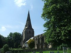 |
|
| 152 | Dartford Dartford Dartford is the principal town in the borough of Dartford. It is situated in the northwest corner of Kent, England, east south-east of central London.... |
56,818 | England | Kent Kent Kent is a county in southeast England, and is one of the home counties. It borders East Sussex, Surrey and Greater London and has a defined boundary with Essex in the middle of the Thames Estuary. The ceremonial county boundaries of Kent include the shire county of Kent and the unitary borough of... |
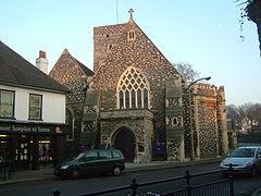 |
|
| 153 | Hereford Hereford Hereford is a cathedral city, civil parish and county town of Herefordshire, England. It lies on the River Wye, approximately east of the border with Wales, southwest of Worcester, and northwest of Gloucester... |
56,373 | England | Herefordshire Herefordshire Herefordshire is a historic and ceremonial county in the West Midlands region of England. For Eurostat purposes it is a NUTS 3 region and is one of three counties that comprise the "Herefordshire, Worcestershire and Gloucestershire" NUTS 2 region. It also forms a unitary district known as the... |
 |
|
| 154 | Fareham Fareham The market town of Fareham lies in the south east of Hampshire, England, between the cities of Southampton and Portsmouth, roughly in the centre of the South Hampshire conurbation.It gives its name to the borough comprising the town and the surrounding area... |
56,160 | England | Hampshire Hampshire Hampshire is a county on the southern coast of England in the United Kingdom. The county town of Hampshire is Winchester, a historic cathedral city that was once the capital of England. Hampshire is notable for housing the original birthplaces of the Royal Navy, British Army, and Royal Air Force... |
Part of Portsmouth Urban Area Portsmouth Urban Area The Portsmouth Urban Area, in south-east Hampshire in southern England, includes the following components :*Fareham*Portchester*Gosport*Havant*Lee-on-the-Solent*Portsmouth*Stubbington*Waterlooville... . Includes the suburb of Portchester Portchester Portchester is a locality and suburb 10km northwest of Portsmouth, England. It is part of the borough of Fareham in Hampshire. Once a small village, Portchester is now a busy part of the expanding conurbation between Portsmouth and Southampton, on the A27 main thoroughfare... . |
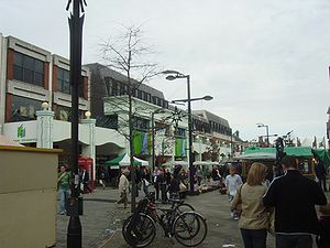 |
| 155 | Littlehampton Littlehampton Littlehampton is a seaside resort town and civil parish in the Arun District of West Sussex, England, on the east bank at the mouth of the River Arun. It lies south southwest of London, west of Brighton and east of the county town of Chichester.... |
55,716 | England | West Sussex West Sussex West Sussex is a county in the south of England, bordering onto East Sussex , Hampshire and Surrey. The county of Sussex has been divided into East and West since the 12th century, and obtained separate county councils in 1888, but it remained a single ceremonial county until 1974 and the coming... |
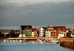 |
|
| 156 | Widnes Widnes Widnes is an industrial town within the borough of Halton, in Cheshire, England, with an urban area population of 57,663 in 2004. It is located on the northern bank of the River Mersey where the estuary narrows to form the Runcorn Gap. Directly to the south across the Mersey is the town of Runcorn... |
55,686 | England | Cheshire Cheshire Cheshire is a ceremonial county in North West England. Cheshire's county town is the city of Chester, although its largest town is Warrington. Other major towns include Widnes, Congleton, Crewe, Ellesmere Port, Runcorn, Macclesfield, Winsford, Northwich, and Wilmslow... |
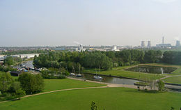 |
|
| 157 | Stourbridge Stourbridge Stourbridge is a town within the Metropolitan Borough of Dudley, in the West Midlands of England. Historically part of Worcestershire, Stourbridge was a centre of glass making, and today includes the suburbs of Amblecote, Lye, Norton, Oldswinford, Pedmore, Wollaston, Wollescote and Wordsley The... |
55,480 | England | West Midlands West Midlands (county) The West Midlands is a metropolitan county in western central England with a 2009 estimated population of 2,638,700. It came into existence as a metropolitan county in 1974 after the passage of the Local Government Act 1972, formed from parts of Staffordshire, Worcestershire and Warwickshire. The... |
||
| 158 | Kidderminster Kidderminster Kidderminster is a town, in the Wyre Forest district of Worcestershire, England. It is located approximately seventeen miles south-west of Birmingham city centre and approximately fifteen miles north of Worcester city centre. The 2001 census recorded a population of 55,182 in the town... |
55,348 | England | Worcestershire Worcestershire Worcestershire is a non-metropolitan county, established in antiquity, located in the West Midlands region of England. For Eurostat purposes it is a NUTS 3 region and is one of three counties that comprise the "Herefordshire, Worcestershire and Warwickshire" NUTS 2 region... |
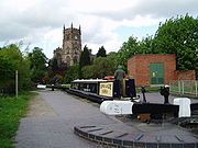 |
|
| 159 | Cheshunt Cheshunt Cheshunt is a town in Hertfordshire, England with a population of around 52,000 according to the United Kingdom's 2001 Census. It is a dormitory town and part of the Greater London Urban Area and London commuter belt served by Cheshunt railway station... |
55,275 | England | Hertfordshire Hertfordshire Hertfordshire is a ceremonial and non-metropolitan county in the East region of England. The county town is Hertford.The county is one of the Home Counties and lies inland, bordered by Greater London , Buckinghamshire , Bedfordshire , Cambridgeshire and... |
||
| 160 | Halesowen Halesowen Halesowen is a town in the Metropolitan Borough of Dudley, in the West Midlands, England.The population, as measured by the United Kingdom Census 2001, was 55,273... |
55,273 | England | West Midlands West Midlands (county) The West Midlands is a metropolitan county in western central England with a 2009 estimated population of 2,638,700. It came into existence as a metropolitan county in 1974 after the passage of the Local Government Act 1972, formed from parts of Staffordshire, Worcestershire and Warwickshire. The... |
||
| 161 | Loughborough Loughborough Loughborough is a town within the Charnwood borough of Leicestershire, England. It is the seat of Charnwood Borough Council and is home to Loughborough University... |
55,258 | England | Leicestershire Leicestershire Leicestershire is a landlocked county in the English Midlands. It takes its name from the heavily populated City of Leicester, traditionally its administrative centre, although the City of Leicester unitary authority is today administered separately from the rest of Leicestershire... |
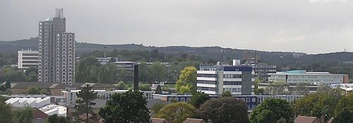 |
|
| 162 | Sale Sale Sale may refer to:* Sales * Sale, discounts and allowances in the prices of goods, such as:**Fire sale, a drastic discount in prices**Loan sale, a sale under contract of all or part of the cash stream from a specific loan... |
55,234 | England | Greater Manchester Greater Manchester Greater Manchester is a metropolitan county in North West England, with a population of 2.6 million. It encompasses one of the largest metropolitan areas in the United Kingdom and comprises ten metropolitan boroughs: Bolton, Bury, Oldham, Rochdale, Stockport, Tameside, Trafford, Wigan, and the... |
 |
|
| 163 | Dewsbury Dewsbury Dewsbury is a minster town in the Metropolitan Borough of Kirklees, in West Yorkshire, England. It is to the west of Wakefield, east of Huddersfield and south of Leeds... |
54,341 | England | West Yorkshire West Yorkshire West Yorkshire is a metropolitan county within the Yorkshire and the Humber region of England with a population of 2.2 million. West Yorkshire came into existence as a metropolitan county in 1974 after the passage of the Local Government Act 1972.... |
||
| 164 | Morley Morley, West Yorkshire Morley is a market town and civil parish within the metropolitan borough of the City of Leeds, in West Yorkshire, England. It lies approximately south-west of Leeds city centre. Together with Drighlington, Gildersome, Churwell, Tingley and East/West Ardsley, the town had a population of 47,579 in... |
54,051 | England | West Yorkshire West Yorkshire West Yorkshire is a metropolitan county within the Yorkshire and the Humber region of England with a population of 2.2 million. West Yorkshire came into existence as a metropolitan county in 1974 after the passage of the Local Government Act 1972.... |
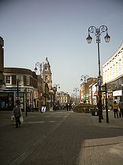 |
|
| 165 | Washington Washington, Tyne and Wear Washington is a town in the City of Sunderland in Tyne and Wear, England. Historically part of County Durham, it joined a new county in 1974 with the creation of Tyne and Wear... |
53,388 | England | Tyne and Wear Tyne and Wear Tyne and Wear is a metropolitan county in north east England around the mouths of the Rivers Tyne and Wear. It came into existence as a metropolitan county in 1974 after the passage of the Local Government Act 1972... |
 |
|
| 166 | Gravesend Gravesend, Kent Gravesend is a town in northwest Kent, England, on the south bank of the Thames, opposite Tilbury in Essex. It is the administrative town of the Borough of Gravesham and, because of its geographical position, has always had an important role to play in the history and communications of this part of... |
53,388 | England | Kent Kent Kent is a county in southeast England, and is one of the home counties. It borders East Sussex, Surrey and Greater London and has a defined boundary with Essex in the middle of the Thames Estuary. The ceremonial county boundaries of Kent include the shire county of Kent and the unitary borough of... |
||
| 167 | Eastleigh Eastleigh Eastleigh is a railway town in Hampshire, England, and the main town in the Eastleigh borough which is part of Southampton Urban Area. The town lies between Southampton and Winchester, and is part of the South Hampshire conurbation... |
52,894 | England | Hampshire Hampshire Hampshire is a county on the southern coast of England in the United Kingdom. The county town of Hampshire is Winchester, a historic cathedral city that was once the capital of England. Hampshire is notable for housing the original birthplaces of the Royal Navy, British Army, and Royal Air Force... |
Part of Southampton Urban Area | |
| 168 | Crosby Crosby, Merseyside Crosby is a town in the Metropolitan Borough of Sefton, in Merseyside, England. Historically part of Lancashire it is situated north of Bootle, south of Southport, Formby and west of Netherton-History:... |
51,789 | England | Merseyside Merseyside Merseyside is a metropolitan county in North West England, with a population of 1,365,900. It encompasses the metropolitan area centred on both banks of the lower reaches of the Mersey Estuary, and comprises five metropolitan boroughs: Knowsley, St Helens, Sefton, Wirral, and the city of Liverpool... |
Part of Liverpool Urban Area Liverpool Urban Area The "Liverpool Urban Area" is a term used by the Office for National Statistics to denote the urban area around Liverpool in England, to the east of the River Mersey. The contiguous built-up area extends beyond the area administered by Liverpool City Council into adjoining local authority areas,... |
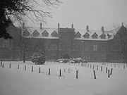 |
| 169 | Clacton-on-Sea Clacton-on-Sea Clacton-on-Sea is the largest town on the Tendring peninsula, in Essex, England and was founded in 1871. It is a seaside resort that attracted many tourists in the summer months between the 1950s and 1970s, but which like many other British sea-side resorts went into decline as a holiday... |
51,284 | England | Essex Essex Essex is a ceremonial and non-metropolitan county in the East region of England, and one of the home counties. It is located to the northeast of Greater London. It borders with Cambridgeshire and Suffolk to the north, Hertfordshire to the west, Kent to the South and London to the south west... |
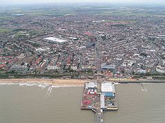 |
|
| 170 | Kettering Kettering Kettering is a market town in the Borough of Kettering, Northamptonshire, England. It is situated about from London. Kettering is mainly situated on the west side of the River Ise, a tributary of the River Nene which meets at Wellingborough... |
51,063 | England | Northampton Northampton Northampton is a large market town and local government district in the East Midlands region of England. Situated about north-west of London and around south-east of Birmingham, Northampton lies on the River Nene and is the county town of Northamptonshire. The demonym of Northampton is... |
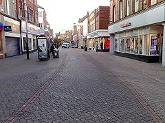 |
|
| 171 | Livingston Livingston, Scotland Livingston is a town in West Lothian, Scotland. It is the fourth post-WWII new town to be built in Scotland, designated in 1962. It is about 15 miles west of Edinburgh and 30 miles east of Glasgow, and is bordered by the towns of Broxburn to the northeast and Bathgate to the northwest.Livingston... |
50,826 | Scotland | West Lothian West Lothian West Lothian is one of the 32 unitary council areas in Scotland, and a Lieutenancy area. It borders the City of Edinburgh, Falkirk, North Lanarkshire, the Scottish Borders and South Lanarkshire.... |
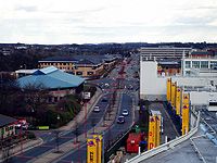 |
|
| 172 | Dunstable Dunstable Dunstable is a market town and civil parish located in Bedfordshire, England. It lies on the eastward tail spurs of the Chiltern Hills, 30 miles north of London. These geographical features form several steep chalk escarpments most noticeable when approaching Dunstable from the north.-Etymology:In... |
50,775 | England | Bedfordshire Bedfordshire Bedfordshire is a ceremonial county of historic origin in England that forms part of the East of England region.It borders Cambridgeshire to the north-east, Northamptonshire to the north, Buckinghamshire to the west and Hertfordshire to the south-east.... |
||
| 173 | Macclesfield Macclesfield Macclesfield is a market town within the unitary authority of Cheshire East, the county palatine of Chester, also known as the ceremonial county of Cheshire, England. The population of the Macclesfield urban sub-area at the time of the 2001 census was 50,688... |
50,688 | England | Cheshire Cheshire Cheshire is a ceremonial county in North West England. Cheshire's county town is the city of Chester, although its largest town is Warrington. Other major towns include Widnes, Congleton, Crewe, Ellesmere Port, Runcorn, Macclesfield, Winsford, Northwich, and Wilmslow... |
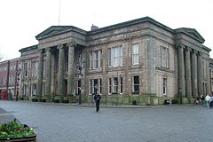 |
|
| 174 | Barry | 50,661 | Wales | Vale of Glamorgan Vale of Glamorgan The Vale of Glamorgan is a county borough in Wales; an exceptionally rich agricultural area, it lies in the southern part of Glamorgan, South Wales... |
||
| 175 | Staines Staines Staines is a Thames-side town in the Spelthorne borough of Surrey and Greater London Urban Area, as well as the London Commuter Belt of South East England. It is a suburban development within the western bounds of the M25 motorway and located 17 miles west south-west of Charing Cross in... |
50,538 | England | Surrey Surrey Surrey is a county in the South East of England and is one of the Home Counties. The county borders Greater London, Kent, East Sussex, West Sussex, Hampshire and Berkshire. The historic county town is Guildford. Surrey County Council sits at Kingston upon Thames, although this has been part of... |
Notes
- † – population is given for entire urban area, as "urban subdivision" figures were not considered useful.
- †† – the actual name of the Urban Subdivision is Cambridge/Milton, the population of the Parish of Milton (code 12UG072 in the ONS 2001 Census publication "Key Statistics for parishes in England and communities in Wales" published 16 March 2004) is given as 4,275. This figure has been deducted from the Urban Subdivision figure of 117,717 to show the population of Cambridge alone.
England
- List of English districts by population
- List of urban areas in England by population
Scotland
Wales
- List of Welsh principal areas by population
- List of settlements in Wales by population
Northern Ireland
- List of districts in Northern Ireland by population
- List of settlements in Northern Ireland by population

