
List of national parks of Chile
Encyclopedia
The following is a list of national park
s in Chile
:
National park
A national park is a reserve of natural, semi-natural, or developed land that a sovereign state declares or owns. Although individual nations designate their own national parks differently A national park is a reserve of natural, semi-natural, or developed land that a sovereign state declares or...
s in Chile
Chile
Chile ,officially the Republic of Chile , is a country in South America occupying a long, narrow coastal strip between the Andes mountains to the east and the Pacific Ocean to the west. It borders Peru to the north, Bolivia to the northeast, Argentina to the east, and the Drake Passage in the far...
:
| Name | Photo | Natural region Natural regions of Chile Because Chile extends from a point about 625 kilometers north of the Tropic of Capricorn to a point hardly more than 1,400 kilometers north of the Antarctic Circle, within its territory can be found a broad selection of the Earth's climates... |
Area | Established |
|---|---|---|---|---|
| Alberto de Agostini Alberto de Agostini National Park Alberto de Agostini National Park is a park located in the Chilean part of Tierra del Fuego. It covers and includes the Cordillera Darwin mountain range. The park is named after Alberto Maria De Agostini, who was an Italian missionary and explorer. Several tidewater glaciers and steep fjords form... |
Zona Austral Zona Austral The Zona Austral is one of the five natural regions into which CORFO divided continental Chile in 1950 corresponding to the Chilean portion of Patagonia. It is surrounded by the Southern Zone and the Chacao Channel to the north, the Pacific Ocean and Drake's Passage to the south and west, and the... |
2000 | ||
| Alerce Andino Alerce Andino National Park Alerce Andino National Park is located in the Andes, in Los Lagos Region of Chile. This national park covers about 393 km². It is bounded by the Reloncaví Estuary on its east and south sides, and by the Reloncaví Sound to the west... |
Zona Sur Zona Sur The Zona Sur is one of the five natural regions on which CORFO divided continental Chile in 1950. Its northern border is formed by the Bío-Bío River, the limit with the Central Chile Zone. By west with the Pacific Ocean, by the east with the Andean mountains and Argentina. Its southern border is... |
1982 | ||
| Archipiélago de Juan Fernández Archipiélago de Juan Fernández National Park Archipiélago de Juan Fernández National Park is a national park located 667 kilometres west of Chile's mainland port of San Antonio, in the Juan Fernández Archipelago. The park covers 96 square kilometres and comprises the islands: Santa Clara, Alejandro Selkirk and the most part of the Robinson... |
None | 1935 | ||
| Bernardo O'Higgins Bernardo O'Higgins National Park Bernardo O'Higgins National Park is the largest of the protected areas in Chile, covering an area of in both the Aisén and Magallanes and Antártica Chilena regions. The park is named after General Bernardo O'Higgins, first head of state of the Republic of Chile... |
Zona Austral Zona Austral The Zona Austral is one of the five natural regions into which CORFO divided continental Chile in 1950 corresponding to the Chilean portion of Patagonia. It is surrounded by the Southern Zone and the Chacao Channel to the north, the Pacific Ocean and Drake's Passage to the south and west, and the... |
1969 | ||
| Bosque de Fray Jorge Bosque de Fray Jorge National Park Bosque de Fray Jorge national park or Bosque Fray Jorge national park lies in the Limarí Province, Coquimbo Region, Chile. It is a UNESCO Biosphere reserve.- Geography :... |
Norte Chico Norte Chico, Chile The Norte Chico is one of the five natural regions on which CORFO divided continental Chile in 1950. Its northern border is formed by the limit with the Far North, on west lies the Pacific Ocean, by the east the Andes mountains and Argentina, and by the south the Zona Central natural region... |
1941 | ||
| Cabo de Hornos Cabo de Hornos National Park Cabo de Hornos National Park is located in the Cape Horn Archipelago, which belongs to the Commune of Cabo de Hornos, in the Antártica Chilena Province of Magallanes y Antártica Chilena Region. It was created in 1945 and includes the Wollaston Archipelago and the Hermite Islands. The park covers... |
Zona Austral Zona Austral The Zona Austral is one of the five natural regions into which CORFO divided continental Chile in 1950 corresponding to the Chilean portion of Patagonia. It is surrounded by the Southern Zone and the Chacao Channel to the north, the Pacific Ocean and Drake's Passage to the south and west, and the... |
1945 | ||
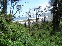
| Chiloé Chiloé National Park Chiloé National Park is a national park of Chile, located in the western coast of Chiloé Island, in Los Lagos Region . It encompasses an area of divided into two main sectors: the smallest, called Chepu, is in the commune of Ancud, whereas the rest, called Anay, is in the communes of Dalcahue,... |
 |
Zona Austral Zona Austral The Zona Austral is one of the five natural regions into which CORFO divided continental Chile in 1950 corresponding to the Chilean portion of Patagonia. It is surrounded by the Southern Zone and the Chacao Channel to the north, the Pacific Ocean and Drake's Passage to the south and west, and the... |
1983 | |
| Conguillío Conguillío National Park Conguillío National Park is located in the Andes, in the provinces of Cautín and Malleco, in the Araucanía Region of Chile. Its name derives from the Mapuche word for "water with Araucaria seeds"... |
Zona Sur Zona Sur The Zona Sur is one of the five natural regions on which CORFO divided continental Chile in 1950. Its northern border is formed by the Bío-Bío River, the limit with the Central Chile Zone. By west with the Pacific Ocean, by the east with the Andean mountains and Argentina. Its southern border is... |
1950 | ||
| Corcovado Corcovado National Park (Chile) Corcovado National Park is an preserved area of Valdivian temperate rainforest, high peaks, alpine lakes, and rivers in Chile's Los Lagos Region. This coastal park borders the same name to the west and includes the iconic volcanoes Corcovado and Yanteles... |
Zona Austral Zona Austral The Zona Austral is one of the five natural regions into which CORFO divided continental Chile in 1950 corresponding to the Chilean portion of Patagonia. It is surrounded by the Southern Zone and the Chacao Channel to the north, the Pacific Ocean and Drake's Passage to the south and west, and the... |
2005 | ||
| Hornopirén Hornopirén National Park Hornopirén National Park is located in the Andes, in the Palena Province of Chile's Los Lagos Region. The park contains of rugged mountains and unspoiled Valdivian temperate rain forests. This national park borders the northern portion of Pumalín Park. The Carretera Austral passes close to the park... |
Zona Austral Zona Austral The Zona Austral is one of the five natural regions into which CORFO divided continental Chile in 1950 corresponding to the Chilean portion of Patagonia. It is surrounded by the Southern Zone and the Chacao Channel to the north, the Pacific Ocean and Drake's Passage to the south and west, and the... |
1988 | ||
| Huerquehue Huerquehue National Park Huerquehue National Park is located in the Andes, in the Valdivian temperate rainforest of the Araucanía Region in southern Chile. The park encompasses 125 square kilometres of mountainous terrain east of Caburgua Lake, and has an elevation range from 720 to 2,000 m asl.One of the most noteworthy... |
Zona Sur Zona Sur The Zona Sur is one of the five natural regions on which CORFO divided continental Chile in 1950. Its northern border is formed by the Bío-Bío River, the limit with the Central Chile Zone. By west with the Pacific Ocean, by the east with the Andean mountains and Argentina. Its southern border is... |
1967 | ||
| Isla Guamblin | Zona Austral Zona Austral The Zona Austral is one of the five natural regions into which CORFO divided continental Chile in 1950 corresponding to the Chilean portion of Patagonia. It is surrounded by the Southern Zone and the Chacao Channel to the north, the Pacific Ocean and Drake's Passage to the south and west, and the... |
1967 | ||
| Isla Magdalena Isla Magdalena National Park The Isla Magdalena national park is a protected area in Magdalena Island, Patagonia, Chile. It was created in 1967 as Forest Reserve and was reclassified as a National Park in 1983.... |
Zona Austral Zona Austral The Zona Austral is one of the five natural regions into which CORFO divided continental Chile in 1950 corresponding to the Chilean portion of Patagonia. It is surrounded by the Southern Zone and the Chacao Channel to the north, the Pacific Ocean and Drake's Passage to the south and west, and the... |
1983 | ||
| La Campana La Campana National Park La Campana National Park is located in the Cordillera de la Costa, Quillota Province, in the Valparaíso Region of Chile. La Campana National Park and the Vizcachas Mountains lie northwest of Santiago... |
Zona Central Zona Central, Chile Zona central is one of the five natural regions into which CORFO divided continental Chile in 1950. It is home to a majority of the Chilean population and includes the three largest metropolitan areas- Santiago, Valparaíso, and Concepción... |
1967 | ||
| Laguna del Laja Laguna del Laja National Park Laguna del Laja National Park is a national park of Chile located in the Andes, between 37°22’ and 37°28’ south latitude and 71°16’ and 71°26’ west longitude.-Geography:... |
Zona Central Zona Central, Chile Zona central is one of the five natural regions into which CORFO divided continental Chile in 1950. It is home to a majority of the Chilean population and includes the three largest metropolitan areas- Santiago, Valparaíso, and Concepción... |
1958 | ||
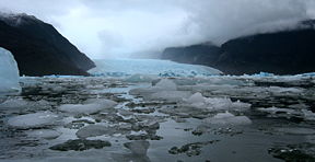
| Laguna San Rafael Laguna San Rafael National Park Laguna San Rafael National Park is a park located on the Pacific coast of southern Chile. The park is named for the San Rafael Lagoon formed by the retreat of the San Rafael Glacier. Created in 1959, it covers an area of and includes the Northern Patagonian Ice Field... |
 |
Zona Austral Zona Austral The Zona Austral is one of the five natural regions into which CORFO divided continental Chile in 1950 corresponding to the Chilean portion of Patagonia. It is surrounded by the Southern Zone and the Chacao Channel to the north, the Pacific Ocean and Drake's Passage to the south and west, and the... |
1959 | |
| Las Palmas de Cocalán Las Palmas de Cocalán National Park Las Palmas de Cocalán National Park is located in the Cordillera de la Costa, Cachapoal Province, in the O'Higgins Region of Chile.... |
Zona Central Zona Central, Chile Zona central is one of the five natural regions into which CORFO divided continental Chile in 1950. It is home to a majority of the Chilean population and includes the three largest metropolitan areas- Santiago, Valparaíso, and Concepción... |
1971 | ||
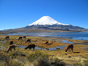
| Lauca Lauca National Park Lauca National Park is located in Chile's far north, in the Andean range. It encompasses an area of 1,379 km² of altiplano and mountains, the latter consisting mainly of enormous volcanoes. Las Vicuñas National Reserve is its neighbour to the south. Both protected areas, along with Salar de Surire... |
 |
Norte Grande Norte Grande Norte Grande is a civil parish in the municipality of Velas on the island of São Jorge in the Azores; owing to the existence of an ecumenical faith community throughout its history, the parish has also taken on the name of its religious invokation... |
1970 | |
| Llanos de Challe Llanos de Challe National Park Llanos de Challe National Park is located on the Pacific coast of the Atacama Region, Chile. Park's mountains are moistened by the Camanchaca. Its highest elevation is Cerro Negro at 950 m.... |
Norte Chico Norte Chico, Chile The Norte Chico is one of the five natural regions on which CORFO divided continental Chile in 1950. Its northern border is formed by the limit with the Far North, on west lies the Pacific Ocean, by the east the Andes mountains and Argentina, and by the south the Zona Central natural region... |
1994 | ||
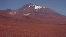
| Llullaillaco Llullaillaco National Park Llullaillaco National Park is a national park of Chile, located 275 km southeast of Antofagasta in the Andes. It lies between the eastern slopes of the Cordillera Domeyko and the international border with Argentina. In the park there are several important mountains that culminate at the summit... |
 |
Norte Grande Norte Grande Norte Grande is a civil parish in the municipality of Velas on the island of São Jorge in the Azores; owing to the existence of an ecumenical faith community throughout its history, the parish has also taken on the name of its religious invokation... |
1995 | |
| Nahuelbuta Nahuelbuta National Park Nahuelbuta National Park is one of the few parks located in Araucanía Region of Chile's Coastal Mountain Range. It sits atop the highest part of the Cordillera de Nahuelbuta. Created in 1939, it consists of 6,832 hectares situated just 162 km northeast of Temuco. Nahuelbuta is a sanctuary for... |
Zona Sur Zona Sur The Zona Sur is one of the five natural regions on which CORFO divided continental Chile in 1950. Its northern border is formed by the Bío-Bío River, the limit with the Central Chile Zone. By west with the Pacific Ocean, by the east with the Andean mountains and Argentina. Its southern border is... |
1939 | ||
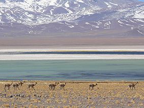
| Nevado Tres Cruces Nevado Tres Cruces National Park Located in the Atacama Region of Chile at 93.2 miles from Copiapó. Nevado Tres Cruces National Park includes Laguna Santa Rosa, Laguna del Negro Francisco, and a part of the Salar de Maricunga. The park is divided into two zones, the northern zone encompasing the southern portion of Salar de... |
 |
Norte Grande Norte Grande Norte Grande is a civil parish in the municipality of Velas on the island of São Jorge in the Azores; owing to the existence of an ecumenical faith community throughout its history, the parish has also taken on the name of its religious invokation... |
1959 | |
| Pali Aike Pali-Aike National Park The Pali-Aike National Park is a park located in the Magallanes Region of the Chilean Patagonia. Pali-Aike is a Tehuelche name that means Desolate Place. Created in 1970, it covers an area of and includes part of the Pali-Aike Volcanic Field. The park draws its name from a prominent volcanic cone... |
Zona Austral Zona Austral The Zona Austral is one of the five natural regions into which CORFO divided continental Chile in 1950 corresponding to the Chilean portion of Patagonia. It is surrounded by the Southern Zone and the Chacao Channel to the north, the Pacific Ocean and Drake's Passage to the south and west, and the... |
1970 | ||
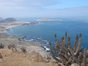
| Pan de Azúcar Pan de Azúcar National Park Pan de Azúcar National Park is a national park of Chile. The park straddles the border between the Antofagasta Region and the Atacama Region. Its name, Parque Nacional Pan de Azúcar, means "sugar loaf".-Geography:... |
 |
Norte Grande Norte Grande Norte Grande is a civil parish in the municipality of Velas on the island of São Jorge in the Azores; owing to the existence of an ecumenical faith community throughout its history, the parish has also taken on the name of its religious invokation... |
1985 | |
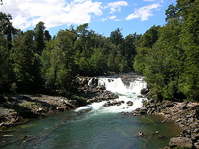
| Puyehue Puyehue National Park Puyehue National Park is located in the Andes, in Los Ríos and Los Lagos Region of Chile. It covers . The Route 215 passes through the park. It connects with the Argentine Route 231 via Cardenal Antonio Samoré Pass.... |
 |
Zona Sur Zona Sur The Zona Sur is one of the five natural regions on which CORFO divided continental Chile in 1950. Its northern border is formed by the Bío-Bío River, the limit with the Central Chile Zone. By west with the Pacific Ocean, by the east with the Andean mountains and Argentina. Its southern border is... |
1941 | |
| Queulat Queulat National Park Queulat National Park is a national park of Chile located in the Aisén Region. The park is bordered by the Cisnes River on the south side and is neighbor to Lago Rosselot National Reserve... |
Zona Austral Zona Austral The Zona Austral is one of the five natural regions into which CORFO divided continental Chile in 1950 corresponding to the Chilean portion of Patagonia. It is surrounded by the Southern Zone and the Chacao Channel to the north, the Pacific Ocean and Drake's Passage to the south and west, and the... |
1983 | ||
| Radal Siete Tazas | Zona Central Zona Central, Chile Zona central is one of the five natural regions into which CORFO divided continental Chile in 1950. It is home to a majority of the Chilean population and includes the three largest metropolitan areas- Santiago, Valparaíso, and Concepción... |
2008 | ||
| Rapa Nui Rapa Nui National Park Rapa Nui National Park is a World Heritage Site located on Easter Island, Chile. The park is divided into seven sections:*Rano Kau *Puna Pau .... |
None | 1935 | ||
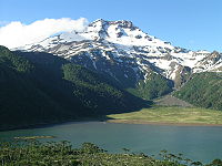
| Tolhuaca Tolhuaca National Park Tolhuaca National Park encompasses part of the forested lower western spurs and foothills of the Andes of the Araucanía Region of southern Chile. Adjoining the park to the north is Malleco National Reserve. The park has an elevation of 700 m asl at its western end and 1,821 m asl at its eastern... |
 |
Zona Sur Zona Sur The Zona Sur is one of the five natural regions on which CORFO divided continental Chile in 1950. Its northern border is formed by the Bío-Bío River, the limit with the Central Chile Zone. By west with the Pacific Ocean, by the east with the Andean mountains and Argentina. Its southern border is... |
1935 | |
| Torres del Paine Torres del Paine National Park Torres del Paine National Park is a national park encompassing mountains, a glacier, a lake, and river-rich areas in southern Chilean Patagonia. The Cordillera del Paine is the centerpiece of the park. It lies in a transition area between the Magellanic subpolar forests and the Patagonian Steppes... |
 |
Zona Austral Zona Austral The Zona Austral is one of the five natural regions into which CORFO divided continental Chile in 1950 corresponding to the Chilean portion of Patagonia. It is surrounded by the Southern Zone and the Chacao Channel to the north, the Pacific Ocean and Drake's Passage to the south and west, and the... |
1959 | |
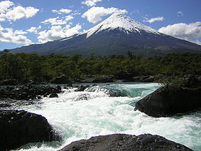
| Vicente Pérez Rosales Vicente Pérez Rosales National Park Vicente Pérez Rosales National Park is located in Los Lagos Region, Llanquihue Province, of Chile. Its western entrance is close to the Ensenada locality, northeast of the provincial capital of Puerto Montt, and from Puerto Varas along Ruta CH-225. This national park covers about and is almost... |
 |
Zona Sur Zona Sur The Zona Sur is one of the five natural regions on which CORFO divided continental Chile in 1950. Its northern border is formed by the Bío-Bío River, the limit with the Central Chile Zone. By west with the Pacific Ocean, by the east with the Andean mountains and Argentina. Its southern border is... |
1926 | |
| Villarrica Villarrica National Park Villarrica National Park is located in the Andes, in the Araucanía and Los Ríos regions of Chile, near Pucón. The centerpiece of the park is a line of three volcanoes stretching transversely to the Andean range: Villarrica, Quetrupillán, and Lanín.... |
Zona Sur Zona Sur The Zona Sur is one of the five natural regions on which CORFO divided continental Chile in 1950. Its northern border is formed by the Bío-Bío River, the limit with the Central Chile Zone. By west with the Pacific Ocean, by the east with the Andean mountains and Argentina. Its southern border is... |
1940 | ||
| Volcán Isluga Volcán Isluga National Park Volcán Isluga National Park is located in the Andes, in the Tarapacá Region of Chile, near Colchane and south of Lauca Biosphere Reserve. It covers 1,747 square kilometers, with elevations ranging between 2,100 and 5,550 meters. It is named after Volcán Isluga, which at 5,550 m, is the tallest... |
Norte Grande Norte Grande Norte Grande is a civil parish in the municipality of Velas on the island of São Jorge in the Azores; owing to the existence of an ecumenical faith community throughout its history, the parish has also taken on the name of its religious invokation... |
1967 |
See also
- Protected areas of ChileProtected areas of ChileThe protected areas of Chile are areas that have natural beauty or significant historical value protected by the government of Chile. These protected areas cover over , which is 19% of the territory of Chile...
; proctected natural areas - National Monuments of ChileNational Monuments of ChileThe National Monuments of Chile , also abbreviated MN, are the constructions, elements and places that form part of the country's cultural heritage, and they are protected by law...
; structures and sites of cultural heritage

