List of protected areas within California
Encyclopedia
According to the California Protected Areas Database (CPAD), in the state of California
California
California is a state located on the West Coast of the United States. It is by far the most populous U.S. state, and the third-largest by land area...

, USA, there are over 14,000 inventoried protected area
Protected area
Protected areas are locations which receive protection because of their recognised natural, ecological and/or cultural values. There are several kinds of protected areas, which vary by level of protection depending on the enabling laws of each country or the regulations of the international...

s administered by public agencies and non-profits. In addition, there are private conservation areas and other easement
Easement
An easement is a certain right to use the real property of another without possessing it.Easements are helpful for providing pathways across two or more pieces of property or allowing an individual to fish in a privately owned pond...

s. They include almost one-third of California
California
California is a state located on the West Coast of the United States. It is by far the most populous U.S. state, and the third-largest by land area...

's scenic coastline, including coastal wetlands, estuaries, beach
Beach
A beach is a geological landform along the shoreline of an ocean, sea, lake or river. It usually consists of loose particles which are often composed of rock, such as sand, gravel, shingle, pebbles or cobblestones...

es, and dune
Dune
In physical geography, a dune is a hill of sand built by wind. Dunes occur in different forms and sizes, formed by interaction with the wind. Most kinds of dunes are longer on the windward side where the sand is pushed up the dune and have a shorter "slip face" in the lee of the wind...

 systems. The California State Parks
State park
State parks are parks or other protected areas managed at the federated state level within those nations which use "state" as a political subdivision. State parks are typically established by a state to preserve a location on account of its natural beauty, historic interest, or recreational...

 system alone has 270 units and covers 1.3 million acres (5,300 km²), with over 280 miles (450 km) of coastline, 625 miles (1,006 km) of lake and river frontage, nearly 18,000 campsites, and 3,000 miles (5,000 km) of hiking, biking, and equestrian trails.

Obtaining an accurate total of all protected land in California and elsewhere is a complex task. Many parcels have inholding
Inholding
An inholding is privately owned land inside the boundary of a national park, national forest, state park, or similar publicly owned, protected area...

s, private lands within the protected areas, which may or may not be accounted for when calculating total area. Also, occasionally one parcel of land is included in two or more inventories. Over 90% of Yosemite National Park for example, is listed both as wilderness by the National Wilderness Preservation System
National Wilderness Preservation System
The National Wilderness Preservation System of the United States protects federally managed land areas designated for preservation in their natural condition. It was established by the Wilderness Act upon the signature of President Lyndon B. Johnson on September 3, 1964...

, and as national park land by the National Park Service
National Park Service
The National Park Service is the U.S. federal agency that manages all national parks, many national monuments, and other conservation and historical properties with various title designations...

. The Cosumnes River Preserve
Cosumnes River Preserve
The Cosumnes River Preserve is a nature preserve of located 20 miles south of Sacramento, in the US state of California. The preserve protects a Central Valley remnant that once contained one of the largest expanses of oak tree savanna, riparian oak forest and wetland habitat in North America...

 is an extreme example, owned and managed by a handful of public agencies and private landowners, including the Bureau of Land Management
Bureau of Land Management
The Bureau of Land Management is an agency within the United States Department of the Interior which administers America's public lands, totaling approximately , or one-eighth of the landmass of the country. The BLM also manages of subsurface mineral estate underlying federal, state and private...

, the County of Sacramento and The Nature Conservancy
The Nature Conservancy
The Nature Conservancy is a US charitable environmental organization that works to preserve the plants, animals, and natural communities that represent the diversity of life on Earth by protecting the lands and waters they need to survive....

. Despite the difficulties, the CPAD gives the total area of protected land at 49000000 acres (198,296.1 km²), or 46.7% of the state (not including easements), a remarkable number for the most populous state in the country.

National Park System

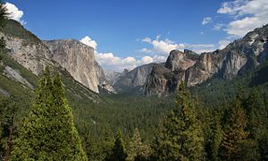
The U.S. National Park System controls a large and diverse group of California parks, monuments, recreation areas and other units which in total exceed 6240000 acres (25,252.4 km²). The best known is Yosemite National Park
Yosemite National Park
Yosemite National Park is a United States National Park spanning eastern portions of Tuolumne, Mariposa and Madera counties in east central California, United States. The park covers an area of and reaches across the western slopes of the Sierra Nevada mountain chain...

, noted for several iconic natural features including Yosemite Falls
Yosemite Falls
Yosemite Falls is the highest measured waterfall in North America. Located in Yosemite National Park in the Sierra Nevada of California, it is a major attraction in the park, especially in late spring when the water flow is at its peak....

, El Capitan
El Capitan
El Capitan is a vertical rock formation in Yosemite National Park, located on the north side of Yosemite Valley, near its western end. The granite monolith extends about from base to summit along its tallest face, and is one of the world's favorite challenges for rock climbers.The formation was...

 and Half Dome
Half Dome
Half Dome is a granite dome in Yosemite National Park, located in northeastern Mariposa County, California, at the eastern end of Yosemite Valley — possibly Yosemite's most familiar rock formation. The granite crest rises more than above the valley floor....

, which is even displayed on the reverse side of the California state quarter. Other prominent parks are the Kings Canyon
Kings Canyon National Park
Kings Canyon National Park is a National Park in the southern Sierra Nevada, east of Fresno, California. The park was established in 1940 and covers...

-Sequoia National Park
Sequoia National Park
Sequoia National Park is a national park in the southern Sierra Nevada east of Visalia, California, in the United States. It was established on September 25, 1890. The park spans . Encompassing a vertical relief of nearly , the park contains among its natural resources the highest point in the...

 complex, Redwood National Park, Channel Islands National Park
Channel Islands National Park
- External links :* Official site: * *...

, Joshua Tree National Park
Joshua Tree National Park
Joshua Tree National Park is located in southeastern California. Declared a U.S. National Park in 1994 when the U.S. Congress passed the California Desert Protection Act , it had previously been a U.S. National Monument since 1936. It is named for the Joshua tree forests native to the park...

 and the largest, Death Valley National Park
Death Valley National Park
Death Valley National Park is a national park in the U.S. states of California and Nevada located east of the Sierra Nevada in the arid Great Basin of the United States. The park protects the northwest corner of the Mojave Desert and contains a diverse desert environment of salt-flats, sand dunes,...

. The NPS also administers the Manzanar
Manzanar
Manzanar is most widely known as the site of one of ten camps where over 110,000 Japanese Americans were imprisoned during World War II. Located at the foot of the Sierra Nevada in California's Owens Valley between the towns of Lone Pine to the south and Independence to the north, it is...

 National Historic Site in Inyo County.

National parks

  • Channel Islands National Park
    Channel Islands National Park
    - External links :* Official site: * *...

  • Death Valley National Park
    Death Valley National Park
    Death Valley National Park is a national park in the U.S. states of California and Nevada located east of the Sierra Nevada in the arid Great Basin of the United States. The park protects the northwest corner of the Mojave Desert and contains a diverse desert environment of salt-flats, sand dunes,...

  • Joshua Tree National Park
    Joshua Tree National Park
    Joshua Tree National Park is located in southeastern California. Declared a U.S. National Park in 1994 when the U.S. Congress passed the California Desert Protection Act , it had previously been a U.S. National Monument since 1936. It is named for the Joshua tree forests native to the park...

  • Kings Canyon National Park
    Kings Canyon National Park
    Kings Canyon National Park is a National Park in the southern Sierra Nevada, east of Fresno, California. The park was established in 1940 and covers...

  • Lassen Volcanic National Park
    Lassen Volcanic National Park
    Lassen Volcanic National Park is a United States National Park in northeastern California. The dominant feature of the park is Lassen Peak; the largest plug dome volcano in the world and the southern-most volcano in the Cascade Range...

  • Redwood National Park
  • Sequoia National Park
    Sequoia National Park
    Sequoia National Park is a national park in the southern Sierra Nevada east of Visalia, California, in the United States. It was established on September 25, 1890. The park spans . Encompassing a vertical relief of nearly , the park contains among its natural resources the highest point in the...

  • Yosemite National Park
    Yosemite National Park
    Yosemite National Park is a United States National Park spanning eastern portions of Tuolumne, Mariposa and Madera counties in east central California, United States. The park covers an area of and reaches across the western slopes of the Sierra Nevada mountain chain...


National monuments

(administered by the NPS)
  • Cabrillo National Monument
    Cabrillo National Monument
    Cabrillo National Monument is located at the southern tip of the Point Loma Peninsula in San Diego, California. It commemorates the landing of Juan Rodríguez Cabrillo at San Diego Bay on September 28, 1542. This event marked the first time that a European expedition had set foot on what later...

  • Devils Postpile National Monument
    Devils Postpile National Monument
    Devils Postpile National Monument is located near Mammoth Mountain in extreme northeastern Madera County in eastern California. It was established in 1911, and protects Devils Postpile, an unusual formation of columnar basalt.-Geography:...

  • Lava Beds National Monument
    Lava Beds National Monument
    Lava Beds National Monument is located in northeastern California, in Siskiyou and Modoc Counties. The Monument lies on the northeastern flank of the Medicine Lake Volcano, with the largest total area covered by a volcano in the Cascade Range....

  • Muir Woods National Monument
    Muir Woods National Monument
    Muir Woods National Monument is a unit of the National Park Service on the Pacific coast of southwestern Marin County, California, north of San Francisco and part of the Golden Gate National Recreation Area...

  • Pinnacles National Monument
    Pinnacles National Monument
    Pinnacles National Monument is a protected mountainous area located east of central California's Salinas Valley, just miles from the town of Soledad...


National recreation areas

  • Santa Monica Mountains National Recreation Area
    Santa Monica Mountains National Recreation Area
    The Santa Monica Mountains National Recreation Area or SMMNRA, is a United States National Recreation Area containing many individual parks and open space preserves, located primarily in the Santa Monica Mountains of Southern California...

  • Whiskeytown National Recreation Area
  • Golden Gate National Recreation Area
    Golden Gate National Recreation Area
    The Golden Gate National Recreation Area is a U.S. National Recreation Area administered by the National Park Service that surrounds the San Francisco Bay area. It is one of the most visited units of the National Park system in the United States, with over 13 million visitors a year...


National seashores

  • Point Reyes National Seashore
    Point Reyes National Seashore
    Point Reyes National Seashore is a park preserve located on the Point Reyes Peninsula in Marin County, California, USA. As a national seashore, it is maintained by the US National Park Service as a nationally important nature preserve within which existing agricultural uses are allowed to continue...


National preserves

  • Mojave National Preserve
    Mojave National Preserve
    Mojave National Preserve is located in the Mojave Desert of San Bernardino County, California, USA, between Interstate 15 and Interstate 40. The preserve was established October 31, 1994 with the passage of the California Desert Protection Act by the US Congress...


National Landscape Conservation System

The Bureau of Land Management
Bureau of Land Management
The Bureau of Land Management is an agency within the United States Department of the Interior which administers America's public lands, totaling approximately , or one-eighth of the landmass of the country. The BLM also manages of subsurface mineral estate underlying federal, state and private...

’s National Landscape Conservation System (NLCS) includes over 850 federally recognized areas and in California, manages 15200000 acres (61,512.3 km²) of public land
Public land
In all modern states, some land is held by central or local governments. This is called public land. The system of tenure of public land, and the terminology used, varies between countries...

s, nearly 15% of the state's land area.
The National Landscape Conservation System is composed of several types of units: national monuments (distinct from the same-named units within the National Park System), national conservation areas, forest reserves, outstanding natural areas, national scenic and historic trails, wilderness, wilderness study areas, and others.

National monuments

(administered by the BLM)
  • California Coastal
    California Coastal National Monument
    The California Coastal National Monument is located along the entire coastline of the U.S. state of California. Created by Presidential proclamation on January 11, 2000, the monument, which covers about of land, is managed by the U.S. Bureau of Land Management, an agency of the U.S. Department...

  • Carrizo Plain
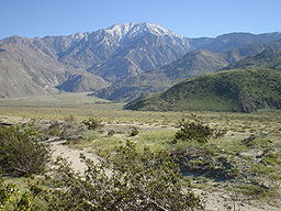
  • Santa Rosa and San Jacinto Mountains
    Santa Rosa and San Jacinto Mountains National Monument
    The Santa Rosa and San Jacinto Mountains National Monument is a National Monument in Southern California. It includes portions of the Santa Rosa and San Jacinto Mountain ranges, the northernmost ones of the Peninsular Ranges system...


National conservation areas

  • California Desert
  • King Range

Forest reserves

  • Headwaters Forest
    Headwaters Forest
    The Headwaters Forest Reserve is a series of old growth Coast Redwood groves measuring about . Located in the Northern California coastal forests ecoregion near Humboldt Bay of the U.S. state of California, most of it was owned by the now defunct Pacific Lumber Company, which was owned by Charles...


Outstanding natural areas

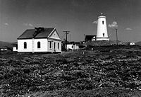
  • Piedras Blancas Historic Light Station
    Piedras Blancas Light
    Piedras Blancas Light Station is a lighthouse on Point Piedras Blancas, about five and half miles west by NW of San Simeon, California.-History:...


National scenic and historic trails

  • California National Historic Trail
  • Juan Bautista de Anza National Historic Trail
    Juan Bautista de Anza National Historic Trail
    thumb|325px|MAP: [[Juan Bautista de Anza]] National Historic Trail routes in [[Arizona]] and [[California]].The Juan Bautista de Anza National Historic Trail is a National Park Service unit in the United States National Historic Trail and National Millennium Trail programs...

  • Old Spanish National Historic Trail
  • Pacific Crest National Scenic Trail

Wilderness and wilderness study areas

Total BLM-managed wilderness land in California is 3725230 acres (15,075.5 km²).

National Marine Sanctuaries

The National Marine Sanctuary System is managed by the Office of Marine Sanctuaries, of the National Oceanic and Atmospheric Administration
National Oceanic and Atmospheric Administration
The National Oceanic and Atmospheric Administration , pronounced , like "noah", is a scientific agency within the United States Department of Commerce focused on the conditions of the oceans and the atmosphere...

.

California has four of the thirteen U.S. National Marine Sanctuaries:
  • Channel Islands National Marine Sanctuary
    Channel Islands National Marine Sanctuary
    The Channel Islands National Marine Sanctuary is a reserve area off the Pacific coast of the United States, near California.Established in 1980, the sanctuary in the Santa Barbara Channel is an area of national significance because of its exceptional natural beauty and resources. It has an area of...

  • Cordell Bank National Marine Sanctuary
    Cordell Bank National Marine Sanctuary
    Cordell Bank National Marine Sanctuary is a marine sanctuary located of the coast of California, at . It protects an area of of marine wildlife. The administrative center of the sanctuary is on an offshore granite outcrop by , located on the continental shelf off of California...

  • Gulf of the Farallones National Marine Sanctuary
    Gulf of the Farallones National Marine Sanctuary
    The Gulf of the Farallones National Marine Sanctuary is one of 13 marine sanctuaries in the U.S., found outside San Francisco's Golden Gate surrounding the Gulf of the Farallones-History:...

  • Monterey Bay National Marine Sanctuary
    Monterey Bay National Marine Sanctuary
    The Monterey Bay National Marine Sanctuary is a US Federally protected marine area offshore of California's central coast around Monterey Bay....

    - one of the largest in the world at 5300 square miles (13,726.9 km²).


National Wildlife Refuges

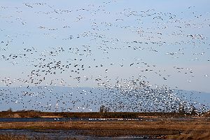
National Wildlife Refuge is a designation for certain protected areas of the United States managed by the United States Fish and Wildlife Service. The National Wildlife Refuge System is an extensive system of public lands and waters set aside to conserve America's fish, wildlife and plants. Many of the state's refuges are important stops and destinations for millions of migrating birds along the Pacific Flyway
Pacific Flyway
The Pacific Flyway is a major north-south route of travel for migratory birds in America, extending from Alaska to Patagonia. Every year, migratory birds travel some or all of this distance both in spring and in fall, following food sources, heading to breeding grounds, or travelling to...

 corridor. One, the Butte Sink Wildlife Management Area
Butte Sink Wildlife Management Area
Butte Sink Wildlife Management Area has the highest concentration of waterfowl per acre in the world. Located in the Sacramento Valley of California, it includes the Butte Sink National Wildlife Refuge and conservation easements acquired on adjacent private lands...

, has the highest density of waterfowl in the world. There are 38 units in the refuge system in California, including both wildlife refuges and wildlife management areas, divided into 9 different regional areas. Combined the areas equal about 440000 acres (1,780.6 km²).

Hopper Mountain NWR Complex
  • Bitter Creek NWR
    Bitter Creek National Wildlife Refuge
    The Bitter Creek National Wildlife Refuge is located in the foothills of the southwestern San Joaquin Valley in Kern County, California. The refuge is one of four units of the Hopper Mountain National Wildlife Refuge Complex for California condors....

  • Blue Ridge NWR
    Blue Ridge National Wildlife Refuge
    Blue Ridge National Wildlife Refuge is located in the Sierra Nevada, in Tulare County, California. The refuge is one of four units of the Hopper Mountain National Wildlife Refuge Complex for California condors.-Geography:...

  • Hopper Mountain NWR
    Hopper Mountain National Wildlife Refuge
    Hopper Mountain National Wildlife Refuge is located in Ventura County, in southern California. It is bordered by the Los Padres National Forest and the Sespe Condor Sanctuary to the north. The refuge was established in 1974 to protect the endangered California condor, its habitat, and other...

  • Guadalupe-Nipomo Dunes NWR
    Guadalupe-Nipomo Dunes National Wildlife Refuge
    The Guadalupe-Nipomo Dunes Refuge is located along the southern coast of California, in San Luis Obispo and Santa Barbara Counties. Bordered by the Pacific Ocean to the west and farmland to the east, the refuge encompasses one of the largest coastal dune systems remaining in California.The refuge...


San Diego NWR Complex
  • San Diego NWR
    San Diego National Wildlife Refuge
    San Diego National Wildlife Refuge is a National Wildlife Refuge in California. It is part of the San Diego National Wildlife Refuge Complex.A variety of habitats from coastal sage scrub and chaparral to oak woodland and freshwater marsh describe this inland refuge in San Diego's backcountry.The...

  • San Diego Bay NWR
    San Diego Bay National Wildlife Refuge
    San Diego Bay National Wildlife Refuge is an urban refuge located on San Diego Bay in San Diego County, California. It is part of the San Diego National Wildlife Refuge Complex...

  • Seal Beach NWR
    Seal Beach National Wildlife Refuge
    The Seal Beach National Wildlife Refuge is a wildlife refuge encompassing located in the California coastal community of Seal Beach. Although it is located in Orange County it is included as part of the San Diego National Wildlife Refuge Complex...

  • Sweetwater Marsh NWR
  • Tijuana Slough NWR
    Tijuana Slough National Wildlife Refuge
    Tijuana Slough National Wildlife Refuge is located in the most southwestern corner of the contiguous United States. It is part of the San Diego National Wildlife Refuge Complex. It was established in 1980....


Humboldt Bay NWR Complex
  • Humboldt Bay NWR
    Humboldt Bay National Wildlife Refuge
    Humboldt Bay National Wildlife Refuge is located on Humboldt Bay, on the California North Coast near the cities of Eureka and Arcata. The refuge exists primarily to protect and enhance wetland habitats for migratory water birds using the bay area, including tens of thousands of shorebirds, ducks,...

  • Castle Rock NWR
    Castle Rock National Wildlife Refuge
    Castle Rock National Wildlife Refuge is half a mile offshore from Crescent City in northern California. This coastal rock covers approximately , and rises steeply above sea level. The refuge provides an important sanctuary for Aleutian Canada geese and nesting seabirds.It is, in fact, known as the...


San Francisco Bay NWR Complex
  • Antioch Dunes NWR
    Antioch Dunes National Wildlife Refuge
    Antioch Dunes National Wildlife Refuge is a sensitive sand dune habitat located near the city of Antioch, California on the south shore of the San Joaquin River. It serves as a refuge for three endangered species of plants and insects, and is closed to the public except for tours and events...

  • Don Edwards San Francisco Bay NWR
    Don Edwards San Francisco Bay National Wildlife Refuge
    Don Edwards San Francisco Bay National Wildlife Refuge is a US National Wildlife Refuge located in the southern part of San Francisco Bay, California. The Refuge headquarters and visitor center is located in the Baylands district of Fremont, next to Coyote Hills Regional Park, in Alameda County. ...

  • Ellicott Slough NWR
    Ellicott Slough National Wildlife Refuge
    Ellicott Slough National Wildlife Refuge is located in Santa Cruz County, California within the Monterey Bay area. The refuge, established in 1975 to protect the endangered Santa Cruz long-toed salamander, supports two of the eight known breeding populations of the salamander.The threatened...

  • Farallon NWR
  • Marin Islands NWR
  • Salinas River NWR
    Salinas River National Wildlife Refuge
    Salinas River National Wildlife Refuge is located approximately 11 miles north of Monterey, California and 3 miles south of Castroville, California at the point where the Salinas River empties into Monterey Bay. The 367 acre refuge encompasses several habitat types including sand dunes, pickleweed...

  • San Pablo Bay NWR
    San Pablo Bay National Wildlife Refuge
    San Pablo Bay National Wildlife Refuge is a National Wildlife Refuge in California established in 1970. It extends along the northern shore of San Pablo Bay from the mouth of the Petaluma River to Tolay Creek, Sonoma Creek and ends at Mare Island...


Kern NWR Complex
  • Kern NWR
    Kern National Wildlife Refuge
    Kern National Wildlife Refuge is located in the southern portion of California's San Joaquin Valley, 20 miles west of the city of Delano. Situated on the southern margin of what was once the largest freshwater wetland complex in the western United States, Kern National Wildlife Refuge provides...

  • Pixley NWR
    Pixley National Wildlife Refuge
    Pixley National Wildlife Refuge is located south of Tulare, California and north of Bakersfield in the San Joaquin Valley. The nature refuge represents one of the few remaining examples of the grasslands, vernal pools, and playas that once bordered historic Tulare Lake, the largest lake west of...


San Luis NWR Complex
  • Grasslands WMA
    Grasslands Wildlife Management Area
    Grasslands Wildlife Management Area lies within the San Joaquin River basin and supports the largest remaining block of wetlands in the Central Valley, containing of private wetlands and associated, and surrounding of state and federal lands...

  • Merced NWR
    Merced National Wildlife Refuge
    The Merced National Wildlife Refuge encompasses of wetlands, native grasslands, vernal pools, and riparian areas. It was established in 1951 under the Lea Act to attract wintering waterfowl from adjacent farmland where their foraging was causing crop damage...

  • San Joaquin River NWR
    San Joaquin River National Wildlife Refuge
    The San Joaquin River National Wildlife Refuge encompasses more than of riparian woodlands, wetlands, and grasslands that host a diversity of wildlife native to California's Central Valley...

  • San Luis NWR
    San Luis National Wildlife Refuge
    The San Luis National Wildlife Refuge in the San Joaquin Valley of central California is one of the great remnants of a historically bountiful wintering grounds for migratory waterfowl on the Pacific Flyway...


Klamath Basin NWR Complex
  • Clear Lake NWR
    Clear Lake National Wildlife Refuge
    Clear Lake National Wildlife Refuge in northeastern California consists of approximately of open water surrounded by over of upland bunchgrass, low sagebrush, and juniper habitat...

  • Lower Klamath NWR
    Lower Klamath National Wildlife Refuge
    The Lower Klamath National Wildlife Refuge is a wildlife preserve operated by the United States Fish and Wildlife Service located in the Klamath Basin along a portion of the northern California and southern Oregon border near Klamath Falls, Oregon...

  • Tule Lake NWR
    Tule Lake National Wildlife Refuge
    The Tule Lake National Wildlife Refuge is a wildlife preserve operated by the United States Fish and Wildlife Service located in the Klamath Basin in northern California near the Oregon border south of Klamath Falls, Oregon....


Sonny Bono Salton Sea NWR Complex
  • Sonny Bono Salton Sea NWR
    Sonny Bono Salton Sea National Wildlife Refuge
    The Sonny Bono Salton Sea National Wildlife Refuge is located north of the Mexican border at the southern end of the Salton Sea in California’s Imperial Valley. Situated along the Pacific Flyway, the Refuge is the only one of its kind, located below sea level...

  • Coachella Valley NWR
    Coachella Valley National Wildlife Refuge
    Coachella Valley National Wildlife Refuge is a protected area in the Coachella Valley, located east of Palm Springs near Palm Desert, California...


Sacramento NWR Complex
  • Butte Sink WMA
    Butte Sink Wildlife Management Area
    Butte Sink Wildlife Management Area has the highest concentration of waterfowl per acre in the world. Located in the Sacramento Valley of California, it includes the Butte Sink National Wildlife Refuge and conservation easements acquired on adjacent private lands...

  • Colusa NWR
    Colusa National Wildlife Refuge
    Colusa National Wildlife Refuge is one of six refuges in the Sacramento National Wildlife Refuge Complex located in the Sacramento Valley of north-central California. The refuge is about north of the metropolitan area of Sacramento....

  • Delevan NWR
    Delevan National Wildlife Refuge
    The Delevan National Wildlife Refuge is one of six refuges in the Sacramento National Wildlife Refuge Complex in the Sacramento Valley of north-central California. The refuge is approximately north of Sacramento and consists of over of intensively managed wetlands and of uplands.More than...

  • North Central Valley WMA
    North Central Valley Wildlife Management Area
    Located within 11 counties in the Sacramento Valley and the Sacramento-San Joaquin Delta of California, North Central Valley Wildlife Management Area consists of conservation easements acquired on privately-owned wetlands...

  • Sacramento NWR
  • Sacramento River NWR
    Sacramento River National Wildlife Refuge
    Sacramento River National Wildlife Refuge is located along the Sacramento River in the Sacramento Valley of California. Landscape is very flat, bordered by the Sierra and Coast ranges, with intensive agriculture...

  • Sutter NWR
    Sutter National Wildlife Refuge
    Sutter National Wildlife Refuge, the southern-most refuge in the Sacramento National Wildlife Refuge Complex, is located in the Sacramento Valley of California, about north of the metropolitan area of Sacramento...

  • Willow Creek-Lurline WMA
    Willow Creek-Lurline Wildlife Management Area
    Willow Creek-Lurline Wildlife Management Area is located in the Sacramento Valley of California. The landscape is very flat, bordered by the Sierra and Coast ranges and surrounded by intensive agriculture...


Other refuges
  • Modoc NWR
    Modoc National Wildlife Refuge
    Modoc National Wildlife Refuge is home to more than 250 species of birds and a variety of other wildlife. Located in a high-altitude desert valley on the western edge of the Great Basin in Modoc County, California, the refuge is part of a large complex of mid-altitude wetlands and lakes in...


Wild and Scenic rivers

Rivers designated as Wild and Scenic are administered by one of four federal land management agencies: The Bureau of Land Management, The National Park Service, The U.S. Fish and Wildlife Service or The U.S. Forest Service. There are 22 rivers in California with portions designated as Wild and Scenic, with 23 designations in all (the American River has two separate designations, one for the North Fork, and one for the Lower section).


  • Amargosa River
    Amargosa River
    The Amargosa River is an intermittent waterway, long, in southern Nevada and eastern California in the United States. It drains a high desert region, the Amargosa Valley in the Amargosa Desert northwest of Las Vegas, into the Mojave Desert, and finally into Death Valley where it disappears into...

  • American
    American River
    The American River is a California watercourse noted as the site of Sutter's Mill, northwest of Placerville, California, where gold was found in 1848, leading to the California Gold Rush...

  • Bautista Creek
  • Big Sur River
    Big Sur River
    The Big Sur River is a river on the Central Coast of California. The river drains a portion of the Big Sur area, a thinly settled region of the Central California coast where the Santa Lucia Mountains rise abruptly from the Pacific Ocean...

  • Black Butte River
    Black Butte River
    The Black Butte River is located in the Mendocino National Forest of northern California in Lake, Glenn and Mendocino counties. It is a tributary to the Middle Fork Eel River and flows northward for from its headwaters near Round Mountain to the confluence with the Middle Fork Eel River.The...

  • Cottonwood Creek
    Cottonwood Creek (Inyo County, California)
    Cottonwood Creek originates in the Ancient Bristlecone Pine Forests of the White Mountains of California. The creek flows eastward from the 14,000-foot crest of the White Mountains and steeply descends through groves of aspen, eventually flowing into a sagebrush desert. Numerous springs feed the...

  • Eel
    Eel River (California)
    The Eel River is a major river system of the northern Pacific coast of the U.S. state of California. Approximately 200 miles long, it drains a rugged area in the California Coast Ranges between the Sacramento Valley and the ocean. For most of its course, the river flows northwest, parallel to the...

  • Feather River
    Feather River
    The Feather River is the principal tributary of the Sacramento River, in the Sacramento Valley of Northern California. The river's main stem is about long. Its length to its most distant headwater tributary is about . Its drainage basin is about...


  • Fuller Mill Creek
  • Kern River
    Kern River
    The Kern River is a river in the U.S. state of California, approximately long. It drains an area of the southern Sierra Nevada mountains northeast of Bakersfield. Fed by snowmelt near Mount Whitney, the river passes through scenic canyons in the mountains and is a popular destination for...

  • Kings River
    Kings River (California)
    The Kings River is a major river of south-central California. About long, it drains an area of the high western Sierra Nevada and the Central Valley. A large alluvial fan has formed where the river's gradient decreases in the Central Valley so the river divides into distributaries...

  • Klamath
    Klamath River
    The Klamath River is an American river that flows southwest through Oregon and northern California, cutting through the Cascade Range to empty into the Pacific Ocean. The river drains an extensive watershed of almost that stretches from the high desert country of the Great Basin to the temperate...

  • Merced
    Merced River
    The Merced River , in the central part of the U.S. state of California, is a -long tributary of the San Joaquin River flowing from the Sierra Nevada into the Central Valley. It is most well known for its swift and steep course through the southern part of Yosemite National Park, and the...

  • Owens River Headwaters
  • Palm Canyon Creek

  • Piru Creek
    Piru Creek
    Piru Creek is a large stream in northern Los Angeles County and eastern Ventura County, California. It is a tributary of the Santa Clara River, the largest stream system in Southern California that is still relatively natural. It drains an area of about and is about long. The creek is the Santa...

  • San Jacinto River
    San Jacinto River (California)
    The San Jacinto River is a river in Riverside County, California. The river's headwaters are in San Bernardino National Forest, but the lower portion of the watershed is urban and agricultural land....

  • Sespe Creek
    Sespe Creek
    Sespe Creek is a stream, some long, in Ventura County, California, in the United States. The creek starts at Potrero Seco in the Sierra Madre Mountains, and is formed by more than thirty tributary streams before it empties into the Santa Clara River in Fillmore. Thirty-one miles of Sespe Creek are...

  • Sisquoc River
    Sisquoc River
    The Sisquoc River is a river in northeastern Santa Barbara County, California. It is a tributary of the Santa Maria River, which is formed when the Sisquoc River meets the Cuyama River. The river is long and originates on the north slopes of Big Pine Mountain, at approximately...

  • Smith River
    Smith River (California)
    The Smith River is a river on the Pacific coast of northern California in the United States, approximately long. It drains a rugged area of the Pacific Coast Ranges west of the Siskiyou Mountains just south of the Oregon border and north of the watershed of the Klamath River. The catchment area is...

  • Trinity
    Trinity River (California)
    The Trinity River is the longest tributary of the Klamath River, approximately long, in northwestern California in the United States. It drains an area of the Coast Ranges, including the southern Klamath Mountains, northwest of the Sacramento Valley...

  • Tuolumne
    Tuolumne River
    The Tuolumne River is a California river that flows nearly from the central Sierra Nevada to the San Joaquin River in the Central Valley...


National Wilderness Preservation System

There are 148 wilderness areas in California totaling just over 15000000 acres (60,702.9 km²). The largest is Death Valley Wilderness at 3055413 acres (12,364.8 km²), the largest federally designated wilderness in the continental United States, and the smallest is the Rocks and Islands Wilderness at 5 acres (20,234.3 m²). The wilderness areas are managed by the US Forest Service, Bureau of Land Management
Bureau of Land Management
The Bureau of Land Management is an agency within the United States Department of the Interior which administers America's public lands, totaling approximately , or one-eighth of the landmass of the country. The BLM also manages of subsurface mineral estate underlying federal, state and private...

, US Fish and Wildlife Service and the National Park Service
National Park Service
The National Park Service is the U.S. federal agency that manages all national parks, many national monuments, and other conservation and historical properties with various title designations...

. It should be noted that rarely, if ever, are designated wilderness areas stand alone protected areas, and thus their areas are, in all likelihood, already accounted for in the various agencies' inventories.

National Forests

California has 17 U.S. National Forests, one special management unit (Lake Tahoe
Lake Tahoe
Lake Tahoe is a large freshwater lake in the Sierra Nevada of the United States. At a surface elevation of , it is located along the border between California and Nevada, west of Carson City. Lake Tahoe is the largest alpine lake in North America. Its depth is , making it the USA's second-deepest...

) and parts of 3 other National Forests. Total combined area of the forests is 20061888 acres (81,187.7 km²) and covers over 19% of the state. The largest forest entirely within the state is Shasta-Trinity National Forest
Shasta-Trinity National Forest
The Shasta-Trinity National Forest is a federally designated forest in northern California, USA. It is the largest National Forest in California and is managed by the United States Forest Service. The 2.2-million acre forest encompasses five wilderness areas, hundreds of mountain lakes and of...

, at 2209832 acres (8,942.9 km²), the smallest is Cleveland National Forest
Cleveland National Forest
Cleveland National Forest encompasses 460,000 acres , mostly of chaparral, with a few riparian areas. A warm dry mediterranean climate prevails over the Forest. It is the southernmost National forest of California. It is administered by the United States Forest Service, a government agency within...

 at 460000 acres (1,861.6 km²). The Lake Tahoe Basin Management Unit
Lake Tahoe Basin Management Unit
The Lake Tahoe Basin Management Unit is a unique Sierra Nevada geologic basin of federally managed land, which is interspersed with a patchwork private and state managed public land...

 is not precisely a national forest in the conventional sense. Instead the Forest Service manages the land with particular attention paid to Lake Tahoe and its relationship with the forests surrounding it, with emphasis on erosion control management and watershed restoration, among other more conventional forest management activities. It is the smallest of the Forest Service units in California, with 191000 acres (773 km²) in its jurisdiction split between California and Nevada
Nevada
Nevada is a state in the western, mountain west, and southwestern regions of the United States. With an area of and a population of about 2.7 million, it is the 7th-largest and 35th-most populous state. Over two-thirds of Nevada's people live in the Las Vegas metropolitan area, which contains its...

.


  • Angeles National Forest
    Angeles National Forest
    The Angeles National Forest of the U.S. National Forest Service is located in the San Gabriel Mountains of Los Angeles County, southern California. It was established on July 1, 1908, incorporating the first San Bernardino National Forest and parts of the former Santa Barbara and San Gabriel...

  • Cleveland National Forest
    Cleveland National Forest
    Cleveland National Forest encompasses 460,000 acres , mostly of chaparral, with a few riparian areas. A warm dry mediterranean climate prevails over the Forest. It is the southernmost National forest of California. It is administered by the United States Forest Service, a government agency within...

  • Eldorado National Forest
    Eldorado National Forest
    Eldorado National Forest is a U.S. National Forest located in the central Sierra Nevada mountain range, in eastern Eldorado National Forest is a [[U.S. National Forest]] located in the central [[Sierra Nevada |Sierra Nevada]] [[mountain range]], in eastern Eldorado National Forest is a [[U.S...

  • Humboldt-Toiyabe National Forest
    Humboldt-Toiyabe National Forest
    The Humboldt-Toiyabe National Forest is the principal U.S. National Forest located in the U.S. state of Nevada. With an area of , it is the largest National Forest of the United States outside of Alaska...

  • Inyo National Forest
    Inyo National Forest
    Inyo National Forest is a federally administered forest in the United States. The forest covers parts of the eastern Sierra Nevada of California, and the White Mountains of California and Nevada. It contains two wilderness areas: the John Muir Wilderness and the Ansel Adams Wilderness...

  • Klamath National Forest
    Klamath National Forest
    Klamath National Forest is a national forest, in the Klamath Mountains, located in Siskiyou County in northern California, but with a tiny extension into southern Jackson County in Oregon. The forest contains continuous stands of ponderosa pine, Jeffrey pine, Douglas fir, red fir, white fir and...

  • Lassen National Forest
    Lassen National Forest
    Lassen National Forest is a national forest of 1,700 square miles in northeastern California. It is named after pioneer Peter Lassen, who mined, ranched and promoted the area to emigrant parties in the 1850s.- Overview :...

  • Lake Tahoe Basin Management Unit
    Lake Tahoe Basin Management Unit
    The Lake Tahoe Basin Management Unit is a unique Sierra Nevada geologic basin of federally managed land, which is interspersed with a patchwork private and state managed public land...

  • Los Padres National Forest
    Los Padres National Forest
    Los Padres National Forest is a forest located in southern and central California, which includes most of the mountainous land along the California coast from Ventura to Monterey, extending inland...

  • Mendocino National Forest
    Mendocino National Forest
    The Mendocino National Forest is located in the Coastal Mountain Range in northwestern California and comprises 913,306 acres...


  • Modoc National Forest
    Modoc National Forest
    Modoc National Forest is a national forest in northeastern California, covering parts of Modoc , Lassen , and Siskiyou counties. Most of the forest was covered by an immense lava flow millions of years ago. The eastern part of the forest east of Alturas contains a spur of the Cascade Range to...

  • Plumas National Forest
    Plumas National Forest
    Plumas National Forest is a 1,146,000-acre United States National Forest located in the Sierra Nevada, in northern California.-Geography:...

  • San Bernardino National Forest
    San Bernardino National Forest
    San Bernardino National Forest is a federally-managed forest covering more than 800,000 acres . There are two main divisions which are the San Bernardino Mountains on the easternmost of the Transverse Range, and the San Jacinto and Santa Rosa Mountains on the northernmost of the Peninsular...

  • Sequoia National Forest
    Sequoia National Forest
    Sequoia National Forest is located in the southern Sierra Nevada mountains of California. The U.S. National Forest is named for the majestic Giant Sequoia trees which populate 38 distinct groves within the boundaries of the forest....

  • Shasta-Trinity National Forest
    Shasta-Trinity National Forest
    The Shasta-Trinity National Forest is a federally designated forest in northern California, USA. It is the largest National Forest in California and is managed by the United States Forest Service. The 2.2-million acre forest encompasses five wilderness areas, hundreds of mountain lakes and of...

  • Sierra National Forest
    Sierra National Forest
    Sierra National Forest is a U.S. National Forest located on the western slope of central Sierra Nevada in the state of California. The forest is known for its mountain scenery and natural resources. Forest headquarters are located in Clovis, California...

  • Six Rivers National Forest
    Six Rivers National Forest
    Six Rivers National Forest is a U.S. National Forest located in the northwestern corner of California. It was established on July 1, 1947 by U.S. President Harry S. Truman from portions of Klamath, Siskiyou and Trinity National Forests. Its over one million acres of land contain a variety of...

  • Stanislaus National Forest
    Stanislaus National Forest
    Stanislaus National Forest contains in four counties in the Sierra Nevada Mountains of Northern California. It was established on February 22, 1897, making it one of the oldest national forests...

  • Tahoe National Forest
    Tahoe National Forest
    Tahoe National Forest is a U.S. National Forest located in the state of California, northwest of Lake Tahoe. It includes the peak of Sierra Buttes, near Sierra City, which has views of Mount Lassen and Mount Shasta. It is located in parts of six counties. In descending order of forestland area...


State parks

The California Department of Parks and Recreation
California Department of Parks and Recreation
The California Department of Parks and Recreation, also known as California State Parks, manages the California state parks system. The system administers 278 parks and 1.4 million acres , with over of coastline; of lake and river frontage; nearly 15,000 campsites; and of hiking, biking, and...

 maintains over 270 protected areas, which include almost one-third of California's scenic coastline, including coastal wetlands, estuaries, beaches, and dune systems. The state park
State park
State parks are parks or other protected areas managed at the federated state level within those nations which use "state" as a political subdivision. State parks are typically established by a state to preserve a location on account of its natural beauty, historic interest, or recreational...

s system covers 1.3 million acres (5,300 km²), with over 280 miles (450 km) of coastline, 625 miles (1,006 km) of lake and river frontage, nearly 18,000 campsites; and 3,000 miles (5,000 km) of hiking, biking, and equestrian trails. The largest is Anza-Borrego State Park
Anza-Borrego Desert State Park
Anza-Borrego Desert State Park is a state park located within the Colorado Desert of Southern California. The park takes its name from 18th century, Spanish explorer Juan Bautista de Anza and borrego, the Spanish word for bighorn sheep...

 at 600000 acres (2,428.1 km²), making it one of the largest state parks in the country. The smallest, Watts Towers
Watts Towers
The Watts Towers or Towers of Simon Rodia in the Watts district of Los Angeles, California, is a collection of 17 interconnected structures, two of which reach heights of over 99 feet . The Towers were built by Italian immigrant construction worker Sabato Rodia in his spare time over a period of...

, owned by the State Park system but managed by the Los Angeles Cultural Affairs Department
City of Los Angeles Cultural Affairs Department
The City of Los Angeles Cultural Affairs Department is the official Los Angeles, California, USA arts council.The agency approves the design of structures built on or over City property and accepts works of art to be acquired by the City...

, is a mere 0.1 acres (404.7 m²). On May 11, 2011, State park officials announced that seventy parks would be closed due to department budget cuts in response to California's continuing budget crises. One of them, Henry W. Coe State Park
Henry W. Coe State Park
Henry W. Coe State Park is a California state park located in Santa Clara and Stanislaus counties. It contains over 86,000 acres , making it the largest state park in northern California, and the second-largest in the state...

, is the 2nd largest park in the California State Park system, at 86000 acres (348 km²). Many of the parks are historical parks and relatively small in size, but the total acreage of closures is still well over 120000 acres (485.6 km²).

State wilderness areas

  • Boney Mountains State Wilderness
  • Mount San Jacinto State Wilderness
    Mount San Jacinto State Park
    Mount San Jacinto State Park is in the San Jacinto Mountains, of the Peninsular Ranges system, in Riverside County, California. The park is near the Greater Los Angeles and the San Diego metropolitan area.-Geography:...

  • Orestimba State Wilderness, officially called the Henry W. Coe State Wilderness
  • Santa Rosa Mountains State Wilderness
  • Sinkyone Wilderness State Park
    Sinkyone Wilderness State Park
    Sinkyone Wilderness State Park is a state park in Mendocino County, California. The wilderness area borders the Pacific Ocean to the west and the King Range National Conservation Area to the north. The nearest settlement is the unincorporated town of Leggett...


Additionally, 386000 acres (1,562.1 km²) of Anza-Borrego State Park have been designated as wilderness.

Department of Fish and Game Protected Areas

The California Department of Fish and Game
California Department of Fish and Game
The California Department of Fish and Game is a department within the government of California, falling under its parent California Natural Resources Agency. The Department of Fish and Game manages and protects the state's diverse fish, wildlife, plant resources, and native habitats...

 (DFG), through its seven regional divisions, manages more than 700 protected area
Protected area
Protected areas are locations which receive protection because of their recognised natural, ecological and/or cultural values. There are several kinds of protected areas, which vary by level of protection depending on the enabling laws of each country or the regulations of the international...

s statewide, totaling 1119360 acres (4,529.9 km²). They are broadly categorized as:
  • 110 wildlife areas, designed to give the public easier access to wildlife while preserving habitats.
  • 123 ecological reserves, which protect rare terrestrial species and habitats.
  • 11 marine reserves, which do the same for sea-dwelling species and habitats.


Municipal parks

Most cities and counties in California, as in elsewhere, own and operate open spaces of various types, the most recognizable being the city and county park
Urban park
An urban park, is also known as a municipal park or a public park, public open space or municipal gardens , is a park in cities and other incorporated places to offer recreation and green space to residents of, and visitors to, the municipality...

. By far the largest inventory of protected land held by a municipal agency belongs to the Los Angeles Department of Water and Power
Los Angeles Department of Water and Power
The Los Angeles Department of Water and Power is the largest municipal utility in the United States, serving over four million residents. It was founded in 1902 to supply water and electricity to residents and businesses in Los Angeles and surrounding communities...

, with just over 400000 acres (1,618.7 km²) in its jurisdiction. The largest city park in the state is Mission Trails Regional Park
Mission Trails Regional Park
Mission Trails Regional Park is a 5,800 acre open space preserve within the city of San Diego, California, established in 1974. It is the sixth largest municipally-owned park in the United States, and the largest in California.-Description:...

 in San Diego at 5800 acres (23.5 km²), although there are several county and regional parks that are larger. Total land owned by municipal agencies is roughly 1500000 acres (6,070.3 km²) acres.

Privately owned preserves
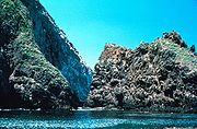
In addition to the many public lands are about 550000 acres (2,225.8 km²)of privately owned preserves. The Nature Conservancy
The Nature Conservancy
The Nature Conservancy is a US charitable environmental organization that works to preserve the plants, animals, and natural communities that represent the diversity of life on Earth by protecting the lands and waters they need to survive....

 is the largest owner of protected lands with 143895 acres (582.3 km²). It has been involved in over 100 projects in the state since 1958. Many are eventually sold to public agencies, but the Conservancy still owns and maintains several substantial preserves, including the Gray Davis/Dye Creek Preserve, Vina Plains Preserve, McCloud River Preserve, Cosumnes River Preserve
Cosumnes River Preserve
The Cosumnes River Preserve is a nature preserve of located 20 miles south of Sacramento, in the US state of California. The preserve protects a Central Valley remnant that once contained one of the largest expanses of oak tree savanna, riparian oak forest and wetland habitat in North America...

, Santa Cruz Island
Santa Cruz Island
Santa Cruz Island was the largest privately owned island off the continental United States, but is currently part-owned by the National Park service . The island, located off the coast of California, is long and from wide...

, Irvine Ranch Wildlands and the Santa Rosa Plateau Ecological Reserve. The largest private preserve is the Wind Wolves Preserve, owned by the Wildlands Conservancy, at 93000 acres (376.4 km²) acres. In total, there are many dozens of land trust and conservation organizations active in California, with thousands of acres preserved on public and private lands through their efforts. A few that operate entirely or substantially in the state are the Peninsula Open Space Trust, the Northern Sierra Partnership, the Sempervirens Fund
Sempervirens Club
Sempervirens Fund, originally established in 1900 as Sempervirens Club, is California's oldest land conservation organization. Founder Andrew P. Hill's goal was to preserve the old-growth forest that became Big Basin Redwoods State Park, the first California state park in 1902...

, the Sacramento Valley Conservancy and the Wilderness Land Trust
Wilderness Land Trust
The Wilderness Land Trust is a 501 non-profit organization based in Carbondale, Colorado, whose mission is to acquire private lands in current and proposed wilderness areas and transfer them to the federal government so that they will be kept forever wild as wilderness...

.

Largest land owners of protected lands

The 20 largest landholders, according to the CPAD:
Agency Total lands owned (in acres)*

U.S. Forest Service

U.S. Bureau of Land Management

U.S. National Park Service

California Department of Parks and Recreation

California Department of Fish and Game

California State Lands Commission

City of Los Angeles - Dept. of Water and Power

U.S. Fish and Wildlife Service

U.S. Bureau of Reclamation

The Nature Conservancy

The Wildlands Conservancy

Imperial Irrigation District

East Bay Regional Park District

California Department of Forestry and Fire Protection

California Department of Water Resources

City of San Diego

City and County of San Francisco - Public Utilities Commission

Midpeninsula Regional Open Space District

U.S. Army Corps of Engineers

Santa Clara County Parks and Recreation Dept.

20,692,727

15,098,026

7,552,237

1,268,317

627,145

618,218

402,289

314,482

225,717

143,895

128,108

103,368

83,049

72,471

68,929

67,624

55,606

50,838

47,402

44,626
*These numbers may not correspond exactly with those reported directly from the various agencies.
The source of this article is wikipedia, the free encyclopedia.  The text of this article is licensed under the GFDL.
 
x
OK