

MBTA Crosstown Buses
Encyclopedia
Massachusetts Bay Transportation Authority
The Massachusetts Bay Transportation Authority, often referred to as the MBTA or simply The T, is the public operator of most bus, subway, commuter rail and ferry systems in the greater Boston, Massachusetts, area. Officially a "body politic and corporate, and a political subdivision" of the...
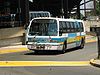
operates three crosstown bus routes in the Boston, Massachusetts area, CT1, CT2 and CT3, intended as limited-stop buses connecting major points. All crosstown buses have bicycle rack
Bicycle carrier
A bicycle carrier, also commonly called a bike rack, is a device attached to an automobile or bus for transporting bicycles.- By vehicle type :Bus mounted bike carriers are usually attached to the front of the bus...
s and offer transfers to the subway at a cost of an additional 45 cents if a CharlieCard is used. They only run weekdays and are based out of the Albany Street garage.
The CT buses are envisioned as a first phase in a gradual improvement in circumferential service connecting the "spokes" of the Metro Boston rapid transit system, planned to culminate in the Urban Ring
Urban Ring Project (MBTA)
The Urban Ring is a project of the Massachusetts Bay Transportation Authority and the Massachusetts Department of Transportation, to develop new public transportation line that would provide improved circumferential connections among many existing transit lines that project radially from downtown...
.
CT1
The CT1 (internally 701) runs between Central SquareCentral Square (Cambridge)
Central Square is an area in Cambridge, Massachusetts centered on the junction of Massachusetts Avenue, Prospect Street and Western Avenue. , formed by the junction of Massachusetts Avenue, Columbia Street, Sidney Street and Main Street, is also considered a part of the Central Square area...
, Cambridge and the B.U. Medical Center/Boston Medical Center
Boston Medical Center
Boston Medical Center is a non-profit 639 licensed-bed medical center in Boston, Massachusetts. It was created by the formal merger of Boston City Hospital which was the first municipal hospital in the United States and Boston University Medical Center Hospital in July 1996 which was sponsored...
, mostly along Massachusetts Avenue
Massachusetts Avenue (Boston)
Massachusetts Avenue, known to locals as Mass Ave, is a major thoroughfare in Boston, Massachusetts, and several cities and towns northwest of Boston...
. The majority of its route is a limited-stop version of the 1.
Station listing
| Station | Transfers and notes |
|---|---|
| Central Square | Red Line Red Line (MBTA) The Red Line is a rapid transit line operated by the MBTA running roughly north-south through Boston, Massachusetts into neighboring communities. The line begins west of Boston, in Cambridge, Massachusetts at Alewife station, near the intersection of Alewife Brook Parkway and Route 2... |
| Pearl Street | |
| University Park | |
| M.I.T. | CT2 |
| Beacon Street | |
| Hynes Convention Center | Green Line Green Line (MBTA) The Green Line is a streetcar system run by the Massachusetts Bay Transportation Authority in the Boston, Massachusetts area of the United States. It is the oldest line of Boston's subway, which is known locally as the 'T'. The Green Line runs underground downtown and on the surface in outlying... |
| Symphony Symphony (MBTA station) Symphony is an underground light rail stop in Boston, Massachusetts on the "E" branch of the MBTA Green Line. It is located at the intersection of Massachusetts Avenue and Huntington Avenue... /Westland Avenue |
Green Line Green Line (MBTA) The Green Line is a streetcar system run by the Massachusetts Bay Transportation Authority in the Boston, Massachusetts area of the United States. It is the oldest line of Boston's subway, which is known locally as the 'T'. The Green Line runs underground downtown and on the surface in outlying... |
| Massachusetts Avenue Station | Orange Line Orange Line (MBTA) The Orange Line is one of the four subway lines of the Massachusetts Bay Transportation Authority. It extends from Forest Hills in Jamaica Plain, Boston in the south to Oak Grove in Malden, Massachusetts in the north. It meets the Red Line at Downtown Crossing, the Blue Line at State, and the Green... |
| Washington Street Massachusetts Avenue (MBTA Silver Line station) Massachusetts Avenue is a street level station on the MBTA Silver Line Washington Street line, located on Washington St at Massachusetts Avenue. This station is approximately 1/2 mile from the Orange Line station of the same name.-External links:... |
Silver Line Silver Line (MBTA) The Silver Line is the only bus rapid transit line currently operated by the Massachusetts Bay Transportation Authority . It operates in two sections; the first runs from Dudley Square in Roxbury to downtown Boston, Massachusetts and South Station, mostly via Washington Street, with buses... |
| Harrison Avenue | CT3 |
| B.U. Medical Center | CT3 |
CT2
The CT2 (internally 747 south and 748 north of Kendall/MIT) connects Sullivan Square, Charlestown with Ruggles, Roxbury via Kendall Square, Cambridge. The south part roughly parallels the .Station listing
| Station | Transfers and notes |
|---|---|
| Sullivan Square Sullivan Square (MBTA station) Sullivan Square is a station on the MBTA rapid transit Orange Line, and a major bus transfer point. It was also a major transfer point on the old Charlestown Elevated, with two streetcar loops for free transfers, later converted for trackless trolleys and buses.The first Sullivan Square station... |
Orange Line Orange Line (MBTA) The Orange Line is one of the four subway lines of the Massachusetts Bay Transportation Authority. It extends from Forest Hills in Jamaica Plain, Boston in the south to Oak Grove in Malden, Massachusetts in the north. It meets the Red Line at Downtown Crossing, the Blue Line at State, and the Green... |
| Cobble Hill | |
| McGrath Highway | |
| Union Square Union Square (Somerville) Union Square is a neighborhood of Somerville, Massachusetts, located around the intersection of Washington Street and Somerville Avenue, about half a mile from Inman Square in neighboring Cambridge. The name "Union Square" comes from the square having been used as a recruitment and mustering site... |
|
| Cambridge Street | |
| Portland Street | |
| Kendall/MIT Kendall/MIT (MBTA station) Kendall/MIT is a station on the rapid transit Red Line in Kendall Square at the intersection of Broadway and Main Street, in Cambridge, Massachusetts. Trains emerge from the Red Line tunnel just east of the station to cross the Charles River via the Longfellow Bridge... |
Red Line Red Line (MBTA) The Red Line is a rapid transit line operated by the MBTA running roughly north-south through Boston, Massachusetts into neighboring communities. The line begins west of Boston, in Cambridge, Massachusetts at Alewife station, near the intersection of Alewife Brook Parkway and Route 2... |
| Massachusetts Avenue | CT1 |
| Memorial Drive Memorial Drive (Cambridge) Memorial Drive runs along the north bank of the Charles River in Cambridge, Massachusetts. It is designated as U.S. Route 3 or Massachusetts Route 3 for its entire length, and Massachusetts Route 2 over the portion west of the Boston University Bridge.... |
|
| Boston University Boston University West (MBTA station) Boston University West is a station on the MBTA Green Line "B" Branch located in Boston, Massachusetts. The station is located on Commonwealth Avenue near Amory Street... |
Green Line Green Line (MBTA) The Green Line is a streetcar system run by the Massachusetts Bay Transportation Authority in the Boston, Massachusetts area of the United States. It is the oldest line of Boston's subway, which is known locally as the 'T'. The Green Line runs underground downtown and on the surface in outlying... |
| Park and Beacon Streets St. Marys Street (MBTA station) St. Marys Street is a stop on the C branch of the Massachusetts Bay Transportation Authority's Green Line, located just west of the intersection of Beacon Street and Park Drive in Boston, Massachusetts.... |
Green Line Green Line (MBTA) The Green Line is a streetcar system run by the Massachusetts Bay Transportation Authority in the Boston, Massachusetts area of the United States. It is the oldest line of Boston's subway, which is known locally as the 'T'. The Green Line runs underground downtown and on the surface in outlying... |
| Fenway Fenway (MBTA station) Fenway is a stop on the D branch of the MBTA Green Line. It is located in the Fenway-Kenmore neighborhood of Boston Massachusetts, under Park Drive near The Riverway. Named after the Fenway parkway rather than Fenway Park, it is not the nearest station to the stadium - Yawkey commuter rail and... Station |
Green Line Green Line (MBTA) The Green Line is a streetcar system run by the Massachusetts Bay Transportation Authority in the Boston, Massachusetts area of the United States. It is the oldest line of Boston's subway, which is known locally as the 'T'. The Green Line runs underground downtown and on the surface in outlying... |
| Beth Israel Hospital Beth Israel Hospital Beth Israel Hospital may refer to:*Beth Israel Deaconess Medical Center in Boston*Beth Israel Medical Center in Manhattan*Beth Israel Medical Center in Newark... |
CT3 |
| Children's Hospital Children's Hospital Boston Children's Hospital Boston is a 396-licensed bed children's hospital in the Longwood Medical and Academic Area of Boston, Massachusetts.At 300 Longwood Avenue, Children's is adjacent both to its teaching affiliate, Harvard Medical School, and to Dana-Farber Cancer Institute... |
CT3 |
| Longwood Avenue Longwood Medical Area (MBTA station) Longwood Medical Area is a stop on the E branch of the MBTA's Green Line in the Mission Hill neighborhood of Boston, MA. It is the named for the adjacent Longwood Medical Area, which is the home of Harvard Medical School, Children's Hospital Boston, and Brigham and Women's Hospital... |
Green Line Green Line (MBTA) The Green Line is a streetcar system run by the Massachusetts Bay Transportation Authority in the Boston, Massachusetts area of the United States. It is the oldest line of Boston's subway, which is known locally as the 'T'. The Green Line runs underground downtown and on the surface in outlying... |
| Huntington Avenue Museum of Fine Arts (MBTA station) Museum of Fine Arts is a surface-level subway stop on the E branch of the MBTA Green Line. It is located in a dedicated median along Huntington Avenue in Boston, Massachusetts, between Museum Road and Ruggles Street.-Nearby Attractions:... |
Green Line Green Line (MBTA) The Green Line is a streetcar system run by the Massachusetts Bay Transportation Authority in the Boston, Massachusetts area of the United States. It is the oldest line of Boston's subway, which is known locally as the 'T'. The Green Line runs underground downtown and on the surface in outlying... , CT3 |
| Ruggles Ruggles (MBTA station) Ruggles Station is a MBTA subway station on the Orange Line; it is also a MBTA commuter rail station serving the Providence/Stoughton, Franklin, and Needham Lines. It is located at the intersection of Ruggles and Tremont Streets, where the Roxbury neighborhood begins and borders with the nearby... |
Orange Line Orange Line (MBTA) The Orange Line is one of the four subway lines of the Massachusetts Bay Transportation Authority. It extends from Forest Hills in Jamaica Plain, Boston in the south to Oak Grove in Malden, Massachusetts in the north. It meets the Red Line at Downtown Crossing, the Blue Line at State, and the Green... , MBTA Commuter Rail MBTA Commuter Rail The MBTA Commuter Rail serves as the regional rail arm of the Massachusetts Bay Transportation Authority, in the United States. It is operated under contract by the Massachusetts Bay Commuter Railroad Company a joint partnership of Veolia Transportation, Bombardier Transportation and Alternate... , CT3 |
CT3
The CT3 (internally 708) connects the Longwood Medical Area to Andrew Square, all in Boston. The route roughly parallels the . The CT3 used to continue east to Logan Airport, but that part (internally 709) was dropped due to low ridership in March 2002. A few early morning trips were kept as the , running from Dudley to Logan.Station listing
| Station | Transfers and notes |
|---|---|
| Louis Pasteur Avenue | part of a one-way loop |
| Children's Hospital Children's Hospital Boston Children's Hospital Boston is a 396-licensed bed children's hospital in the Longwood Medical and Academic Area of Boston, Massachusetts.At 300 Longwood Avenue, Children's is adjacent both to its teaching affiliate, Harvard Medical School, and to Dana-Farber Cancer Institute... |
CT2 part of a one-way loop |
| Beth Israel Hospital Beth Israel Hospital Beth Israel Hospital may refer to:*Beth Israel Deaconess Medical Center in Boston*Beth Israel Medical Center in Manhattan*Beth Israel Medical Center in Newark... |
CT2 part of a one-way loop |
| Ruggles Street/Huntington Avenue Museum of Fine Arts (MBTA station) Museum of Fine Arts is a surface-level subway stop on the E branch of the MBTA Green Line. It is located in a dedicated median along Huntington Avenue in Boston, Massachusetts, between Museum Road and Ruggles Street.-Nearby Attractions:... |
Green Line Green Line (MBTA) The Green Line is a streetcar system run by the Massachusetts Bay Transportation Authority in the Boston, Massachusetts area of the United States. It is the oldest line of Boston's subway, which is known locally as the 'T'. The Green Line runs underground downtown and on the surface in outlying... , CT2 |
| Ruggles Ruggles (MBTA station) Ruggles Station is a MBTA subway station on the Orange Line; it is also a MBTA commuter rail station serving the Providence/Stoughton, Franklin, and Needham Lines. It is located at the intersection of Ruggles and Tremont Streets, where the Roxbury neighborhood begins and borders with the nearby... |
Orange Line Orange Line (MBTA) The Orange Line is one of the four subway lines of the Massachusetts Bay Transportation Authority. It extends from Forest Hills in Jamaica Plain, Boston in the south to Oak Grove in Malden, Massachusetts in the north. It meets the Red Line at Downtown Crossing, the Blue Line at State, and the Green... , MBTA Commuter Rail MBTA Commuter Rail The MBTA Commuter Rail serves as the regional rail arm of the Massachusetts Bay Transportation Authority, in the United States. It is operated under contract by the Massachusetts Bay Commuter Railroad Company a joint partnership of Veolia Transportation, Bombardier Transportation and Alternate... , CT2 |
| Washington Street Melnea Cass Boulevard (MBTA station) Melnea Cass Boulevard is a street in Boston, Massachusetts, located between Dudley Square in Roxbury and the South End. It is named after local community and civil rights activist Melnea Cass. There is also an MBTA Silver Line station named Melnea Cass Boulevard on this street.... |
Silver Line Silver Line (MBTA) The Silver Line is the only bus rapid transit line currently operated by the Massachusetts Bay Transportation Authority . It operates in two sections; the first runs from Dudley Square in Roxbury to downtown Boston, Massachusetts and South Station, mostly via Washington Street, with buses... |
| Boston Medical Center Boston Medical Center Boston Medical Center is a non-profit 639 licensed-bed medical center in Boston, Massachusetts. It was created by the formal merger of Boston City Hospital which was the first municipal hospital in the United States and Boston University Medical Center Hospital in July 1996 which was sponsored... |
CT1 |
| B.U. Medical Center | CT1 |
| 1010 Massachusetts Avenue Massachusetts Avenue (Boston) Massachusetts Avenue, known to locals as Mass Ave, is a major thoroughfare in Boston, Massachusetts, and several cities and towns northwest of Boston... |
only some trips |
| Andrew Andrew (MBTA station) Andrew is a station on the rapid transit Red Line at Dorchester Avenue at Andrew Square, by Southampton Street, Dorchester Street, and Boston Street in South Boston, Massachusetts... Station |
Red Line Red Line (MBTA) The Red Line is a rapid transit line operated by the MBTA running roughly north-south through Boston, Massachusetts into neighboring communities. The line begins west of Boston, in Cambridge, Massachusetts at Alewife station, near the intersection of Alewife Brook Parkway and Route 2... |