

Maine State Route 9
Encyclopedia
State Route 9 is a numbered state highway in Maine
, running from the New Hampshire border at Berwick in the west to the Canadian border with New Brunswick
at Calais in the east. State Route 9 runs a total of 290 miles (466.7 km).
to Canada
. It frequently runs concurrent
with other highways listed below and also frequently changes direction. For instance, in Kennebunk
, State Route 9 travels in a westerly direction even though it is signed as eastbound. State Route 9 runs through most of Maine's major cities including Biddeford
, Saco
, South Portland
, Portland
, Augusta
, and Bangor
. Its leg from Bangor to Calais
is often referred to as "The Airline" commonly thought to be due to its shorter route than the older U.S. 1
. (Before the coming of air travel
, the term airline
often referred to such a shortcut.) Although anecdotes about unexploded ordnance deriving from bombers flying from the former Dow Air Force Base
(now Bangor International Airport
) using a number of towers and landmarks along "The Airline", in fact the term goes back to the early 1850s as a contrast to the shoreline route.
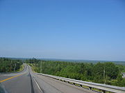
The last section of "The Airline" was paved in 1973 in Crawford and many old sections of the road are visible to the side of the present roadway. The "Whale's Back", a 2 mile stretch built atop an esker in Hancock County
is one of the most notable features of the highway.
Over the years, a number of improvements have been made by the Route 9 Committee, a partnership of local government officials and business interests in the Baileyville-Calais area.
Maine
Maine is a state in the New England region of the northeastern United States, bordered by the Atlantic Ocean to the east and south, New Hampshire to the west, and the Canadian provinces of Quebec to the northwest and New Brunswick to the northeast. Maine is both the northernmost and easternmost...
, running from the New Hampshire border at Berwick in the west to the Canadian border with New Brunswick
New Brunswick
New Brunswick is one of Canada's three Maritime provinces and is the only province in the federation that is constitutionally bilingual . The provincial capital is Fredericton and Saint John is the most populous city. Greater Moncton is the largest Census Metropolitan Area...
at Calais in the east. State Route 9 runs a total of 290 miles (466.7 km).
Route description
State Route 9 is a meandering highway that works its way from New HampshireNew Hampshire
New Hampshire is a state in the New England region of the northeastern United States of America. The state was named after the southern English county of Hampshire. It is bordered by Massachusetts to the south, Vermont to the west, Maine and the Atlantic Ocean to the east, and the Canadian...
to Canada
Canada
Canada is a North American country consisting of ten provinces and three territories. Located in the northern part of the continent, it extends from the Atlantic Ocean in the east to the Pacific Ocean in the west, and northward into the Arctic Ocean...
. It frequently runs concurrent
Concurrency (road)
A concurrency, overlap, or coincidence in a road network is an instance of one physical road bearing two or more different highway, motorway, or other route numbers...
with other highways listed below and also frequently changes direction. For instance, in Kennebunk
Kennebunk, Maine
Kennebunk is a town in York County, Maine, United States. The population was 1,075 people at the 2000 census. Including Kennebunkport , the population totals 14,196 people...
, State Route 9 travels in a westerly direction even though it is signed as eastbound. State Route 9 runs through most of Maine's major cities including Biddeford
Biddeford, Maine
Biddeford is a town in York County, Maine, United States. It is the largest town in the county, and is the sixth-largest in the state. It is the most southerly incorporated town in the state and the principal commercial center of York County. The population was 21,277 at the 2010 census...
, Saco
Saco, Maine
Saco is a city in York County, Maine, United States. The population was 18,482 at the 2010 census. It is home to Ferry Beach State Park, Funtown Splashtown USA, Thornton Academy, as well as General Dynamics Armament Systems , a subsidiary of the defense contractor General Dynamics...
, South Portland
South Portland, Maine
South Portland is a city in Cumberland County, Maine, United States, and is the fourth-largest city in the state. Founded in 1895, as of the 2010 census, the city population was 25,002. Known for its working waterfront, South Portland is situated on Portland Harbor and overlooks the skyline of...
, Portland
Portland, Maine
Portland is the largest city in Maine and is the county seat of Cumberland County. The 2010 city population was 66,194, growing 3 percent since the census of 2000...
, Augusta
Augusta, Maine
Augusta is the capital of the US state of Maine, county seat of Kennebec County, and center of population for Maine. The city's population was 19,136 at the 2010 census, making it the third-smallest state capital after Montpelier, Vermont and Pierre, South Dakota...
, and Bangor
Bangor, Maine
Bangor is a city in and the county seat of Penobscot County, Maine, United States, and the major commercial and cultural center for eastern and northern Maine...
. Its leg from Bangor to Calais
Calais, Maine
Calais is a city in Washington County, Maine, United States. The city has three United States border crossings or also known as a Port of entry with the busiest being on the St. Croix River bordering St. Stephen, New Brunswick, Canada...
is often referred to as "The Airline" commonly thought to be due to its shorter route than the older U.S. 1
U.S. Route 1 in Maine
In the U.S. state of Maine, U.S. Route 1 is a major north–south state highway serving the eastern part of the state. It parallels the Atlantic Ocean from New Hampshire north through Portland, Brunswick, and Belfast to Calais, and then the St. Croix River and the rest of the Canadian border...
. (Before the coming of air travel
Air travel
Air travel is a form of travel in vehicles such as airplanes, helicopters, hot air balloons, blimps, gliders, hang gliding, parachuting or anything else that can sustain flight.-Domestic and international flights:...
, the term airline
Airline (disambiguation)
Airline is the common term for a company that provides air transport services for passengers or freight.Airline may also refer to:* A single holding company, which as an independent business and its holding, made up and composed of a single government-certificated air carrier that is an IATA...
often referred to such a shortcut.) Although anecdotes about unexploded ordnance deriving from bombers flying from the former Dow Air Force Base
Dow Air Force Base
-History:Dow Air Force Base began as "Godfrey Field" in 1927, on land owned by local attorney Edward Rawson Godfrey . Commercial flights began at the field in 1931 under Northeast Airlines...
(now Bangor International Airport
Bangor International Airport
Bangor International Airport is a joint civil-military public airport located west of the city of Bangor, in Penobscot County, Maine, United States. It is owned and operated by the City of Bangor and was formerly a military installation known as Dow Air Force Base. The airport possesses a single...
) using a number of towers and landmarks along "The Airline", in fact the term goes back to the early 1850s as a contrast to the shoreline route.
The last section of "The Airline" was paved in 1973 in Crawford and many old sections of the road are visible to the side of the present roadway. The "Whale's Back", a 2 mile stretch built atop an esker in Hancock County
Hancock County, Maine
Hancock County is a county located in the U.S. state of Maine. As of 2010, the population was 54,418. Its county seat is Ellsworth. It was incorporated on June 25, 1789...
is one of the most notable features of the highway.
Over the years, a number of improvements have been made by the Route 9 Committee, a partnership of local government officials and business interests in the Baileyville-Calais area.
Concurrent routes
- State Route 109State Route 109 (Maine)State Route 109 is a north–south state highway in York County, Maine, United States. The northern terminus of State Route 109 is in Acton at the Wakefield, New Hampshire border, continuing from New Hampshire Route 109. The southern terminus is at the U.S. 1 junction in the oceanside resort...
, Wells (2 miles) - U.S. 1U.S. Route 1 in MaineIn the U.S. state of Maine, U.S. Route 1 is a major north–south state highway serving the eastern part of the state. It parallels the Atlantic Ocean from New Hampshire north through Portland, Brunswick, and Belfast to Calais, and then the St. Croix River and the rest of the Canadian border...
, Wells (2 miles) - State Route 208State Route 208 (Maine)State Route 208 is a numbered state highway in Maine. Serving as the main north–south connector between Biddeford Pool northwest to downtown Biddeford, State Route 208 is approximately seven miles long and two lanes wide...
, Biddeford (5 miles) - U.S. 1U.S. Route 1 in MaineIn the U.S. state of Maine, U.S. Route 1 is a major north–south state highway serving the eastern part of the state. It parallels the Atlantic Ocean from New Hampshire north through Portland, Brunswick, and Belfast to Calais, and then the St. Croix River and the rest of the Canadian border...
, Scarborough to South Portland (6 miles) - State Route 126, Sabattus to Randolph (21 miles)
- State Route 3, Augusta to China (12 miles)
- U.S. Route 202U.S. Route 202U.S. Route 202 is a highway stretching from Delaware to Maine, also passing through the states of Pennsylvania, New Jersey, New York, Connecticut, Massachusetts, and New Hampshire....
, Augusta to Hampden (60 miles) - U.S. Route 1A, Hampden to Bangor (5 miles)
- State Route 178, Brewer to Eddington (4 miles)
- U.S. 1U.S. Route 1 in MaineIn the U.S. state of Maine, U.S. Route 1 is a major north–south state highway serving the eastern part of the state. It parallels the Atlantic Ocean from New Hampshire north through Portland, Brunswick, and Belfast to Calais, and then the St. Croix River and the rest of the Canadian border...
, Baring to Calais (7 miles)
External links
- http://www.mainething.com/alexander/Transportation%20and%20Trade/THE%20AIRLINE%20ROAD.html