
Minnesota gubernatorial election, 1998
Encyclopedia
The 1998 Minnesota gubernatorial election took place on November 3, 1998. Reform Party
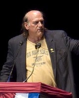
candidate Jesse Ventura
defeated Republican Party
challenger Norm Coleman
and Minnesota Democratic-Farmer-Labor Party
challenger Hubert H. "Skip" Humphrey III
. Ventura governed with a DFL-controlled state Senate and a Republican-controlled state House.
Ventura's victory as a third party candidate was considered a historic major upset. He ran on the Reform Party ticket, which was founded by Ross Perot
, who received 23% of the vote in 1992 in Minnesota.
campaign that featured a statewide bus tour, pioneered use of the Internet for political purposes, and aired quirky TV ads designed by Bill Hillsman
, who forged the phrase “Don’t vote for politics as usual.” Unable to afford many television ads, Ventura mainly focused on televised debates and public appearances, preaching his brand of libertarian
politics. His speech at a parade in rural Minnesota during the summer attracted what organizers of the annual event described as one of its largest audiences. He ran on cutting taxes, reducing state government, and reducing public school classroom sizes to a 17 to 1 ratio. He also supported a public debate on the viability of legalized prostitution.
Independence Party of Minnesota
The Independence Party of Minnesota , formerly the Reform Party of Minnesota, is the third largest political party in Minnesota, behind the Democratic-Farmer-Labor Party and Republican Party . It is the political party of former Minnesota Governor Jesse Ventura , and endorsed former U.S...
candidate Jesse Ventura
Jesse Ventura
James George Janos , better known as Jesse Ventura, is an American politician, the 38th Governor of Minnesota from 1999 to 2003, Navy UDT veteran, former SEAL reservist, actor, and former radio and television talk show host...
defeated Republican Party
Republican Party (United States)
The Republican Party is one of the two major contemporary political parties in the United States, along with the Democratic Party. Founded by anti-slavery expansion activists in 1854, it is often called the GOP . The party's platform generally reflects American conservatism in the U.S...
challenger Norm Coleman
Norm Coleman
Norman Bertram Coleman, Jr. is an American attorney and politician. He was a United States senator from Minnesota from 2003 to 2009. Coleman was elected in 2002 and served in the 108th, 109th, and 110th Congresses. Before becoming a senator, he was mayor of Saint Paul, Minnesota, from 1994 to 2002...
and Minnesota Democratic-Farmer-Labor Party
Minnesota Democratic-Farmer-Labor Party
The Minnesota Democratic–Farmer–Labor Party is a major political party in the state of Minnesota and the state affiliate of the Democratic Party. It was created on April 15, 1944, with the merger of the Minnesota Democratic Party and the Farmer–Labor Party...
challenger Hubert H. "Skip" Humphrey III
Skip Humphrey
Hubert Horatio "Skip" Humphrey III is a former Minnesota politician who served as attorney general of the state from 1983 to 1999. Prior to that, he was a state senator from 1973 to 1983...
. Ventura governed with a DFL-controlled state Senate and a Republican-controlled state House.
Ventura's victory as a third party candidate was considered a historic major upset. He ran on the Reform Party ticket, which was founded by Ross Perot
Ross Perot
Henry Ross Perot is a U.S. businessman best known for running for President of the United States in 1992 and 1996. Perot founded Electronic Data Systems in 1962, sold the company to General Motors in 1984, and founded Perot Systems in 1988...
, who received 23% of the vote in 1992 in Minnesota.
DFL
- Hubert H. Humphrey III: Won nomination of the Democratic-Farmer-Labor PartyMinnesota Democratic-Farmer-Labor PartyThe Minnesota Democratic–Farmer–Labor Party is a major political party in the state of Minnesota and the state affiliate of the Democratic Party. It was created on April 15, 1944, with the merger of the Minnesota Democratic Party and the Farmer–Labor Party...
. He is the son of former Vice PresidentVice President of the United StatesThe Vice President of the United States is the holder of a public office created by the United States Constitution. The Vice President, together with the President of the United States, is indirectly elected by the people, through the Electoral College, to a four-year term...
Hubert HumphreyHubert HumphreyHubert Horatio Humphrey, Jr. , served under President Lyndon B. Johnson as the 38th Vice President of the United States. Humphrey twice served as a United States Senator from Minnesota, and served as Democratic Majority Whip. He was a founder of the Minnesota Democratic-Farmer-Labor Party and...
and U.S. Senator Muriel HumphreyMuriel HumphreyMuriel Fay Buck Humphrey Brown was the widow of former Vice President Hubert Humphrey. Following her husband's death, she was appointed to his seat in the United States Senate, thus being the first wife of a Vice President to hold public office...
. He was elected Attorney General of Minnesota in 1982, a position he held for two decades. - Mike FreemanMichael O. FreemanMichael O. "Mike" Freeman is an attorney and politician from the state of Minnesota. He is currently the county attorney for Hennepin County, the most populous county in the state, of which the county seat is Minneapolis. He is the son of Orville Freeman, who was a former Minnesota governor and...
: Minnesota State SenatorMinnesota SenateThe Minnesota Senate is the upper house in the Minnesota Legislature. There are 67 members, half as many as are in the Minnesota House of Representatives. In terms of membership, it is the largest upper house of any state legislature. Each Senate district in the state includes an A and B House...
. Son of Orville FreemanOrville FreemanOrville Lothrop Freeman was an American Democratic politician who served as the 29th Governor of Minnesota from January 5, 1955 to January 2, 1961, and as the U.S. Secretary of Agriculture from 1961 to 1969 under Presidents John F. Kennedy and Lyndon B. Johnson...
who was the former Governor of MinnesotaGovernor of MinnesotaThe Governor of Minnesota is the chief executive of the U.S. state of Minnesota, leading the state's executive branch. Forty different people have been governors of the state, though historically there were also three governors of Minnesota Territory. Alexander Ramsey, the first territorial...
and United States Secretary of AgricultureUnited States Secretary of AgricultureThe United States Secretary of Agriculture is the head of the United States Department of Agriculture. The current secretary is Tom Vilsack, who was confirmed by the U.S. Senate on 20 January 2009. The position carries similar responsibilities to those of agriculture ministers in other...
under the John F. KennedyJohn F. KennedyJohn Fitzgerald "Jack" Kennedy , often referred to by his initials JFK, was the 35th President of the United States, serving from 1961 until his assassination in 1963....
and Lyndon B. JohnsonLyndon B. JohnsonLyndon Baines Johnson , often referred to as LBJ, was the 36th President of the United States after his service as the 37th Vice President of the United States...
Administrations. - Doug JohnsonDoug JohnsonDoug Johnson is the keyboardist for the Canadian rock band Loverboy. Loverboy just celebrated their 29th year and were honoured at the 2009 JUNO Awards with induction to the Canadian Music Hall of Fame. Doug Johnson is also a published classical music composer. He wrote the classical quintet "The...
: Minnesota State SenatorMinnesota SenateThe Minnesota Senate is the upper house in the Minnesota Legislature. There are 67 members, half as many as are in the Minnesota House of Representatives. In terms of membership, it is the largest upper house of any state legislature. Each Senate district in the state includes an A and B House... - Mark DaytonMark DaytonMark Brandt Dayton is an American politician, the 40th and current Governor of the state of Minnesota. Dayton previously served as United States Senator from Minnesota from 2001 to 2007 in the 107th, 108th, and 109th Congresses...
: State Auditor - Ted MondaleTed MondaleTheodore A. "Ted" Mondale is a politician and entrepreneur. He is the elder son of the former senator, ambassador and Vice President Walter Mondale and Joan Mondale. He is a former Minnesota state senator and is currently the CEO of Nazca Solutions, Inc...
: Minnesota State Senator and son of former Vice President Walter MondaleWalter MondaleWalter Frederick "Fritz" Mondale is an American Democratic Party politician, who served as the 42nd Vice President of the United States , under President Jimmy Carter, and as a United States Senator for Minnesota...
.
Republican
- Norm ColemanNorm ColemanNorman Bertram Coleman, Jr. is an American attorney and politician. He was a United States senator from Minnesota from 2003 to 2009. Coleman was elected in 2002 and served in the 108th, 109th, and 110th Congresses. Before becoming a senator, he was mayor of Saint Paul, Minnesota, from 1994 to 2002...
: Won the RepublicanRepublican Party (United States)The Republican Party is one of the two major contemporary political parties in the United States, along with the Democratic Party. Founded by anti-slavery expansion activists in 1854, it is often called the GOP . The party's platform generally reflects American conservatism in the U.S...
nomination for governor, by winning the primary with token opposition. He is the Mayor of St. Paul. He was elected mayor in 1993 as a Democrat with almost 55% of the vote. In 1996, he switched parties to become a Republican after years of heat from his party. He won re-election as mayor in the heavily liberal city (70% registered Democrats) with almost 59% of the vote in 1997. - Bill Dahn: Retired auto mechanicAuto mechanicAn auto mechanic is a mechanic with a variety of car makes or either in a specific area or in a specific make of car. In repairing cars, their main role is to diagnose the problem accurately and quickly...
, around the same age as Coleman.
Reform
- Jesse VenturaJesse VenturaJames George Janos , better known as Jesse Ventura, is an American politician, the 38th Governor of Minnesota from 1999 to 2003, Navy UDT veteran, former SEAL reservist, actor, and former radio and television talk show host...
: Won the Reform Party nomination with no opposition. He was elected Mayor in 1990 of Brooklyn Park, MinnesotaBrooklyn Park, MinnesotaAccording to the 2010 census, there were 75,781 people residing in the city. The racial makeup of the city was 52% White, 24% African American, 1% Native American, 15% Asian, 42 residents identifying themselves as Pacific Islander, 4% from other races, and 4% from two or more races...
, a city of a population of over 70,000.
Other independents
- Ken PentelKen PentelKen Pentel is an American politician, and a candidate for Governor of Minnesota for the Ecology Democracy Party. Pentel was the gubernatorial candidate for the Green party three previous times, in 1998, 2002, and 2006.-Biography:...
of the Green PartyGreen Party (United States)The Green Party of the United States is a nationally recognized political party which officially formed in 1991. It is a voluntary association of state green parties. Prior to national formation, many state affiliates had already formed and were recognized by other state parties... - Frank Germann of the Libertarian PartyLibertarian Party (United States)The Libertarian Party is the third largest and fastest growing political party in the United States. The political platform of the Libertarian Party reflects its brand of libertarianism, favoring minimally regulated, laissez-faire markets, strong civil liberties, minimally regulated migration...
- Chris Wright Grassroots PartyGrassroots PartyThe Grassroots Party is a minor political party. It was created in the 1980s to oppose drug prohibition. The party shares the political leftist values of the Greens but with a greater emphasis on marijuana/hemp legalization issues....
- "Fancy" Ray McCloneyFancy RayRay "Fancy Ray" McCloney is a comedian and television personality who has built a comedy and advertising career partly by becoming famous for being famous, especially in and near his home town of Minneapolis, Minnesota, USA...
, "People's Champion" - Thomas Fiske of the Socialist Workers PartySocialist Workers Party (United States)The Socialist Workers Party is a far-left political organization in the United States. The group places a priority on "solidarity work" to aid strikes and is strongly supportive of Cuba...
Democratic
Republican
Campaign
Ventura spent around $300,000 and combined it with an aggressive grassrootsGrassroots
A grassroots movement is one driven by the politics of a community. The term implies that the creation of the movement and the group supporting it are natural and spontaneous, highlighting the differences between this and a movement that is orchestrated by traditional power structures...
campaign that featured a statewide bus tour, pioneered use of the Internet for political purposes, and aired quirky TV ads designed by Bill Hillsman
Bill Hillsman
William Gerard Hillsman, Jr. is an American political consultant and advertising executive. He works and lives in Minneapolis, Minnesota...
, who forged the phrase “Don’t vote for politics as usual.” Unable to afford many television ads, Ventura mainly focused on televised debates and public appearances, preaching his brand of libertarian
Libertarianism
Libertarianism, in the strictest sense, is the political philosophy that holds individual liberty as the basic moral principle of society. In the broadest sense, it is any political philosophy which approximates this view...
politics. His speech at a parade in rural Minnesota during the summer attracted what organizers of the annual event described as one of its largest audiences. He ran on cutting taxes, reducing state government, and reducing public school classroom sizes to a 17 to 1 ratio. He also supported a public debate on the viability of legalized prostitution.
Polling
A poll taken in June showed that Coleman would defeat any other Democratic candidate than Humphrey. But Humphrey would defeat Coleman 44% to 34%. However, Ventura polled in the double digits. No other candidate in the Reform party's brief history in Minnesota has received more than 5 percent of the votes in a statewide election. Following the primary election in September, a poll on October 20 showed Humphrey leading 35% to Coleman (34%) and Ventura (21%). But the Star Tribune poll suggested that Ventura's surge with the voters has come mostly at Humphrey's expense. Since the primary, Humphrey's support among likely voters had dropped by 14 percentage points, while Coleman's had increased by 5 percentage points.Results
Results Breakdown
By county:| County | Coleman | Votes | Humphrey | Votes | Ventura | Votes | Others | Votes |
|---|---|---|---|---|---|---|---|---|
| Aitkin Aitkin County, Minnesota Aitkin County is a county located in the U.S. state of Minnesota. As of 2010, the population is 16,202. Its county seat is Aitkin. A portion of the Mille Lacs Indian Reservation is in the county.-History:... |
31.6% | 2,447 | 30.3% | 2,347 | 37.4% | 2,897 | 0.6% | 47 |
| Anoka Anoka County, Minnesota Anoka County is the fourth-most populous county in the U.S. state of Minnesota. The county is bordered by the counties of Isanti on the north, Chisago and Washington on the east, Hennepin and Ramsey on the south, Sherburne on the west, and the Mississippi River on the southwest.As of 2010, Anoka... |
29.3% | 37,111 | 19.7% | 24,975 | 50.7% | 64,100 | 0.3% | 363 |
| Becker Becker County, Minnesota Becker County is a county located in the U.S. state of Minnesota. As of 2010, the population was 32,504. Its county seat is Detroit Lakes. A portion of the White Earth Indian Reservation extends into the county.-History:... |
41.4% | 5,030 | 35.7% | 4,349 | 22.4% | 2,721 | 0.5% | 62 |
| Beltrami Beltrami County, Minnesota Beltrami County is a county located in the northern part of the U.S. state of Minnesota. As of 2010, the population was 44,442. Its county seat is Bemidji. Portions of the Leech Lake and Red Lake Indian reservations are in the county. The northernmost portion of the Mississippi River flows... |
39.8% | 5,872 | 35.9% | 5,289 | 23.0% | 3,387 | 1.3% | 195 |
| Benton Benton County, Minnesota As of the census of 2000, there were 34,226 people, 13,065 households, and 8,518 families residing in the county. The population density was 84 people per square mile . There were 13,460 housing units at an average density of 33 per square mile... |
33.2% | 4,388 | 20.8% | 2,750 | 45.6% | 6,027 | 0.4% | 47 |
| Big Stone Big Stone County, Minnesota As of the census of 2000, there were 5,820 people, 2,377 households, and 1,611 families residing in the county. The population density was 12 people per square mile . There were 3,171 housing units at an average density of 6 per square mile... |
31.9% | 912 | 40.0% | 1,144 | 27.5% | 786 | 0.5% | 15 |
| Blue Earth Blue Earth County, Minnesota Blue Earth County is a county located in the U.S. state of Minnesota. As of 2010, the population was 64,013. Its county seat is Mankato.Blue Earth County is part of the Mankato–North Mankato Metropolitan Statistical Area.-Geography:... |
30.9% | 7,031 | 24.9% | 5,666 | 43.8% | 9,973 | 0.6% | 111 |
| Brown Brown County, Minnesota Brown County is a county located in the U.S. state of Minnesota. As of 2010, the population was 25,893. Its county seat is New Ulm.-Geography:... |
35.4% | 5,150 | 21.2% | 2,417 | 33.3% | 3,794 | 0.4% | 44 |
| Carlton Carlton County, Minnesota As of the census of 2000, there were 31,671 people, 12,064 households, and 8,408 families residing in the county. The population density was 37 people per square mile . There were 13,721 housing units at an average density of 16 per square mile... |
31.0% | 3,929 | 42.9% | 5,439 | 25.5% | 3,226 | 0.6% | 70 |
| Carver Carver County, Minnesota As of the census of 2000, there were 70,205 people, 24,356 households, and 18,778 families residing in the county. The population density was 197 people per square mile . There were 24,883 housing units at an average density of 70 per square mile... |
39.9% | 11,479 | 16.1% | 4,621 | 43.8% | 12,606 | 0.3% | 88 |
| Cass Cass County, Minnesota Cass County is a county located in the U.S. state of Minnesota. As of 2010, the population was 28,567. Its county seat is Walker. A portion of the Leech Lake Indian Reservation is in the county.-Geography:... |
32.0% | 4,781 | 28.1% | 3,288 | 28.7% | 3,268 | 0.5% | 55 |
| Chippewa Chippewa County, Minnesota As of the census of 2000, there were 13,088 people, 5,361 households, and 3,597 families residing in the county. The population density was 22 people per square mile . There were 5,855 housing units at an average density of 10 per square mile... |
38.3% | 1,721 | 34.0% | 2,064 | 37.4% | 2,271 | 0.3% | 19 |
| Chisago | 28.0% | 5,376 | 18.9% | 3,621 | 52.8% | 10,138 | 0.4% | 71 |
| Clay Clay County, Minnesota Clay County is a county located in the U.S. state of Minnesota. As of 2010, the population was 58,999. Its name is in honor of American statesman Henry Clay, member of the United States Senate from Kentucky and United States Secretary of State in the 19th century. Its county seat is Moorhead... |
34.7% | 6,200 | 43.5% | 7,766 | 21.8% | 3,797 | 0.5% | 91 |
| Clearwater Clearwater County, Minnesota As of the census of 2000, there were 8,423 people, 3,330 households, and 2,287 families residing in the county. The population density was 8 people per square mile . There were 4,114 housing units at an average density of 4 per square mile... |
44.8% | 1,439 | 35.0% | 1,124 | 19.5% | 625 | 0.7% | 24 |
| Cook Cook County, Minnesota Northern Minnesota offers extreme winter weather. While the averages are low, the extremes provide more details. A third of the year is below freezing . Of those days, 21 are below zero degrees Fahrenheit .-External links:... |
38.6 | 1,010 | 39.6% | 1,046 | 18.0% | 474 | 3.8% | 100 |
| Cottonwood Cottonwood County, Minnesota Cottonwood County is a county located in the U.S. state of Minnesota. As of 2010, the population was 11,687. Its county seat is Windom.-History:... |
39.6% | 2,420 | 30.8% | 1,884 | 29.2 | 1,788 | 0.5% | 29 |
| Crow Wing Crow Wing County, Minnesota Crow Wing County is a county located in the U.S. state of Minnesota. As of 2010, the population was 62,500. Its county seat is Brainerd.-Geography:... |
39.7% | 9,559 | 26.0% | 6,257 | 33.9% | 8,162 | 0.4% | 104 |
| Dakota Dakota County, Minnesota Dakota County is the third most populous county in the U.S. state of Minnesota. The county is bordered by the Minnesota and Mississippi Rivers on the north, and the state of Wisconsin on the east. Dakota County comprises the southeast portion of seven-county Minneapolis-St. Paul, the thirteenth... |
37.3% | 56,242 | 22.0% | 33,253 | 40.4% | 60,909 | 0.3% | 484 |
| Dodge Dodge County, Minnesota As of the census of 2000, there were 17,731 people, 6,420 households, and 4,853 families residing in the county. The population density was 40 people per square mile . There were 6,642 housing units at an average density of 15 per square mile... |
37.4% | 2,619 | 21.2% | 1,484 | 41.0% | 2,867 | 0.4% | 27 |
| Douglas Douglas County, Minnesota As of the census of 2000, there were 32,821 people, 13,276 households, and 9,027 families residing in the county. The population density was 52 people per square mile . There were 16,694 housing units at an average density of 26 per square mile... |
42.1% | 6,323 | 23.3% | 3,503 | 34.3% | 5,162 | 0.3% | 41 |
| Faribault Faribault County, Minnesota As of the census of 2000, there were 16,181 people, 6,652 households, and 4,476 families residing in the county. The population density was 23 people per square mile . There were 7,247 housing units at an average density of 10 per square mile... |
34.2% | 2,778 | 29.3% | 2,382 | 36.0% | 2,923 | 0.4% | 34 |
| Fillmore Fillmore County, Minnesota As of the census of 2000, there were 21,122 people, 8,228 households, and 5,718 families residing in the county. The population density was 24 people per square mile . There were 8,908 housing units at an average density of 10 per square mile... |
39.7% | 3,359 | 33.4% | 2,823 | 26.2% | 2,219 | 0.7% | 56 |
| Freeborn Freeborn County, Minnesota As of the census of 2000, there were 32,584 people, 13,356 households, and 9,015 families residing in the county. The population density was 46 people per square mile . There were 13,996 housing units at an average density of 20 per square mile... |
39.5% | 5,463 | 33.3% | 4,605 | 26.9% | 3,706 | 0.5% | 65 |
| Goodhue Goodhue County, Minnesota Goodhue County is a county located in the U.S. state of Minnesota. As of 2010, the population was 46,183. Its county seat is Red Wing. Nearly all of Prairie Island Indian Community is within the county.-History:... |
33.9% | 6,786 | 22.7% | 4,547 | 43.0% | 8,610 | 0.5% | 92 |
| Grant Grant County, Minnesota As of the census of 2000, there were 6,289 people, 2,534 households, and 1,740 families residing in the county. The population density was 12 people per square mile . There were 3,098 housing units at an average density of 6 per square mile... |
30.6% | 1,055 | 31.6% | 1,089 | 37.5% | 1,294 | 0.3% | 10 |
| Hennepin Hennepin County, Minnesota Hennepin County is a county located in the U.S. state of Minnesota, named in honor of the 17th-century explorer Father Louis Hennepin. As of 2010 the population was 1,152,425. Its county seat is Minneapolis. It is by far the most populous county in Minnesota; more than one in five Minnesotans live... |
31.9% | 155,311 | 30.2% | 147,059 | 36.9% | 179,954 | 1.0% | 4,778 |
| Houston Houston County, Minnesota As of the census of 2000, there were 19,718 people, 7,633 households, and 5,411 families residing in the county. The population density was 35 people per square mile . There were 8,168 housing units at an average density of 15 per square mile... |
48.8% | 3,616 | 37.7% | 2,797 | 12.0% | 891 | 1.5% | 111 |
| Hubbard Hubbard County, Minnesota As of the census of 2000, there were 18,376 people, 7,435 households, and 5,345 families residing in the county. The population density was 20 people per square mile . There were 12,229 housing units at an average density of 13 per square mile... |
42.6% | 3,697 | 30.1% | 2,609 | 26.7% | 2,317 | 0.7% | 57 |
| Isanti Isanti County, Minnesota As of the census of 2010, there were 37,816 people, 14,331 households, and 8,415 families residing in the county. The population density was 71 people per square mile . There were 12,062 housing units at an average density of 28 per square mile... |
27.3% | 3,719 | 19.6% | 2,665 | 52.9% | 7,209 | 0.3% | 36 |
| Itasca Itasca County, Minnesota Itasca County is a county located in the U.S. state of Minnesota. It is named after Lake Itasca, which is in turn a shortened version the Latin words veritas caput, meaning 'truth' and 'head', a reference to the source of the Mississippi River. As of 2010, the population was 45,058. Its county seat... |
37.8% | 7,181 | 41.6% | 7,911 | 19.8% | 3,768 | 0.8% | 143 |
| Jackson Jackson County, Minnesota As of the census of 2000, there were 11,268 people, 4,556 households, and 3,116 families residing in the county. The population density was 16 people per square mile . There were 5,092 housing units at an average density of 7 per square mile... |
34.9% | 1,796 | 33.5% | 1,728 | 31.1% | 1,605 | 0.5% | 24 |
| Kanabec | 29.0% | 1,895 | 21.1% | 1,374 | 49.6% | 3,238 | 0.3% | 17 |
| Kandiyohi Kandiyohi County, Minnesota Kandiyohi County is a county located in the U.S. state of Minnesota. As of 2010, its population was 42,239. Its county seat is Willmar.- History :... |
34.5% | 6,287 | 29.3% | 5,337 | 35.9% | 6,530 | 0.2% | 45 |
| Kittson Kittson County, Minnesota As of the census of 2000, there were 5,285 people, 2,167 households, and 1,447 families residing in the county. The population density was 5 people per square mile . There were 2,719 housing units at an average density of 2 per square mile... |
32.2% | 757 | 50.3% | 1,185 | 16.5% | 389 | 1.0% | 23 |
| Koochiching Koochiching County, Minnesota Koochiching County is a county located in the U.S. state of Minnesota. As of 2010, the population was 13,311. Its county seat is International Falls. A portion of the Bois Forte Indian Reservation is in the county. A small part of Voyageurs National Park extends into its northeast... |
46.4% | 2,721 | 34.9% | 2,347 | 18.1% | 1,064 | 0.56% | 31 |
| Lac Qui Lac qui Parle County, Minnesota As of the census of 2000, there were 8,067 people, 3,316 households, and 2,225 families residing in the county. The population density was 10 people per square mile . There were 3,774 housing units at an average density of 5 per square mile... |
27.6% | 1,133 | 39.5% | 1,621 | 32.4% | 1,330 | 0.4% | 16 |
| Lake Lake County, Minnesota Lake County is a county located in the U.S. state of Minnesota. As of 2010, the population was 10,866. Its county seat is Two Harbors. Lake County was founded on February 20, 1855, as Superior County, though its name was changed on March 3, of that year to St. Louis County. On March 1, 1856, St... |
30.1% | 1,766 | 42.2% | 2,472 | 26.4% | 1,545 | 1.3% | 75 |
| LOTW Lake of the Woods County, Minnesota Lake of the Woods County is a county located in the U.S. state of Minnesota. As of 2010, the population was 4,045. Its county seat is Baudette. The county contains the Northwest Angle, the northernmost point of the Lower 48 States, and includes the U.S. portion of Lake of the Woods, shared with... |
41.5% | 837 | 42.2% | 852 | 14.3% | 288 | 2.1% | 41 |
| Le Sueur Le Sueur County, Minnesota As of the census of 2000, there were 25,426 people, 9,630 households, and 6,923 families residing in the county. The population density was 57 people per square mile . There were 10,858 housing units at an average density of 24 per square mile... |
30.4% | 3,582 | 22.2% | 2,614 | 47.1% | 5,551 | 0.3% | 35 |
| Lincoln Lincoln County, Minnesota As of the census of 2000, there were 6,429 people, 2,653 households, and 1,785 families residing in the county. The population density was 12 people per square mile . There were 3,043 housing units at an average density of 6 per square mile... |
36.4% | 1,129 | 36.7% | 1,136 | 26.3% | 815 | 0.6% | 18 |
| Lyon Lyon County, Minnesota As of the census of 2000, there were 25,425 people, 9,715 households, and 6,334 families residing in the county. The population density was 36 people per square mile . There were 10,298 housing units at an average density of 14 per square mile... |
39.1% | 4,043 | 28.7% | 2,966 | 31.7% | 3,277 | 0.6% | 66 |
| McLeod McLeod County, Minnesota As of the census of 2000, there were 34,898 people, 13,449 households, and 9,427 families residing in the county. The population density was 71 people per square mile . There were 14,087 housing units at an average density of 29 per square mile... |
30.9% | 4,754 | 15.9% | 2,449 | 52.8% | 8,126 | 0.3% | 50 |
| Mahnomen Mahnomen County, Minnesota As of the census of 2000, there were 5,190 people, 1,969 households, and 1,366 families residing in the county. The population density was 9 people per square mile . There were 2,700 housing units at an average density of 5 per square mile... |
41.8% | 821 | 36.5% | 716 | 20.7% | 406 | 1.1% | 21 |
| Marshall Marshall County, Minnesota Marshall County is a county located in the U.S. State of Minnesota. In 2010, the population was 9,439. It's county seat is Warren.-Geography:... |
40.5 | 1,959 | 41.5% | 2,008 | 17.2% | 834 | 0.8% | 38 |
| Martin Martin County, Minnesota As of the census of 2000, there were 21,802 people, 9,067 households, and 6,047 families residing in the county. The population density was 31 people per square mile . There were 9,800 housing units at an average density of 14 per square mile... |
38.8% | 3,676 | 26.7% | 2,534 | 34.2% | 3,243 | 0.2% | 23 |
| Meeker Meeker County, Minnesota As of the census of 2000, there were 22,644 people, 8,590 households, and 6,133 families residing in the county. The population density was 37 people per square mile . There were 9,821 housing units at an average density of 16 per square mile... |
31.3% | 3,320 | 19.7% | 2,083 | 48.6% | 5,153 | 0.4% | 39 |
| Mille Lacs Mille Lacs County, Minnesota As of the census of 2000, there were 22,330 people, 8,638 households, and 6,003 families residing in the county. The population density was 39 people per square mile . There were 10,467 housing units at an average density of 18 per square mile... |
31.0% | 2,898 | 21.4% | 1,998 | 47.2% | 4,404 | 0.4% | 39 |
| Morrison Morrison County, Minnesota -Demographics:As of the census of 2000, there were 31,712 people, 11,816 households, and 8,460 families residing in the county. The population density was 28 people per square mile . There were 13,870 housing units at an average density of 12 per square mile... |
40.6% | 5,377 | 21.9% | 2,899 | 37.0% | 4,905 | 0.6% | 78 |
| Mower Mower County, Minnesota As of the census of 2000, there were 38,603 people, 15,582 households, and 10,315 families residing in the county. The population density was 54 people per square mile . There were 16,251 housing units at an average density of 23 per square mile... |
34.9% | 5,529 | 39.3% | 6,234 | 25.2% | 3,990 | 0.7% | 111 |
| Murray Murray County, Minnesota As of the census of 2000, there were 9,165 people, 3,722 households, and 2,601 families residing in the county. The population density was 13 people per square mile . There were 4,357 housing units at an average density of 6 per square mile... |
38.7% | 1,819 | 34.5% | 1,620 | 26.2% | 1,233 | 0.6% | 30 |
| Nicollet Nicollet County, Minnesota As of the census of 2000, there were 29,771 people, 10,642 households, and 7,311 families residing in the county. The population density was 66 people per square mile . There were 11,240 housing units at an average density of 25 per square mile... |
33.2% | 4,345 | 25.9% | 3,384 | 40.3% | 5,272 | 0.6% | 78 |
| Nobles Nobles County, Minnesota Nobles County is a county located in the U.S. state of Minnesota. As of 2010, the population was 21,378. Its county seat is Worthington.-Geography:... |
39.0% | 3,265 | 31.8% | 2,664 | 28.7% | 2,404 | 0.4% | 34 |
| Norman | 31.4% | 1,024 | 49.7% | 1,621 | 18.3% | 596 | 0.6% | 19 |
| Olmsted Olmsted County, Minnesota As of the census of 2000, there were 124,277 people, 47,807 households, and 32,317 families residing in the county. The population density was 190 people per square mile . There were 49,422 housing units at an average density of 76 per square mile... |
26.8% | 19,480 | 30.4% | 12,205 | 30.1% | 13,710 | 0.4% | 199 |
| Otter Tail Otter Tail County, Minnesota Otter Tail County is a county located in the U.S. state of Minnesota. As of 2010, the population was 57,303. Its county seat is Fergus Falls.-History:... |
45.0% | 10,785 | 29.1% | 6,982 | 25.3% | 6,069 | 0.5% | 116 |
| Pennington Pennington County, Minnesota As of the census of 2000, there were 13,584 people, 5,525 households, and 3,552 families residing in the county. The population density was 22 people per square mile . There were 6,033 housing units at an average density of 10 per square mile... |
38.8% | 2,226 | 39.3% | 2,253 | 21.4% | 1,226 | 0.6% | 35 |
| Pine Pine County, Minnesota As of the census of 2000, there were 26,530 people, 9,939 households, and 6,917 families residing in the county. The population density was 19 people per square mile . There were 15,353 housing units at an average density of 11 per square mile... |
26.9% | 2,869 | 25.6% | 2,730 | 47.1% | 5,027 | 0.4% | 48 |
| Pipestone Pipestone County, Minnesota As of the census of 2000, there were 9,895 people, 4,069 households, and 2,726 families residing in the county. The population density was 21 people per square mile . There were 4,434 housing units at an average density of 10 per square mile... |
46.8% | 2,127 | 35.7% | 1,621 | 16.6% | 752 | 0.9% | 43 |
| Polk Polk County, Minnesota As of the census of 2000, there were 31,369 people, 12,070 households, and 8,050 families residing in the county. The population density was 16 people per square mile . There were 14,008 housing units at an average density of 7 per square mile... |
40.7% | 4,462 | 43.5% | 2,347 | 15.5% | 1,699 | 0.4% | 44 |
| Pope Pope County, Minnesota As of the census of 2000, there were 11,236 people, 4,513 households, and 3,064 families residing in the county. The population density was 17 people per square mile . There were 5,827 housing units at an average density of 9 per square mile... |
33.6% | 1,954 | 32.9% | 1,738 | 36.1% | 2,099 | 0.3% | 17 |
| Ramsey Ramsey County, Minnesota Ramsey County is a county located in the U.S. state of Minnesota, founded in 1849. As of 2010, the population was 508,640. Its county seat is St. Paul, which is also Minnesota's state capital. The county is named for Alexander Ramsey , the first governor of the Minnesota Territory... |
32.4% | 69,240 | 32.1% | 68,619 | 34.6% | 73,993 | 0.8% | 1,714 |
| Red Lake | 39.6% | 842 | 43.3% | 920 | 16.0% | 339 | 1.1% | 24 |
| Redwood Redwood County, Minnesota As of the census of 2000, there were 16,815 people, 6,674 households, and 4,524 families residing in the county. The population density was 19 people per square mile . There were 7,230 housing units at an average density of 8 per square mile... |
42.8% | 3,140 | 22.5% | 1,654 | 34.5% | 2,533 | 0.2% | 17 |
| Renville Renville County, Minnesota As of the census of 2000, there were 17,154 people, 6,779 households, and 4,623 families residing in the county. The population density was 18 people per square mile . There were 7,413 housing units at an average density of 8 per square mile... |
30.7% | 2,514 | 25.4% | 2,079 | 43.7% | 3,583 | 0.3% | 24 |
| Rice Rice County, Minnesota As of the census of 2000, there were 56,665 people, 18,888 households, and 13,353 families residing in the county. The population density was 114 people per square mile . There were 20,061 housing units at an average density of 40 per square mile... |
29.7% | 6,732 | 28.5% | 6,518 | 41.3% | 9,444 | 0.7% | 170 |
| Rock Rock County, Minnesota As of the census of 2000, there were 9,721 people, 3,843 households, and 2,705 families residing in the county. The population density was 20 people per square mile . There were 4,137 housing units at an average density of 9 per square mile... |
47.7% | 1,832 | 36.1% | 1,384 | 15.5% | 596 | 0.7% | 25 |
| Roseau Roseau County, Minnesota Roseau County is a county located in the state of Minnesota, United States. As of 2010, the population was 15,629. Its county seat is Roseau.-Geography:... |
49.8% | 2,975 | 31.2% | 1,863 | 18.1% | 1,081 | 1.0% | 57 |
| St. Louis St. Louis County, Minnesota St. Louis County is a county located in the U.S. state of Minnesota. As of 2010, the population was 200,226. Its county seat is Duluth. It is the largest county by total area in Minnesota, and the second largest in the United States east of the Mississippi River; in land area alone, after Aroostook... |
28.1% | 24,439 | 47.3% | 41,208 | 23.8% | 20,682 | 0.8% | 17 |
| Scott Scott County, Minnesota Scott County is a county located in the U.S. state of Minnesota. It was organized in 1853 and named in honor of General Winfield Scott. As of 2010, the population was 129,928. Its county seat is Shakopee... |
34.9% | 12,075 | 16.7% | 5,787 | 48.1% | 16,612 | 0.3% | 97 |
| Sherburne Sherburne County, Minnesota As of the census of 2000, there were 64,417 people, 21,581 households, and 16,746 families residing in the county. The population density was 148 people per square mile . There were 22,827 housing units at an average density of 52 per square mile... |
32.1% | 8,139 | 16.4% | 4,163 | 51.2% | 13,004 | 0.3% | 73 |
| Sibley Sibley County, Minnesota As of the census of 2000, there were 15,356 people, 5,772 households, and 4,086 families residing in the county. The population density was 26 people per square mile . There were 6,024 housing units at an average density of 10 per square mile... |
32.1% | 2,261 | 17.9% | 1,262 | 49.7% | 3,497 | 0.3% | 24 |
| Stearns Stearns County, Minnesota As of the census of 2000, there were 133,166 people, 47,604 households, and 32,132 families residing in the county. The population density was 99 people per square mile . There were 50,291 housing units at an average density of 37 per square mile... |
38.5% | 20,731 | 21.7% | 11,696 | 39.2% | 21,116 | 0.6% | 320 |
| Steele Steele County, Minnesota As of the census of 2000, there were 33,680 people, 12,846 households, and 9,082 families residing in the county. The population density was 78 people per square mile . There were 13,306 housing units at an average density of 31 per square mile... |
38.5% | 5,399 | 21.6% | 3,022 | 39.7% | 5,559 | 0.3% | 37 |
| Stevens Stevens County, Minnesota As of the census of 2000, there were 10,053 people, 3,751 households, and 2,366 families residing in the county. The population density was 18 people per square mile . There were 4,074 housing units at an average density of 7 per square mile... |
40.7% | 2,052 | 29.9% | 1,507 | 28.9% | 1,455 | 0.5% | 25 |
| Swift Swift County, Minnesota As of the census of 2000, there were 11,956 people, 4,353 households, and 2,881 families residing in the county. The population density was 16 people per square mile . There were 4,821 housing units at an average density of 6 per square mile... |
26.7% | 1,410 | 35.1% | 1,852 | 38.0% | 2,006 | 0.2% | 11 |
| Todd Todd County, Minnesota -External links:*... |
39.3% | 4,293 | 22.4% | 2,426 | 37.9% | 4,146 | 0.5% | 60 |
| Traverse Traverse County, Minnesota As of the census of 2000, there were 4,134 people, 1,717 households, and 1,129 families residing in the county. The population density was 7 people per square mile . There were 2,199 housing units at an average density of 4 per square mile... |
34.3% | 733 | 33.7% | 733 | 31.5% | 674 | 0.7% | 14 |
| Wabasha Wabasha County, Minnesota As of the census of 2000, there were 21,610 people, 8,277 households, and 5,876 families residing in the county. The population density was 41 people per square mile . There were 9,066 housing units at an average density of 17 per square mile... |
35.8% | 3,363 | 23.6% | 2,221 | 40.2% | 3,776 | 0.4% | 41 |
| Wadena Wadena County, Minnesota As of the census of 2000, there were 13,713 people, 5,426 households, and 3,608 families residing in the county. The population density was 26 people per square mile . There were 6,334 housing units at an average density of 12 per square mile... |
43.1% | 2,563 | 25.9% | 1,537 | 30.3% | 1,782 | 1.1% | 63 |
| Waseca Waseca County, Minnesota -External links:**... |
35.8% | 3,064 | 22.3% | 1,904 | 41.4% | 3,543 | 0.5% | 42 |
| Washington Washington County, Minnesota Washington County is a county established in 1849 in the U.S. state of Minnesota. As of 2010, the population was 238,136. Its county seat is Stillwater.-History:... |
35.8% | 32,565 | 22.2% | 20,205 | 41.7% | 37,910 | 0.3% | 300 |
| Watonwan Watonwan County, Minnesota As of the census of 2000, there were 11,876 people, 4,627 households, and 3,141 families residing in the county. The population density was 27 people per square mile . There were 5,036 housing units at an average density of 12 per square mile... |
33.4% | 1,711 | 27.9% | 1,429 | 38.3% | 1,965 | 0.4% | 19 |
| Wilkin Wilkin County, Minnesota -External links:*... |
43.2% | 1,181 | 32.6% | 892 | 23.4% | 639 | 0.8% | 22 |
| Winona Winona County, Minnesota As of the census of 2000, there were 49,985 people, 18,744 households, and 11,696 families residing in the county. The population density was 80 people per square mile . There were 19,551 housing units at an average density of 31 per square mile... |
42.9% | 7,856 | 33.7% | 6,176 | 22.1% | 4,039 | 1.3% | 235 |
| Wright Wright County, Minnesota Wright County is a county located in the U.S. state of Minnesota, founded in 1855. As of 2010, the population was 124,700. Its county seat is Buffalo.-History:... |
32.1% | 11,957 | 16.2% | 6,027 | 51.4% | 19,124 | 0.3% | 106 |
| Yellow Yellow Medicine County, Minnesota -External links:***... |
29.8% | 1,628 | 33.7% | 1,838 | 36.0% | 1,966 | 0.5% | 25 |
External links
- http://www.sos.state.mn.us/docs/genstate1998.pdf
- http://www.sos.state.mn.us/docs/vote_for_gov._1998.pdf