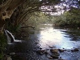
Mulgrave River
Encyclopedia

Far North Queensland
Far North Queensland, or FNQ, is the northernmost part of the Australian state of Queensland. The region, which contains a large section of the Tropical North Queensland area, stretches from the city of Cairns north to the Torres Strait...
, Australia. It flows in a northerly direction through Gordonvale
Gordonvale, Queensland
Gordonvale is a small sugar-growing suburb situated in the southern end of Cairns on the Mulgrave River. At the 2006 census, Gordonvale had a population of 4,420....
and the southern outskirts of Cairns
Cairns, Queensland
Cairns is a regional city in Far North Queensland, Australia, founded 1876. The city was named after William Wellington Cairns, then-current Governor of Queensland. It was formed to serve miners heading for the Hodgkinson River goldfield, but experienced a decline when an easier route was...
, after rising in the Bellenden Ker Range
Bellenden Ker Range
The Belleden Ker Range, also known as the Wooroonooran Range is a coastal mountain range in Far North Queensland, Australia. Part of the Great Dividing Range it is located between Gordonvale and Babinda....
. Some of the 1315 km² catchment area is protected with the Wooroonooran National Park
Wooroonooran National Park
Wooroonooran is a national park in Queensland , 1367 km northwest of Brisbane, between Innisfail and Cairns.The park is one of the Wet Tropics World Heritage Area series of national parks, and is a gazetted World Heritage site...
and the Wet Tropics World Heritage Area.
The Mulgrave River empties into the Coral Sea
Coral Sea
The Coral Sea is a marginal sea off the northeast coast of Australia. It is bounded in the west by the east coast of Queensland, thereby including the Great Barrier Reef, in the east by Vanuatu and by New Caledonia, and in the north approximately by the southern extremity of the Solomon Islands...
30 km south at the southern extremity of the Yarrabah Hills range where the Mulgrave meets the Russell River
Russell River
The Russell River is a short river that passes east of the town of Babinda in Far North Queensland, Australia. The river rises near the highest mountain in Queensland, Mount Bartle Frere, part of the Frances Range in the Wooroonooran National Park...
. The Trinity Inlet
Trinity Inlet
The Trinity Inlet is an estuary which serves as the port for the city of Cairns, Queensland, Australia. The city centre is on the western bank where the inlet meets the sea.In prehistoric times, the Trinity Inlet was the river mouth of the Mulgrave River...
was once the river mouth of the Mulgrave River. Volcanic activity that resulted in the rise of Green Hill in the Mulgrave Valley blocked the river from entering the sea near present day Cairns
Cairns, Queensland
Cairns is a regional city in Far North Queensland, Australia, founded 1876. The city was named after William Wellington Cairns, then-current Governor of Queensland. It was formed to serve miners heading for the Hodgkinson River goldfield, but experienced a decline when an easier route was...
.
The Mulgrave River runs through the Goldsbrough Valley south of Gordonvale. Gold was discovered in the river in the 1870s, bringing considerable change to the Goldsbrough Valley. Gravel is now extracted from the riverbed.
Freshwater stonefish
Stonefish
Synanceia verrucosa is a fish species, sometimes lethal to humans, which is known as the reef stonefish or simply stonefish. They are carnivorous ray-finned fish with venomous spines that lives on reef bottoms, camouflaged as a rock...
and crocodiles are found in the river, so caution is advised if swimming in the river. The pest fish tilapia
Tilapia
Tilapia , is the common name for nearly a hundred species of cichlid fish from the tilapiine cichlid tribe. Tilapia inhabit a variety of fresh water habitats, including shallow streams, ponds, rivers and lakes. Historically, they have been of major importance in artisan fishing in Africa and the...
have been discovered in the river and been the target of eradication efforts.
See also
- Kearneys FallsKearneys FallsKearneys Falls are found on a tributary of the Mulgrave River, in the Wooroonooran National Park, in Goldsborough Valley of Far North Queensland, Australia.Access to the falls is via a 1.6 km walking track....
- List of rivers of Australia
- Desmond Trannore BridgeDesmond Trannore BridgeThe Desmond Trannore Bridge is a road bridge on the Bruce Highway over the Mulgrave River in Gordonvale, Queensland, Australia.The bridge is named after Senior Constable Desmond Trannore, local police officer, killed in the line of duty in 1964....

