
National Register of Historic Places listings in North Philadelphia
Encyclopedia
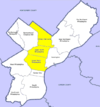
This is intended to be a complete list of the properties and districts on the National Register of Historic Places
National Register of Historic Places
The National Register of Historic Places is the United States government's official list of districts, sites, buildings, structures, and objects deemed worthy of preservation...
in North Philadelphia, Pennsylvania
Pennsylvania
The Commonwealth of Pennsylvania is a U.S. state that is located in the Northeastern and Mid-Atlantic regions of the United States. The state borders Delaware and Maryland to the south, West Virginia to the southwest, Ohio to the west, New York and Ontario, Canada, to the north, and New Jersey to...
, United States
United States
The United States of America is a federal constitutional republic comprising fifty states and a federal district...
. The locations of National Register properties and districts for which the latitude and longitude coordinates are included below, may be seen in a Google map.
There are 532 properties and districts listed on the National Register in Philadelphia, including 67 National Historic Landmarks. North Philadelphia includes 143 of these properties and districts, including 17 National Historic Landmarks; the city's remaining properties and districts are listed elsewhere
National Register of Historic Places listings in Philadelphia, Pennsylvania
This is a list of the National Register of Historic Places listings in Philadelphia, Pennsylvania. There are 532 properties and districts listed on the National Register in Philadelphia, including 67 National Historic Landmarks....
. Two sites are split between North Philadelphia and other parts of the city, and are thus included on multiple lists. Two other properties in North Philadelphia were once listed but have been removed.
Current listings
| Landmark name | Image | Date listed | Location | Neighborhood | Summary | |
|---|---|---|---|---|---|---|
| 1 | Adams Avenue Bridge in Philadelphia Adams Avenue Bridge The Adams Avenue Bridge is a historic bridge in Philadelphia, Pennsylvania. It carries Adams Avenue over Tacony Creek in Tacony Creek Park.A two-lane, triple-span, closed-spandrel, filled stone arch bridge, built in 1901, it was listed on the National Register of Historic Places in 1988.-External... |
Adams Avenue over Tacony Creek 40°2′31"N 75°6′48"W |
Olney Olney, Philadelphia, Pennsylvania Olney is a neighborhood in the North Philadelphia section of Philadelphia, Pennsylvania, United States. It is roughly bounded by the Roosevelt Boulevard to the south, Tacony Creek to the east, Godfrey Avenue to the north, and the railroad right-of-way west of Sixth Street to the west.Although... |
Extends into Northeast Philadelphia National Register of Historic Places listings in Northeast Philadelphia This is a list of the National Register of Historic Places listings in Northeast Philadelphia.This is intended to be a complete list of the properties and districts on the National Register of Historic Places in Northeast Philadelphia, Pennsylvania, United States... |
||
| 2 | William Adamson School | 2637–2647 North 4th Street 39°59′28"N 75°8′17"W |
West Kensington West Kensington, Philadelphia, Pennsylvania West Kensington is a neighborhood in the North Philadelphia section of Philadelphia. It is north of Olde Kensington. The Market Frankford El above Front Street forms the line between West Kensington and its bordering neighborhoods to the east , although its other boundaries are less well-defined... |
Built 1879-80, designed by Addison Hutton Addison Hutton Addison Hutton was a Philadelphia architect who designed prominent residences in Philadelphia and its suburbs, plus courthouses, hospitals, and libraries, including the Ridgway Library and the Historical Society of Pennsylvania... |
||
| 3 | American Railway Express Company Garage American Railway Express Company Garage The American Railway Express Company Garage is a historic parking garage located at 3002-3028 Cecil B. Moore Ave. in the Strawberry Mansion neighborhood of north Philadelphia, Pennsylvania. It was designed by the firm Harris & Richards and constructed by the Robert E... |
3002–3028 Cecil B. Moore Avenue 39°59′2"N 75°11′3"W |
Strawberry Mansion Strawberry Mansion, Philadelphia, Pennsylvania Strawberry Mansion is a neighborhood in the United States city of Philadelphia, Pennsylvania, located east of Fairmount Park in North Philadelphia. It has a large and predominantly African-American population. The neighborhood is bounded by 33rd Street in the west, 29th Street in the east, Lehigh... |
|||
| 4 | Alexander Dallas Bache School | 801 North 22nd Street 39°58′12"N 75°10′26"W |
Fairmount Fairmount, Philadelphia, Pennsylvania Fairmount is a United States neighborhood in the North Philadelphia area of Philadelphia, Pennsylvania. The name "Fairmount" itself derives from the prominent hill on which the Philadelphia Museum of Art now sits, and where William Penn originally intended to build his own manor house... |
|||
| 5 | Matthew Baird Mansion | 814 North Broad Street 39°58′7"N 75°9′37"W |
Francisville Francisville, Philadelphia, Pennsylvania Francisville is a neighborhood in North Philadelphia, which is a section of the city of Philadelphia, Pennsylvania. Its boundaries are Fairmount Avenue to the south, Girard Avenue to the north, Broad Street to the east, and Corinthian Avenue to the west. In 2000, it had a population of about 4,500... |
(1863-64). | ||
| 6 | Clara Barton School | 300 East Wyoming Avenue 40°1′13"N 75°7′10"W |
North Hunting Park Hunting Park, Philadelphia, Pennsylvania Hunting Park is a neighborhood in the North Philadelphia section of the United States city of Philadelphia, Pennsylvania. Like many North Philadelphia neighborhoods, it grew mainly in the 1920s and 1940s. The neighborhood's namesake is large park which is a regular location for recreation for many... |
|||
| 7 | Bergdoll Mansion | 2201–2205 Green Street 39°57′56"N 75°10′28"W |
Spring Garden Spring Garden, Philadelphia, Pennsylvania Spring Garden is a neighborhood in the central Philadelphia, Pennsylvania, USA, bordering Center City on the north. Spring Garden is a neighborhood that combines diverse residential neighborhoods and significant cultural attractions... |
James H. Windrim James H. Windrim James Hamilton Windrim was a Philadelphia architect who specialized in public buildings.-Biography:Born in Philadelphia, Pennsylvania, he apprenticed under John Notman, and opened his own office in 1867... , architect (1885-89). |
||
| 8 | Louis Bergdoll House | 929 North 29th Street 39°58′26"N 75°11′2"W |
Brewerytown Brewerytown, Philadelphia, Pennsylvania Brewerytown is a neighborhood in the North Philadelphia district of the city of Philadelphia, Pennsylvania, United States. An unofficial region, Brewerytown runs approximately between the Schuylkill River's eastern bank and 25th Street, bounded by Cecil B. Moore Avenue to the north and Parrish... |
Otto Charles Wolf, architect (1885). | ||
| 9 | Biberman Building | 611–619 North 15th Street 39°57′53"N 75°9′46"W |
Spring Garden Spring Garden, Philadelphia, Pennsylvania Spring Garden is a neighborhood in the central Philadelphia, Pennsylvania, USA, bordering Center City on the north. Spring Garden is a neighborhood that combines diverse residential neighborhoods and significant cultural attractions... |
|||
| 10 | Gen. David B. Birney School | 900 West Lindley Street 40°1′45"N 75°8′20"W |
Logan Logan, Philadelphia, Pennsylvania Logan is a neighborhood in the upper North Philadelphia section of the city of Philadelphia, in the U.S. state of Pennsylvania. Philadelphians usually define Logan as being bounded by Wingohocking Street to the south, Olney Avenue to the north, Broad Street to the east, and to 16th Street to the... |
|||
| 11 | Boat House Row Boathouse Row -Early 19th century beginnings:The history of Boathouse Row begins with the construction of the Fairmount Dam and the adjacent Water Works. The Dam was built in 1810 as part of a lock at the Falls of the Schuylkill to bring coal downriver. The Dam submerged rapids and transformed the Schuylkill... |
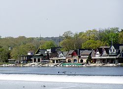 |
1–15 East River Drive 39°58′14"N 75°11′14"W |
Fairmount Park | ||
| 12 | Daniel Boone School | Hancock and Wildey Streets 39°58′03"N 75°8′14"W |
Northern Liberties Northern Liberties, Philadelphia, Pennsylvania -Boundaries:Northern Liberties is located north of Center City and is bordered by Girard Avenue to the north; Callowhill Street to the south; North 6th Street to the west; and the Delaware River to the east... |
|||
| 13 | Brewerytown Historic District Brewerytown, Philadelphia, Pennsylvania Brewerytown is a neighborhood in the North Philadelphia district of the city of Philadelphia, Pennsylvania, United States. An unofficial region, Brewerytown runs approximately between the Schuylkill River's eastern bank and 25th Street, bounded by Cecil B. Moore Avenue to the north and Parrish... |
Roughly bounded by 30th St., Girard Ave., 32nd St. and Glenwood Ave. 39°58′34"N 75°11′12"W |
Brewerytown Brewerytown, Philadelphia, Pennsylvania Brewerytown is a neighborhood in the North Philadelphia district of the city of Philadelphia, Pennsylvania, United States. An unofficial region, Brewerytown runs approximately between the Schuylkill River's eastern bank and 25th Street, bounded by Cecil B. Moore Avenue to the north and Parrish... |
|||
| 14 | Edward G. Budd Manufacturing Company Budd Company The Budd Company is a metal fabricator and major supplier of body components to the automobile industry, and was formerly a manufacturer of stainless steel passenger rail cars during the 20th century.... |
2450 West Hunting Park Ave. 40°0′32"N 75°10′8"W |
Hunting Park Industrial Area | |||
| 15 | Burk Brothers and Company | 913–916 North Third St. 39°57′54"N 75°8′31"W |
Northern Liberties Northern Liberties, Philadelphia, Pennsylvania -Boundaries:Northern Liberties is located north of Center City and is bordered by Girard Avenue to the north; Callowhill Street to the south; North 6th Street to the west; and the Delaware River to the east... |
|||
| 16 | Callowhill Industrial Historic District | Roughly bounded by Pearl St., North Broad St., Hamilton St., and the Reading Railroad Viaduct 39°57′35"N 75°9′43"W |
Callowhill Callowhill, Philadelphia, Pennsylvania Callowhill is a neighborhood in Philadelphia, Pennsylvania, USA. It is roughly located in the vicinity of Callowhill Street, between Vine Street, Spring Garden Street, Broad Street, and 8th Street. It is named for Hannah Callowhill Penn, William Penn's second wife... |
|||
| 17 | Central High School | Olney and Ogontz Avenues 40°2′14"N 75°8′58"W |
Ogontz Ogontz, Philadelphia, Pennsylvania Ogontz is a neighborhood in the North Philadelphia section of Philadelphia, Pennsylvania, United States that borders suburban Cheltenham Township, Montgomery County.... |
Irwin T. Catharine Irwin T. Catharine Irwin Thornton Catharine was the chief architect of Philadelphia public schools from 1920 until his retirement in 1937. Buildings built during Catharine's tenure ranged from Gothic Revival, as in the case of Simon Gratz High School, to Streamline Moderne, as in his last project, Joseph H. Brown... , architect (1937-39). |
||
| 18 | George Chandler School | 1050 East Montgomery St. 39°58′12"N 75°7′37"W |
Fishtown Fishtown, Philadelphia, Pennsylvania Fishtown is a neighborhood in Philadelphia, Pennsylvania, United States. Located immediately northeast of Center City, its borders are somewhat disputed today due to many factors, but are roughly defined by the triangle created by the Delaware River, Frankford Avenue, and York Street... |
|||
| 19 | Church of St. James the Less Church of St. James the Less The Church of St. James the Less is a historic Episcopal church building in Philadelphia, Pennsylvania that was architecturally influential. As St... |
Hunting Park Ave. and Clearfield St. 40°0′13"N 75°10′57"W |
Allegheny West Allegheny West, Philadelphia, Pennsylvania Allegheny West is a neighborhood in the North Philadelphia section of Philadelphia. It is named after an association formed by Pep Boys and Tasty Baking Company, among others, and the community bordering East Falls, Strawberry Mansion and Germantown... |
George Gordon Place & John E. Carver, architects (1846). | ||
| 20 | City Park Brewery City Park Brewery City Park Brewery, also known as the Louis Bergdoll Brewing Company was a brewery in north Philadelphia, Pennsylvania built in 1856. Several brewery buildings were added to the National Register of Historic Places in 1980 as a historic district. Louis J. Bergdoll started his brewery business in... |
Roughly bounded by Pennsylvania Ave., 28th, 30th, and Poplar Sts. 39°58′19"N 75°11′3"W |
Fairmount Fairmount, Philadelphia, Pennsylvania Fairmount is a United States neighborhood in the North Philadelphia area of Philadelphia, Pennsylvania. The name "Fairmount" itself derives from the prominent hill on which the Philadelphia Museum of Art now sits, and where William Penn originally intended to build his own manor house... |
|||
| 21 | Class and Nachod Brewery Class and Nachod Brewery The Class and Nachod Brewery, is located in Philadelphia, Pennsylvania. The house was built in 1911 and was added to the National Register of Historic Places on July 31, 2003.... |
1801–1823 North 10th St. 39°58′47"N 75°9′1"W |
Templetown Templetown, Philadelphia, Pennsylvania Templetown is a neighborhood in the North Philadelphia section of the city of Philadelphia, Pennsylvania, United States. The district is loosely arranged around the main campus of Temple University, hence the name 'Temple' town. Until recently, the area was primarily a slum, but is now rapidly... |
|||
| 22 | The Cliffs The Cliffs The Cliffs is a historic country house located near 33rd and Oxford Sts. in East Fairmount Park, Philadelphia, Pennsylvania, in the United States. It is a Registered Historic Place.-History:... |
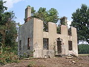 |
East Fairmount Park near 33rd St. 39°58′46"N 75°11′39"W |
Fairmount Park Fairmount Park Fairmount Park is the municipal park system of Philadelphia, Pennsylvania. It consists of 63 parks, with , all overseen by the Philadelphia Department of Parks and Recreation, successor to the Fairmount Park Commission in 2010.-Fairmount Park proper:... |
||
| 23 | John Coltrane House John Coltrane House John Coltrane House was the home of saxophonist and jazz pioneer John Coltrane from 1952 until 1958. He continued to use the house as an alternate residence to his New York home until the end of his life. On his death in 1967 the house passed to his cousin... |
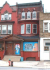 |
1511 North 33rd St. 39°58′49"N 75°11′21"W |
Strawberry Mansion Strawberry Mansion, Philadelphia, Pennsylvania Strawberry Mansion is a neighborhood in the United States city of Philadelphia, Pennsylvania, located east of Fairmount Park in North Philadelphia. It has a large and predominantly African-American population. The neighborhood is bounded by 33rd Street in the west, 29th Street in the east, Lehigh... |
||
| 24 | Jay Cooke Junior High School | 4735 Old York Road 40°1′32"N 75°8′47"W |
Logan Logan, Philadelphia, Pennsylvania Logan is a neighborhood in the upper North Philadelphia section of the city of Philadelphia, in the U.S. state of Pennsylvania. Philadelphians usually define Logan as being bounded by Wingohocking Street to the south, Olney Avenue to the north, Broad Street to the east, and to 16th Street to the... |
|||
| 25 | Lydia Darrah School | 708–732 North 17th St. 39°58′5"N 75°9′58"W |
Francisville Francisville, Philadelphia, Pennsylvania Francisville is a neighborhood in North Philadelphia, which is a section of the city of Philadelphia, Pennsylvania. Its boundaries are Fairmount Avenue to the south, Girard Avenue to the north, Broad Street to the east, and Corinthian Avenue to the west. In 2000, it had a population of about 4,500... |
|||
| 26 | Murrell Dobbins Vocational School | 2100 Lehigh Ave. 39°59′43"N 75°10′2"W |
South Lehigh | |||
| 27 | Dobson Mills | 4001–4041 Ridge Ave.; 3302–3530 Scott's Lane 40°0′28"N 75°11′14"W |
Hunting Park Industrial Area | |||
| 28 | Dropsie University Complex Center for Advanced Judaic Studies The Center for Advanced Judaic Studies at the University of Pennsylvania is the world's only institution exclusively dedicated to post-doctoral research on Jewish Civilization. It is located at 420 Walnut Street in Philadelphia, Pennsylvania. The center is directed by Professor David B... |
Broad and York Sts. 39°59′21"N 75°9′18"W |
Templetown Templetown, Philadelphia, Pennsylvania Templetown is a neighborhood in the North Philadelphia section of the city of Philadelphia, Pennsylvania, United States. The district is loosely arranged around the main campus of Temple University, hence the name 'Temple' town. Until recently, the area was primarily a slum, but is now rapidly... |
|||
| 29 | Paul Lawrence Dunbar School | Twelfth St. above Columbia Ave. 39°58′43"N 75°9′17"W |
Templetown Templetown, Philadelphia, Pennsylvania Templetown is a neighborhood in the North Philadelphia section of the city of Philadelphia, Pennsylvania, United States. The district is loosely arranged around the main campus of Temple University, hence the name 'Temple' town. Until recently, the area was primarily a slum, but is now rapidly... |
|||
| 30 | Thomas Eakins House Thomas Eakins House The Thomas Eakins House was a home of Thomas Eakins in Philadelphia, Pennsylvania. It is a National Historic Landmark.The house was built about 1854 by the father of Thomas Eakins. It is a four-story townhouse with three stories built of brick and the fourth of wood. Thomas Eakins inherited the... |
.jpg) |
1729 Mount Vernon Place 39°57′56"N 75°10′2"W |
Spring Garden Spring Garden, Philadelphia, Pennsylvania Spring Garden is a neighborhood in the central Philadelphia, Pennsylvania, USA, bordering Center City on the north. Spring Garden is a neighborhood that combines diverse residential neighborhoods and significant cultural attractions... |
||
| 31 | Eastern State Penitentiary Eastern State Penitentiary The Eastern State Penitentiary is a former American prison in Philadelphia, Pennsylvania. It is located on 2027 Fairmount Avenue between Corinthian Avenue and North 22nd Street in the Fairmount section of Philadelphia and was operational from 1829 until 1971... |
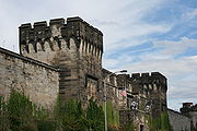 |
21st St. and Fairmount Ave. 39°58′5"N 75°10′23"W |
Fairmount Fairmount, Philadelphia, Pennsylvania Fairmount is a United States neighborhood in the North Philadelphia area of Philadelphia, Pennsylvania. The name "Fairmount" itself derives from the prominent hill on which the Philadelphia Museum of Art now sits, and where William Penn originally intended to build his own manor house... |
John Haviland, architect (1821-29). | |
| 32 | James Elverson, Jr. School | 1300 Susquehanna Ave. 39°59′9"N 75°9′16"W |
Templetown Templetown, Philadelphia, Pennsylvania Templetown is a neighborhood in the North Philadelphia section of the city of Philadelphia, Pennsylvania, United States. The district is loosely arranged around the main campus of Temple University, hence the name 'Temple' town. Until recently, the area was primarily a slum, but is now rapidly... |
|||
| 33 | The Elverson Building The Philadelphia Inquirer The Philadelphia Inquirer is a morning daily newspaper that serves the Philadelphia, Pennsylvania, metropolitan area of the United States. The newspaper was founded by John R. Walker and John Norvell in June 1829 as The Pennsylvania Inquirer and is the third-oldest surviving daily newspaper in the... |
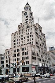 |
400–440 North Broad St. 39°57′36"N 75°9′44"W |
Callowhill Callowhill, Philadelphia, Pennsylvania Callowhill is a neighborhood in Philadelphia, Pennsylvania, USA. It is roughly located in the vicinity of Callowhill Street, between Vine Street, Spring Garden Street, Broad Street, and 8th Street. It is named for Hannah Callowhill Penn, William Penn's second wife... |
Rankin, Kellogg & Crane, architects (1923-24). | |
| 34 | Fair Hill Burial Ground | Roughly along Germantown and Indiana Aves., 9th, and Cambria Sts. 39°59′49"N 75°8′46"W |
Fairhill Fairhill, Philadelphia, Pennsylvania Fairhill is a neighborhood on the east side of the North Philadelphia section of Philadelphia, Pennsylvania, United States. Fairhill is located in an area between Kensington Avenue and 6th Street ranging from York Street to Gurney Street/Clearfield Street... |
|||
| 35 | Fairmount Avenue Historic District | Fairmount Ave. and Melon, North, 15th, 16th, and 17th Sts. 39°58′00"N 75°9′44"W |
Spring Garden Spring Garden, Philadelphia, Pennsylvania Spring Garden is a neighborhood in the central Philadelphia, Pennsylvania, USA, bordering Center City on the north. Spring Garden is a neighborhood that combines diverse residential neighborhoods and significant cultural attractions... |
|||
| 36 | Fairmount Park Fairmount Park Fairmount Park is the municipal park system of Philadelphia, Pennsylvania. It consists of 63 parks, with , all overseen by the Philadelphia Department of Parks and Recreation, successor to the Fairmount Park Commission in 2010.-Fairmount Park proper:... |
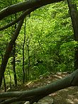 |
Both banks of the Schuylkill River Schuylkill River The Schuylkill River is a river in Pennsylvania. It is a designated Pennsylvania Scenic River.The river is about long. Its watershed of about lies entirely within the state of Pennsylvania. The source of its eastern branch is in the Appalachian Mountains at Tuscarora Springs, near Tamaqua in... and Wissahickon Creek Wissahickon Creek Wissahickon Creek is a stream in southeastern Pennsylvania. Rising in Montgomery County, Pennsylvania, it runs about 23 miles passing through and dividing Northwest Philadelphia before emptying into the Schuylkill River at Philadelphia... , from Spring Garden St. to Northwestern Ave. 39°58′58"N 75°11′50"W |
Fairmount Park Fairmount Park Fairmount Park is the municipal park system of Philadelphia, Pennsylvania. It consists of 63 parks, with , all overseen by the Philadelphia Department of Parks and Recreation, successor to the Fairmount Park Commission in 2010.-Fairmount Park proper:... |
Extends into Northwest National Register of Historic Places listings in Northwest Philadelphia This is a list of the National Register of Historic Places listings in Northwest Philadelphia.This is intended to be a complete list of the properties and districts on the National Register of Historic Places in Northwest Philadelphia, Pennsylvania, United States... and West National Register of Historic Places listings in West Philadelphia This is a list of the National Register of Historic Places listings in West Philadelphia.This is intended to be a complete list of the properties and districts on the National Register of Historic Places in West Philadelphia, Pennsylvania, United States... Philadelphia |
|
| 37 | Fairmount Water Works Fairmount Water Works The Fairmount Water Works in Philadelphia, Pennsylvania was Philadelphia's second municipal waterworks. Designed in 1812 by Frederick Graff and built between 1812 and 1872, it operated until 1909, winning praise for its design and becoming a popular tourist attraction... |
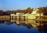 |
Eastern banks of the Schuylkill River Schuylkill River The Schuylkill River is a river in Pennsylvania. It is a designated Pennsylvania Scenic River.The river is about long. Its watershed of about lies entirely within the state of Pennsylvania. The source of its eastern branch is in the Appalachian Mountains at Tuscarora Springs, near Tamaqua in... 39°57′59"N 75°11′9"W |
Fairmount Park Fairmount Park Fairmount Park is the municipal park system of Philadelphia, Pennsylvania. It consists of 63 parks, with , all overseen by the Philadelphia Department of Parks and Recreation, successor to the Fairmount Park Commission in 2010.-Fairmount Park proper:... |
Frederick Graff, et al., architects (1812-22). | |
| 38 | David Farragut School | Hancock and Cumberland Sts. 39°59′16"N 75°8′8"W |
West Kensington West Kensington, Philadelphia, Pennsylvania West Kensington is a neighborhood in the North Philadelphia section of Philadelphia. It is north of Olde Kensington. The Market Frankford El above Front Street forms the line between West Kensington and its bordering neighborhoods to the east , although its other boundaries are less well-defined... |
|||
| 39 | Feltonville School No. 2 | 4901 Rising Sun Ave. 40°1′29"N 75°7′21"W |
Feltonville Feltonville, Philadelphia, Pennsylvania Feltonville is a neighborhood in Northeast Philadelphia It is located east of Logan, Philadelphia, south of Olney, northeast of Hunting Park, west of Frankford, and northwest of Juniata... |
|||
| 40 | Joseph C. Ferguson School | 2000–2046 North 7th St. 39°58′55"N 75°8′48"W |
Templetown Templetown, Philadelphia, Pennsylvania Templetown is a neighborhood in the North Philadelphia section of the city of Philadelphia, Pennsylvania, United States. The district is loosely arranged around the main campus of Temple University, hence the name 'Temple' town. Until recently, the area was primarily a slum, but is now rapidly... |
|||
| 41 | Fidelity Mutual Life Insurance Company Building | 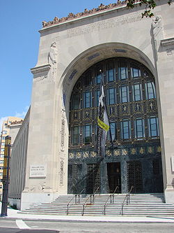 |
Fairmount and Pennsylvania Aves. 39°58′3"N 75°10′47"W |
Fairmount Fairmount, Philadelphia, Pennsylvania Fairmount is a United States neighborhood in the North Philadelphia area of Philadelphia, Pennsylvania. The name "Fairmount" itself derives from the prominent hill on which the Philadelphia Museum of Art now sits, and where William Penn originally intended to build his own manor house... |
Zantzinger, Borie and Medary Zantzinger, Borie and Medary Zantzinger, Borie and Medary was an early to mid-twentieth-century American architecture firm based in Philadelphia, Pennsylvania specializing in institutional and civic projects, and active under that name from 1910 through 1929, and continuing until 1950. The partners were Clarence C. Zantzinger,... , architects (1927). |
|
| 42 | Thomas K. Finletter School | 6101 North Front St. Front Street (Philadelphia) Front Street in Philadelphia, Pennsylvania is a north-south street running parallel to and near the Delaware River. It was constructed when Philadelphia was laid out by William Penn in 1682.... 40°2′37"N 75°7′10"W |
Olney Olney, Philadelphia, Pennsylvania Olney is a neighborhood in the North Philadelphia section of Philadelphia, Pennsylvania, United States. It is roughly bounded by the Roosevelt Boulevard to the south, Tacony Creek to the east, Godfrey Avenue to the north, and the railroad right-of-way west of Sixth Street to the west.Although... |
|||
| 43 | Thomas Fitzsimons Junior High School The Young Men's Leadership School at Thomas FitzSimons High School The Young Men's Leadership School at Thomas E. FitzSimons High School is a public secondary school for boys located at 2601 Cumberland Street in Philadelphia, Pennsylvania, United States... |
2601 West Cumberland St. 39°59′38"N 75°10′29.5"W |
Strawberry Mansion Strawberry Mansion, Philadelphia, Pennsylvania Strawberry Mansion is a neighborhood in the United States city of Philadelphia, Pennsylvania, located east of Fairmount Park in North Philadelphia. It has a large and predominantly African-American population. The neighborhood is bounded by 33rd Street in the west, 29th Street in the east, Lehigh... |
|||
| 44 | Helen Fleischer Vocational School | 13th and Brandywine Sts. 39°57′46.5"N 75°9′33.5"W |
Callowhill Callowhill, Philadelphia, Pennsylvania Callowhill is a neighborhood in Philadelphia, Pennsylvania, USA. It is roughly located in the vicinity of Callowhill Street, between Vine Street, Spring Garden Street, Broad Street, and 8th Street. It is named for Hannah Callowhill Penn, William Penn's second wife... |
|||
| 45 | Edwin Forrest House Edwin Forrest House The Edwin Forrest House is a house in Philadelphia, Pennsylvania built in 1853-54 for William Gaul, a wealthy brewer... |
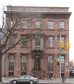 |
1326 North Broad St. 39°58′28"N 75°9′33"W |
Cabot | ||
| 46 | Founder's Hall, Girard College Girard College Girard College is an independent boarding school on a 43-acre campus in Philadelphia, Pennsylvania, in the United States.Girard is for academically capable students, grades one through 12, and awards a full scholarship with a yearly value of approximately $42,000 to every child admitted to the... |
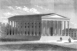 |
Corinthian St. and Girard Ave. 39°58′26"N 75°10′12"W |
Girard College Girard College Girard College is an independent boarding school on a 43-acre campus in Philadelphia, Pennsylvania, in the United States.Girard is for academically capable students, grades one through 12, and awards a full scholarship with a yearly value of approximately $42,000 to every child admitted to the... |
Thomas Ustick Walter, architect (1833-48). | |
| 47 | Henry S. Frank Memorial Synagogue Henry S. Frank Memorial Synagogue The Frank Memorial Synagogue is a synagogue in Philadelphia, Pennsylvania, United States, named after philanthropist Henry S. Frank.It was added to the National Register of Historic Places in 1983.... |
Old York and West Tabor Roads 40°2′13.5"N 75°8′37.5"W |
Logan Logan, Philadelphia, Pennsylvania Logan is a neighborhood in the upper North Philadelphia section of the city of Philadelphia, in the U.S. state of Pennsylvania. Philadelphians usually define Logan as being bounded by Wingohocking Street to the south, Olney Avenue to the north, Broad Street to the east, and to 16th Street to the... |
|||
| 48 | Franklin Institute Science Museum Franklin Institute The Franklin Institute is a museum in Philadelphia, Pennsylvania, and one of the oldest centers of science education and development in the United States, dating to 1824. The Institute also houses the Benjamin Franklin National Memorial.-History:On February 5, 1824, Samuel Vaughn Merrick and... |
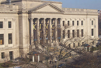 |
20th St. and the Benjamin Franklin Parkway 39°57′34"N 75°10′16"W |
Franklintown Franklintown, Philadelphia, Pennsylvania Franklintown is the name given to the area in Philadelphia, Pennsylvania that lies north of the Vine Street Expressway, south of Spring Garden Street, and west of Broad Street. It is sometimes considered to be the southernmost part of the Spring Garden neighborhood. Franklintown consists of mostly... |
John T. Windrim John T. Windrim John Torrey Windrim was an American architect.He trained in the office of his father, architect James H. Windrim. He was elected to the Philadelphia Chapter of the American Institute of Architects in 1901, and became a Fellow of the Institute in 1926... , architect (1929-31). |
|
| 49 | General Electric Switchgear Plant | Seventh and Willow Sts. 39°57′32"N 75°9′0"W |
Callowhill Callowhill, Philadelphia, Pennsylvania Callowhill is a neighborhood in Philadelphia, Pennsylvania, USA. It is roughly located in the vicinity of Callowhill Street, between Vine Street, Spring Garden Street, Broad Street, and 8th Street. It is named for Hannah Callowhill Penn, William Penn's second wife... |
|||
| 50 | North Philadelphia station North Philadelphia (SEPTA Regional Rail station) North Philadelphia, formerly Germantown Junction Station, is a railroad station on the Northeast Corridor in Philadelphia, Pennsylvania, United States. It is an above-ground station at 2900 North Broad Street in the city's North Philadelphia section... |
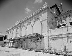 |
2900 North Broad St. 39°59′50"N 75°8′16"W |
North Central North Central, Philadelphia, Pennsylvania North Central is an area in the North Philadelphia section of Philadelphia, Pennsylvania, United States. The name of the area is derived from its location, near the center of North Philadelphia. According to Census 2010 North Central is primarily a low-income neighborhood where 60% of its residents... |
Theophilus P. Chandler, Jr. Theophilus Parsons Chandler, Jr. Theophilus Parsons Chandler, Jr. was a Philadelphia architect best remembered for his churches and country houses. He founded the Department of Architecture at the University of Pennsylvania , and was its first head.-Career:... , architect (1896-1901). |
|
| 51 | Elizabeth Duane Gillespie Junior High School | 3901–3961 North 18th St. 40°0′47.5"N 75°9′21.5"W |
Nicetown–Tioga Nicetown-Tioga, Philadelphia, Pennsylvania Nicetown-Tioga is a neighborhood in the North Philadelphia section of the city of Philadelphia, in the U.S. state of Pennsylvania. It comprises two smaller, older neighborhoods, Nicetown and Tioga, although the distinction between the two is rarely emphasized today... |
|||
| 52 | Girard Avenue Historic District | 1415–2028 Girard Avenue and 1700 block of Thompson Street 39°58′21"N 75°9′36"W |
Cabot | |||
| 53 | Girard Avenue West Historic District | West Girard Avenue, between North Taney and North 29th Streets 39°58′28"N 75°10′52"W |
Brewerytown Brewerytown, Philadelphia, Pennsylvania Brewerytown is a neighborhood in the North Philadelphia district of the city of Philadelphia, Pennsylvania, United States. An unofficial region, Brewerytown runs approximately between the Schuylkill River's eastern bank and 25th Street, bounded by Cecil B. Moore Avenue to the north and Parrish... |
|||
| 54 | Girard College Complex Girard College Girard College is an independent boarding school on a 43-acre campus in Philadelphia, Pennsylvania, in the United States.Girard is for academically capable students, grades one through 12, and awards a full scholarship with a yearly value of approximately $42,000 to every child admitted to the... |
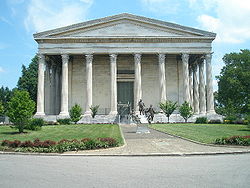 |
Bounded by Poplar St., Girard, West College, South College, and Ridge Aves. 39°58′25"N 75°9′22"W |
Girard College Girard College Girard College is an independent boarding school on a 43-acre campus in Philadelphia, Pennsylvania, in the United States.Girard is for academically capable students, grades one through 12, and awards a full scholarship with a yearly value of approximately $42,000 to every child admitted to the... |
||
| 55 | Goodman Brothers and Hinlein Company | 1238 Callowhill St. 39°57′33"N 75°9′35"W |
Callowhill Callowhill, Philadelphia, Pennsylvania Callowhill is a neighborhood in Philadelphia, Pennsylvania, USA. It is roughly located in the vicinity of Callowhill Street, between Vine Street, Spring Garden Street, Broad Street, and 8th Street. It is named for Hannah Callowhill Penn, William Penn's second wife... |
|||
| 56 | Graham and Laird, Schober and Mitchell Factories | 19th St. between Hamilton and Buttonwood Sts. 39°57′44"N 75°10′11"W |
Franklintown Franklintown, Philadelphia, Pennsylvania Franklintown is the name given to the area in Philadelphia, Pennsylvania that lies north of the Vine Street Expressway, south of Spring Garden Street, and west of Broad Street. It is sometimes considered to be the southernmost part of the Spring Garden neighborhood. Franklintown consists of mostly... |
Site now a parking lot. | ||
| 57 | Simon Gratz High School Simon Gratz High School Simon Gratz High School is a secondary school located in Philadelphia, Pennsylvania, U.S. An inner-city school, it is perhaps best-known for its famous alumni . Originally operated as a public school by the School District of Philadelphia, Gratz has been run as a charter school by Mastery Charter... |
3901–3961 North 18th St. 40°0′50.5"N 75°9′21"W |
Nicetown–Tioga Nicetown-Tioga, Philadelphia, Pennsylvania Nicetown-Tioga is a neighborhood in the North Philadelphia section of the city of Philadelphia, in the U.S. state of Pennsylvania. It comprises two smaller, older neighborhoods, Nicetown and Tioga, although the distinction between the two is rarely emphasized today... |
|||
| 58 | Harrington Machine Shop | 1640–1666 Callowhill St. 39°57′36"N 75°10′0"W |
Franklintown Franklintown, Philadelphia, Pennsylvania Franklintown is the name given to the area in Philadelphia, Pennsylvania that lies north of the Vine Street Expressway, south of Spring Garden Street, and west of Broad Street. It is sometimes considered to be the southernmost part of the Spring Garden neighborhood. Franklintown consists of mostly... |
|||
| 59 | William H. Harrison School | 1012–1020 West Thompson St. 39°58′20.5"N 75°9′12.5"W |
Yorktown Yorktown, Philadelphia, Pennsylvania Yorktown is a neighborhood in North Philadelphia. It is located north of Poplar and west of Ludlow.... |
|||
| 60 | Hatfield House Hatfield House (Philadelphia, Pennsylvania) The Hatfield House is a historic house located in Fairmount Park in Philadelphia, Pennsylvania, built in 1760. It was added to the National Register of Historic Places on March 16, 1972.... |
33rd St. near Girard Avenue Girard Avenue Girard Avenue is a major east-west thoroughfare in Philadelphia that forms sections of U.S. Route 13 and U.S. Route 30 and is named for Franco-American financier Stephen Girard. It stretches through several major neighborhoods of Philadelphia, including West Philadelphia, Fishtown, Kensington, and... 39°58′33.3"N 75°11′18"W |
Fairmount Park Fairmount Park Fairmount Park is the municipal park system of Philadelphia, Pennsylvania. It consists of 63 parks, with , all overseen by the Philadelphia Department of Parks and Recreation, successor to the Fairmount Park Commission in 2010.-Fairmount Park proper:... |
|||
| 61 | Houses at 1907-1951 N. 32nd St. | 1907–1951 North 32nd St. 39°59′10"N 75°11′8.5"W |
Strawberry Mansion Strawberry Mansion, Philadelphia, Pennsylvania Strawberry Mansion is a neighborhood in the United States city of Philadelphia, Pennsylvania, located east of Fairmount Park in North Philadelphia. It has a large and predominantly African-American population. The neighborhood is bounded by 33rd Street in the west, 29th Street in the east, Lehigh... |
|||
| 62 | Julia Ward Howe School | 1301–1331 Grange St. 40°2′29"N 75°8′32"W |
Fern Rock Fern Rock, Philadelphia, Pennsylvania thumb|Fern Rock Transportation CenterFern Rock is a neighborhood in the upper North Philadelphia section of Philadelphia, Pennsylvania bounded by Olney to the east, Ogontz to the west, Logan to south, and East Oak Lane to the north. It is approximately situated between Broad Street, Tabor Road, 7th... |
|||
| 63 | Integrity Title Insurance, Trust and Safe Deposit Company | 4th and Green Sts. 39°57′42"N 75°8′42"W |
Northern Liberties Northern Liberties, Philadelphia, Pennsylvania -Boundaries:Northern Liberties is located north of Center City and is bordered by Girard Avenue to the north; Callowhill Street to the south; North 6th Street to the west; and the Delaware River to the east... |
|||
| 64 | Thomas Jefferson School | 1101–1125 North 4th St. 39°58′5"N 75°8′36"W |
Northern Liberties Northern Liberties, Philadelphia, Pennsylvania -Boundaries:Northern Liberties is located north of Center City and is bordered by Girard Avenue to the north; Callowhill Street to the south; North 6th Street to the west; and the Delaware River to the east... |
|||
| 65 | Kensington Branch of the Philadelphia YWCA | 174 West Allegheny Ave. 39°59′55.5"N 75°7′57"W |
Hugh | |||
| 66 | John L. Kinsey School | 65th Ave. and Limekiln Pike 40°3′13"N 75°9′9"W |
West Oak Lane West Oak Lane, Philadelphia, Pennsylvania West Oak Lane is a neighborhood in the Northwest Philadelphia section of Philadelphia. It is located between East Mount Airy, East Germantown, Cheltenham, Montgomery County, East Oak Lane, and Fern Rock. Ogontz Avenue runs generally north, then northwest as the spine of the neighborhood and the... |
|||
| 67 | Laurel Hill Cemetery Laurel Hill Cemetery Laurel Hill Cemetery, in Philadelphia, Pennsylvania, is the second major garden or rural cemetery in the United States. It was designated a National Historic Landmark in 1998, one of only a few cemeteries to receive the distinction.... |
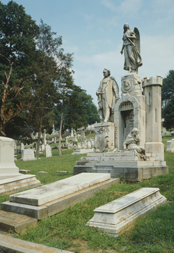 |
3822 Ridge Ave. 40°0′15"N 75°11′19"W |
Fairmount Park Fairmount Park Fairmount Park is the municipal park system of Philadelphia, Pennsylvania. It consists of 63 parks, with , all overseen by the Philadelphia Department of Parks and Recreation, successor to the Fairmount Park Commission in 2010.-Fairmount Park proper:... |
||
| 68 | Logan Demonstration School | 5000 North 17th St. 40°1′52"N 75°9′6.5"W |
Logan Logan, Philadelphia, Pennsylvania Logan is a neighborhood in the upper North Philadelphia section of the city of Philadelphia, in the U.S. state of Pennsylvania. Philadelphians usually define Logan as being bounded by Wingohocking Street to the south, Olney Avenue to the north, Broad Street to the east, and to 16th Street to the... |
|||
| 69 | Lorraine Apartments Divine Lorraine Hotel The Divine Lorraine Hotel, also known as the Lorraine Apartments, stands at the corner of Broad and Fairmount Streets in North Philadelphia, Pennsylvania. Designed by architect Willis G. Hale and built between 1892 and 1894, the building originally functioned as apartments, housing some of... |
699 North Broad St. 39°58′0"N 75°9′37"W |
Poplar Poplar, Philadelphia, Pennsylvania Poplar is a neighborhood in North Philadelphia. It is located north of Chinatown, between Spring Garden and Northern Liberties, bound roughly by Girard Avenue to the north, North Broad Street to the West, Spring Garden Street to the south, and 5th Street to the east... |
Willis G. Hale Willis G. Hale Willis Gaylord Hale was a late-19th century architect who worked primarily in Philadelphia, Pennsylvania... , architect (1892-93). |
||
| 70 | James Russell Lowell School | 5801–5851 North 5th St. 40°2′27"N 75°7′44"W |
Olney Olney, Philadelphia, Pennsylvania Olney is a neighborhood in the North Philadelphia section of Philadelphia, Pennsylvania, United States. It is roughly bounded by the Roosevelt Boulevard to the south, Tacony Creek to the east, Godfrey Avenue to the north, and the railroad right-of-way west of Sixth Street to the west.Although... |
|||
| 71 | Lower North Philadelphia Speculative Housing Historic District | Roughly bounded by North 15th St., Sydenham St., North 16th St., Montgomery Ave., North 19th St., Jefferson St., and Willington St. 39°58′47"N 75°9′41"W |
North Central North Central, Philadelphia, Pennsylvania North Central is an area in the North Philadelphia section of Philadelphia, Pennsylvania, United States. The name of the area is derived from its location, near the center of North Philadelphia. According to Census 2010 North Central is primarily a low-income neighborhood where 60% of its residents... |
|||
| 72 | James R. Ludlow School | 1323–1345 North 6th St. 39°58′21"N 75°8′45"W |
Yorktown Yorktown, Philadelphia, Pennsylvania Yorktown is a neighborhood in North Philadelphia. It is located north of Poplar and west of Ludlow.... |
|||
| 73 | Martin Orthopedic School | 800 North 22nd St. 39°58′12.5"N 75°10′27"W |
Fairmount Fairmount, Philadelphia, Pennsylvania Fairmount is a United States neighborhood in the North Philadelphia area of Philadelphia, Pennsylvania. The name "Fairmount" itself derives from the prominent hill on which the Philadelphia Museum of Art now sits, and where William Penn originally intended to build his own manor house... |
|||
| 74 | Alexander K. McClure School | 4139 North 6th St. 40°0′54"N 75°8′15"W |
Hunting Park Hunting Park, Philadelphia, Pennsylvania Hunting Park is a neighborhood in the North Philadelphia section of the United States city of Philadelphia, Pennsylvania. Like many North Philadelphia neighborhoods, it grew mainly in the 1920s and 1940s. The neighborhood's namesake is large park which is a regular location for recreation for many... |
|||
| 75 | George Meade School | 1801 Oxford St. 39°58′42"N 75°9′53.5"W |
North Central North Central, Philadelphia, Pennsylvania North Central is an area in the North Philadelphia section of Philadelphia, Pennsylvania, United States. The name of the area is derived from its location, near the center of North Philadelphia. According to Census 2010 North Central is primarily a low-income neighborhood where 60% of its residents... |
|||
| 76 | Metropolitan Opera House | 858 North Broad St. 39°58′11.5"N 75°9′36.5"W |
Francisville Francisville, Philadelphia, Pennsylvania Francisville is a neighborhood in North Philadelphia, which is a section of the city of Philadelphia, Pennsylvania. Its boundaries are Fairmount Avenue to the south, Girard Avenue to the north, Broad Street to the east, and Corinthian Avenue to the west. In 2000, it had a population of about 4,500... |
|||
| 77 | Middishade Clothing Factory | 1600 Callowhill St. 39°57′36"N 75°9′55"W |
Franklintown Franklintown, Philadelphia, Pennsylvania Franklintown is the name given to the area in Philadelphia, Pennsylvania that lies north of the Vine Street Expressway, south of Spring Garden Street, and west of Broad Street. It is sometimes considered to be the southernmost part of the Spring Garden neighborhood. Franklintown consists of mostly... |
|||
| 78 | Mifflin School Mifflin School The Mifflin School, built in 1825 is the oldest surviving school building used in the Philadelphia public school system. It is a two story, two bay red brick building, which now has its side walls stuccoed over. In the first phase of the development of the public school system in Philadelphia,... |
808–818 North 3rd St. 39°57′49"N 75°8′35"W |
Northern Liberties Northern Liberties, Philadelphia, Pennsylvania -Boundaries:Northern Liberties is located north of Center City and is bordered by Girard Avenue to the north; Callowhill Street to the south; North 6th Street to the west; and the Delaware River to the east... |
|||
| 79 | Andrew J. Morrison School | 300 Duncannon St. 40°1′46"N 75°7′46"W |
Olney Olney, Philadelphia, Pennsylvania Olney is a neighborhood in the North Philadelphia section of Philadelphia, Pennsylvania, United States. It is roughly bounded by the Roosevelt Boulevard to the south, Tacony Creek to the east, Godfrey Avenue to the north, and the railroad right-of-way west of Sixth Street to the west.Although... |
|||
| 80 | Most Precious Blood Roman Catholic Church, Rectory and Parochial School Most Precious Blood Roman Catholic Church, Rectory and Parochial School Most Precious Blood Roman Catholic Church, Rectory and Parochial School is a historic church at 2800—2818 Diamond Street in Philadelphia, Pennsylvania.It was built in 1908 and added to the National Register in 1992.-References:... |
2800–2818 Diamond St. 39°59′14"N 75°10′46.5"W |
Strawberry Mansion Strawberry Mansion, Philadelphia, Pennsylvania Strawberry Mansion is a neighborhood in the United States city of Philadelphia, Pennsylvania, located east of Fairmount Park in North Philadelphia. It has a large and predominantly African-American population. The neighborhood is bounded by 33rd Street in the west, 29th Street in the east, Lehigh... |
|||
| 81 | Mount Pleasant Mount Pleasant (mansion) Mount Pleasant is a mansion located in Philadelphia, Pennsylvania, and was built in what was then the countryside outside of the city by the privateer John Mcpherson... |
 |
East Reservoir Drive 39°59′0.3"N 75°11′59.5"W |
Fairmount Park Fairmount Park Fairmount Park is the municipal park system of Philadelphia, Pennsylvania. It consists of 63 parks, with , all overseen by the Philadelphia Department of Parks and Recreation, successor to the Fairmount Park Commission in 2010.-Fairmount Park proper:... |
||
| 82 | Muhlenberg School | 1640 Master St. 39°58′30"N 75°9′48.5"W |
Cabot | |||
| 83 | Simon Muhr Work Training School | 12th St. and Allegheny Ave. 40°0′3"N 75°8′55"W |
Nicetown–Tioga Nicetown-Tioga, Philadelphia, Pennsylvania Nicetown-Tioga is a neighborhood in the North Philadelphia section of the city of Philadelphia, in the U.S. state of Pennsylvania. It comprises two smaller, older neighborhoods, Nicetown and Tioga, although the distinction between the two is rarely emphasized today... |
|||
| 84 | Mulford Building | 640 North Broad St. 39°57′54"N 75°9′40"W |
Spring Garden Spring Garden, Philadelphia, Pennsylvania Spring Garden is a neighborhood in the central Philadelphia, Pennsylvania, USA, bordering Center City on the north. Spring Garden is a neighborhood that combines diverse residential neighborhoods and significant cultural attractions... |
|||
| 85 | N. Snellenburg Company Department Store Warehouse N. Snellenburg & Company N. Snellenburg & Company, commonly known as Snellenburg's, was a Philadelphia, Pennsylvania based middle class department store and wholesale clothing manufacturer, established in 1869. The company became the largest clothing manufacturer in the world and at one time employed 3,000... |
1825–1851 North 10th St. 39°58′49"N 75°9′0"W |
Templetown Templetown, Philadelphia, Pennsylvania Templetown is a neighborhood in the North Philadelphia section of the city of Philadelphia, Pennsylvania, United States. The district is loosely arranged around the main campus of Temple University, hence the name 'Temple' town. Until recently, the area was primarily a slum, but is now rapidly... |
|||
| 86 | National Bank of North Philadelphia | 3701 North Broad St. 40°00′36"N 75°09′03"W |
Nicetown–Tioga Nicetown-Tioga, Philadelphia, Pennsylvania Nicetown-Tioga is a neighborhood in the North Philadelphia section of the city of Philadelphia, in the U.S. state of Pennsylvania. It comprises two smaller, older neighborhoods, Nicetown and Tioga, although the distinction between the two is rarely emphasized today... |
|||
| 87 | North Broad Street Mansion District North Broad Street Mansion District The North Broad Street Mansion District is a historic district in Philadelphia, Pennsylvania. It is roughly bounded by Broad, Jefferson, Willington, and Oxford Streets. It comprises 76 contributing buildings and 15 non-contributing buildings over 15 acres.... |
Roughly bounded by Broad, Jefferson, Willington, and Oxford Sts. 39°58′37"N 75°9′38"W |
Templetown Templetown, Philadelphia, Pennsylvania Templetown is a neighborhood in the North Philadelphia section of the city of Philadelphia, Pennsylvania, United States. The district is loosely arranged around the main campus of Temple University, hence the name 'Temple' town. Until recently, the area was primarily a slum, but is now rapidly... |
|||
| 88 | North Broad Street Station, Reading Company North Broad (SEPTA station) North Broad is a SEPTA Regional Rail station located at 2601 North Broad Street south of Lehigh Avenue along the SEPTA Main Line. Unlike most stations, such as Wayne Junction, only the Lansdale/Doylestown Line and Manayunk/Norristown Line serve this station, while most trains pass by the station... |
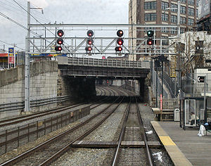 |
2601 North Broad St. 39°59′32.5"N 75°9′16"W |
Templetown Templetown, Philadelphia, Pennsylvania Templetown is a neighborhood in the North Philadelphia section of the city of Philadelphia, Pennsylvania, United States. The district is loosely arranged around the main campus of Temple University, hence the name 'Temple' town. Until recently, the area was primarily a slum, but is now rapidly... |
||
| 89 | Northeast Manual Training School | 701 Lehigh Ave. 39°59′35"N 75°8′40"W |
Fairhill Fairhill, Philadelphia, Pennsylvania Fairhill is a neighborhood on the east side of the North Philadelphia section of Philadelphia, Pennsylvania, United States. Fairhill is located in an area between Kensington Avenue and 6th Street ranging from York Street to Gurney Street/Clearfield Street... |
|||
| 90 | Northern Liberties Historic District Northern Liberties, Philadelphia, Pennsylvania -Boundaries:Northern Liberties is located north of Center City and is bordered by Girard Avenue to the north; Callowhill Street to the south; North 6th Street to the west; and the Delaware River to the east... |
Roughly bounded by Brown, Boone and Galloway, Green and Wallace, and 5th and 6th Sts. 39°57′57"N 75°8′48"W |
Northern Liberties Northern Liberties, Philadelphia, Pennsylvania -Boundaries:Northern Liberties is located north of Center City and is bordered by Girard Avenue to the north; Callowhill Street to the south; North 6th Street to the west; and the Delaware River to the east... |
|||
| 91 | Northern National Bank | 2300 Germantown Ave. 39°59′12"N 75°8′43.5"W |
Hartranft Hartranft, Philadelphia, Pennsylvania Hartranft is a neighborhood in the central part of North Philadelphia section of Philadelphia, Pennsylvania, United States.Hartranft is on the border of the predominantly Black central region of North Philadelphia and the predominantly Hispanic eastern region of North Philadelphia. Bounded by 10th... |
|||
| 92 | Northern Saving Fund and Safe Deposit Company | 600 Spring Garden St. 39°57′40"N 75°8′55"W |
Callowhill Callowhill, Philadelphia, Pennsylvania Callowhill is a neighborhood in Philadelphia, Pennsylvania, USA. It is roughly located in the vicinity of Callowhill Street, between Vine Street, Spring Garden Street, Broad Street, and 8th Street. It is named for Hannah Callowhill Penn, William Penn's second wife... |
|||
| 93 | Ogontz Hall | 7175–7165 Ogontz Ave. 40°3′51"N 75°9′9"W |
West Oak Lane West Oak Lane, Philadelphia, Pennsylvania West Oak Lane is a neighborhood in the Northwest Philadelphia section of Philadelphia. It is located between East Mount Airy, East Germantown, Cheltenham, Montgomery County, East Oak Lane, and Fern Rock. Ogontz Avenue runs generally north, then northwest as the spine of the neighborhood and the... |
|||
| 94 | Olney Elementary School | Tabor Road and Water St. 40°1′52"N 75°7′14"W |
Olney Olney, Philadelphia, Pennsylvania Olney is a neighborhood in the North Philadelphia section of Philadelphia, Pennsylvania, United States. It is roughly bounded by the Roosevelt Boulevard to the south, Tacony Creek to the east, Godfrey Avenue to the north, and the railroad right-of-way west of Sixth Street to the west.Although... |
|||
| 95 | Olney High School | Duncannon and Front Sts. 40°1′44"N 75°7′25.5"W |
Olney Olney, Philadelphia, Pennsylvania Olney is a neighborhood in the North Philadelphia section of Philadelphia, Pennsylvania, United States. It is roughly bounded by the Roosevelt Boulevard to the south, Tacony Creek to the east, Godfrey Avenue to the north, and the railroad right-of-way west of Sixth Street to the west.Although... |
|||
| 96 | Charles Willson Peale House Charles Willson Peale House Charles Willson Peale House, also known as Belfield, was a home of Charles Willson Peale, who painted George Washington seven times.It was declared a National Historic Landmark in 1965.-References:... |
.jpg) |
2100 Clarkson Ave. 40°2′17"N 75°9′20"W |
Logan Logan, Philadelphia, Pennsylvania Logan is a neighborhood in the upper North Philadelphia section of the city of Philadelphia, in the U.S. state of Pennsylvania. Philadelphians usually define Logan as being bounded by Wingohocking Street to the south, Olney Avenue to the north, Broad Street to the east, and to 16th Street to the... |
||
| 97 | William Penn High School for Girls | 1501 Wallace St. 39°57′54"N 75°9′47"W |
Spring Garden Spring Garden, Philadelphia, Pennsylvania Spring Garden is a neighborhood in the central Philadelphia, Pennsylvania, USA, bordering Center City on the north. Spring Garden is a neighborhood that combines diverse residential neighborhoods and significant cultural attractions... |
|||
| 98 | Joseph Pennell School | 1800–1856 Nedro Ave. 40°2′36.5"N 75°9′2.5"W |
Belfield | |||
| 99 | Pennsylvania State Office Building | 1400 Spring Garden St. 39°57′43.2"N 75°9′44"W |
Hahnemann | |||
| 100 | Samuel W. Pennypacker School | 1800–1850 East Washington Lane 40°3′55"N 75°9′32"W |
West Oak Lane West Oak Lane, Philadelphia, Pennsylvania West Oak Lane is a neighborhood in the Northwest Philadelphia section of Philadelphia. It is located between East Mount Airy, East Germantown, Cheltenham, Montgomery County, East Oak Lane, and Fern Rock. Ogontz Avenue runs generally north, then northwest as the spine of the neighborhood and the... |
|||
| 101 | Philadelphia High School for Girls Julia R. Masterman School The Julia Reynolds Masterman Laboratory and Demonstration School is a secondary school located in Philadelphia. It is a magnet school, located in the Spring Garden neighborhood... |
17th and Spring Garden Sts. 39°57′48"N 75°9′56.5"W |
Spring Garden Spring Garden, Philadelphia, Pennsylvania Spring Garden is a neighborhood in the central Philadelphia, Pennsylvania, USA, bordering Center City on the north. Spring Garden is a neighborhood that combines diverse residential neighborhoods and significant cultural attractions... |
|||
| 102 | Philadelphia National Cemetery Philadelphia National Cemetery The Philadelphia National Cemetery is a cemetery in Pennsylvania north of Germantown managed by the from offices at the Washington Crossing National Cemetery... |
Haines St. and Limekiln Road 40°3′31"N 75°9′17.5"W |
West Oak Lane West Oak Lane, Philadelphia, Pennsylvania West Oak Lane is a neighborhood in the Northwest Philadelphia section of Philadelphia. It is located between East Mount Airy, East Germantown, Cheltenham, Montgomery County, East Oak Lane, and Fern Rock. Ogontz Avenue runs generally north, then northwest as the spine of the neighborhood and the... |
|||
| 103 | Philadelphia School of Design for Women Moore College of Art and Design Moore College of Art & Design educates students for careers in the visual arts. Moore is an independent college of art and design. Located in the heart of Philadelphia, Pennsylvania Moore is the first and only women's visual arts college in the nation, and one of only two in the world... |
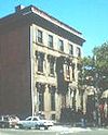 |
1346 North Broad St. 39°58′28"N 75°9′33"W |
Cabot | ||
| 104 | Philadelphia Wholesales Drug Company Building | 513–525 North Tenth St. 39°57′41"N 75°9′21"W |
Callowhill Callowhill, Philadelphia, Pennsylvania Callowhill is a neighborhood in Philadelphia, Pennsylvania, USA. It is roughly located in the vicinity of Callowhill Street, between Vine Street, Spring Garden Street, Broad Street, and 8th Street. It is named for Hannah Callowhill Penn, William Penn's second wife... |
|||
| 105 | Plaza Apartments | 1719–1725 North 33rd St., 3226–3228 Clifford St. 39°58′59"N 75°11′18"W |
Strawberry Mansion Strawberry Mansion, Philadelphia, Pennsylvania Strawberry Mansion is a neighborhood in the United States city of Philadelphia, Pennsylvania, located east of Fairmount Park in North Philadelphia. It has a large and predominantly African-American population. The neighborhood is bounded by 33rd Street in the west, 29th Street in the east, Lehigh... |
|||
| 106 | Edgar Allan Poe House, National Historic Site Edgar Allan Poe National Historic Site The Edgar Allan Poe National Historic Site is a preserved home once rented by American author Edgar Allan Poe, located in the Spring Garden neighborhood of Philadelphia, Pennsylvania... |
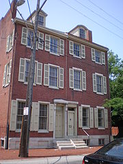 |
530–532 North Seventh St. 39°57′43.3"N 75°8′59.5"W |
Callowhill Callowhill, Philadelphia, Pennsylvania Callowhill is a neighborhood in Philadelphia, Pennsylvania, USA. It is roughly located in the vicinity of Callowhill Street, between Vine Street, Spring Garden Street, Broad Street, and 8th Street. It is named for Hannah Callowhill Penn, William Penn's second wife... |
||
| 107 | Randolph House Randolph House (Philadelphia, Pennsylvania) The Randolph House, is located in Philadelphia, Pennsylvania. The house was built in 1750 and was added to the National Register of Historic Places on March 24, 1972.... |
Edgeley Drive 39°59′29"N 75°11′41.5"W |
Fairmount Park Fairmount Park Fairmount Park is the municipal park system of Philadelphia, Pennsylvania. It consists of 63 parks, with , all overseen by the Philadelphia Department of Parks and Recreation, successor to the Fairmount Park Commission in 2010.-Fairmount Park proper:... |
|||
| 108 | Reading Company Grain Elevator Reading Company Grain Elevator The Reading Company Grain Elevatior was built as a grain elevator in 1925 by the Reading Railroad in Center City Philadelphia to replace an elevator that had operated on the same spot since the Civil War... |
411 North 20th St. 39°57′41"N 75°10′16"W |
Franklintown Franklintown, Philadelphia, Pennsylvania Franklintown is the name given to the area in Philadelphia, Pennsylvania that lies north of the Vine Street Expressway, south of Spring Garden Street, and west of Broad Street. It is sometimes considered to be the southernmost part of the Spring Garden neighborhood. Franklintown consists of mostly... |
|||
| 109 | Gen. John F. Reynolds School | 2300 Jefferson St. 39°58′41"N 75°10′28.5"W |
North Central North Central, Philadelphia, Pennsylvania North Central is an area in the North Philadelphia section of Philadelphia, Pennsylvania, United States. The name of the area is derived from its location, near the center of North Philadelphia. According to Census 2010 North Central is primarily a low-income neighborhood where 60% of its residents... |
|||
| 110 | Ridge Avenue Farmers' Market | 1810 Ridge Ave. 39°58′19"N 75°9′59"W |
Francisville Francisville, Philadelphia, Pennsylvania Francisville is a neighborhood in North Philadelphia, which is a section of the city of Philadelphia, Pennsylvania. Its boundaries are Fairmount Avenue to the south, Girard Avenue to the north, Broad Street to the east, and Corinthian Avenue to the west. In 2000, it had a population of about 4,500... |
|||
| 111 | Rodeph Shalom Synagogue Rodeph Shalom Synagogue Rodeph Shalom Synagogue is a historic synagogue at 607-615 N. Broad Street in Philadelphia, Pennsylvania.It was built in 1928 and added to the National Register in 2007.-References:... |
607–615 North Broad St. 39°57′50"N 75°9′39"W |
Poplar Poplar, Philadelphia, Pennsylvania Poplar is a neighborhood in North Philadelphia. It is located north of Chinatown, between Spring Garden and Northern Liberties, bound roughly by Girard Avenue to the north, North Broad Street to the West, Spring Garden Street to the south, and 5th Street to the east... |
|||
| 112 | William Rowen School | 6801 North 19th St. 40°3′31"N 75°8′55"W |
West Oak Lane West Oak Lane, Philadelphia, Pennsylvania West Oak Lane is a neighborhood in the Northwest Philadelphia section of Philadelphia. It is located between East Mount Airy, East Germantown, Cheltenham, Montgomery County, East Oak Lane, and Fern Rock. Ogontz Avenue runs generally north, then northwest as the spine of the neighborhood and the... |
|||
| 113 | St. John's Church St. John's Church, Philadelphia St. John's Church is a historic church at 220-230 Brown Street in Philadelphia, Pennsylvania.It was built in 1815 and added to the National Register in 1983.-References:... |
220–230 Brown St. 39°57′47"N 75°8′32"W |
Northern Liberties Northern Liberties, Philadelphia, Pennsylvania -Boundaries:Northern Liberties is located north of Center City and is bordered by Girard Avenue to the north; Callowhill Street to the south; North 6th Street to the west; and the Delaware River to the east... |
|||
| 114 | St. Joseph's House for Homeless Industrious Boys St. Joseph's House for Homeless Industrious Boys St. Joseph's House for Homeless Industrious Boys is a historic charity building at 1511 and 1515-1527 West Allegheny Avenue in Philadelphia, Pennsylvania.It was built in 1929 and added to the National Register in 1996.-References:... |
1511 and 1515–1527 Allegheny Ave. 40°0′8"N 75°9′20"W |
Nicetown–Tioga Nicetown-Tioga, Philadelphia, Pennsylvania Nicetown-Tioga is a neighborhood in the North Philadelphia section of the city of Philadelphia, in the U.S. state of Pennsylvania. It comprises two smaller, older neighborhoods, Nicetown and Tioga, although the distinction between the two is rarely emphasized today... |
|||
| 115 | Frank C. Scherer Wagon Works | 801 North 27th St. 39°58′14"N 75°10′52"W |
Fairmount Fairmount, Philadelphia, Pennsylvania Fairmount is a United States neighborhood in the North Philadelphia area of Philadelphia, Pennsylvania. The name "Fairmount" itself derives from the prominent hill on which the Philadelphia Museum of Art now sits, and where William Penn originally intended to build his own manor house... |
|||
| 116 | Smaltz Building | 315 North 12th St. 39°57′29.5"N 75°9′29"W |
Callowhill Callowhill, Philadelphia, Pennsylvania Callowhill is a neighborhood in Philadelphia, Pennsylvania, USA. It is roughly located in the vicinity of Callowhill Street, between Vine Street, Spring Garden Street, Broad Street, and 8th Street. It is named for Hannah Callowhill Penn, William Penn's second wife... |
|||
| 117 | Snellenburg's Clothing Factory | 642 North Broad St. 39°57′56"N 75°9′40"W |
Spring Garden Spring Garden, Philadelphia, Pennsylvania Spring Garden is a neighborhood in the central Philadelphia, Pennsylvania, USA, bordering Center City on the north. Spring Garden is a neighborhood that combines diverse residential neighborhoods and significant cultural attractions... |
|||
| 118 | George W. South Memorial Protestant Episcopal Church of the Advocate Church of the Advocate The George W. South Memorial Church of the Advocate, also known as the George W. South Memorial Protestant Episcopal Church, is a historic church in Philadelphia, Pennsylvania.... |
 |
18th and Diamond Sts. 39°59′9"N 75°9′49"W |
North Central North Central, Philadelphia, Pennsylvania North Central is an area in the North Philadelphia section of Philadelphia, Pennsylvania, United States. The name of the area is derived from its location, near the center of North Philadelphia. According to Census 2010 North Central is primarily a low-income neighborhood where 60% of its residents... |
Charles Marquedant Burns, architect (1887-97). | |
| 119 | Special Troops Armory | 5350 Ogontz Ave. 40°2′7.5"N 75°9′3"W |
Ogontz Ogontz, Philadelphia, Pennsylvania Ogontz is a neighborhood in the North Philadelphia section of Philadelphia, Pennsylvania, United States that borders suburban Cheltenham Township, Montgomery County.... |
|||
| 120 | Spring Garden District Spring Garden, Philadelphia, Pennsylvania Spring Garden is a neighborhood in the central Philadelphia, Pennsylvania, USA, bordering Center City on the north. Spring Garden is a neighborhood that combines diverse residential neighborhoods and significant cultural attractions... |
Roughly bounded by Fairmount Ave. and 15th, 24th, Mount Vernon, and Spring Garden Sts.; also Fairmount Ave. and Mt. Vernon, 15th, and 19th Sts. 39°57′58"N 75°10′11"W |
Spring Garden Spring Garden, Philadelphia, Pennsylvania Spring Garden is a neighborhood in the central Philadelphia, Pennsylvania, USA, bordering Center City on the north. Spring Garden is a neighborhood that combines diverse residential neighborhoods and significant cultural attractions... |
Second set of boundaries represents a boundary increase of | ||
| 122 | Spring Garden School No. 1 | 12th and Ogden Sts. 39°58′6.5"N 75°9′21"W |
Poplar Poplar, Philadelphia, Pennsylvania Poplar is a neighborhood in North Philadelphia. It is located north of Chinatown, between Spring Garden and Northern Liberties, bound roughly by Girard Avenue to the north, North Broad Street to the West, Spring Garden Street to the south, and 5th Street to the east... |
|||
| 122 | Spring Garden School No. 2 | 12th and Melon Sts. 39°57′54"N 75°9′22"W |
Poplar Poplar, Philadelphia, Pennsylvania Poplar is a neighborhood in North Philadelphia. It is located north of Chinatown, between Spring Garden and Northern Liberties, bound roughly by Girard Avenue to the north, North Broad Street to the West, Spring Garden Street to the south, and 5th Street to the east... |
|||
| 123 | Steel Heddle Manufacturing Company Complex | 2100 West Allegheny Ave. 40°0′10"N 75°9′54"W |
Allegheny West Allegheny West, Philadelphia, Pennsylvania Allegheny West is a neighborhood in the North Philadelphia section of Philadelphia. It is named after an association formed by Pep Boys and Tasty Baking Company, among others, and the community bordering East Falls, Strawberry Mansion and Germantown... |
|||
| 124 | Stenton Stenton (mansion) Stenton, also known as the James Logan Home, was the country home of James Logan, colonial Mayor of Philadelphia and Chief Justice of the Pennsylvania Supreme Court.... |
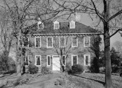 |
18th and Courtland Streets 40°1′29"N 75°9′13"W |
Logan Logan, Philadelphia, Pennsylvania Logan is a neighborhood in the upper North Philadelphia section of the city of Philadelphia, in the U.S. state of Pennsylvania. Philadelphians usually define Logan as being bounded by Wingohocking Street to the south, Olney Avenue to the north, Broad Street to the east, and to 16th Street to the... |
||
| 125 | Thaddeus Stevens School of Observation | 1301 Spring Garden St. 39°57′45.5"N 75°9′37"W |
Poplar Poplar, Philadelphia, Pennsylvania Poplar is a neighborhood in North Philadelphia. It is located north of Chinatown, between Spring Garden and Northern Liberties, bound roughly by Girard Avenue to the north, North Broad Street to the West, Spring Garden Street to the south, and 5th Street to the east... |
|||
| 126 | Suffolk Manor Apartments | 1414–1450 Clearview St. 40°2′26"N 75°8′45"W |
Ogontz Ogontz, Philadelphia, Pennsylvania Ogontz is a neighborhood in the North Philadelphia section of Philadelphia, Pennsylvania, United States that borders suburban Cheltenham Township, Montgomery County.... |
|||
| 127 | Henry O. Tanner House Henry O. Tanner House The Henry O. Tanner House is a boyhood home of Henry Ossawa Tanner, who, as an expatriate in Europe, was a successful painter. He studied under Thomas Eakins in Philadelphia. He was one of the most successful African American artists of his day... |
.jpg) |
2908 West Diamond St. 39°59′16"N 75°10′52"W |
Strawberry Mansion Strawberry Mansion, Philadelphia, Pennsylvania Strawberry Mansion is a neighborhood in the United States city of Philadelphia, Pennsylvania, located east of Fairmount Park in North Philadelphia. It has a large and predominantly African-American population. The neighborhood is bounded by 33rd Street in the west, 29th Street in the east, Lehigh... |
||
| 128 | Tasty Baking Company Building Tastykake Tastykake is the brandname for a line of snack foods manufactured by the Tasty Baking Company, currently headquartered at the Philadelphia Naval Business Center in Philadelphia, Pennsylvania. Established in 1914 by Philip J. Baur and Herbert T... |
2801 West Hunting Park Avenue 40°0′25.5"N 75°10′31"W |
Hunting Park Industrial Area | |||
| 129 | Bayard Taylor School | 3614–3630 North Randolph St. 40°0′25.5"N 75°8′17.5"W |
Hunting Park Hunting Park, Philadelphia, Pennsylvania Hunting Park is a neighborhood in the North Philadelphia section of the United States city of Philadelphia, Pennsylvania. Like many North Philadelphia neighborhoods, it grew mainly in the 1920s and 1940s. The neighborhood's namesake is large park which is a regular location for recreation for many... |
|||
| 130 | Terminal Commerce Building | 401 North Broad St. 39°57′35.5"N 75°9′41.5"W |
Callowhill Callowhill, Philadelphia, Pennsylvania Callowhill is a neighborhood in Philadelphia, Pennsylvania, USA. It is roughly located in the vicinity of Callowhill Street, between Vine Street, Spring Garden Street, Broad Street, and 8th Street. It is named for Hannah Callowhill Penn, William Penn's second wife... |
|||
| 131 | Thirty-third Street Bridge in Philadelphia Thirty-third Street Bridge in Philadelphia The Thirty-third Street Bridge in Philadelphia carries Thirty-third Street over the former course of Master Street in the Brewerytown section of North Philadelphia, near Fairmount Park. The bridge was built in 1901 with an unusual skewed arch, and listed on the National Register of Historic Places... |
33rd St. above Master St. 39°58′42.5"N 75°11′22.5"W |
Brewerytown Brewerytown, Philadelphia, Pennsylvania Brewerytown is a neighborhood in the North Philadelphia district of the city of Philadelphia, Pennsylvania, United States. An unofficial region, Brewerytown runs approximately between the Schuylkill River's eastern bank and 25th Street, bounded by Cecil B. Moore Avenue to the north and Parrish... |
|||
| 132 | Union Methodist Episcopal Church | 2019 West Diamond St. 39°59′10.5"N 75°10′1"W |
North Central North Central, Philadelphia, Pennsylvania North Central is an area in the North Philadelphia section of Philadelphia, Pennsylvania, United States. The name of the area is derived from its location, near the center of North Philadelphia. According to Census 2010 North Central is primarily a low-income neighborhood where 60% of its residents... |
|||
| 133 | Uptown Theater and Office Building Uptown Theater (Philadelphia, Pennsylvania) The Uptown Theater in Philadelphia, Pennsylvania, also known as Uptown Theater and Office Building, is an Art Deco building built in 1927. The Uptown Theater is located on 2240 N. Broad Street. It became a major venue on the chitlin circuit, from 1951-1978. It was listed on the National Register... |
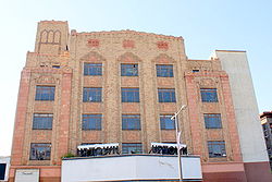 |
2240–2248 North Broad St. 39°59′14.5"N 75°9′22"W |
Templetown Templetown, Philadelphia, Pennsylvania Templetown is a neighborhood in the North Philadelphia section of the city of Philadelphia, Pennsylvania, United States. The district is loosely arranged around the main campus of Temple University, hence the name 'Temple' town. Until recently, the area was primarily a slum, but is now rapidly... |
Magaziner, Eberhard & Harris, architects (1929). | |
| 134 | Roberts Vaux Junior High School | 2300–2344 West Master St. 39°58′34.5"N 75°10′27"W |
North Central North Central, Philadelphia, Pennsylvania North Central is an area in the North Philadelphia section of Philadelphia, Pennsylvania, United States. The name of the area is derived from its location, near the center of North Philadelphia. According to Census 2010 North Central is primarily a low-income neighborhood where 60% of its residents... |
|||
| 135 | Wagner Free Institute of Science Wagner Free Institute of Science The Wagner Free Institute of Science is a natural history museum located in Philadelphia, Pennsylvania. It was founded in 1855 by William Wagner, a notable merchant, philanthropist, and gentleman scientist of the time, who sought to offer free educational courses to all who would seek to learn... |
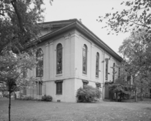 |
17th St. and Montgomery Ave. 39°58′50"N 75°9′46"W |
North Central North Central, Philadelphia, Pennsylvania North Central is an area in the North Philadelphia section of Philadelphia, Pennsylvania, United States. The name of the area is derived from its location, near the center of North Philadelphia. According to Census 2010 North Central is primarily a low-income neighborhood where 60% of its residents... |
John McArthur, Jr. John McArthur, Jr. John McArthur Jr was a prominent American architect practicing from Philadelphia, Pennsylvania. Designer of some of the city's most ambitious buildings of the Civil War era, few of his works survive... , architect (1859-65). |
|
| 136 | Gen. Louis Wagner Junior High School | 17th St. and Chelten Ave. 40°3′6"N 75°8′52"W |
West Oak Lane West Oak Lane, Philadelphia, Pennsylvania West Oak Lane is a neighborhood in the Northwest Philadelphia section of Philadelphia. It is located between East Mount Airy, East Germantown, Cheltenham, Montgomery County, East Oak Lane, and Fern Rock. Ogontz Avenue runs generally north, then northwest as the spine of the neighborhood and the... |
|||
| 137 | Rudolph Walton School | 2601–2631 North 28th St. 39°59′43"N 75°10′36"W |
Strawberry Mansion Strawberry Mansion, Philadelphia, Pennsylvania Strawberry Mansion is a neighborhood in the United States city of Philadelphia, Pennsylvania, located east of Fairmount Park in North Philadelphia. It has a large and predominantly African-American population. The neighborhood is bounded by 33rd Street in the west, 29th Street in the east, Lehigh... |
|||
| 138 | West Diamond Street Townhouse Historic District | 3008–3146, 3011–3215 Diamond St. 39°59′18"N 75°11′2"W |
Strawberry Mansion Strawberry Mansion, Philadelphia, Pennsylvania Strawberry Mansion is a neighborhood in the United States city of Philadelphia, Pennsylvania, located east of Fairmount Park in North Philadelphia. It has a large and predominantly African-American population. The neighborhood is bounded by 33rd Street in the west, 29th Street in the east, Lehigh... |
|||
| 139 | John Greenleaf Whittier School | 2600 Clearfield St. 40°0′9"N 75°10′26"W |
Allegheny West Allegheny West, Philadelphia, Pennsylvania Allegheny West is a neighborhood in the North Philadelphia section of Philadelphia. It is named after an association formed by Pep Boys and Tasty Baking Company, among others, and the community bordering East Falls, Strawberry Mansion and Germantown... |
|||
| 140 | Wills Hospital | 1601 Spring Garden St. 39°57′47.5"N 75°9′54"W |
Spring Garden Spring Garden, Philadelphia, Pennsylvania Spring Garden is a neighborhood in the central Philadelphia, Pennsylvania, USA, bordering Center City on the north. Spring Garden is a neighborhood that combines diverse residential neighborhoods and significant cultural attractions... |
John T. Windrim John T. Windrim John Torrey Windrim was an American architect.He trained in the office of his father, architect James H. Windrim. He was elected to the Philadelphia Chapter of the American Institute of Architects in 1901, and became a Fellow of the Institute in 1926... , architect (1931-32). |
||
| 141 | Mary Channing Wister School | 843–855 North 8th St. 39°58′1"N 75°9′2"W |
Poplar Poplar, Philadelphia, Pennsylvania Poplar is a neighborhood in North Philadelphia. It is located north of Chinatown, between Spring Garden and Northern Liberties, bound roughly by Girard Avenue to the north, North Broad Street to the West, Spring Garden Street to the south, and 5th Street to the east... |
|||
| 142 | Woodford Woodford (mansion) Woodford is a historic mansion in Philadelphia, Pennsylvania.Built in 1756, Woodford is the first of the great, opulent, late-Georgian mansions to be erected in the Philadelphia area... |
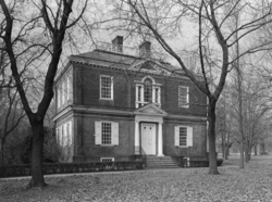 |
Dauphin and 33rd Sts. 39°59′33"N 75°11′18"W |
Fairmount Park Fairmount Park Fairmount Park is the municipal park system of Philadelphia, Pennsylvania. It consists of 63 parks, with , all overseen by the Philadelphia Department of Parks and Recreation, successor to the Fairmount Park Commission in 2010.-Fairmount Park proper:... |
||
| 143 | Richardson L. Wright School Richardson L. Wright School The Richardson L. Wright School was a school in the Nicetown-Tioga neighborhood in northern Philadelphia, Pennsylvania, designed by Lloyd Titus, the Chief Draftsman, from 1901-1905, of the Department of Buildings of the Philadelphia School Board. He was the last non-architect to serve in the... |
1101 Venango St. 40°0′25"N 75°8′46"W |
Nicetown–Tioga Nicetown-Tioga, Philadelphia, Pennsylvania Nicetown-Tioga is a neighborhood in the North Philadelphia section of the city of Philadelphia, in the U.S. state of Pennsylvania. It comprises two smaller, older neighborhoods, Nicetown and Tioga, although the distinction between the two is rarely emphasized today... |
Lloyd Titus, architect. Built 1905. Destroyed before 2008. |
Former listings
| Landmark name | Image | Date delisted | Location | City or Town | Summary | |
|---|---|---|---|---|---|---|
| 1 | P.A.B. Widener Mansion | 1200 North Broad St. 39°58′20"N 75°9′33"W |
Yorktown Yorktown, Philadelphia, Pennsylvania Yorktown is a neighborhood in North Philadelphia. It is located north of Poplar and west of Ludlow.... |
Willis G. Hale Willis G. Hale Willis Gaylord Hale was a late-19th century architect who worked primarily in Philadelphia, Pennsylvania... , architect. Demolished after 1980 fire. |
||
| 2 | William J. Stokely School | 1844–1860 North 32nd St. 39°59′7"N 75°11′11"W |
Strawberry Mansion Strawberry Mansion, Philadelphia, Pennsylvania Strawberry Mansion is a neighborhood in the United States city of Philadelphia, Pennsylvania, located east of Fairmount Park in North Philadelphia. It has a large and predominantly African-American population. The neighborhood is bounded by 33rd Street in the west, 29th Street in the east, Lehigh... |
Listed December 4, 1986 |
See also
- List of National Historic Landmarks in Philadelphia
- National Register of Historic Places listings in Philadelphia, PennsylvaniaNational Register of Historic Places listings in Philadelphia, PennsylvaniaThis is a list of the National Register of Historic Places listings in Philadelphia, Pennsylvania. There are 532 properties and districts listed on the National Register in Philadelphia, including 67 National Historic Landmarks....

