National Register of Historic Places listings in Williamsburg, Virginia
Encyclopedia
This list includes properties and districts listed on the National Register of Historic Places
in the independent city
of Williamsburg, Virginia
. Click the "Map of all coordinates" link to the right to view a Google map of all properties and districts with latitude and longitude coordinates in the table below.
National Register of Historic Places
The National Register of Historic Places is the United States government's official list of districts, sites, buildings, structures, and objects deemed worthy of preservation...
in the independent city
Independent city
An independent city is a city that does not form part of another general-purpose local government entity. These type of cities should not be confused with city-states , which are fully sovereign cities that are not part of any other sovereign state.-Historical precursors:In the Holy Roman Empire,...
of Williamsburg, Virginia
Williamsburg, Virginia
Williamsburg is an independent city located on the Virginia Peninsula in the Hampton Roads metropolitan area of Virginia, USA. As of the 2010 Census, the city had an estimated population of 14,068. It is bordered by James City County and York County, and is an independent city...
. Click the "Map of all coordinates" link to the right to view a Google map of all properties and districts with latitude and longitude coordinates in the table below.
| Landmark name | Image | Date listed | Location | Summary | |
|---|---|---|---|---|---|
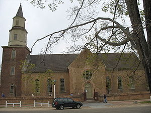
| 1 | Bruton Parish Church Bruton Parish Church Bruton Parish Church is located in the restored area of Colonial Williamsburg in Williamsburg, Virginia, USA. It was established in 1674 in the Virginia Colony, and remains an active Episcopal parish.-History of Bruton Parish Church:... |
 |
Duke of Gloucester St. 37°16′16"N 76°42′10"W |
||
| 2 | Chandler Court and Pollard Park Historic District | Roughly bounded by Jamestown Rd., Griffin Ave., Pollard Park, and College of William and Mary Maintenance Yard 37°16′4"N 76°42′36"W |
|||
| 3 | College Landing | Address Restricted | |||
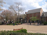
| 4 | Merchants Square and Resort Historic District Merchants Square Merchants Square is an 18th-century style retail village in Colonial Williamsburg, Virginia, USA.-History:Conceived in 1927 by John D. Rockefeller, Jr. and Reverend W. A. R. Goodwin , Merchants Square is considered to be one of the first planned shopping districts in the United States, if not the... |
 |
Boundary St., Duke of Gloucester St., S. England St., Francis St., Henry St. Prince George St. 37°16′14"N 76°42′6"W |
||
| 5 | Peyton Randolph House Peyton Randolph House Peyton Randolph House, also known as Randolph-Peachy House, is a home in Williamsburg, Virginia. It was the home of Peyton Randolph , first President of the Continental Congress. It is located within what is now known as Colonial Williamsburg.It was declared a National Historic Landmark in... |
 |
Corner of Nicholson and N. England Sts. 37°16′19"N 76°42′0"W |
||
| 6 | James Semple House James Semple House The James Semple House is a historic home within what is now known as Colonial Williamsburg in Williamsburg, Virginia. Its design is attributed to Thomas Jefferson and it was built in 1770.Future U.S... |
.jpg) |
S side of Frances St. between Blair and Walker Sts. 37°16′12"N 76°41′36"W |
||
| 7 | Matthew Whaley School Matthew Whaley School Matthew Whaley School is a historic school building located in Williamsburg, Virginia. The Georgian Revival structure was built between 1929 and 1930 based on a design by noted Virginia architect Charles M. Robinson... |
301 Scotland St. 37°16′34"N 76°42′16"W |
|||
| 8 | Williamsburg Historic District Colonial Williamsburg Colonial Williamsburg is the private foundation representing the historic district of the city of Williamsburg, Virginia, USA. The district includes buildings dating from 1699 to 1780 which made colonial Virginia's capital. The capital straddled the boundary of the original shires of Virginia —... |
 |
Bounded by Francis, Waller, Nicholson, N. England, Lafayette, and Nassau Sts. 37°15′45"N 76°41′59"W |
||
| 9 | Williamsburg Inn | 136 E. Francis St. 37°16′8"N 76°41′52"W |
|||
| 10 | Wren Building, College of William and Mary Wren Building The Wren Building is the signature building of the College of William and Mary in Williamsburg, Virginia, USA. Along with the Brafferton and President's House, these buildings form the College's Historic Campus.... |
 |
College of William and Mary campus 37°16′15"N 76°42′33"W |
||
| 11 | Wythe House Wythe House Wythe House was the Williamsburg, Virginia home of George Wythe, signer of the Declaration of Independence and father of American jurisprudence. It is located in what is now Colonial Williamsburg, on Palace Green, adjacent to Bruton Parish Church... |
 |
W side of the Palace Green 37°16′18"N 76°42′12"W |
See also
- National Register of Historic Places listings in VirginiaNational Register of Historic Places listings in VirginiaBuildings, sites, districts, and objects in Virginia listed on the National Register of Historic Places:As of November 25, 2011, there are 2,768 properties and districts listed on the National Register of Historic Places in all 95 Virginia counties and 36 of 39 independent cities, including 119...
- National Register of Historic Places listings in James City County, Virginia
- List of National Historic Landmarks in Virginia

