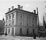
List of National Historic Landmarks in Virginia
Encyclopedia
This is a list of National Historic Landmarks in Virginia. There are presently 120 current National Historic Landmarks (NHLs)
, 1 former NHL, and 13 historic sites that are National Historical Parks or other areas in the National Park Service
system.
s (NHLs) are widely distributed across Virginia's 95 counties and 39 independent cities.
and the Maggie L. Walker National Historic Site
are also NHLs and are listed above. The remaining 11 are:
National Historic Landmark
A National Historic Landmark is a building, site, structure, object, or district, that is officially recognized by the United States government for its historical significance...
, 1 former NHL, and 13 historic sites that are National Historical Parks or other areas in the National Park Service
National Park Service
The National Park Service is the U.S. federal agency that manages all national parks, many national monuments, and other conservation and historical properties with various title designations...
system.
Current NHLs
The National Historic LandmarkNational Historic Landmark
A National Historic Landmark is a building, site, structure, object, or district, that is officially recognized by the United States government for its historical significance...
s (NHLs) are widely distributed across Virginia's 95 counties and 39 independent cities.
| Landmark name | Image | Date designated | Locality | County | Description | |
|---|---|---|---|---|---|---|
| Alexandria Historic District Alexandria Historic District Alexandria Historic District is a historic district in Alexandria, Virginia. It is noted for its "outstanding" Federal-style buildings, although other late 18th- and 19th-century architecture is represented.... |
.jpg) |
Alexandria Alexandria, Virginia Alexandria is an independent city in the Commonwealth of Virginia. As of 2009, the city had a total population of 139,966. Located along the Western bank of the Potomac River, Alexandria is approximately six miles south of downtown Washington, D.C.Like the rest of northern Virginia, as well as... 38.803333°N 77.046389°W |
Alexandria (independent city) Alexandria, Virginia Alexandria is an independent city in the Commonwealth of Virginia. As of 2009, the city had a total population of 139,966. Located along the Western bank of the Potomac River, Alexandria is approximately six miles south of downtown Washington, D.C.Like the rest of northern Virginia, as well as... |
Comprises the central portion of Alexandria, Virginia Alexandria, Virginia Alexandria is an independent city in the Commonwealth of Virginia. As of 2009, the city had a total population of 139,966. Located along the Western bank of the Potomac River, Alexandria is approximately six miles south of downtown Washington, D.C.Like the rest of northern Virginia, as well as... |
||
| Aquia Church Aquia Church Aquia Church , in Stafford, Virginia, USA, is an Episcopal church that has been designated a National Historic Landmark since 1991. It maintains an active congregation with a variety of programs and outreach to the community.... |
.jpg) |
Garrisonville Garrisonville, Virginia Garrisonville is an unincorporated community in Stafford County in the U.S. state of Virginia. Garrisonville is located south of the Marine Corps Base Quantico.- External links :*... |
Stafford Stafford County, Virginia Stafford County is a county located in the Commonwealth of Virginia, a U.S. state, and just across the Rappahannock River from the City of Fredericksburg. As of the 2000 census, the population was 92,446, increasing to 128,961 in 2010.. Its county seat is Stafford. In 2006, and again in 2009,... |
Mid-18th century church | ||
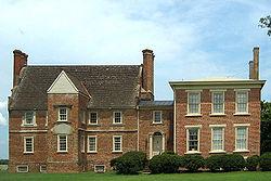
| Bacon's Castle Bacon's Castle Bacon's Castle, also variously known as "Allen's Brick House" or the "Arthur Allen House" is located in Surry County, Virginia, USA, and is one of the oldest dateable brick buildings in Virginia.... |
 |
Bacon's Castle 37°06′38"N 76°43′41"W |
Surry Surry County, Virginia As of the census of 2010, there were 7,058 people, 2,619 households, and 1,917 families residing in the county. The population density was 24 people per square mile . There were 3,294 housing units at an average density of 12 per square mile... |
One of the oldest brick buildings in Virginia | ||
| Ball's Bluff Battlefield and National Cemetery Ball's Bluff Battlefield and National Cemetery Ball's Bluff Battlefield Regional Park and National Cemetery is a battlefield area and an United States National Cemetery, located northeast of Leesburg, Virginia. The cemetery is the third smallest national cemetery in the United States... |
 |
Leesburg Leesburg, Virginia Leesburg is a historic town in, and county seat of, Loudoun County, Virginia, United States of America. Leesburg is located west-northwest of Washington, D.C. along the base of the Catoctin Mountain and adjacent to the Potomac River. Its population according the 2010 Census is 42,616... |
Loudoun Loudoun County, Virginia Loudoun County is a county located in the Commonwealth of Virginia, and is part of the Washington Metropolitan Area. As of the 2010 U.S. Census, the county is estimated to be home to 312,311 people, an 84 percent increase over the 2000 figure of 169,599. That increase makes the county the fourth... |
Site of an embarrassing Union defeat early in the American Civil War American Civil War The American Civil War was a civil war fought in the United States of America. In response to the election of Abraham Lincoln as President of the United States, 11 southern slave states declared their secession from the United States and formed the Confederate States of America ; the other 25... , caused by inept generalship, after which drowned troops' bodies floated down the Potomac River Potomac River The Potomac River flows into the Chesapeake Bay, located along the mid-Atlantic coast of the United States. The river is approximately long, with a drainage area of about 14,700 square miles... to Washington, D.C. |
||
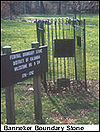
| Banneker (Benjamin) SW-9 Intermediate Boundary Stone Benjamin Banneker: SW-9 Intermediate Boundary Stone Benjamin Banneker: SW 9 Intermediate Boundary Stone, also known as Intermediate Stone of the District of Columbia, is a surveyors' boundary marker stone... |
 |
Arlington 38.8901229289°N 77.1594625585°W |
Arlington Arlington County, Virginia Arlington County is a county in the Commonwealth of Virginia. The land that became Arlington was originally donated by Virginia to the United States government to form part of the new federal capital district. On February 27, 1801, the United States Congress organized the area as a subdivision of... |
A boundary stone associated with Benjamin Banneker Benjamin Banneker Benjamin Banneker was a free African American astronomer, mathematician, surveyor, almanac author and farmer.-Family history and early life:It is difficult to verify much of Benjamin Banneker's family history... , (1731-1806), an African American African American African Americans are citizens or residents of the United States who have at least partial ancestry from any of the native populations of Sub-Saharan Africa and are the direct descendants of enslaved Africans within the boundaries of the present United States... surveyor, mathematician and astronomer who assisted Andrew Ellicott Andrew Ellicott Andrew Ellicott was a U.S. surveyor who helped map many of the territories west of the Appalachians, surveyed the boundaries of the District of Columbia, continued and completed Pierre Charles L'Enfant's work on the plan for Washington, D.C., and served as a teacher in survey methods for... during the first two month's of Ellicott's 1791-1792 survey of the boundaries of the original District of Columbia. |
||
| Barracks, Virginia Military Institute Barracks, Virginia Military Institute Barracks, Virginia Military Institute, also known as Old Barracks is a historic building still in use on the campus of the Virginia Military Institute in Lexington, Virginia. They were designed by architect Alexander Jackson Davis and built in 1848.... |
.jpg) |
Lexington Lexington, Virginia Lexington is an independent city within the confines of Rockbridge County in the Commonwealth of Virginia. The population was 7,042 in 2010. Lexington is about 55 minutes east of the West Virginia border and is about 50 miles north of Roanoke, Virginia. It was first settled in 1777.It is home to... 37.790278°N 79.438611°W |
Lexington (independent city) Lexington, Virginia Lexington is an independent city within the confines of Rockbridge County in the Commonwealth of Virginia. The population was 7,042 in 2010. Lexington is about 55 minutes east of the West Virginia border and is about 50 miles north of Roanoke, Virginia. It was first settled in 1777.It is home to... |
Gothic style cadet barracks building on the grounds of Virginia Military Institute Virginia Military Institute The Virginia Military Institute , located in Lexington, Virginia, is the oldest state-supported military college and one of six senior military colleges in the United States. Unlike any other military college in the United States—and in keeping with its founding principles—all VMI students are... |
||
| Berkeley Berkeley Plantation Berkeley Plantation, one of the first great estates in America, comprises about on the banks of the James River on State Route 5 in Charles City County, Virginia. Berkeley Plantation was originally called Berkeley Hundred and named after one of its founders of the 1618 land grant, Richard Berkeley... |
 |
Charles City Charles City, Virginia Charles City is a census-designated place in and the county seat of Charles City County, Virginia, United States. The population as of the 2010 Census was 133.... |
Charles City Charles City County, Virginia As of the census of 2000, there were 6,926 people, 2,670 households, and 1,975 families residing in the county. The population density was 38 people per square mile . There were 2,895 housing units at an average density of 16 per square mile... |
One of the great plantations of Virginia, associated with Presidents William Henry Harrison William Henry Harrison William Henry Harrison was the ninth President of the United States , an American military officer and politician, and the first president to die in office. He was 68 years, 23 days old when elected, the oldest president elected until Ronald Reagan in 1980, and last President to be born before the... and Benjamin Harrison Benjamin Harrison Benjamin Harrison was the 23rd President of the United States . Harrison, a grandson of President William Henry Harrison, was born in North Bend, Ohio, and moved to Indianapolis, Indiana at age 21, eventually becoming a prominent politician there... . |
||
| Berry Hill Berry Hill Plantation Berry Hill Plantation, also known simply as Berry Hill, is located in Halifax County, Virginia, USA, near South Boston. It was one of the largest plantations to ever exist in Virginia. The plantation was originally owned by Isaac Coles, and began using black slaves in 1803. In 1814 and 1841, the... |
.jpg) |
South Boston South Boston, Virginia South Boston is a town in Halifax County, Virginia, United States. The population was 8,142 at the 2010 census.- History :On December 8, 1796, the General Assembly authorized eight commissioners to establish at Boyd's Ferry on the south side of the Dan River the town of South Boston, named for... 36.6967315643°N 78.9442251731°W |
Halifax | A Greek Revival plantation mansion, imitating the Parthenon Parthenon The Parthenon is a temple on the Athenian Acropolis, Greece, dedicated to the Greek goddess Athena, whom the people of Athens considered their virgin patron. Its construction began in 447 BC when the Athenian Empire was at the height of its power. It was completed in 438 BC, although... |
||
| Brandon Lower Brandon Plantation Lower Brandon Plantation is located on the south shore of the James River in present-day Prince George County, Virginia.... |
Burrowsville Burrowsville, Virginia Burrowsville is an unincorporated community in Prince George County, Virginia, United States. It is located on James River Drive.It is the location of Brandon Plantation and Upper Brandon Plantations, U.S. National Historic Landmarks, as well as the historic Willow Hill Plantation, and Martin's... 37°15′27.1440"N 76°59′36.2039"W |
Prince George Prince George County, Virginia As of the census of 2000, there were 33,047 people, 10,159 households, and 8,096 families residing in the county. The population density was 124 people per square mile . There were 10,726 housing units at an average density of 40 per square mile... |
Plantation tended from 1614 on, with unusual brick mansion in style of Palladio's "Roman Country House" completed in 1760's | |||
| Bremo Historic District Bremo Historic District Bremo, also known as Bremo Plantation or Bremo Historic District, is a plantation estate covering on the west side of Bremo Bluff in Fluvanna County, Virginia. The large mansion at Upper Bremo is believed to be based on the architectural work of Thomas Jefferson... |
.jpg) |
Bremo Bluff Bremo Bluff, Virginia Bremo Bluff is an unincorporated community located on the northern bank of the James River in Fluvanna County, Virginia, United States. The locale was established by the Cocke family in 1636. During the American Civil War, the family of General Robert E. Lee sought refuge in the community... |
Fluvanna Fluvanna County, Virginia As of 2002, Fluvanna County's population was 20,047. There are 7,387 households, and 5,702 families residing in the county. The population density was 70 people per square mile . There were 8,018 housing units at an average density of 28 per square mile... |
James River plantation with mansion probably designed by Thomas Jefferson Thomas Jefferson Thomas Jefferson was the principal author of the United States Declaration of Independence and the Statute of Virginia for Religious Freedom , the third President of the United States and founder of the University of Virginia... |
||
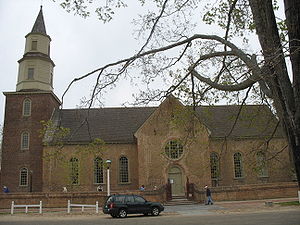
| Bruton Parish Church Bruton Parish Church Bruton Parish Church is located in the restored area of Colonial Williamsburg in Williamsburg, Virginia, USA. It was established in 1674 in the Virginia Colony, and remains an active Episcopal parish.-History of Bruton Parish Church:... |
 |
Williamsburg Williamsburg, Virginia Williamsburg is an independent city located on the Virginia Peninsula in the Hampton Roads metropolitan area of Virginia, USA. As of the 2010 Census, the city had an estimated population of 14,068. It is bordered by James City County and York County, and is an independent city... 37.2692899128°N 76.7027610648°W |
Williamsburg (independent city) Williamsburg, Virginia Williamsburg is an independent city located on the Virginia Peninsula in the Hampton Roads metropolitan area of Virginia, USA. As of the 2010 Census, the city had an estimated population of 14,068. It is bordered by James City County and York County, and is an independent city... |
Earliest church in the British American colonies to reflect the infusion of English Renaissance style. | ||
| Camden Camden (Port Royal, Virginia) Camden is an Italian Villa-style house on the Rappahannock River just downriver of Port Royal, Virginia. It was built during 1857-1859. During the American Civil War, a Union gunboat shot the top off of its tower, which has not been replaced.-Description:... |
.jpg) |
Port Royal Port Royal, Virginia Port Royal is an incorporated town in Caroline County, Virginia, United States. The population was 170 at the 2000 census.Port Royal was established in the mid-17th century in the Colony of Virginia primary as a port on a navigable portion of the Rappahannock River for export of tobacco, Virginia's... |
Caroline Caroline County, Virginia Caroline County is a county located in the Commonwealth of Virginia. As of 2010, the population was 28,545. Its county seat is Bowling Green. Caroline County is also home to The Meadow stables, the birthplace of the renowned racehorse Secretariat, winner of the 1973 Kentucky Derby, Preakness and... |
2-story Italian villa featuring such 19th-century innovations as a central heating system, gas lights, inside toilets, and shower baths. | ||
| Camp Hoover Rapidan Camp Rapidan Camp in Shenandoah National Park in Madison County, Virginia, was built by U.S. President Herbert Hoover and his wife Lou Henry Hoover, and served as their rustic retreat throughout Hoover's administration from 1929 to 1933... |
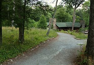 |
Graves Mill Graves Mill, Virginia Graves Mill is an unincorporated community located in Madison County, Virginia, USA.-References:*... 38°29′30.7"N 78°25′15.5"W |
Madison Madison County, Virginia As of the census of 2000, there were 12,520 people, 4,739 households, and 3,521 families residing in the county. The population density was 39 people per square mile . There were 5,239 housing units at an average density of 16 per square mile... |
President Herbert Hoover Herbert Hoover Herbert Clark Hoover was the 31st President of the United States . Hoover was originally a professional mining engineer and author. As the United States Secretary of Commerce in the 1920s under Presidents Warren Harding and Calvin Coolidge, he promoted partnerships between government and business... 's rustic presidential retreat, also known as Rapidan Camp. |
||
| Cape Henry Lighthouse Cape Henry Lighthouse The Cape Henry Lighthouse has long been important for the large amount of ocean-going shipping traffic for the harbors, its rivers, and shipping headed to ports on the Chesapeake Bay. The original lighthouse was the first lighthouse authorized by the U.S. government, dating from 1792... |
 |
Virginia Beach Virginia Beach, Virginia Virginia Beach is an independent city located in the Hampton Roads metropolitan area of Virginia, on the Atlantic Ocean at the mouth of the Chesapeake Bay... 36.9238540822°N 76.0082410227°W |
Virginia Beach (independent city) Virginia Beach, Virginia Virginia Beach is an independent city located in the Hampton Roads metropolitan area of Virginia, on the Atlantic Ocean at the mouth of the Chesapeake Bay... |
First lighthouse to be erected by the Federal Government. | ||
| Carter's Grove Carter's Grove Carter's Grove, also known as Carter's Grove Plantation, is a 750 acre plantation located on the north shore of the James River in the Grove Community of southeastern James City County in the Virginia Peninsula area of the Hampton Roads region of Virginia in the US.The plantation was built for... |
Williamsburg Williamsburg, Virginia Williamsburg is an independent city located on the Virginia Peninsula in the Hampton Roads metropolitan area of Virginia, USA. As of the 2010 Census, the city had an estimated population of 14,068. It is bordered by James City County and York County, and is an independent city... |
James City James City County, Virginia James City County is a county located on the Virginia Peninsula in the Hampton Roads metropolitan area of the Commonwealth of Virginia, a state of the United States. Its population was 67,009 , and it is often associated with Williamsburg, an independent city, and Jamestown which is within the... |
Georgian country house and plantation near Williamsburg, recently closed and sold to a private owner | |||
| Cedar Creek Battlefield and Belle Grove Plantation Cedar Creek and Belle Grove National Historical Park Cedar Creek and Belle Grove National Historical Park became the 388th unit of the United States National Park Service when it was authorized on December 19, 2002... |
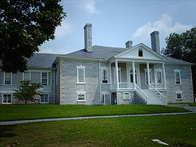 |
Middletown Middletown, Virginia Middletown is a town in Frederick County, Virginia, United States. The population was 1,265 at the 2010 census.- History :Belle Grove Plantation, about a mile southwest of Middletown, was first settled in about 1750 and its historic Federal-style manor house was completed in 1797... and Strasburg Strasburg, Virginia Strasburg is a town in Shenandoah County, Virginia, United States, which was founded in 1761 by Peter Stover. It is the largest town, population-wise, in the county and is known for its pottery, antiques, and Civil War history... 39°10′03"N 78°18′03"W |
Frederick Frederick County, Virginia Frederick County is a county located in the Commonwealth of Virginia. It is included in the Winchester, Virginia-West Virginia Metropolitan Statistical Area. It was formed in 1743 by the splitting of Orange County. For ten years it was the home of George Washington. As of 2010, the population was... and Warren Warren County, Virginia As of the census of 2000, there were 31,584 people, 12,087 households, and 8,521 families residing in the county. The population density was 148 people per square mile . There were 13,299 housing units at an average density of 62 per square mile... |
Site of the American Civil War American Civil War The American Civil War was a civil war fought in the United States of America. In response to the election of Abraham Lincoln as President of the United States, 11 southern slave states declared their secession from the United States and formed the Confederate States of America ; the other 25... battle of Cedar Creek Battle of Cedar Creek The Battle of Cedar Creek, or Battle of Belle Grove, October 19, 1864, was one of the final, and most decisive, battles in the Valley Campaigns of 1864 during the American Civil War. The final Confederate invasion of the North, led by Lt. Gen. Jubal A. Early, was effectively ended... and the Belle Grove Plantation Belle Grove Plantation (Middletown, Virginia) Belle Grove Plantation is a late-18th-century plantation and estate in the northern Shenandoah Valley of Virginia, USA. It is situated in Frederick County, about a mile southwest of Middletown.... . |
||
| Christ Church, Alexandria | 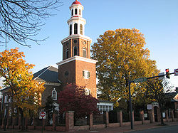 |
Alexandria Alexandria, Virginia Alexandria is an independent city in the Commonwealth of Virginia. As of 2009, the city had a total population of 139,966. Located along the Western bank of the Potomac River, Alexandria is approximately six miles south of downtown Washington, D.C.Like the rest of northern Virginia, as well as... |
Alexandria (independent city) Alexandria, Virginia Alexandria is an independent city in the Commonwealth of Virginia. As of 2009, the city had a total population of 139,966. Located along the Western bank of the Potomac River, Alexandria is approximately six miles south of downtown Washington, D.C.Like the rest of northern Virginia, as well as... |
1773 Georgian brick church | ||
| Christ Church (Lancaster County) Christ Church (Lancaster) Christ Church or Historic Christ Church of Lancaster County, Virginia is an historic Episcopal church. Christ Church is notable for its unique Georgian design... |
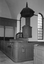 |
Irvington Irvington, Virginia Irvington is a town in Lancaster County, Virginia, United States. The population was 673 at the 2000 census and it is located on a peninsula of land known as the Northern Neck. It is the name also of a historic district.... |
Lancaster Lancaster County, Virginia As of the census of 2000, there were 11,567 people, 5,004 households, and 3,412 families residing in the county. The population density was 87 people per square mile . There were 6,498 housing units at an average density of 49 per square mile... |
Example of British Colonial ecclesiastical architecture. | ||
| City Hall (Richmond) Old City Hall (Richmond, Virginia) Old City Hall, known formerly as City Hall, is the former city hall of Richmond, Virginia that was designed by Elijah E. Myers. It served as City Hall from its completion in 1894 through the 1970s. The building occupies its own city block in downtown Richmond, bounded by 10th and 11th Streets to... |
.jpg) |
Richmond Richmond, Virginia Richmond is the capital of the Commonwealth of Virginia, in the United States. It is an independent city and not part of any county. Richmond is the center of the Richmond Metropolitan Statistical Area and the Greater Richmond area... 37.5378730659°N 77.4330658333°W |
Richmond (independent city) Richmond, Virginia Richmond is the capital of the Commonwealth of Virginia, in the United States. It is an independent city and not part of any county. Richmond is the center of the Richmond Metropolitan Statistical Area and the Greater Richmond area... |
Example of the High Victorian Gothic style. | ||
| Confederate Capitol Virginia State Capitol The Virginia State Capitol is the seat of state government in the Commonwealth of Virginia, located in Richmond, the third capital of Virginia. It houses the oldest legislative body in the United States, the Virginia General Assembly... |
 |
Richmond Richmond, Virginia Richmond is the capital of the Commonwealth of Virginia, in the United States. It is an independent city and not part of any county. Richmond is the center of the Richmond Metropolitan Statistical Area and the Greater Richmond area... 37.5387576°N 77.4335940°W |
Richmond (independent city) Richmond, Virginia Richmond is the capital of the Commonwealth of Virginia, in the United States. It is an independent city and not part of any county. Richmond is the center of the Richmond Metropolitan Statistical Area and the Greater Richmond area... |
From July 1861 to April 1865, the Confederate Congress met here; state capitol before and after the war | ||
| Charles Richard Drew House Charles Richard Drew House Charles Richard Drew House was a home of Afro-American doctor Charles Richard Drew, whose leadership on stockpiling of blood plasma saved lives during World War II.... |
image pending | Arlington 38.872600°N 77.087178°W |
Arlington Arlington County, Virginia Arlington County is a county in the Commonwealth of Virginia. The land that became Arlington was originally donated by Virginia to the United States government to form part of the new federal capital district. On February 27, 1801, the United States Congress organized the area as a subdivision of... |
Home of Dr. Charles R. Drew Charles R. Drew Charles Richard Drew was an American physician, surgeon and medical researcher. He researched in the field of blood transfusions, developing improved techniques for blood storage, and applied his expert knowledge to developing large-scale blood banks early in World War II. This allowed medics to... , an African-American physician and researcher whose leadership on stockpiling blood plasma saved lives in World War II World War II World War II, or the Second World War , was a global conflict lasting from 1939 to 1945, involving most of the world's nations—including all of the great powers—eventually forming two opposing military alliances: the Allies and the Axis... |
||
| Drydock Number One, Norfolk Naval Shipyard Drydock Number One, Norfolk Naval Shipyard Drydock Number One, Norfolk Naval Shipyard, also known as Drydock No. 1,is the site where the USS Merrimack was modified to be the Confederate Navy ironclad CSS Virginia. It is now included within the Norfolk Naval Shipyard... |
 |
Portsmouth Portsmouth, Virginia Portsmouth is located in the Hampton Roads metropolitan area of the U.S. Commonwealth of Virginia. As of 2010, the city had a total population of 95,535.The Norfolk Naval Shipyard, often called the Norfolk Navy Yard, is a historic and active U.S... 36.8187230544°N 76.2930630727°W |
Portsmouth (independent city) Portsmouth, Virginia Portsmouth is located in the Hampton Roads metropolitan area of the U.S. Commonwealth of Virginia. As of 2010, the city had a total population of 95,535.The Norfolk Naval Shipyard, often called the Norfolk Navy Yard, is a historic and active U.S... |
Union frigate USS Merrimack USS Merrimack USS Merrimack, or variant spelling USS Merrimac, may be any one of several ships commissioned in the United States Navy and named after the Merrimack River.*USS Merrimack , 1798–1801, later known as the Monticello, sunk off Cape Cod... was rebuilt by the Confederates in this drydock, becoming the ironclad CSS Virginia CSS Virginia CSS Virginia was the first steam-powered ironclad warship of the Confederate States Navy, built during the first year of the American Civil War; she was constructed as a casemate ironclad using the raised and cut down original lower hull and steam engines of the scuttled . Virginia was one of the... . Now part of Norfolk Naval Shipyard Norfolk Naval Shipyard The Norfolk Naval Shipyard, often called the Norfolk Navy Yard and abbreviated as NNSY, is a U.S. Navy facility in Portsmouth, Virginia, for building, remodeling, and repairing the Navy's ships. It's the oldest and largest industrial facility that belongs to the U.S. Navy as well as the most... . |
||
| Egyptian Building Egyptian Building The Egyptian Building is a National Historic Landmark in Richmond, Virginia, built in 1845. It is the first permanent home of the Medical Department of Hampden-Sydney College and now is a part of Virginia Commonwealth University Medical Center. It is located on Shockoe Hill at the 1200 block of E... |
Richmond Richmond, Virginia Richmond is the capital of the Commonwealth of Virginia, in the United States. It is an independent city and not part of any county. Richmond is the center of the Richmond Metropolitan Statistical Area and the Greater Richmond area... 37.5384309593°N 77.4291684125°W |
Richmond (independent city) Richmond, Virginia Richmond is the capital of the Commonwealth of Virginia, in the United States. It is an independent city and not part of any county. Richmond is the center of the Richmond Metropolitan Statistical Area and the Greater Richmond area... |
First permanent home of the Medical Department of Hampden-Sydney College Hampden-Sydney College Hampden–Sydney College is a liberal arts college for men located in Hampden Sydney, Virginia, United States. Founded in 1775, Hampden–Sydney is the oldest private charter college in the Southern U.S., the last college founded before the American Revolution, and one of only three four-year,... |
|||
| Eight-Foot High Speed Tunnel Eight-Foot High Speed Tunnel The Eight-Foot High Speed Tunnel, also known as Eight-Foot Transonic Tunnel, is a wind tunnel at NASA's Langley Research Center in Hampton, Virginia. It is a National Historic Landmark.... |
.jpg) |
Hampton Hampton, Virginia Hampton is an independent city that is not part of any county in Southeast Virginia. Its population is 137,436. As one of the seven major cities that compose the Hampton Roads metropolitan area, it is on the southeastern end of the Virginia Peninsula. Located on the Hampton Roads Beltway, it hosts... 37.0802809507°N 76.3415136105°W |
Hampton (independent city) Hampton, Virginia Hampton is an independent city that is not part of any county in Southeast Virginia. Its population is 137,436. As one of the seven major cities that compose the Hampton Roads metropolitan area, it is on the southeastern end of the Virginia Peninsula. Located on the Hampton Roads Beltway, it hosts... |
Wind tunnel at Langley Research Center Langley Research Center Langley Research Center is the oldest of NASA's field centers, located in Hampton, Virginia, United States. It directly borders Poquoson, Virginia and Langley Air Force Base... . |
||
| Elsing Green Elsing Green Elsing Green Plantation, a National Historic Landmark and wildlife refuge, rests upon nearly along the Pamunkey River in King William County, Virginia, a rural county on the western end of the state’s middle peninsula, approximately northeast of the City of Richmond. The 18th-century plantation,... |
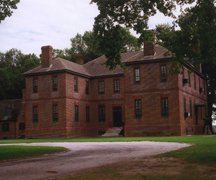 |
Tunstall Tunstall, Virginia Tunstall is an unincorporated community in New Kent County, Virginia, United States.-References:*... |
King William King William County, Virginia As of the census of 2000, there were 13,146 people, 4,846 households, and 3,784 families residing in the county. The population density was 48 people per square mile . There were 5,189 housing units at an average density of 19 per square mile... |
Georgian plantation house built by Carter Braxton Carter Braxton Carter Braxton was a signer of the United States Declaration of Independence, a planter, and a representative of Virginia.... |
||
| Exchange Exchange Building (Petersburg, Virginia) Exchange Building, also known as Merchant's Exchange Building or The Exchange, is a building in Petersburg, Virginia.It was declared a National Historic Landmark in 1971.-External links:*, at Historic American Building Survey... |
.jpg) |
Petersburg Petersburg, Virginia Petersburg is an independent city in Virginia, United States located on the Appomattox River and south of the state capital city of Richmond. The city's population was 32,420 as of 2010, predominantly of African-American ethnicity... 37.2301048298°N 77.4044496954°W |
Petersburg (independent city) Petersburg, Virginia Petersburg is an independent city in Virginia, United States located on the Appomattox River and south of the state capital city of Richmond. The city's population was 32,420 as of 2010, predominantly of African-American ethnicity... |
Two story Greek Revival structure with a Doric Portico. | ||
| Five Forks Battlefield Five Forks Battlefield Five Forks Battlefield is the area where, late in the American Civil War, General Grant's troops broke the extended lines of General Lee's Confederate forces, cutting the last rail line supporting Petersburg, causing the Confederates to abandon that city, and in turn undermining the defense of... |
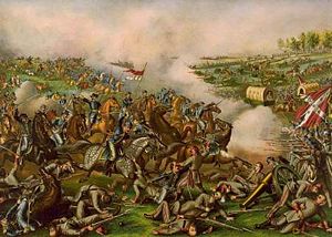 |
Petersburg Petersburg, Virginia Petersburg is an independent city in Virginia, United States located on the Appomattox River and south of the state capital city of Richmond. The city's population was 32,420 as of 2010, predominantly of African-American ethnicity... 37.13927°N 77.62292°W |
Dinwiddie Dinwiddie County, Virginia Dinwiddie County is a county located in the Commonwealth of Virginia. As of 2010, the population was 28,001. Its county seat is Dinwiddie.- History :... |
Site of Battle of Five Forks Battle of Five Forks The Battle of Five Forks was fought on April 1, 1865, southwest of Petersburg, Virginia, in Dinwiddie County, during the Appomattox Campaign of the American Civil War. The battle, sometimes referred to as the "Waterloo of the Confederacy," pitted Union Maj. Gen. Philip H. Sheridan against... , where Lee's flank was turned, leading to virtual end of the American Civil War American Civil War The American Civil War was a civil war fought in the United States of America. In response to the election of Abraham Lincoln as President of the United States, 11 southern slave states declared their secession from the United States and formed the Confederate States of America ; the other 25... in 1865. |
||
| Gerald R. Ford, Jr., House Gerald R. Ford, Jr., House The President Gerald R. Ford, Jr., House is a home in Alexandria, Virginia.It was declared a National Historic Landmark in 1985.The Secret Service put a command post in the garage.-External links:*... |
 |
Alexandria Alexandria, Virginia Alexandria is an independent city in the Commonwealth of Virginia. As of 2009, the city had a total population of 139,966. Located along the Western bank of the Potomac River, Alexandria is approximately six miles south of downtown Washington, D.C.Like the rest of northern Virginia, as well as... 38.8111894223°N 77.0802632259°W |
Alexandria (independent city) Alexandria, Virginia Alexandria is an independent city in the Commonwealth of Virginia. As of 2009, the city had a total population of 139,966. Located along the Western bank of the Potomac River, Alexandria is approximately six miles south of downtown Washington, D.C.Like the rest of northern Virginia, as well as... |
House of President Gerald R. Ford. | ||
| Fort Monroe Fort Monroe Fort Monroe was a military installation in Hampton, Virginia—at Old Point Comfort, the southern tip of the Virginia Peninsula... |
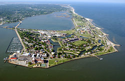 |
Hampton Hampton, Virginia Hampton is an independent city that is not part of any county in Southeast Virginia. Its population is 137,436. As one of the seven major cities that compose the Hampton Roads metropolitan area, it is on the southeastern end of the Virginia Peninsula. Located on the Hampton Roads Beltway, it hosts... 37°00′13"N 76°18′27"W |
Hampton (independent city) Hampton, Virginia Hampton is an independent city that is not part of any county in Southeast Virginia. Its population is 137,436. As one of the seven major cities that compose the Hampton Roads metropolitan area, it is on the southeastern end of the Virginia Peninsula. Located on the Hampton Roads Beltway, it hosts... |
Fort Monroe was completed in 1834, and is named in honor of U.S. President James Monroe. Completely surrounded by a moat, the six-sided stone fort is the only one of its kind left in the United States that is still an active Army post. | ||
| Fort Myer Historic District Fort Myer Fort Myer is a U.S. Army post adjacent to Arlington National Cemetery in Arlington County, Virginia, across the Potomac River from Washington, D.C. It is a small post by U.S... |
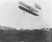 |
Arlington | Arlington Arlington County, Virginia Arlington County is a county in the Commonwealth of Virginia. The land that became Arlington was originally donated by Virginia to the United States government to form part of the new federal capital district. On February 27, 1801, the United States Congress organized the area as a subdivision of... |
U.S. Army post adjacent to Arlington National Cemetery Arlington National Cemetery Arlington National Cemetery in Arlington County, Virginia, is a military cemetery in the United States of America, established during the American Civil War on the grounds of Arlington House, formerly the estate of the family of Confederate general Robert E. Lee's wife Mary Anna Lee, a great... . |
||
| Franklin & Armfield Office Franklin and Armfield Office Now known as Freedom House, the Franklin and Armfield Office was started in 1828 by Isaac Franklin and John Armfield. The office was known to have been the largest slave trading firm in the antebellum south. At its height in the 1830s, the firm transported between 1,000 and 1,200 slaves from... |
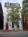 |
Alexandria Alexandria, Virginia Alexandria is an independent city in the Commonwealth of Virginia. As of 2009, the city had a total population of 139,966. Located along the Western bank of the Potomac River, Alexandria is approximately six miles south of downtown Washington, D.C.Like the rest of northern Virginia, as well as... 38.801911417°N 77.054660815°W |
Alexandria (independent city) Alexandria, Virginia Alexandria is an independent city in the Commonwealth of Virginia. As of 2009, the city had a total population of 139,966. Located along the Western bank of the Potomac River, Alexandria is approximately six miles south of downtown Washington, D.C.Like the rest of northern Virginia, as well as... |
Largest slave trading firm in the antebellum South | ||
| Full Scale 30- by 60-Foot Tunnel Full Scale 30- by 60-Foot Tunnel The Full-Scale Tunnel was a wind tunnel at NASA's Langley Research Center. It is a National Historic Landmark.... |
.jpg) |
Hampton Hampton, Virginia Hampton is an independent city that is not part of any county in Southeast Virginia. Its population is 137,436. As one of the seven major cities that compose the Hampton Roads metropolitan area, it is on the southeastern end of the Virginia Peninsula. Located on the Hampton Roads Beltway, it hosts... 37.0809993519°N 76.3417512724°W |
Hampton (independent city) Hampton, Virginia Hampton is an independent city that is not part of any county in Southeast Virginia. Its population is 137,436. As one of the seven major cities that compose the Hampton Roads metropolitan area, it is on the southeastern end of the Virginia Peninsula. Located on the Hampton Roads Beltway, it hosts... |
Full-scale wind tunnel at Langley Research Center Langley Research Center Langley Research Center is the oldest of NASA's field centers, located in Hampton, Virginia, United States. It directly borders Poquoson, Virginia and Langley Air Force Base... . |
||
| Gadsby's Tavern | 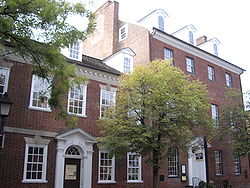 |
Alexandria Alexandria, Virginia Alexandria is an independent city in the Commonwealth of Virginia. As of 2009, the city had a total population of 139,966. Located along the Western bank of the Potomac River, Alexandria is approximately six miles south of downtown Washington, D.C.Like the rest of northern Virginia, as well as... 38.8036302213°N 77.0440011721°W |
Alexandria (independent city) Alexandria, Virginia Alexandria is an independent city in the Commonwealth of Virginia. As of 2009, the city had a total population of 139,966. Located along the Western bank of the Potomac River, Alexandria is approximately six miles south of downtown Washington, D.C.Like the rest of northern Virginia, as well as... |
Original tavern was a central part of the social, economic, political, and educational life of the city of Alexandria, and the United States. (Try Gadsby's Tavern Museum) | ||
| Ellen Glasgow House Ellen Glasgow House Ellen Glasgow House, also known as Branch-Glascow House, was a home of writer Ellen Glasgow.It was declared a National Historic Landmark in 1971.-External links:*, at Historic American Building Survey... |
.jpg) |
Richmond Richmond, Virginia Richmond is the capital of the Commonwealth of Virginia, in the United States. It is an independent city and not part of any county. Richmond is the center of the Richmond Metropolitan Statistical Area and the Greater Richmond area... 37.5409335813°N 77.4450029298°W |
Richmond (independent city) Richmond, Virginia Richmond is the capital of the Commonwealth of Virginia, in the United States. It is an independent city and not part of any county. Richmond is the center of the Richmond Metropolitan Statistical Area and the Greater Richmond area... |
Residence of author Ellen Glasgow Ellen Glasgow Ellen Anderson Gholson Glasgow was a Pulitzer Prize-winning American novelist who portrayed the changing world of the contemporary south.-Biography:... |
||
| Carter Glass House Carter Glass House Carter Glass House was a home of Virginia congressman and senator Carter Glass who was influential in establishing the fiscal policy of the United States.It was declared a National Historic Landmark in 1976.-External links:*... |
.jpg) |
Lynchburg Lynchburg, Virginia Lynchburg is an independent city in the Commonwealth of Virginia. The population was 75,568 as of 2010. Located in the foothills of the Blue Ridge Mountains along the banks of the James River, Lynchburg is known as the "City of Seven Hills" or "The Hill City." Lynchburg was the only major city in... 37.4134512422°N 79.1474883057°W |
Lynchburg (independent city) Lynchburg, Virginia Lynchburg is an independent city in the Commonwealth of Virginia. The population was 75,568 as of 2010. Located in the foothills of the Blue Ridge Mountains along the banks of the James River, Lynchburg is known as the "City of Seven Hills" or "The Hill City." Lynchburg was the only major city in... |
A home of influential congressman and senator Carter Glass Carter Glass Carter Glass was a newspaper publisher and politician from Lynchburg, Virginia. He served many years in Congress as a member of the Democratic Party. As House co-sponsor, he played a central role in the development of the 1913 Glass-Owen Act that created the Federal Reserve System. Glass... |
||
| Green Springs Historic District |  |
Zion Crossroads Zion Crossroads, Virginia Zion Crossroads is an unincorporated community in Louisa and Fluvanna counties, Virginia, at the intersection of James Madison Highway and Three Notch Road . About 2½ miles north is Green Springs National Historic Landmark District, a U.S. National Historic Landmark... 38°0′55"N 78°9′51"W |
Louisa Louisa County, Virginia Louisa County is a county located in the Commonwealth of Virginia. As of 2010, the population was 33,153. The county seat is Louisa.- History :... |
Rural manor houses and related buildings. | ||
| Greenway Court Greenway Court, Virginia Greenway Court was the estate and hunting lodge of Thomas Fairfax, 6th Lord Fairfax of Cameron in what is now Clarke County, Virginia, United States... |
.jpg) |
White Post White Post, Virginia White Post is an unincorporated town in Clarke County, Virginia, USA. White Post is located at the crossroads of White Post and Berrys Ferry Roads off Lord Fairfax Highway White Post is an unincorporated town in Clarke County, Virginia, USA. White Post is located at the crossroads of White Post and... 39.044365558°N 78.1191950459°W |
Clarke Clarke County, Virginia Clarke County is a county in the Commonwealth of Virginia. As of 2010, the population was 14,034. Its county seat is Berryville.-History:Clarke County was established in 1836 by Thomas Fairfax, 6th Lord Fairfax of Cameron who built a home, Greenway Court, on part of his 5 million acre property,... |
Remnants of 5000000 acres (20,234.3 km²) estate of Thomas Fairfax, 6th Lord Fairfax of Cameron Thomas Fairfax, 6th Lord Fairfax of Cameron Thomas Fairfax, 6th Lord Fairfax of Cameron was the son of Thomas Fairfax, 5th Lord Fairfax of Cameron and of Catherine, daughter of Thomas Culpeper, 2nd Baron Culpeper of Thoresway.... , only British peer in America, where George Washington George Washington George Washington was the dominant military and political leader of the new United States of America from 1775 to 1799. He led the American victory over Great Britain in the American Revolutionary War as commander-in-chief of the Continental Army from 1775 to 1783, and presided over the writing of... worked as a surveyor |
||
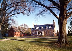
| Gunston Hall Gunston Hall Gunston Hall is an 18th-century Georgian mansion near the Potomac River in Mason Neck, Virginia, United States of America. The house was the home of the United States Founding Father George Mason. It was located at the center of a 5500 acre plantation... |
 |
Lorton Lorton, Virginia Lorton is a census-designated place in Fairfax County, Virginia, United States. The population is 27,709 as of the 2008 census estimate.-History:... 38°38′49.10"N 77°8′47.12"W |
Fairfax Fairfax County, Virginia Fairfax County is a county in Virginia, in the United States. Per the 2010 Census, the population of the county is 1,081,726, making it the most populous jurisdiction in the Commonwealth of Virginia, with 13.5% of Virginia's population... |
Home of the United States Founding Father George Mason George Mason George Mason IV was an American Patriot, statesman and a delegate from Virginia to the U.S. Constitutional Convention... . |
||
| Hampton Institute Hampton University Hampton University is a historically black university located in Hampton, Virginia, United States. It was founded by black and white leaders of the American Missionary Association after the American Civil War to provide education to freedmen.-History:... |
 |
Hampton Hampton, Virginia Hampton is an independent city that is not part of any county in Southeast Virginia. Its population is 137,436. As one of the seven major cities that compose the Hampton Roads metropolitan area, it is on the southeastern end of the Virginia Peninsula. Located on the Hampton Roads Beltway, it hosts... |
Hampton (independent city) Hampton, Virginia Hampton is an independent city that is not part of any county in Southeast Virginia. Its population is 137,436. As one of the seven major cities that compose the Hampton Roads metropolitan area, it is on the southeastern end of the Virginia Peninsula. Located on the Hampton Roads Beltway, it hosts... |
Hampton University began in 1868 as a teacher training school to train young Black men and women. | ||
| Hanover County Courthouse Hanover County Courthouse Hanover County Courthouse, built in 1735, is an historic courthouse located in Hanover Court House, Virginia. In 1763, Patrick Henry, who lived and practiced law in Hanover County, argued the case of the Parson's Cause, a case involving King George III's requirement that Virginians pay taxes to... |
 |
Hanover Court House 37.7612038601°N 77.3675072611°W |
Hanover Hanover County, Virginia As of the census of 2000, there were 86,320 people, 31,121 households, and 24,461 families residing in the county. The population density was 183 people per square mile . There were 32,196 housing units at an average density of 68 per square mile... |
This Georgian courthouse has been used continuously since its completion around 1735. It was here that, in 1763, Patrick Henry Patrick Henry Patrick Henry was an orator and politician who led the movement for independence in Virginia in the 1770s. A Founding Father, he served as the first and sixth post-colonial Governor of Virginia from 1776 to 1779 and subsequently, from 1784 to 1786... argued and won THE PARSON'S CAUSE, a case involving religious liberty in the Colony. |
||
| Holly-Knoll-Robert R. Moton House Holly Knoll Holly Knoll, also known as Robert R. Moton House, is a retirement home in Gloucester County, Virginia. It was the retirement home of educator Robert Russa Moton.It was declared a National Historic Landmark in 1981.... |
image pending | Capahosic Capahosic, Virginia Capahosic is an unincorporated community in Gloucester County, in the U. S. state of Virginia.-References:... |
Gloucester Gloucester County, Virginia Gloucester County is within the Commonwealth of Virginia in the Hampton Roads metropolitan area in the USA. Formed in 1651 in the Virginia Colony, the county was named for Henry Stuart, Duke of Gloucester, third son of King Charles I of Great Britain. Located in the Middle Peninsula region, it... |
Retirement home of Black educator Robert Russa Moton Robert Russa Moton Robert Russa Moton was an African American educator and author. He served as an administrator at Hampton Institute and was named principal of Tuskegee Institute in 1915 after the death of Dr. Booker T. Washington, a position he held for 20 years until retirement in 1935.-Youth, education,... |
||
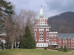
| The Homestead The Homestead, Virginia The Homestead is a luxury resort in Hot Springs, Virginia, in the middle of the Allegheny Mountains. The area has the largest hot springs in the state, and the resort is also known for its championship golf courses, which have hosted several national tournaments. The resort also includes an... |
 |
Hot Springs Hot Springs, Virginia Hot Springs is a census-designated place in Bath County, Virginia, United States. The population as of the 2010 Census was 738. It is located about 5 miles southwest of Warm Springs on U.S. Route 220. Hot Springs is the site of a number of resorts that make use of the springs.The area is... |
Bath Bath County, Virginia As of the census of 2000, there were 5,048 people, 2,053 households, and 1,451 families residing in the county. The population density was 10 people per square mile . There were 2,896 housing units at an average density of 5 per square mile... |
Example of Georgian and Colonial Revival architecture. | ||
| Jackson Ward Historic District Jackson Ward Jackson Ward is a historically African-American neighborhood in Richmond, Virginia, USA. It is located less than a mile from the Virginia State Capitol... |
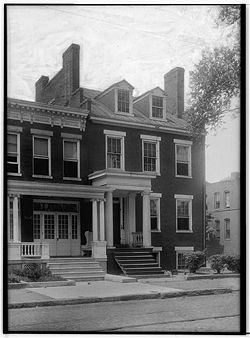 |
Richmond Richmond, Virginia Richmond is the capital of the Commonwealth of Virginia, in the United States. It is an independent city and not part of any county. Richmond is the center of the Richmond Metropolitan Statistical Area and the Greater Richmond area... |
Richmond (independent city) Richmond, Virginia Richmond is the capital of the Commonwealth of Virginia, in the United States. It is an independent city and not part of any county. Richmond is the center of the Richmond Metropolitan Statistical Area and the Greater Richmond area... |
A historically African-American neighborhood. | ||
| Stonewall Jackson Headquarters Stonewall Jackson's Headquarters Museum The Stonewall Jackson's Headquarters Museum was an antebellum home owned by Lieutenant Colonel Lewis Tilghman Moore, commander of the 31st Virginia Militia. Later, while commanding the 4th Virginia Infantry, Colonel Moore offered his home at 415 North Braddock Street, Winchester, Virginia, USA, to... |
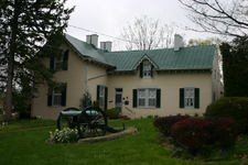 |
Winchester Winchester, Virginia Winchester is an independent city located in the northwestern portion of the Commonwealth of Virginia in the USA. The city's population was 26,203 according to the 2010 Census... 39.1879470123°N 78.166125059°W |
Winchester (independent city) Winchester, Virginia Winchester is an independent city located in the northwestern portion of the Commonwealth of Virginia in the USA. The city's population was 26,203 according to the 2010 Census... |
Confederate Major General Jackson lived here during the 1861-1862 winter | ||
| Kenmore Kenmore Plantation Kenmore, perhaps also known as Kenmore Plantation, was the home of Fielding Lewis in Fredericksburg, Virginia. Fielding was married to Betty Washington Lewis, the sister of George Washington. The house was built in the 1770s on a plantation. The property was purchased by the Gordon family in 1819... |
.jpg) |
Fredericksburg Fredericksburg, Virginia Fredericksburg is an independent city in the Commonwealth of Virginia located south of Washington, D.C., and north of Richmond. As of the 2010 census, the city had a population of 24,286... 38.2931548394°N 77.4664676626°W |
Fredericksburg (independent city) Fredericksburg, Virginia Fredericksburg is an independent city in the Commonwealth of Virginia located south of Washington, D.C., and north of Richmond. As of the 2010 census, the city had a population of 24,286... |
Home of Fielding Lewis Fielding Lewis Fielding Lewis was a Colonel during the American Revolutionary War and the brother-in-law of George Washington.... |
||
| Lee Chapel, Washington and Lee University Lee Chapel Lee Chapel is a National Historic Landmark in Lexington, Virginia, on the campus of Washington and Lee University. It was constructed during 1867-68 at the request of Robert E. Lee, who was President of the University at the time, and after whom the building is named... |
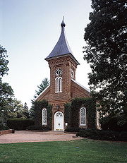 |
Lexington Lexington, Virginia Lexington is an independent city within the confines of Rockbridge County in the Commonwealth of Virginia. The population was 7,042 in 2010. Lexington is about 55 minutes east of the West Virginia border and is about 50 miles north of Roanoke, Virginia. It was first settled in 1777.It is home to... 37.7855082917°N 79.4421129052°W |
Lexington (independent city) Lexington, Virginia Lexington is an independent city within the confines of Rockbridge County in the Commonwealth of Virginia. The population was 7,042 in 2010. Lexington is about 55 minutes east of the West Virginia border and is about 50 miles north of Roanoke, Virginia. It was first settled in 1777.It is home to... |
Victorian Gothic brick chapel commemorates the years Robert E. Lee (1807-1870) served as president (1865-1870) of the college, then known as Washington College. Lee is buried in a chapel vault. | ||
| LIGHTSHIP NO. 101 "PORTSMOUTH" | 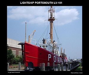 |
Portsmouth Portsmouth, Virginia Portsmouth is located in the Hampton Roads metropolitan area of the U.S. Commonwealth of Virginia. As of 2010, the city had a total population of 95,535.The Norfolk Naval Shipyard, often called the Norfolk Navy Yard, is a historic and active U.S... 36.8367987736°N 76.2986155953°W |
Portsmouth (independent city) Portsmouth, Virginia Portsmouth is located in the Hampton Roads metropolitan area of the U.S. Commonwealth of Virginia. As of 2010, the city had a total population of 95,535.The Norfolk Naval Shipyard, often called the Norfolk Navy Yard, is a historic and active U.S... |
Lightship Portsmouth, commissioned as Lightship 101, was first stationed at Cape Charles, Virginia Cape Charles, Virginia Cape Charles is a town in Northampton County, Virginia, United States. The population was 1,134 at the 2000 census.-Geography:Cape Charles is located at .... . |
||
| Lunar Landing Research Facility Lunar Landing Research Facility In 1965, Langley Research Center opened the Lunar Landing Research Facility for simulations of moon landings with a mock Apollo Lunar Module suspended from a crane over a simulated lunar landscape.... |
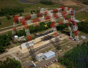 |
Hampton Hampton, Virginia Hampton is an independent city that is not part of any county in Southeast Virginia. Its population is 137,436. As one of the seven major cities that compose the Hampton Roads metropolitan area, it is on the southeastern end of the Virginia Peninsula. Located on the Hampton Roads Beltway, it hosts... 37.1002757457°N 76.3898034759°W |
Hampton (independent city) Hampton, Virginia Hampton is an independent city that is not part of any county in Southeast Virginia. Its population is 137,436. As one of the seven major cities that compose the Hampton Roads metropolitan area, it is on the southeastern end of the Virginia Peninsula. Located on the Hampton Roads Beltway, it hosts... |
Crane at Langley Research Center Langley Research Center Langley Research Center is the oldest of NASA's field centers, located in Hampton, Virginia, United States. It directly borders Poquoson, Virginia and Langley Air Force Base... used to practice Apollo lunar landings |
||
| Main Street Station and Trainshed Main Street Station (Richmond) Richmond Main Street Station is a historic railroad station and office building in Richmond, Virginia. Originally built in 1901, it is currently served by Amtrak, and is planned in the future to become the northern terminus of the Southeast High Speed Rail Corridor as well as an intermodal station... |
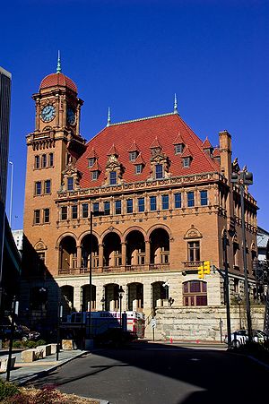 |
Richmond Richmond, Virginia Richmond is the capital of the Commonwealth of Virginia, in the United States. It is an independent city and not part of any county. Richmond is the center of the Richmond Metropolitan Statistical Area and the Greater Richmond area... 37.5328611436°N 77.4292026432°W |
Richmond (independent city) Richmond, Virginia Richmond is the capital of the Commonwealth of Virginia, in the United States. It is an independent city and not part of any county. Richmond is the center of the Richmond Metropolitan Statistical Area and the Greater Richmond area... |
Station is an example of Beaux-Arts influence, and trainshed is one of the last gable-roofed trainsheds in America. | ||
| Marlbourne Edmund Ruffin Plantation The Edmund Ruffin Plantation, also known as Marlbourne, was built in 1843. It was the home of Edmund Ruffin, a secessionist fire-eater who fired one of the first shots at Fort Sumter in 1861... |
image pending | Richmond Richmond, Virginia Richmond is the capital of the Commonwealth of Virginia, in the United States. It is an independent city and not part of any county. Richmond is the center of the Richmond Metropolitan Statistical Area and the Greater Richmond area... |
Hanover Hanover County, Virginia As of the census of 2000, there were 86,320 people, 31,121 households, and 24,461 families residing in the county. The population density was 183 people per square mile . There were 32,196 housing units at an average density of 68 per square mile... |
Property of Confederate secessionist Edmund Ruffin Edmund Ruffin Edmund Ruffin was a farmer and slaveholder, a Confederate soldier, and an 1850s political activist. He advocated states' rights, secession, and slavery and was described by opponents as one of the Fire-Eaters. He was an ardent supporter of the Confederacy and a longstanding enemy of the North... |
||
| General George C. Marshall House Dodona Manor Dodona Manor is a National Historic Landmark, located in Leesburg, Virginia. It is owned by the George C. Marshall International Center, which is currently restoring the property to its Marshall era appearance.... |
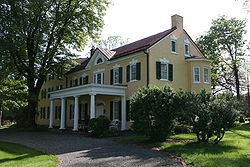 |
Leesburg Leesburg, Virginia Leesburg is a historic town in, and county seat of, Loudoun County, Virginia, United States of America. Leesburg is located west-northwest of Washington, D.C. along the base of the Catoctin Mountain and adjacent to the Potomac River. Its population according the 2010 Census is 42,616... 39.114178°N 77.559959°W |
Loudoun Loudoun County, Virginia Loudoun County is a county located in the Commonwealth of Virginia, and is part of the Washington Metropolitan Area. As of the 2010 U.S. Census, the county is estimated to be home to 312,311 people, an 84 percent increase over the 2000 figure of 169,599. That increase makes the county the fourth... |
Last home of General George C. Marshall, who called it "Dodona Manor." | ||
| John Marshall House John Marshall House The John Marshall House is the home of Supreme Court Chief Justice John Marshall, located in Richmond, Virginia. Marshall was appointed to the court in 1801 by John Adams and served for the rest of his life, writing such influential decisions as Marbury v. Madison and McCulloch v... |
.jpg) |
Richmond Richmond, Virginia Richmond is the capital of the Commonwealth of Virginia, in the United States. It is an independent city and not part of any county. Richmond is the center of the Richmond Metropolitan Statistical Area and the Greater Richmond area... 37.5408915267°N 77.4330847553°W |
Richmond (independent city) Richmond, Virginia Richmond is the capital of the Commonwealth of Virginia, in the United States. It is an independent city and not part of any county. Richmond is the center of the Richmond Metropolitan Statistical Area and the Greater Richmond area... |
Home of 4th Chief Justice John Marshall John Marshall John Marshall was the Chief Justice of the United States whose court opinions helped lay the basis for American constitutional law and made the Supreme Court of the United States a coequal branch of government along with the legislative and executive branches... . |
||
| Cyrus McCormick Farm and Workshop | image pending | Steele's Tavern | Rockbridge Rockbridge County, Virginia As of the census of 2000, there were 20,808 people, 8,486 households, and 6,075 families residing in the county. The population density was 35 people per square mile . There were 9,550 housing units at an average density of 16 per square mile... |
Home of the inventor of mechanical reaper Reaper A reaper is a person or machine that reaps crops at harvest, when they are ripe.-Hand reaping:Hand reaping is done by various means, including plucking the ears of grains directly by hand, cutting the grain stalks with a sickle, cutting them with a scythe, or with a later type of scythe called a... . |
||
| Gari Melchers Home Gari Melchers Home The Gari Melchers Home, also known as Belmont, was the home and studio of American artist Gari Melchers in Falmouth, Virginia... |
image pending | Falmouth Falmouth, Virginia Falmouth is an unincorporated community in Stafford County, Virginia, United States. Situated on the north bank of the Rappahannock River at the falls, the community is north of and opposite the city of Fredericksburg. Recognized by the U.S... |
Stafford Stafford County, Virginia Stafford County is a county located in the Commonwealth of Virginia, a U.S. state, and just across the Rappahannock River from the City of Fredericksburg. As of the 2000 census, the population was 92,446, increasing to 128,961 in 2010.. Its county seat is Stafford. In 2006, and again in 2009,... |
Residence and studio of painter Gari Melchers Gari Melchers Julius Garibaldi Melchers was an American artist. He was one of the leading American proponents of naturalism.-Biography:... |
||
| Menokin Menokin Menokin, also known as Francis Lightfoot Lee House, was the home of Francis Lightfoot Lee near Warsaw, Virginia. Lee was a signer of the United States Declaration of Independence... |
 |
Warsaw Warsaw, Virginia Warsaw is the county seat of Richmond County, Virginia, United States. The population was 1,375 at the 2000 census.-History:The original name of the town was Richmond Courthouse. In 1830 the town's named changed to Warsaw... |
Richmond Richmond County, Virginia Richmond County is a county located on the Northern Neck in the Commonwealth of Virginia, a state in the United States. As of 2010, the population was 9,254. Its county seat is Warsaw. The rural county should not be confused with the large city and state capital Richmond, Virginia, which is over... |
Home of Declaration of Independence signer Francis Lightfoot Lee Francis Lightfoot Lee Francis Lightfoot Lee was a member of the House of Burgesses in the Colony of Virginia. As an active protester of issues such as the Stamp Act, Lee helped move the colony in the direction of independence from Britain. Lee was a delegate to the Virginia Conventions and the Continental Congress... . |
||
| Gen. William "Billy" Mitchell House Gen. William Mitchell House The Gen. William Mitchell House, also known as Boxwood or the Gen. Billy Mitchell House was the home of Billy Mitchell during the last ten years of his life, from 1926 through 1936. Mitchell was an American general who is regarded as the father of the U.S. Air Force... |
image pending | Middleburg Middleburg, Virginia Middleburg is a town in Loudoun County, Virginia, United States with a population of approximately 976 as of July 2010.-History:The town was established in 1787 by American Revolutionary War Lieutenant Colonel and Virginia statesman, Levin Powell. He purchased the land for Middleburg at $2.50 per... |
Loudoun Loudoun County, Virginia Loudoun County is a county located in the Commonwealth of Virginia, and is part of the Washington Metropolitan Area. As of the 2010 U.S. Census, the county is estimated to be home to 312,311 people, an 84 percent increase over the 2000 figure of 169,599. That increase makes the county the fourth... |
Residence of General William "Billy" Mitchell, advocate of military air power. | ||
| James Monroe Law Office James Monroe Law Office The James Monroe Law Office located in Fredericksburg, Virginia was used for that purpose from 1786 to 1789. James Monroe would later become the fifth President of the United States .It was declared a National Historic Landmark in 1966.... |
 |
Fredericksburg Fredericksburg, Virginia Fredericksburg is an independent city in the Commonwealth of Virginia located south of Washington, D.C., and north of Richmond. As of the 2010 census, the city had a population of 24,286... 38.300193645°N 77.4616750693°W |
Fredericksburg (independent city) Fredericksburg, Virginia Fredericksburg is an independent city in the Commonwealth of Virginia located south of Washington, D.C., and north of Richmond. As of the 2010 census, the city had a population of 24,286... |
James Monroe James Monroe James Monroe was the fifth President of the United States . Monroe was the last president who was a Founding Father of the United States, and the last president from the Virginia dynasty and the Republican Generation... used this structure as a law office from 1786 to 1789. |
||
| James Monroe Tomb James Monroe Tomb The James Monroe Tomb is the burial place for U.S. President James Monroe in Hollywood Cemetery, Richmond, Virginia, United States. The site is "significant for the execution of its flamboyant and delicate tracery in cast iron, the tomb is a cage over the simple granite sarcophagus of the former... |
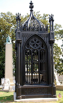 |
Richmond Richmond, Virginia Richmond is the capital of the Commonwealth of Virginia, in the United States. It is an independent city and not part of any county. Richmond is the center of the Richmond Metropolitan Statistical Area and the Greater Richmond area... 37.5331536389°N 77.4555666809°W |
Richmond (independent city) Richmond, Virginia Richmond is the capital of the Commonwealth of Virginia, in the United States. It is an independent city and not part of any county. Richmond is the center of the Richmond Metropolitan Statistical Area and the Greater Richmond area... |
Tomb with "flamboyant and delicate tracery in cast iron" of President James Monroe James Monroe James Monroe was the fifth President of the United States . Monroe was the last president who was a Founding Father of the United States, and the last president from the Virginia dynasty and the Republican Generation... |
||
| Monticello (Thomas Jefferson House) Monticello Monticello is a National Historic Landmark just outside Charlottesville, Virginia, United States. It was the estate of Thomas Jefferson, the principal author of the United States Declaration of Independence, third President of the United States, and founder of the University of Virginia; it is... |
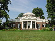 |
Charlottesville Charlottesville, Virginia Charlottesville is an independent city geographically surrounded by but separate from Albemarle County in the Commonwealth of Virginia, United States, and named after Charlotte of Mecklenburg-Strelitz, the queen consort of King George III of the United Kingdom.The official population estimate for... 38°0.5′N 78°27.2′W |
Albemarle Albemarle County, Virginia As of the census of 2000, there were 79,236 people, 31,876 households, and 21,070 families residing in the county. The population density was 110 people per square mile . There were 33,720 housing units at an average density of 47 per square mile... |
Mansion of President Thomas Jefferson Thomas Jefferson Thomas Jefferson was the principal author of the United States Declaration of Independence and the Statute of Virginia for Religious Freedom , the third President of the United States and founder of the University of Virginia... . |
||
| Montpelier (James Madison House) | 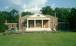 |
Orange Orange, Virginia Orange is a town in Orange County, Virginia, United States. The population was 4,721 at the 2010 census. It is the county seat of Orange County... |
Orange Orange County, Virginia As of the census of 2000, there were 25,881 people, 10,150 households, and 7,470 families residing in the county. The population density was 76 people per square mile . There were 11,354 housing units at an average density of 33 per square mile... |
Residence of President James Madison James Madison James Madison, Jr. was an American statesman and political theorist. He was the fourth President of the United States and is hailed as the “Father of the Constitution” for being the primary author of the United States Constitution and at first an opponent of, and then a key author of the United... . |
||
| Monument Avenue Historic District Monument Avenue Monument Avenue, in Richmond, Virginia, is a premier example of the Grand American Avenue city planning style. The first monument, a statue of Robert E. Lee was erected in 1890. Between 1900 and 1925, Monument Avenue exploded with architecturally significant houses, churches and apartment buildings... |
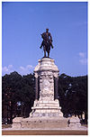 |
Richmond Richmond, Virginia Richmond is the capital of the Commonwealth of Virginia, in the United States. It is an independent city and not part of any county. Richmond is the center of the Richmond Metropolitan Statistical Area and the Greater Richmond area... |
Richmond (independent city) Richmond, Virginia Richmond is the capital of the Commonwealth of Virginia, in the United States. It is an independent city and not part of any county. Richmond is the center of the Richmond Metropolitan Statistical Area and the Greater Richmond area... |
Broad tree-lined avenue with several impressive memorials. | ||
| Monumental Church Monumental Church Monumental Church is a former Episcopal Church that stands at 1224 E. Broad Street between N. 12th and College Streets in Richmond, Virginia. Designed by architect Robert Mills, it is one of America's earliest and most distinctive Greek Revival churches and is listed on the National Register of... |
Richmond Richmond, Virginia Richmond is the capital of the Commonwealth of Virginia, in the United States. It is an independent city and not part of any county. Richmond is the center of the Richmond Metropolitan Statistical Area and the Greater Richmond area... 37.5369897008°N 77.4300156292°W |
Richmond (independent city) Richmond, Virginia Richmond is the capital of the Commonwealth of Virginia, in the United States. It is an independent city and not part of any county. Richmond is the center of the Richmond Metropolitan Statistical Area and the Greater Richmond area... |
Early Greek Revival church. | |||
| Robert Russa Moton High School | Farmville Farmville, Virginia Farmville is a town in Prince Edward and Cumberland counties in the U.S. state of Virginia. The population was 6,845 at the 2000 census. It is the county seat of Prince Edward County.... |
Prince Edward Prince Edward County, Virginia Prince Edward County is a county located in the Commonwealth of Virginia. As of 2010, the population was 23,368. Its county seat is Farmville.-Formation and County Seats:... |
Site of a 1951 student strike that led to court case striking down the practice of "separate but equal" schools; now a museum | |||
| Mount Airy Mount Airy, Richmond County, Virginia Mount Airy, near Warsaw in Richmond County, Virginia, built in 1758-62, is a mid-Georgian plantation house, the first built in the manner of a neo-Palladian villa. It was constructed for Colonel John Tayloe II, perhaps the richest Virginia planter of his generation... |
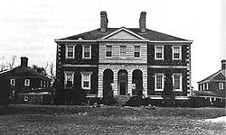 |
Warsaw Warsaw, Virginia Warsaw is the county seat of Richmond County, Virginia, United States. The population was 1,375 at the 2000 census.-History:The original name of the town was Richmond Courthouse. In 1830 the town's named changed to Warsaw... 37°58′20"N 76°47′29"W |
Richmond Richmond County, Virginia Richmond County is a county located on the Northern Neck in the Commonwealth of Virginia, a state in the United States. As of 2010, the population was 9,254. Its county seat is Warsaw. The rural county should not be confused with the large city and state capital Richmond, Virginia, which is over... |
Stone plantation house. Burial place of Francis Lightfoot Lee Francis Lightfoot Lee Francis Lightfoot Lee was a member of the House of Burgesses in the Colony of Virginia. As an active protester of issues such as the Stamp Act, Lee helped move the colony in the direction of independence from Britain. Lee was a delegate to the Virginia Conventions and the Continental Congress... . |
||
| Mount Vernon Mount Vernon The name Mount Vernon is a dedication to the English Vice-Admiral Edward Vernon. It was first applied to Mount Vernon, the Virginia estate of George Washington, the first President of the United States... |
 |
Alexandria Alexandria, Virginia Alexandria is an independent city in the Commonwealth of Virginia. As of 2009, the city had a total population of 139,966. Located along the Western bank of the Potomac River, Alexandria is approximately six miles south of downtown Washington, D.C.Like the rest of northern Virginia, as well as... 38.7079°N 77.0861°W |
Fairfax Fairfax County, Virginia Fairfax County is a county in Virginia, in the United States. Per the 2010 Census, the population of the county is 1,081,726, making it the most populous jurisdiction in the Commonwealth of Virginia, with 13.5% of Virginia's population... |
Plantation home of President George Washington George Washington George Washington was the dominant military and political leader of the new United States of America from 1775 to 1799. He led the American victory over Great Britain in the American Revolutionary War as commander-in-chief of the Continental Army from 1775 to 1783, and presided over the writing of... . |
||
| Natural Bridge Natural Bridge (Virginia) Natural Bridge, known as Natty B by locals, in the eponymous Rockbridge County, Virginia is a geological formation in which Cedar Creek has carved out a gorge in the mountainous limestone terrain, forming an arch 215 ft high with a span of 90 ft... |
 |
Natural Bridge 37.6256806633°N 79.5451727263°W |
Rockbridge Rockbridge County, Virginia As of the census of 2000, there were 20,808 people, 8,486 households, and 6,075 families residing in the county. The population density was 35 people per square mile . There were 9,550 housing units at an average density of 16 per square mile... |
Natural rock arch. (Once owned by Thomas Jefferson) | ||
| New Kent School and George W. Watkins School | New Kent New Kent, Virginia New Kent is a census-designated place in and the county seat of New Kent County, Virginia, United States. The population as of the 2010 Census was 239.-References:... and Quinton Quinton, Virginia Quinton is a small unincorporated community in New Kent County, Virginia, United States. It is located on State Route 249 in the western portion of the county.... |
New Kent New Kent County, Virginia At the 2000 census, there were 13,462 people, 4,925 households and 3,895 families residing in the county. The population density was 64 per square mile . There were 5,203 housing units at an average density of 25 per square mile... |
Pair of schools that represent widespread token desegregation of southern schools in the decade after the 1954 Brown v. Board of Education supreme court decision. Focus of 1968 Green v. County School Board, which was effective in bringing about real desegregation. | |||
| N.S. SAVANNAH (Nuclear Merchant Ship) NS Savannah NS Savannah, named for SS Savannah, was the first nuclear-powered cargo-passenger ship, built in the late 1950s at a cost of $46.9 million, including a $28.3 million nuclear reactor and fuel core, funded by United States government agencies as a demonstration project for the potential... |
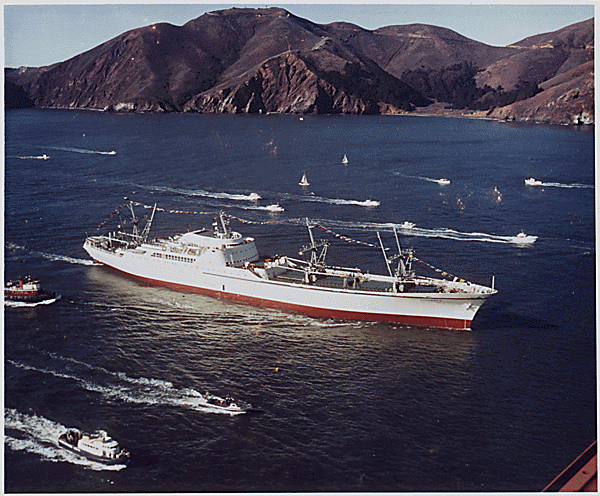 |
Newport News Newport News, Virginia Newport News is an independent city located in the Hampton Roads metropolitan area of Virginia. It is at the southeastern end of the Virginia Peninsula, on the north shore of the James River extending southeast from Skiffe's Creek along many miles of waterfront to the river's mouth at Newport News... 32.7866276696°N 79.9086140284°W |
York York County, Virginia York County is a county located on the north side of the Virginia Peninsula in the Hampton Roads metropolitan area of the Commonwealth of Virginia, a state of the United States. Situated on the York River and many tributaries, the county seat is the unincorporated town of Yorktown... |
First nuclear-powered cargo-passenger ship. | ||
| Oak Hill (James Monroe House) | Leesburg Leesburg, Virginia Leesburg is a historic town in, and county seat of, Loudoun County, Virginia, United States of America. Leesburg is located west-northwest of Washington, D.C. along the base of the Catoctin Mountain and adjacent to the Potomac River. Its population according the 2010 Census is 42,616... |
Loudoun Loudoun County, Virginia Loudoun County is a county located in the Commonwealth of Virginia, and is part of the Washington Metropolitan Area. As of the 2010 U.S. Census, the county is estimated to be home to 312,311 people, an 84 percent increase over the 2000 figure of 169,599. That increase makes the county the fourth... |
Residence of President James Monroe James Monroe James Monroe was the fifth President of the United States . Monroe was the last president who was a Founding Father of the United States, and the last president from the Virginia dynasty and the Republican Generation... |
|||
| Oatlands Oatlands Plantation Oatlands Plantation is an estate located in Leesburg, Virginia. Oatlands is operated by the National Trust for Historic Preservation and is listed on the National Register of Historic Places as a National Historic Landmark... |
.jpg) |
Leesburg Leesburg, Virginia Leesburg is a historic town in, and county seat of, Loudoun County, Virginia, United States of America. Leesburg is located west-northwest of Washington, D.C. along the base of the Catoctin Mountain and adjacent to the Potomac River. Its population according the 2010 Census is 42,616... |
Loudoun Loudoun County, Virginia Loudoun County is a county located in the Commonwealth of Virginia, and is part of the Washington Metropolitan Area. As of the 2010 U.S. Census, the county is estimated to be home to 312,311 people, an 84 percent increase over the 2000 figure of 169,599. That increase makes the county the fourth... |
Notable Federal-style mansion designed and built by George Carter George Carter George Carter is a retired American professional basketball player.Carter played collegiate basketball as a 6'4" guard/forward from St. Bonaventure University.... . |
||
| Pentagon The Pentagon The Pentagon is the headquarters of the United States Department of Defense, located in Arlington County, Virginia. As a symbol of the U.S. military, "the Pentagon" is often used metonymically to refer to the Department of Defense rather than the building itself.Designed by the American architect... |
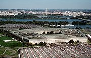 |
Arlington 38.87099°N 77.05596°W |
Arlington Arlington County, Virginia Arlington County is a county in the Commonwealth of Virginia. The land that became Arlington was originally donated by Virginia to the United States government to form part of the new federal capital district. On February 27, 1801, the United States Congress organized the area as a subdivision of... |
Building is symbolic of national military power. | ||
| Petersburg Breakthrough Battlefield Petersburg Breakthrough Battlefield Petersburg Breakthrough Battlefield is a historic district in Petersburg, Virginia. It was the location of a Union army breakthrough of the Petersburg to Richmond trenches and fortifications on April 2, 1865. The success of the breakthrough led to abandonment of Richmond by the General Robert E... |
Petersburg Petersburg, Virginia Petersburg is an independent city in Virginia, United States located on the Appomattox River and south of the state capital city of Richmond. The city's population was 32,420 as of 2010, predominantly of African-American ethnicity... |
Dinwiddie Dinwiddie County, Virginia Dinwiddie County is a county located in the Commonwealth of Virginia. As of 2010, the population was 28,001. Its county seat is Dinwiddie.- History :... |
Site of Union breakthrough that collapsed Confederate General Lee's fortifications from Petersburg to Richmond, on April 2, 1865. | |||
| Pittsylvania County Courthouse Pittsylvania County Courthouse Pittsylvania County Courthouse is a building in Chatham, Virginia, USA. It is located on the east side of US Business Route 29.In 1878, Judge J.D. Coles was arrested for excluding black citizens from serving as jurors.... |
.jpg) |
Chatham Chatham, Virginia Chatham is a town in Pittsylvania County, Virginia, United States. Chatham's population was 1,338 at the 2000 census. It is included in the Danville, Virginia Metropolitan Statistical Area. Chatham is home to Chatham High School and Hargrave Military Academy. It is also home to Chatham Hall , an... 36.8234111261°N 79.3982679873°W |
Pittsylvania Pittsylvania County, Virginia As of the census of 2000, there were 61,745 people, 24,684 households, and 18,216 families residing in the county. The population density was 64 people per square mile . There were 28,011 housing units at an average density of 29 per square mile... |
In 1878, Judge J.D. Coles was arrested for excluding Black citizens from serving as jurors. | ||
| Pocahontas Exhibition Coal Mine Pocahontas Exhibition Coal Mine Pocahontas Exhibition Coal Mine, also known as Pocahontas Mine No. 1, or Baby Mine, is an inactive coal mine in the Pocahontas coalfield. The mine was the first in the sub-bituminous coal of the Pocahontas coalfield, opening in 1882. In 1938 it became the first exhibition coal mine in the United... |
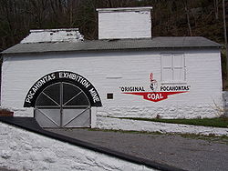 |
Pocahontas Pocahontas, Virginia Pocahontas is a town in Tazewell County, Virginia, named for the Algonquian Indian woman Pocahontas. The population was 441 at the 2000 census. It is part of the Bluefield, WV-VA micropolitan area which has a population of 107,578... |
Tazewell Tazewell County, Virginia As of the census of 2000, there were 44,598 people, 18,277 households and 13,232 families residing in the county. The population density was 86 people per square mile . There were 20,390 housing units at an average density of 39 per square mile... |
1882 Mine in the Pocahontas coalfield Pocahontas coalfield Pocahontas Coalfield, which is also known as the Flat Top-Pocahontas Coalfield, is located in Mercer County/McDowell County, West Virginia and Tazewell County, Virginia. The coal seams—Pocahontas No. 3, No. 4, No. 6, and No... . |
||
| Poplar Forest Poplar Forest Poplar Forest was Thomas Jefferson's plantation and plantation house in what is now Forest, Virginia, near Lynchburg. He designed it and treated it as a private retreat, working on it from 1806 until his death 20 years later. "It is the most valuable of my possessions," Jefferson once wrote a... |
 |
Lynchburg Lynchburg, Virginia Lynchburg is an independent city in the Commonwealth of Virginia. The population was 75,568 as of 2010. Located in the foothills of the Blue Ridge Mountains along the banks of the James River, Lynchburg is known as the "City of Seven Hills" or "The Hill City." Lynchburg was the only major city in... |
Bedford Bedford County, Virginia As of the census of 2000, there were 60,371 people, 23,838 households, and 18,164 families residing in the county. The population density was 80 people per square mile . There were 26,841 housing units at an average density of 36 per square mile... |
Thomas Jefferson Thomas Jefferson Thomas Jefferson was the principal author of the United States Declaration of Independence and the Statute of Virginia for Religious Freedom , the third President of the United States and founder of the University of Virginia... built this structure as a country retreat. |
||
| Potomac (Potowmack)(Patowmack) Canal Historic District Potomac Canal Historic District Potomac Canal Historic District, also known as Patowmack Canal Historic District or Potowmack Canal Historic District, is at the Great Falls of the Potomac River and is part of Great Falls Park... |
 |
Great Falls Great Falls, Virginia Great Falls is a census-designated place in Fairfax County, Virginia, United States. The population was 15,427 at the 2010 census.Although primarily a bedroom community for Washington, D.C., one major attraction is Great Falls Park which overlooks the Great Falls of the Potomac River, for which... |
Fairfax Fairfax County, Virginia Fairfax County is a county in Virginia, in the United States. Per the 2010 Census, the population of the county is 1,081,726, making it the most populous jurisdiction in the Commonwealth of Virginia, with 13.5% of Virginia's population... |
Remains of an impressively engineered canal built beside the falls of the Potomac. | ||
| Prestwould Prestwould Prestwould is a historic home near Clarksville, Virginia. It is the most intact and best documented plantation surviving in Southside Virginia... |
.jpg) |
Clarksville Clarksville, Virginia Clarksville is a town founded in Mecklenburg County and overlapping across Halifax County in the U.S. state of Virginia, near the southern border of the state. The population was 1,139 at the 2010 census... |
Mecklenburg Mecklenburg County, Virginia As of the census of 2010, there were 32,727 people, 12,951 households, and 8,962 families residing in the county. The population density was 52 people per square mile . There were 17,403 housing units at an average density of 28 per square mile... |
Most intact and best documented plantation surviving in Southside Virginia. | ||
| Quarters 1 (Fort Myer) Quarters 1 (Fort Myer) Quarters 1, Fort Myer is a site significant in part for its association with Dwight D. Eisenhower and Douglas MacArthur.It was built on Fort Myer's ridge, was completed on 27 May 1899. The historic dwelling has been the residence of Chiefs of Staff of the US Army since 1908, including Dwight D... |
image pending | Arlington | Arlington Arlington County, Virginia Arlington County is a county in the Commonwealth of Virginia. The land that became Arlington was originally donated by Virginia to the United States government to form part of the new federal capital district. On February 27, 1801, the United States Congress organized the area as a subdivision of... |
Residence of all U.S. Army Chiefs of Staff since 1910 | ||
| Peyton Randolph House Peyton Randolph House Peyton Randolph House, also known as Randolph-Peachy House, is a home in Williamsburg, Virginia. It was the home of Peyton Randolph , first President of the Continental Congress. It is located within what is now known as Colonial Williamsburg.It was declared a National Historic Landmark in... |
 |
Williamsburg Williamsburg, Virginia Williamsburg is an independent city located on the Virginia Peninsula in the Hampton Roads metropolitan area of Virginia, USA. As of the 2010 Census, the city had an estimated population of 14,068. It is bordered by James City County and York County, and is an independent city... 37.2701839534°N 76.7001309504°W |
Williamsburg (independent city) Williamsburg, Virginia Williamsburg is an independent city located on the Virginia Peninsula in the Hampton Roads metropolitan area of Virginia, USA. As of the 2010 Census, the city had an estimated population of 14,068. It is bordered by James City County and York County, and is an independent city... |
Home of Peyton Randolph Peyton Randolph Peyton Randolph was a planter and public official from the Colony of Virginia. He served as speaker of the Virginia House of Burgesses, chairman of the Virginia Conventions, and the first President of the Continental Congress.-Early life:Randolph was born in Tazewell Hall, Williamsburg, Virginia... , first President of the Continental Congress Continental Congress The Continental Congress was a convention of delegates called together from the Thirteen Colonies that became the governing body of the United States during the American Revolution.... . |
||
| Virginia Randolph Cottage Virginia Randolph Cottage Virginia Randolph Cottage, also known as Virginia E. Randolph Museum, Virginia Cardwell Cottage, or Home Economics Cottage, is a building that was built in 1937 in Glen Allen, Virginia, United States. It was the home economics building of the Virginia Randolph Training School, a vocational school.... |
.jpg) |
Glen Allen Glen Allen, Virginia Glen Allen is a census-designated place in Henrico County, Virginia, United States. The population was 12,562 at the 2000 census.-Geography:... 37.661124°N 77.482340°W |
Henrico Henrico County, Virginia Henrico is a county located in the Commonwealth of Virginia, a state of the United States. As of 2010, Henrico was home to 306,935 people. It is located in the Richmond-Petersburg region and is a portion of the Richmond Metropolitan Statistical Area... |
Commemorates notable Black teacher Virginia E. Randolph (1874-1958). | ||
| Rendezvous Docking Simulator Rendezvous Docking Simulator The Rendezvous Docking Simulator, also known as the Real-Time Dynamic Simulator, is a simulator at Langley Research Center in building. It was constructed for the Gemini program in building 1244 and it became operatioal in June1963 at a cost of $320,000 and later reconfigured for the Apollo program... |
 |
Hampton Hampton, Virginia Hampton is an independent city that is not part of any county in Southeast Virginia. Its population is 137,436. As one of the seven major cities that compose the Hampton Roads metropolitan area, it is on the southeastern end of the Virginia Peninsula. Located on the Hampton Roads Beltway, it hosts... 37.0838282299°N 76.3780276457°W |
Hampton (independent city) Hampton, Virginia Hampton is an independent city that is not part of any county in Southeast Virginia. Its population is 137,436. As one of the seven major cities that compose the Hampton Roads metropolitan area, it is on the southeastern end of the Virginia Peninsula. Located on the Hampton Roads Beltway, it hosts... |
Trainer used by Gemini and Apollo program astronauts to practice rendezvous and docking techniques at Langley Research Center Langley Research Center Langley Research Center is the oldest of NASA's field centers, located in Hampton, Virginia, United States. It directly borders Poquoson, Virginia and Langley Air Force Base... |
||
| Reynolds Homestead Reynolds Homestead The Reynolds Homestead, also known as Rock Spring Plantation, was home of R. J. Reynolds, founder of the R. J. Reynolds Tobacco Company.It was declared a National Historic Landmark in 1977.... |
image pending | Critz 36.6422976814°N 80.1485822619°W |
Patrick Patrick County, Virginia Patrick County is a county located in the Commonwealth of Virginia. As of 2010, the population was 18,490. Its county seat is Stuart. It is located within both the rolling hills and valleys of the Piedmont Region of Virginia and mountainous Southwest Virginia.... |
Home of R. J. Reynolds, founder of the R. J. Reynolds Tobacco Company | ||
| Ripshin Farm Ripshin Farm Ripshin Farm, also known as Ripshin or Sherwood Anderson Farm, was a home of writer Sherwood Anderson near Troutdale, Virginia.It was declared a National Historic Landmark in 1971.... |
image pending | Trout Dale | Grayson Grayson County, Virginia As of the census of 2000, there were 17,917 people, 7,259 households, and 5,088 families residing in the county. The population density was 40 people per square mile . There were 9,123 housing units at an average density of 21 per square mile... |
Summer home of author Sherwood Anderson Sherwood Anderson Sherwood Anderson was an American novelist and short story writer. His most enduring work is the short story sequence Winesburg, Ohio. Writers he has influenced include Ernest Hemingway, William Faulkner, John Steinbeck, J. D. Salinger, and Amos Oz.-Early life:Anderson was born in Clyde, Ohio,... . |
||
| Rising Sun Tavern |  |
Fredericksburg Fredericksburg, Virginia Fredericksburg is an independent city in the Commonwealth of Virginia located south of Washington, D.C., and north of Richmond. As of the 2010 census, the city had a population of 24,286... 38.304773735°N 77.4624016944°W |
Fredericksburg (independent city) Fredericksburg, Virginia Fredericksburg is an independent city in the Commonwealth of Virginia located south of Washington, D.C., and north of Richmond. As of the 2010 census, the city had a population of 24,286... |
Tavern built by Charles Washington Charles Washington Charles Washington was the youngest brother of United States President George Washington. He was a son of Augustine Washington and his second wife, Mary Ball Washington.... , youngest brother of George Washington George Washington George Washington was the dominant military and political leader of the new United States of America from 1775 to 1799. He led the American victory over Great Britain in the American Revolutionary War as commander-in-chief of the Continental Army from 1775 to 1783, and presided over the writing of... |
||
| Rotunda, University of Virginia The Rotunda (University of Virginia) The Rotunda is a building located on The Lawn in the original grounds of the University of Virginia. It was designed by Thomas Jefferson to represent the "authority of nature and power of reason" and was inspired by the Pantheon in Rome. Construction began in 1822 and was completed in 1826, after... |
Charlottesville Charlottesville, Virginia Charlottesville is an independent city geographically surrounded by but separate from Albemarle County in the Commonwealth of Virginia, United States, and named after Charlotte of Mecklenburg-Strelitz, the queen consort of King George III of the United Kingdom.The official population estimate for... 38.0307975629°N 78.5052224415°W |
Charlottesville (independent city) Charlottesville, Virginia Charlottesville is an independent city geographically surrounded by but separate from Albemarle County in the Commonwealth of Virginia, United States, and named after Charlotte of Mecklenburg-Strelitz, the queen consort of King George III of the United Kingdom.The official population estimate for... |
Designed by Thomas Jefferson Thomas Jefferson Thomas Jefferson was the principal author of the United States Declaration of Independence and the Statute of Virginia for Religious Freedom , the third President of the United States and founder of the University of Virginia... shortly before his death. |
|||
| Sabine Hall | .jpg) |
Tappahannock Tappahannock, Virginia Tappahannock is the oldest town in Essex County, Virginia, United States. The population was 2,068 at the 2000 census. Located on the Rappahannock River, Tappahannock is the county seat of Essex County... |
Richmond Richmond County, Virginia Richmond County is a county located on the Northern Neck in the Commonwealth of Virginia, a state in the United States. As of 2010, the population was 9,254. Its county seat is Warsaw. The rural county should not be confused with the large city and state capital Richmond, Virginia, which is over... |
Early Georgian two story brick mansion. | ||
| St. John's Episcopal Church (Richmond) | 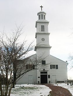 |
Richmond Richmond, Virginia Richmond is the capital of the Commonwealth of Virginia, in the United States. It is an independent city and not part of any county. Richmond is the center of the Richmond Metropolitan Statistical Area and the Greater Richmond area... 37.5295394637°N 77.4198162958°W |
Richmond (independent city) Richmond, Virginia Richmond is the capital of the Commonwealth of Virginia, in the United States. It is an independent city and not part of any county. Richmond is the center of the Richmond Metropolitan Statistical Area and the Greater Richmond area... |
Patrick Henry Patrick Henry Patrick Henry was an orator and politician who led the movement for independence in Virginia in the 1770s. A Founding Father, he served as the first and sixth post-colonial Governor of Virginia from 1776 to 1779 and subsequently, from 1784 to 1786... delivered his "Liberty or Death" speech here. |
||
| Saint Luke's Church (Smithfield) St. Luke's Church (Smithfield, Virginia) St. Luke's Church, also known as Old Brick Church, or Newport Parish Church, is a historic American church located in the unincorporated community of Benns Church, near Smithfield in Isle of Wight County, Virginia. The present dedication was ascribed in 1820... |
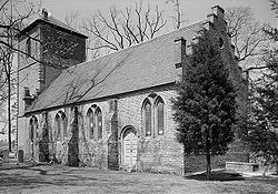 |
Smithfield Smithfield, Virginia Smithfield is a town in Isle of Wight County, in the South Hampton Roads subregion of the Hampton Roads region of Virginia in the United States. The population was 8,089 at the 2010 census.... 36.9380915484°N 76.5862759508°W |
Isle Of Wight Isle of Wight County, Virginia As of the census of 2010, there were 35,270 people, 11,319 households, and 8,670 families residing in the county. The population density was 94 people per square mile . There were 12,066 housing units at an average density of 38 per square mile... |
English room church with Gothic details | ||
| Saratoga Saratoga (Boyce, Virginia) Saratoga, also known as the General Daniel Morgan House, is a home near Boyce, Virginia. It is a gray limestone Georgian house built by Brig. Gen. Daniel Morgan, best known for his victory over the British at the Battle of Cowpens in 1781... |
.jpg) |
Boyce Boyce, Virginia Boyce is a town in Clarke County, Virginia, United States. The population was 426 at the 2000 census.-Geography:Boyce is located at .... |
Clarke Clarke County, Virginia Clarke County is a county in the Commonwealth of Virginia. As of 2010, the population was 14,034. Its county seat is Berryville.-History:Clarke County was established in 1836 by Thomas Fairfax, 6th Lord Fairfax of Cameron who built a home, Greenway Court, on part of his 5 million acre property,... |
Gray limestone Georgian house built by Brig. Gen. Daniel Morgan Daniel Morgan Daniel Morgan was an American pioneer, soldier, and United States Representative from Virginia. One of the most gifted battlefield tacticians of the American Revolutionary War, he later commanded troops during the suppression of the Whiskey Rebellion.-Early years:Most authorities believe that... , best known for his victory over the British at the Battle of Cowpens Battle of Cowpens The Battle of Cowpens was a decisive victory by Patriot Revolutionary forces under Brigadier General Daniel Morgan, in the Southern campaign of the American Revolutionary War... in 1781. |
||
| Sayler's Creek Battlefield Sayler's Creek Battlefield Sayler's Creek Battlefield near Farmville, Virginia was the site of the Battle of Sayler's Creek of the American Civil War. Robert E. Lee's army was retreating from the Richmond to Petersburg line. Here, on April 6, 1865, Union General Philip Sheridan cut off and beat back about a quarter of Lee's... |
 |
Farmville Farmville, Virginia Farmville is a town in Prince Edward and Cumberland counties in the U.S. state of Virginia. The population was 6,845 at the 2000 census. It is the county seat of Prince Edward County.... |
Amelia Amelia County, Virginia As of the census of 2000, there were 11,400 people, 4,240 households, and 3,175 families residing in the county. The population density was 32 people per square mile . There were 4,609 housing units at an average density of 13 per square mile... and Prince Edward Prince Edward County, Virginia Prince Edward County is a county located in the Commonwealth of Virginia. As of 2010, the population was 23,368. Its county seat is Farmville.-Formation and County Seats:... |
Sites of Battle of Sayler's Creek Battle of Sayler's Creek -External links:* * : Maps, histories, photos, and preservation news... on April 6, 1865, where 1/4 of Lee's army was cut off, three days before surrender at Appomattox |
||
| Scotchtown (Patrick Henry House) Scotchtown (plantation) Scotchtown is a plantation located in Hanover County, Virginia, that was once owned and used as a residence by Patrick Henry, revolutionary and first Governor of Virginia. It is located in Beaverdam, Virginia, northwest of Ashland, Virginia on VA 685... |
.jpg) |
Ashland Ashland, Virginia Originally known as Slash Cottage, Ashland is located on the Old Washington Highway U.S. Route One and the Richmond, Fredericksburg and Potomac Railroad, a busy north-south route now owned by CSX Transportation... |
Hanover Hanover County, Virginia As of the census of 2000, there were 86,320 people, 31,121 households, and 24,461 families residing in the county. The population density was 183 people per square mile . There were 32,196 housing units at an average density of 68 per square mile... |
Plantation house of unusual size that was childhood home of Dolley Madison Dolley Madison Dolley Payne Todd Madison was the spouse of the fourth President of the United States, James Madison, and was First Lady of the United States from 1809 to 1817... and later a home of Patrick Henry Patrick Henry Patrick Henry was an orator and politician who led the movement for independence in Virginia in the 1770s. A Founding Father, he served as the first and sixth post-colonial Governor of Virginia from 1776 to 1779 and subsequently, from 1784 to 1786... |
||
| James Semple House James Semple House The James Semple House is a historic home within what is now known as Colonial Williamsburg in Williamsburg, Virginia. Its design is attributed to Thomas Jefferson and it was built in 1770.Future U.S... |
.jpg) |
Williamsburg Williamsburg, Virginia Williamsburg is an independent city located on the Virginia Peninsula in the Hampton Roads metropolitan area of Virginia, USA. As of the 2010 Census, the city had an estimated population of 14,068. It is bordered by James City County and York County, and is an independent city... 37.2682987147°N 76.6933221123°W |
Williamsburg (independent city) Williamsburg, Virginia Williamsburg is an independent city located on the Virginia Peninsula in the Hampton Roads metropolitan area of Virginia, USA. As of the 2010 Census, the city had an estimated population of 14,068. It is bordered by James City County and York County, and is an independent city... |
House likely designed by Thomas Jefferson Thomas Jefferson Thomas Jefferson was the principal author of the United States Declaration of Independence and the Statute of Virginia for Religious Freedom , the third President of the United States and founder of the University of Virginia... ; a relative of the Semples, President John Tyler John Tyler John Tyler was the tenth President of the United States . A native of Virginia, Tyler served as a state legislator, governor, U.S. representative, and U.S. senator before being elected Vice President . He was the first to succeed to the office of President following the death of a predecessor... resided here while attending school. |
||
| Seven Springs Seven Springs (Enfield, Virginia) Seven Springs, situated on the Mehixen Swamp near the Pamunkey River in upper King William County, Virginia, is an historic home. Set in rolling farm country near the town of Manquin, the property lies within a community rich in colonial, revolutionary, and civil war history.-Early History:The... |
W of Enfield 37°44′49"N 77°13′44"W |
King William King William County, Virginia As of the census of 2000, there were 13,146 people, 4,846 households, and 3,784 families residing in the county. The population density was 48 people per square mile . There were 5,189 housing units at an average density of 19 per square mile... |
Home of the Dabney family, c. 1725 | |||
| Shack Mountain Shack Mountain Shack Mountain is a house near Charlottesville, Virginia, that is a tribute to Thomas Jefferson's architectural style. It was designed by and for Fiske Kimball , an architectural historian who was the founder of the University of Virginia School of Architecture, and who is credited with restoring... |
Charlottesville Charlottesville, Virginia Charlottesville is an independent city geographically surrounded by but separate from Albemarle County in the Commonwealth of Virginia, United States, and named after Charlotte of Mecklenburg-Strelitz, the queen consort of King George III of the United Kingdom.The official population estimate for... |
Albemarle Albemarle County, Virginia As of the census of 2000, there were 79,236 people, 31,876 households, and 21,070 families residing in the county. The population density was 110 people per square mile . There were 33,720 housing units at an average density of 47 per square mile... |
Home of Fiske Kimball Fiske Kimball Fiske Kimball was an American architect, architectural historian and museum director.-Biography:Kimball was born in Newton, Massachusetts on December 8, 1888.... , author of Thomas Jefferson, Architect. |
|||
| Shirley Shirley Plantation Shirley Plantation is an estate located on the north bank of the James River in Charles City County, Virginia. It is located on State Route 5, a scenic byway which runs between the independent cities of Richmond and Williamsburg... |
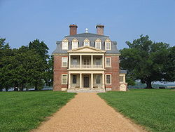 |
Hopewell Hopewell, Virginia Hopewell is an independent city in the Commonwealth of Virginia. The population was 22,591 at the 2010 Census . It is in Tri-Cities area of the Richmond-Petersburg region and is a portion of the Richmond Metropolitan Statistical Area... |
Charles City Charles City County, Virginia As of the census of 2000, there were 6,926 people, 2,670 households, and 1,975 families residing in the county. The population density was 38 people per square mile . There were 2,895 housing units at an average density of 16 per square mile... |
Oldest plantation in Virginia. | ||
| Skyline Drive Historic District Skyline Drive Skyline Drive is a 105-mile road that runs the entire length of the National Park Service's Shenandoah National Park in the Blue Ridge Mountains of Virginia, generally along the ridge of the mountains. The scenic drive is particularly popular in the fall when the leaves are changing colors... |
 |
Luray Luray, Virginia Luray is a town in Page County, Virginia, United States, in the Shenandoah Valley of the northern part of the state. It is also the county seat... |
Albemarle Albemarle County, Virginia As of the census of 2000, there were 79,236 people, 31,876 households, and 21,070 families residing in the county. The population density was 110 people per square mile . There were 33,720 housing units at an average density of 47 per square mile... |
Road through the Shenandoah National Park | ||
| Spence's Point (John Roderigo Dos Passos House) Spence's Point Spence's Point, on the Potomac River near Westmoreland, Virginia, also known as John R. Dos Passos Farm, was the home of writer John Dos Passos... |
Westmoreland Westmoreland, Westmoreland County, Virginia Westmoreland is an unincorporated community in Westmoreland County, in the U. S. state of Virginia.-References:*... |
Westmoreland Westmoreland County, Virginia As of the census of 2000, there were 16,718 people, 6,846 households, and 4,689 families residing in the county. The population density was . There were 9,286 housing units at an average density of... |
Farm home of writer John Roderigo Dos Passos. | |||
| ! | Stratford Hall Stratford Hall Plantation Stratford Hall Plantation in Westmoreland County, Virginia, was the home of four generations of the Lee family of Virginia, including two signers of the Declaration of Independence, and it was the birthplace of Robert Edward Lee , who became the Confederate General-in-chief during the American... |
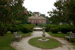 |
Lerty Lerty, Virginia Lerty is an unincorporated community in Westmoreland County, in the U. S. state of Virginia. Stratford Hall Plantation, a National Historic Landmark and birthplace of Robert E. Lee, is located near the community.-References:*... 38.1498014349°N 76.8397313057°W |
Westmoreland Westmoreland County, Virginia As of the census of 2000, there were 16,718 people, 6,846 households, and 4,689 families residing in the county. The population density was . There were 9,286 housing units at an average density of... |
Notable example of early Georgian architecture. Birthplace of Robert E Lee. | |
| Adam Thoroughgood House Adam Thoroughgood House The Adam Thoroughgood House is a brick house in located within the neighborhood of Thoroughgood, in Virginia Beach, Virginia. It was at one time thought to have been built in 1636, but recent research has placed its construction ca. 1720. The building underwent major restorations in 1923 and in the... |
Virginia Beach Virginia Beach, Virginia Virginia Beach is an independent city located in the Hampton Roads metropolitan area of Virginia, on the Atlantic Ocean at the mouth of the Chesapeake Bay... |
Virginia Beach (independent city) Virginia Beach, Virginia Virginia Beach is an independent city located in the Hampton Roads metropolitan area of Virginia, on the Atlantic Ocean at the mouth of the Chesapeake Bay... |
One of the oldest houses in the British Colonies, built by Adam Thoroughgood Adam Thoroughgood Adam Thoroughgood was a colonist and community leader in the Virginia Colony who helped settle the area of South Hampton Roads known in contemporary times as the independent city of Virginia Beach, Virginia.... . |
|||
| Thunderbird Archeological District Thunderbird Archeological District Thunderbird Archeological District"The district consists of three sites--Thunderbird Site, the Fifty Site, and the Fifty Bog--which provide a stratified cultural sequence spanning Paleo-Indian cultures through the end of Early Archaic times with scattered evidence of later occupation."It was... |
image pending | Limeton | Warren Warren County, Virginia As of the census of 2000, there were 31,584 people, 12,087 households, and 8,521 families residing in the county. The population density was 148 people per square mile . There were 13,299 housing units at an average density of 62 per square mile... |
Three archeological sites. | ||
| Tredegar Iron Works Tredegar Iron Works The Tredegar Iron Works was a historic iron foundry in Richmond, Virginia, United States of America, opened in 1837. During the American Civil War, the works served as the primary iron and artillery production facility of the Confederate States of America... |
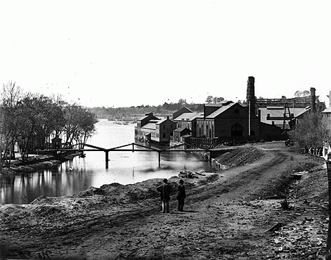 |
Richmond Richmond, Virginia Richmond is the capital of the Commonwealth of Virginia, in the United States. It is an independent city and not part of any county. Richmond is the center of the Richmond Metropolitan Statistical Area and the Greater Richmond area... |
Richmond (independent city) Richmond, Virginia Richmond is the capital of the Commonwealth of Virginia, in the United States. It is an independent city and not part of any county. Richmond is the center of the Richmond Metropolitan Statistical Area and the Greater Richmond area... |
One of the largest iron works from 1841 to 1865. | ||
| Tuckahoe Tuckahoe Plantation Tuckahoe, also known as Tuckahoe Plantation, is located on Route 650 near Manakin, Virginia overlapping both Goochland and Henrico counties... |
 |
Manakin | Goochland Goochland County, Virginia Goochland County is a county located in the Commonwealth of Virginia. As of 2010, the population was 21,717. Its county seat is Goochland. It is located in the Richmond-Petersburg region and is a portion of the Richmond Metropolitan Statistical Area .... and Henrico Henrico County, Virginia Henrico is a county located in the Commonwealth of Virginia, a state of the United States. As of 2010, Henrico was home to 306,935 people. It is located in the Richmond-Petersburg region and is a portion of the Richmond Metropolitan Statistical Area... |
Tuckahoe, owned by the Randolph family, was the home of president Thomas Jefferson for 7 years during his boyhood. | ||
| John Tyler House Sherwood Forest Plantation Sherwood Forest Plantation, also known as John Tyler House, is located on the north bank of the James River in Charles City County, Virginia. It is located on State Route 5, a scenic byway which runs between the independent cities of Richmond and Williamsburg... |
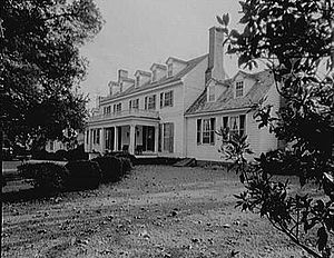 |
Charles City Charles City, Virginia Charles City is a census-designated place in and the county seat of Charles City County, Virginia, United States. The population as of the 2010 Census was 133.... |
Charles City Charles City County, Virginia As of the census of 2000, there were 6,926 people, 2,670 households, and 1,975 families residing in the county. The population density was 38 people per square mile . There were 2,895 housing units at an average density of 16 per square mile... |
Residence of President John Tyler John Tyler John Tyler was the tenth President of the United States . A native of Virginia, Tyler served as a state legislator, governor, U.S. representative, and U.S. senator before being elected Vice President . He was the first to succeed to the office of President following the death of a predecessor... . |
||
| University Of Virginia Historic District The Lawn The Lawn is a large, terraced grassy court at the historic center of Jefferson's academic community at the University of Virginia. The design shows Jefferson's mastery of Palladian architecture... |
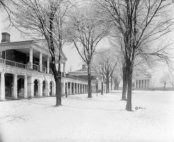 |
Charlottesville Charlottesville, Virginia Charlottesville is an independent city geographically surrounded by but separate from Albemarle County in the Commonwealth of Virginia, United States, and named after Charlotte of Mecklenburg-Strelitz, the queen consort of King George III of the United Kingdom.The official population estimate for... |
Charlottesville (independent city) Charlottesville, Virginia Charlottesville is an independent city geographically surrounded by but separate from Albemarle County in the Commonwealth of Virginia, United States, and named after Charlotte of Mecklenburg-Strelitz, the queen consort of King George III of the United Kingdom.The official population estimate for... |
District includes Jefferson's original "academical village" and the Rotunda. | ||
| Variable Density Tunnel Variable Density Tunnel The Variable Density Tunnel was a wind tunnel at NASA's Langley Research Center. It is a National Historic Landmark. It was the world's first variable density wind tunnel that allowed accurate testing with small-scale models... |
.gif) |
Hampton Hampton, Virginia Hampton is an independent city that is not part of any county in Southeast Virginia. Its population is 137,436. As one of the seven major cities that compose the Hampton Roads metropolitan area, it is on the southeastern end of the Virginia Peninsula. Located on the Hampton Roads Beltway, it hosts... 37.076825889°N 76.3441525971°W |
Hampton (independent city) Hampton, Virginia Hampton is an independent city that is not part of any county in Southeast Virginia. Its population is 137,436. As one of the seven major cities that compose the Hampton Roads metropolitan area, it is on the southeastern end of the Virginia Peninsula. Located on the Hampton Roads Beltway, it hosts... |
Steel tank from a wind tunnel at Langley Research Center Langley Research Center Langley Research Center is the oldest of NASA's field centers, located in Hampton, Virginia, United States. It directly borders Poquoson, Virginia and Langley Air Force Base... . (use source http://www.nps.gov/history/history/online_books/butowsky4/space1.htm) |
||
| Virginia Governor's Mansion Virginia Governor's Mansion The Virginia Governor's Mansion, better known as the Executive Mansion, is located in Richmond, Virginia on Capitol Square and serves as the official residence of the Governor of the Commonwealth of Virginia. Designed by Alexander Parris, it is the oldest occupied governor's mansion in the United... |
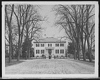 |
Richmond Richmond, Virginia Richmond is the capital of the Commonwealth of Virginia, in the United States. It is an independent city and not part of any county. Richmond is the center of the Richmond Metropolitan Statistical Area and the Greater Richmond area... 37.5367583392°N 77.432497723°W |
Richmond (independent city) Richmond, Virginia Richmond is the capital of the Commonwealth of Virginia, in the United States. It is an independent city and not part of any county. Richmond is the center of the Richmond Metropolitan Statistical Area and the Greater Richmond area... |
State Executive Mansion. | ||
| Virginia Military Institute Historic District Virginia Military Institute Historic District Virginia Military Institute Historic District is a portion of the Virginia Military Institute that was declared a National Historic Landmark and listed on the National Register of Historic Places in 1974.... |
.jpg) |
Lexington Lexington, Virginia Lexington is an independent city within the confines of Rockbridge County in the Commonwealth of Virginia. The population was 7,042 in 2010. Lexington is about 55 minutes east of the West Virginia border and is about 50 miles north of Roanoke, Virginia. It was first settled in 1777.It is home to... |
Lexington (independent city) Lexington, Virginia Lexington is an independent city within the confines of Rockbridge County in the Commonwealth of Virginia. The population was 7,042 in 2010. Lexington is about 55 minutes east of the West Virginia border and is about 50 miles north of Roanoke, Virginia. It was first settled in 1777.It is home to... |
First State-supported military college. | ||
| Maggie Lena Walker House Maggie L. Walker National Historic Site The Maggie L. Walker National Historic Site is a United States National Historic Landmark and a National Historic Site located at 110½ E. Leigh Street in the Jackson Ward neighborhood of Richmond, Virginia. The site was designated a U.S. National Historic Landmark in 1975. The National Historic... |
Richmond Richmond, Virginia Richmond is the capital of the Commonwealth of Virginia, in the United States. It is an independent city and not part of any county. Richmond is the center of the Richmond Metropolitan Statistical Area and the Greater Richmond area... 37.5459265937°N 77.4380019542°W |
Richmond (independent city) Richmond, Virginia Richmond is the capital of the Commonwealth of Virginia, in the United States. It is an independent city and not part of any county. Richmond is the center of the Richmond Metropolitan Statistical Area and the Greater Richmond area... |
Home of Maggie Lena Walker, first woman to establish an American bank. | |||
| Washington and Lee University Historic District Washington and Lee University Historic District Washington and Lee University Historic District is a historic district that includes a set of buildings on the campus of Washington and Lee University in Lexington, Virginia.The row of brick buildings that form the Front Campus, which trace to 1824, is a U.S... |
 |
Lexington Lexington, Virginia Lexington is an independent city within the confines of Rockbridge County in the Commonwealth of Virginia. The population was 7,042 in 2010. Lexington is about 55 minutes east of the West Virginia border and is about 50 miles north of Roanoke, Virginia. It was first settled in 1777.It is home to... 37.7855082917°N 79.4421129052°W |
Lexington (independent city) Lexington, Virginia Lexington is an independent city within the confines of Rockbridge County in the Commonwealth of Virginia. The population was 7,042 in 2010. Lexington is about 55 minutes east of the West Virginia border and is about 50 miles north of Roanoke, Virginia. It was first settled in 1777.It is home to... |
Neoclassical buildings that form one of the most dignified college campuses. Washington & Lee University | ||
| George Washington Boyhood Home Site Ferry Farm Ferry Farm, also known as George Washington Boyhood Home Site or Ferry Farm Site, is the name of the farm and home at which George Washington spent much of his childhood. The site is located in Stafford County, Virginia, along the northern bank of the Rappahannock River, across from the city of... |
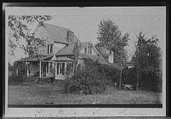 |
Fredericksburg Fredericksburg, Virginia Fredericksburg is an independent city in the Commonwealth of Virginia located south of Washington, D.C., and north of Richmond. As of the 2010 census, the city had a population of 24,286... |
Stafford Stafford County, Virginia Stafford County is a county located in the Commonwealth of Virginia, a U.S. state, and just across the Rappahannock River from the City of Fredericksburg. As of the 2000 census, the population was 92,446, increasing to 128,961 in 2010.. Its county seat is Stafford. In 2006, and again in 2009,... |
Known locally as Ferry Farm, site of fables about George Washington George Washington George Washington was the dominant military and political leader of the new United States of America from 1775 to 1799. He led the American victory over Great Britain in the American Revolutionary War as commander-in-chief of the Continental Army from 1775 to 1783, and presided over the writing of... 's boyhood |
||
| Waterford Historic District |  |
Waterford Waterford, Virginia Waterford is an unincorporated village in the Catoctin Valley of Loudoun County, Virginia, located along Catoctin Creek. Waterford is northwest of Washington, D.C., and northwest of Leesburg... |
Loudoun Loudoun County, Virginia Loudoun County is a county located in the Commonwealth of Virginia, and is part of the Washington Metropolitan Area. As of the 2010 U.S. Census, the county is estimated to be home to 312,311 people, an 84 percent increase over the 2000 figure of 169,599. That increase makes the county the fourth... |
Picturesque village, oldest settlement in Loudoun County | ||
| Westover Westover Plantation Westover Plantation is located on the north bank of the James River in Charles City County, Virginia. It is located south of State Route 5, a scenic byway which runs between the independent cities of Richmond and Williamsburg... |
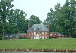 |
Charles City Charles City, Virginia Charles City is a census-designated place in and the county seat of Charles City County, Virginia, United States. The population as of the 2010 Census was 133.... 37°19′58"N 77°10′23"W |
Charles City Charles City County, Virginia As of the census of 2000, there were 6,926 people, 2,670 households, and 1,975 families residing in the county. The population density was 38 people per square mile . There were 2,895 housing units at an average density of 16 per square mile... |
Plantation that is ancestral seat of the Byrd family | ||
| White House of the Confederacy | 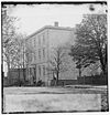 |
Richmond Richmond, Virginia Richmond is the capital of the Commonwealth of Virginia, in the United States. It is an independent city and not part of any county. Richmond is the center of the Richmond Metropolitan Statistical Area and the Greater Richmond area... 37.5388878372°N 77.4297377619°W |
Richmond (independent city) Richmond, Virginia Richmond is the capital of the Commonwealth of Virginia, in the United States. It is an independent city and not part of any county. Richmond is the center of the Richmond Metropolitan Statistical Area and the Greater Richmond area... |
Residence of Confederate Confederate States of America The Confederate States of America was a government set up from 1861 to 1865 by 11 Southern slave states of the United States of America that had declared their secession from the U.S... President Jefferson Davis Jefferson Davis Jefferson Finis Davis , also known as Jeff Davis, was an American statesman and leader of the Confederacy during the American Civil War, serving as President for its entire history. He was born in Kentucky to Samuel and Jane Davis... . |
||
| Wickham-Valentine House |  |
Richmond Richmond, Virginia Richmond is the capital of the Commonwealth of Virginia, in the United States. It is an independent city and not part of any county. Richmond is the center of the Richmond Metropolitan Statistical Area and the Greater Richmond area... 37.5395803278°N 77.4311182643°W |
Richmond Richmond County, Virginia Richmond County is a county located on the Northern Neck in the Commonwealth of Virginia, a state in the United States. As of 2010, the population was 9,254. Its county seat is Warsaw. The rural county should not be confused with the large city and state capital Richmond, Virginia, which is over... |
One of Richmond's finest Federal residences. | ||
| Williamsburg Historic District Colonial Williamsburg Colonial Williamsburg is the private foundation representing the historic district of the city of Williamsburg, Virginia, USA. The district includes buildings dating from 1699 to 1780 which made colonial Virginia's capital. The capital straddled the boundary of the original shires of Virginia —... |
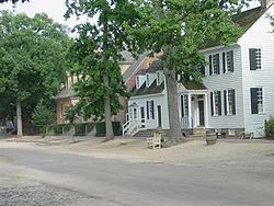 |
Williamsburg Williamsburg, Virginia Williamsburg is an independent city located on the Virginia Peninsula in the Hampton Roads metropolitan area of Virginia, USA. As of the 2010 Census, the city had an estimated population of 14,068. It is bordered by James City County and York County, and is an independent city... |
Williamsburg (independent city) Williamsburg, Virginia Williamsburg is an independent city located on the Virginia Peninsula in the Hampton Roads metropolitan area of Virginia, USA. As of the 2010 Census, the city had an estimated population of 14,068. It is bordered by James City County and York County, and is an independent city... |
Capital of Virginia from 1699 to 1799. | ||
| Woodlawn Woodlawn Plantation Woodlawn Plantation is a historic home located in Fairfax County, Virginia, and was originally a part of Mount Vernon, George Washington's historic plantation estate.... |
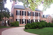 |
Alexandria Alexandria, Virginia Alexandria is an independent city in the Commonwealth of Virginia. As of 2009, the city had a total population of 139,966. Located along the Western bank of the Potomac River, Alexandria is approximately six miles south of downtown Washington, D.C.Like the rest of northern Virginia, as well as... |
Fairfax Fairfax County, Virginia Fairfax County is a county in Virginia, in the United States. Per the 2010 Census, the population of the county is 1,081,726, making it the most populous jurisdiction in the Commonwealth of Virginia, with 13.5% of Virginia's population... |
Flagship property of the National Trust for Historic Preservation National Trust for Historic Preservation The National Trust for Historic Preservation is an American member-supported organization that was founded in 1949 by congressional charter to support preservation of historic buildings and neighborhoods through a range of programs and activities, including the publication of Preservation... . Try also Woodlawn Woodlawn, Virginia Woodlawn is a census-designated place in Carroll County, Virginia, United States. The population was 2,249 at the 2000 census. Woodlawn is musically notable as the home of Heritage Shoppe and Heritage Records, a store and record label owned by Bobby Patterson, a musician from a regionally... |
||
| Woodrow Wilson Birthplace | 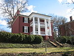 |
Staunton Staunton, Virginia Staunton is an independent city within the confines of Augusta County in the commonwealth of Virginia. The population was 23,746 as of 2010. It is the county seat of Augusta County.... 38.1484733285°N 79.0691360817°W |
Staunton (independent city) Staunton, Virginia Staunton is an independent city within the confines of Augusta County in the commonwealth of Virginia. The population was 23,746 as of 2010. It is the county seat of Augusta County.... |
Birthplace of President Thomas Woodrow Wilson. | ||
| Wren Building, College of William and Mary Wren Building The Wren Building is the signature building of the College of William and Mary in Williamsburg, Virginia, USA. Along with the Brafferton and President's House, these buildings form the College's Historic Campus.... |
 |
Williamsburg Williamsburg, Virginia Williamsburg is an independent city located on the Virginia Peninsula in the Hampton Roads metropolitan area of Virginia, USA. As of the 2010 Census, the city had an estimated population of 14,068. It is bordered by James City County and York County, and is an independent city... 37.2689728498°N 76.7091257019°W |
Williamsburg (independent city) Williamsburg, Virginia Williamsburg is an independent city located on the Virginia Peninsula in the Hampton Roads metropolitan area of Virginia, USA. As of the 2010 Census, the city had an estimated population of 14,068. It is bordered by James City County and York County, and is an independent city... |
Wren Building at the College of William and Mary College of William and Mary The College of William & Mary in Virginia is a public research university located in Williamsburg, Virginia, United States... . |
||
| Wythe House Wythe House Wythe House was the Williamsburg, Virginia home of George Wythe, signer of the Declaration of Independence and father of American jurisprudence. It is located in what is now Colonial Williamsburg, on Palace Green, adjacent to Bruton Parish Church... |
 |
Williamsburg Williamsburg, Virginia Williamsburg is an independent city located on the Virginia Peninsula in the Hampton Roads metropolitan area of Virginia, USA. As of the 2010 Census, the city had an estimated population of 14,068. It is bordered by James City County and York County, and is an independent city... 37.2699583647°N 76.7032836156°W |
Williamsburg (independent city) Williamsburg, Virginia Williamsburg is an independent city located on the Virginia Peninsula in the Hampton Roads metropolitan area of Virginia, USA. As of the 2010 Census, the city had an estimated population of 14,068. It is bordered by James City County and York County, and is an independent city... |
One of Virginia's finest Georgian brick townhouse and home of George Wythe George Wythe George Wythe was an American lawyer, a judge, a prominent law professor and "Virginia's foremost classical scholar." He was a teacher and mentor of Thomas Jefferson. Wythe's signature is positioned at the head of the list of seven Virginia signatories on the United States Declaration of Independence... . |
||
| Yeocomico Church Yeocomico Church Yeocomico Church is an historic church in Westmoreland County in the U.S. state of Virginia. The original wooden structure was built in 1655. It was replaced in 1706 by a structure built of locally fired bricks... |
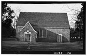 |
Tucker Hill Tucker Hill, Virginia Tucker Hill is an unincorporated community in Westmoreland County, in the U. S. state of Virginia.-References:*... |
Westmoreland Westmoreland County, Virginia As of the census of 2000, there were 16,718 people, 6,846 households, and 4,689 families residing in the county. The population density was . There were 9,286 housing units at an average density of... |
Significant example of transitional Colonial architecture. |
Historic areas administered by the National Park Service
National Historic Sites, National Historical Parks, National Memorials, and certain other areas listed in the National Park system are historic landmarks of national importance that are highly protected already, often before the inauguration of the NHL program in 1960, and are then often not also named NHLs per se. There are 13 of these in Virginia. The National Park Service lists these thirteen together with the NHLs in the state, The Cedar Creek and Belle Grove National Historical ParkCedar Creek and Belle Grove National Historical Park
Cedar Creek and Belle Grove National Historical Park became the 388th unit of the United States National Park Service when it was authorized on December 19, 2002...
and the Maggie L. Walker National Historic Site
Maggie L. Walker National Historic Site
The Maggie L. Walker National Historic Site is a United States National Historic Landmark and a National Historic Site located at 110½ E. Leigh Street in the Jackson Ward neighborhood of Richmond, Virginia. The site was designated a U.S. National Historic Landmark in 1975. The National Historic...
are also NHLs and are listed above. The remaining 11 are:
| Landmark name |
Image | Date established | Location | County | Description | |
|---|---|---|---|---|---|---|
| Appomattox Court House National Historical Park Appomattox Court House National Historical Park The Appomattox Court House National Historical Park is a National Historical Park of original and reconstructed nineteenth century buildings. It was signed into law August 3, 1935. The village was made a national monument in 1940 and a national historical park in 1954... |
 |
Appomattox Appomattox, Virginia Appomattox is a town in Appomattox County, Virginia, United States. The population was 1,761 at the 2000 census. It is the county seat of Appomattox County.Appomattox is part of the Lynchburg Metropolitan Statistical Area.-History:... |
Appomattox Appomattox County, Virginia Appomattox County is a county located in the Commonwealth of Virginia. As of 2010, the population was 14,973. Its county seat is Appomattox. For a long time, Appomattox was a prohibition or dry county... |
|||
| Arlington House, The Robert E. Lee Memorial Arlington House, The Robert E. Lee Memorial Arlington House, The Robert E. Lee Memorial, formerly named the Custis-Lee Mansion, is a Greek revival style mansion located in Arlington, Virginia, USA that was once the home of Confederate General Robert E. Lee. It overlooks the Potomac River, directly across from the National Mall in Washington,... |
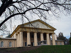 |
Arlington | Arlington Arlington County, Virginia Arlington County is a county in the Commonwealth of Virginia. The land that became Arlington was originally donated by Virginia to the United States government to form part of the new federal capital district. On February 27, 1801, the United States Congress organized the area as a subdivision of... |
|||
| Booker T. Washington National Monument Booker T. Washington National Monument The Booker T. Washington National Monument is a National Monument near Hardy, Franklin County, Virginia. It preserves portions of the 207-acre tobacco farm on which educator and leader Booker T. Washington was born into slavery on April 5, 1856... |
 |
Hardy Hardy, Virginia Hardy is an unincorporated community lying both in Bedford County and Franklin County, Virginia, United States, about twenty miles southeast of Roanoke. The Booker T. Washington National Monument commemorates where Booker T. Washington was born in 1856.... |
Franklin Franklin County, Virginia As of the census of 2000, there were 47,286 people, 18,963 households, and 13,918 families residing in the county. The population density was 68 people per square mile . There were 22,717 housing units at an average density of 33 per square mile... |
|||
| Colonial National Historical Park Colonial National Historical Park Colonial National Historical Park is located in the Hampton Roads region of Virginia and is operated by the National Park Service of the United States government... |
.jpg) |
James City James City County, Virginia James City County is a county located on the Virginia Peninsula in the Hampton Roads metropolitan area of the Commonwealth of Virginia, a state of the United States. Its population was 67,009 , and it is often associated with Williamsburg, an independent city, and Jamestown which is within the... , York York County, Virginia York County is a county located on the north side of the Virginia Peninsula in the Hampton Roads metropolitan area of the Commonwealth of Virginia, a state of the United States. Situated on the York River and many tributaries, the county seat is the unincorporated town of Yorktown... and Williamsburg (independent city) Williamsburg, Virginia Williamsburg is an independent city located on the Virginia Peninsula in the Hampton Roads metropolitan area of Virginia, USA. As of the 2010 Census, the city had an estimated population of 14,068. It is bordered by James City County and York County, and is an independent city... |
||||
| Cumberland Gap National Historical Park Cumberland Gap National Historical Park Established on June 11, 1940, Cumberland Gap National Historical Park is a United States National Historical Park located at the border between Kentucky, Tennessee, and Virginia. The Cumberland Gap is a sizable natural break in the Appalachian Mountains.... |
 |
(shared with Kentucky and Tennessee) | ||||
| Fredericksburg and Spotsylvania County Battlefields Memorial National Military Park | 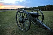 |
Fredericksburg Fredericksburg, Virginia Fredericksburg is an independent city in the Commonwealth of Virginia located south of Washington, D.C., and north of Richmond. As of the 2010 census, the city had a population of 24,286... , Chancellorsville Chancellorsville, Virginia Chancellorsville is a historic site and unincorporated community in Virginia, about ten miles west of Fredericksburg. It is located in Spotsylvania County. The name of the locale derives from the mid-19th century inn operated by the family of George Chancellor at the intersection of the Orange... , and Spotsylvania |
Spotsylvania Spotsylvania County, Virginia As of the census of 2000, there were 90,395 people, 31,308 households, and 24,639 families residing in the county. The population density was 226 people per square mile . There were 33,329 housing units at an average density of 83 per square mile... |
|||
| George Washington Birthplace National Monument George Washington Birthplace National Monument The George Washington Birthplace National Monument is in Westmoreland County, Virginia, United States. Originally settled by John Washington, George Washington's great-grandfather, George Washington was born here on February 22, 1732... |
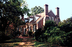 |
Colonial Beach Colonial Beach, Virginia Colonial Beach is a town in Westmoreland County, Virginia, United States. The population was 3,228 at the 2000 census. Possessing the second largest beach front in the state, Colonial Beach was a popular resort town in the early to mid-20th century, before the Chesapeake Bay Bridge made ocean... |
Westmoreland Westmoreland County, Virginia As of the census of 2000, there were 16,718 people, 6,846 households, and 4,689 families residing in the county. The population density was . There were 9,286 housing units at an average density of... |
|||
| Harpers Ferry National Historical Park Harpers Ferry National Historical Park Harpers Ferry National Historical Park is located at the confluence of the Potomac and Shenandoah rivers in and around Harpers Ferry, West Virginia. The park includes land in Jefferson County, West Virginia; Washington County, Maryland and Loudoun County, Virginia. The park is managed by the... |
 |
Harpers Ferry, WV Harpers Ferry, West Virginia Harpers Ferry is a historic town in Jefferson County, West Virginia, United States. In many books the town is called "Harper's Ferry" with an apostrophe.... |
(shared with Maryland and West Virginia) | |||
| Manassas National Battlefield Park Manassas National Battlefield Park Manassas National Battlefield Park, located north of Manassas, in Prince William County, Virginia preserves the site of two major American Civil War battles: the First Battle of Bull Run on July 21, 1861, and the Second Battle of Bull Run which was fought between August 28 and August 30, 1862... |
 |
Manassas Manassas, Virginia The City of Manassas is an independent city surrounded by Prince William County and the independent city of Manassas Park in the Commonwealth of Virginia in the United States. Its population was 37,821 as of 2010. Manassas also surrounds the county seat for Prince William County but that county... |
Prince William Prince William County, Virginia -National protected areas:* Featherstone National Wildlife Refuge* Manassas National Battlefield Park* Occoquan Bay National Wildlife Refuge* Prince William Forest Park-Government and politics:... |
Site of the First First Battle of Bull Run First Battle of Bull Run, also known as First Manassas , was fought on July 21, 1861, in Prince William County, Virginia, near the City of Manassas... and Second Battles of Bull Run Second Battle of Bull Run The Second Battle of Bull Run or Second Manassas was fought August 28–30, 1862, as part of the American Civil War. It was the culmination of an offensive campaign waged by Confederate Gen. Robert E. Lee's Army of Northern Virginia against Union Maj. Gen... . |
||
| Petersburg National Battlefield Petersburg National Battlefield Petersburg National Battlefield is a National Park Service unit preserving sites related to the American Civil War Siege of Petersburg. The Battlefield is centered around Petersburg, Virginia, and also includes outlying components in Hopewell, Prince George County, and Dinwiddie County... |
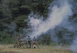 |
Petersburg Petersburg, Virginia Petersburg is an independent city in Virginia, United States located on the Appomattox River and south of the state capital city of Richmond. The city's population was 32,420 as of 2010, predominantly of African-American ethnicity... , Hopewell Hopewell, Virginia Hopewell is an independent city in the Commonwealth of Virginia. The population was 22,591 at the 2010 Census . It is in Tri-Cities area of the Richmond-Petersburg region and is a portion of the Richmond Metropolitan Statistical Area... , and more |
Petersburg (independent city) Petersburg, Virginia Petersburg is an independent city in Virginia, United States located on the Appomattox River and south of the state capital city of Richmond. The city's population was 32,420 as of 2010, predominantly of African-American ethnicity... , and Dinwiddie Dinwiddie County, Virginia Dinwiddie County is a county located in the Commonwealth of Virginia. As of 2010, the population was 28,001. Its county seat is Dinwiddie.- History :... |
May include NHL Petersburg Breakthrough Battlefield Petersburg Breakthrough Battlefield Petersburg Breakthrough Battlefield is a historic district in Petersburg, Virginia. It was the location of a Union army breakthrough of the Petersburg to Richmond trenches and fortifications on April 2, 1865. The success of the breakthrough led to abandonment of Richmond by the General Robert E... , and does include NHL Five Forks Battlefield Five Forks Battlefield Five Forks Battlefield is the area where, late in the American Civil War, General Grant's troops broke the extended lines of General Lee's Confederate forces, cutting the last rail line supporting Petersburg, causing the Confederates to abandon that city, and in turn undermining the defense of... , both listed above, as well as other area. |
||
| Richmond National Battlefield Park Richmond National Battlefield Park Richmond National Battlefield Park commemorates more than 30 American Civil War sites around Richmond, Virginia, which served as the capital of the Confederate States of America for the majority of the war... |
 |
Richmond, Virginia Richmond, Virginia Richmond is the capital of the Commonwealth of Virginia, in the United States. It is an independent city and not part of any county. Richmond is the center of the Richmond Metropolitan Statistical Area and the Greater Richmond area... and environs |
Richmond (independent city) Richmond, Virginia Richmond is the capital of the Commonwealth of Virginia, in the United States. It is an independent city and not part of any county. Richmond is the center of the Richmond Metropolitan Statistical Area and the Greater Richmond area... |
30 sites of American Civil War battles, including Gaines 'Mill, Glendale, and Malvern Hill Battle of Malvern Hill The Battle of Malvern Hill, also known as the Battle of Poindexter's Farm, took place on July 1, 1862, in Henrico County, Virginia, on the seventh and last day of the Seven Days Battles of the American Civil War. Gen. Robert E. Lee launched a series of disjointed assaults on the nearly impregnable... , all sites of battles during the 1862 Seven Days Battles Seven Days Battles The Seven Days Battles was a series of six major battles over the seven days from June 25 to July 1, 1862, near Richmond, Virginia during the American Civil War. Confederate General Robert E. Lee drove the invading Union Army of the Potomac, commanded by Maj. Gen. George B. McClellan, away from... , as well as the 1864 battles of Cold Harbor Battle of Cold Harbor The Battle of Cold Harbor was fought from May 31 to June 12, 1864 . It was one of the final battles of Union Lt. Gen. Ulysses S. Grant's Overland Campaign during the American Civil War, and is remembered as one of American history's bloodiest, most lopsided battles... and New Market Heights |
Former NHLs
While no National Historic Landmarks in Virginia have been de-designated, one has been moved out of the state.| Landmark name | Image | Date designated | Locality | County | Description | |
|---|---|---|---|---|---|---|
| USS Sequoia (presidential yacht) USS Sequoia (presidential yacht) USS Sequoia is a former United States presidential yacht used from Herbert Hoover to Jimmy Carter, who had it sold in 1977. The ship was decommissioned under Roosevelt and lost its "USS" status at that time, but by popular convention is still often used... |
Now in the District of Columbia. |
See also
- List of areas in the National Park System of the United States in Virginia
- National Register of Historic Places listings in VirginiaNational Register of Historic Places listings in VirginiaBuildings, sites, districts, and objects in Virginia listed on the National Register of Historic Places:As of November 25, 2011, there are 2,768 properties and districts listed on the National Register of Historic Places in all 95 Virginia counties and 36 of 39 independent cities, including 119...
- List of National Historic Landmarks by state
External links
- National Register Information System, National Park Service.

