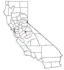
New Don Pedro Dam
Encyclopedia

Tuolumne River
The Tuolumne River is a California river that flows nearly from the central Sierra Nevada to the San Joaquin River in the Central Valley...
and creates Lake Don Pedro in the foothills of the Sierra Nevada mountain range in the U.S. state
U.S. state
A U.S. state is any one of the 50 federated states of the United States of America that share sovereignty with the federal government. Because of this shared sovereignty, an American is a citizen both of the federal entity and of his or her state of domicile. Four states use the official title of...
of California
California
California is a state located on the West Coast of the United States. It is by far the most populous U.S. state, and the third-largest by land area...
. The New Don Pedro Dam takes its name from Don Pedros Bar which was named after Pierre "Don Pedro" Sainsevain
Pierre Sainsevain
Pierre "Don Pedro" Sainsevain was a French settler in California during the Mexican era. Sainsevain was the recipient of a Mexican land grant, and built a lumber mill and a flour mill...
. Since its construction, the original Don Pedro Dam
Don Pedro Dam
The Don Pedro Dam, since 1971 also known as the Old Don Pedro Dam, was a dam across the Tuolumne River in Tuolumne County, California. The structure is currently flooded underneath Don Pedro Reservoir, which is formed by the New Don Pedro Dam....
has been flooded underneath its reservoir, Lake Don Pedro.
The dam is an earth and rock fill type at 37.7008°N 120.4208°W that is 585 feet (178.3 m) high, 2800 feet (853.4 m) thick at the base, and 1900 feet (579.1 m) long. The dam contains 16,750,000 cubic yards (12,800,000 m³) of material, much of which came from gold dredge
Dredge
Dredging is an excavation activity or operation usually carried out at least partly underwater, in shallow seas or fresh water areas with the purpose of gathering up bottom sediments and disposing of them at a different location...
tailings
Tailings
Tailings, also called mine dumps, slimes, tails, leach residue, or slickens, are the materials left over after the process of separating the valuable fraction from the uneconomic fraction of an ore...
in the Tuolumne River
Tuolumne River
The Tuolumne River is a California river that flows nearly from the central Sierra Nevada to the San Joaquin River in the Central Valley...
bed downstream near La Grange
La Grange, California
La Grange is a small unincorporated community in rural Stanislaus County, California, United States. Its altitude is 249 feet. As of 2008 it has a population of 345. , and it is located at .-History:...
. Construction was started in September of 1967, the dam was topped out on May 28, 1970, and the dam was dedicated on May 22, 1971. While the Turlock Irrigation District (TID) operates the powerhouse
Hydroelectricity
Hydroelectricity is the term referring to electricity generated by hydropower; the production of electrical power through the use of the gravitational force of falling or flowing water. It is the most widely used form of renewable energy...
at the dam's base, the Modesto Irrigation District (MID) owns 31.54% of the plant and so is entitled to about 63 megawatts of the 203 MW produced by the four generator
Electrical generator
In electricity generation, an electric generator is a device that converts mechanical energy to electrical energy. A generator forces electric charge to flow through an external electrical circuit. It is analogous to a water pump, which causes water to flow...
s.
Behind Don Pedro Dam is Lake Don Pedro, also called Don Pedro Reservoir, which holds up to 2030000 acre.ft of water, making it the 6th largest body of water in California. Water leaving the dam's powerhouse flows about 2.5 miles (4 km) downstream to the La Grange Dam
La Grange Dam
The La Grange Dam is a masonry-gravity diversion dam on the Tuolumne River near La Grange, California. The dam was completed in 1883 by the Turlock Irrigation District and Modesto Irrigation District in an effort to divert water into their canal systems for local farmers.The La Grange Dam is two...
where about 885000 acre.ft of water is released into two canals. About 575000 acre.ft goes through TID's canal to Turlock Lake and another 310000 acre.ft goes through MID's canal to Modesto Reservoir. Nearly all of this water irrigates crops in the Turlock and Modesto Irrigation Districts. Another 230000 acre.ft goes to San Francisco's Hetch Hetchy Water and Power. And, finally, about 780000 acre.ft of water is delivered to the Tuolumne River
Tuolumne River
The Tuolumne River is a California river that flows nearly from the central Sierra Nevada to the San Joaquin River in the Central Valley...
channel to maintain flows in the 52 miles (84 km) of the Lower Tuolumne River through its confluence with the San Joaquin River
San Joaquin River
The San Joaquin River is the largest river of Central California in the United States. At over long, the river starts in the high Sierra Nevada, and flows through a rich agricultural region known as the San Joaquin Valley before reaching Suisun Bay, San Francisco Bay, and the Pacific Ocean...
and then into the Sacramento-San Joaquin Delta.

