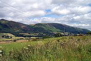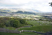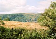
Ochil Hills
Encyclopedia

Scotland
Scotland is a country that is part of the United Kingdom. Occupying the northern third of the island of Great Britain, it shares a border with England to the south and is bounded by the North Sea to the east, the Atlantic Ocean to the north and west, and the North Channel and Irish Sea to the...
north of the Forth
River Forth
The River Forth , long, is the major river draining the eastern part of the central belt of Scotland.The Forth rises in Loch Ard in the Trossachs, a mountainous area some west of Stirling...
valley bordered by the towns of Stirling
Stirling
Stirling is a city and former ancient burgh in Scotland, and is at the heart of the wider Stirling council area. The city is clustered around a large fortress and medieval old-town beside the River Forth...
, Alloa
Alloa
Alloa is a town and former burgh in Clackmannanshire, set in the Central Lowlands of Scotland. It lies on on the north bank of the Firth of Forth close to the foot of the Ochil Hills, east of Stirling and north of Falkirk....
, Kinross
Kinross
Kinross is a burgh in Perth and Kinross, Scotland. It was formerly the county town of Kinross-shire.Kinross is a fairly small town, with some attractive buildings...
and Perth
Perth, Scotland
Perth is a town and former city and royal burgh in central Scotland. Located on the banks of the River Tay, it is the administrative centre of Perth and Kinross council area and the historic county town of Perthshire...
. The only major roads crossing the hills pass through Glen Devon/Glen Eagles
Gleneagles, Scotland
Gleneagles is a glen which connects with Glen Devon to form a pass through the Ochil Hills of Perth and Kinross in Scotland...
and Glenfarg
Glenfarg
Glenfarg is a small village in the Ochil Hills in the county of Perth and Kinross, central Scotland. The village benefited from a station on the Perth to Kinross railway line until the line's closure in 1964. The North British Railway experienced problems because of the landscape, which required 2...
, the latter now largely replaced except for local traffic by the M90
M90
M90 or M-90 may refer to:* M90 , a camouflage pattern used by the Swedish armed forces* M-90 , a state highway in Michigan* M90 motorway, a motorway in Scotland* Barrett M90, a bullpup sniper rifle...
Edinburgh
Edinburgh
Edinburgh is the capital city of Scotland, the second largest city in Scotland, and the eighth most populous in the United Kingdom. The City of Edinburgh Council governs one of Scotland's 32 local government council areas. The council area includes urban Edinburgh and a rural area...
-Perth motorway cutting through the eastern foothills. The hills are part of a Devonian
Devonian
The Devonian is a geologic period and system of the Paleozoic Era spanning from the end of the Silurian Period, about 416.0 ± 2.8 Mya , to the beginning of the Carboniferous Period, about 359.2 ± 2.5 Mya...
lava extrusion whose appearance today is largely due to the Ochil Fault
Ochil Fault
The Ochil Fault is the geological feature which defines the southern edge of the Ochil Hills escarpment, Scotland.North of the fault, Devonian lava flows and pyroclastic deposits slope gently down, thinning towards the north. These are in part overlain by Old Red Sandstone rocks formed later in the...
which results in the southern face of the hills forming an escarpment
Escarpment
An escarpment is a steep slope or long cliff that occurs from erosion or faulting and separates two relatively level areas of differing elevations.-Description and variants:...
. The plateau is undulating with no prominent peak, the highest point being Ben Cleuch
Ben Cleuch
Ben Cleuch is a mountain in Scotland.It is the highest point in the Ochil Hills, and the highest point in Clackmannanshire. It is high....
at 721m The south-flowing burns have cut deep ravine
Ravine
A ravine is a landform narrower than a canyon and is often the product of streamcutting erosion. Ravines are typically classified as larger in scale than gullies, although smaller than valleys. A ravine is generally a fluvial slope landform of relatively steep sides, on the order of twenty to...
s including Dollar
Dollar, Clackmannanshire
Dollar is a small town in Clackmannanshire, Scotland. It is one of the Hillfoots Villages, situated between the Ochil Hills range to the north and the River Devon to the south. Dollar is on the A91 road, which runs from Stirling to St. Andrews. The town is around 3 miles east of Tillicoultry...
Glen, Silver Glen
Silver Glen
The Silver Glen lies approximately 1 km to the east of the town of Alva, Clackmannanshire, Scotland, and takes its name from the silver that was mined there in the early 18th century. The story of the silver mine is a remarkable one...
and Alva Glen, often only passable with the aid of wooden walkways.
Historically, the hills, combined with the town being built at the lowest bridge-point on the River Forth, led to Stirling's
Stirling
Stirling is a city and former ancient burgh in Scotland, and is at the heart of the wider Stirling council area. The city is clustered around a large fortress and medieval old-town beside the River Forth...
importance as a main gateway to the Highlands
Scottish Highlands
The Highlands is an historic region of Scotland. The area is sometimes referred to as the "Scottish Highlands". It was culturally distinguishable from the Lowlands from the later Middle Ages into the modern period, when Lowland Scots replaced Scottish Gaelic throughout most of the Lowlands...
. They also acted as a boundary to the Kingdom of Fife
Fife
Fife is a council area and former county of Scotland. It is situated between the Firth of Tay and the Firth of Forth, with inland boundaries to Perth and Kinross and Clackmannanshire...
. Castle Campbell
Castle Campbell
Castle Campbell is a mediæval castle situated above the town of Dollar, Clackmannanshire in central Scotland. It was the seat of the Earls and Dukes of Argyll, chiefs of Clan Campbell.- History :...
was built at the head of Dollar Glen in the late 15th century (an earlier castle on the site being called "Castle Gloom") mainly as a very visible symbol of the Campbell
Clan Campbell
Clan Campbell is a Highland Scottish clan. Historically one of the largest, most powerful and most successful of the Highland clans, their lands were in Argyll and the chief of the clan became the Earl and later Duke of Argyll.-Origins:...
domination of the area. Sheriffmuir
Sheriffmuir
Sheriffmuir , the site of the inconclusive 1715 Battle of Sheriffmuir , lies on the slopes of the Ochil Hills just inside the Perthshire border in Scotland...
, the site of the 1715 battle of the Jacobite rising
Jacobite rising
The Jacobite Risings were a series of uprisings, rebellions, and wars in Great Britain and Ireland occurring between 1688 and 1746. The uprisings were aimed at returning James VII of Scotland and II of England, and later his descendants of the House of Stuart, to the throne after he was deposed by...
is on the northern slopes of the hills. In the early Industrial Revolution
Industrial Revolution
The Industrial Revolution was a period from the 18th to the 19th century where major changes in agriculture, manufacturing, mining, transportation, and technology had a profound effect on the social, economic and cultural conditions of the times...
, several mill towns such as Tillicoultry
Tillicoultry
Tillicoultry...
, Alva and Menstrie
Menstrie
Menstrie is a village in the county of Clackmannanshire in Scotland, UK. It is about 5 miles east-north-east of Stirling...
(the Hillfoots Villages
Hillfoots Villages
The Hillfoots Villages are the villages and small towns which lie at the base of the southern scarp face of the Ochil Hills, formed by the Ochil Fault, in Stirlingshire and Clackmannanshire in central Scotland....
) grew up in the shadow of the Ochils to tap the water power. Some of the mills are open today as museums.

G8
The Group of Eight is a forum, created by France in 1975, for the governments of seven major economies: Canada, France, Germany, Italy, Japan, the United Kingdom, and the United States. In 1997, the group added Russia, thus becoming the G8...
protests in July 2005.
Proposed wind farms
A proposal for an 18 turbine development at Green Knowes, south of AuchterarderAuchterarder
Auchterarder is a small town located north of the Ochil Hills in Perth and Kinross, Scotland, and home to the famous Gleneagles Hotel. The 1.5 mile long High Street of Auchterarder gave the town its popular name of "Lang Toon"....
, north of Glendevon was approved in June 2006. The development will be situated about 400m north of the Ben Thrush summit. This is now complete.
In early 2007 approval was given for the construction of a wind farm
Wind farm
A wind farm is a group of wind turbines in the same location used to produce electric power. A large wind farm may consist of several hundred individual wind turbines, and cover an extended area of hundreds of square miles, but the land between the turbines may be used for agricultural or other...
consisting of 13 102 m (334 ft) turbines on Burnfoot Hill, which lies north of Tillicoultry
Tillicoultry
Tillicoultry...
and Ben Cleuch
Ben Cleuch
Ben Cleuch is a mountain in Scotland.It is the highest point in the Ochil Hills, and the highest point in Clackmannanshire. It is high....
and to the south of the Upper Glendevon Reservoir.
Construction of this site has begun.
Selection of summits in the Ochil Hills
- Andrew Gannel Hill (670m)
- Ben Buck (679m)
- Ben CleuchBen CleuchBen Cleuch is a mountain in Scotland.It is the highest point in the Ochil Hills, and the highest point in Clackmannanshire. It is high....
(721m)
- Ben Ever (622m)
- Ben Shee (516m)
- Blairdenon (631m)
- Burnfoot Hill (526m)
- Colsnaur Hill (553m)
- Tarmangie (645m)
- White Wisp (643m)
- The LawThe Law- Music :* The Law , an English rock group** The Law * The Law , an indie rock band from Scotland* The Law * "The Law", a song by Leonard Cohen on the album Various Positions- Film :...
(638m) - Kings Seat (648m)
- Greenforet Hill (616m)
- Innerdownie (611m = 2005 feet; the lowest of the 2000ft summits in the ochils.)
- Mickle Corum (594m)
- Scad Hill (586m)
- Bengengie Hill (565m)
- Grodwell Hill (553m)
- Core Hill (543m)
- Sauchanwood Hill (541m)
- Wood Hill (525m)
- Craig Leith (513m)
- Wether Hill (503m)
- Bald Hill (500m)
- Elistoun Hill (497m)
- Craigentaggert Hill (493m)
- Steele's Knowe (485m)
- Sim's Hill (482m)
- Glentye Hill (481m)
- Eastbow Hill (476m)
- Commonedge Hill (468m)
- Hillfoot Hill (442m)
- The Nebit (438m)
- The Seat (429m)
- Kinpauch Hill (426m)
- DumyatDumyatDumyat is a hill at the western extremity of the Ochil Hills in central Scotland. The name is thought to originate from Dun of the Maeatae....
(418m) - Loss Hill (417m)
- Craig Rossie (410m)
- Myreton HillMyreton HillMyreton Hill is the hill immediately behind the village of Menstrie in the Ochil Hills of Scotland. See the for location.The track up the scarp face of Myreton Hill leads to some calcite workings which date from the Napoleonic Wars...
(387m) - Black Hill (358m)
- Bank Hill (346m)
External links
- Photographic Panorama of the Ochils - Ochils panorama on Flickr
- Computer generated summit panoramas North from Ben Cleuch South from Ben Cleuch index
- Clacksweb - Ochil Hills
- Ochils Mountain Rescue Team
- Ochil Hills Pronunciation (WAV Format)
- Ochils Mountaineering Club
- Ochils Landscape Partnership
- Friends of the Ochils

