Rapides-des-Joachims, Quebec
Encyclopedia
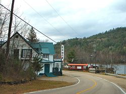
Rapides-des-Joachims is a municipality and village in western Quebec
, Canada
, part of Pontiac County
in the Outaouais region. The village is situated on Rapides-des-Joachims Island (l'île de Rapides-des-Joachims) on the Ottawa River
, about 100 km northwest of Fort-Coulonge. It is also known as Swisha.
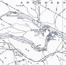
The municipality covers a vast sparsely populated area characterized by boreal forest, lakes, and streams. Prior to the construction of a hydro-electric dam in 1950, the village's site was not an island. The rising water flooded the old river bed from the north through Lake McConnell. The dam can be bypassed on one of the Ottawa Navigable Waterway bypasses, connecting the Pembroke stretch of the Ottawa River to the upstream section to Mattawa
.
Rapides-des-Joachims is isolated from the rest of Quebec's road network because the only paved road link to the village is through Rolphton, Ontario. It is the only community on the Quebec side of the Ottawa River between Sheenboro
and Témiscaming
. Because it is also isolated from Quebec's telecommunications network, the community is part of Rolphton's telephone exchange
area, and is consequently served by Ontario's area code 613
rather than Quebec's area code 819
.
 The site had long been inhabited by the indigenous people
before Europeans arrived. The explorers and voyageurs of the seventeenth and eighteenth centuries would travel on the Ottawa River to the west and at the foot of the rapids, they would have established a resting place and may have given it the name of an explorer.
It was a busy place during the seventeenth century, when a mission post was set up along the river where a Hudson's Bay Company
trading post had been established at the foot of the "Long Rapids", as they were called at the time.
But the place was called Rapides des Joachims de l'Estang in a memorandum of 1686 by Jacques-René de Brisay
, Governor of New France, to Marquis de Seignelay
, and named Portage de Joachim de l'Estan on a map of Franquelin
of 1688. Another document from 1699 shows Joachim de l'Estang.
However, both in Quebec and in Ontario, the name Swisha, Sweshaw, or Shesha Rapids has also long been used for this location as a map of 1790 indicates. Swisha is an obvious distortion of the French pronunciation of "Joachim".
In 1863, Stanislas Drapeau described Rapides des Joachims and Rapides des Deux Joachims as "the most important place for navigation on the Ottawa River and flourished thanks to the logging industry."
By 1871 it had become a small village complete with a telegraph office of the Montreal Telegraph Company. The river steamers had to stop here because it was the head of navigation on the Ottawa River. In 1886 the Oblate Fathers built a frame church in the village, which was used until 1922, when a new church was built.
In 1948, the construction of a dam and hydro-electric station began and the rapids which gave the town its name disappeared.
The municipality was incorporated in 1955 when it was formed out of the Sheen-Esher-Aberdeen-Malakoff United Townships. It adopted its present name of Rapides-des-Joachims, which had already been assigned to the post office created about 100 years earlier in 1853. Its first mayor was J.H. Mador. Subsequently in 1960, the territory of the former Aberdeen Township was added to the municipality.
 Since Rapides-des-Joachims provides access to vast tracks of wilderness, including ZEC Dumoine
, it depends largely on the hunting and fishing business. It is the long-time base of a charter float plane company (Air Swisha, formerly Bradley Air Service/First Air
), operating a de Havilland Canada DHC-2 Beaver
.
The economy depends also on logging and the Commonwealth Plywood Mill.
Total private dwellings: 93
Languages:
Quebec
Quebec or is a province in east-central Canada. It is the only Canadian province with a predominantly French-speaking population and the only one whose sole official language is French at the provincial level....
, Canada
Canada
Canada is a North American country consisting of ten provinces and three territories. Located in the northern part of the continent, it extends from the Atlantic Ocean in the east to the Pacific Ocean in the west, and northward into the Arctic Ocean...
, part of Pontiac County
Pontiac Regional County Municipality, Quebec
Pontiac is a county regional municipality MRC Pontiac in the Outaouais region of Quebec, Canada. It should not be confused with the municipality of Pontiac, which is located inside the county regional municipality of Les Collines-de-l'Outaouais....
in the Outaouais region. The village is situated on Rapides-des-Joachims Island (l'île de Rapides-des-Joachims) on the Ottawa River
Ottawa River
The Ottawa River is a river in the Canadian provinces of Ontario and Quebec. For most of its length, it now defines the border between these two provinces.-Geography:...
, about 100 km northwest of Fort-Coulonge. It is also known as Swisha.
The municipality covers a vast sparsely populated area characterized by boreal forest, lakes, and streams. Prior to the construction of a hydro-electric dam in 1950, the village's site was not an island. The rising water flooded the old river bed from the north through Lake McConnell. The dam can be bypassed on one of the Ottawa Navigable Waterway bypasses, connecting the Pembroke stretch of the Ottawa River to the upstream section to Mattawa
Mattawa, Ontario
Mattawa is a town in northeastern Ontario, Canada, at the confluence of the Mattawa and Ottawa Rivers in Nipissing District. Mattawa means "Meeting of the Waters" in Ojibwa...
.
Rapides-des-Joachims is isolated from the rest of Quebec's road network because the only paved road link to the village is through Rolphton, Ontario. It is the only community on the Quebec side of the Ottawa River between Sheenboro
Sheenboro, Quebec
Sheenboro is a village and municipality in the Outaouais region, part of the Pontiac Regional County Municipality, Quebec, Canada. Its territory stretches along the north shore of the Ottawa River from Chichester to Rapides-des-Joachims....
and Témiscaming
Témiscaming, Quebec
Témiscaming is a town located at the south end of Lac Témiscamingue on the upper Ottawa River in the Témiscamingue Regional County Municipality of western Quebec, Canada. Also nearby is Lake Kipawa.-History:...
. Because it is also isolated from Quebec's telecommunications network, the community is part of Rolphton's telephone exchange
Telephone exchange
In the field of telecommunications, a telephone exchange or telephone switch is a system of electronic components that connects telephone calls...
area, and is consequently served by Ontario's area code 613
Area code 613
Area code 613 are area codes for Ottawa and surrounding Eastern Ontario, Canada. 613 is one of the 86 original area codes of North America assigned in October 1947...
rather than Quebec's area code 819
Area code 819
Area code 819 is an area code for central and western Quebec, Canada, including the Quebec portion of the National Capital Region, and the entire Hudson Strait and Ungava Bay coastlines of Quebec....
.
History

Indigenous peoples of the Americas
The indigenous peoples of the Americas are the pre-Columbian inhabitants of North and South America, their descendants and other ethnic groups who are identified with those peoples. Indigenous peoples are known in Canada as Aboriginal peoples, and in the United States as Native Americans...
before Europeans arrived. The explorers and voyageurs of the seventeenth and eighteenth centuries would travel on the Ottawa River to the west and at the foot of the rapids, they would have established a resting place and may have given it the name of an explorer.
It was a busy place during the seventeenth century, when a mission post was set up along the river where a Hudson's Bay Company
Hudson's Bay Company
The Hudson's Bay Company , abbreviated HBC, or "The Bay" is the oldest commercial corporation in North America and one of the oldest in the world. A fur trading business for much of its existence, today Hudson's Bay Company owns and operates retail stores throughout Canada...
trading post had been established at the foot of the "Long Rapids", as they were called at the time.
But the place was called Rapides des Joachims de l'Estang in a memorandum of 1686 by Jacques-René de Brisay
Jacques-René de Brisay de Denonville, Marquis de Denonville
Jacques-Rene de Brisay de Denonville, Marquis de Denonville was Governor General of New France from 1685 to 1689 and was a key figure in the Beaver Wars....
, Governor of New France, to Marquis de Seignelay
Jean-Baptiste Colbert, Marquis de Seignelay
Jean-Baptiste Antoine Colbert, Marquis de Seignelay was a French politician. He was the eldest son of Jean-Baptiste Colbert, nephew of Charles Colbert de Croissy and cousin of Jean-Baptiste Colbert de Torcy....
, and named Portage de Joachim de l'Estan on a map of Franquelin
Jean-Baptiste-Louis Franquelin
Jean-Baptiste-Louis Franquelin was born at Saint-Michel de Villebernin, France in 1651. He died in France around 1712. He was a cartographer, a royal hydrographer, and a teacher of navigation. He was also the first official cartographer in Canada....
of 1688. Another document from 1699 shows Joachim de l'Estang.
However, both in Quebec and in Ontario, the name Swisha, Sweshaw, or Shesha Rapids has also long been used for this location as a map of 1790 indicates. Swisha is an obvious distortion of the French pronunciation of "Joachim".
In 1863, Stanislas Drapeau described Rapides des Joachims and Rapides des Deux Joachims as "the most important place for navigation on the Ottawa River and flourished thanks to the logging industry."
By 1871 it had become a small village complete with a telegraph office of the Montreal Telegraph Company. The river steamers had to stop here because it was the head of navigation on the Ottawa River. In 1886 the Oblate Fathers built a frame church in the village, which was used until 1922, when a new church was built.
In 1948, the construction of a dam and hydro-electric station began and the rapids which gave the town its name disappeared.
The municipality was incorporated in 1955 when it was formed out of the Sheen-Esher-Aberdeen-Malakoff United Townships. It adopted its present name of Rapides-des-Joachims, which had already been assigned to the post office created about 100 years earlier in 1853. Its first mayor was J.H. Mador. Subsequently in 1960, the territory of the former Aberdeen Township was added to the municipality.
Economy

ZEC
A ZEC is a "Controlled harvesting zone". ZECs are a system of territorial infrastructures set up in 1978 by the Government of Quebec to take over from private hunting and fishing clubs...
, it depends largely on the hunting and fishing business. It is the long-time base of a charter float plane company (Air Swisha, formerly Bradley Air Service/First Air
First Air
Bradley Air Services Limited, operating as First Air, is an airline headquartered in Kanata, Ontario, Canada. It operates services to 30 communities in Nunavut, Nunavik, and the Northwest Territories. The majority of its fleet is available for charters worldwide...
), operating a de Havilland Canada DHC-2 Beaver
De Havilland Canada DHC-2 Beaver
The de Havilland Canada DHC-2 Beaver is a single-engined, high-wing, propeller-driven, STOL aircraft developed by de Havilland Canada, primarily known as a bush plane. It is used for cargo and passenger hauling, aerial application , and has been widely adopted by armed forces as a utility aircraft...
.
The economy depends also on logging and the Commonwealth Plywood Mill.
Demographics
Demographics:- Population in 2006: 172 (2001 to 2006 population change: −12.7 %)
- Population in 2001: 197
- Population in 1996: 185
- Population in 1991: 183
Total private dwellings: 93
Languages:
- English as first language: 69 %
- French as first language: 31 %

